
Scan the QR code and open PeakVisor on your phone
North Karelia is home to 48 named mountains. The highest is Ukko-Koli at 347 m.
North Karelia is one of the 19 administrative regions of Finland. It is located in the larger region of Eastern Finland and is a part of the historic region of Karelia. The main natural feature of North Karelia is a series of hills called Koli, which are the highest in Eastern and Southern Finland and which offer a breathtaking view of stunning Pielinen Lake. There are 48 named mountains in North Karelia, the highest and most prominent of which is Ukko-Koli (347 m / 1,138 ft).
The name “North Karelia” derives from that of Karelia, which is the historic and cultural name for a region that spans a large swath of southern Finland and western Russia. The Karelians are an ethnic group that has traditionally inhabited this region.
The Karelians speak Karelian, which is an officially recognized minority language in both Finland as a whole and in the Republic of Karelia in Russia. Karelian is a Balto-Finnic language and it is similar to Finnish, though it differs slightly in vocabulary, tone, and expression.
The Karelians call their homeland Karjala. However, while the origin of the word is unclear, it’s believed that Karjala derives from the modern Finnish karja, which means “herd.” This may refer to animal husbandry, a common method of subsistence in this region for thousands of years.
North Karelia is located in Eastern Finland on the country’s border with the Republic of Karelia in Russia. It borders the Finnish region of Kainuu to the north, North Savo to the west, and South Savo, and South Karelia to the south. The total area of North Karelia is 21,584 sq. km (8,333 sq. mi).
However, the culture of North Karelia is not limited to the region’s boundaries. Rather, North Karelia is also part of one big cultural region called Karelia, which you can learn more about in the guide to the Republic of Karelia in Russia.
Nevertheless Karelia should not be confused with the Finnish Lakeland. The term “Lakeland” refers to a tourist region in Finland, not an administrative one. It contains part of Eastern Finland, Southern Finland, and Central Finland, including North Karelia.
You can get to North Karelia from Helsinki in around 5 hours by car (438 km / 272.1 mi to the capital of the region, Joensuu). There is also great public transport, including buses (Matkahuolto and Onnibus) and VR.fi trains.
The nearest town in Russian Karelia is Sortavala (2 hours by car or 136 km / 84.5 mi). There are buses, too (check out the local bus companies), but you need to know some Russian to get around. One possible solution for those who haven’t brushed up on their Russian recently could be the European BlaBlaCar car sharing service, which is extremely popular among locals in Russia.
North Karelia and Finland are also great places for traveling by bicycle. For example, in the Savo region, where I lived in 2018, there are bicycle lanes along all the small roads. The situation is similar in many other parts of the country.
Also note that the nearest major airports to North Karelia are located also in Helsinki and Saint Petersburg, Russia.
The Baltic Shield is the main segment of the Earth’s crust that underlies the whole of Scandinavia and the Nordic countries, including Karelia and Finland. It is a very old segment of rock that’s approximately 1.5 to 3 billion years old.
But if you look closer, the territory of South Karelia is also considered to be a part of the Karelian Domain or the Karelian Block, which formed during the Archean and Paleoproterozoic (4 to 1.6 billion years ago).
So granite, gneisses, shales, and quartzites are the main rocks in North Karelia. You can see and climb cliffs made of these stunning rocks throughout the region.
The landscape of North Karelia is a combination of five main features. If we take away one of them, the region would not look the way we know and love it.
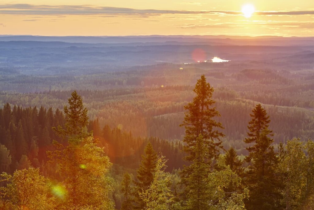
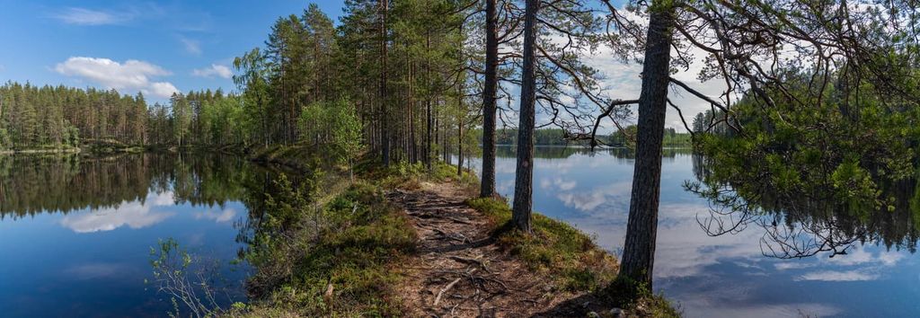
First of all, like everywhere else in Finland (except in the very north of Lapland), there are many pine and spruce forests, where you can pick berries and mushrooms from mid-June to November. The people of Karelia, like Finns in general, like to joke about themselves: “We live in forests, not in cities or even villages.”
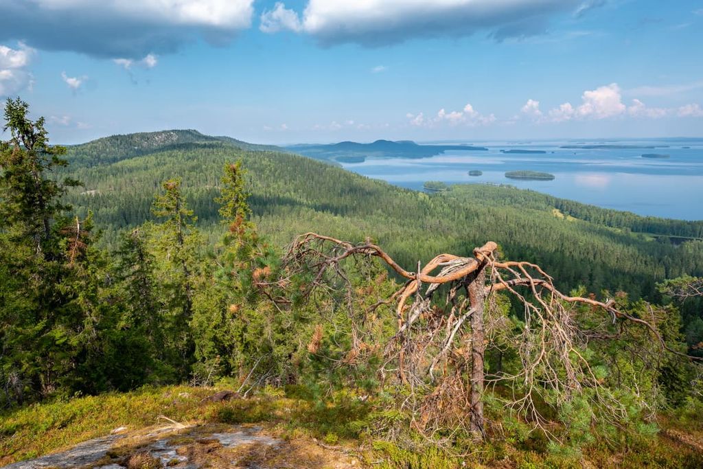
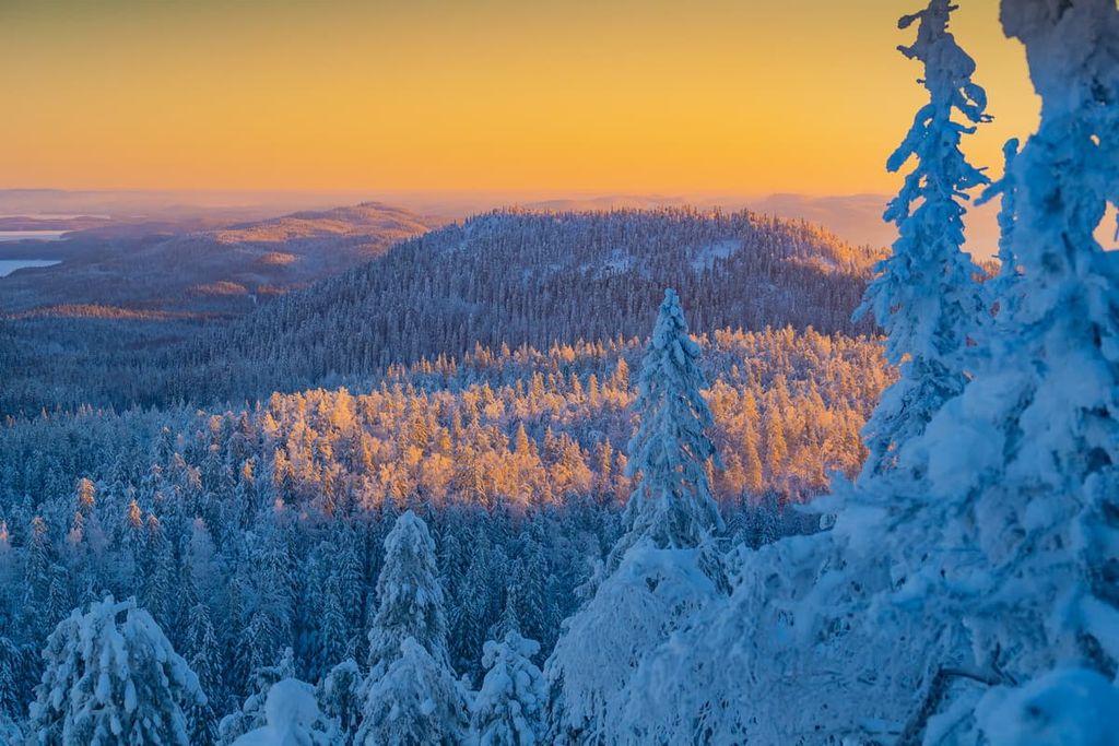
Second, the region is famous for its highest peak—Koli. You will learn more about its particular features further in the guide.
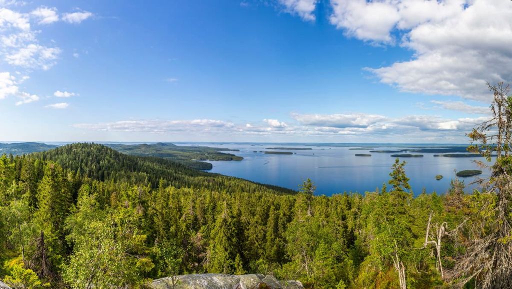
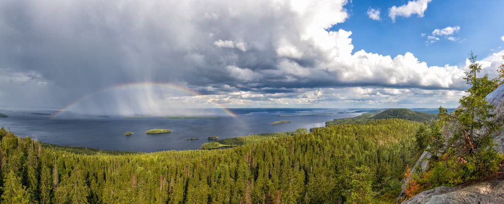
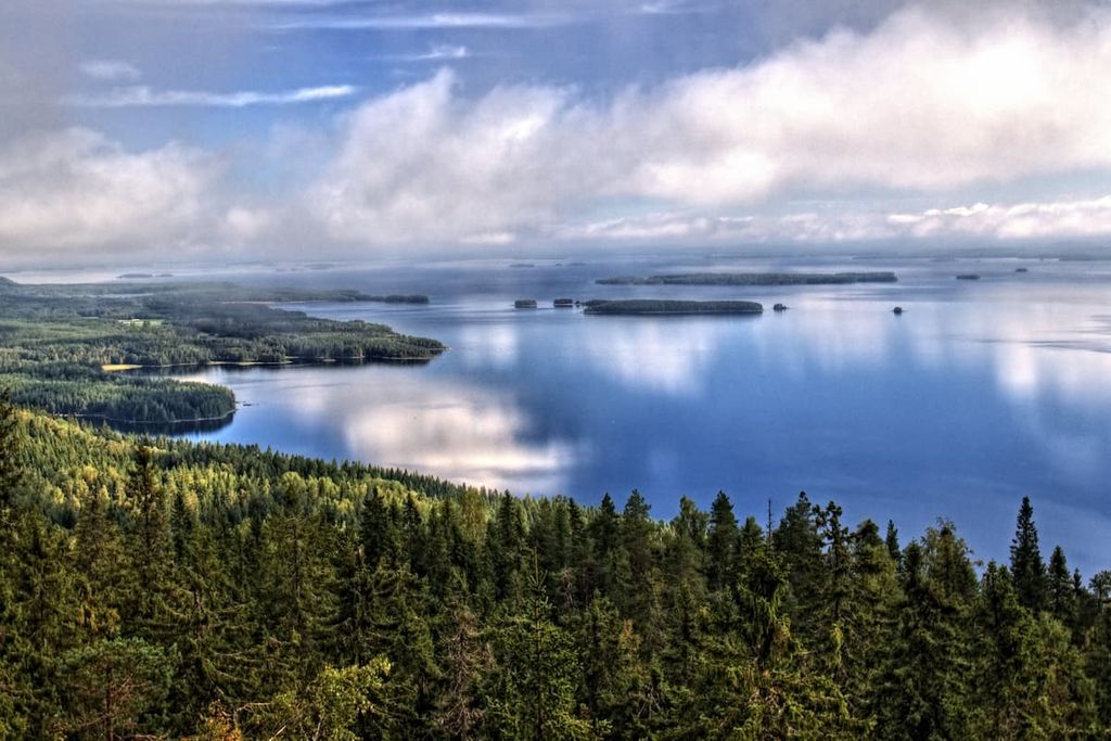
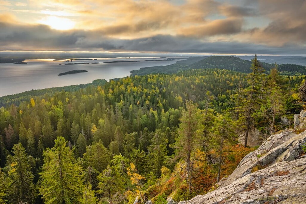
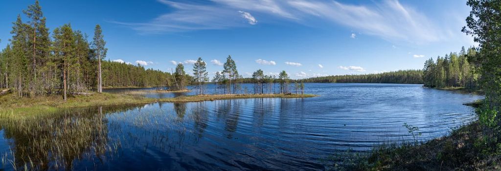
Third, the region is primarily known for the views of the gigantic Pielinen Lake, the fourth-largest in Finland after Saimaa, Päijänne, and Inari lakes. In the lake, there are many large and small rocky islands (also known as skerries), such as Purjesaari, Kelvänsaari, Mantina, Hiekkasaaret, Rääkkyy, Murtosaari. In total, there are 1,491 islands in the lake, which you can get a great view of from Koli.
Tourists come to Koli and North Karelia also because this landscape is considered so beautiful that it was included in the list of 27 national landscapes of Finland in 1992. This list was created to celebrate the country’s 75 years of independence.
Fourth, Pielinen Lake is a dominant feature of the local landscape in and of itself. It is worth visiting its different parts. There is also a hiking trail around the lake that totals some 300 km (186.4 mi), including main interesting sights on the way like, for example, small villages and towns. It is also a part of the larger Via Karelia Trail.
Here are some of the lake's characteristics:
In addition to Pielinen Lake there are other lakes in North Karelia, the largest of which is Pyhäselkä Lake. You will definitely see it because the capital city of the region is located right on its shores.
Pyhäselkä Lake is also a unique lake because it is the northernmost part of the Saimaa lake system, which is a new UNESCO Geopark. Read more about it in the guide to South Karelia.
To the north of the town, there is another large lake, Höytiäinen, so the town is located between two lakes.
Fifth, the area’s scenery is also famous for the fields and meadows that have formed in the place of the forests, as a result of slash-and-burn agriculture, which was practiced in the seventeenth centuries. This way of agriculture is even shown on the logo of the local national park, which pictures a mix of slash-and-burn agricultural lands and a birch forest at sunset overlooking the region’s famous hills.
North Karelia is the southernmost place in Finland where you can find real mountains. Or rather, these are the remains of once high mountains called the Karelides.
Some 2 to 3 billion years ago, the Karelides were as high as the Alps and even surpassed them in elevation, reaching heights of over 5,000 m (16,404 ft), while the highest mountain in the Alps, Mont Blanc, is only 4,807 m (15,774 ft).
With the passage of time and many geological processes, including the retreat of the glaciers that once covered all of Northern Europe, today only a 300-meter (984 ft) high base of these great mountains remains. Nevertheless, even today they are the highest peaks in Southern, Eastern and Central Finland.
Here are the three main things to know about Koli:
There are also several other peaks in Koli National Park, including Ipati (315 m / 1,033 ft), Savivaara (185 m / 606 ft), and Mäkrä (306 m / 1,004 ft). I also climbed Mäkrä on my way through the entire park and I will tell you that the views from its summit are just as beautiful as those from Koli.
For those who will not go to Koli National Park (although this is unlikely if you find yourself there), here are a few peaks near the capital city of the region, Joensuu: Vestinkallio (107 m / 351 ft), located almost in the city limits, and Huhmarisvaara (147 m / 482 ft) and Kirkkovuori (98 m / 321 ft), which is located near the city on the nearby lake.
Here are some other geographical feature of the region’s peaks for those who want to travel throughout the whole region of North Karelia:
The Karelides do not end in North Karelia, they stretch almost along with the entire country along its eastern part all the way to Lapland. Over 90–95 percent of all the peaks in this northern region are also remnants of the Karelides. The difference with Karelia is that in Lapland they are higher, reaching heights of 600–800m (1,965–2,624 ft), including Taivaskero (809 m / 2,654 ft), the region’s highest mountain.
There are many places for hiking or skiing in the North Karelia region. However, it’s easy to get the various recreation areas in the regions confused if you haven’t been here before. So, here’s a list of the most important destinations to help you to choose one or two places to visit:
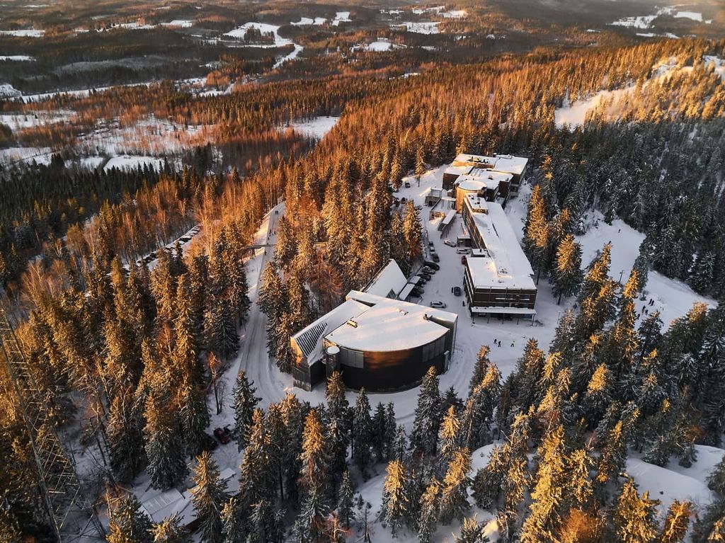
Three of Finland’s forty national parks are located in North Karelia: Koli National Park (including Koli Nature Center Ukko), Patvinsuo National Park, and Petkeljärvi National Park.
Koli National Park is considered one of the most important not only in the region but in the whole country. I also made my first real multi-day hike here, and I highly recommend this place, despite its popularity among tourists. Actually, there are a lot of people only on its three main peaks.
If this isn’t enough adventure for you, on the border of the region there are also two more parks: Hiidenportti National Park (North Savo) and Kolovesi National Park (South Savo). Of course, they are great, too.
Finally, in North Karelia, you can go on an adventure in the Ruunaa Hiking Area. It is one of seven such areas in the country, which is good for both easy and family hiking and a real adventure in the wilderness.
There are also several long hiking trails in North Karelia of about 2–3 days to more than a week in length, including the famous Herajärvi Trail, which takes you through the entire Koli National Park, and the Taitajan Taival Trail, the oldest trail in the entire region, which takes you from Petkeljärvi Lake to Mekrijärvi village.
Here’s a complete list from shorter to longer trails with total time requirements listed based off of hiking no more than about 10 km (6.2 mi) a day:
For fans of skiing and snowboarding, snowshoeing and other winter sports in North Karelia, there are two small ski resorts: Ukko-Koli Ski Resort (6 slopes of 6 km / 3.7 mi in total, 3 lifts) in the Koli National Park and Mustavaara Ski Resort (2 slopes of 1.8 km / 1.1 mi in total, 3 lifts) close to the region’s capital of Joensuu.
There are also two resorts right on the border with the Savo region: Maarianrinteet Ski Resort (North Savo) and Lekotinmäki Ski Resort (South Savo).

You can get more information about North Karelia at the Carelicum Cultural and Tourism Center, which is located in the center of Joensuu.
I always visit such centers not only to ask for advice but also to get a couple of paper maps and brochures, which not only help to orientate in the area but also serve as a great unique souvenir that you can’t get anywhere else.
Usually in the tourist centers, they also sell real souvenirs: books, toys, and so on with the symbols of the region. Karelia is characterized by very rich national ornaments and different symbols, which are used in clothing, tableware, and other items.
Carelicum Cultural and Tourism Center
Koskikatu 5, 80100, Joensuu, Finland
Monday—Friday from 10 am to 4 pm
+358132675222
Note that, in the event of an emergency, 112 is the single number of the Finnish Emergency Responder Center Agency for ambulance, fire, and police calls.
The most popular type of accommodation while hiking in North Karelia is an ordinary tent that you carry with you and can pitch anywhere, even on private property. This is thanks to the special “Everyman’s Right” law or “Right to Roam,” as it is also called. The same law allows you to pick mushrooms and berries and other gifts of nature all over the country and just wander wherever you want.
However, it is important to know and remember that in national parks and other natural areas in Finland you can only pitch a tent and make a fire in specially designated areas. These designated campfire and tent sites already have a flat place for your tent, a supply of firewood, a toilet, and usually a water source.
I spent two nights in a place like this in Koli National Park and I wanted to spend at least a week there—it was very peaceful, natural, and just amazing.
There are also many lean-to shelters in the region. These are wooden shelters under which you can rest and sleep in a warm sleeping bag.
Just keep in mind that from May to August there are a lot of mosquitoes in Karelia. When I say "a lot", I mean a lot. For example, if you leave your hands and feet uncovered and stand still in the middle of the forest, they will immediately totally become covered with mosquitoes. So in lean-to shelters, you may want to pack a bug net.
In national parks and other areas, you can also stay overnight in one of the rental huts. For example, there are as many as 11 such huts in the same Koli park. They cost about €43 to €85 per day for a whole house for two, four, or more people. But you need to book them a few months in advance—in summer they are usually always reserved.
Before and after your hike, you will not have problems finding housing in the cities and in nature, including the most popular type of accommodation in Finland—the typical Finnish summer cottages. These are large houses that are usually rented for 3–4 people at a minimum. There could be thousands of them, even in small municipalities.
Here are a few interesting, in my opinion, options for accommodation in North Karelia that you may also enjoy:
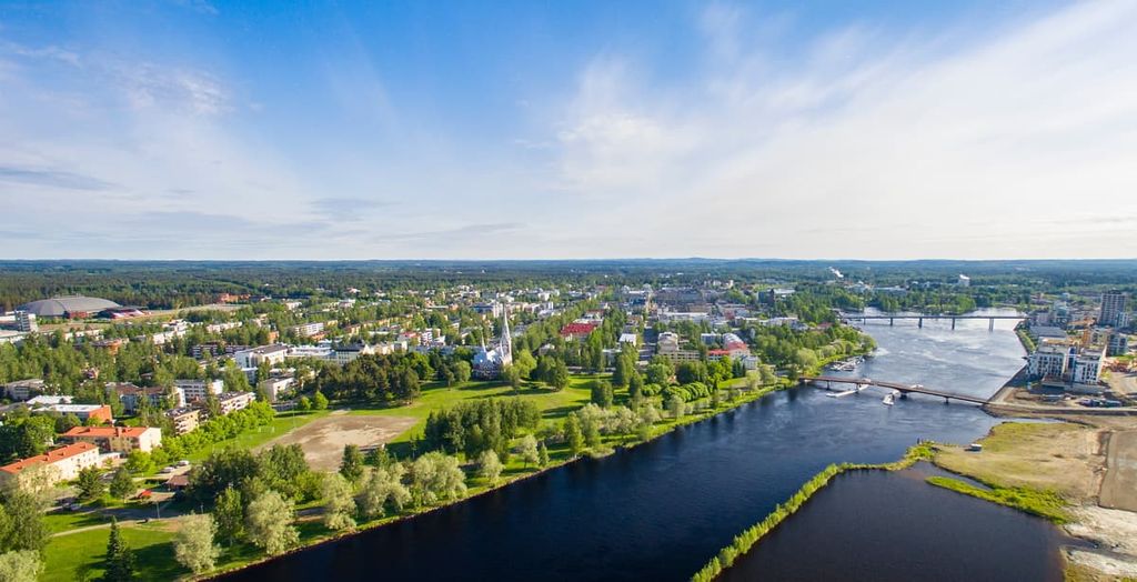
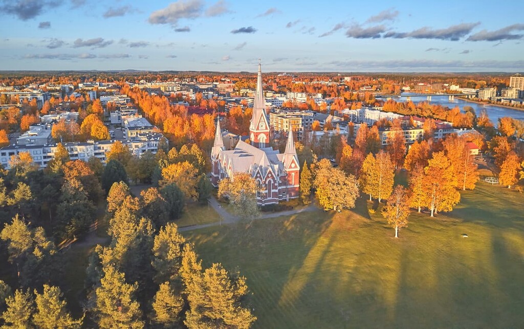
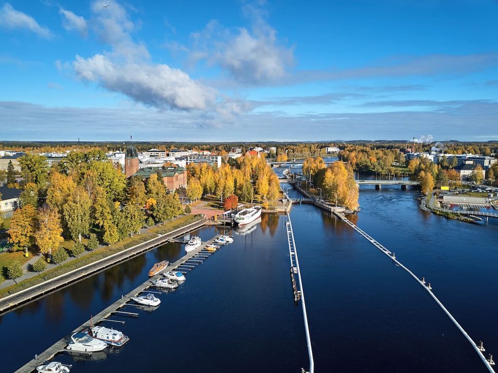
The main city of North Karelia, Joensuu, is located in the southwestern part of the region. The name of the city literally means the "river's mouth" because it is located at the mouth of the Pielisjoki River (67 km / 42 mi) (or Pielinen River as it is also called). The Pielisjoki River flows from Lake Pielisjoki into the second largest lake in the region, Pyhäselkä (part of Saimaa).
Joensuu is a relatively young city. It was founded in 1848 by Czar Nicholas I of Russia, at which time Finland was part of the Russian Empire as an autonomous province, more or less like today's Trentino and South Tyrol in Italy, for example.
Joensuu has 76,833 (2021) inhabitants so it is the twelfth largest city in Finland by population, which means that it is rather a town with wooden nineteenth houses right in the city's center than a major metropolis. By comparison, the twelfth largest city in the United States and the most populous in the state of Florida, Jacksonville, has 949,611 people (2020).
The population numbers, however, always include the surrounding smaller towns and villages. Downtown Joensuu is quite small. You can walk around the whole thing in about half a day.
The main architectural and cultural attractions of Joensuu include:
The official websites, which will help you to navigate the area: Visitjoensuu.fi, Joensuu.fi.
Other smaller towns in North Karelia that you can choose as alternative of Joensuu include:
Nurmes has a rail connection to Joensuu and there are also several hiking areas, trails, and cultural sites in the region.


Yes. North Karelia has 48 named mountains. The highest is Ukko-Koli at 347 m.
The highest mountain in North Karelia is Ukko-Koli, at 347 m.
North Karelia has 48 named mountains.


