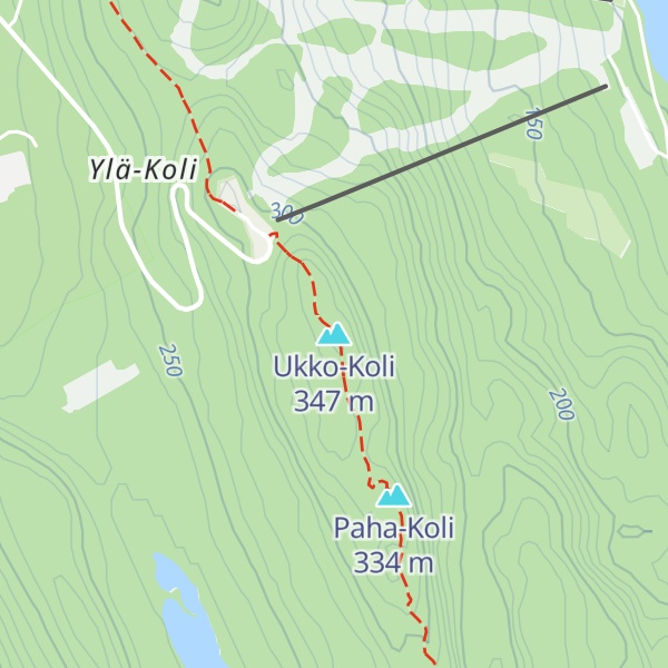
Koli is a hill by the lake Pielinen in municipality of Lieksa in eastern Finland. It mainly consists of white quartzite, and its summit has large treeless areas. Koli village is at the root of the hill, and the area is part of Koli National Park.
There's a hiking trail (T1) leading to the summit. Ukko-Koli is one of the 94 peaks along the multi-day European walking route E10.
By elevation Ukko-Koli is
# 1 out of 39 in North Karelia # 1 out of 6 in Koli National Park
By prominence Ukko-Koli is
# 1 out of 39 in North Karelia # 50 out of 3767 in Finland # 1 out of 6 in Koli National Park # 25 out of 1310 in the Karelides
We use GPS information embedded into the photo when it is available.
3D mountains overlay
Adjust mountain panorama to perfectly match your photos because recorded by camera photo position might be imprecise.
Move tool
Rotate tool
Zoom
More customization
Choose which peak labels should make into the final photo and what photo title should be.
Next
Photo Location
Satellitte
Flat map
Relief map
Latitude
Longitude
Altitude
OR
Latitude
°'''
Longitude
°'''
Apply
Register Peak
Peak Name
Latitude
Longitude
Altitude
Register
Teleport
PeakVisor
This 3D model of Sagarmatha National Park in Nepal was made using the PeakVisor app topographic data. The mobile app features higher precision models worldwide, more topographic details, and works offline. Download PeakVisor maps today.
Download OBJ model
PeakVisor
The download should start shortly. If you find it useful please consider supporting the PeakVisor app.
PeakVisor for iOS and Android
Be a superhero of outdoor navigation with state-of-the-art 3D maps and mountain identification in the palm of your hand!