
Scan the QR code and open PeakVisor on your phone
Northern Savonia is home to 169 named mountains. The highest is Välimäki at 314 m.
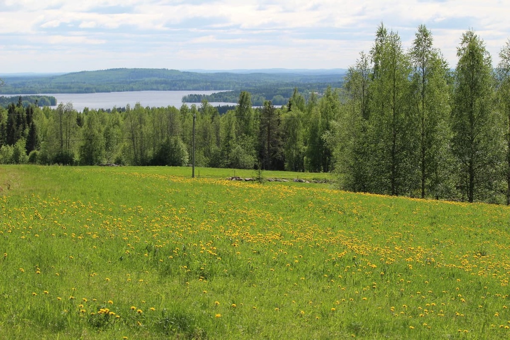
Northern Savonia, or North Savo, is one of Finland's 19 counties. It is located in the east of the country. The main feature of the region is Puijo, a nature reserve with dozens of different attractions near the region's capital, Kuopio. It is also the heart of the Finnish Lakeland, which is world-famous for its magnificent water and forest scenery There are 169 named mountains in North Savo, the highest and the most prominent of which is Välimäki (314 m / 1,030 ft).
The name of the county comes from its location in the north of the historical province of Savonia, which also now contains Southern Savonia, or South Savo.
The province was named after the Savonian people, a subgroup of the Finnish people, who today constitute the 5 million people in the country.
More precisely: Modern Finns are descendants of several peoples inhabiting these territories before the formation of Finland. Besides Savonians, they include Karelians also in the east, Tavastians (Häme) in Tampere area in the west, the people of Finland Proper and Satakunta regions in the southwest, the Ostrobothnians in the geographical center of the country, and the Sámi in Lapland to the north.
The main difference between Savonians and Finns and other ethnic groups is the Savonian dialects of the modern Finnish language. However, this dialect is one of the most widely distributed dialects of the language in Finland. It is spoken not only in Savonia itself, but also in North Karelia, parts of Päijät-Häme, Central Finland, Kainuu, Northern Ostrobothnia, and even the Lapland regions.
The Finnish name for the North Savo region is Pohjois-Savon.
The region of Northern Savonia is located in the east of Finland. Its total area is 20,366 sq. km (7,863 sq. mi), which is 2,000 sq km (772 sq. mi) larger than South Savo.
North Savo is part of the historic province of the same name, Savonia, one of six such provinces in the country, along with Finland Proper (Southwest Finland), Karelia, Laponia or Lapland, Ostrobothnia, Satakunta, Tavastia, Uusimaa, and Åland. These provinces existed before 1634 during the time when Finland was a part of Sweden (1200–1809).
North Savo was also part of Eastern Finland province from 1997 to 2009, when Finland was divided into only six major administrative units (compared to 19 today).
Today, the region of North Savo borders the following other regions Kainuu and North Ostrobothnia to the north, Central Finland to the west, Southern Savonia (South Savo) to the south, and North Karelia to the east.
At the same time, the North Savo region is part of one of Finland’s four major tourist regions called Finnish Lakeland or sometimes Finnish Lake District (the other three are Helsinki area, Baltic Sea Coast and Archipelago, and Lapland). In addition to North Savo and South Savo, the Lakeland also includes neighboring regions, all of which have a large number of lakes.
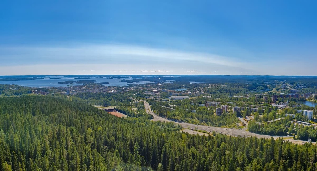
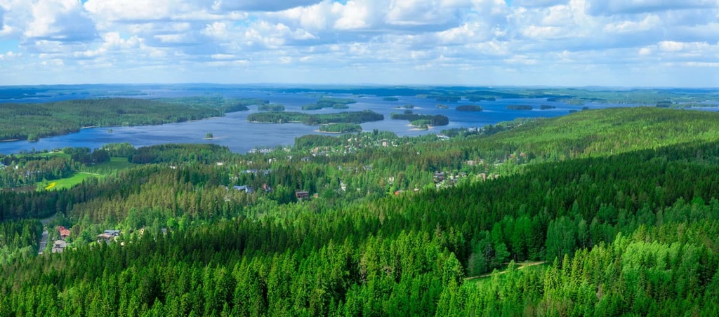
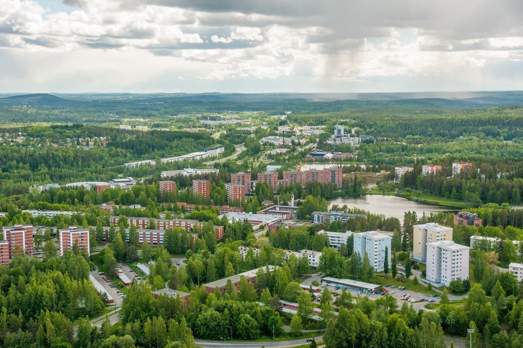
The largest city in the region of North Savo is Kuopio. It is located almost in the geographical center of the region, so it is easy to find.
Getting to Kupio from Helsinki by car will take you 4:30 hours (390 km / 242 miles). You can also get here from St. Petersburg, Russia, (6 hours, 435 km / 270 miles) and Sortavala (3:40 hours, 272 km / 169 miles), the capital of the Republic of Karelia in Russia.
Public transport in Finland is available on Matkahuolto or OnniBus buses and VR.fi trains. If you’re traveling from Russia, you can take Lux Express buses and Allegro trains.
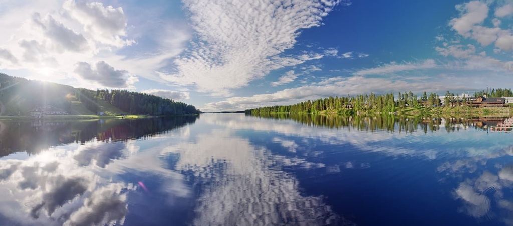
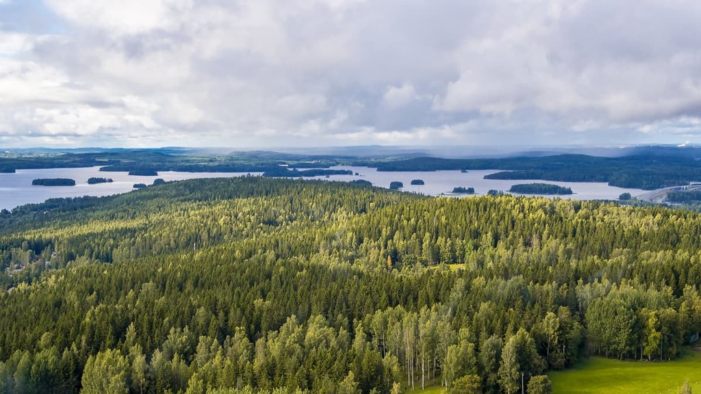
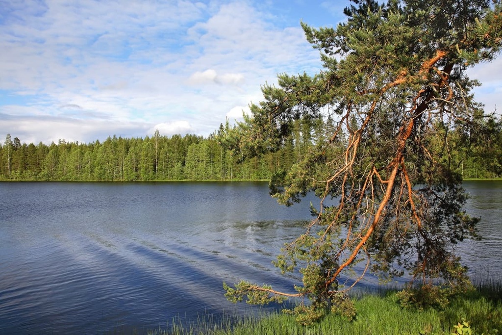
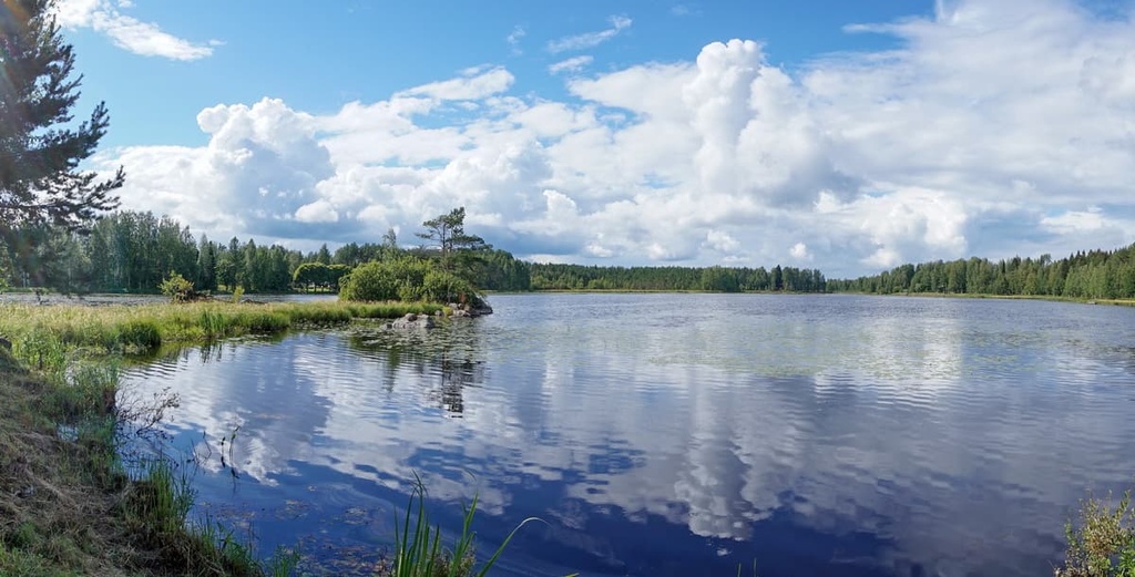
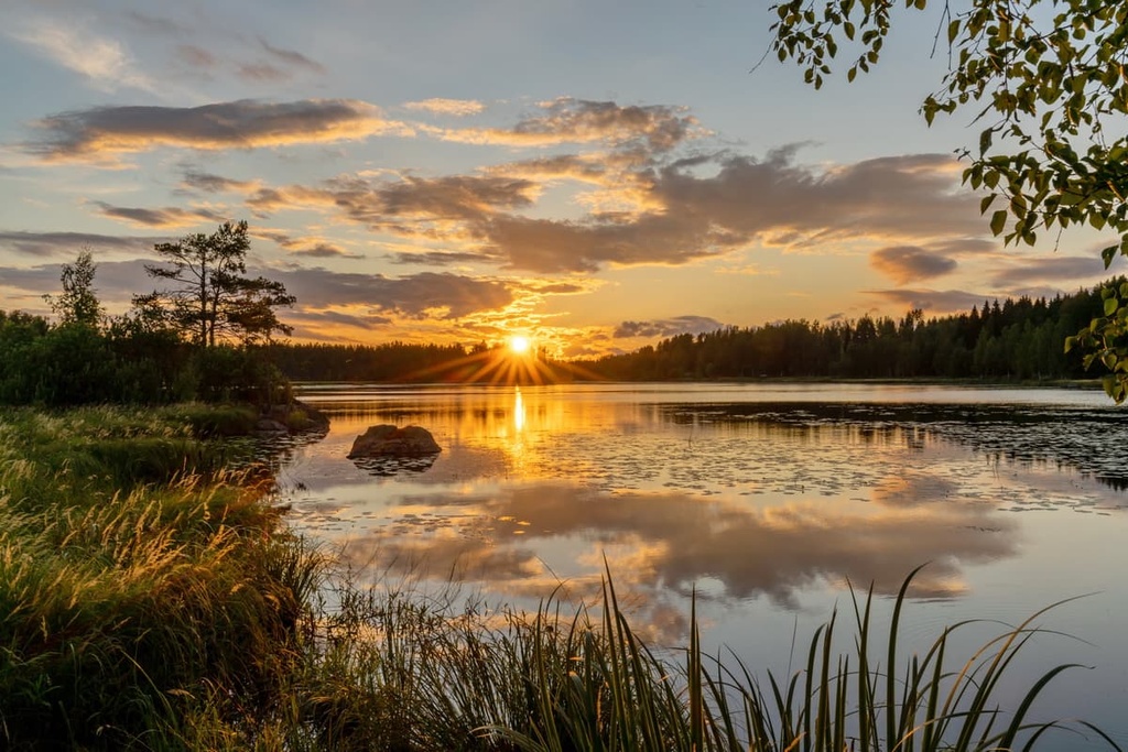
The main feature of the Savonia region landscape is that it is located in the heart of the Finnish Lakeland or Finnish Lake District. It is the largest such region not only in Finland but in all of Europe, which contains most of the 188,000 lakes in the country.
Lakes cover up to 25 percent of this Finnish region, though this number is largely due to the biggest lake in Finland, Saimaa. It is also the fourth largest lake in Europe, after Ladoga and Onega lakes in the Republic of Karelia in Russia and Vänern Lake in Sweden.
Among the lakes of Northern Savonia, the Kallavesi Lake is the tenth largest lake in Finland (472 sq km / 239 sq mi against 1.377 sq km / 855 sq mi of Saimaa Lake). The largest city of the region, Kuopio, is located on the shore of Kallavesi. It is a large lake port and marina. That is, the lake is not only beautiful but also serves practical transportation purposes, being part of the larger Saimaa lake system.
The lakes were formed by long processes of erosion (fractures in the earth’s crust) and weathering when the glaciers covered north of Europe retreated 10,000 years ago. These same processes have formed numerous skerries (groups of rocky islands), picturesque bays, straits, and other features that distinguish these places.

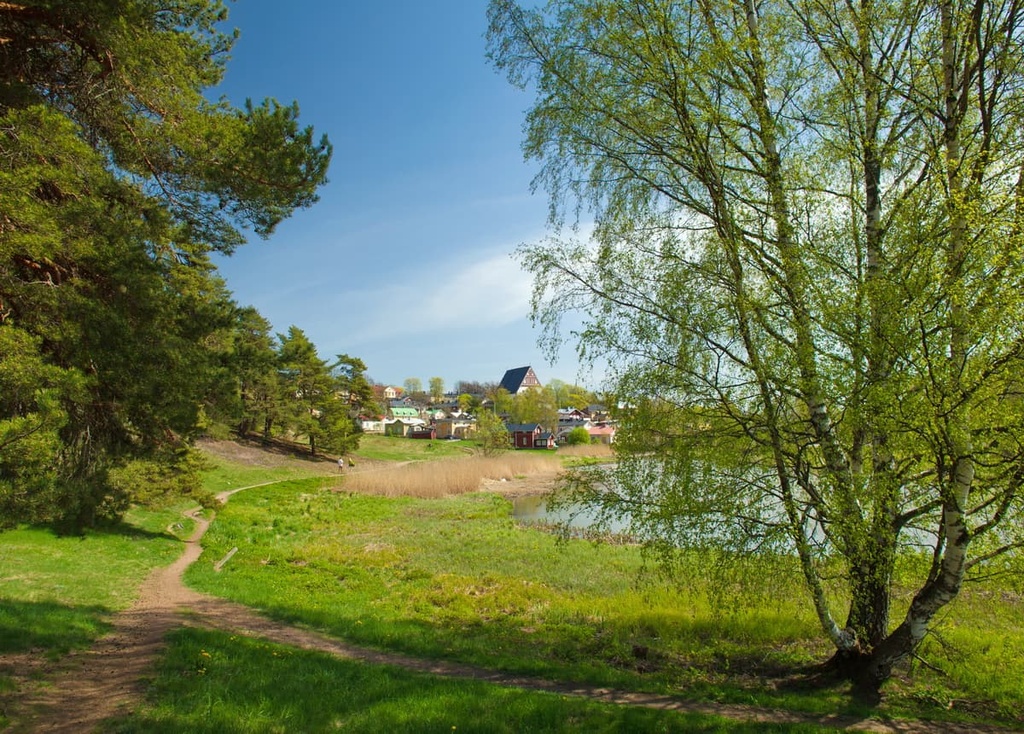
On the shores of the lakes and on the islands among the forests you can easily find many cottages. These are what Finns call their traditional “summer vacation homes.” But these cottages can vary dramatically: from tiny houses and saunas (without bedrooms and kitchens) to a large house that you can live in all year round.
It's interesting to note that most cottages in Finland are located in the Kuopio area (10,847 cottages as of 2020), followed by neighboring Mikkeli, the capital municipality of South Savo (10,558). In total, there are more than 50,000 cottages in the country. A large part of them are for rent, too.
Speaking of cottages, it is impossible not to mention another main feature of the landscape of Northern Savo—Väisälänmäki Village.
Väisälänmäki is a traditional Finnish village located in the municipality of Lapinlahti to the north of Kuopio in vast meadows that are surrounded by forests.
The village is maybe the best example of slash-and-burn agriculture, a traditional farming method that was common in the eighteenth and nineteenth centuries, but which has been abandoned over time because the method involves cutting down the forest for planting.
Due to its historical significance, the village is included in the list of 27 national landscapes in Finland. This is the only such site in the region, while in South Savo there are three. However, for some reason, Väisälänmäki is less known compared to the scenery of Puijo Hill and Kallavesi Lake, the two other main features of the region.
This is perhaps because it is located at a distance from Kuopio, and also because the village itself no longer exists as an inhabited place. Today, only a few houses, barns, and traditional fences have been preserved, as well as information boards, where you can learn more about the village.
The first information board talks about the famous painting “Under the Yoke (Burning the Brushwood),” which demonstrates slash-and-burn method and was made by Finnish artist Eero Järnefeltin in Väisälänmäki in summer 1893.
The models for the painting were the villagers themselves, and the girl, the main character in the picture, was a maid from the estate of the local Puurus family, where he stayed for the summer while working on his paintings. “The artist put soot on the girl's face on purpose to convey the drama of these hard times,” says a local amateur photographer, who visited the site in October 2018.
Savonia, including both its northern and southern parts, has been continuously inhabited since the Stone Age, and the first finds of pottery and other objects in this region date back to the early Iron Age.
Considering the peculiarities of the local nature and landscape, water has always been a major element in the life of the Savonian people. As I said before using the Kuopio example, the numerous lakes served as transport and trade routes as well as for military reasons.
Therefore, traditionally the people of Savo are fishermen and hunters, as evidenced, in particular, by the most famous local dish, kalakukko. This is a large pie made of rye bread with a filling of fish that is baked directly in the dough.
Kalakukko is still very popular today, especially in Kuopio, so you can try it in any corner of the city. Sometimes it is cooked with liquid so that the bread serves as a plate at the same time—yes, which you can gradually and gently eat.
In the past, slash-and-burn farming was one of the main agricultural methods for the local population. It was later replaced by more sustainable methods because, with slash-and-burn agriculture, the farmer only ends up degrading the forest and dehydrating the soil over the long term.
It’s worth noting that the region’s archeological records are more or less non-existent until the 700s. More recent finds suggest strong ties between the inhabitants of Eastern Finland and the tribes in the west of the country. The richest archeological finds are known from the area of the modern city of Mikkeli between 800–1150.
These records speak, however, not only of friendship but also of clashes with neighbors from both west and east. In particular, between 950–1300, the region fell under a strong Karelian influence but maintained its identity. In 1323 by the Treaty of Nöteborg between Sweden and the Novgorod Republic (Russia in the past), the border between Savo and Karelians was drawn and as a result, Savo came under Swedish power.
Further, for centuries, the Savo under Swedish rule was the border territory with Russia. The main military building of that time (1475) is Olavinlinna aka St. Olaf's Castle, which is located in the town of Savonlinna in South Savo. That is to say, the formation of the region went from south to north, not vice versa.
By about the 1500s, Savonians inhabited the whole territory of today’s Savo region and even part of Ostrobothnia. In search of a better and more peaceful life, during the sixteenth and seventeenth centuries, many farmers of Savo origin moved as far away as the wilds of central Scandinavia. There they were nicknamed “Forest Finns.”
In the nineteenth century, during the period of national romanticism, the inhabitants of Finnish Savonia are said to have achieved a harmony of self-determination between their belonging to Finland and their identity. In the process, however, many cultural elements and traditions were lost, including dialects of the language.
Today, Savo, as part of Eastern Finland, is one of the four major regions of the country on par with Helsinki, the West coast, and Lapland.
The mountains of Northern Savonia belong to the Karelides Range, which were named after the region of Karelia. In fact, they no longer exist, and they today consist of hills that are up to 300 meters (feet) high in the east of the country.
They stretch all the way to the northern borders of Lapland where they reach 800 meters (2,624 feet) in elevation. But these mountains were once as high as the Alps and even surpassed them in height.
Välimäki (314 m / 1,030 ft) is the highest peak of Savonia, including both northern and southern parts.
The peak is located in the municipality of Nilsiä 60 km (37.2 miles) to north of Kuopio near Tahko, which has recently become part of the latter. Now they are promoted as a single tourist area called Kuopio-Tahko.
Tahkomäki, or Tahkovuori/Tahko Hill, (296 m / 971 ft) is the second-highest peak in the region. It is located just next to Välimäki in the same municipality of Nilsiä.
However, it is much better known for the Tahko Ski Resort, which is located on several mountains in addition to Välimäki and Tahkomäki, including Korkea-aho (296 m / 971 ft), Tarpisenmäki (266 m / 872 ft), and Kettukangas (222 m / 728 ft).
So Tahko is a concentration of the highest mountains in the region and the main center of outdoor activities in the region on par with the city of Kuopio itself.
Pisa (271 m / 889 ft) is the fourth highest peak of North Savo, which is located at a small distance from the aforementioned mountains to the east of the town of Nilsiä. Yes, it looks like the mountain is named after the famous leaning tower in Italy.
The Finnish Pisa is famous for having an observation tower on top of it that offers panoramic views of the Savo landscape. But not only that: The Treaty of Teusina in 1595 determined Pisa to be one of the landmarks of the border between Russia and Sweden. You can still see the boundary stone on the peak.
Around the mountain, there is also a small natural protected area called Pisa Nature Reserve.
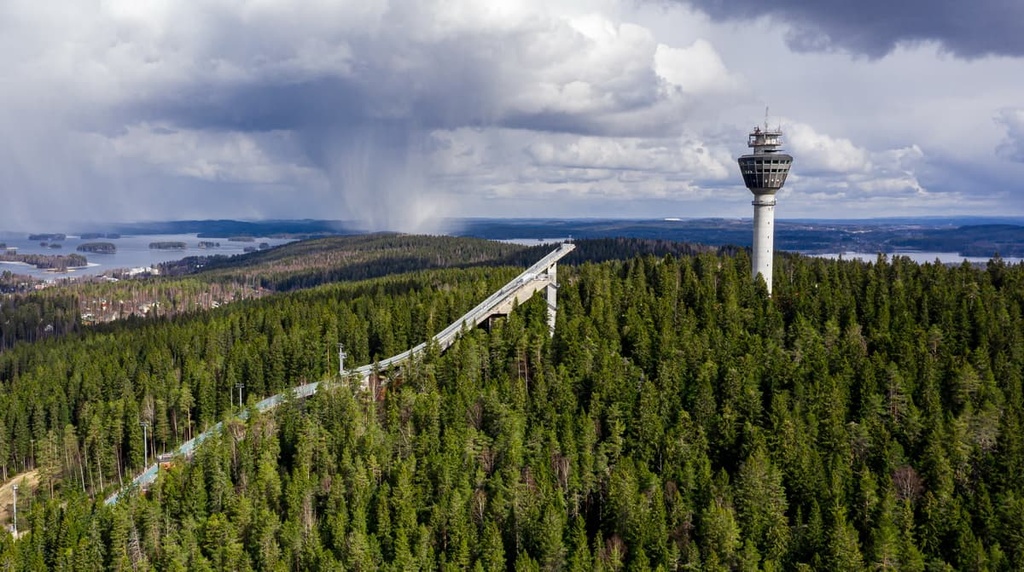
Puijo (232 m / 761 ft) is the eighth highest mountain in the region, which is, however, arguably its most famous because it is located almost in the center of Kuopio and is its main and most popular recreation area.
Puijo is not just a hill, but a whole series of attractions and sites that includes Puijo Tower, 75 meters (246 ft) high, built in 1963 on top of the hill and is home to the first panoramic restaurant in the Nordic Region. There are also the three hundred Puijo Stairs that take you to climb to the foot of the tower, the Puijo Ski Jumps where local athletes train, and the Puijo Nature Activity Park.
Finally, Puijo is one of the oldest nature reserves in Finland with more than 200 hectares (494 acres) of protected old-growth spruce forest. On Puijo, you can also see the remains of ancient fossilized beaches from the Yoldia Sea (6,000–11,000 years ago), which preceded the modern Baltic Sea.
Despite the fact that Puijo is not formally on the list of the 27 national landscapes of the country, the whole landscape of Puijo is also nationally valuable as it contains areas of geological, natural, recreational, and cultural significance.
Linnamäki (220 m / 721 ft) is the last in a series of famous peaks in the region, because the Väisälänmäki Village, which I have already described above, is located partly on it.
There is also a high wooden observation tower at the top of the hill, which offers views of the village, the forests, and Onkivesi Lake in the distance. If you’re looking for an adventure, you can hike the 2.5 km (1.5 miles) long nature trail that takes you through the mountain. There is also a lean-to shelter on the mountain where you can rest or spend the night during the summer months.
There are at least five main hiking areas with marked trails of various lengths in the Northern Savonia region.
In Pujio Nature Reserve, you can hike one of the following trails:
As you can see, these hikes are not long, but they can be combined into one trail of more than 6 km (3.7 miles). Add to that a 2 km (1.2 mi) walk back and forth from the city center to the nature reserve and you can get a solid 10 km (6.2 mi) hike in during a trip to the region.
North Savo is also home to two of Finland’s national parks: Southern Konnevesi National Park in the west of the region bordering Central Finland and Tiilikkajärvi National Park in the northern part of the region.
The longest trail in Southern Konnevesi, Kolmen Vuoren Vaellus (The Trail of Three Mountains), is 16 km (9.9 mi) long and it can be hiked in two days, with an overnight stay right on the lakeshore at an equipped camp site. In Tiilikkajärvi, you can hike the Tiilikan kierto Trail (18 km / 11.1 mi), which involves a 4 km (2.4 mi) hike through the islands of Tiilikka Lake.
If you’re in the region, it’s also worth checking out the area’s two locally famous deep gorges: Seinavuori Gorge and Orinoro Gorge, both of which are over 20 meters (65 ft) high and up to 500 meters (1,640 ft) long. Both gorges can be accessed by nature trails of 3.5 km (2.1 mi) and 7 km (4.3 mi) in length, which is enough for an out-and-back day hike as well.
Additionally, you could head to Tahko Ski Resort on the Tahkovuori, which also has several hiking trails. The longest of these trails are Tahko Mountain Route (14.1 km / 8.7 mi) and Rahasmäki Route (20.1 km / 12.4 mi), both of which involve climbing the mountain and offer views of the surrounding area.
Finally, there’s also the small Pisa Nature Reserve surrounding the mountain of the same name also offers marked hiking trails with a total length of 8.5 km (5.2 mi).
That said, there are many more hiking areas in North Savo than we could possibly list here. As the Finns themselves truthfully joke about their country, “nature is at most 500 meters (1,640 feet) from your home.”
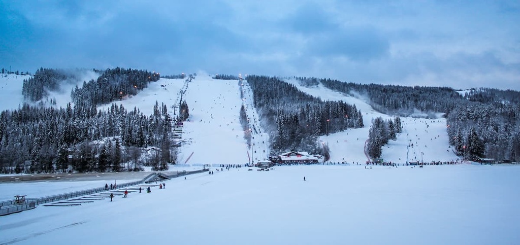
There are several ski resorts in the Savonia region where you can practice Alpine and cross-country skiing on mountains up to 300 m (984 ft) in elevation.
The largest of them is the Tahko Ski Resort in North Savo. It has 24 blue, red and black slopes (half of which are blue and red) with a total distance of 20 km (12.4 mi).
Additionally, the resort has 15 ski lifts: 2 chair lifts, 4 button lifts, and 1 carpet lift. There are also 42 km (26 mi) of cross-country trails, including a 20 km (12.4 mi) illuminated trail that’s generally open until 10 PM each night during the ski season. With 62 km (38.5 mi) of trails, it is the fourth biggest ski resort in Finland.
The Tahko Ski Resort has a ski school, equipment rental, ski maintenance, ski patrol and five on-slope restaurants, and seven shelters.
There is also the quite large Häkärinteet Ski Resort (6.5 km / 4mi), which features slopes for skiers and riders of all levels plus 5 ski lifts. It is located in Central Finland on the border with North Savo.
The rest of the resorts in Savonia are smaller and located mostly in South Savo. This includes:
To learn more about ski resorts in Finland, visit the World Mountains Lifts page on PeakVisor.
During your trip to North Savonia, be sure to visit the Kuopio Tourist Information office located in a new glass pavilion in Kuopio’s Market Square (Kauppakatu, 45, 70110, Kuopio, Finland). It is open from Monday to Friday from 9 am to 6 pm and on Saturday from 9 am to 3 pm.
You can also visit the Lakeland region page on the official tourist site of Finland for general information about the Eastern Finland.
In North Savo, there are a lot of accommodation options, ranging from Airbnb apartments to traditional Finnish cottages, which I described at the beginning of this guide.
However, if we are talking about hiking in national parks, as the most popular areas for outdoor activities, there you can stay in equipped camping sites, where you can pitch your tent and make a fire.
Many of these places also have lean-to-shelters, so you don’t even need to bring a tent—a sleeping bag could be enough from July until the first snow in October. However, from May to July, there are many mosquitos in Finland, so a tent or other bug shelter is highly recommended.
In Southern Konnevesi National Park, there are 10 such lean-to shelters, including Vuori-Kalaja, Lapinsalo, and Iso-Pyysalo, among others.
The region of Northern Savo has five major cities and resorts that are considered local centers of education, culture, business, tourism, and life in general: Kuopio, Iisalmi, Varkaus, Kiuruvesi, and Suonenjoki.
Kuopio is the capital of the region and its largest city. It is located on Finnish national road 5, which is the main road in the east of the country. This road connects the south of Finland with Lapland and it is 905 kilometers (562 miles) in length.
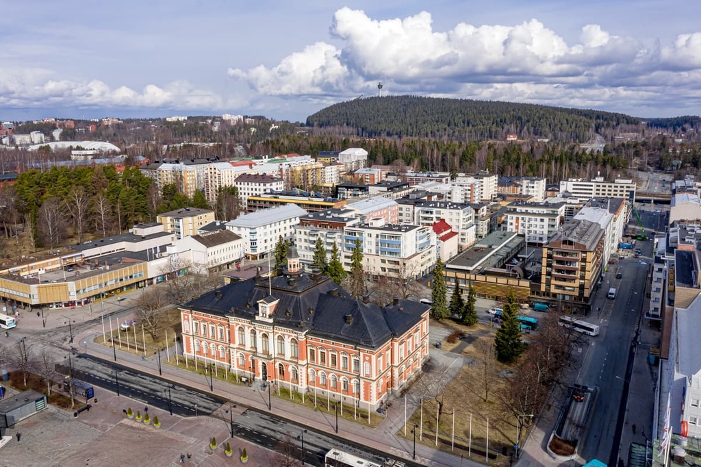
There are over 120,000 people living in Kuopio. It is also the most populous city in the former province of Eastern Finland and the eighth most populous city in the country to this day.
Life in the city is centered in Kuopio Market Square, which is one of the main cultural and architectural attractions of Kuopio. Other unique buildings include the Kuopio Museum (which was built in the Art Nouveau style in 1907), the Kuopio Art Museum, the Kuopio City Theater, and the Kuopio Academy of Design.
Among the two of the most important religious buildings, there are Kuopio Cathedral, a stone Neoclassical-style Evangelical Lutheran church (built between 1806 and 1815), and Orthodox Cathedral of St. Nicholas in the Väinölänniemi district.
Kuopio is home to one of the headquarters of the Finnish Orthodox Church. It is also the site of Buddha Dhamma Ramsi Monastery—the first Burmese Buddhist monastery in Finland.
Besides the Puijo Ski Jumps, there are many sports facilities and parks in and around the city, including Väinölänniemi Park, Piispanpuisto Park, and Brahe Park.
Väinölänniemi Beach is maybe the most famous in the city during the summer months. But there are many other great beaches to check out in Kuopio as the icty is home to a large number of lakes.
For more information, check out Kuopio’s official tourist site: Kuopiotahko.fi.


Yes. Northern Savonia has 169 named mountains. The highest is Välimäki at 314 m.
The highest mountain in Northern Savonia is Välimäki, at 314 m.
Northern Savonia has 169 named mountains.


