Get PeakVisor App
Sign In
Search by GPS coordinates
- Latitude
- ° ' ''
- Longitude
- ° ' ''
- Units of Length

Yes
Cancel
❤ Wishlist ×
Choose
Delete
Åland Islands, or simply Åland, is a unique cultural and natural Finnish region located in the Baltic Sea. The main feature of Åland (Ahvenanmaan maakunta) is that it is considered one the largest archipelagos in the world with more than 6,700 islands, skerries, and rocks. There are 49 named peaks in the Åland Islands. The highest and the most prominent point in the islands is Orrdalsklint (129 m / 423 ft).
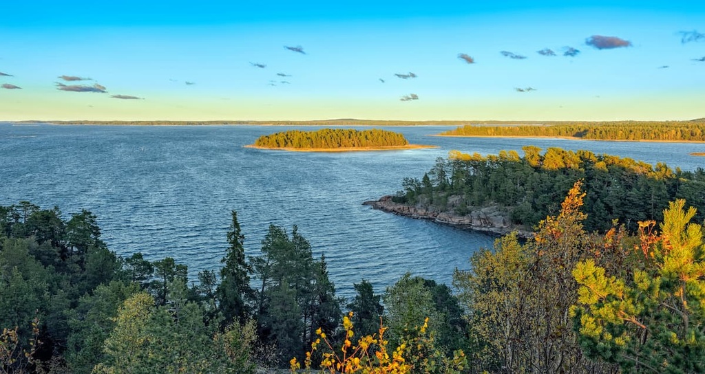
The name of the Åland Islands conveys its geographical features. The word Åland likely means "water” and comes from the Proto-Norse ahva and Proto-Germanic ahwō. It shares a similar root as the Latin word aqua.
However, according to other sources, the word Åland may come from the Finnish name of the region, Ahvenanmaa, rather than from Norwegian or German.
Åland is one of 20 large regions of Finland and it encompasses its namesake islands in the northern Baltic Sea at the entrance to the Gulf of Bothnia, which washes the west coast of Finland and the east coast of Sweden. The islands are situated exactly in the middle between these two countries, with the Swedish coast only 36 km (22 mi) away.
The region includes more than 6,700 islands, making it one of the largest archipelagos in the world. Moreover, the islands continue to the east, merging with the Archipelago Sea, which features its namesake national park in the region of Finland Proper or Southwest Finland.
In total, there are more than 40,000 islands in this region. Conversely, to the west of Åland, there are almost no islands. This part of the Baltic Sea is called the Sea of Åland.
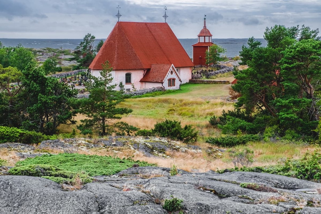
The total land area of the region of the Åland Islands is 1,580 sq km (610 sq mi). It is the smallest region of Finland, and it is five times smaller than its nearest neighbor, Central Ostrobothnia (5,706 sq km / 2,203 sq mi) in the Western Finland. The total area of Åland, including the water within its boundaries, is 13,324 sq km (5,144 sq mi).
The Åland Islands can be reached from one of the two surrounding countries, Finland or Sweden. There are regular ferries on the Helsinki–Mariehamn–Stockholm route. Mariehamn is the only town and the capital of Åland. This route is operated by both the Viking Line and Tallink / Silja Line ferry lines and it has both day and night departures.
There are also ferries from Turku and Naantali in Finland, which is closer to Åland than Helsinki. However, the fastest way to the islands is from Sweden, specifically from the port of Grisslehamn in Norrtälje municipality of Stockholm with the Eckerö Linjen ferry company or from Kapellskär with Viking Line. The total travel time on the ferry is two hours.
You can also arrive here on a ferry from Tallinn, the capital of Estonia on the Tallink / Silja Line, but the distance for this voyage is longer than it is from Sweden and Finland.
For those who come by their own yacht from any place in the world, the most notable harbor of Åland is named Ytternäs. It is located in Mariehamn.
You can also reach the islands by plane from the Helsinki-Vantaa or Turku airports in Finland or Arlanda Airport in Sweden, but the sea route is of course a thousand times more beautiful (trust me—I’ve made the voyage myself). From Finland, I recommend going not only to Åland but also to Stockholm, which is also surrounded by many pretty islands.
On the archipelago itself, you can drive your own car, which you can transport on the ferry, or you can rent a car from one of two local companies: RBS biluthyrning and Budgetrent.
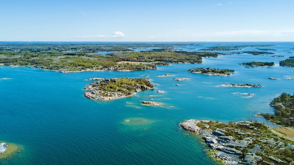
As far as public transport is concerned, there are buses, ferries and water taxis available.
Another great way to travel around the Åland Islands is by bicycle or ebike, which can be taken on ferries as well. In the latter case, the most convenient route is between the municipalities of Hammarland and Geta. The longest distance by land that awaits you is just 50 km (31 mi) from west to east across the largest island in the archipelago.
The geology of Åland Islands is similar to that of the entire Archipelago Sea. The tens of thousands of its beautiful rocky islands were formed as a result of a geological process known as post-glacial rebound (isostatic rebound).
This is the process by which land, which has long been covered by a layer of heavy glaciers, gradually rises above other parts of land that wasn’t as heavily glaciated. That process started about 11,500 years ago. At that time, the ancient Yoldia Sea covered the land that would eventually become the archipelago’s islands.
That's how the islands formed. It is interesting that the process of their formation continues to this day. In fact, the existing islands rise by about 5 mm (0.1 in) per year. This might not seem very fast, but in geological terms, it is lightning speed.
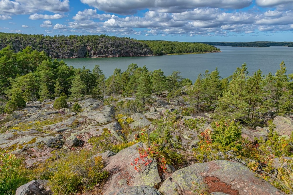
That said, the largest inland bay of Åland, Lumparn Bay, which is located to the southeast of the main island of Fasta Åland, is believed to be the result of an impact crater from a meteorite that fell 1 billion years ago in Proterozoic (2.5 billion to 541 million years ago). This meteorite formed a "hole" in the island in an almost perfectly round shape.
As far as the most common type of bedrock in the Åland region goes, it is the same as for the rest of Finland: various kinds of granites and gneisses. One of the most common rocks is the Rapakivi granite with quartz crystals, which gives the rocks of the islands their characteristic reddish and pinkish beautiful color.
The main feature of Åland's landscape is the islands themselves. First of all, you should know that among the more than 6,700 islands, only about 300 islands are habitable, of which only more than 60 are actually inhabited. Here are a few more important details about the islands:
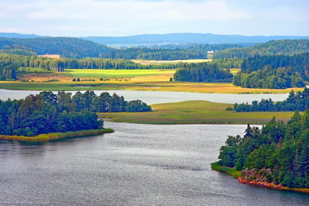
There are also a number of other unique landscape features on the islands themselves. These include:
People began to settle on the Åland Islands about 7,000 years ago during the Neolithic period, which was the final part of the Stone Age. In the Iron Age, the population of the islands was already actively communicating with other tribes of Scandinavia and the Kola Peninsula in Russia. The locals lived by hunting, fishing, and gathering.
However, Åland is located closer to Sweden and it is to Finland. Therefore, the main language of Åland is Swedish, not Finnish.
Like Finland itself, the region was for centuries under Swedish control (1157–1809), until the latter ceded it to Russia (1809–1917). Finland became independent for the first time in its history in 1917 at the end of the Russian Empire. The history of this, in particular, can be traced through the many castles and military fortifications on the islands.
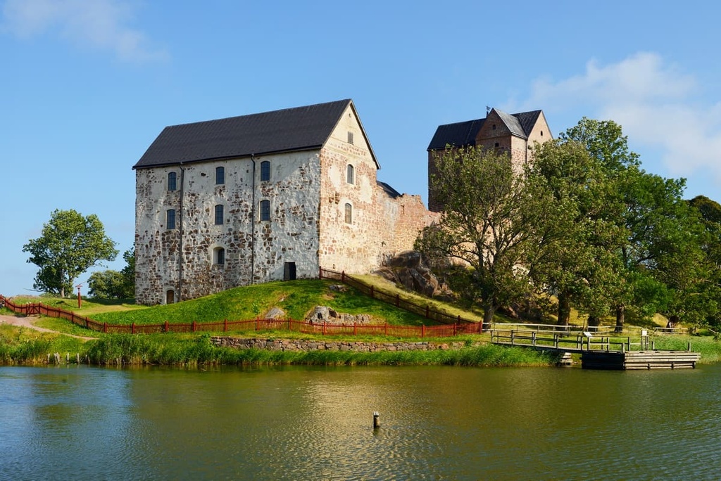
In 1918, approximately 95 percent of locals on the islands voted to become part of Sweden, but Finland did not allow this independence. Therefore, the residents of the islands shifted their fight toward greater autonomy from Finland. Åland gained autonomy three years later, in 1921. One of the main demands of the local population was for complete demilitarization of the islands.
Today, the autonomy of the Åland Islands means that the region has its own government and its own policy on a wide range of issues such as culture, economy, tourism, and ecology. The region makes full use of its rights, which is evident in its high standard of living.
Most of Åland's 43 named mountains are excellent viewpoints for overlooking the archipelago. Here are some of the most notable summits in the region.
The highest summit in the Åland Islands is Orrdalsklint (129 m / 423 ft). The peak is located in the north of Fasta Åland in the municipality of Saltvik, about 7 km (4.3 mi) to the northeast of the center of the archipelago. This part of the islands is considered one of the most picturesque, so the summit of Orrdalsklint is a must-see, despite its remoteness.
The trail to the summit is not heavily promoted by the local tourist office because it may be on private property, but you can still climb it easily by a marked trail and wooden stairs.
At the top, you will find a wooden observation deck. From the top you can see the endless pine forests of Åland, the equally endless Baltic Sea, and other large islands in the region, such as Boxö, Sommarö, Flatö, and Ryssö.
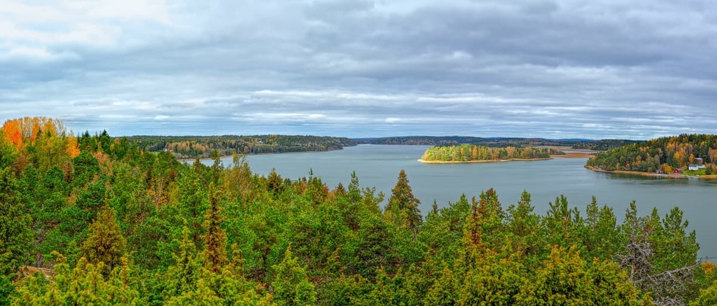
There is also a hiker’s cabin on the mountain, which is easily recognizable because it is painted in the same red color as many other buildings in the Ålands and in Scandinavia.
The other mountains of the archipelago are spread out relatively evenly across the islands. These include:
Due to its geographical, natural and historical features, Åland is one of the best hiking destinations in Finland. It has several hiking areas that are filled with hiking trails of different lengths and various points of interest. Here are some of the best hikes to check out in the region.
The Åland Islands do not contain any of Finland’s 40 national parks, but all the islands are essentially one big hiking area, thanks to the great outdoors and the region’s developed tourist infrastructure.
Nevertheless, some of the most popular hiking areas include Fasta Åland, Eckerö, and Lemland, the latter of which can only be reached by water transport.

You’ll find at least 35 major marked hiking trails in the Åland Islands, which can be divided into two large groups: short nature trails up to 8–10 km (4.9–6.2 mi) long, and long trails ranging from 10 to 60 km (6.2–37.2 mi).
Nature trails and various themed trails are located throughout the archipelago in small nature reserves and other protected areas. For example, on the "Långbergen—Wilderness And Stone Age" trail from Vargstensslätten to Långbergen (5.5 km / 3.4 mi) on the main island of Åland, you can learn about the lives of the first inhabitants of the islands.
Examples of long trails in the archipelago include:
All these trails have approximately the same level of difficulty (easy to moderate), but be careful on the rocks throughout the archipelago, which can be very slippery.
Another great and even longer hiking trail is St. Olav Waterway. This is arguably one of the first pilgrimage routes in the world. It runs from the Turku Cathedral in Turku on the Finnish mainland to Sweden. In Sweden, the trail separates to several alternative routes, including the Viking Trail, Helgonleden, and Stråsjöleden, the latter of which brings you to Trondheim in Norway.
For those keen on cycling, the entire archipelago can be seen and experienced on two wheels on the Åland Archipelago Trail, thanks to a system of ferry crossings. The route has three sub-options along with the central, northern, and southern parts of the main island.
The main points of interest on Åland are various historical buildings and sights, museums, and observation towers. There are about 300 points of interest in total, some of the most popular of which include:
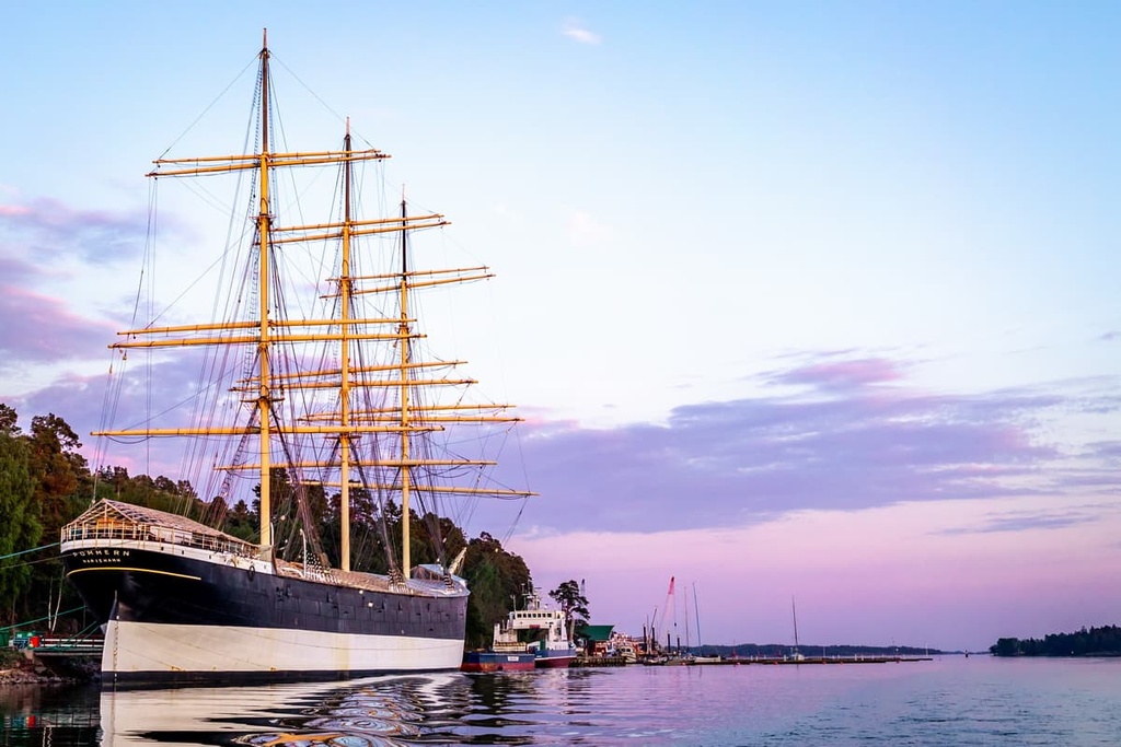
When traveling to the Åland Islands, be sure to visit the region's official tourist center, Visit Åland, located in Mariehamn. Here, you can get help with your travel itinerary and cool souvenirs.
Visit Åland
Storagatan, 8, AX-22100, Mariehamn, Åland, Finland
+3581824000
Opening Hours:

In Åland, you can easily find accommodations, such as hotels, apartments, cottages, B&Bs, and campgrounds, throughout much of the archipelago. Some of the eco-friendly accommodations in the region include:
All of these accommodation options boast a local sustainable certification called the “Green Key.” The Green Key is also represented in the form of a green flag on these buildings. This is similar to the “Blue Flag,” which is an award given to the best beaches with the cleanest water and developed infrastructure in the region.
In general, Åland positions itself as a place where it develops sustainable tourism in all available ways.
In Åland, you can also pitch your tent to camp nearly anywhere you’d like. You can also walk wherever you’d like and collect berries and mushrooms thanks to the Everyman’s Right Law in Finland.
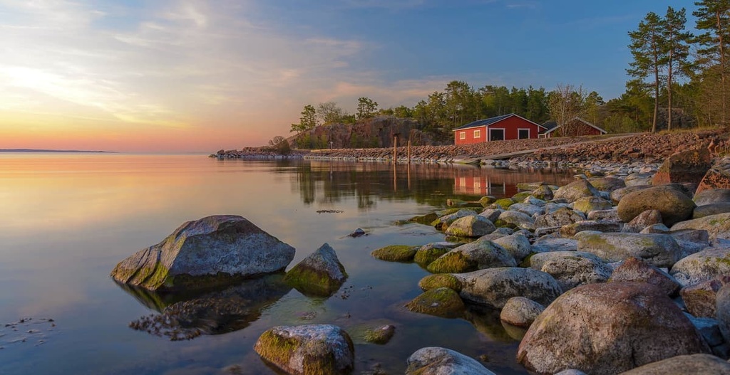
Mariehamn is the main and only town on the Åland Islands, all the other towns in the archipelago are considered villages and small settlements. The town was founded in 1861 by Russian Czar Alexander II. The town is named after his wife, Russian empress Maria Alexandrovna. The town’s name means “Marie’s Harbor” in Russian.
The city has around 12,000 residents, or about one-third of the population of the islands. However, the city is visited by about 1.5 million tourists a year. Therefore, it is not difficult to assume that locals make their living primarily from tourism but also from sailing and various maritime services, fishing, and banking.
The city is considered and is a great place to travel for outdoor activities. It features two major scenic harbors (Västerhamn and Österhamn), a historic center with beautiful long streets and wooden houses, as well as many parks.
In particular, be sure to walk along Södragatan, one of the oldest streets in the town, or Ålandsvägen, which is decorated with Linden trees. There are many of these trees in the town, so for this reason, it is also called “The Town of the Thousand Linden Trees.”
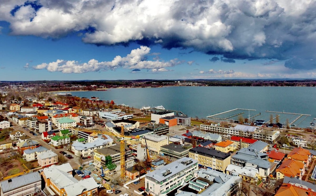
The main cultural and architectural attractions of the city include St. George’s Church, Nordea Bank, Municipal Library, Åland Maritime College, Town Hall, and Åland Museum. There are also many buildings that were designed by two celebrated Finnish architects, Hilda Hongell and Lars Sonck.
For more information, check out the official tourist website for the region: VisitÅland.com.
Explore Åland Islands with the PeakVisor 3D Map and identify its summits.


