Scan the QR code and open PeakVisor on your phone
Central Ostrobothnia is one of Finland’s 19 regions, located in the southwest of the country. The main feature of the region is Tankar Island of Luoto Archipelago, one of the several clusters of islands in the Gulf of Bothnia of the Baltic Sea, which is a perfect example of the local scenic landscape. There are lighthouses, long sandy beaches, and cozy ports, and fishing villages, hued in the color of red ochre in Scandinavian style. However, it is far from the only region’s attractions. There are 8 named mountains in Central Ostrobothnia. The highest and most prominent mountain is Patamäki (40 m / 131 ft).
The name of the region indicates that it is the central part of the larger region of Ostrobothnia, which is one of the nine historic provinces of the country, along with Finland Proper (the main city of Turku), Uusimaa (Helsinki), Laponia or Lapland (Rovaniemi and Inari), and others. At the same time, it is the largest province in terms of territory, occupying about 40% of the country in its geographical center.
The name of the region in Finnish and Swedish is Keski-Pohjanmaa and Mellersta Österbotten, respectively. For what exactly the word itself means, read the guide to the region of Ostrobothnia, which is considered the main one for the province.
Central Ostrobothnia is the smallest not only of the four regions of the namesake historic province but of the whole country apart from the Aland Islands between Finland and Sweden. The area of the region is 5,706.39 sq km (2,203.25 sq mi).
It is bordered by North Ostrobothnia to the north and northeast, Central Finland to the southeast, South Ostrobothnia to the south, and Ostrobothnia to the southwest.
As has already been made clear, the western boundary of the region is the Bothnian Sea, an inland sea of the larger Baltic Sea. For this reason, Central Ostrobothnia also belongs to the Coast and Archipelago natural and touristic region, one of the four in the country along with Helsinki, Lakeland in the east, and Lapland.
The region is also part of the former province of Western Finland, which between 1997 and 2009 was a separate large region of the country, on par with the other five.
The capital and largest city of Central Ostrobothnia in Kokkola, which is located on the coast. It is also one of the two sub-regions on par with Kaustinen, which occupies the mainland part of the region. To get to Kokkola from Helsinki by car, you need about 5:30 hours (470 km / 292 mi). By public transport, this distance-time can be covered by bus (state-run Matkahuolto or low-cost OnniBus) and VR.fi train.
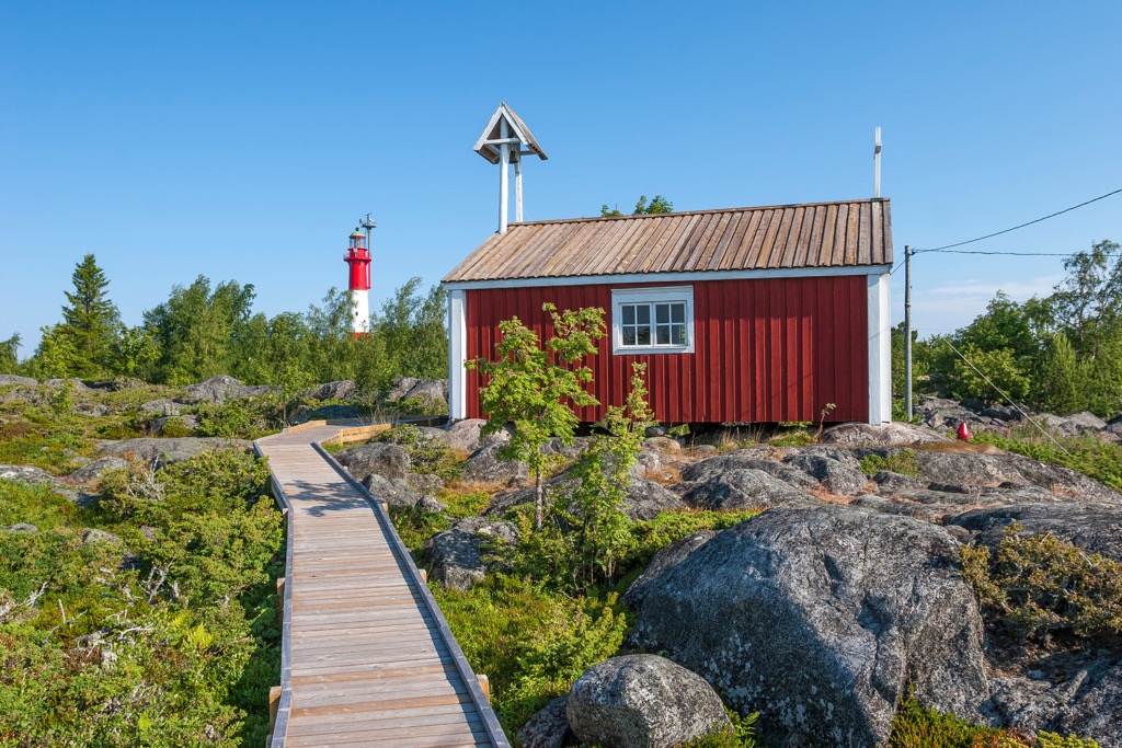
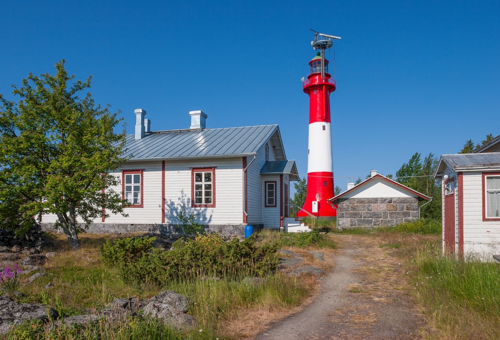
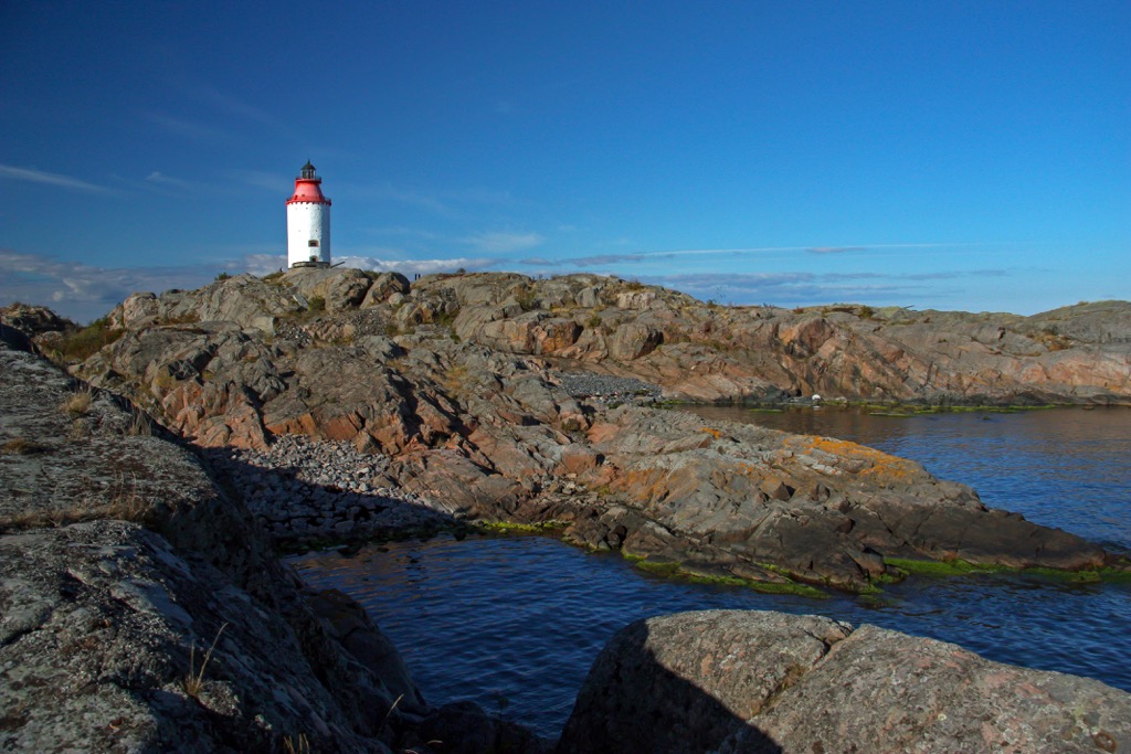
The main feature of the region’s landscape is the Island of Tankar (Tankarin Majakka) of Luoto Archipelago, one of the several clusters of islands of the larger archipelago that stretches almost all along the Gulf of Bothnia along the western borders of the country.
A relatively small island, located 15 km (9.3 mi) from the center of Kokkola, is a prime example of the local landscape and way of life in general, in which the word “sea” (and everything associated with it) is central. First and foremost, this is seafaring and fishing.
There are several attractions with the same name on the island including:
You can reach Tankar Island by ferry from the local shipping company M/S Jenny from Kokkola in the summer season. The ticket cost 14 € for adults. But be aware that the lighthouse itself is open to visitors only from June 8 to August 31 (in 2022) on Wednesdays from 2:30 am to 3:00 pm. The fee is 5 € per person over 15 y. o.
All in all, it is a must-visit place when visiting Central Ostrobothnia. However, it has some good alternatives, which I will name further in the guide.
Central Ostrobothnia is probably the least mountainous region of Finland because of its small size and location on the shores of the Baltic Sea. However, it is not without some low mountains, of which there are eight. Lucky for travelers, they are all located within the city of Kokkola, which means that they are easy to climb to look at the surroundings, including the highest peak Patamäki (40 m / 131 ft) just a few steps from the city center.
In Central Ostrobothnia, despite its small size compared to other Finnish regions, you will find many hiking areas and trails, of which I would single out five main ones.
The first is still Tankar Island, which is also a protected nature area included in the Natura 2000 Network as part of the Luoto Archipelago. There you can hike the 1.5 km (0.9 mi) nature trail around the island, while checking its main attractions.
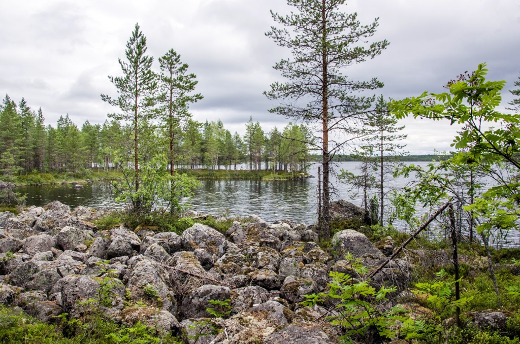
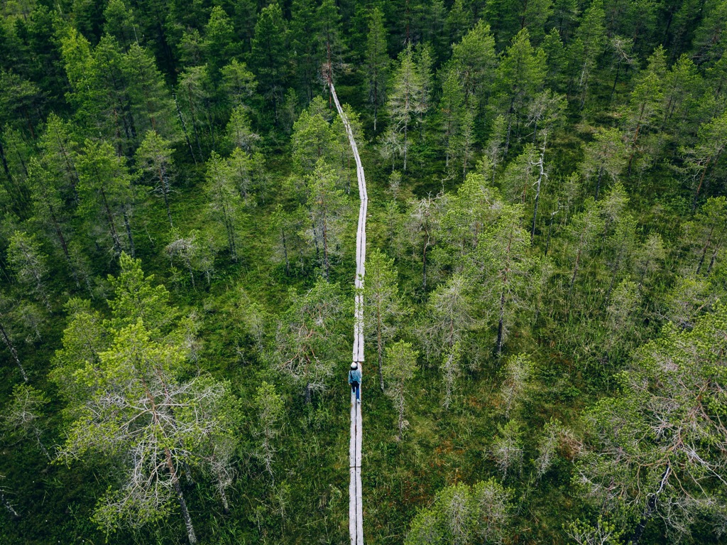
The second is Salamajärvi National Park, the only one in the region and one of 40 in the country, which is located on the border with Central Finland. It is suitable for longer hikes.
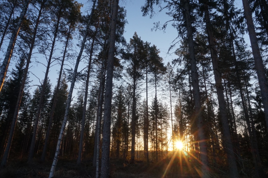
The park’s landscape differs from that of the coast in that it is dominated by dense pine and spruce forests and bogs, typical of mainland Finland, which are ideal habitats for the wild forest reindeer that are depicted on the park’s emblem. The forest reindeer was specially introduced to the area and now number over 1000 individuals in the population, indicating a good chance of meeting them during a hike.
The park’s longest trail is the Hirvaan kierros, which is 59 km (36.6 mi) long. But there are also easier routes for day-hikes: Vaatimen kierros (18 km / 11.1 mi), Pahapuron lenkki (7 km / 4.3 mi), Metsäperäläisen taival (6.2 km / 3.8 mi), and others.
The third main hiking area in Central Ostrobothnia is Vattajanniemi Cape on the very north of the region with 15 km (9.3 mi) coastal line with the longest sandy beach in the Nordic countries, and the largest coastal dune area in the boreal region.
So the cape is suitable for so-called "coastal walking", which I like to practice myself and highly recommend trying. You can walk right along the sea, and sleep in a tent in the forest a few meters (feet) away.
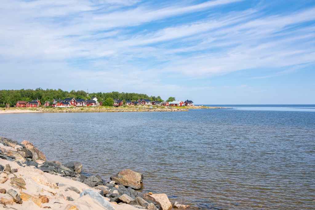
At the tip of the cape is also Ohtakari Island with the fishing village of the same name, the second most known in the region after Tankar.
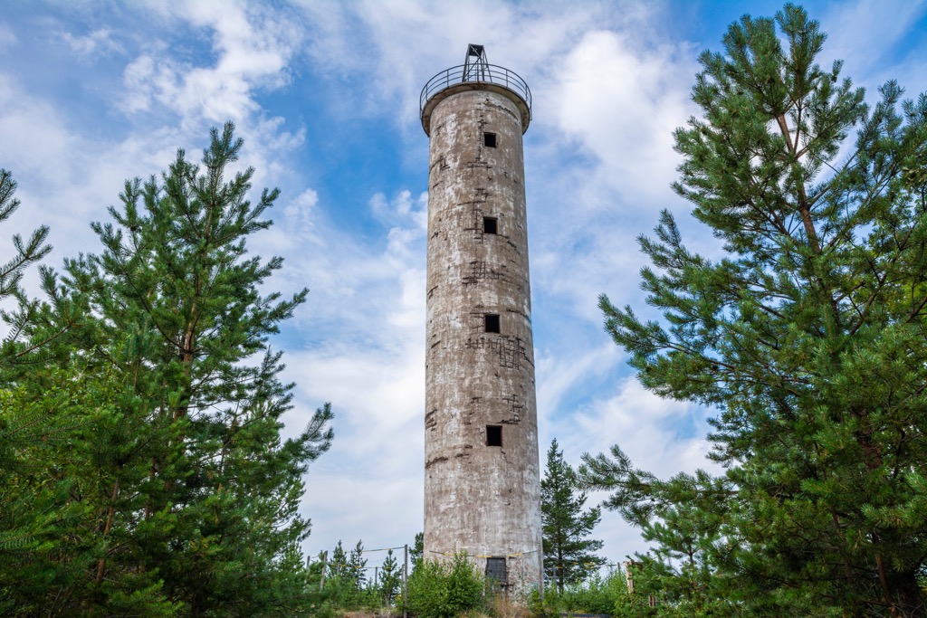
The fourth area is Kokkola itself with many smaller hiking areas in the immediate vicinity of the city: Meripuisto Park, Laajalahti Bay, Harrinniemi, and Trullevinniemi capes with another lighthouse for those who will not go to Tankar and another fishing harbor, Trullö, and others.
In each of them, you will also find hiking trails. For example, in Trullevinniemi there is Trullevi Hiking Trail (12.9 km / 8 mi), which runs in a diverse forest landscape across the cape.
The fifth main hiking area is Öja Archipelago, which is also one of those near Kokkola, but it should be noted separately because it is included in the same Natura 2000 Network. There you can hike along the 21 km (13 mi) trail, one of the longest in the Kokkola area.
Öja is also a popular cycling destination as it is accessible via a scenic coastal route of about 15 km (9.3 mi).
Here you will also find the third most famous fishing village in the region on par with Tankar and Ohtakari. It has the same name—Öja.
When traveling in the Central Ostrobothnia region, visit one of its official tourist offices and info points, which are located in almost all towns and resorts, starting with Kokkola on the coast and Kaustinen in the inner part of the region.
Kokkola Tourist Information
Kauppatori 5, Kokkola, Finland
Open during the summertime, in other seasons via phone and email
+358408065075
Kaustinen Tourist Information
Lestintie, 39, 69440, Lestijärvi, Finland
+358044 516 8733
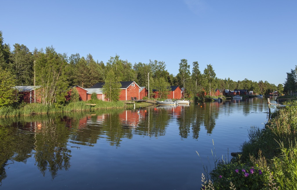
There are many different types of accommodation in Central Ostrobothnia — rental huts, open wilderness huts, camping grounds, cottages, B&Bs, and others—throughout the region. Let's take the Salamajärvi National Park as an example, as the main place for hiking in the region.
In Salamajärvi, there are first five rental huts: three Sysilampi Rental Huts with rooms for 2, 6 and 6 people; Pieni Sääksjärvi Rental Hut for 6 people; and Koirasalmi Nature Information Hut—the largest one, with rooms for 1–4 people, 22 person in total. You can rent it on Koirasalmi.com.
Then, there are three open wilderness huts: Sysilampi Open Wilderness Hut for 4 people; Pitkälahti Open Wilderness Hut for 2 people; and Valvatti Open Wilderness Hut for 4 people.
Finally, there is a lean-to shelter and several camping sites.
As everywhere else in Finland, you can pitch your tent literally everywhere following the Everyman's Right law, even on private property, but not within the national parks.
Kokkola is the capital and largest city of the Central Ostrobothnia region with a population of 47,915 (2021).
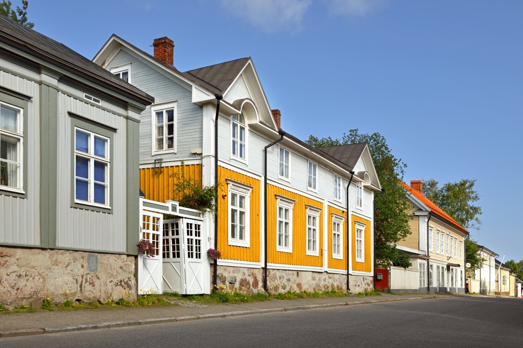
The main architectural and cultural attraction of the city that I haven't mentioned yet is the Old Town of Neristan, which is located in the center of the city. It consists of 12 blocks with several hundred wooden buildings, the oldest of which date back to 1665. What is even more amazing is that Finns have carefully preserved almost perfect conditions as if they were painted only yesterday. More: It is one of Finland's most extensively preserved historical areas of wooden houses.
In addition to Kokkola, consider also visiting the town of Lestijärvi, located to the east of Central Ostrobothnia on the only large lake in the region with the same name.