
Scan the QR code and open PeakVisor on your phone
Ostrobothnia is home to 17 named mountains. The highest is Bötombergen at 131 m.
Ostrobothnia is one of the 19 regions of Finland, which is located on the western coast of the country. The main feature of the region is Kvarken Archipelago with more than 5,600 beautiful rocky islands, the only natural site on the UNESCO World Heritage List in the country, and a very good reason to visit it, if you haven’t been here before or missed it on your last trip to Finland. There are 17 named mountains in Ostrobothnia. The highest and the most prominent mountain is Bötombergen (131 m / 430 ft).
The name of the region is a simplified version of its Swedish version, Österbotten, where "öster" means "east" and "botten" means "bay". So it is "Eastern Bay (of Sweden)", which was indeed the case for much of the history of Finland, which was the eastern region of Sweden.
I will also note right away that Ostrobothnia is the leading of only a few regions in the country, with a dominant Swedish-speaking population (51.2%), although this language is considered the second official language and is used everywhere on a par with Finnish.
The Finnish name for the region is Pohjanmaa, where "pohja" means "north" or also "bottom", which is consonant with "botten" in Swedish (and "botn" in Norwegian), and "maa" means "land". So, it is "Northern Land" or "Lower Land".
There is no mistaking it: the ancient Scandinavians believed that the north was the bottom of the world (and the south, respectively, the top), where the sun hides every day, not the top as is commonly believed today.
Bothnia is also the name of the gulf, on whose shores the region is located: Gulf of Bothnia (Finnish: Pohjanlahti; Swedish: Bottniska viken). It is a gulf in the Baltic Sea, the inner part of which is also called separately the Bothnian Sea.
Ostrobothnia, as Finland’s modern region, is located at the western tip of Western Finland, which between 1997 and 2009 was a separate large province, on par with the five others. The region has an area of 7,932.36 sq km (3,062.70 sq mi), one of the smallest in the country.
Ostrobothnia is bordered to the north by Central Ostrobothnia (the main town is Kokkola) and to the east by South Ostrobothnia (Seinäjoki) regions. Together with North Ostrobothnia (Oulu), which is just right next, they form a large historical province of the same name, one of eight similar provinces. Among them, Ostrobothnia is the largest in terms of area, occupying more than 1/3 of the country or about 40%. Previously it also included the Kainuu (Kajaani), which today is also an independent region, and the southern part of Lapland, known as Peräpohjola.
To the south, Ostrobothnia is bordered by Satakunta (Pori).
Ostrobothnia is also the center of one of the country’s four great natural and tourist areas called the Coast and Archipelago (the other three being Helsinki, Lakeland, and Lapland).
The main city of the region is Vaasa, which is located 421 km (261 mi) or 5 hours by car from Helsinki to the northwest. You can also reach the city by bus (state-run Matkahuolto or low-cost OnniBus) and VR.fi train.
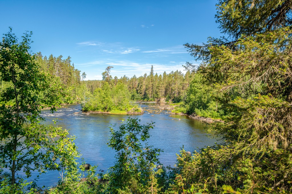
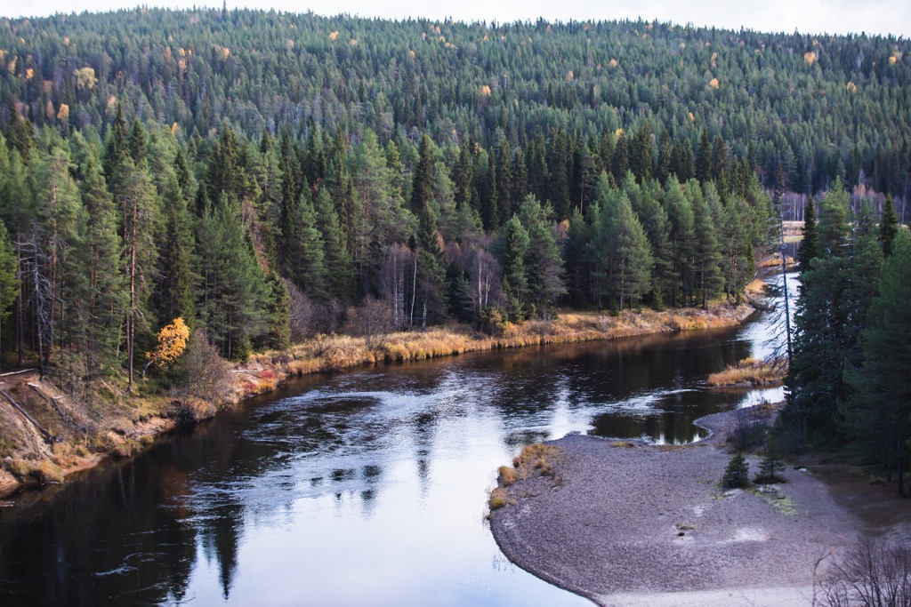
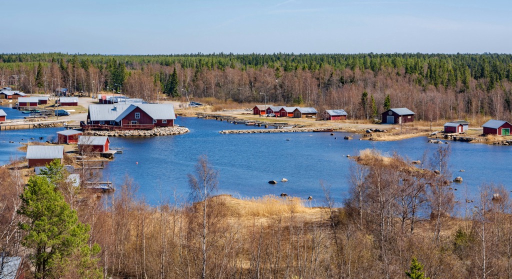
Accordingly, the main feature of the landscape of Ostrobothnia is the heavily rugged coastline of the Baltic Sea with a lot of rocky islands, capes, and bays, which form picturesque skerries, including the aforementioned Kvarken Archipelago with over 5,600 islands.
The archipelago is the only natural UNESCO World Heritage Site in Finland (there are also six cultural sites, seven in total) under the name High Coast / Kvarken Archipelago. The first part of its name (Höga Kusten in Swedish) refers to the west coast of Sweden on the opposite side of the gulf.
Both areas are listed as the best representatives of a geological process known as post-glacial rebound (isostatic rebound), which means that the gulf is getting bigger all the time. The land is rising above sea level, as it was relatively recently released from the pressure of the Fennoscandian ice sheet, which melted about 10,000 years ago. During this time it has risen to an "incredible by geological standards" 285 meters (feet).
Kvarken Archipelago is also included in the list of 27 national landscapes of Finland, which have special spiritual significance to Finns, as well as to all those who love this country.
However, it is not the only natural feature of the region. I’ll tell you about the others right next.

In this section I will briefly discuss the human history of the entire Ostrobothnia historical province, including all four parts of it.
The area on the eastern shore of the Gulf of Bothnia, as well as Finland in general, began to be inhabited by ancient hunters and gatherers immediately after the melting of the glacier some 10,000 years ago. This is evidenced by many archaeological finds, including the Neolithic stone enclosures unique to Ostrobothnia known locally as Giant’s Churches (Finnish: Jätinkirkko).
There are over a dozen such sites found through the region, the most known of which is Kastelli Giant’s Church (Kastellin Jätinkirkko) located near the town of Raahe south of the city of Oulu in Northern Ostrobothnia. They look like large mounds of medium-sized stones, laid out in a rectangular shape, suggesting that they are clearly of human rather than natural origin. It dates back to 2000 BC.
By the Middle Ages, hunter-gatherers were gradually replaced by farmers. The region is considered one of the main agricultural areas of Finland with many vast arable lands in the valleys of the major rivers for planting various types of products. These, however, have not only practical but also aesthetic value, so they just inspire with their views. For example, one of these valleys, Kyrönjoki Valley, and its agricultural area in Southern Ostrobothnia, is another site on the list of 27 national landscapes in Finland (read more about it in the guide to this region).
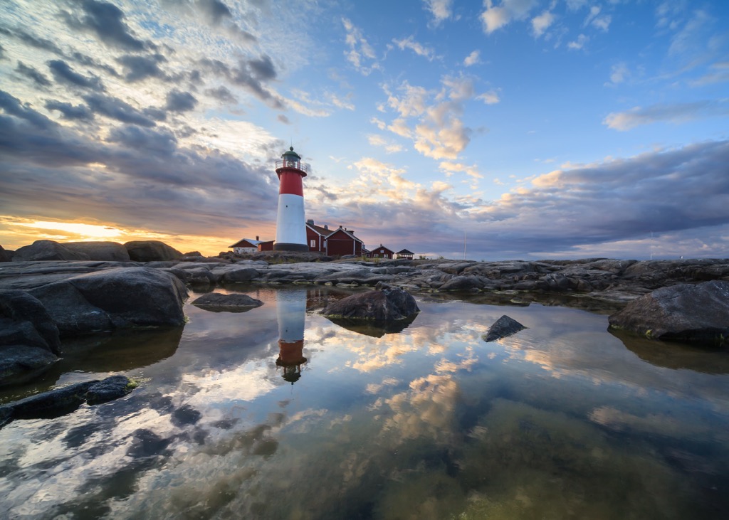
To finish with the national landscapes in Ostrobothnia, the third such site in the historic province is Hailuoto Island in Northern Ostrobothnia, famous for its white-washed lighthouse and the red wooden houses and boat garages, painted in the color of red ochre, adopted both in Sweden and throughout Scandinavia (Finns also follow this tradition, though to a lesser extent).
There are many other similar seaside locations such as Hailuoto—ports and fishing villages (local hunted mainly on the seal) in Ostrobothnia—which contribute to the history of the region. You can learn more about this part or side of human history of the region in one of its great maritime museums, in particular: Maritime Museum of Vaasa in the center of the region—one of more than 10 such a museums in Finland, Kvarken Boat Museum in Maalahti in the same Ostrobothnia, Seal Hunting Museum on an island of Tankar, near Kokkola, in Central Ostrobothnia, and others.
The fourth, and the last of national landscapes, is Oulankajoki River Valley, the main natural artery of Oulanka National Park, flowing from Southern Lapland through eastern part of Northern Ostrobothnia to Paanajärvi National Park in the Republic of Karelia in Russia.
Going back to history, the first real towns and cities in Ostrobothnia appeared only around the 17th century, when the region as part of Finland was, in turn, a part of Sweden and then Russia, gaining independence along with the whole country only in 1917. From here one can feel the strong Swedish influence in the general planning, architecture of buildings and their individual details, and so on, in Ostrobothnia.
As in the past, today Ostrobothnia is one of the main regions of the country, and not only because of its size. For example, the University of Oulu is considered one of the best in the country for teaching and practicing a variety of exact and modern sciences, including IT. At the same time, the city is preparing to become the European Capital of Culture in 2026. Overall, it’s just a nice and safe place to live, not riddled with tourists compared to Helsinki, Tampere, and Turku, the three Finnish capitals to the south of it.
So I recommend visiting the region if you haven’t been here before or missed it on your last trip to Finland so that when asked where you've been and what you've seen in Finland, you can surprise the questioner with the counter question, "I bet you haven't heard of Ostrobothnia".
Bötombergen (131 m / 430 ft) is the highest of the 17 peaks in Ostrobothnia. It is located near the small village of Karijoki, 15 km (9.3 mi) east of the nearby coastal town of Kristinestad, south of Vaasa. The name of the mountain is Swedish, in Finnish it is known as Pyhävuori (113 / 370 ft), as evidenced by the second highest peak in the region, located in the same small series of hills. These are wide open peaks with views of the surrounding pine forests.
Bötombergen / Pyhävuori is also known for two other reasons:
Just south of Bötombergen / Pyhävuori is also Söderberget (108 m / 354 ft). Together they make up the top of only three mountains over 100 m (328 ft) or the most elevated place in the region.
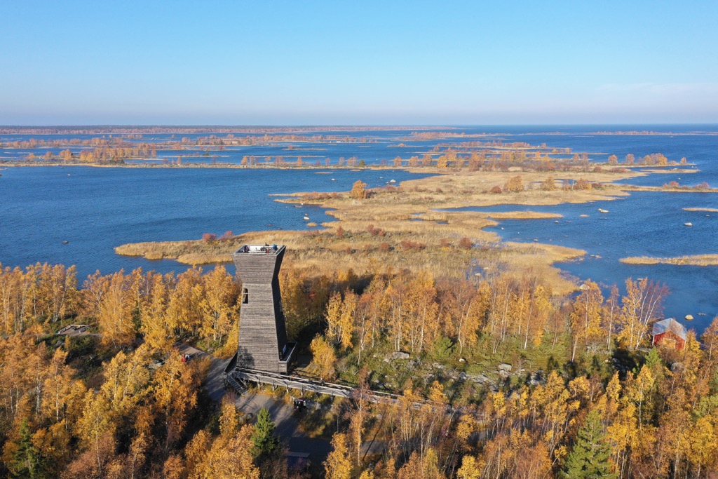
The rest of the mountains in Ostrobothnia are lower rocky hills. But, luckily for lovers of outdoor activities, they are located mostly along the coast with their maximum concentration near the main town of Vaasa, which makes them excellent easily accessible observation points on the sea, despite the low altitude. For example, to see the Kvarken Archipelago from a height of 41 m (134 ft), climb Gerbynmäki, which is located to the north of Vaasa.
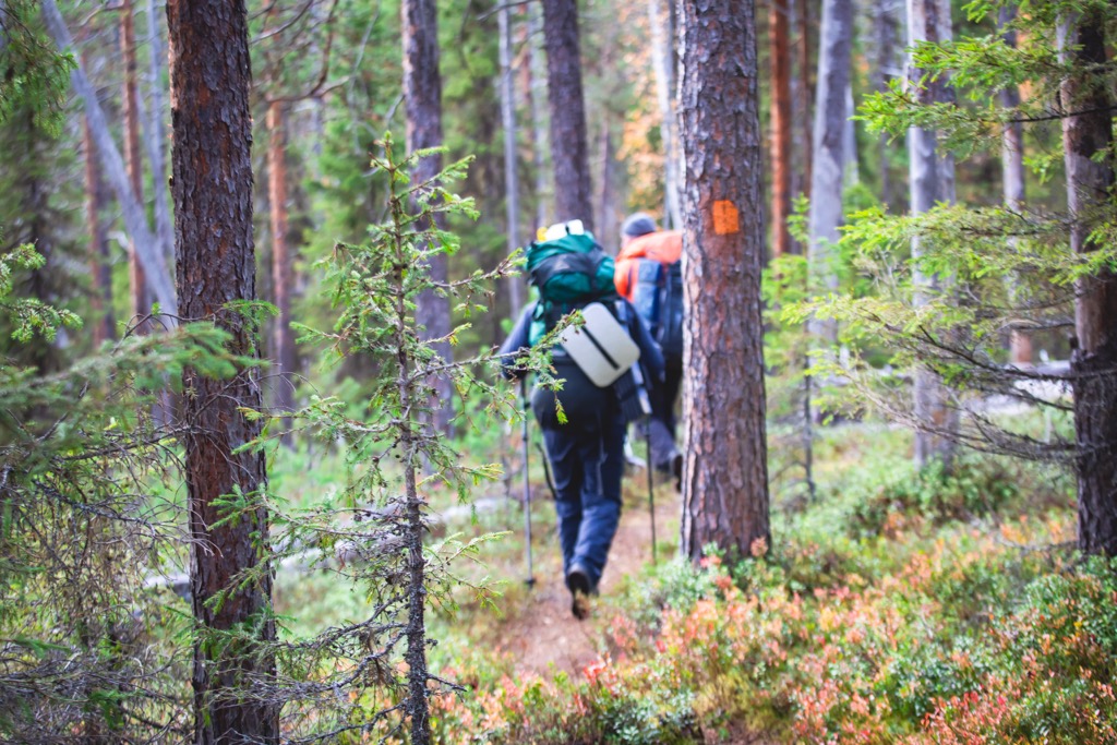
The main hiking area in Ostrobothnia is the same as its main natural attraction—the Kvarken Archipelago. There are more than a dozen marked nature trails of varying lengths and levels of difficulty, which can be divided into two large groups: trails accessible by land and trails accessible only by sea.
The longest of the first group includes the Västerö Hiking Trail, which is 4.6 km (2.8 mi), 6 km (3.7 mi), and 14 km (8.6 mi), and the Risö Nature Trail, 4.9 km (3 mi).
While hiking in the archipelago, don’t forget to also visit the Kvarken Visitor Center World Heritage Gateway (Replotvägen 2, 65800, Korsholm, Finland)—one of Finland’s nature centers located throughout the country, to learn more about it.
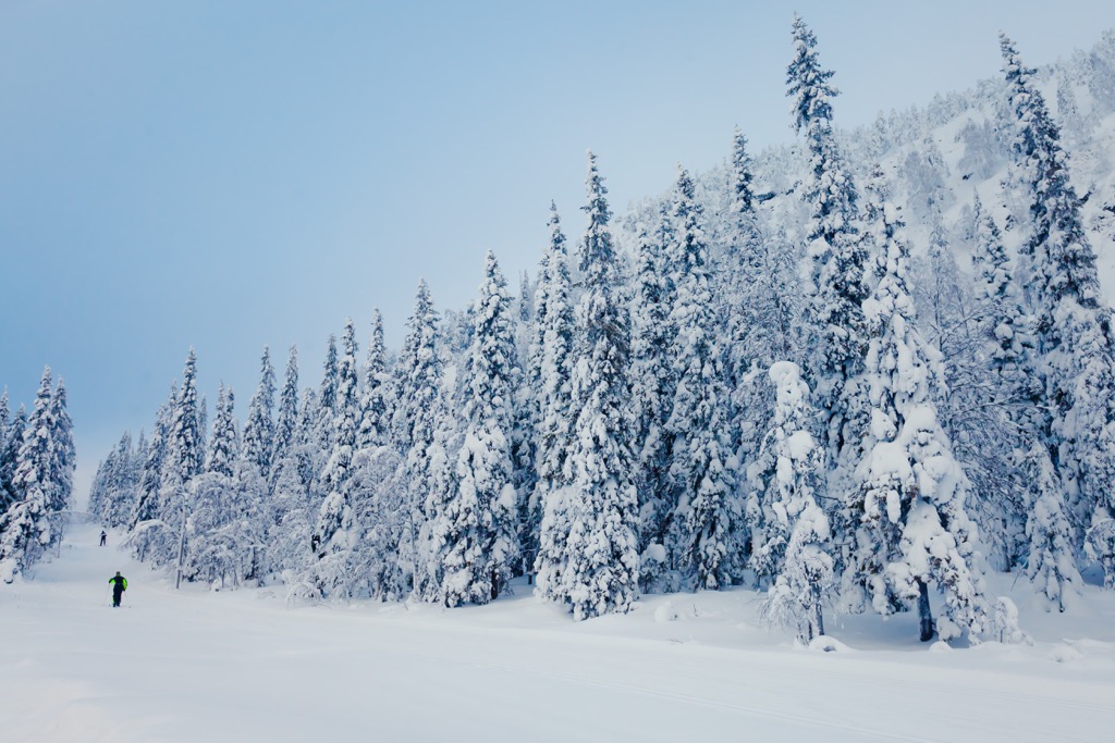
The second popular area for hiking is the Bötombergen / Pyhävuori Ski Resort, which in summer offers five hiking trails up to 8.5 km (5.2 mi).
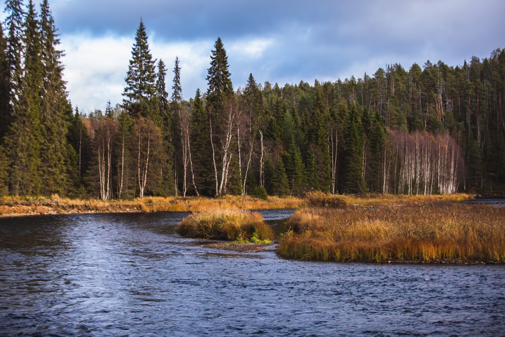
The third main area is the Öjen Old-Growth Forest, located a little south of Vaasa. This is one of the country’s oldest forests, where trees (mainly pines and spruces) have not been actively harvested, so many of them are hundreds of years old. There is a 4.5 km (2.7 mi) long Öjen Nature Trail through the forest.
Further south of Vaasa, on the border with Southern Ostrobothnia, near the town of Laihia, is the Levaneva Nature Reserve (Levanevan luonnonsuojelualue), with a hiking trail 10 times as long—45 km (27.9 mi) through forests and marshlands, suitable for backpacking. The trail is called Kurjenkierros (Crane’s Path).
Finally, you will also find about five dozen other different trails in Ostrobothnia, which are easy to reach in a couple of hours at most, given the region's small size. In other words, wherever you go, there's more likely to be a trail than not.
Bötombergen / Pyhävuori Ski Resort (Bötombergens skidcentrum) is the largest ski resort in Ostrobothnia, located, as the name suggest, on Bötombergen (131 m / 430 ft) and Pyhävuori (113 / 370 ft) peaks. The resort has 3 downhill skiing routes, 2 ski lifts and 40 km (24.8 mi) of cross-country skiing tracks. The larger resorts in the historic province are located in North Ostrobothnia: Ruka Ski Resort and Iso-Syöte Ski Resort.
Learn more about these and other ski resorts in Finland at World Mountain Lifts in PeakVisor.
When traveling in the Ostrobothnia region, visit one of its official tourist offices and info points, which are located in almost all towns and resorts, starting with Vaasa. You will also find the Coast and Archipelago section on the official tourist website of Finland helpful.
Vaasa Region Tourist Information
Rewell Shopping Center (2nd floor), Ylätori, 65101, Vaasa, Finland
Monday to Friday from 10 am to 5pm
+35840123 8977
There are many different types of accommodation in Ostrobothnia—rental huts, open wilderness huts, camping grounds, cottages, B&Bs, and others—throughout the region. Let's take the Kvarken Archipelago as an example, as the main place for hiking in the region.
In Kvarken, there are four rental huts: Björkören Hut in Panike, Korsholm, for 8 people with electricity and sauna; and Sommarö Guardhouse Rental Hut in Södra Vallgrund, Korsholm, for 22 people with water, electricity, WC, and shower. Two other huts—Rönnskäret Hut n the island of Fäliskäret for 18 people and Gåshällan Hut in Närpes for 28 people—you can reach by boat.
But the main form of accommodation when camping on the Kvarken islands is the usual camping in a tent. It is allowed everywhere in the archipelago according to Everyman’s Right law, except in Valsörarna, where camping areas are marked with special signs and are only available from August 1 to April 30. However, campfires are only allowed in the designated areas.
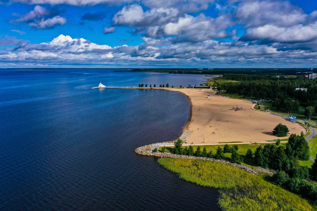
One way or another, the center of your journey through Ostrobothnia will be its main city Vaasa. The beautiful name of the city is the surname of the famous Swedish royal dynasty Vasa or Wasa, which ruled in Sweden between 1523 and 1654, but also in Poland and Lithuania of the past.
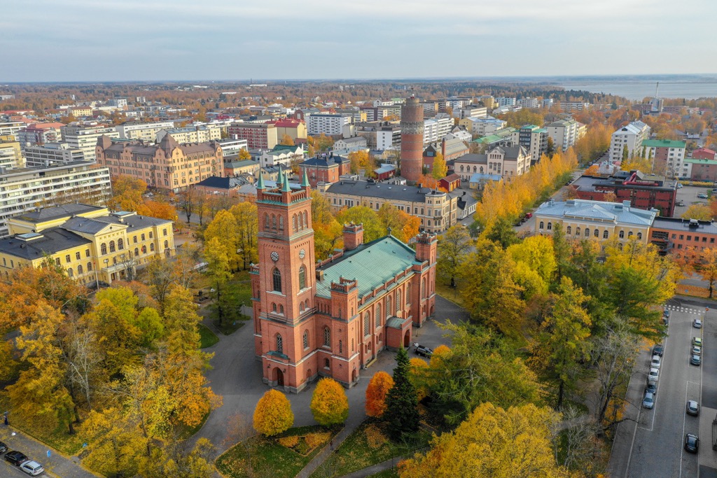
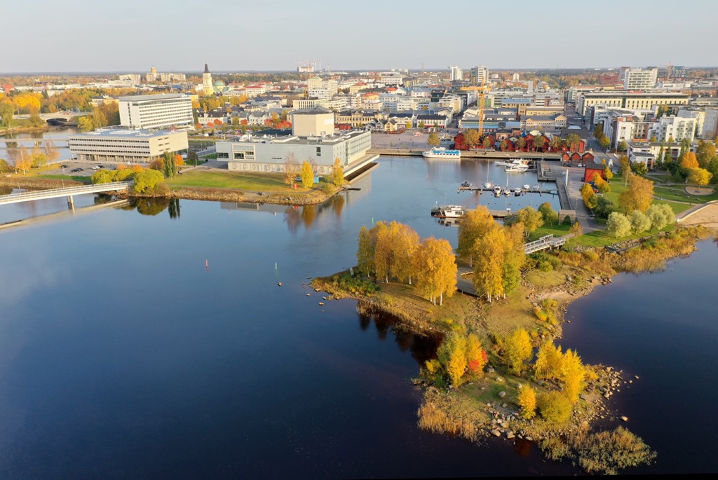
It is a quite large city by Finnish standards, with 67,376 (2021) inhabitants, which makes it the 10th in the country by population.
Among the locals, Vaasa is most notably known for Tropiclandia Water Park, which is located on Vaskiluoto Island right next to the city center. But the city has many other attractions, which will be of interest to travelers from abroad or from other parts of Finland.
Some of the major attractions of Vaasa are Vaasa Market Hall; three main churches, including the Holy Trinity Church, the Church of Korsholm (the ex-Court of Appeal), and the ruins of Saint Mary Church; Vaasa Railway Station; Vaasa Water Tower; the Port of Vaasa; and several museums such as the Ostrobothnian Museum and the Museum of Old Vaasa, Kuntsi Museum of Modern Art, Vaasa Car and Motor Museum.
Other smaller Ostrobothnia cities which are nevertheless important regional towns and resorts include Mustasaari / Korsholm, Pietarsaari / Jakobstad, Pedersören kunta / Pedersöre, Närpiö / Närpes, as well as Kristiinankaupunki / Kristinestad, about which I already told you about.


Yes. Ostrobothnia has 17 named mountains. The highest is Bötombergen at 131 m.
The highest mountain in Ostrobothnia is Bötombergen, at 131 m.
Ostrobothnia has 17 named mountains.


