
Scan the QR code and open PeakVisor on your phone
Paanajärvi National Park is one of four national parks in the Republic of Karelia in northwest Russia. The main feature of the park is its popularity among local tourists. It features a variety of landscapes including many lakes and the most mountainous terrain in the region. Although there are only 7 named mountains in Paanajärvi National Park, they are the highest peaks in Karelia. The tallest and most prominent peak in the park is Gora Nuorunen (577 m / 1,893 ft).
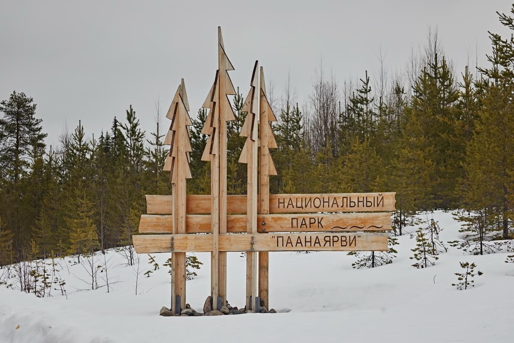
Paanajärvi National Park, which was founded on May 20, 1992, is named after its main attraction—Lake Paanajärvi. In Finnish, järvi means ‘lake.’ The meaning of the beginning of the word, paana, isn’t clear.
Don’t be surprised at this bilingualism when you are here: the Russian part of Karelia is divided on the political map between Russia and Finland. Meanwhile, Finland includes North Karelia and South Karelia.
The whole region is very characterized by Finnish names. Very often in Karelia, there are Finnish place names. These names are simply written in Cyrillic rather than Latin. They are also slightly altered to sound and look better in Russian.
The name of the park itself in Russian and Finnish are Paanayarvi or Paanajaervi (Russian) and Paanajärven kansallispuisto (Finnish)
The main thing to know about the geography of the Paanajärvi National Park is that the region is very difficult to access even by car. So when planning a trip here, think carefully about how much time you have to spend in the area.
The park is located northwest of Lake Pyaozero or Pääjärvi (note: this is not the same Lake Paanajärvi that’s located in the park) in the Loukhsky District in the north of the Republic of Karelia. It is situated very close to the region’s border with the Murmansk Oblast—the northernmost region of northwest Russia.
In the west, the border of the park corresponds with Russia’s international border with Finland. Here, on the other side of the border, there is one of Finland’s 40 national parks, Oulanka. Together they form one nature protection area, Oulanka-Paanajärvi Transboundary Parks. This is overseen by an organization called Europarcs Federation, whose goal is cooperation for the benefits of wilderness and tourism alike.
The territory of the park is 1,045 sq km (403.4 sq mi). Its boundaries are wild forested areas with no major roads. The nearest such roads are A136 and 86K-16 on its eastern borders.
Despite its inaccessibility, the park is a popular destination for tourists from St. Petersburg, Petrozavodsk, and Moscow.
To get to the park, you need to travel from St. Petersburg along the highway St. Petersburg—Petrozavodsk—Murmansk (E105), also known as the Kola Highway, which is named after the Kola Peninsula. You’ll take the highway to Loukhi village, where you turn left into the smaller Pyaozersky village. This is the closest settlement to the park, and it is where it's visitor center is located.

The whole journey will take you about 13 hours or 1,063 km (660.5 miles) to complete. You can also come here from Finland by crossing the border either at Suoperja (60 km / 37.2 mi) from Pyaozersky or at Ljuttja.
But that’s not all: A 59 km (36.6 mi) dirt road leads from the Pyaozersky to the territory of the park and its highest mountain, Gora Nuorunen, which is located on its southern border to the great good fortune of travelers. Believe me, “the Russian dirt road” is the last thing you want to experience in your life. To ride it, you’ll need a Jeep or another similar 4x4 vehicle.
There is a train to Loukhi from St. Petersburg, but, most likely, the only way to get to the park on your own is by car. The other option is to walk about 170 km (105.6 mi) from Loukhi township or try hitchhiking, which is probably not a good idea, because only about 5,000 people visit the park annually.
On the other hand, the geographical location of the park makes it a unique place with almost untouched wilderness. It’s highly likely that there won’t be any other non-local tourists other than you. I could say that a trip here is like a real adventure even on paper, to say nothing of the actual experience itself.
The main types of rocks that you can see in the park are basically the same as for the whole of Karelia. This includes different types of granites, gneisses, shales, and quartzites.
These Karelian rocks come from the Baltic Shield, which is one of the oldest layers of the Earth’s crust with an estimated age of 1.5 to 3 billion years old. It lies beneath the base of all of Scandinavia, including Finland, the Kola Peninsula of Russia, and the Republic of Karelia, too.
However, on the territory of the park and in its vicinity, we can distinguish several types of the aforementioned rocks, which are characteristic of this area. For this purpose, I used the Geological Map of Karelian ASSR (Autonomous Soviet Socialist Republics), published in the Soviet Union in 1934.
In the park, it shows areas dominated by the following minerals: white-sea granites and their migmatites, Onego granites, intrusive diabases, and even some dolomites and limestones, which are very common in the world-famous Dolomites mountains. All of these belong to the geological layer of the Karelian Formation.
You can check out the map yourself on the website of the Geological Institute of the Russian Academy of Sciences. It is available in three languages: Russian, Finnish and English. It is also interesting that on the map you can see that in the first half of the twentieth century, before World War II, the territory of the park belonged to Finland, not Russia, including almost the whole of Lake Pyaozero.
In total, there are 15 large geological objects and 54 separate natural monuments of great scientific value in the park not only for Karelia and Russia, but also for Europe and the world. Mainly these are mountains and deep fractures in the Earth's crust, and river-lake systems.
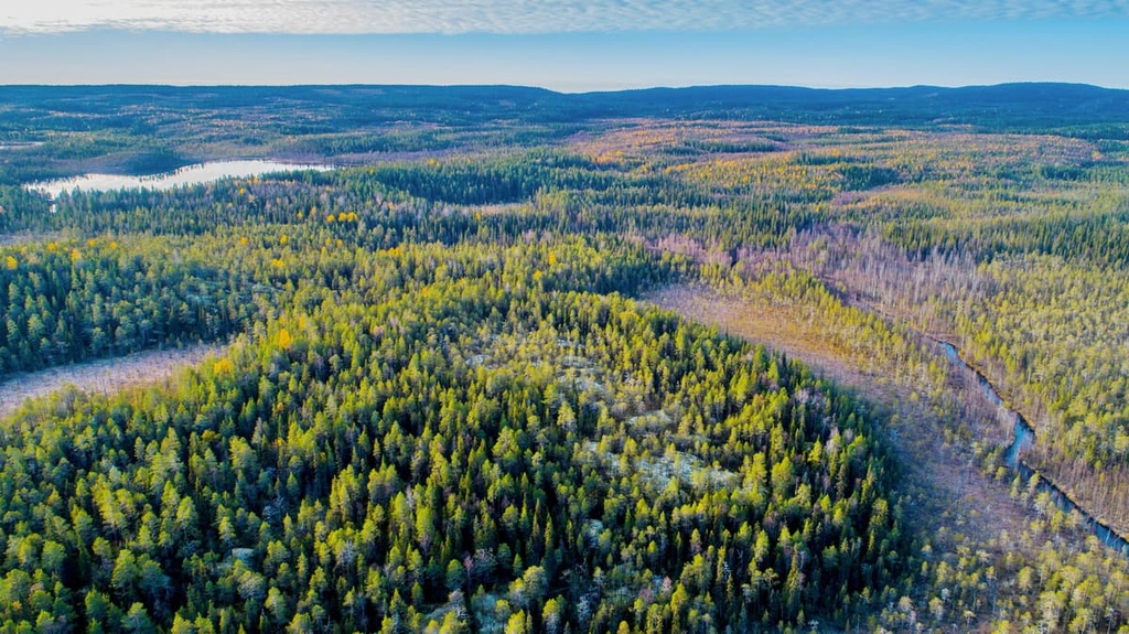
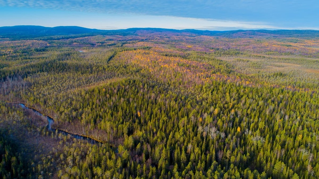
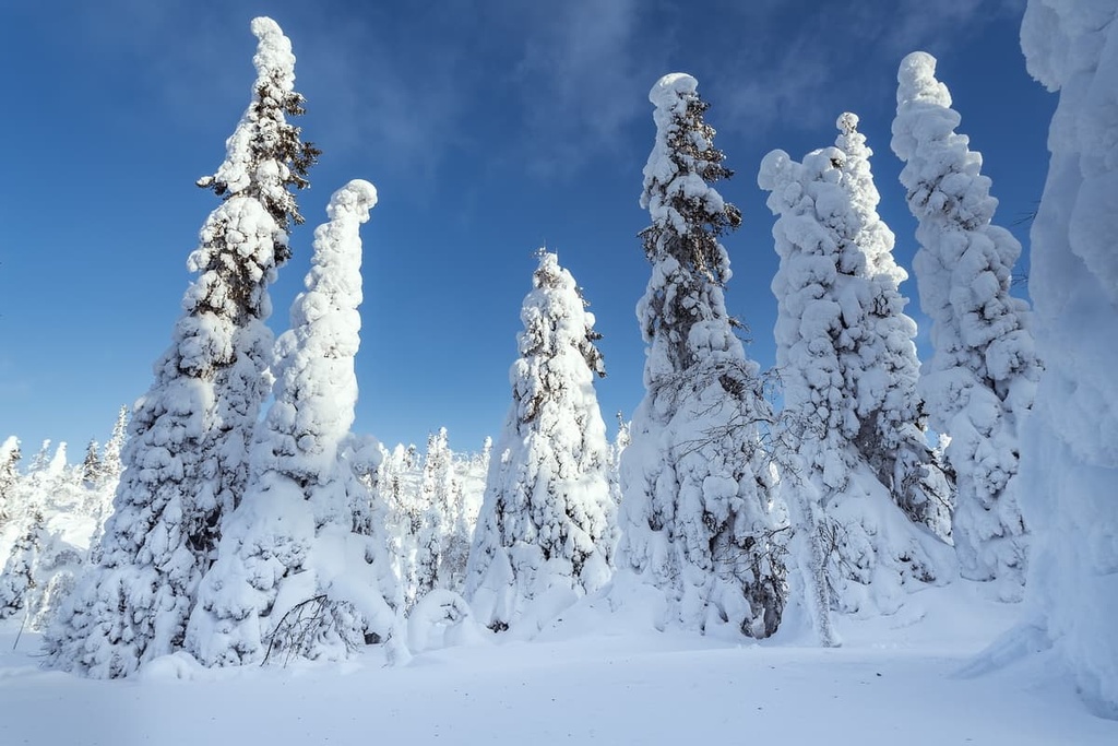
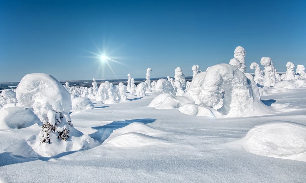
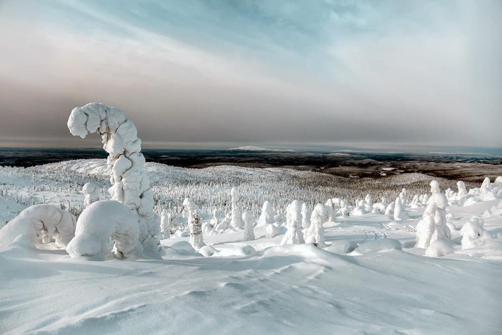
To say that the landscape of the park is picturesque is an understatement. The park has everything that Karelia is famous for, and even more, most of which you won’t know about until you see it yourself. (Or read about it in PeakVisor.)
Here is the list of the main features of the local landscape:
Next, I will briefly tell you more about the three main features of the park’s landscape: the river, the lake, and the waterfall:
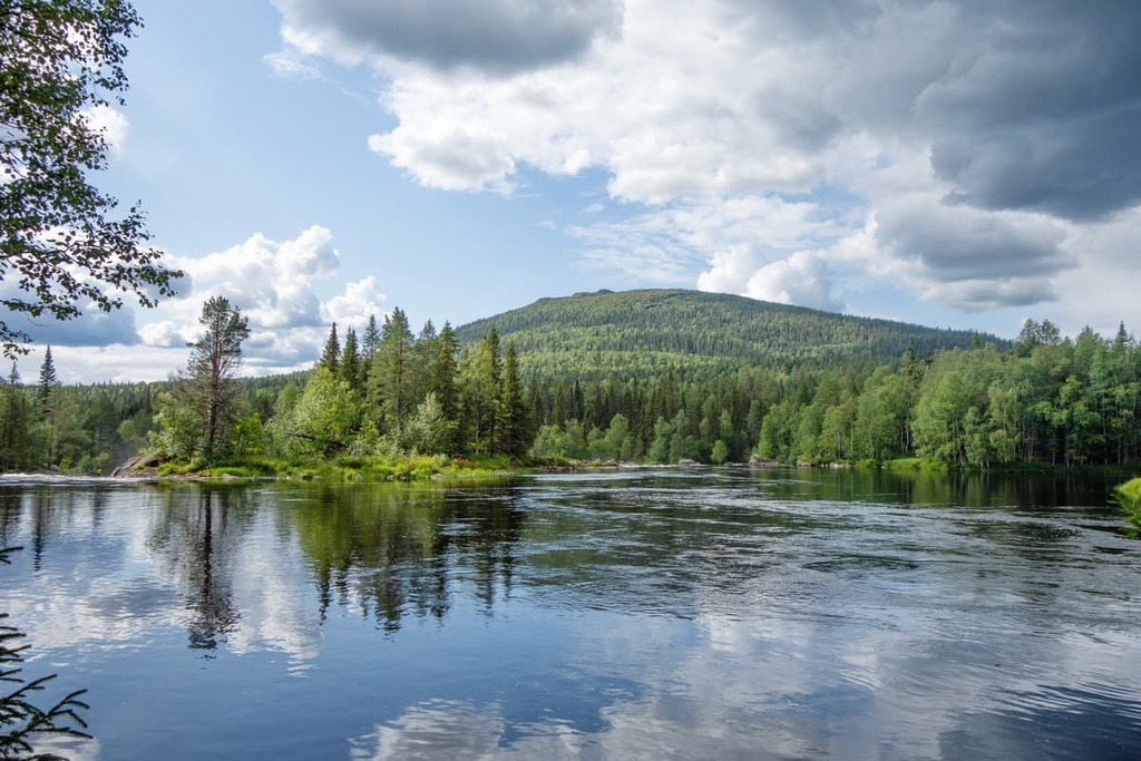
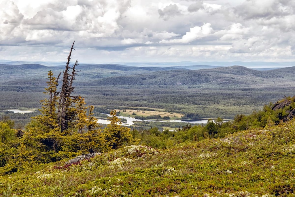
Oulanka River is the main river of not one but two national parks: Paanajärvi and Oulanka in Finland, the latter of which is named after it.
It begins in Finland in Lake Ulkujarvi, some 70 km (43.4 mi) to the east of Rovaniemi, the capital city of Lapland. The river flows eastward across the border between Russia and Finland, until it flows into Lake Pyaozero (Pääjärvi) and from there into the White Sea. The length of the river in Russia is 67 km (41.6 mi), but its total length is 135 km (83.8 mi).
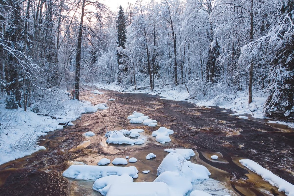
This incredibly winding river with its many rapids changes names a few times, depending on where you’re located: in Finland it is called Oulankajoki, in Russia—Olanga.
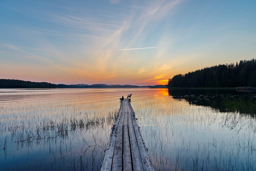
Paanajärvi Lake is the main lake in the park. It is located approximately in the center of the park and it runs in an almost straight line that’s nearly 24 km (14.9 mi) long from west to east with a maximum width of only 1.2 km (0.7 mi). The total coastline of the lake is 50.5 km (31.3 mi). The Oulanka flows into the lake in the west and flows out of it in the east.
The lake is also considered to be one of the deepest small freshwater lakes in Fennoscandia with a maximum depth of 128 m (419 ft) and an average depth of 38 m (124 ft). The lake’s basin was formed as a result of powerful tectonic movements in the past.
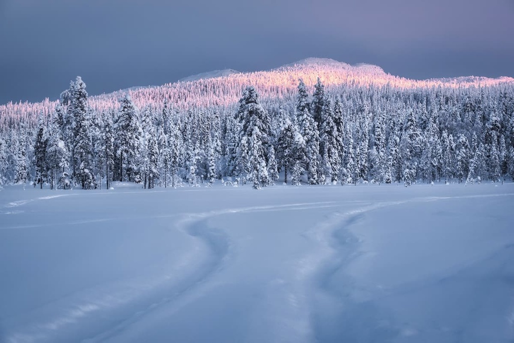
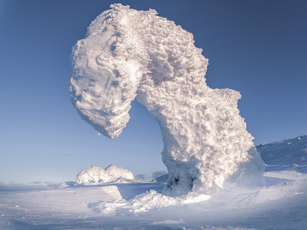
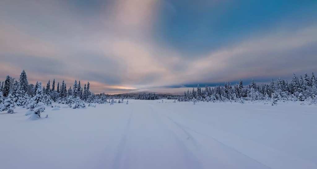
As elsewhere in Karelia, the lake is completely frozen in winter, and you can easily navigate on snowmobiles or skis. Walking a frozen lake that cracks loudly beneath you (but that you don't fall through because the ice is so thick) is another incredible experience to have in Karelia/Finland that I can highly recommend.
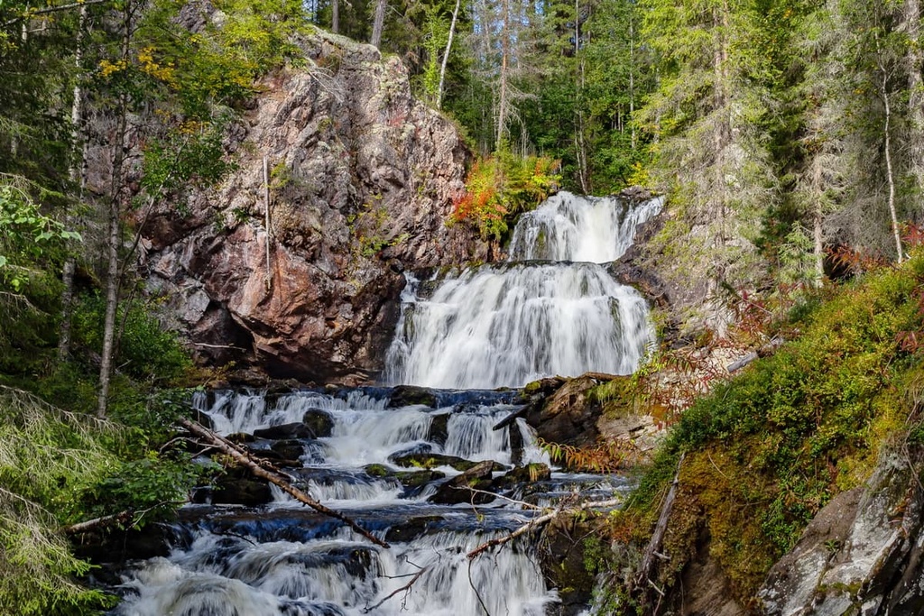
Mäntykoski Waterfall (Vodopad Myatyukoski in Russian) is a small but very famous waterfall in the park. It’s located at the place where the Mäntyjoki River flows into Lake Paanajärvi in its western part near Myantyutunturi, the second-highest mountain in the national park.
The height of the waterfall, which consists of five levels, is 9 m (29.5 ft). The waterfall became famous thanks to the works of the Finnish artist Akseli Gallen-Kallela, who had depicted it in several of his paintings at the end of the nineteenth century in 1892.
Also, one more waterfall on the territory of the park, Kivakkakoski Waterfall (Vodopad Kivakkakoski), is known as the most powerful unregulated rapids in Karelia. It is located near the Kivakka mountain in the east of the park.
The flora and fauna of Paanajärvi National Park is very rich. This biodiversity is the main reason for the park’s existence, alongside its geological features, mountains and lakes.
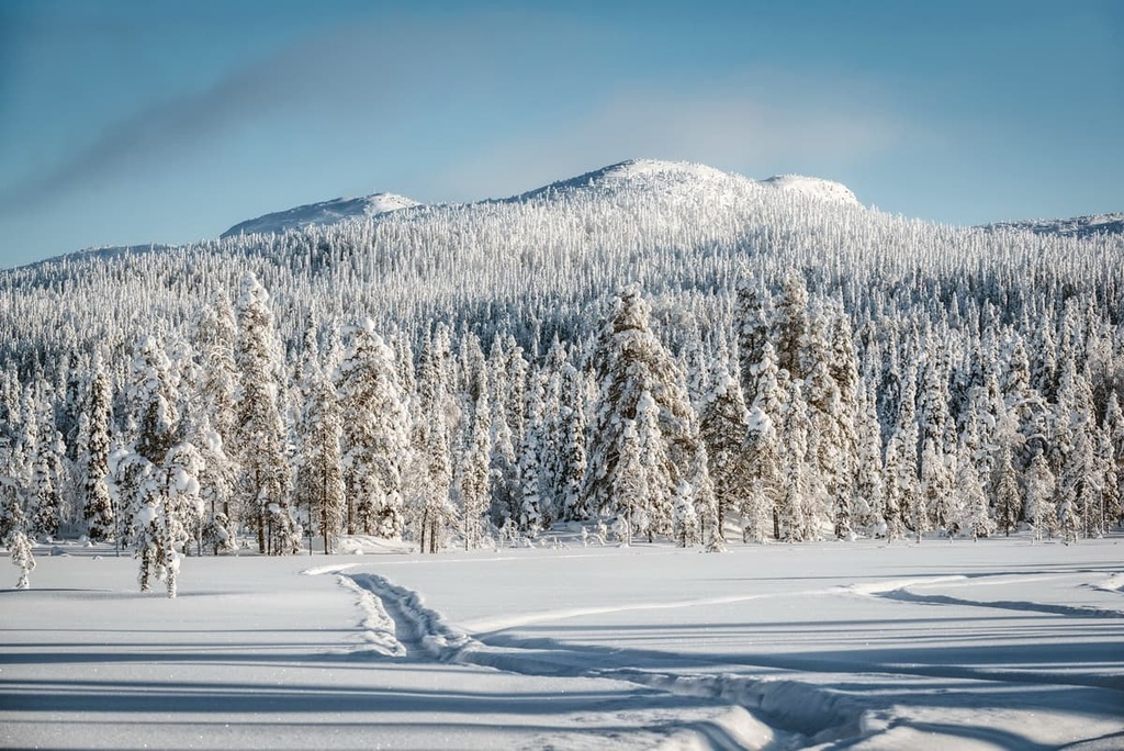
Most of the park’s territory, namely more than 75 percent, is covered with pine and spruce forests, which are very typical for Karelia as a whole. The peculiarities of these territories include the fact that spruce trees predominate here, and that most of the forests are as wild as possible.
The mountain slopes in the park are covered with rare spruce as well as birch forests. Meanwhile, mountain tundra prevails at the mountain tops.
Individual plants include gypsophila, draba, potentilla nivea, androsace, convallaria, fragaria vesca, colutea, Lonicera caprifolium, Aster sibirica, Soetes lacustris, and many others. The park is home to 623 species of vascular plants—more than anywhere else in the rest of Karelia. About 20 types of plans are endemic to the park, too. Mosses and lichens are also very common here.
There are a lot of edible mushrooms in the park’s forests. You do not have to look for them—all you have to do is to turn off the path into the forest. But, do not eat any mushrooms that you can’t say for certain aren’t toxic. When in doubt, it’s best not to eat an unidentified mushroom.
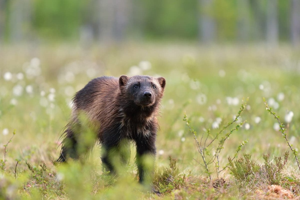
The park is home to all of the animals typically found in the region, including elk, lynx, wolverine, wolf, fox, marten, hare, squirrel, mink, ermine, weasel, small rodents, voles, and others. Of particular note is the king of the forest, as it is called here, the reindeer. And of course, there are brown bears here. A total of 42 species of mammals have been registered in the park.
There are many more birds in the park. Researchers have identified a total of 171 species, including the whooper swan, bean goose, grey crane, black-throated diver, goosander, and capercaillie.
Finally, the park's lakes are home to many valuable species of fish. These include brown trout, arctic char, trout, whitefish, and grayling, among others.
The main feature of the park's mountains is that all the highest peaks of the Republic of Karelia are located here.
All the mountains and rocks that can be found in the park belong to one mountain range called Maanselkä. This is one of the four main ranges in Karelia, which lies between it, Finland, and Norway. The other three are West Karelian Uplands, the southern part of Maanselkä, Windy Belt Range (Vetryanni Poyas in Russian), and Olonets-Shokshinsky Upland on the south of the republic.
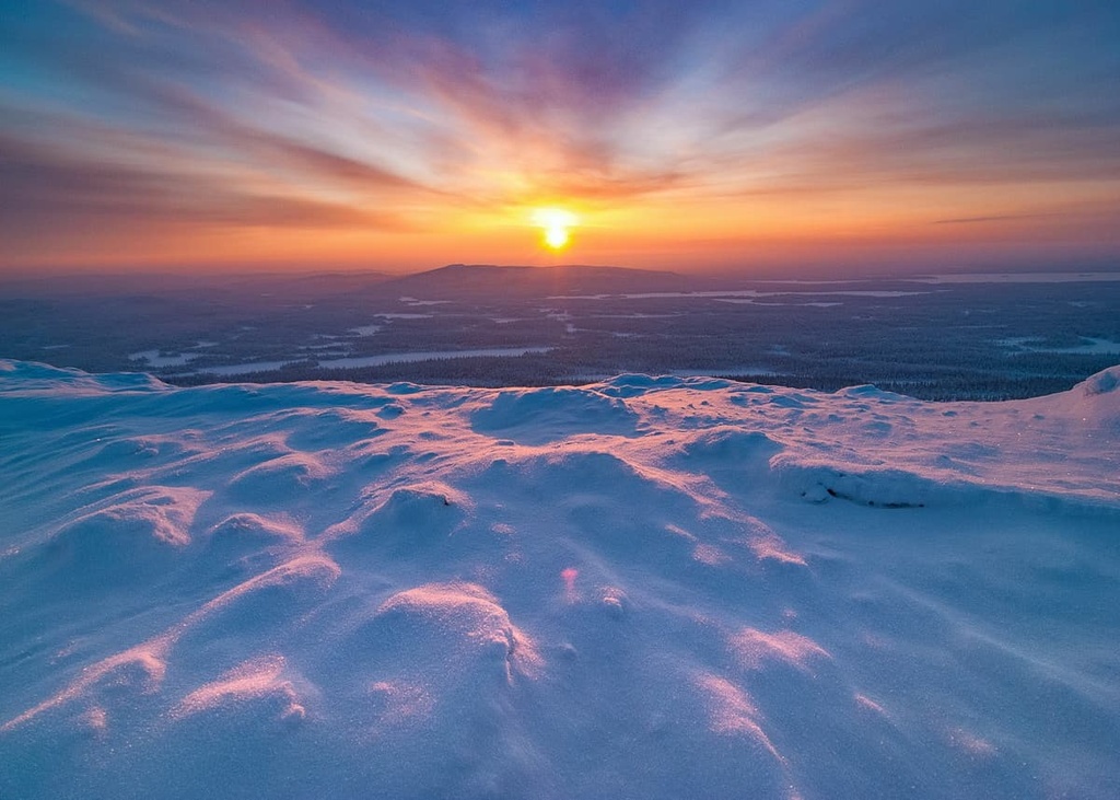
The average height of the mountains in the park is also the highest in Karelia, above 200 m (656 ft). Here’s some more information about the five highest peaks in the park:
Gora Nuorunen (577 m / 1,893 ft) is the second-highest mountain in Karelia after Hositunturi (592 m / 1,942 ft). It is also the most prominent peak in the region.
Hositunturi is located in the very north of the region on the border with Murmansk Oblast. For this reason, in all Russian language sources, Gora Nuorunen is considered the highest in the republic and in the park. According to local geologists, this is also the highest mountain in this latitude from the Gulf of Bothnia, between Finland and Sweden, to the Ural Mountains in Russia.
The mountain is also often called Nuorunen Fell. Fell is an English word for Norwegian fjell or fjall, which means the ‘mountain.’ Fells are mountains with flat (plateau-like) treeless surfaces, which are very common in Karelia and Lapland.
The peak is located on the south of Paanajärvi National Park. One of the most popular hiking trails in the region leads to its summit.
Another incredible attraction of the peak is sieidi, or ancient sanctuaries of the Sami, the Indigenous people of Lapland, and northern Karelia. Seidi are large stones that lie on smaller stones and have been stacked in a special way—sometimes in the form of labyrinths. The siedi on Mount Nuorunen is believed to be the largest in Karelia.
Myantyutunturi (550 m / 1,804 ft) is the second-highest mountain in the national park.
However, according to some reports its height is lower—438 m (1,447 ft). Either way, its summit also offers an excellent view of Paanajärvi Lake. The mountain is also best known for the Mäntyukoski Waterfall, which is located nearby.
Gora Kivakka (499 m / 1,637 ft) or Kivakkatunturi is the officially third highest mountain in the park. The name means ‘stone woman’ in Finnish.
While climbing, you will see how the landscape changes between 3 ecological zones: taiga, forest-tundra, and tundra. On the slopes of the Nuorunen Fell, you can also see the famous “hanging” bogs. And there is even a small lake in one of the rock faults in the mountain.
The mountain is located a little closer to the boundaries of the park from the south than Gora Nuorunen. It is also more popular because it is easier to climb. There is also a marked trail to the peak. At the top of the mountain, you can also find sieidi that were created by the Sámi people over the course of millennia.
Ruskeakallio (60 m / 196 ft) is a tall rock with a huge vertical wall, located directly on the shore of Lake Paanajärvi. As there is no beach below the rock wall, you can reach it only by water in summer and by snowmobile in winter. It is also one of the main attractions of the park on par with other higher mountains.
The rock is part of the long Paanajärvi Mountain Rift or razdvig in Russian—a type of disturbance of the Earth’s crust, which is caused by its stretching. In other words, some blocks of the crust move away from others, which is how mountains and rocks are created, among other things.
The name of the rock comes from the famous Finnish word ruskea, which means ‘brown.’ Ruska in Finnish also means the period of autumn leaves in bloom. Ruskeakallio has a predominantly red color so that at sunset it transforms into an even deeper, more saturated hue. Kallio in Finnish means ‘rock.’ So it is called “Brown Rock.”
Gora Pyaynur (486 m / 1,594 ft) is not formally part of the park, but it is located near its eastern borders on the shores of beautiful Tsipringa Lake. It is interesting and beloved by locals and tourists because it resembles the classic peaks of the Himalaya or the Alps. The summit of Piajnur can be climbed on foot, as well.
Paanajärvi National Park has five marked hiking trails of varying lengths and with approximately the same moderate level of difficulty. As a result, you must be physically sturdy and be prepared to walk many kilometers during the day with a backpack on your back while in the park.
But the area of the park you can explore is huge. To reach the more remote areas, you need to rent a boat (in summer) or snowmobile (in winter) excursions in the Visitor Center.
Here is some more information about the park's two main routes to its two most famous peaks:
The hike to Gora Nuorunen is the main trail in the park to the highest mountain in Karelia.
It is interesting not only for the mountain I described just above, but also for the trail itself. It is part of an old horse road. Along this road, the Karelians of the White Sea used to transport herring to mainland Finland. The Finns on the other side of the modern border used to carry their goods to the opposite direction.
The trail passes through old Finnish farms, meadows, spruce and pine forests, and bogs.
From the top of the peak, you will see Lake Tavajarvi, Kivakka Fell, as well as the very famous Ruka mountain (500 m / 1,640 ft) in Finland on a cloudless day. Ruka is home to one of the largest and the most popular ski resorts in the country.
This is the route to the third highest peak of the park and also one of the highest and most famous in Karelia.
The route is found on the western, gentle slopes of the mountain, so the ascent is not difficult, even for very first-time hikers. Theoretically, after crossing the mountain, you can also continue on to the Kivakkakoski Rapids to follow an equipped trail along the river, but there is no equipped trail to the river itself.
Anyway, you will see rapids from the top, as well as Lake Pyaozero, and Nuorunen Fell. On sunny days the mountains of Finland can be clearly observed from Kivakka, too.
Since the territory of the park is located along an international border area between Russia and Finland, you can’t simply visit it without any prior planning.
To visit the park, you need to buy a tour (entrance ticket) in advance through the contacts listed below and in the specified time intervals. However, the tour may include excursions from a local guide, accommodation, equipment rentals, and even the transportation from the nearest towns, which is the most expensive part of the whole experience.
You must have your passport with you when you buy a tour because all tourists must register in the Visitor Center.
Paanajärvi National Park
Pyaozersky, Loukhsky District, Republic of Karelia, 186667, Russia
+78143948504 (questions about visiting the park)
+78143948688 (administration)
Opening Hours:
Tourists with advance booking will be received from 8 am to 7 pm any day of the week
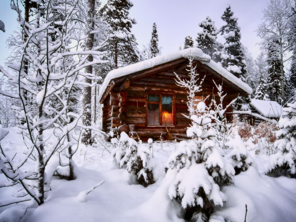
While hiking through the park, you can stay in one of the traditional Russian wooden houses, which are called izba.
These are houses with heating stoves, beds for 3 to 14 people, water supply, and outdoor toilets in a separate small building. There are a total of 17 such huts in the park, each with a name, such as The Island, The Fairytale, Anthill, Olanga Estuary, and The Pearl.
For example, in the Olanga Estuary, located, as you can guess, at the mouth of the river of the same name, for 9 people you will find everything you need to live, including not only a bed, but also a set of dishes, firewood and an ax, and so on.
Clean linens can be picked up at the Visitor Center during check-in before hiking through the park, then they should be returned there as well. Thes cabins need to be booked in advance on the park’s official website.
The park also has several places to pitch a tent. There are 13 of them. They are located both near the huts and in their own individual areas. To stay hygienic during your stay, the park has several Russian bathhouses (banyas) that you can check out.
Before and after the hike, you can stay in the nearest cities, but, in my experience of traveling through Karelia, it is better to count on a fully self-supported journey to the park, as there is a small selection of good hotels in this part of the republic. But there are many of them in the capital city of Petrozavodsk.
Before World War II, the village of Paanajärvi, which at the time was located on the lake and was part of Finland, not Russia, was one of the wealthiest in the Kuusamo municipality of Finland.
Even back then, it was well-known as a tourist center. For example, in the summer of 1939, more than a thousand tourists visited Paanajärvi. The area was also actively visited by scientists to research the local geology, flora, and fauna.
Today, as I said at the beginning, the park is a hard-to-reach area away from large settlements. I will remind you that even the park’s Visitor Center, in the very small village of Pyaozersky, is located 59 km (36.6 mi) from its southern border. It is another 110 km (68.3 mi) to the other nearest settlement, Loukhi.
The nearest communities that can be considered towns are Belomorsk in the south and Kandalaksha in the north. Both are located on the shore of the White Sea.
Nevertheless, here is some information about what to see in the villages of Pyaozersky and Loukhi:
Pyaozersky is the only village in the area. It has a population of 1,564 people (2021) and it was founded in 1973.
In addition to the Visitor Center, which has a great exposition about the nature and history of the park, from the cultural and architectural sights of the place, there is the Church of Saint Nicholas of Myra and a small waterfall Tukhkapadun in the form of rapids in the upper part of Korpijoki River.
This is the administrative center of the Louhsky District of Karelia. The town was founded in 1913, today it has 3,749 inhabitants.
Surprisingly, the namesake of the town is the name of a wicked queen Louhi of the land known as Pohjola in Finnish and Karelian mythology. She is the main villain of the national epic Kalevala. The word itself is translated from Finnish as a ‘cluster of rocks.’
With regards to local cultural and architectural attractions, tourists may be interested in the Loukhi Local Museum, the Orthodox Church of Seraphim of Sarov—one of the most revered saints in Russia as a whole—as well as several monuments in memory of soldiers of World War II.
The Loukhsky District page on the official tourist site of the Republic of Karelia can provide more information: Ticrk.ru.


