Scan the QR code and open PeakVisor on your phone
Satakunta is one of Finland's 20 regions, located in the west of the country on the coast of the Baltic Sea. The main feature of the Satakunta mountains is not one, but a whole series of archipelagos, consisting of hundreds and thousands of picturesque rocky islands—the result of the gradual coastal uplift after the retreat of the glaciers about 10,000 years ago. Probably, the Oura Archipelago is the most famous of them. Satakunta is also known for Yyteri Beach with the largest sand dunes in Scandinavia. The mainland of the region is also not devoid of natural attractions, including low mountains. The highest and most prominent peak is Soininharju (186 m / 610 ft). In total there are 55 named mountains in Satakunta.
The name of the region Satakunta means "hundred", which was previously used to refer to an administrative unit equal to 100 hides of arable land in England, as well as Scandinavia, some parts of the United States, as well as some other countries and regions of the world.
Satakunta is located in southwest Finland.
To the west, the shores of the region are washed by the Bothnian Sea, which should not be confused with the Bothnian Bay to the north. Both are parts of the larger Gulf of Bothnia of the larger Baltic Sea. The region also borders South Ostrobothnia and Ostrobothnia to the north, Pirkanmaa to the east, and Southwest Finland or Finland Proper to the south. All these regions are part of the former province of Western Finland, one of several large parts, into which the country was divided from 1997 to 2009.
At the same time, Satakunta is one of the nine historical provinces of the country, which existed on the administrative map even before in the Middle Ages. It was twice as large in area and included almost the entire neighboring region of Pirkanmaa. The historic provinces of Finland differ in dialects of the Finnish language, traditions, and various cultural features.
Not least Satakunta is an important part of the tourist region called the "Coast and Archipelago", one of the top four in the country along with Helsinki metropolitan area to the south, the Finnish Lakeland to the east, and Lapland to the north.
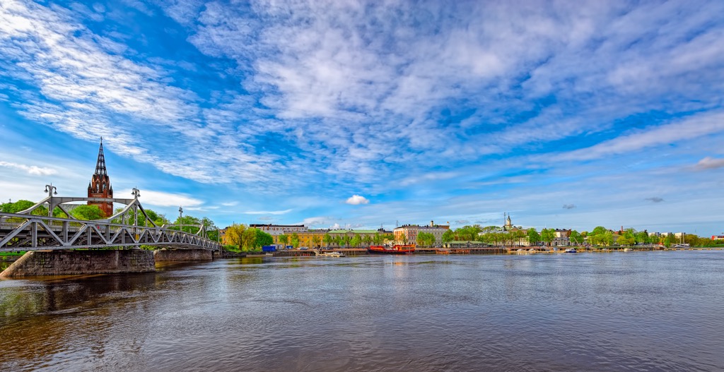
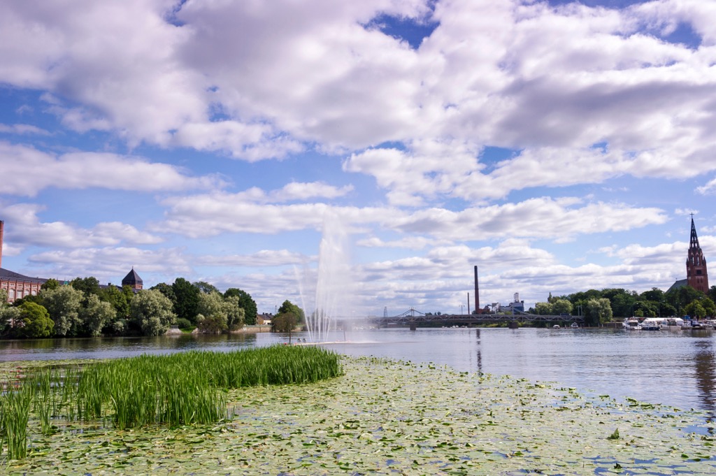
The main city in the region and the 10th largest in Finland, Pori, with more than 80,000 inhabitants, is located just 100 km (62 mi) from Tampere, 2nd in the country, and 244 km (152 mi) from Helsinki, the capital and the largest city of all of Finland. You can reach the region by car, bus, or train in 2–3 hours.
The city also has an airport, one of the 20 Finnish airports, all of which are run by the main local aviation company Finavia. The airport hosts flights from European airlines such as Air France, airBaltic (Latvia), Aegean Airlines (Greece), and many others, and international airlines from all over the world such as United Airlines, American Airlines, and Air Canada from North America, or Air China from Asia. The Pori Airport is also home to the Finnish Aviation Academy, the country’s main flight training center.
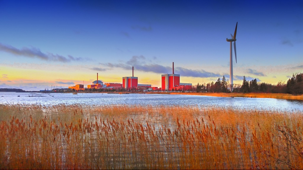
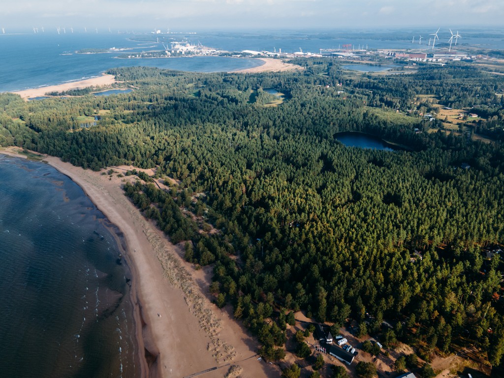
As I have already said, the main feature of the landscape of the region stems from its location on the eastern shore of the Bothnian Sea. It is known above all for the fact that it is heavily rugged with picturesque bays and inlets, in the distance of which there are thousands of rocky islands, islets, and just rocks sticking out of the water, as well as just huge boulders lying on the seabed, which has been slowly rising from the water for the last 10,000 years since the retreat of the glaciers that once covered all of northern Europe. This process is known in science as the post-glacial rebound. This has also made it the world’s largest concentration of islands numbering over 50,000, most of which are in the Archipelago Sea to the south and the Åland Islands.
The difference of the Satakunta shoreline is the presence of not one large, but a series of small archipelagos. The most famous of them, the Oura Archipelago, is a compact group of about 300 islands in the north of the region, opposite the town of Merikarvia. The main island of the archipelago is Ouranluoto, which has some tourist services and can be reached from the mainland by ferry in the summer.
Moving further south, we also have the following pairs of other archipelagos, whose names often also coincide with the nearest cities: Gummandoora and Pooskeri, Luvia, Rauma and Eurajoki, Uusikaupunki and Seksmiilari.
The archipelago is known not only for its nature but also for some man-made attractions, the main of which, of course, are lighthouses of various sizes and types. For example, this is snow-white Säppi Lighthouse on the namesake island close to Eurajoki. Other famous lighthouses are Kylmäpihlaja and Isokari.
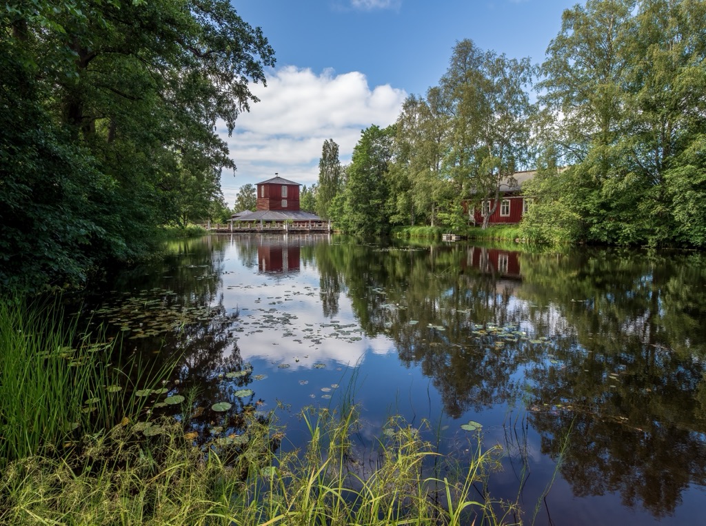
The region’s most important bay, Preiviikinlahti, is located opposite the main city of Pori.
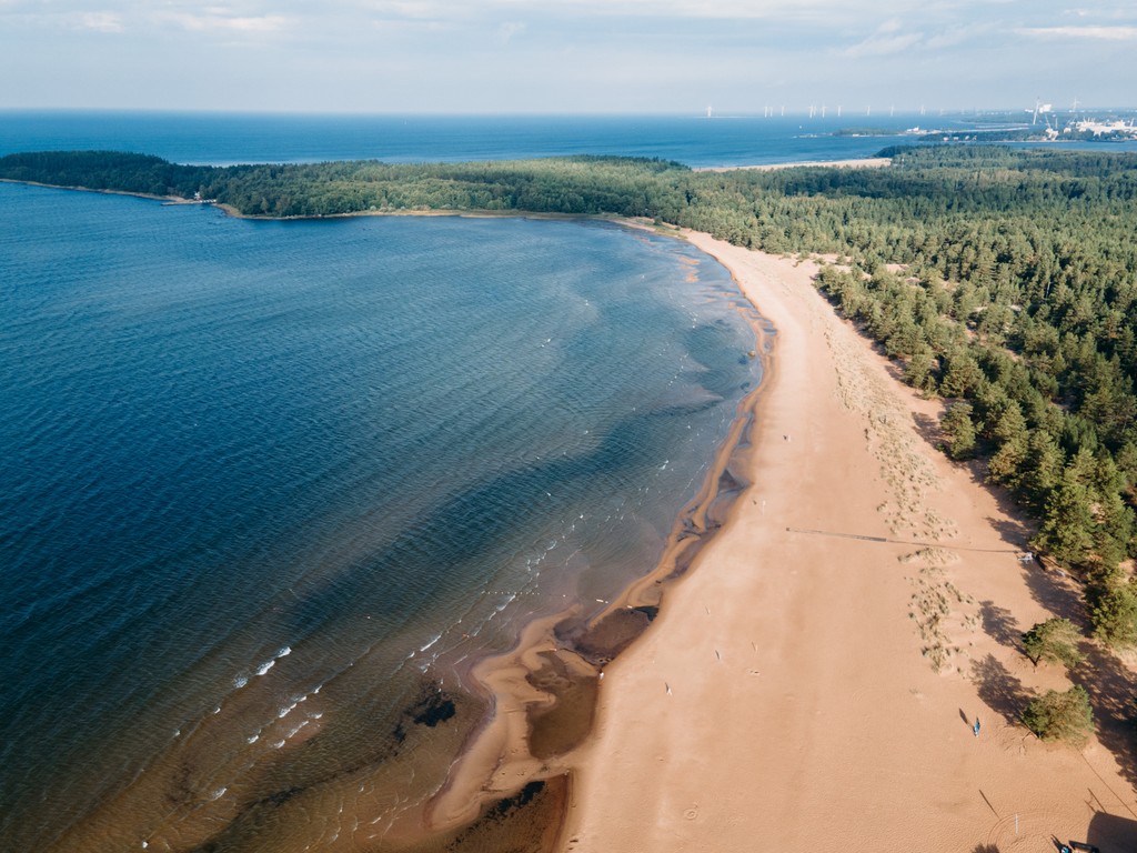
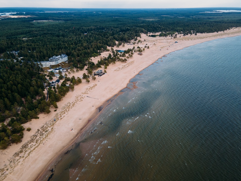
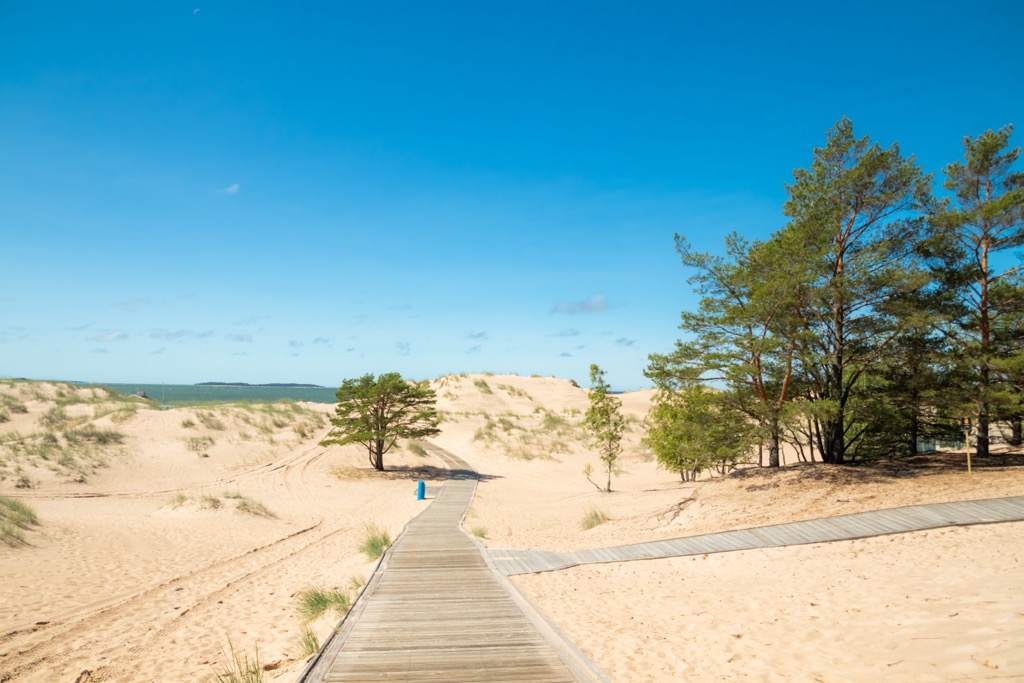
Finishing with the coastline, the other main and much more famous feature of the maritime part of the region’s landscape is Yyteri Beach, a sort of local Californian Malibu. It is the largest sandy beach in the country and one of the largest in Scandinavia both in length (5 km / 3 mi) and width (several hundred meters / feet) with huge sand dunes, from which the pine trees grow. It is also the main seaside resort of the country with a developed tourist infrastructure with camping, hotels, spas, cottages, and other types of accommodation. In Yyteri, you can do hiking, golf, horse riding, beach volleyball, surfing, and many other outdoor activities and sports.
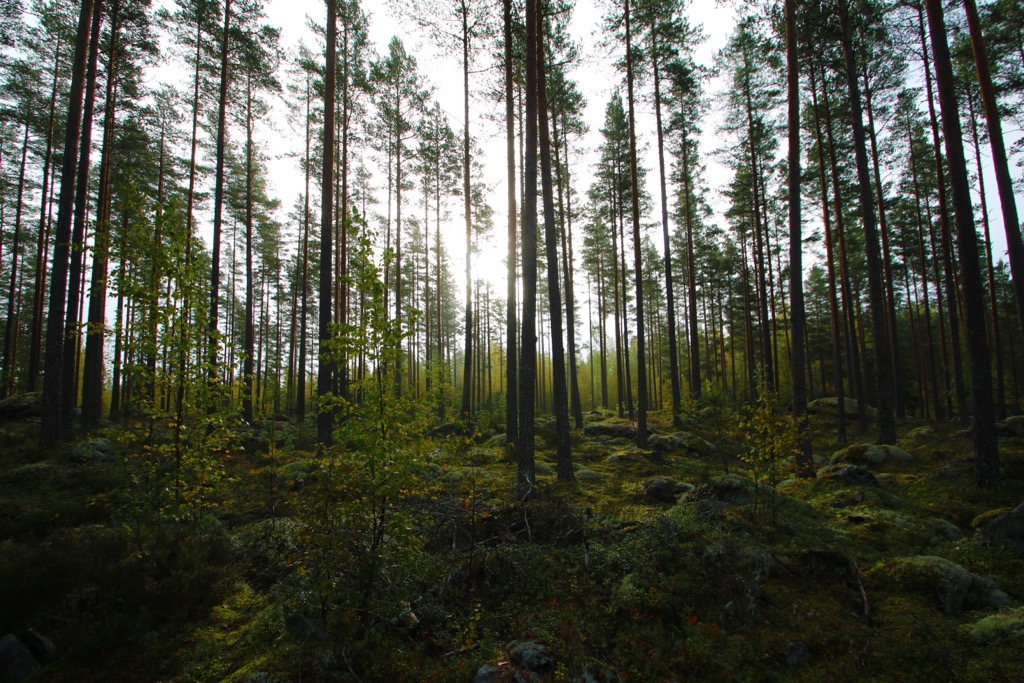
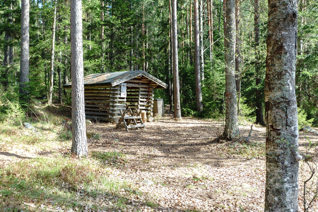
The mainland part of the region is generally similar to others in the southwest of the country and in Finland as a whole. In general, its landscape is divided between vast wild pine forests and fields and meadows for various agricultural needs. A large lake, Pyhäjärvi, is also located in the south of the region.
The vast majority of the most interesting mountains of Satakunta are the aforementioned granite rocky islands in the Baltic Sea, many of which reach heights of several tens of meters (feet). The low altitude is more than compensated for by the magnificent sea scenery.
The highest peak of the mainland part of the region, Soininharju (186 m / 610 ft), is located near the town of Jämijärvi on the lake of the same name also with many islands in Lauhanvuori-Hämeenkangas UNESCO Global Geopark. It is a large flat mountain, on top of which is an observation tower. There's a trail leading to the summit. In winter, the mountain turns into a ski slope.
But even if you don't go far from the main city of Pori, you can still climb the small hills for a nice view of the surrounding area—Stenroosinmäki (35 m / 115 ft) and Sudenkallio (28 m / 92 ft) to the south of the center, and Kirkkokallio (40 m / 131 ft), Yrjönkallio (33 m / 108 ft), and others to the north. By the way, "mäki" and "kallio" in the names are actually "hill" and "rock" in Finnish.
The highest peak in the south of the region is Susivuori (81 m / 266 ft). It is located slightly north of the aforementioned region's largest lake Pyhäjärvi.
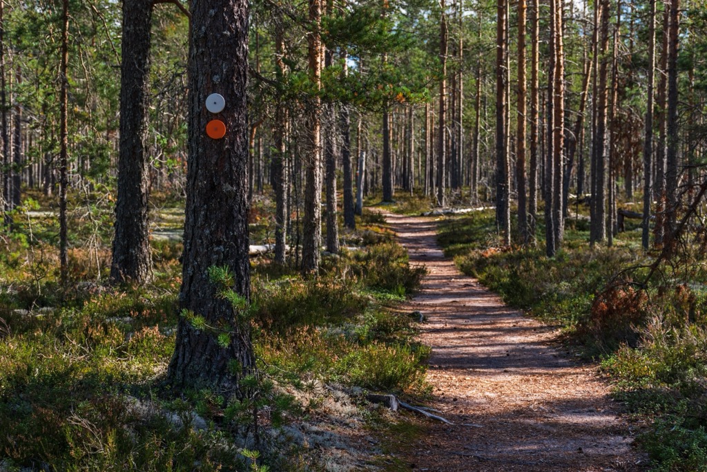
The best hikes in Satakunta start in the vicinity of the main city of Pori, go right along Yyteri Beach, then pass through the Finnish Archipelago islands, and end in the forests in the north of the region. Or should I say just beginning, because the forests offer many more hiking trails than the islands in the sea or the cities.
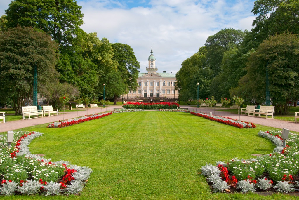
In Pori, go to Kirjurinluoto Park, which is a part of Finland's new network of urban national parks. Several small trails of the park can be combined into one with a total length of up to 7 km (4.3 mi).
It should be said that the park is also the site of the annual Pori Jazz Festival, which is held in July, and which is known far beyond the borders of not only the city and the region but also the country, where music and just party lovers from all over Scandinavia and Europe come to visit.
Being in one of the Satakunta’s archipelagos, which together make up the Bothnian Sea National Park, covering the entire coast of the region, you can also find hiking trails on some of its largest islands. For example on Iso-Enskeri Island in Preiviikinlahti Bay near Pori and Säppi Island in Luvia Archipelago, there are nature trails that are several kilometers (miles) long. There is also a 3 km (1.8 mi) long trail on Kuuskajaskari Island near the town of Rauma.
But in general, almost any island is suitable for walking and easy climbing, even without marked trails. You just need to land on it. But for this, you can use the ferry, which leaves for the islands from many towns, or rent a boat with a tour.
There are also automobile (think bicycle) routes through many islands of the archipelago. Find out about them on a special website at Finnisharchipelagoroutes.fi.
It's logical to guess that the whole of Yyteri Beach is one long hiking route over 5 km (3.1 mi). But in its vicinity, you will find up to another 30 km (mi) of marked hiking trails.
Finally, there are three more national parks in the northern part of the region—4 of 41 parks, nearly 10%, with the following longest trails:
The longest trail of the UNESCO Global Geopark Lauhanvuori-Hämeenkangas is Kuntoura of 5.1 km (3.1 mi).
Satakunta is not the main ski destination in Finland. There are only two small resorts with up to 1 km (0.6 mi) of slopes and two ski lifts in each—Hiittenharju and Salomonkallio. However, like I said before, many other mountains in the region turn into individual ski slopes in winter, not to mention the hundreds of kilometers (miles) of cross-country skiing tracks available in Satakunta and throughout the country, wherever you go.
The nearest larger ski resorts are in Pirkanmaa (Sappee with more than 5 km (3.1 mi) of slopes and more than 5 ski lifts), and Central Finland (Himos with more than 12 km (7.4 mi) of slopes and more than 15 ski lifts).
Check the Satakunta ski resorts map on the larger Western Finland ski resorts map in the World Mountain Lifts section of the site. It includes information about open ski lifts / slopes in Satakunta in real-time with opening dates and hours. There are also year-round cable cars, funiculars, cog railways, aerial tramways, and all other types of mountain lifts.
Before or after hiking and other activities in Satakunta, visit one of the official tourist offices of the region. The main one is located in Pori:
Visit Pori Tourist Information
Yrjönkatu, 13, Pori, Finland
Monday to Thursday from 10 am to 4 pm, Friday from 10 am to 3 pm
+35826217900
Here are also the contacts of the region's official tourist office: info@visitsatakunta.fi, Visitsatakunta.fi.
Unlike most forest areas in Western Finland, where you will usually find two or three huts for overnight stay, there are none on the islands of the Finnish Archipelago in Satakunta region, at least within the national park, so the main type of temporary accommodation here is your own tent, which you can set up at any of them. This is best done near campfire sites, of which there are several dozen.
But in the towns of the region it is much easier to stay. You have access to almost all types of accommodation—especially in the Yyteri Beach area. But be careful: For July and August in this area I recommend booking a couple of months before your trip, because there may not be any vacancies, given the popularity of beach holidays among Finns, who wait for a warm sea for more than half the year during the cold and snowy winters.
In addition to Pori, Satakunta has 7 other localities with city status from 16 municipalities in total. These are Kankaanpää, Harjavalta, Huittinen, Kokemäki, Ulvila, and Rauma with populations ranging from 6 to almost 40,000 in the case of the latter, about which I will say a bit more, as it is also the second most famous city in the region after Pori.
In particular, Old Rauma, or the historic center of the town, is known for the fact that it has a huge number of perfectly preserved medieval wooden buildings, totaling about 600 with great architectural and cultural value for the entire Nordic region, which is why the entire center was inscribed on the UNESCO World Heritage List in 1991. Moreover, it is the only entire medieval town in the country, while the other towns have only a few separate buildings—forts like the famous Olavinlinna in Savonlinna town in the east, churches, houses, etc. The main building of Old Rauma is the Church of the Holy Cross (Pyhän Ristin kirkko), which was completed in 1520. Being also located on the seashore south of Pori, Rauma it is also one of the oldest ports in Finland.
In other words, and even though this may sound clichéd, it is a must-visit place in the southwestern Finland, even if you’re planning to go to the wild Finnish woods and islands for hiking.