
Scan the QR code and open PeakVisor on your phone
Pirkanmaa is one of Finland's 20 regions, formed around the country’s second-largest city, Tampere. The main feature of the Pirkanmaa mountains is Pyynikki Esker (Pyynikinharju in Finnish), a long series of ridges of gravel and sand, with a maximum height of 160 m (525 ft), making it, as believed, the highest such geological formation in the world. The most famous single mountain in the region is Sappeenvuori (208 m / 682 ft), where the small Sappee Ski Resort of the same name is located. You also can't imagine Tampere without the man-made Näsinneula Tower (168 m / 535 ft), the symbol of the city, and its best viewing platform from where you can see many of the 143 named mountains in Pirkanmaa. Its highest and most prominent mountain is Venäläisvuori (235 m / 771 ft).
The exact meaning of the name of the region is unknown, but it apparently comes from the small town of Pirkkala, located on its territory. The full name in Finnish is Pirkanmaan maakunta, in Swedish, the country's second official language, Birkaland. It is also often referred to simply as the Tampere region by the largest city.
Pirkanmaa is among the 10 largest regions in the country by area (12,585 sq km / 4,859 sq mi vs. 92,674 sq km / 35,782 sq km of Lapland, the first by area). It borders Satakunta in the west, South Ostrobothnia in the north, Central Finland in the east, Päijät-Häme and Kanta-Häme in the southeast and south, and Southwest Finland, also known as Finland Proper, in the southwest.
The region is part of two of the country's nine historic provinces, which existed in the Middle Ages: Satakunta, which also includes the above-mentioned modern region, and Häme or Tavastia.
From 1997 to 2009, it was also part of the province of Western Finland, one of the country's six large regions.
Finally, Pirkanmaa is part of one of the four major tourist regions of the country—Coast and Archipelago.
Tampere is located northwest of Helsinki, the capital of Finland. The distance between the cities is 211 km (131 mi) or 2:30 hours by car or local bus, or Vr.fi train. However, you can get here directly from abroad to the Tampere-Pirkkala Airport. In particular, it receives flights from many local low-cost airlines, such as airBaltic, for which it is the main hub.
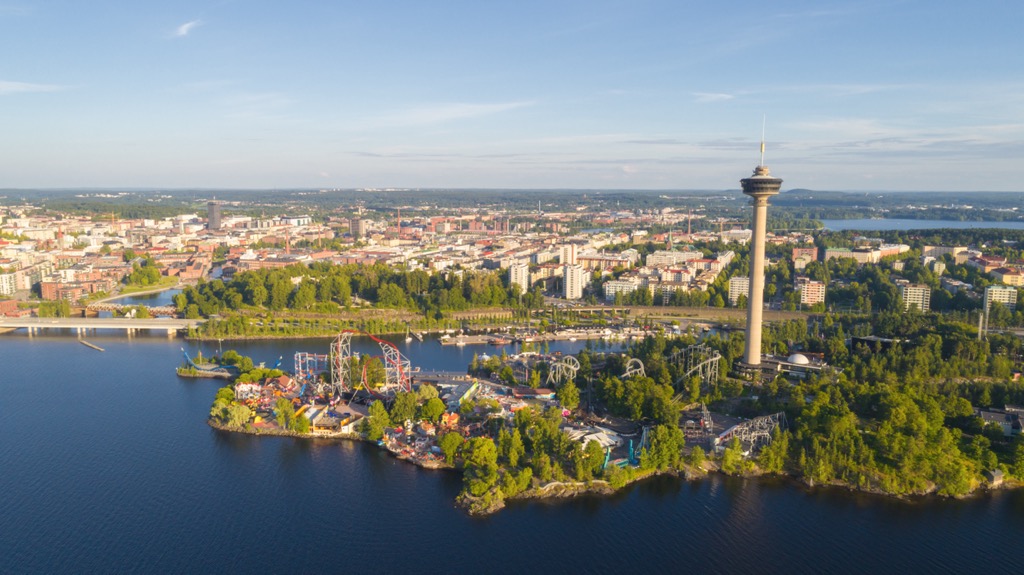
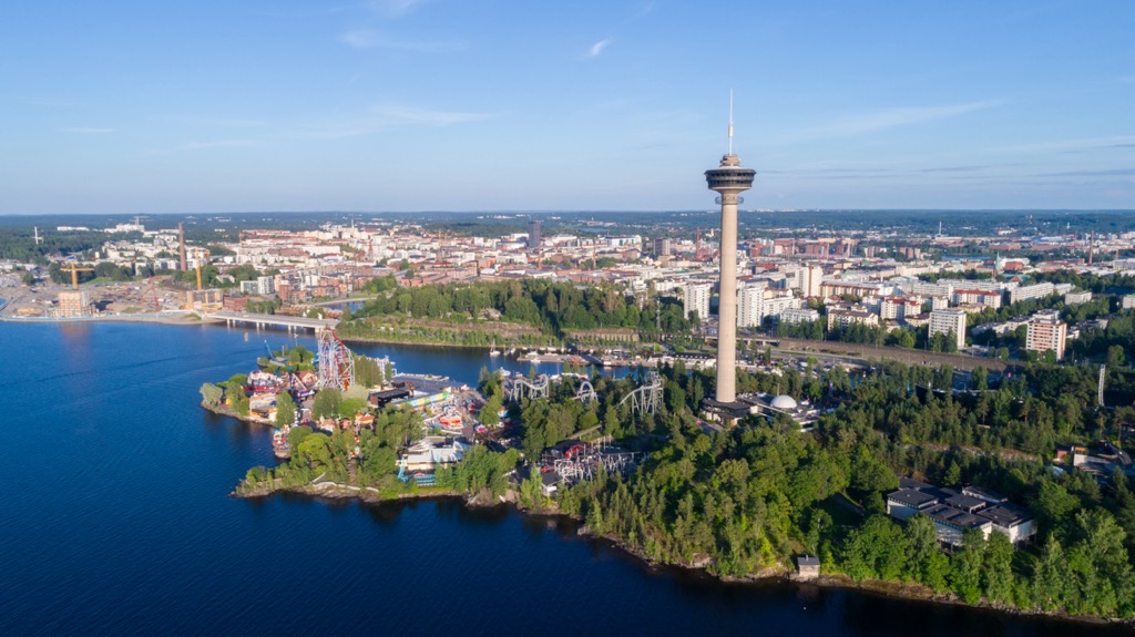
The landscape of the Pirkanmaa region stands out because of four main attractions, all of which are concentrated in Tampere—two natural: Pyynikki Esker, and a pair of large lakes—and two man-made: canal with rapids between them, as well as Näsinneula Tower. Let me tell you about each of them briefly:
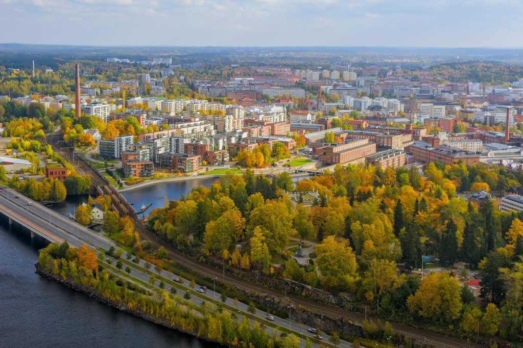
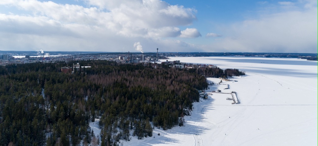
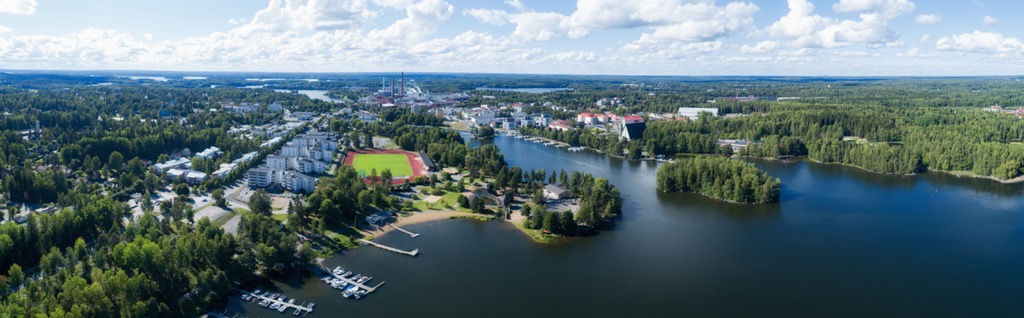
Pyynikki Esker. This is one of many eskers in Finland, formed from moraines during the last glacial period (115,000–11,700 years ago), located throughout the south of the country, which are part of the larger Salpausselkä series of three main ridges, stretching for more than 200 km (124 mi) from west to east, or vice versa. Pyynikki belongs to its northernmost smaller branch, but thanks to its maximum height of up to 80 m (48 ft) from the nearest lakes and twice that from sea level, it is considered the highest in the world. The ridge, consisting mainly of gravel and sand, starts directly from the center of Tampere and extends westward. After the center, it is the most famous district of the city consisting of two neighborhoods: Pyynikki and Pispala with their colorful wooden houses as opposed to the brick factories and plants and other modern buildings of Tampere.
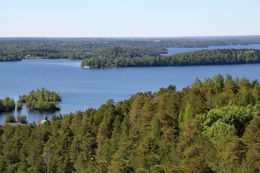
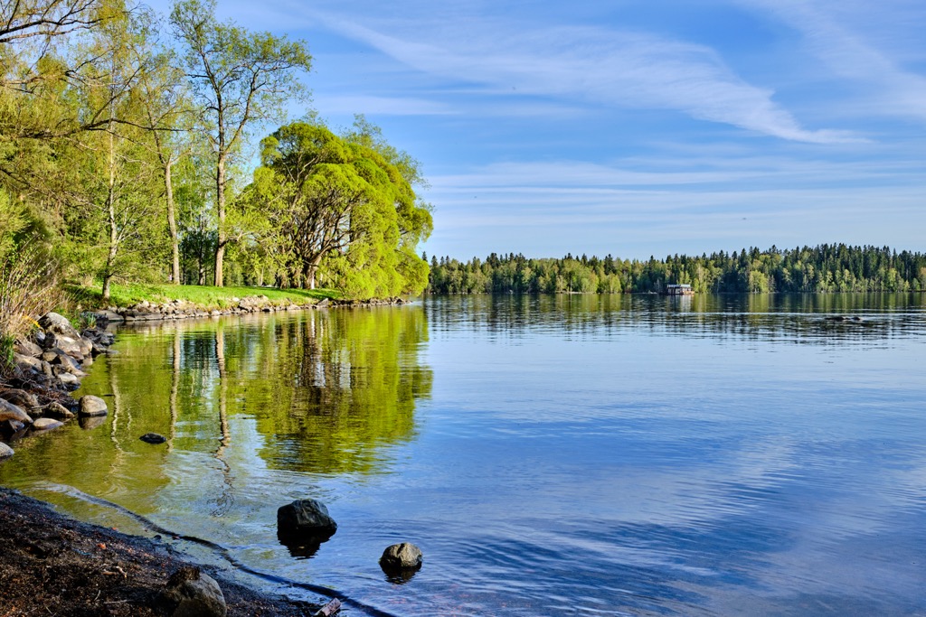
Näsijärvi and Pyhäjärvi Lakes. These are the two main lakes of the region in which Tampere is located. The first, larger, with a total shoreline length of 800 km (497 mi), is to the north, and the second (400 km / 249 mi)—is to the south of the city.
Tammerkoski Canal. It is an artificial canal with rapids less than a kilometer (mile) long, which was built to connect the two lakes, as well as bring them to a common water level. Before, the rapids, in particular, helped to produce mechanical energy for the paper mills, electricity and served other purposes in the country’s most industrial city. Today it is more of a historical site.
Näsinneula Tower. The 168 m (551 ft)-high tower is a symbol of Tampere and the entire region, located in the city center in the Sarkanniemi Amusement Park. It is the second highest in all the Nordic countries after the Kaknästornet in Stockholm, which is 170 m (558 ft) but 155 m (509 ft) without the antenna, which Näsinneula doesn't have, so it depends on the angle of view. From the circular observation deck at a height of 120 m (390 ft), you have a 360-degree view of the entire city, both lakes, and Pyynikki Esker as well as the endless forests.
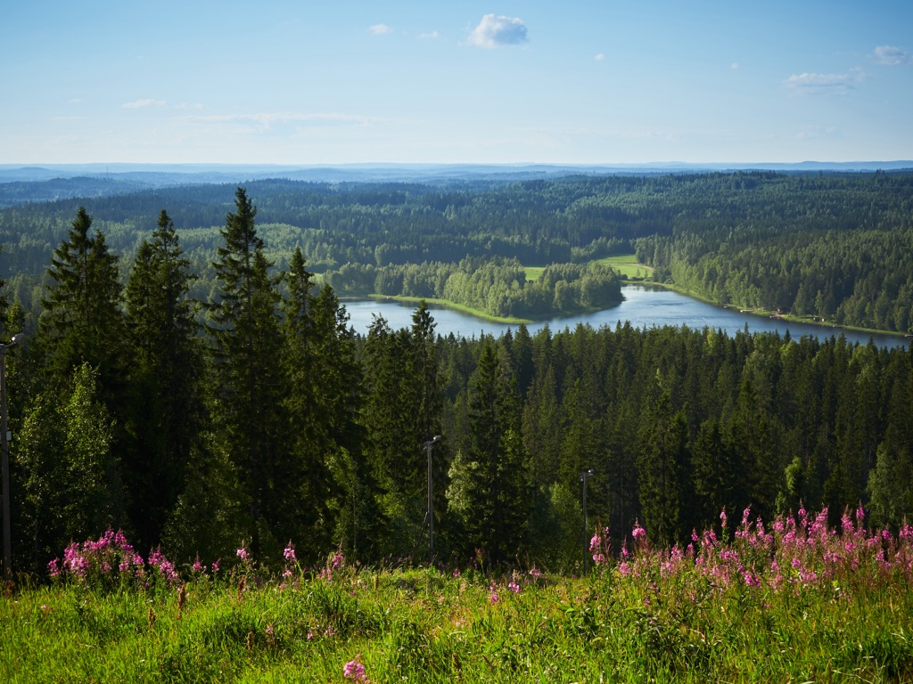
The mountains in the Pirkanmaa region are generally similar to those found throughout Western and Southern Finland. These are low, rocky hills made up of granite and gneiss, which came to the surface after the melting of the glaciers. Nevertheless, even at a low height of up to 300 m (984 ft), these are very picturesque rocks and cliffs that are great points for viewing the surrounding lakes and forests. Many of them also have observation towers, which add another couple of dozen meters (feet).
The region's highest mountain, Venäläisvuori (235 m / 771 ft), is located northeast of Tampere. It is also a small ski slope. Pirkanmaa also has three more mountains higher than 200 m (656 ft) out of 143 peaks in total: Töyryvuori (217 m / 712 ft), Koskelankorkea (211 m / 692 ft), and Sappeenvuori (208 m / 682 ft). The latter is another, much larger skiing area, but I will talk about it next. Next, all the other mountains exceed 100 m (328 ft) in height, except the lowest, Ellivuori (86 m / 282 ft).
Besides also the rocks of Pyynikki Esker such as Nimikallio (Rock of Names) with unknown inscriptions of the 19th century, the most famous mountains in the Tampere area are Mustavuori (150 m / ft) and Kalkunvuori (132 m / 433 ft) to the west—another two ski slopes; Isomäki (119 m / 390 ft) to the south; and Pirunvuori (151 m / 495 ft) or Tree Mountain (in its time the mountain were planted with pines in a certain golden proportion to cover it with trees entirely) to the east in a large green area. The latter also includes many other hills: Tähtitorninmäki (145 m / 476 ft), Tuomikallio (154 m / 505 ft), Soukonvuori (126 m / 413 ft), Hepovuori (146 m / 479 ft), and others.
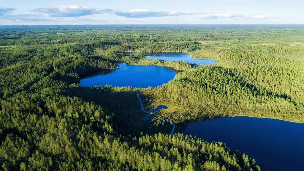
The most popular hiking areas in Pirkanmaa are expectedly located in the Tampere area. Right in the city and around its center, there are several nature reserves, outdoor recreational areas, and just forested parks, where you will find dozens or even hundreds of hiking trails of different lengths and levels of difficulty.
In particular, Pyynikki Esker itself is namesake Pyynikki Nature Reserve (Pyynikin luonnonsuojelualue). Another, much larger, is Soukonvuoren Nature Reserve (Soukonvuoren luonnonsuojelualue) located east of the city. The third one is Viikinsaari Nature Reserve (Viikinsaaren luonnonsuojelualue), on the same-named Viikinsaari island south of the city center.
For those who will have time to explore not only Tampere but also the less central parts of the region, you have 4 of the country's 41 national parks to choose from, that is almost 10%. Three of them are located in the north of the region and one in the east on the border with Central Finland region, with the correspondingly longest trails:
Another great hiking area is the Lauhanvuori-Hämeenkangas UNESCO Global Geopark, which, according to the organization itself, "tell the story of the development of the landscape from an Alpine type mountain range 1900 million years ago to the flat, mire-covered plain of today." Its longest trail is Kuntoura of 5.1 km (3.1 mi).
For those who are not satisfied with that, it is useful to know that the region is covered by the extensive Pirkan Taival Hiking Trail—a network of routes of 300 km (186 mi). For example, a good idea is to hike a trail, which connects the aforementioned Helvetinjärvi and Seitseminen national parks, therefore, both are also good starting points for hiking the Pirkan Taival. The distance is 46.5 km (29 mi).
For skiing and snowboarding enthusiasts, there are more than 5 ski resorts in Pirkanmaa, which are located throughout the region.
The largest and the most popular ski resort in Pirkanmaa is Sappee with more than 5 km (3.1 mi) of slopes and more than 5 ski lifts. Other areas for skiing in Pirkanmaa, Ellivuori and Pukkivuori, are smaller. The main ski resort near Tampere, the largest city in the Pirkanmaa, is Mustavuori. The nearest largest ski resort is Himos in Central Finland.
Check the Pirkanmaa ski resorts map on the larger Western Finland ski resorts map in the World Mountain Lifts section of the site. It includes information about open ski lifts / slopes in Pirkanmaa in real-time with opening dates and hours. There are also year-round cable cars, funiculars, cog railways, aerial tramways, and all other types of mountain lifts.
Visit Tampere is the official tourist organization of the city and the region. It has no tourist office but you can take maps and brochures at the Tampere Market Hall (Hämeenkatu, 19). You can also communicate with the Visit Tampere by phone +358356566800, visittampere@visittampere.fi, and chat on its site Visittampere.fi.
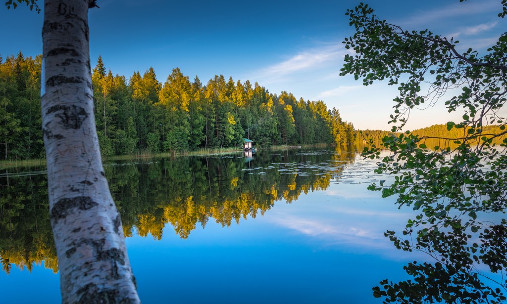
The main type of lodging when hiking in national parks and other natural areas in Finland is a classical mountain, or rather to say, forest hut.
In case this is the first PeakVisor guide to Finland mountains that you are reading, I will remind you that there are three main types: open huts, reservable huts, and rental huts. The first, as the name suggests, is always open, you do not have to pay for accommodation. But they are mostly located in Lapland. The other two types involve booking a bed in the hut or a part of a hut with several beds, or an entire hut. Such huts prevail in the more southern regions of the country.
For example in Isojärvi National Park you will find four rental huts—Lortikka and Luutsaari, as well as Heretty Rental Huts 1 and 2. They generally cost 40–50 € / day.
In other parks and natural areas, the situation is similar: You will find at least two or three such huts in most of them.
There are also many lean-to shelters and tent sites, which you can use as another type of temporary accommodation. You can also put up a tent in any part of the region, even on private property, under the "Everyman's Right".
In addition to Tampere with a population of over 240,000 people, there are 12 cities out of 23 Pirkanmaa municipalities: Kangasala, Nokia, Orivesi, Ylöjärvi, Ikaalinen, Parkano, Mänttä-Vilppula, Virrat, Akaa, Valkeakoski, and Sastamala. There are between 8 to 34,000 people living in each of them.
Of all these cities as a tourist destination, I would mention Valkeakoski, situated in the middle of a picturesque maze of islands in the center of Finnish Lakeland in the south of Pirkanmaa region. Its main architectural and natural attraction is Rapola Hill Fort, the largest of the prehistoric hill forts in Finland, which was in use during 800–1250 in the Viking Age, located on the upper slopes of the namesake Rapola Ridge.
The remaining settlements in the region, as elsewhere in Finland, are small villages, which are often also resorts, thanks to their location in the middle of nature and the equally good tourist infrastructure in the country.


