Get PeakVisor App
Sign In
Search by GPS coordinates
- Latitude
- ° ' ''
- Longitude
- ° ' ''
- Units of Length

Yes
Cancel
❤ Wishlist ×
Choose
Delete
Isojärvi National Park is one of Finland’s 40 national parks. Located in the Central Finland region, the main feature of the park is its former logging areas, which give you an idea of how people lived in the area before the park was established. It is also one of the best parks to explore by kayak rather than on foot or bike. In total, there are 8 named mountains in Isojärvi National Park, making it the most mountainous park outside Lapland. Vahtervuori (218 m / 715 ft) is both the highest and the most prominent peak in the park.
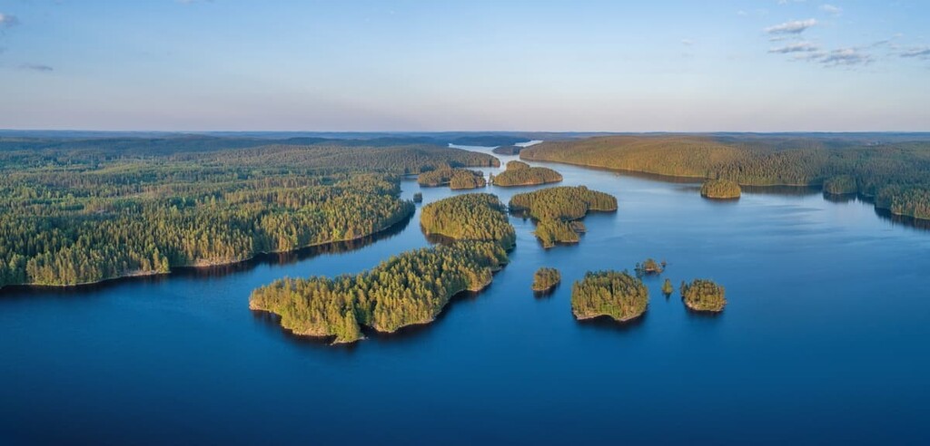
Isojärvi National Park (Isojärven kansallispuisto) was established in 1982 on the site of old logging sites of this area. It is named after Isojärvi Lake, which is located within the park’s boundaries.
The word järvi means “lake” in Finnish while iso translates to “big” or “major.” Therefore, the name of the park, Isojärvi, means “Big Lake.”
Isojärvi National Park is situated in the municipality of Kuhmoinen in the Central Finland region, roughly in the middle between the two large cities that are both among Finland’s top 10 most populous and important cities—Tampere (241,000 people) and Jyväskylä (143,400 people).
However, the settlements around the park are sparsely populated and there are no major cities and towns in the vicinity.
The park is located on the left shore of Isojärvi Lake. Some parts of the park are also located on islands in the lake and peninsulas on its shoreline. The forested area of the park has several lakes, too, the largest of which is Kurkijärvi Lake.
The total area of the park including the lake is 22 sq. km (8.4 sq. mi). As such, it is one of the largest parks in the region.
To the south, the park is surrounded by Päijänne Lake, the third-largest in Finland after Saimaa Lake in Eastern Finland and Inari Lake in Lapland.
Furthermore, Päijänne National Park is also located on Päijänne Lake. This is the only park in Finland that is only accessible by boat because it is located entirely on islands.
I spent January 2016 here in Isojärvi National Park. It was -30 degrees Celsius (-22 degrees Fahrenheit) for the whole month. Of course, the lake was frozen, but I was still quite impressed by the scenery and I highly recommend traveling here. Right across the lake and its islands there is a thin strip of highway with only water to the right and left. It makes you feel like you’re floating, rather than driving along the highway in a bus.
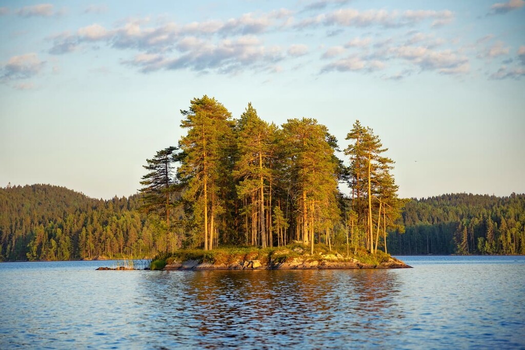
From Tampere to the national park it is about 83.5 km (51.8 mi) or 1 hour and 20 minutes by car and from Jyväskylä it is 90.3 km (56.1 mi) or about 1 hour and 20 minutes by car.
The park itself is located 18 km (11.1 mi) or 25 minutes by car from the highway between the cities. You need to turn off the highway at the place called Vilkkilä to get to the park.
At the same time, both cities are quite far away from the capital and the main city of Finland—Helsinki. Therefore, if you are coming from Helsinki, you can make it to the park without making a stop at Tamepre or Jyväskylä.
From Helsinki to the park, it is 208 km (129. mi) or 2 hours and 40 minutes by car. This route is very direct and efficient and it takes you to the southern borders of the park. This road is more scenic because it runs along Päijänne Lake.
Unfortunately, you can’t get to the Isojärvi National Park by public transport. But you can take the bus by one of the two Finnish bus companies—Matkahuolto or Onnibus—on the Tampere—Jyväskylä route and get off at the Länkipohja crossroads.
From there, it is about 9 km (5.5 mi) to the park. When I reached Koli National Park in North Karelia in a similar way, I hitchhiked. Hitchhiking in Finland is usually quite straightforward as many drivers are willing to pick up hitchhikers on the road.
The entire territory of Scandinavia, including Finland, is located on the Baltic Shield—a segment of the Earth’s crust that is 1.5 to 3 billion years old. So the main rocks here are various kinds of granite, gneisses, shales, and quartzites, including some of the oldest rocks in Europe.
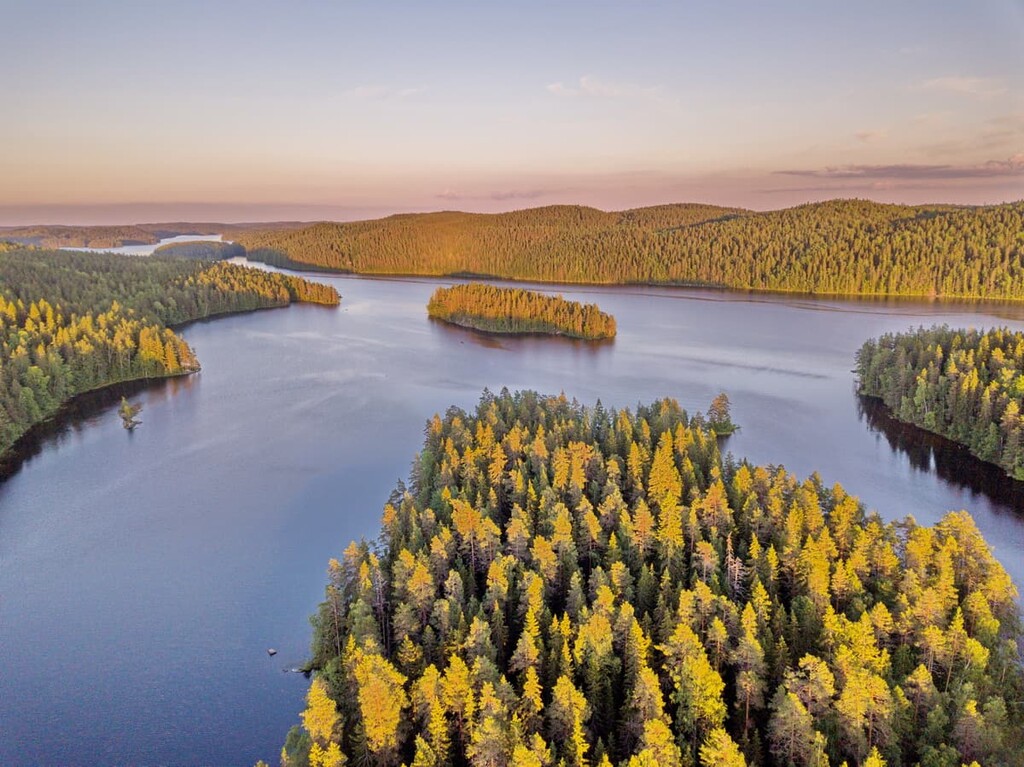
The landscape of Isojärvi National Park has three main features: a lake and its associated islands, high cliffs and ancient gorges, and dense pine and spruce forests. But the main feature of the park is its rugged terrain, at least with respect to the region of Central Finland, where there are not many mountains.
This landscape formed 200 million years ago by rifts in the Earth’s tectonic plates. These rifts created many ravines, the largest of which were filled with water—that’s why this and many other large lakes in Finland exist to this day.
Isojärvi is a relatively large lake that sits at an elevation of 118 m (387 ft). It runs in a northwest to southeast direction and features highly rugged and rocky shores. Here are its exact dimensions:

The two largest islands of the lake, Peltosaari, and Pukkisaari, are located in the southern part of the lake itself. The northern part, on the other hand, has a group of many small islands that’s known as the Jamasselkä archipelago. This area is an ideal place for kayaking.
Because of the steep rocky slopes and hillsides around the lake, the local Finns also call Isojärvi “The Gorge Lake.” Meanwhile, the smooth rocks and large boulders scattered in the forests around the lake are glacial erratics that were left behind by the retreating glaciers during the last glacial maximum.
In total, there are about 187,000–188,000 lakes in Finland, but the figure is usually rounded up to 190,000. The exact figure is not known even by the Finns themselves, because there are too many lakes everywhere in this country—especially in the region of Eastern Finland, which is often called Lakeland.
In Finland, a lake is considered a body of water larger than 500 sq. m (5,382 sq. ft). But the depth of the water is also important and a body of water must be at least 30 m (98,4 ft) deep to be considered a lake.
The flora and fauna of Isojärvi National Park are very diverse, which is not the case in the more northern areas of Lapland. Therefore, travel to this and other parks in Central Finland and Southern Finland is particularly exciting.
The vegetation of the park is dominated by the ancient Latokuusikko Forest, which consists mainly of Scots pine and Norway spruce trees. In addition to pines and spruces, the park also has trees such as birches, aspen trees, oaks, and others.
These forests, particularly those with pines and spruces, used to be used for logging from about the 1880s onward, but after the creation of the park, logging is no longer a concern. The former commercial forests are becoming natural forests again, which is great for the local ecosystems.
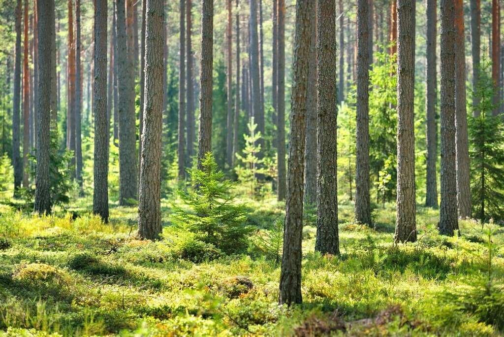
However, in the Kalakorpi, Vahtervuori, and Hevosjärvi areas, there are plenty of old-growth forests. These forests boast trees that are up to 30 m (98.4 ft) high and hundreds of years old, all of which managed to survive the heavy logging that once dominated this region.
As far as small plants are concerned, the most common are long beech fern and lady fern, which you can generally find along stream beds. The butterfly orchid is a particularly unique flower that’s found in this area as it has a very rich smell that you will experience while hiking through the park.
Furthermore, the rocks in this area are usually covered by various types of mosses and lichens. The latter don’t like when you step on them, so try to walk only on the marked trails.
With respect to the animals in Isojärvi National Park, you can often see and hear some of the most common wild birds in Finland, including the black-throated diver (Gavia arctica) and red-throated diver (Gavia stellata). These are my favorite birds: I have seen and heard them many times when I traveled on lakes in Finland.
In fact, these are large birds that live in colonies. They spend a significant portion of their time underwater, hunting small fish. The cry (yes, cry) of the loons—long, loud and sad—is an incredible thing to experience.
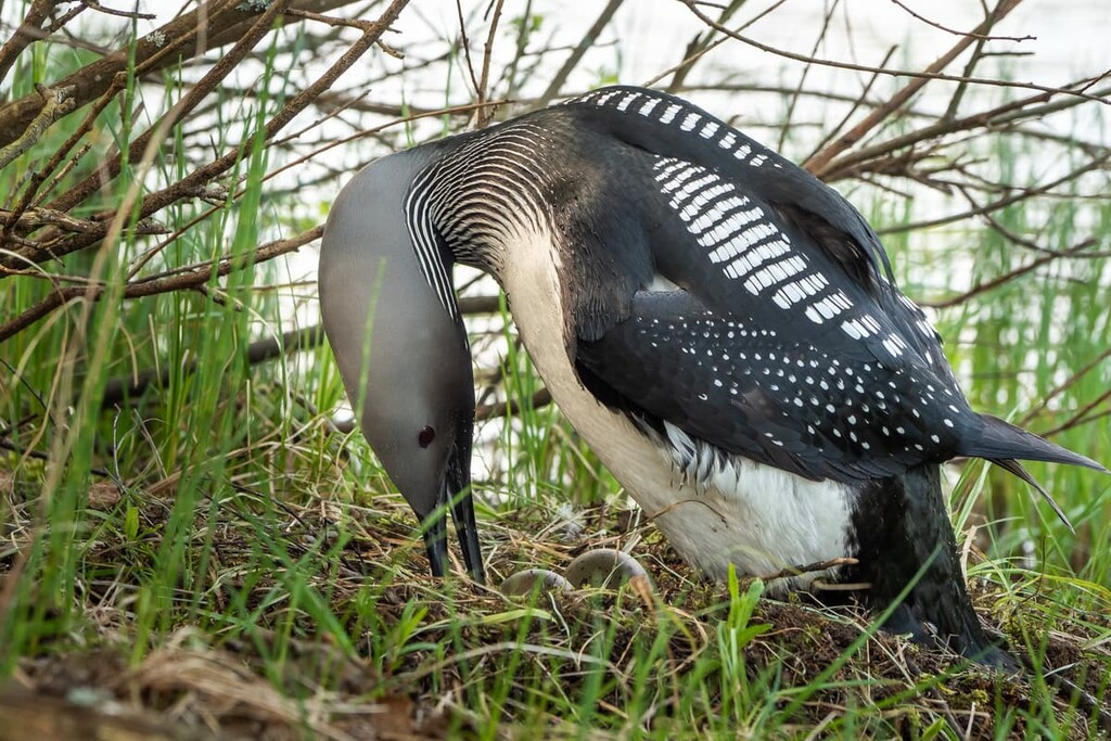
Every winter, when the lakes freeze over, these birds migrate south to warmer lakes and seas. For example, I see them all the time on all four of the largest lakes in Italy: Maggiore, Como, Iseo, and Garda. Before that, I have seen them on the Black Sea. In the summer, loons usually return to the north to breed.
Additionally, Isojärvi Lake is home to many species of fish, including such species as vendace and whitefish.
However, the main animal of the park, which we can see even on its logo, is the American beaver (Castor canadensis), which was introduced to the country in the 1930s. Walking through the park, you can see the trees they fell to build dams to raise the water level of the lake and have more water resources to feed on. Beavers feed on aquatic plants, tree bark, roots, and leaves.
All 40 Finnish national parks have logos or emblems. They show the main features of the park's flora and fauna—plants or animals—or some features of the landscape. For example, the symbol of Nuuksio National Park near Helsinki is a flying squirrel, and that of Oulanka National Park is a calypso orchid. For Isojärvi, it’s the American beaver.
Vahtervuori, the highest point of the park, rises 219 m (718 ft) above sea level and about 100 m (328 ft) above the surface of Isojärvi Lake. It is located in the geographical center of the park in the forest near the shore of a small inland lake Vahterjärvi (the common root of the word suggests that the mountain is also named after the same lake).
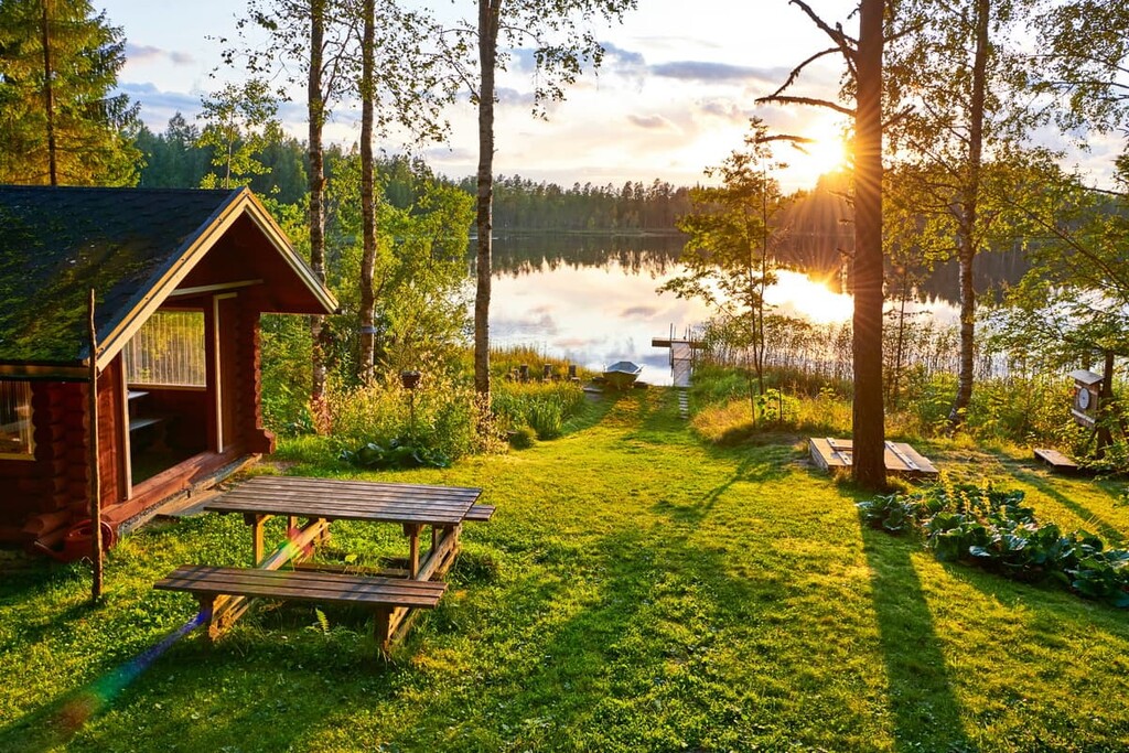
On the shore of the lake, there is a small shelter—a typical thing of national parks and other nature areas in Finland. It is a wooden shelter without doors or windows with a wooden floor on which you can sleep in a sleeping bag in warm weather. Next to it, there is a place to make a fire and a large stock of firewood.
In my experience, in places like this, the atmosphere is so quiet and peaceful that you can spend a whole week here without moving. You can sit back and just admire the way the lake landscape changes at different times of day and in different weather, and listen to the cries of loons.
The rest of the park’s mountains are smaller, including the last in the list—Kaakkovuori (178 m / 584 ft).
There are 33 km (20.5 mi) of marked hiking trails of varying lengths from 3 km (1.8 mi) to 21 km (13 mi) long in Isojärvi National Park. All of them are loop trails, which is great for those who travel to the park by car. Two major starting points are Heretty or Kalalahti Parking Areas. Up next, I will tell you a bit about the main trails:
This is the main trail in the park, even though it is only 3 km (1.8 mi) long. It is easily accessible from the south of the park if you come here directly from Helsinki. You can also find here the Metsähallitus Customer Service, the park’s visitor center, and the Heretty Summer Café, where you can eat before or after your hike.
Eight information boards along the trail tell you how Finnish loggers lived in the area before the park was created.
At Kurkijärvi Lake you can have a picnic in the idealistic Kannuslahti rest spot and even make a campfire to cook something hot, especially if hiking during the shoulder seasons.
The Hevosenlenkki Trail is an extended version of the first trail that leads to Hevojärvi, Kurkijärvi, and Kuorejärvi lakes, three other inland bodies of water in the park. So, this trail could be called "Thee Lakes Trail".
However, the name does not refer to the lakes, but rather to the history of logging in these areas. Its main attraction is the Heretty Loggers’ Cabin, which is now the park’s visitor center. It is an old building (built in 1946-47) that was constructed to house local loggers, many of whom were also horsemen. Horses were kept in the stables nearby. The cabin itself accommodated 26 people on a regular basis but during the high season, it could house up to 40 people.
Another attraction on this trail is the former dams built by beavers, the main occupants and loggers of the park today.
The Savottapolku and Jätkän Polku Trails are the two longest trails in the park, both of which run from north to south or vice versa for almost the entire territory. The first trail is 10 km (6.2 mi) long and the second is 11 km (6.8 mi) long. The trails can be hiked individually or together to make a huge loop of 21 km (13 mi).
On the trail, you will see all the major attractions of Isojärvi, including the highest peak of the park, Vahtervuori, which is located right on the intersection of two trails or in the middle of the big 21 km (13 mi) route); and another logger's hut called Lortikka, located on the second trail—the building today serves as a rental hut so you can stay in it for the night and continue your way on the next day.
I recommend this option because it will save you energy and leave you much more time to enjoy nature.
In addition to hiking and backpacking, in Isojärvi, you can enjoy other summer sports and outdoor activities. This includes mountain biking (16 km / 9.9 mi of trails) around the half of the park, canoeing and rowing, geocaching, fishing, birdwatching, picking berries and mushrooms, swimming, and even enjoying the sauna on the park’s territory.
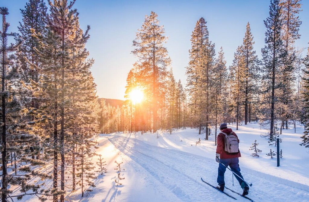
In winter, the park is a great cross-country skiing area with no restrictions, but note that there are no maintained ski trails. Snowshoeing is also an option in the park.
The Isojärvi National Park Visitor Center is located in its southern part at the Heretty Parking Area. There is also the Heretty Cafe, where you can eat a snack and rent some equipment, such as a rowboat, a canoe or a kayak, a fatbike, hiking equipment, or a packraft in the park.
Metsähallitus Customer Service and Heretty Cafe
Kylämäntie, 1335, 17950, Kuhmoinen, Finland
Opening hours: From Monday to Friday from 9 am to 3 pm
+358206395270
IMPORTANT: Some parts of the park may be closed to the public during certain times of the year. If you see a sign about this, don’t enter the closed AREA.
Before going to this and other Finnish national parks, you should know and follow some simple rules of responsible travel. This includes some rights of free movement in Finland, but also some restrictions and prohibitions.
In this particular park, it is also forbidden to travel on the islands of the Kaatselkä area between May 1 and July 31.
Read more about the rules in Isojärvi on the Finnish National Parks website under the “Rules and Regulations” section.
When hiking in Finland’s national parks, you can stay overnight in one of several basic types of temporary accommodation that are used in Finland: rental huts, lean-tos, camping, cottages, and B&Bs, among others.
In this park, there are four rental huts: Two separated rooms in Heretty Loggers’ Cabin, as well as Lortikka and Luutsaari rental huts in other parts of the park. Bookings can be made at the café or via email or phone to Metsähallitus. Prices vary, but the rooms in Heretty Logger’s Cabin are usually €55 per night.
In the summer, you can also sleep in one of the lean-to shelters in the Kuorejärvi, Vahterjärvi, Kalalahti, and Renusaari areas, or you can pitch your tent in one of them.
You can find out more about overnight stays in the parks in the “Services” section of each park’s page on the official website of the national parks of Finland.
You also generally won't have a problem finding a place to stay before and after hiking: Most of the villages around the park offer rental cabins, camping grounds, typical Finnish summer and winter cottages, B&Bs, and so on.
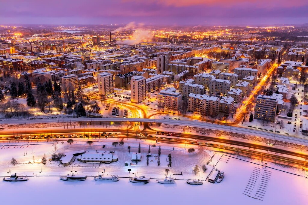
Tampere is the closest major city to the park and the quickest way to get there by public transportation. Furthermore, it is the second-largest city in Finland after the capital Helsinki, which is 180 km (590 miles) to the north. There are 241,700 (2021) people living in Tampere.
Tampere is considered the industrial capital of the country: There are many industries located in the city. The most famous of them is the Finlayson cotton factory, which produces bedding and household goods. It is actually a former factory because today the goods are made in Turkey and the factory functions as a cultural space.
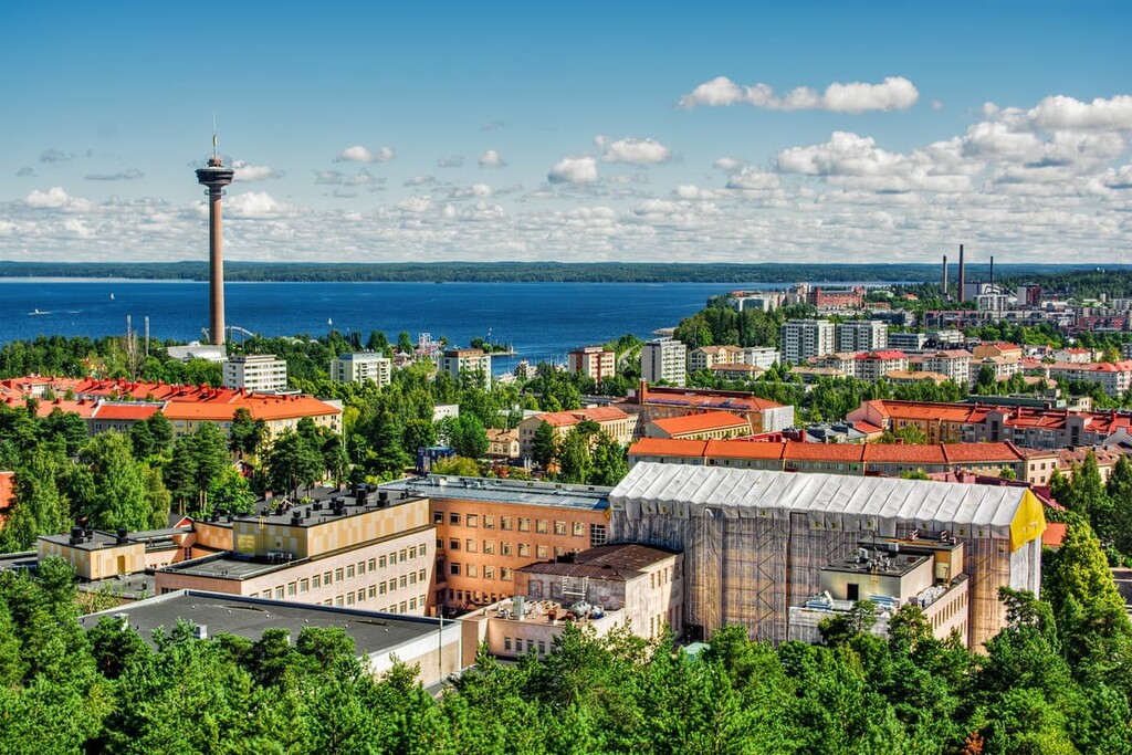
Yet, like in all other cities in Finland, there is more nature than concrete buildings, traffic, and everything else urban in Tampere. For example, a streetcar/tram line started operating on August 9, 2021 for the very first time in the city.
The city is located between two large lakes—Näsijärvi and Pyhäjärvi. The lakes are connected by the Tammerkoski River, which flows through the city. It compensates for the difference in height between the lakes of 18 m (59 ft). The lakes are surrounded by wild pine forests, as well, with many smaller bodies of water.
The best way to view the entire city is to climb its second main attraction—the 168-m (551 ft) high Näsinneula Observation Tower at Särkänniemi Amusement Park located not far from the city center. I did so in October 2012 during a three-day trip to the city and I still remember those beautiful views, and want to come back to see it again.
The third main place in Tampere to visit, and especially if you have kids, is the only museum in Finland (and the world) of the work of Finland’s main writer Tuve Jansson, who invented and wrote many books about the Moomintrolls.
The official tourist site: Visittampere.fi.
Explore Isojärvi National Park with the PeakVisor 3D Map and identify its summits.


