
Scan the QR code and open PeakVisor on your phone
Päijät-Häme or Päijänne Tavastia is one of Finland’s 19 regions, located in the southern part of the country. The two main natural features of this region are Finland's second-largest lake Päijänne and the hills of the Salpausselkä Ridge, which stretches across the entire south of the country. It is impossible not to say at once about its main cultural peculiarity—belonging to the historic province of Häme or Tavastia with its distinctive culture and traditions. There are 84 named mountains in Päijät-Häme. Tiirismaa (281 m / 921 ft) is the highest point. The most prominent mountain is Kammiovuori (223 m / ft).
The name of the region Päijät-Häme is composed of two words. The first is an adjective from Päijänne, Finland's second-largest lake after Saimaa, which is located in the southeastern part of the country. The second, Häme, is one of the nine historic provinces of the country, which existed on the administrative map of Finland until 1634, but remained on many other maps, linguistic, geographical, and others. Hence the name means the "Region of Häme in the area of Päijänne Lake".
However, Päijät-Häme is only a part of the province: the other two, Kanta-Häme, with its capital in Hämeenlinna, and Central Finland (Keski-Suomi in Finland) with its capital in Jyväskylä, is to the south and north of it, respectively.
The Häme region also has a second common name, Tavastia, which is the Latin version (Tavastland in Swedish). So Päijät-Häme is also called Päijänne Tavastia (Päijänne-Tavastland in Swedish).
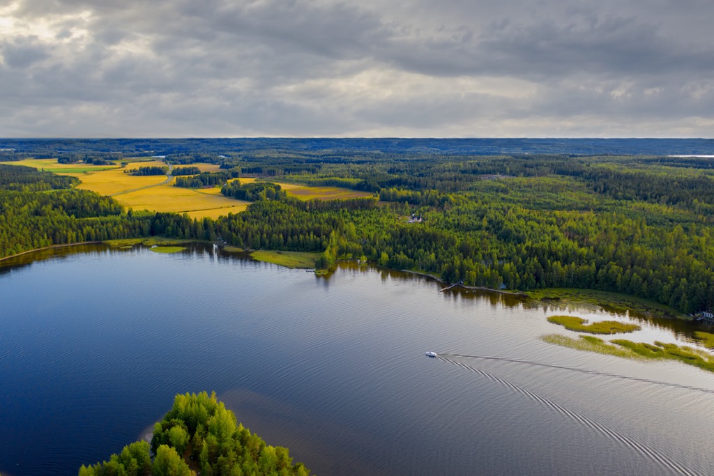
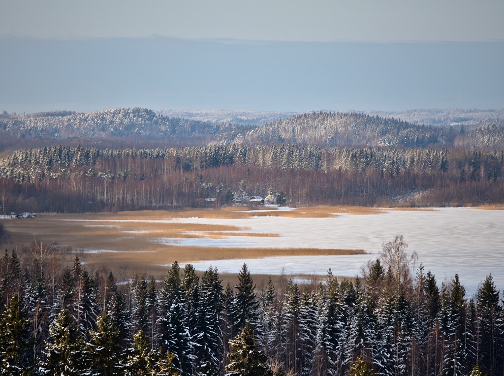
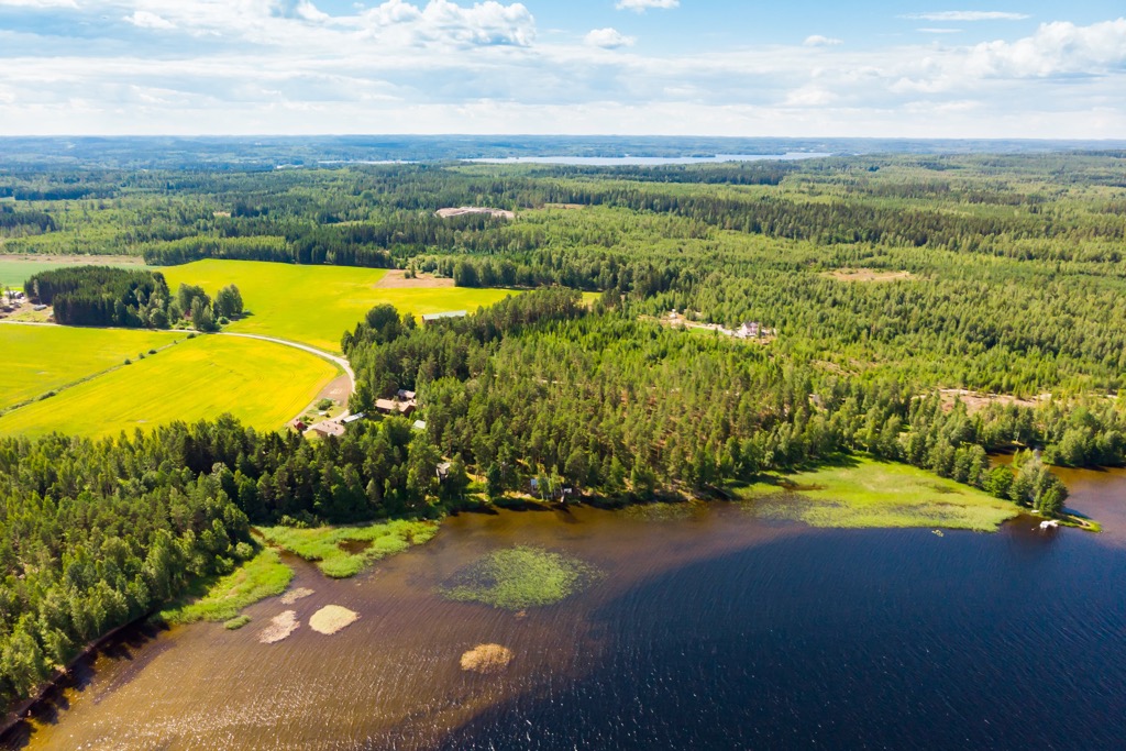
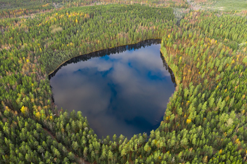
Päijät-Häme is one of the smallest regions of the country, which occupies an area of 6,256.66 sq km (2,415.71 sq mi), of which 5,126.11 sq km (1,979.20 sq mi) is land and the rest is water. The region is the southwestern tip of the famous Finnish Lakeland, one of the four major natural and tourist regions of Finland on par with Helsinki, the Coast and Archipelago, and Lapland. Therefore, a large part of the region is covered by lakes, including the Päijänne.
In addition to Central Finland and Kanta-Häme, the region borders the metropolitan area of Uusimaa (Helsinki) to the south, Pirkanmaa (Tampere) to the west, South Savo (Mikkeli), and Kymenlaakso (Kuovola and Kotka) to the east.
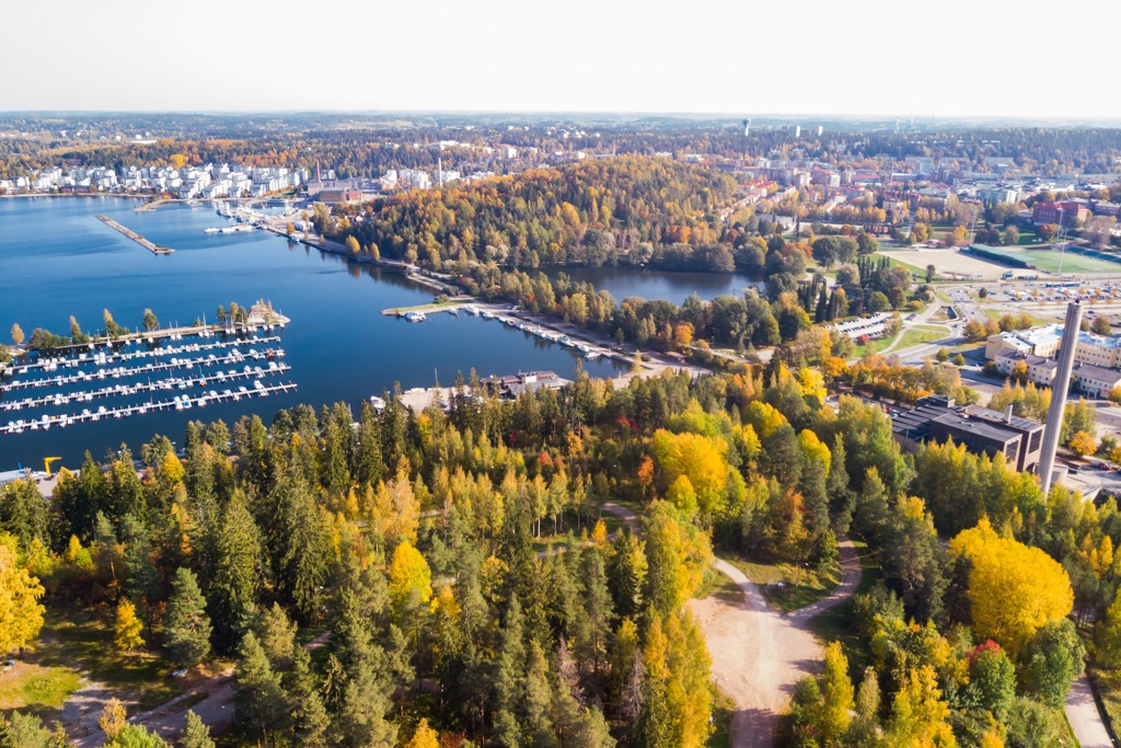
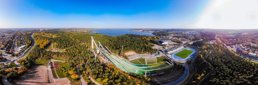
There are 10 municipalities in Päijänne Tavastia. The capital and largest city of the region is Lahti.
You can get to Lahti from Helsinki by car, train, or bus. The distance between cities is 107 km (66.4 mi) or 1:30 hours. When traveling around the country by bus, take an English-Finnish phrasebook with you, because outside of Helsinki, not all bus drivers speak English.
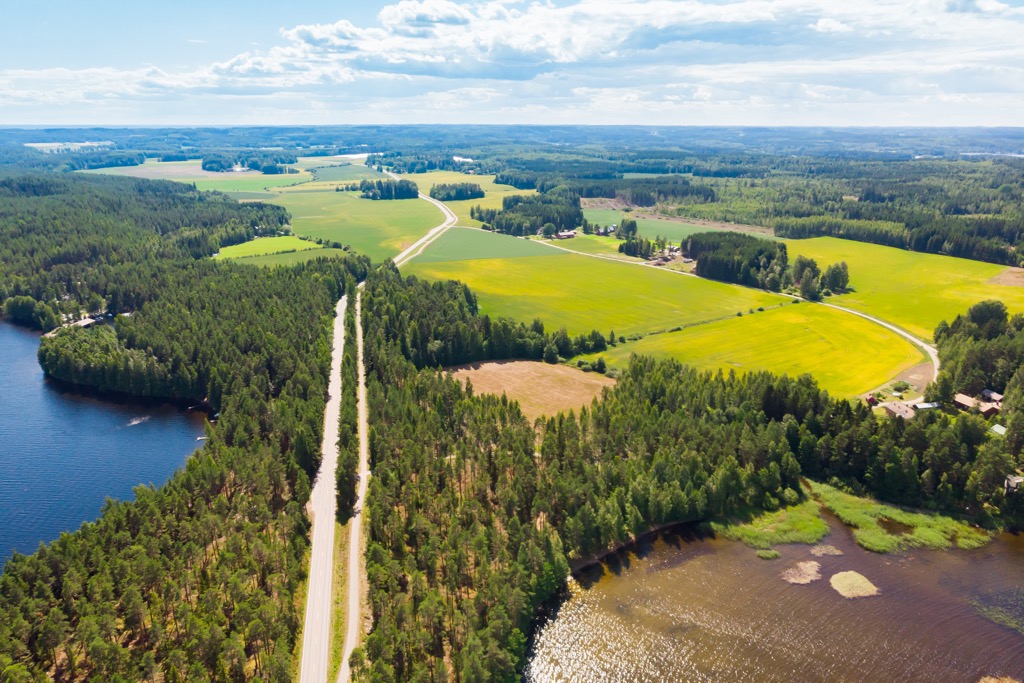
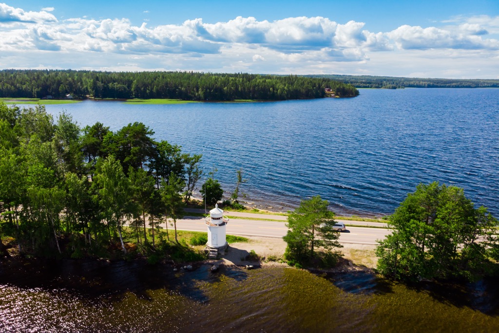
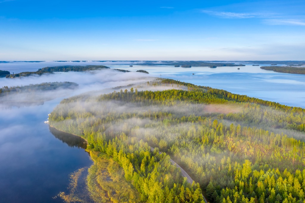
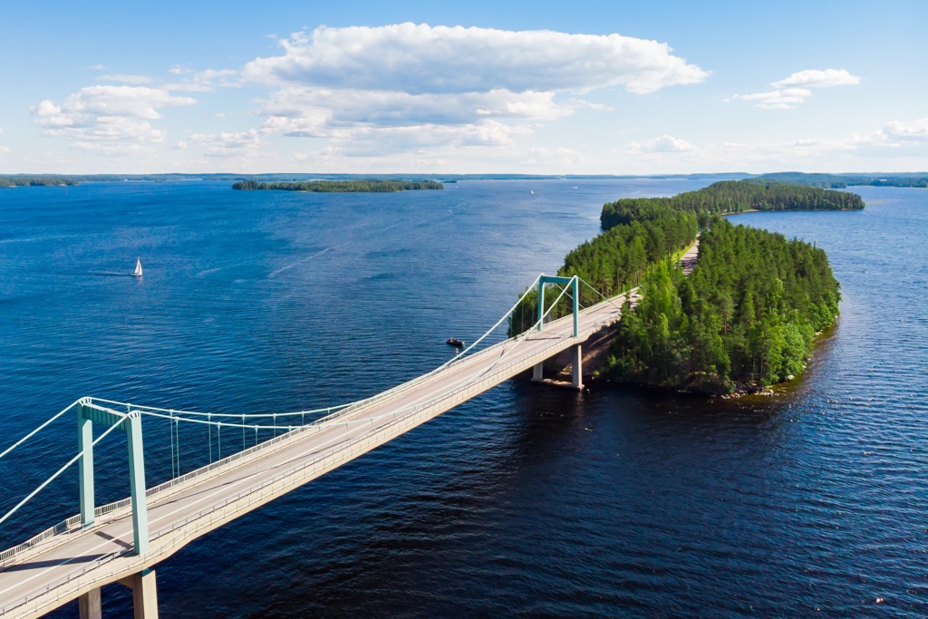
In particular, I reconnected between Lahti and the village of Sysmä by an incredibly scenic road that winds along the Pulkkilanharju Esker, which runs straight and across Päijänne Lake. Along with the Salpausselkä Ridge, which I will talk about next, this is the main feature of the landscape of the whole region, which simply cannot be missed.
Given that the northern part of the Häme region is newer, and the main and more historically important part is located south of it in the Kanta-Häme region, here I will tell briefly about the human history of Lahti.
Read more about the history of the historic province of Häme in a separate guide to the Kanta-Häme region, which is its historical center.
Päijät-Häme is not the main mountainous region in Finland, yielding in the number of peaks, but most importantly their height, not only Lapland but even Karelia. There are 84 peaks in the region, the highest of which is Tiirismaa (223 m / 731 ft). They belong to the Svecofennian orogeny geological layer (2,000 to 1,800 million years ago during the Paleoproterozoic Era) underlying all of southern, western, and central Finland.
However, the region is well-known on the geographical and geological map of the country primarily for Salpausselkä ("salpa" means shutter, barrier and "selkä" means ridge in Finnish), an extensive system of moraine ridges, left by the Ice Age between 12,300 and 11,250 years ago, which stretches over 500 km (310 mi) across all the Southern Finland.
In particular, there are two main ridges running parallel to each other, Salpausselkä I and Salpausselkä II, a small separate ridge Salpausselkä III in Southwest Finland, and small ridges in Central Finland and North Karelia.
It is important to note that it is in Lahti that the ridge reaches its greatest height of 80 m (260 ft), but in general, it does not exceed 20 m (65 ft). Accordingly, many hills in the region belong to it.
Salpausselkä ridges are not only a landmark of the landscape. One of the main values of the ridge is that it literally "holds" the whole Finnish Lakeland from the south. Without this ridge, this beautiful natural region simply would not exist as we know it. They are also a source of sand and gravel for construction and groundwater.
The individual major summits of Päijänne Tavastia include at least the following eight peaks, each with its own characteristics:
Päijät-Häme, which is small in comparison to other regions, is characterized by a wide variety of hiking areas and marked hiking trails of various lengths. I would highlight at least three main areas:
First, the region is home to one of Finland’s 40 national parks, Päijänne National Park, which is a major natural attraction for all local outdoor enthusiasts. It is also one of only a few parks that are located entirely on the water, so it can only be accessed by ferry during a summer season.
The park’s main route, the Kelvenne Trail, is 9.7 km (6 mi) long and runs along the lake’s largest island, Kelvenne. The park is also connected to neighboring areas via the Päijänne-Ilves Connection Trail of 12.6 km (7.8 mi) and the Aurinko-Ilves Connecting Trail of 30 km (18.6 mi). But if you are not ready to dive deep into the park, you can get off at Pulkkilanharju Esker, along which the highway runs, to take the 4.5 km (mi) long nature trail. This is exactly half of the total length of the esker, which is 8 km (4.9 mi). The trail starts from the Karisalmi bridge’s parking area.
Secondly, most of the listed places in the guide are part of the Salpausselkä UNESCO Global Geopark, a new park that was created only in 2022 to protect the main natural landmark of the region.
For example, you can hike the 4.5 km (2.7 mi) nature trail in Pirunpesä Gorge also known as The Devil’s Nest, which is part of Tiirismaa—I will remind you, the highest in the region and all of Southern Finland. It is also a separate nature reserve with the same name—Pirunpesä Nature Reserve.
Third, you can hike right in Lahti around the city center. Here, as in all other cities in Finland, dense pine and spruce forests and lakes are located right within the city limits and start just behind the main streets.
In particular, Lehmusreitti Urban Nature Trail of 13 km (8 mi) goes long around the center but does not go more than 2 km (1.2 mi) from it, so you can always turn from the trail to get a coffee and snack. This trail is also part of the Salpausselkä UNESCO Global Geopark and features many of the attractions listed above with the most fantastic scenery of the trail on top of Mustakallionmäki Hill.
Other good hiking areas and trails in Päijänne Tavastia are the following:
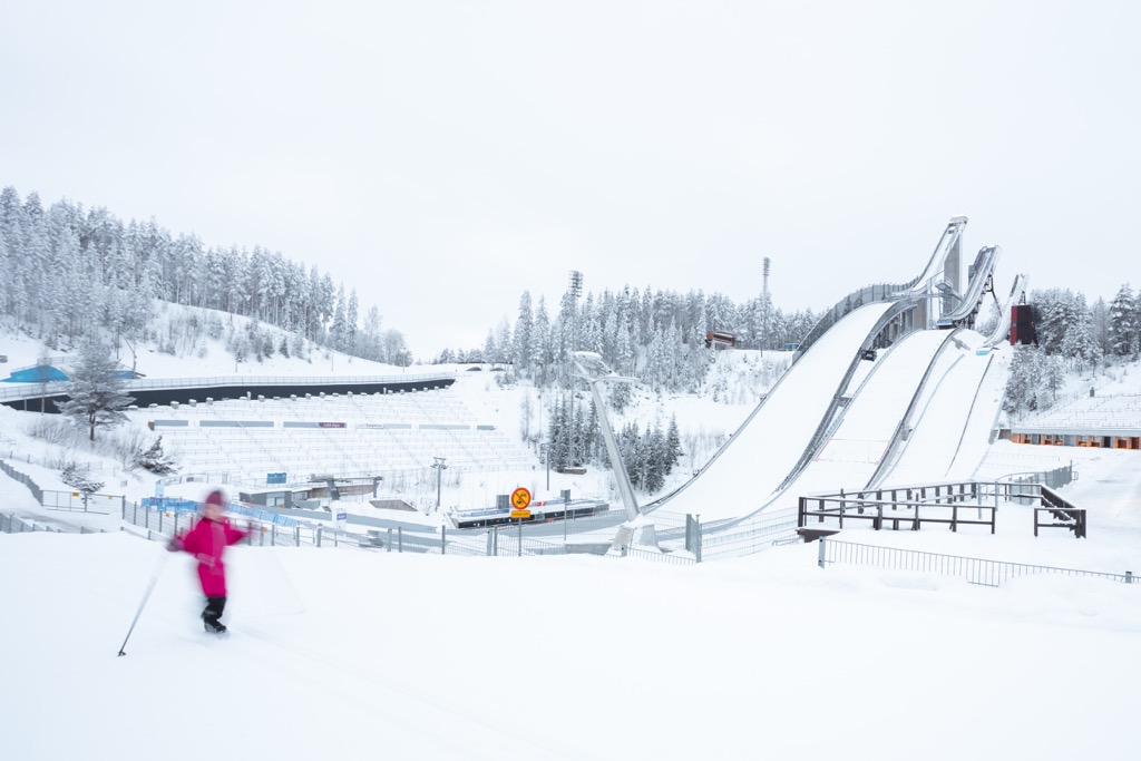
The main ski resort in the region and all of southern Finland is located right in Lahti. It is called Messilä Ski Center. It has 10 illuminated ski slopes and 70 km (43.4 mi) of cross-country ski tracks (20 illuminated in total), 9 ski lifts, ski school and ski rental service, and 2 restaurants. The highest elevation is 222 m (728 ft).
Find other ski resorts in Finland on the country's page in the World Mountains Lifts section on the PeakVisor site.
Before or after hiking through Päijät-Häme, visit the region's official tourist center, located in Lahti, to pick up a paper map and ask for advice. You will also find several official travel sites useful.
Lahti Tourist Information
Kauppakeskus Trio, Aleksanterinkatu, 18, 15140, Lahti, Finland
+358207281760
In Päijät-Häme’s parks and hiking areas, as well as in the country as a whole, you can stay overnight in one of several types of accommodation. This includes lean-to-shelters, rented and reservable huts, and traditional Sámi huts. For example, in Päijänne National Park, the only one in the region, there are 2 lean-to shelters on Iso Lammassaari and Virmailansaari islands, and four camping sites at the same island but also at the Hietasaari, and on Kelvenne.
Within some parks or near their boundaries, you can also find other campgrounds, cabins, B&Bs, saunas, cottages, and other types of accommodation.
Thanks to Finland’s Everyman’s Right law, you can also pitch a tent in most areas of the country unless they’re specifically restricted as no-camping regions.
In addition to Lahti and its suburbs, the next two largest cities in the region are Heinola and Orimattila.
The main attraction of the first is Tähtiniemi Bridge, the second longest in the country (924 m / 3,031 ft) cable-stayed harp form bridge across the Ruotsalainen Lake (the longest Finnish bridge is Replot Bridge between the town of Vaasa and Replot Island of 1,045 m (3,428 ft). The Orimattila is famous because of the Orimattila Church (Orimattilan Kirkko) with a tall white stone tower, built in 1886.
As I already recommended, another great place to go is the small village of Sysmä in the north of the region, however, connected directly to Lahti by bus. Sysma is very small and nice with many old wooden buildings, including the Sysmä Local History Museum, located in the building of the medieval church of Swedish king St. Olav; the Finnish Accordion Museum for those who want to get to know the Finns through this very popular musical instrument in the country; and Villa Sarkia, a former bank house converted into a creative residence, among others.


