
Scan the QR code and open PeakVisor on your phone
Kymenlaakso is home to 543 named mountains. The highest is Tornimäki at 159 m.
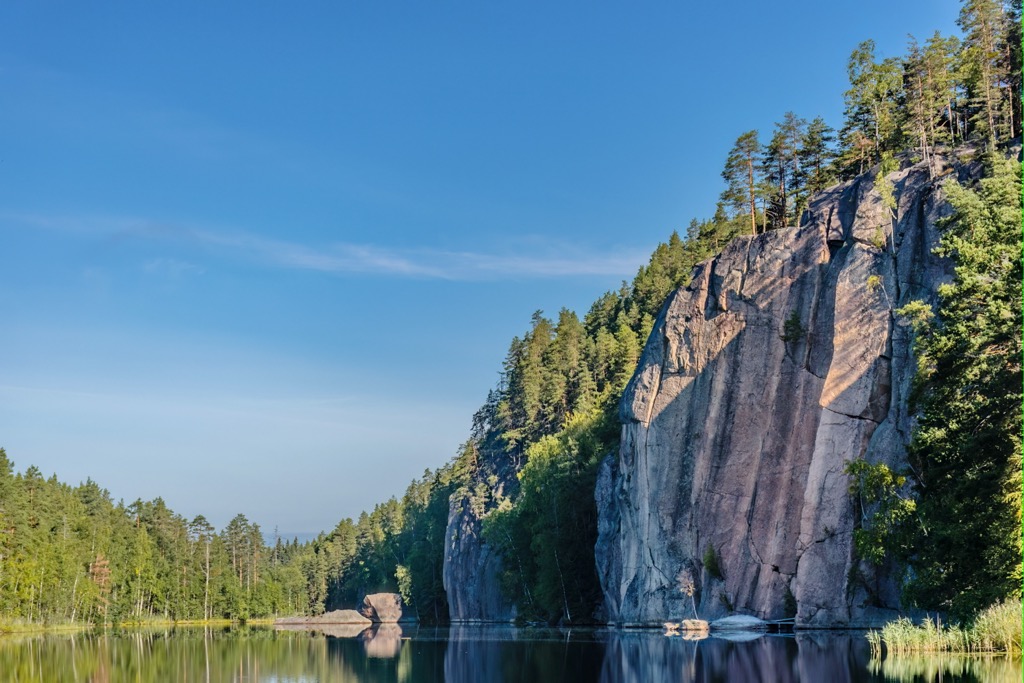
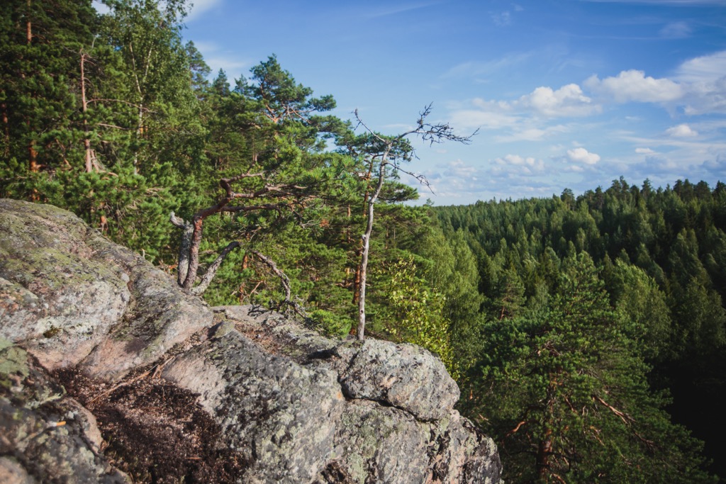
Kymenlaakso is one of the smallest of Finland's 19 regions, which nevertheless has a wild, mighty character, which it displays in competition with the more popular tourist regions of the country. The main feature of the Kymenlaakso mountains is that it is the most mountainous in Southern Finland in terms of the number of named peaks. They are represented by granite rocks and cliffs up to 250 m (820 ft), which offer stunning views of numerous lakes and endless pine and spruce forests. In particular, the main places in Kymenlaakso with a similar landscape are neighboring Repovesi National Park and Aarnikotka Forest Nature Reserve. The region is also famous for the mighty Kymi River, from which it takes its name, and thousands of rocky islands in the Archipelago of the Eastern Gulf of Finland. In total there are 543 named mountains in Kymenlaakso. The highest and most prominent mountain is Tornimäki (159 m / 522 ft).
The name of the region, Kymenlaakso, which is spelled in full as Kymenlaakson maakunta, literally means “The Valley of Kymi River”. The name of the river itself means just “large river” in the Old Finnish language.
Kymenlaakso is the fourth-smallest region in Finland out of 19 (5,149 sq km / 1,988 sq mi). Only Åland, Central Ostrobothnia and Päijät-Häme are before it (at the end of the list of the largest Finnish regions). With the latter, it also borders. Other regions bordering Kymenlaakso are Uusimaa in the west, South Savo in the north, and South Karelia in the east, as well as Leningrad Oblast in Russia.
The region is part of the larger former province of Southern Finland, which existed on the administrative map of the country from 1997 to 2009 along with five other provinces. This term continues to be actively used because it coincides with the geographic region of the country.
Kymenlaakso was also part of three of the nine historical provinces of Finland: Uusimaa, Karelia, and Tavastia.
Finally, the region is part of two of Finland's four major tourist regions: the Coast and Archipelago, covering the entire coast of the country, including the Archipelago Sea, and the Finnish Lakeland, which I already mentioned before (two others are Helsinki and Lapland).
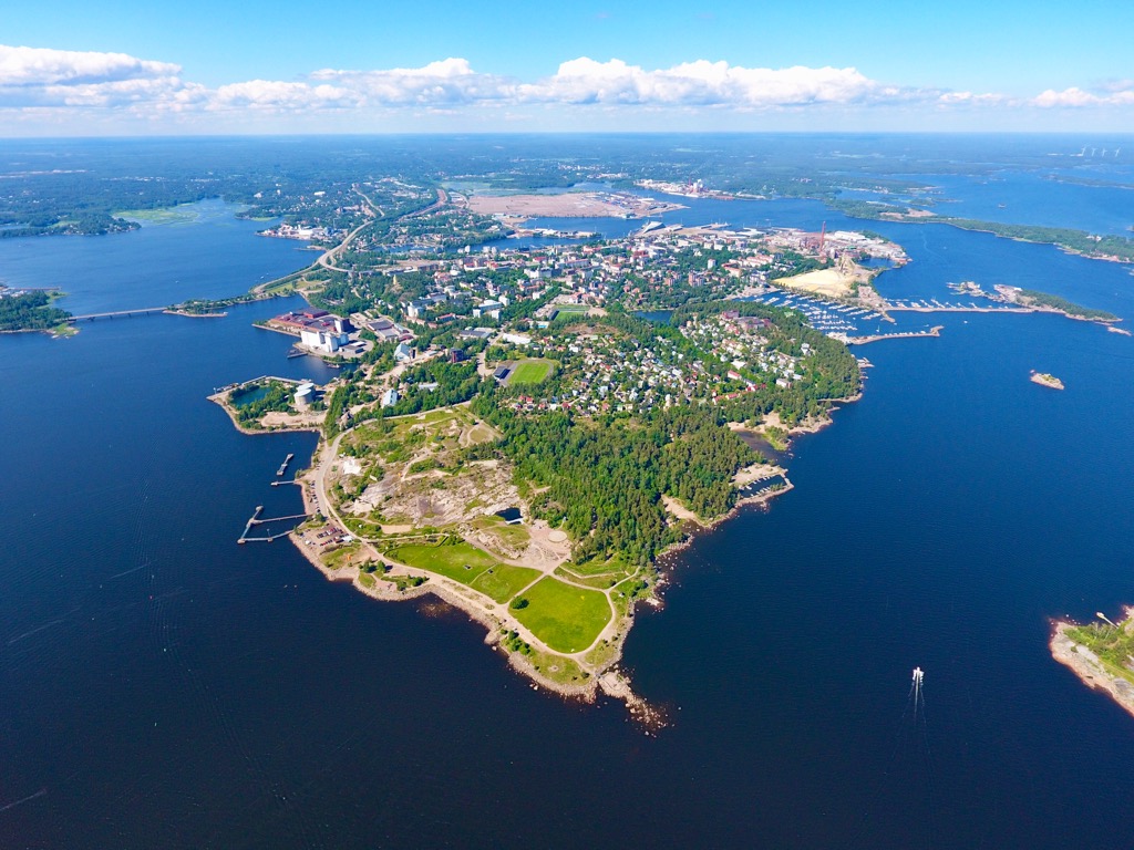
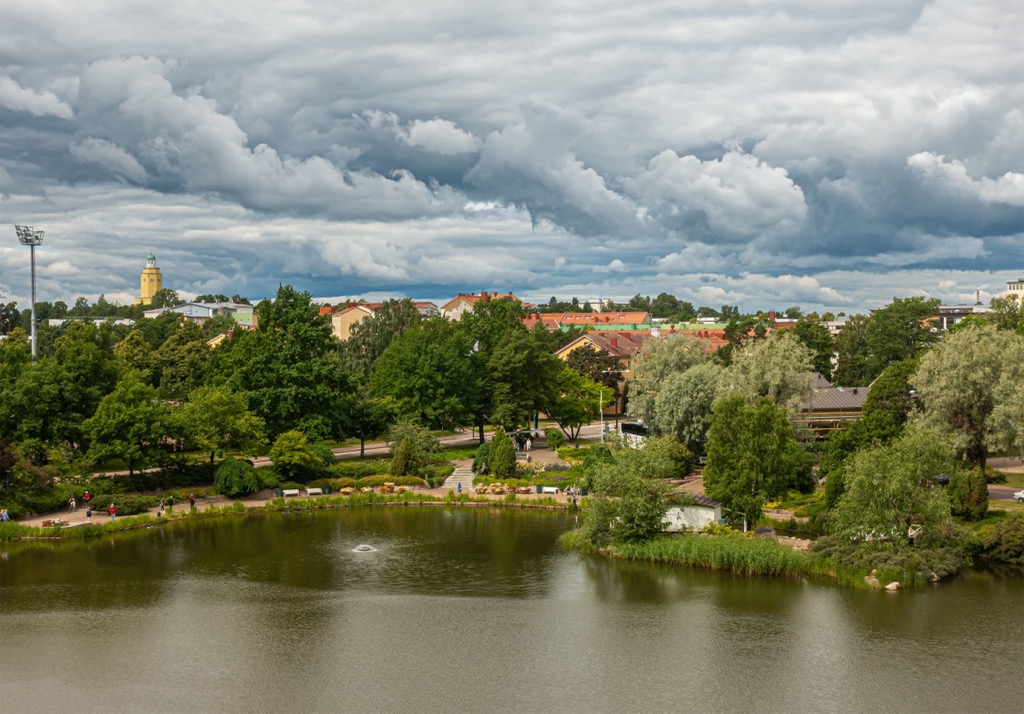
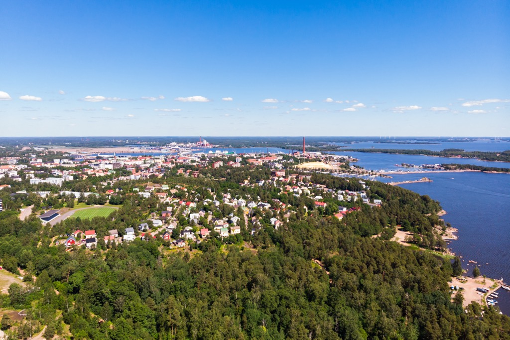
The two largest cities of Kymenlaakso are Kotka on the coast of the Baltic Sea (here is also the mouth of the Kymi River) and Kouvola in the central plain part (the river flows also through the latter). In this respect, it is a unique Finnish region with two capitals at once.
The easiest and fastest way to get to Kymenlaakso is by car, train, or bus from Helsinki or St. Petersburg in Russia — the region is located about midway between these two major capital cities. They are also the nearest international airports, which Kymenlaakso’s capitals do not have.
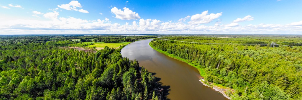
In addition to Kymijoki, two other main natural features of the Kymenlaakso landscape are numerous lakes and the islands of the archipelago. So I will tell you now more about them all, including some of their man-made attractions, without which the landscape of the region would also not be complete.
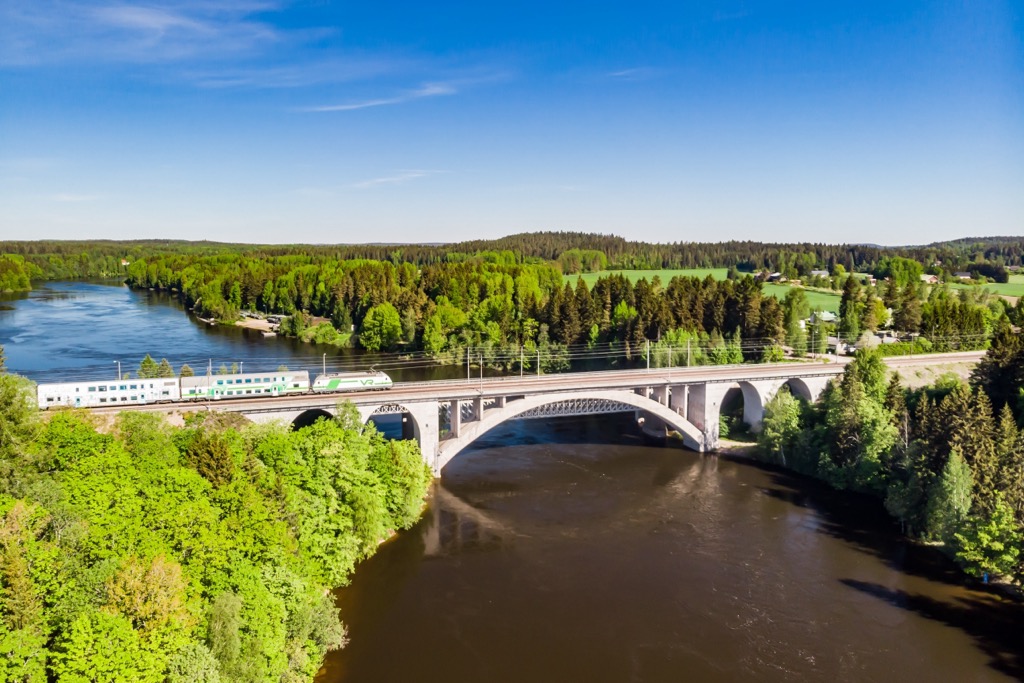
The Kymijoki is the 7th–9th longest river in Finland, depending on the data source, which originates in Päijänne Lake, the second-largest in the country, and flows into the Eastern Gulf of Finland of the Baltic Sea passing 180–204 km (112–127 mi) on its way. Note: it should not be confused with the longest river in the country with a similar name, Kemijoki (550 km / 342 mi), which flows in Lapland, because the difference is only one letter—“y” instead of “e”. If you take only Southern Finland, then Kymijoki is the longest: All other Finnish major rivers are also in Lapland. It is also literally the mightiest river in the region, with many rapids, on which hydroelectric power plants have been built that power all the major cities on both banks of the river. It also serves as a source of water for drinking and agriculture. Historically, it is also the region's main water transportation artery, linking the western part of the Finnish Lakeland to the sea. There are also various attractions on the river such as Verla Mills, one of only seven UNESCO World Heritage Sites in Finland.
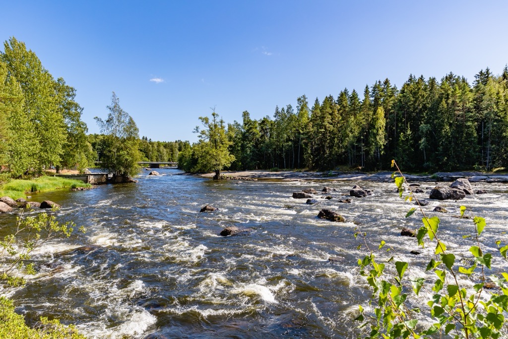
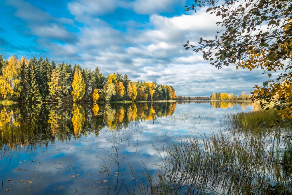
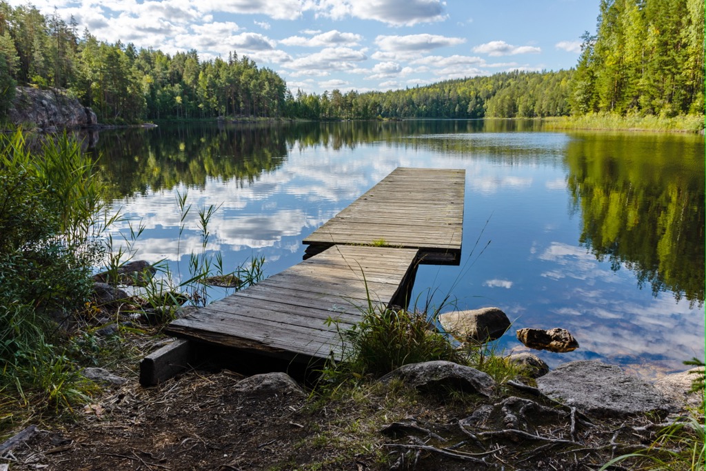
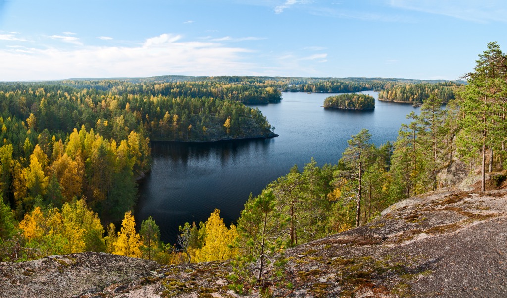
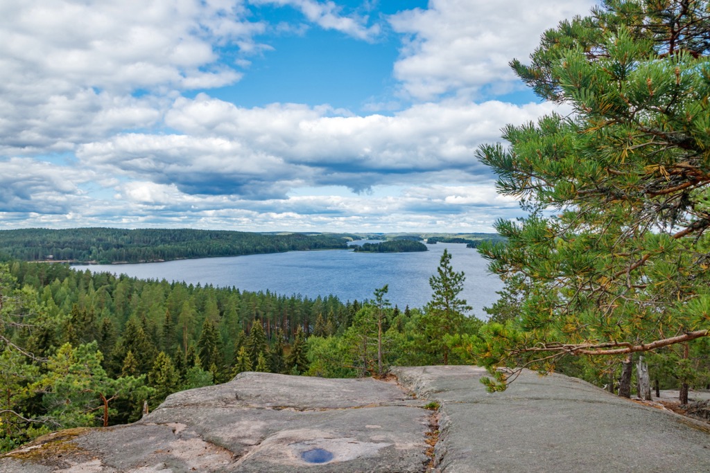
The northern part of the region is the southernmost part of Finland's best-known natural region famous for its more than 180,000 bodies of water, connected into a single system. Therefore, all the lakes of the region, including the largest Vuohijärvi, famous also for Kirjokivi Manor, and the smaller but also larger ones—Karijärvi, Rautjarvi, Suolajärvi, Luujarvi, Korpijärvi, and others, are gathered here in a total number of several dozens. Here is also the "tourist gem" of the region (forgive me for this cliché, but it is very appropriate)—Repovesi National Park, famous for its lake scenery. The park is also named after the large lake to the west of its territory.
In the south of the region, bordered by the Baltic Sea, is the archipelago of thousands of rocky islands stretching from Helsinki to the borders with Russia. Its very eastern or "outer" part is also a national park with the same name—Gulf of Finland National Park. The largest of them by area are Kirkontasari, Kaunissaari, Kuutsalo, Mussalo, Kroko, Kuorsalo, and Kotkasaari. The latter hosts the center of the city of Kotka. In particular, the islands of the archipelago are known as a huge site on the migration route of arctic birds to Siberia and Africa. They can be seen in thousands of individuals of dozens of different species every spring. The main man-made attraction of the archipelago is the Vellamo Maritime Center, the best in this part of the country.
Despite its small size, Kymenlaakso is the most mountainous region in Southern Finland with 543 named peaks or just under 1/3 of all summits in this part of the country, ahead of Uusimaa (300+) and Kanta-Häme (240+). Consequently, if you want to find mountains in Finland's south, you can easily do so wherever you go in the region.
The highest of them, starting with the Tornimäki (159 / 522 ft) and Ukkovuori (158 m / 518 ft), are located in the region's north, including the Repovesi and the neighboring Aarnikotka area near the relatively large town of Tuohikosti. In particular, the top two peaks of the region are located to the south and north of the park boundaries. They both are excellent viewing points for forests and lakes: the first is on the large Vekaranjarvi, and the second is surrounded by two small ponds.
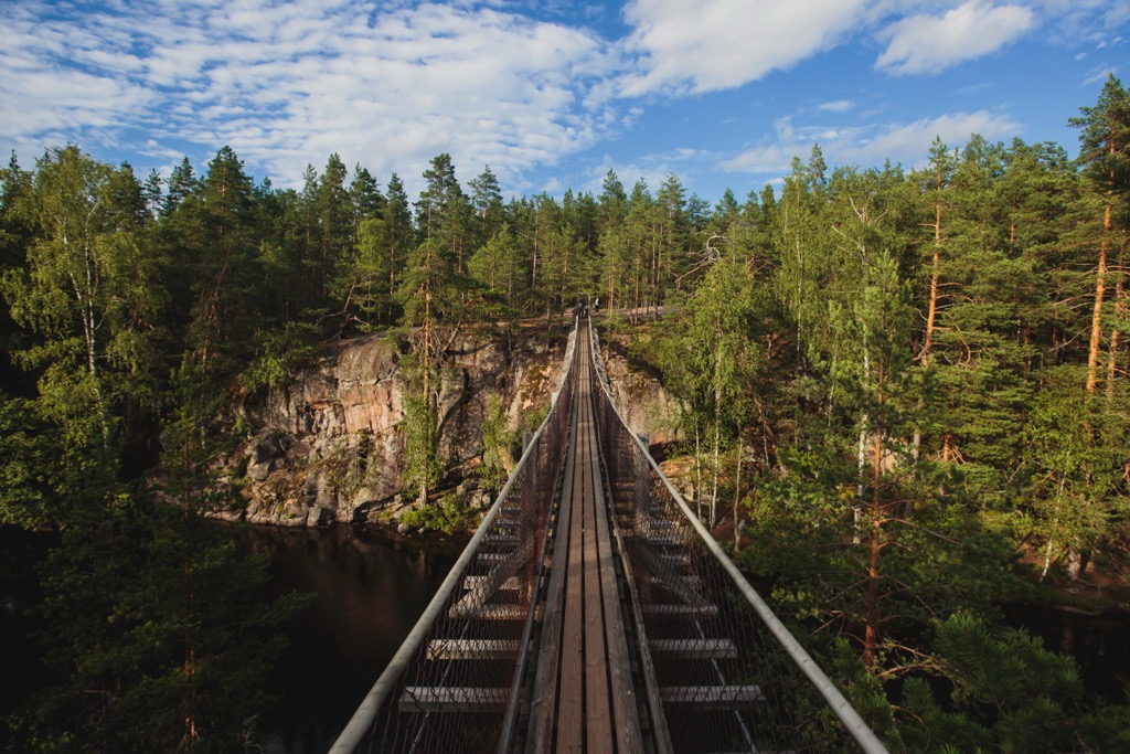
But much more famous are the peaks in the park itself, such as Katajavuori (126 m / 413 ft)—one of Southern Finland’s best natural viewpoints on a lake and forests. So the trail to its summit is one of the most popular local routes, also thanks to a wooden staircase with more than a hundred steps and a suspension bridge you need to cross.
Another well-known mountain in the Repovesi-Aarnikotka area is Olhavanvuori (142 m / 465 ft), a huge red granite rock with a smooth vertical wall that grew right out of Olhavanlampi Pond. It also attracts hikers by the prehistoric drawings—a human hand, and others—of more than 4000–5000 years old, which were found relatively recently, in 2000. From below, to see the paintings, it can be reached only by water but you can hike to the top of the mountain by one of the marked trails in the park.
They are also surrounded by many other peaks higher than 100 m (328 ft): Hauklamminvuori (152 m / 498 ft), Mustalamminvuori (134 m / 439 ft), and others.
In the generally flat area of Kouvola, the highest and best-known hills are Mielakka (125 m / 410 ft) to the south of the center (which is also a small ski slope in winter) and Niivermäki (102 m / 334 ft), Kasakkakallio (92 m / 301 ft), and Lamminmäki (96 m / 314 ft) to the north. The latter also overlooks a small lake, too.
In the south of Kymenlaakso, the height of the peaks is reduced to a few tens of meters (feet), but the sea views of the Archipelago of the Eastern Gulf of Finland will help you quickly forget about low altitude. For example, to see the open sea with the islands and skerries from the coast, you can climb such mountains as Tonttuvuori (23 m / ft) to the west of the city of Kotka or Häpelinvuori (18 m / 75 ft) to the north. Some islands, which you can go to with the excursion, are also quite high—Vironvuori (36 m / 118 ft), Högberget (34 m / 111 ft), and others.
In summary, for lovers of mountain identification, I would recommend the north of Kymenlaakso above all, secondarily the south, and thirdly the center, where there are the least mountains.
Besides Repovesi and the Eastern Gulf of Finland national parks, and Aarnikotka Forest Nature Reserve, the main hiking areas in Kymenlaakso are Valkmusa National Park, formed around one of the largest bogs in the Southern Finland northwest of Kotka, and Langinkoski Nature Reserve, whose main feature is the Imperial Fishing Lodge of the Tsar Alexander III of Russia built in 1889, where he used to go for salmon and other fish from Saint Petersburg, then the Russian capital. The latter is situated just above the center of Kotka on one of the branches of Kymi River where it flows into the Gulf of Finland.
Of all the parks, Repovesi and Aarnikotka, where the longest routes are, are certainly best suited for hiking. It is generally one of the most popular parks in Finland, due to its scenic lake views, it is second only to Koli in North Karelia and Nuuksio in two hours from Helsinki. But you can also hike in Valkmusa on duckboards. The islands of the archipelago are also suitable for walking if you get to them. Given that they are relatively small, you won’t get lost even without marked trails and other navigational elements. Here is a list of the longest trails in all the parks:
In addition to the aforementioned parks, you can also hike in Kymenlaakso in several other areas located in a more urban and less wild environment. First, these are two parks in the center of Kotka on the coast: Katariina Seaside Park with sculptures of the most famous lighthouses of Finland from the different parts of the Coast and Archipelago tourist region, and Sapokka Water Garden—a good place to rent a boat and make a short water trip in the pond right in the city. Second, this is Arboretum Mustila — a large botanical garden with many plants (or rather a real forest in the case of Finland) on the western border of the region.
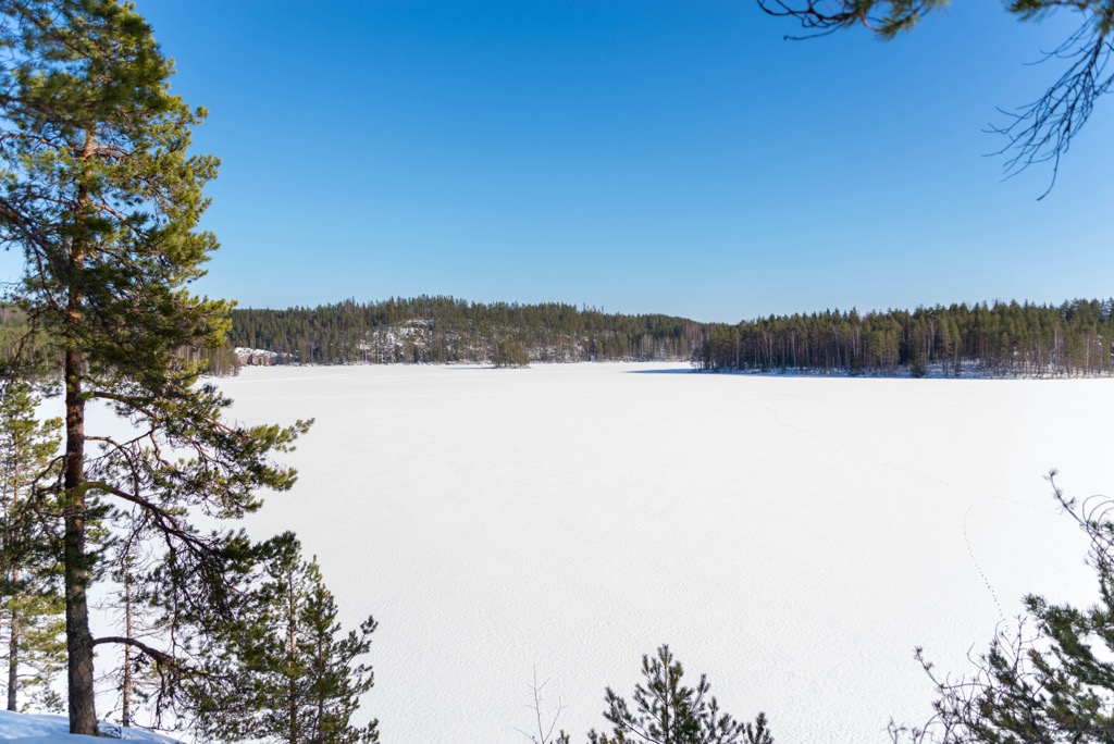
There are two small ski resorts in Kymenlaakso with several slopes of no more than 3 km (1.8 mi) in total and several ski lifts. In addition to Mielakka (Mielakan Rinnekeskus) near Kouvola in the center of the region, it is Uuperi (Uuperin rinteet) to the northeast of Kotka. Of course, they are too small for Alpine skiing but if you like cross-country skiing you wouldn't be disappointed, because they offer tens of km (mi) of marked trail around them.
The nearest larger ski resort in Southern Finland is Messilä near the city of Lahti with 5.7 km (3.5 mi) of slopes with 111 m (364 ft) of vertical drop and 9 ski lifts—enough for a day of skiing.
Check the Finland ski resorts map in the World Mountain Lifts section of the site. It includes information about open ski lifts / slopes in Finland in real-time with opening dates and hours. There are also year-round cable cars, funiculars, cog railways, aerial tramways, and all other types of mountain lifts.
Before or after the hike, visit the region's official tourist office, which can be found in Kotka. It also gives information about Hamina, the third largest city of the region.
Visit Kotka-Hamina Tourist Information
Kyminlinnantie 6, 48600, Kotka, Finland
+358401356588
VisitKouvola Tourist Information
Only online services
+358206155295
The first and easiest to find—or rather to say, create yourself—type of accommodation in the Kymenlaakso mountains and islands, which I recommend use extensively, is a tent, which you can pitch in special camping and campfire sites in national parks and other protected areas, as well as everywhere throughout the region in accordance with the "Everyman's Right" law that applies in Finland and throughout Scandinavia.
The second is the mountain huts, which in the region come in two main types: open wilderness huts and rented huts. The first can be found in Valkmusa National Park (Moronvuori Day Trip Hut) and Gulf of Finland National Park (Koivuluoto and Ulko-Tammio huts), and in Repovesi National Park you will find four rented huts: Karhulahti, Lojukoski, Mustavuori, and Määkijä, which can be booked at Verkkokauppa.eraluvat.fi.
In the Langinkoski Nature Reserve camping is not allowed at all, so you will need to find lodging in the surrounding area, which is easy, keeping in mind its location close to the center of Kotka.
So, you already know about Kotka and Kouvola, as the main cities of the regions. To this list (there are few cities in Finland at all) we can add only Hamina, the third in the region, which is only slightly north of the first, and can be considered as its alternative—at least for one interesting reason.
The main feature of Hamina is that it was founded and build in 1653 by Swedes as a star-shaped fortress city where the streets diverge in all directions from the central square until they meet the fortress walls, inspired by Palmanova city in the province of Udine in the Friuli-Venezia Giulia region in the northeastern Italy.
The latter, in turn, was built up during the Venetian Republic in 1593 as one of the defensive fortifications in the series, which also includes the Upper Town of Bergamo and Peschiera del Garda in Lombardy, Kotor in Montenegro, and some other towns in the Balkans. This is a UNESCO site.


Yes. Kymenlaakso has 543 named mountains. The highest is Tornimäki at 159 m.
The highest mountain in Kymenlaakso is Tornimäki, at 159 m.
Kymenlaakso has 543 named mountains.


