
Scan the QR code and open PeakVisor on your phone
Lombardy is one of the 20 regions of Italy. The region is located in the northwestern part of the country and it’s one of Italy’s biggest cultural hubs. Lombardy is home to a large section of the Alps as well as numerous nature parks and reserves with amazing recreational facilities. There are 3489 named mountains in Lombardy, the highest of which is La Spedla (4,020 m / 13,188 ft) and the most prominent of which is Pizzo di Coca (3,050 m / 10,006 ft).
The name of the region of Lombard comes from the Latin word Longobardus. According to popular accounts, the word Longobardus itself translated into English means “long beard.” This is what the region’s inhabitants called the Germanic peoples who came to the area from the Elbe River Valley in northern Germany and the historic province of Scania in southern Sweden.
The Lombards invaded what is now Italy when it was mostly controlled by the Byzantine Empire. By about 568, the Lombards ruled over almost all of what is now Italy with the exception of Rome, Venice, and some southern territories throughout the early Middle Ages. The Lombards effectively lost control over much of their territory by 774.
As is the case throughout most of Italy, modern Lombards primarily call themselves Lombards, not Italians. This means they identify themselves primarily with their native region and even its individual provinces, rather than with the whole country. This is perhaps an understandable tradition, because the modern state of Italy first appeared on political maps very recently in 1861.
Do note that the Italian name of the region is Lombardia, with emphasis on the last syllable. This is also the name of the region in the Lombard dialect, which is spoken throughout parts of northern Italy and southern Switzerland.
The region of Lombardy is located in the geographical center of the northern part of Italy. It is bordered by Piedmont in the west, Trentino-Alto Adige / Südtirol (Trento and Bolzano) and Veneto in the east, and Emilia-Romagna (Bologna) in the south. The northern border of the region runs exactly along the border between Italy and Switzerland in the Alps.
Lombardy is the fourth largest (23.864 sq km / 9.213 sq mi) region in Italy after Sicily, Piedmont and Sardinia. It is the largest in the whole country in terms of population as it has a population of nearly 10 million people (2021). In fact, Lombardy has as many people as Lazio and Campania combined.
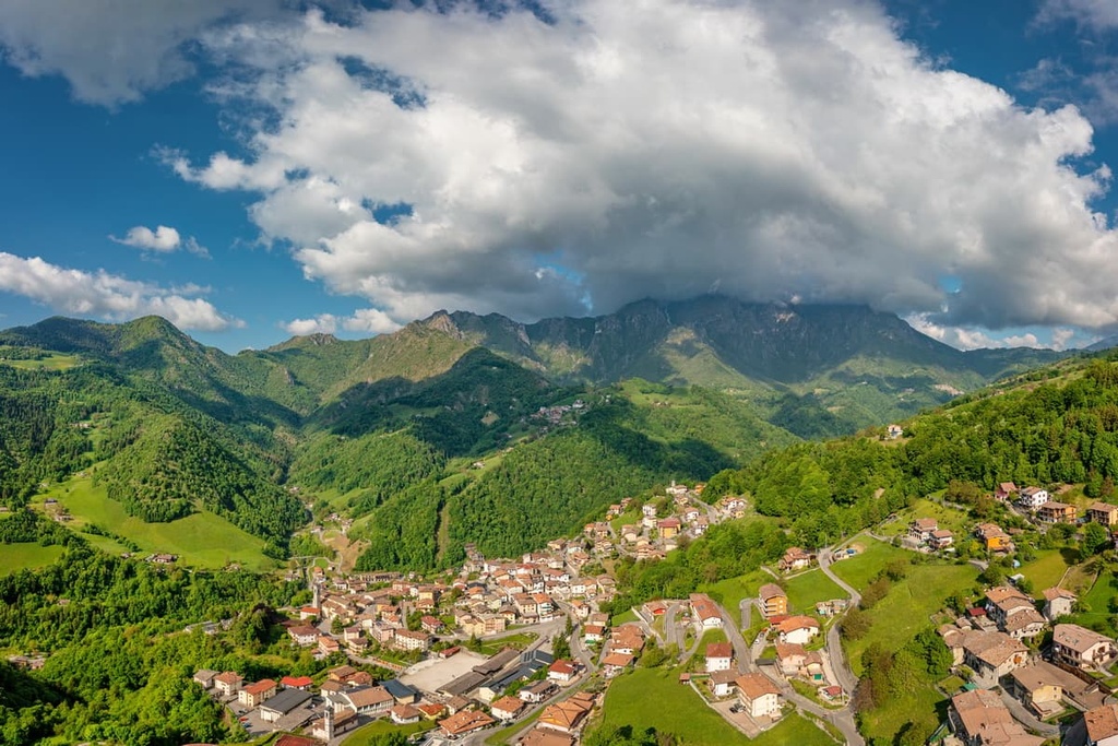
The region of Lombardy is made up of 12 provinces, 6 of which are mountainous areas. These highly mountainous provinces are Varese, Como, Lecco, Bergamo, Sondrio, and Brescia in the north and Pavia in the south.
The accessibility of regional transportation is one of the distinct advantages of the region of Lombardy.
Since Lombardy is one of the most developed regions in the country, it is easily and quickly accessible from anywhere in Italy, from neighboring countries, or even from the most remote corners of the world.
Lombardy's main transportation hub is in Milan. The city is home to the region’s two main airports: Milan Malpensa and Milan Bergamo Airport also known as Il Caravaggio Orio al Serio International Airport.
Interestingly, Bergamo Airport is the third busiest in the country after Rome and Milan and one of the top 50 busiest in Europe. This is because of the many budget airlines that fly here from England and other European countries.

From these airports, you can travel around Lombardy by car or by public transport. The two main train companies in the region are the regional operator Trenord and the national operator Trenitalia. Buses operate in the region, too, but they’re difficult to navigate—even for locals.
Finally, there are two other ways to travel around the region: by water and by bicycle.
All five major lakes in the region are accessible via various ferries. However, these ferries are almost non-existent in winter. To find schedules for operating ferries, use the website Navigazionelaghi.it.
Lombardy, on the other hand, has a huge number of bicycle paths in each town and between them. You can find the routes on Italian maps by looking for the words pista ciclabile.
For example, one such road located in Lombardy leads from the city of Bergamo along one of the main mountain valleys in the region, Brembana. This path is called Ciclovia Valle Brembana and it is about 40 km (24.8 mil) long one way with an elevation gain of about 300 m (984 ft). This and other cycle paths are a great way to get around the region in a healthy and environmentally friendly way.
The landscape of Lombardy is extremely diverse and includes two main zones: the plain and the mountains.
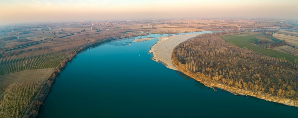
Most of the territory of the region (about 47 percent) is a vast plain, which, in turn, is commonly divided into upper (Alta) and lower (Bassa). This plain is formed by the River Po, the longest in Italy (652 km / 405 mi), and it occupies the entire territory of northern Italy, not just Lombardy. The Po River plain is also known as the Padan Plain or Padan Valley from its Latin name.
The valley is characterized by various types of fertile soils, which were formed by alluvial deposits. Alluvial sediment is usually created when flowing waters reach a level or gently sloping area, causing sediments to fall out of suspension.
This wide gently sloping region is evident in Lombardy, where the Po is located in a large valley between two mountain ranges: the Alps and the Apennines.
That said, the Po River is the main, but not the only river in the region. In addition to it, there are other rivers such as Olona, Lambro, Adda, Oglio, Mincio, Brembo, and Imagna, among others.
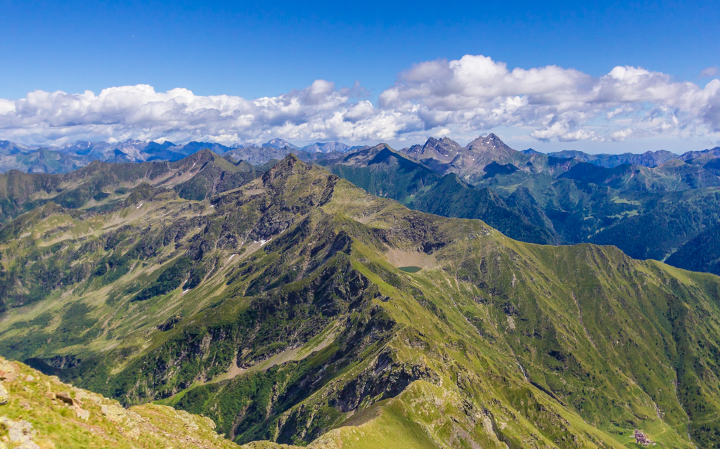
The Alps and Prealps occupy about 41 percent of the region of Lombardy.
The two most famous hilly areas in the region can be found around Bergamo and Brescia. These regions are home to two important nature parks: Parco dei Colli di Bergamo and Parco delle Colline di Brescia.
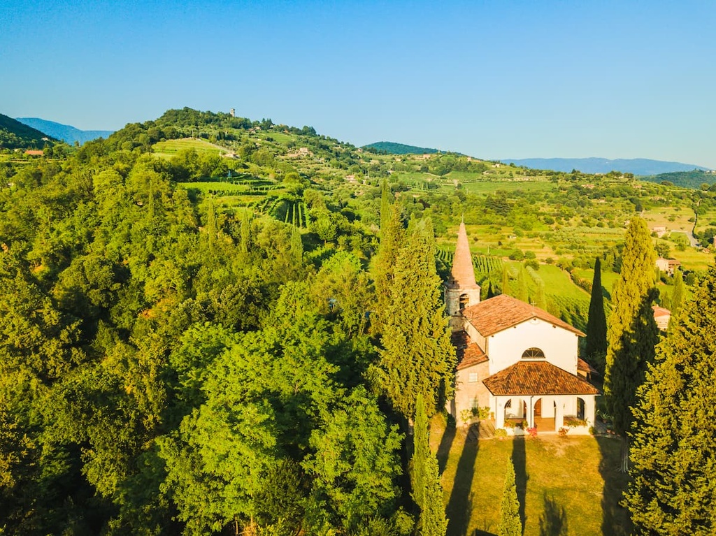
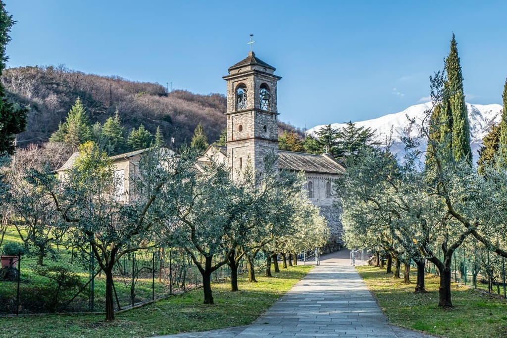
The region’s hills and the lower slopes of its mountains up to about 2,000 meters (6,561 ft) in elevation are covered with beech, birch, spruce, pine, and mixed forests. You can also find a lot of cypresses, olive and citrus trees, thanks to the region’s special Mediterranean microclimate.
The geology of the mountainous part of Lombardy includes about a dozen different geological layers.
In particular, the Bergamo Alps, the largest mountain group in Lombardy, formed during the Miocene about 20 million years ago. The rocks that form this mountain range are a mix of gneiss, mica, phyllite, sandstone, dolomite, and limestone.
Tuff and porphyry are also found in some mountainous areas of the region. These were formed here by the eruption of volcanoes in the southern part of the Po Valley.
Lombardy is so big that it extends all the way to the Apennines, the major mountain range that runs down the spine of the boot of the Italian Peninsula.
To the south of the Po River, there is also a small subregion known as Oltrepo Pavese. This subregion is located in the province of Pavia in the foothills of the Apennines. It is famous because of its vineyards, which are known for producing excellent pinot noir (pinot nero). The region is sometimes called the “Tuscany of Northern Italy.”
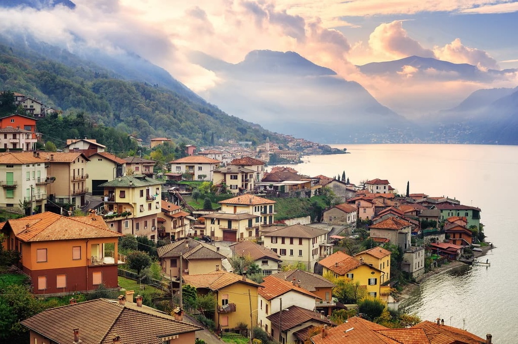
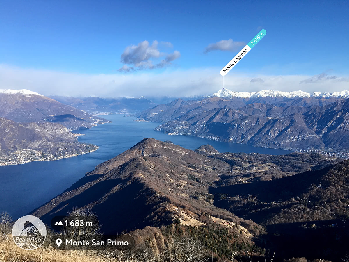
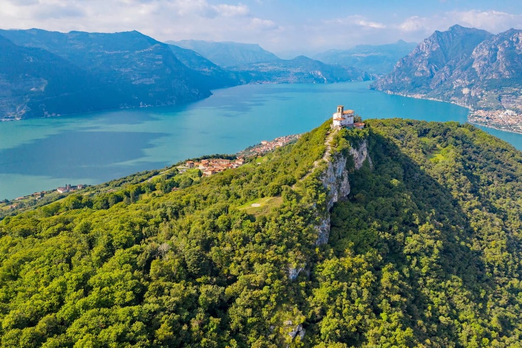
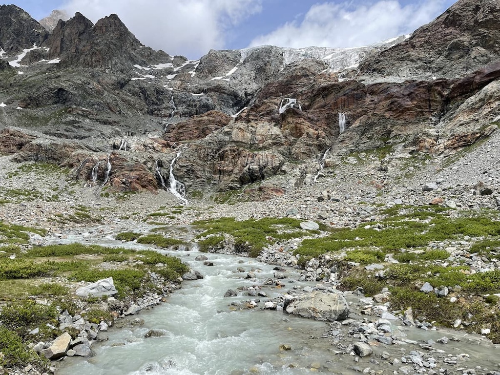
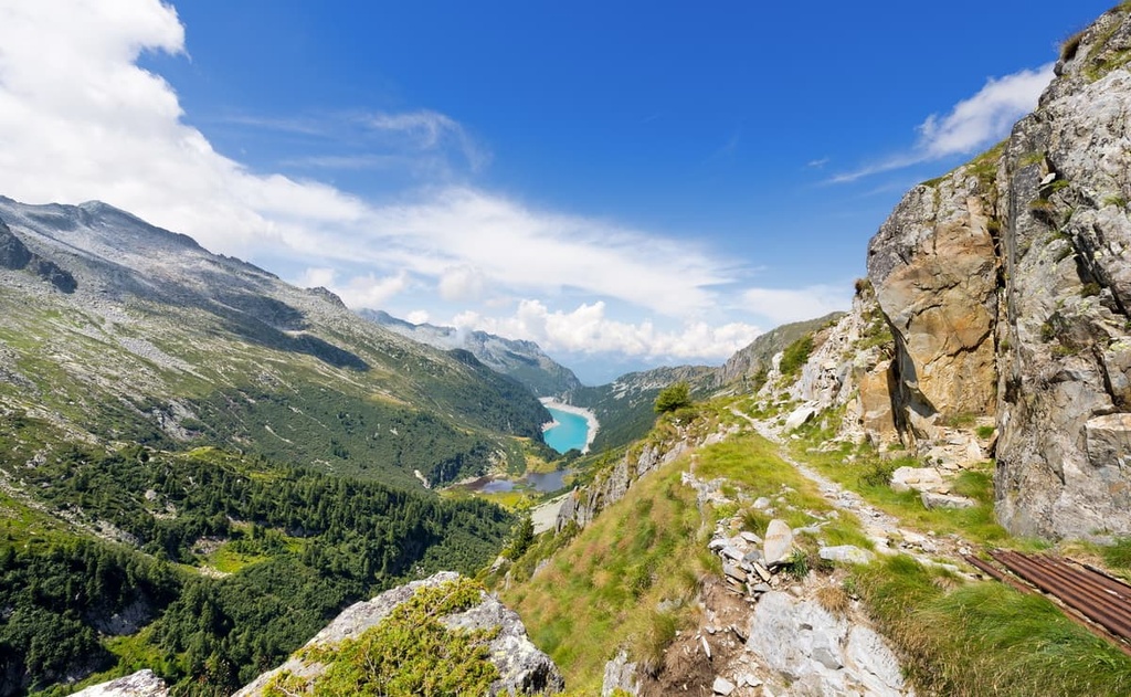
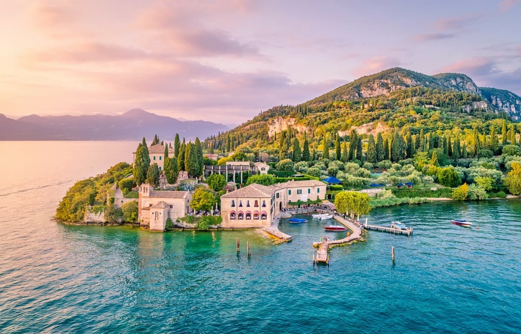
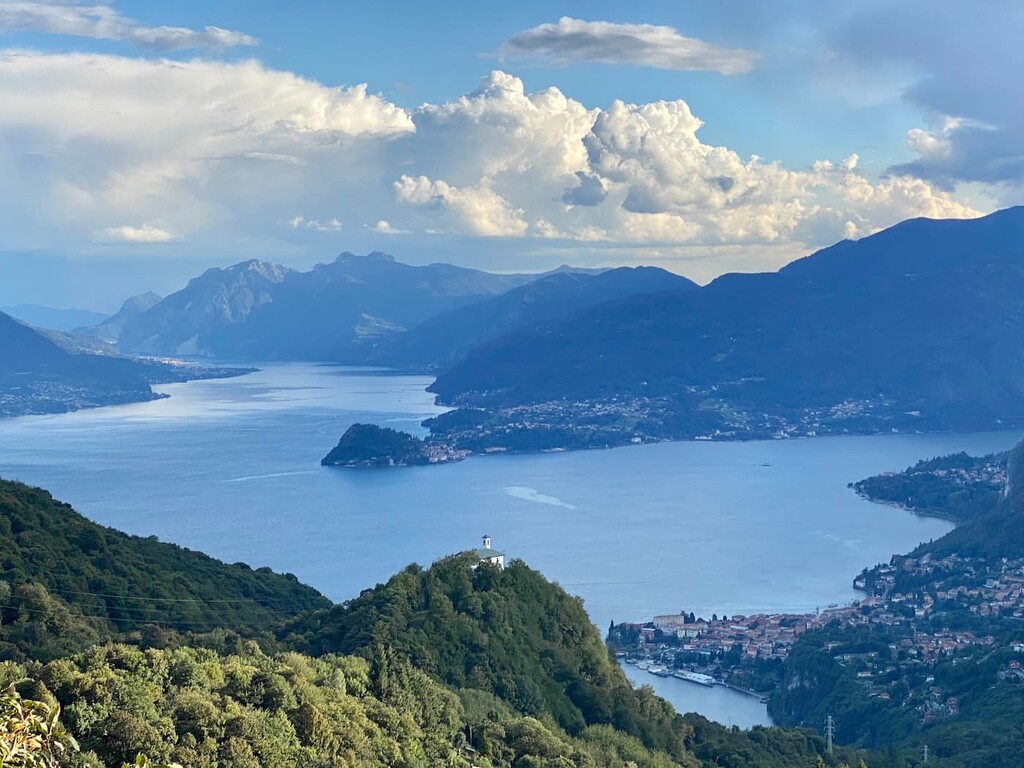
The famous Lake District of Italy, which includes the large lakes Maggiore, Lugano, Como, Iseo, and Garda, formed between 250 and 26 million years ago. It was sculpted by the glaciers that once covered much of Europe.
In fact, all of these lakes are of glacial origin, which accounts for their elongated shape and small width, and yet great depth. The largest of the lakes is Garda, and the deepest is Como, with depths of up to 400 meters (1,312 feet).
In addition, there are many other smaller lakes in the region such as Idro, Varese, Comabbio, Piano, Moro, Gemelli, Nero, Annone, Alserio, Mezzola, Pisiano, and Endine, among others. Some of these lakes are high-elevation glacial lakes that are accessible only to hikers, or, in some cases, with the help of cable cars.
Mountain Lombardy also has several dozen famous mountain passes that attract fans of all kinds of sports, mainly hiking, skiing, cycling.
As a cyclist myself, it’s my duty to mention three passes that are particularly important: Spluga Pass, Stelvio Pass, and Ganda Pass (1,100 m / 3,608 ft). If you’re traveling through Lombardy, these passes are well worth a visit.
Last but not least, the Lombardy region, according to the official tourist website, has at least 112 mountain valleys. The largest ones are: Val Seriana, Val Cavallina, Val Brembana, Val Camonica and Valtellina. In my opinion, these valleys are quite urbanized and noisy, so for a more relaxed trip, I recommend choosing smaller valleys, they will be less touristy.
Other famous valleys that are worth checking out are Val Astino, Val Imagna, Val Brembilla, and Val Taleggio.
The region of Lombardy has a human history that goes back thousands of years. To describe it completely would require a separate guide, so here are the most important bits of Lombard history that you ought to know.
The first people settled in this territory as early as the Bronze and Iron Ages (3300–332 BCE). This is evidenced by the more than 300,000 rock drawings left by the Camuni people, the ancient inhabitants of the Camonica Valley.
One of these drawings, a representation of some flower similar to the rose, Rosa camuna (Camunian Rose), is the official logo of the region. These rock drawings in Valcamonica are a UNESCO World Heritage Site.
Like the other peoples of the Alps, the Camunians fell to the Romans when the Roman Empire expanded northward. The geography and climate of what is now Lombardy made the region one of the most developed and populated areas in the Empire. But it was conquered by Germanic tribes after the fall of the Western Roman Empire by the year 476 CE.
After the fall of the Western Roman Empire, the region went through a long series of political transformations in which it changed its name, borders, kings, and so on.
Consecutively, it was a part of the Kingdom of the Lombards (568–774), the Holy Roman Empire (800/962—1806), the Cisalpine Republic in the Napoleonic Kingdom of Italy (1805–1814), and the Kingdom of Lombardy-Venetia (1815–1866).
It also should be noted separately that from 1395 to 1447 and then from 1450 to 1796, the current capital of the region, Milan, was, in fact, a separate state under the name of the Duchy of Milan. It was created by the noble Italian Visconti family and included 26 towns.
After joining the new version of the Kingdom of Italy (1861–1946), Lombardy took on its modern territorial shape by also incorporating the Oltrepo Pavese subregion into the province of Pavia. Lombardy subsequently became part of the Republic of Italy at the time of its formation in 1946.
Within the two major mountain ranges of Lombardy (the Alps and Apennines), there are six major mountain sub-ranges and about a dozen smaller mountain groups.
In the Alps and Prealps, these mountain groups include:
In the Apennines, the primary mountain group in Lombardy is the Ligurian Apennines.
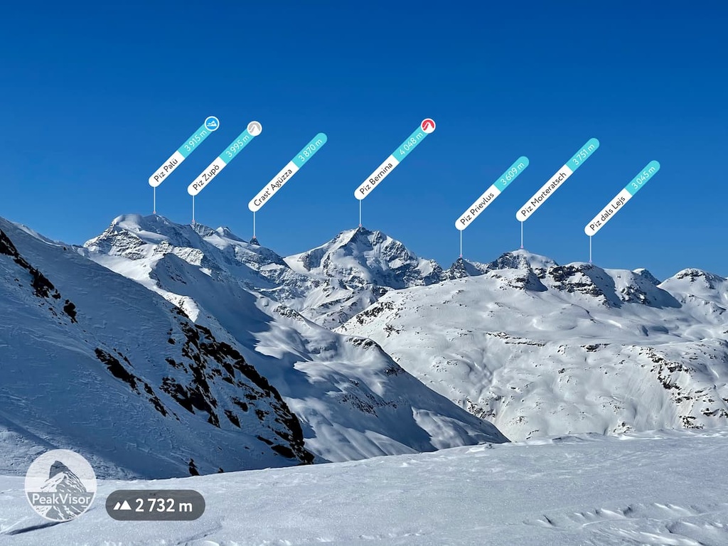
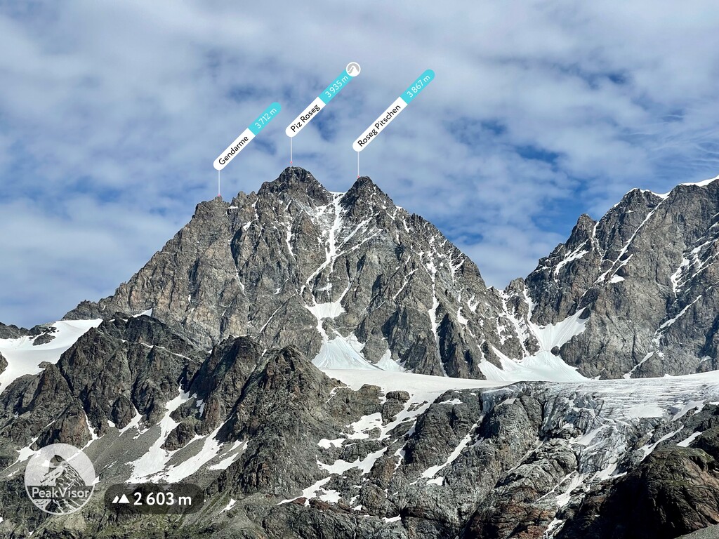
Among the most interesting peaks of the region, there are 8 mountains that are particularly noteworthy:
Thanks to its mountains, the region of Lombardy is a great place for hiking. It has everything that usually interests a hiker, climber, or mountaineer, such as nature parks and long hiking trails.
Here are some of the best places to check out during a visit to Lombardy.
In all, there are more than a hundred different natural areas in the region of Lombardy. These can be divided into three large groups: national parks, regional nature parks, and nature reserves.
National Parks
Stelvio National Park is Lombardy’s only national park. It is located in the north of the region on the border with Switzerland in the Ortler Alps. It is the fourth largest park in Italy (1.307 sq km / 504 sq mi), and its highest peak, Cima Ortler (3,905 m / 12,812 ft), is listed as one of the 50 highest in the Alps.
The park is also famous for the Passo dello Stelvio (2,757 m / 9,045 ft), which features many twists and turns. Almost every year the main Italian bicycle race, the Giro d'Italia, rides down the Passo dello Stelvio.
Regional Nature Parks
There are at least 24 major regional nature parks in Lombardy. Some of the most interesting nature parks in the region include:
Nature Reserves
Various nature reserves are also located throughout the region of Lombardy. There are more than 65 in total according to the official Italian parks website, Parks.it.
As a rule, these reserves are small in area but of great importance in terms of nature conservation. Access to these reserves may occasionally be limited, but most are open to hiking.
For example, on my recent hike up Monte Misma, I discovered a small and interesting reserve at its foot in the Valpredina Valley called Riserva Naturale Oasi WWF ZSC Valpredina-Misma. It is a wildlife refuge that helps to treat sick and injured animals before releasing them back into nature.
Lombardy region has a huge variety of hiking trails. According to its official tourist website, there are at least 6,700 km (4,163 mi) of marked hiking trails in the region. Here are some of the longest trails in Lombardy that are suitable for multi-day trekking trips:
In Lombardy, there are also numerous points of interest, which include, for example, different natural monuments of regional, national, European, and even global importance.
An example of such a point of interest is the Monumento Naturale della Valle del Brunone in Imagna The monument is characterized by the presence of ancient sulfur springs near a small waterfall and important paleontological artifacts from the Upper Triassic.
Another great point of interest to check out is the collection of rock carvings in the Camonica Valley, which is a UNESCO World Heritage Site.
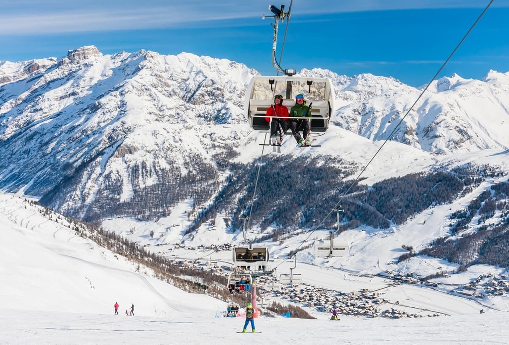
Ski and snowboard enthusiasts will find more than 30 ski resorts in Lombardy. The region can be seen as a great alternative to the neighboring ski areas of Dolomiti Superski and Skirama Dolomiti Adamello Brenta.
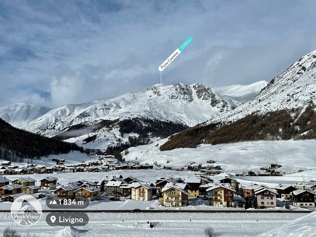
The largest resort in Lombardy is the Livigno Ski Area, which is located in the north of the province in the Livigno Alps at an elevation of 1,816 m (5,958 ft). The resort offers 70 slopes (6 black, 29 red, and 35 blue) with a total distance of 115 km (71.4 mi), as well as 30 km (18.6 mi) of cross country skiing trails. There are 32 different ski lifts (6 cableways, 14 chairlifts, and 10 ski lifts).
The list of other resorts include such famous ski areas as Alpe Teglio, Bormio, Brembo Ski, Cima Piazzi, PontediLegno-Tonale, Piani di Bobbio near Lecco, and others.
The highest lift and ski trail in Livigno Ski Resort is “Carosello 3000,” which has starting and finishing points at 2,225 m (7,299 ft) and 2,761 m (9,058 ft), respectively. The lift and slope operating hours are 8 am to 4:40 pm daily.
You can check out real-time information about the resort using the Winter Mode feature in PeakVisor.
Before or during your trip, be sure to check out the website of the Official Tourism Board of the Lombardy Region, In-lombardia.it. Here, you will find more information about the region.
When you’re in Lombardy, make sure to visit one of the info points, which are located in all of the region’s major cities and resorts, including the central one in the heart of Milan:
Ufficio Turismo del Comune di Milano
Piazza Duomo, 14, Milano, Lombardy, Italy
+390288455555
For overnight stays in the mountains of Lombardy, you can choose one of the basic types of accommodation that other regions have, namely mountain huts, bivouacs, campsites, hotels, and B&Bs, and tent camping.
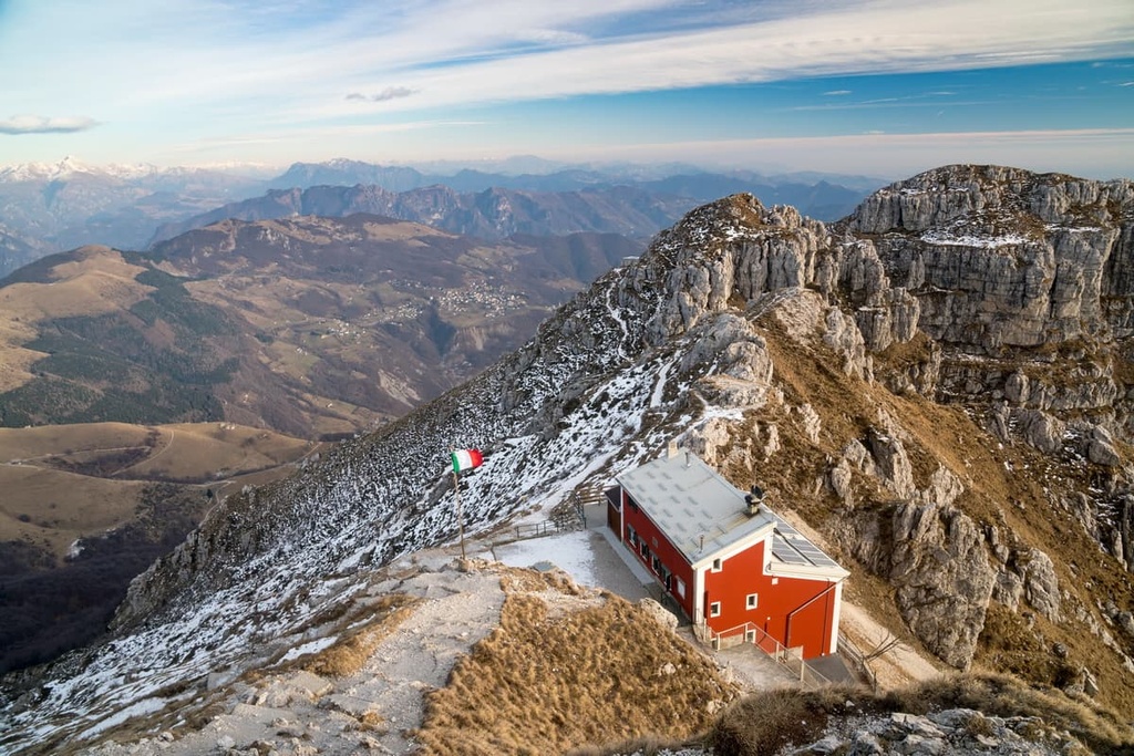
In total, there are about 150–200 major mountain huts in the region. In Lombardy, these rifugios can be found literally at each mountain or on each pass, so they are easy enough to find on any trip.
Of all these rifugios, three are worth mentioning: rifugio Azzoni on Mount Resegone overlooking Lecco, rifugio Laghi Gemelli (1,968 m / 6,456 ft) by the lakes of the same name in Bergamasque Alps Nature Park, and rifugio Lupi on the pass near Pizzo Cerro (1,285 m / 4,215 ft) between Brembilla and Brembana valleys.
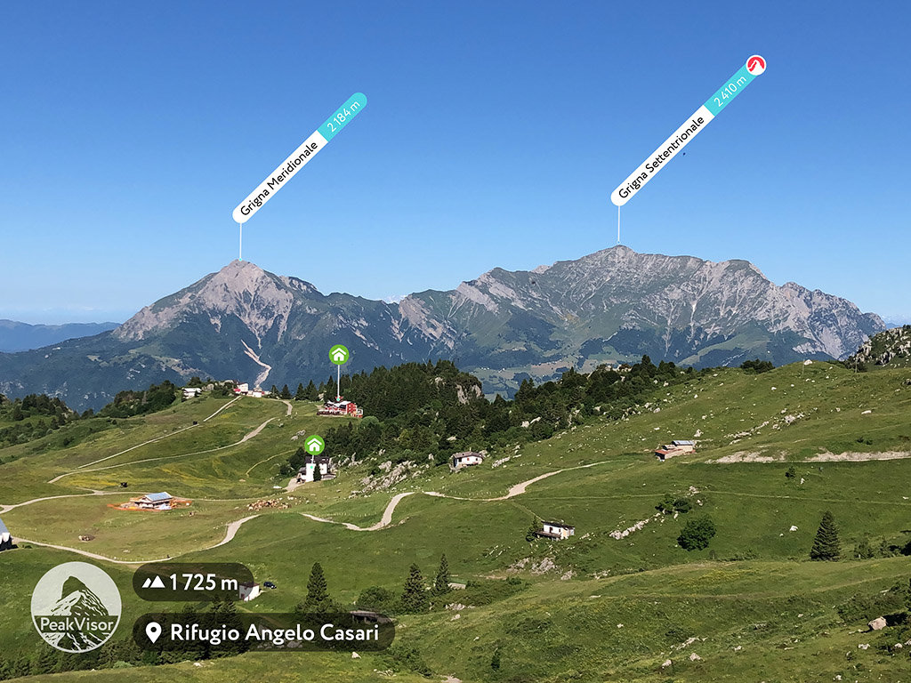
The most famous bivouac of the region is definitely bivacco Spaziale (2,184 m / 7,165 ft) on Grigna Meridionale / Monte Grignetta (2,184 m / 7,165 ft).
It is located above the town of Lecco, and it looks like a small spaceship from a Steven Spielberg or James Cameron movie that happened to land in Lombardy. (Perhaps it did, all the “space” stuff was removed from it, and it was camouflaged as a bivacco for hikers and climbers. Or maybe not.)
There are campsites located along all of the major lakes in Lombardy. In particular, check out Dervio on Como Lake, but be sure to book your sites well in advance to avoid disappointment.
Lombardy has many hotels and B&Bs to cater to any budget. Number one on my list is the hotel Conca Verde surrounded by greenery in the village of Zone on the Antica Strada Valeriana on Iseo Lake.
I also liked the B&B and residence Abbazia di Piona on Como Lake, which offers the best view of the lake. There’s also the real family Alpine hotel Corona in the village of Branzi in the Brembana Valley and the trendy hotel Da Giorgio in the village of Ardesio in the Seriana Valley.
Agriturismos, which are hotels on farms (or vice versa), are also very popular in the region. One such example in the Imagna Valley is Agriturismo Scuderia della Valle, which features a huge zoo with dozens of animals.
Finally, you can pitch a tent in the Alps if you come prepared with the right equipment.
Technically, wild camping is officially forbidden in the Italian Alps. But there is a loophole that says that you can camp legally if you accidentally get benighted on the trail. It’s generally best to avoid getting caught out in the mountains after nightfall, but you can camp if need be.
Navigating Italy’s most populous region can be difficult even for its residents, let alone first-time visitors.
Here’s some information about the largest towns and resorts in Lombardy that you should look for when planning your adventures in the region. Since the north of the region is the most interesting for outdoor enthusiasts, we’ll focus primarily on communities in that part of Lombardy.
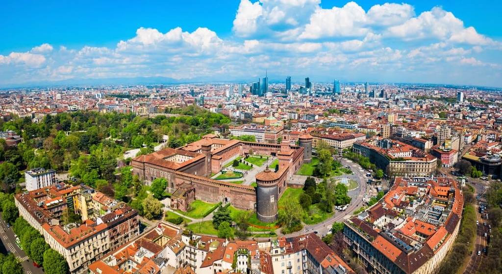
Your journey to Lombardy will probably start with Milan, the capital of the region, which today has 1.3 million inhabitants. It is so big that it even has several dozen skyscrapers.
The city of Milan is surrounded by many smaller cities, which, however, are also quite large compared to the villages and resorts in the mountain valleys of Lombardy. Some popular cities include Monza, Treviglio, Busto Arsizio, and Varese, among others.
It often makes more sense to choose one of the cities located on the famous lakes as your travel base.
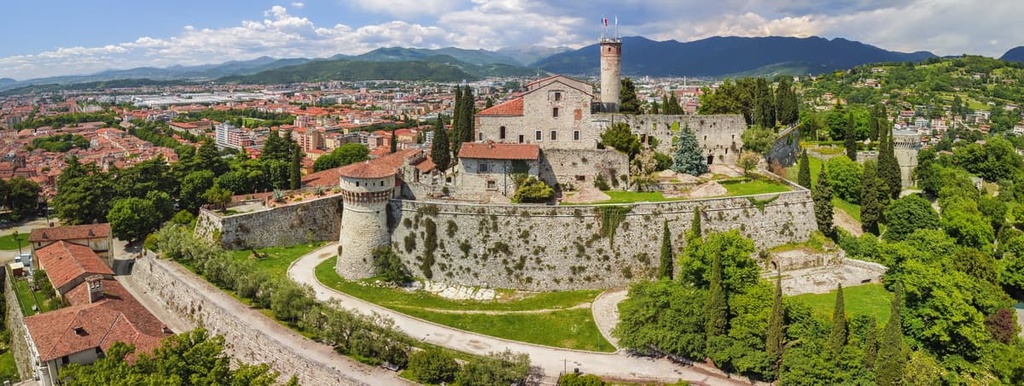
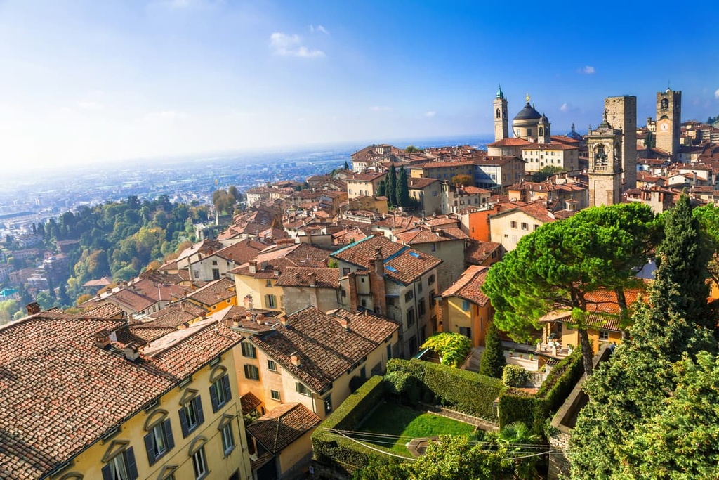
Just a short drive from Milan, you can find two other large cities, Bergamo and Brescia. I would say that they are also a kind of gateways to the mountains. Bergamo is located at the foot of the Bergamasque Prealps and Prealps and Brescia is close to the Brescia and Garda Prealps.
In addition, they are themselves very beautiful and interesting cities where you can easily spend a week or more and not get bored.
In Bergamo, for example, there is a nice area of Ponteranica-Sorisole in the Bergamo Hills Nature Park. Or check out the mountains in Sant’Omobono Terme, Brembilla or San Pellegrino Terme, which are the capitals of the three closest valleys to Bergamo: Imagna, Brembilla and Brembana.
The largest towns in the vicinity of Brescia are Lumezzane, Rezzato, and others. One good place to check out is Paderno Franciacorta, which is the center of the famous Franciacorta wine region between Brescia and Lake Iseo. It features a cycle route of the same name along 60 kilometers (37.2 miles) of vineyards.
From Milan, you can also go straight to the high mountains through one of the three largest valleys in the region—Seriana, Camonica, and Valtellina. Each is home to its own communities that would take a lifetime to explore. They are also a great base for hikes, especially if your goal is mountains rather than lakes or cities.
Here’s what you need to know about each valley:
Moving further east and then northeast you reach the most remote corner of Lombardy. The main centers of tourism here are Tirano, Livigno and Ponte di Legno. They are also the largest ski resorts in the region, located on the slopes of Livigno-Alps.


top50
ultra
glacier
alps-4000ers
italy-ultras
switzerland-ultras
top50
ultra
glacier
alps-4000ers
italy-ultras
switzerland-ultras


