Scan the QR code and open PeakVisor on your phone
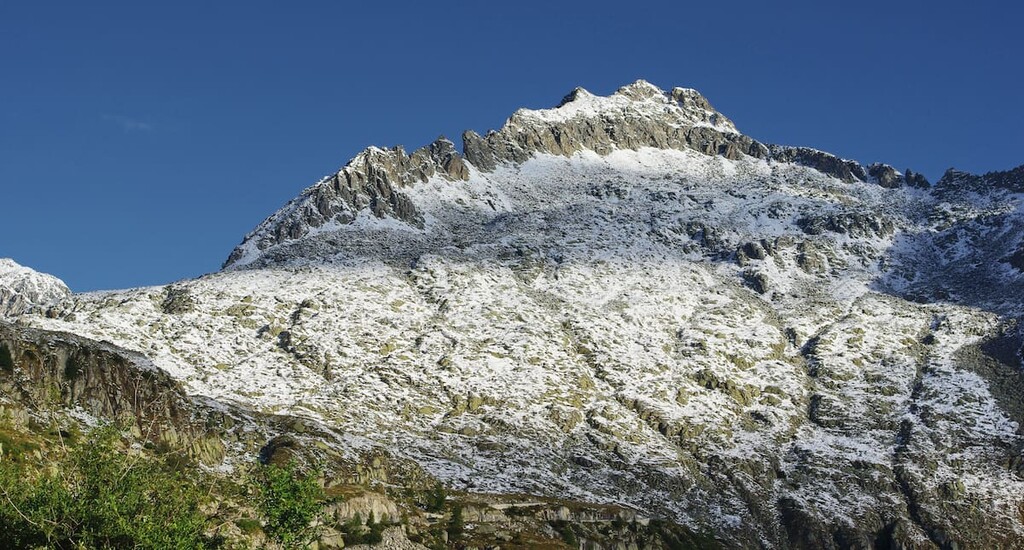
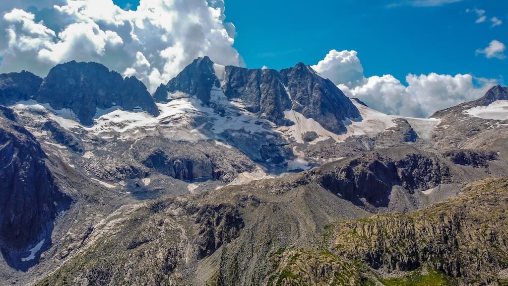
The Adamello-Presanella Alps is a mountain group in Northern Italy with a vast territory, varied landscape, and rich nature. The main feature of the group that distinguishes it from neighboring groups is the Adamello Glacier, the largest in the country and one of the largest in Europe. In total, there are 572 named mountains in the Adamello-Presanella Alps. The highest is Cima Presanella (3,558 m / 11,673 ft), one of the 119 ultra-prominent peaks in Europe with a prominence of 1,676 m (5,499 ft).
The name of the Adamello-Presanella Alps consists of the names of its two main subgroups and the two highest peaks, Adamello (3,539 m (11,611 ft) and Presanella, respectively.
The Adamello-Presanella Alps are located in northern Italy in the regions of Lombardy and Trentino-Alto Adige / South Tyrol, near the country’s border with Switzerland. The border between the two Italian regions runs almost perfectly down the middle of the northern part of the group.
If you look at a geographical map, the territory of the group goes from northeast to southwest and consists of two parts. The Adamello subgroup is much larger in area, comprising about 7/10 of the entire group. At the same time, the smaller Presanella subgroup has the highest peak. It also happens to be the tallest mountain in the Trentino / South Tyrol region.
The Adamello-Presanella Alps border the following other groups: the Bergamasque Alps and Prealps to the west, the Brescia and Garda Prealps to the south and southeast, the Brenta Group to the northeast, the Ortles Alps to the north, and the Sobretta-Gavia Group, and the Nonsberg Group to the northwest.
In total, there are five other mountain groups around the Adamello-Presanella Alps, the first two of which are much larger and the other three smaller than Adamello-Presanella in the area. Visiting any of them is also a very good idea if you’re in the region and have some extra time.
You can get to these mountains from one of the nearest major cities in Italy, where there are regular flights from various international airlines, such as Milan, Brescia, Verona, Trento. If you are visiting from the north, the best way to get here is from Sondrio, Bolzano. Travel around Italy is most convenient by Trenitalia trains and by local buses.
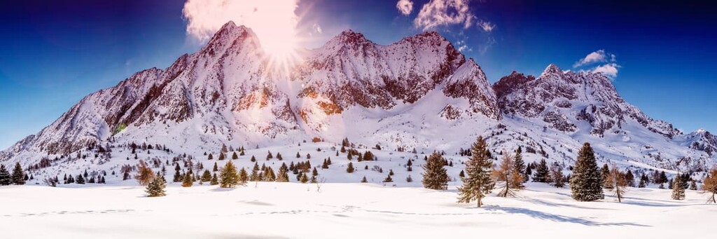
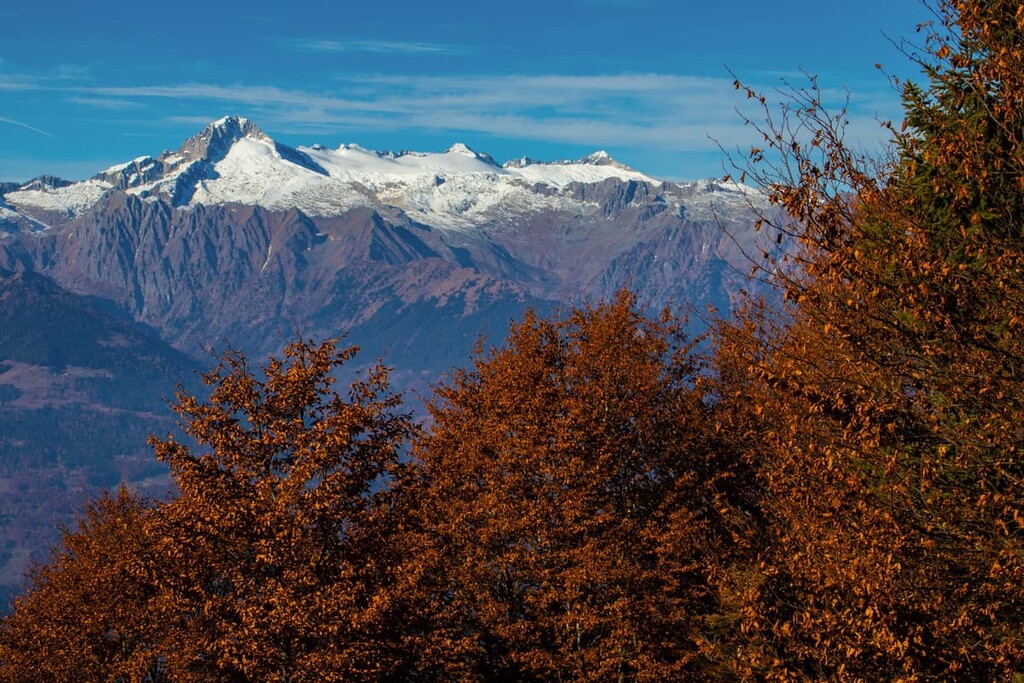
The landscape of the Adamello-Presanella Alps is dominated by the region’s numerous mountain peaks. The highest of them are covered by glaciers.
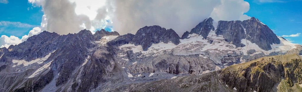
The Adamello Glacier is the largest of these glaciers as it has a total area of some 6.4 sq. km (6.3 sq. mi). It is also the largest and deepest (270 m / 885 ft) glacier in Italy and one of the largest (and important for scientists) in Europe. By studying glaciers like this, scientists, in particular, hope to understand how global warming is affecting the planet because glaciers all over the earth are constantly melting.
Adamello Glacier includes a smaller but also very famous glacier, the Mandrone Glacier (10.46 sq. km / 4.03 sq. mi). The second, third, and fourth largest glaciers in the group in terms of area are Lobbia (5.8 sq. km / 2.2 sq. mi), Lares (4.1 sq. km / 1.6 sq. mi), and Presanella (2.6 sq. km / 1 sq. mi).
In total, there are 92 glaciers in the Adamello-Presanella Alps with an area of 35.6 sq. km (13.7 sq. mi). They are, quite simply, incredible and very impressive.
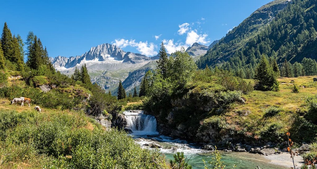
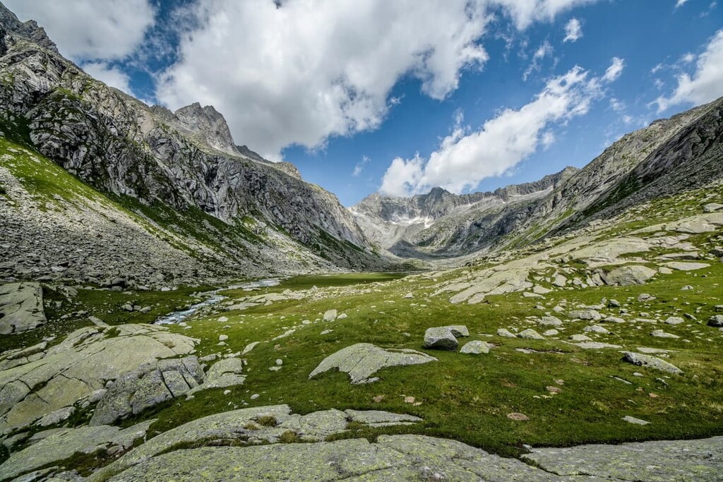
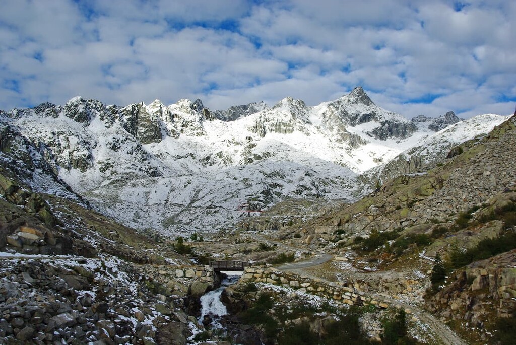
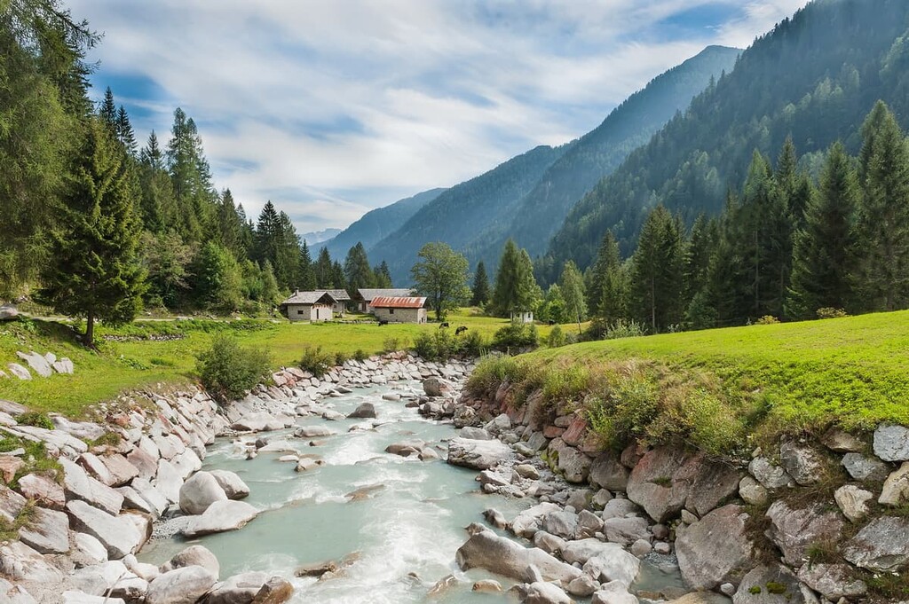
Traveling through the Adamello-Presanella landscape, from the glaciers one descends through spruce, pine, and mixed forests, which grow up to an elevation of about 2,000 m (6,561 ft) and in picturesque mountain valleys.
Some of these valleys are quite wide and long, while others are narrower and shorter. Sometimes it feels like the mountains are literally closing in on you, and sometimes it feels like you’re not in a mountain valley, but somewhere in a flat area—that’s how big some of the valleys are.
The main valleys in the northern part of the group where you are likely to arrive are Val Algone, Val Ambiez, Val Brenta, Val di Borzago, Val di Breguzzo, Val di Fumo, Val di Daone, Val di San Valentino, Val di Tovel, Val Genova, Val Manez, Val Meledrio, and Val Nambrone, among others.
If you haven’t been to the mountains yet, remember that the valleys are always hotter than the alpine regions—the temperature gradients can be as much as 10–15 or more degrees Celsius (50–59 Fahrenheit) from the valleys to the summits.
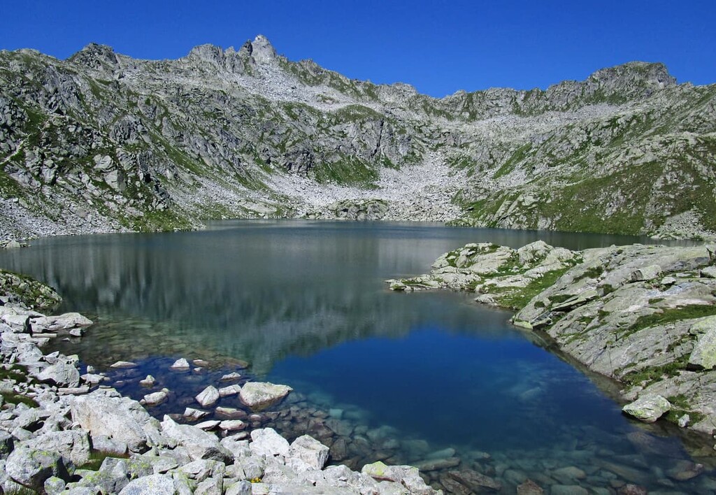
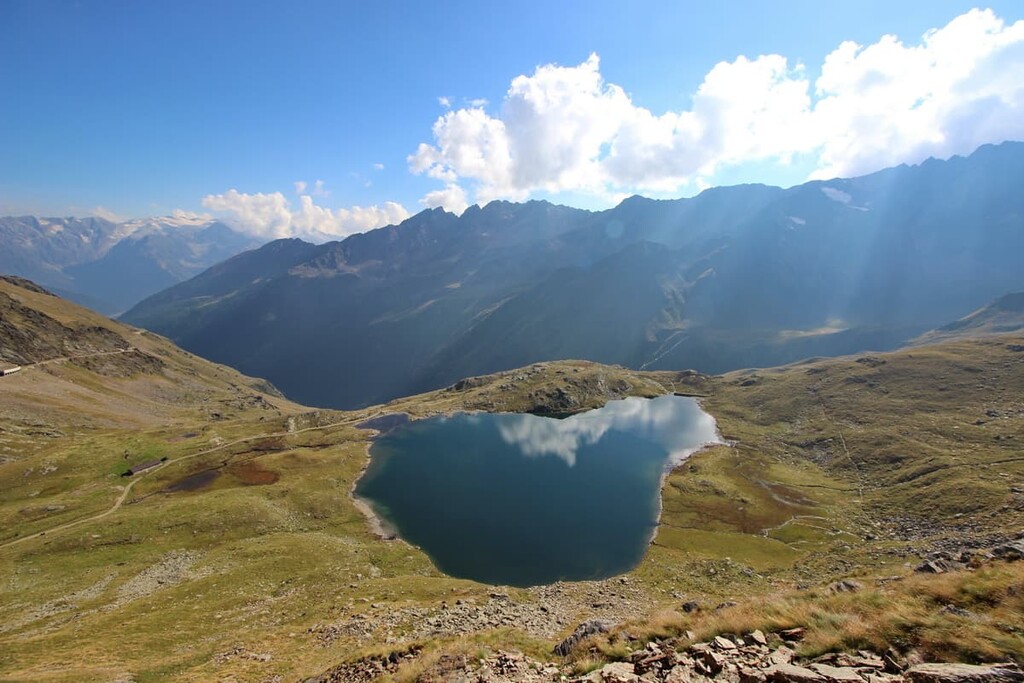
Furthermore, there are 44 lakes in the Adamello subgroup: Lares, Nambino, Ritorto, Serodoli, Nero, Lambin, Malghette, Cornisello, San Giuliano, Valagola. There are also several large rivers or mountain streams, such as the Sarca River in the Genova Valley, which divides the two subgroups from each other.
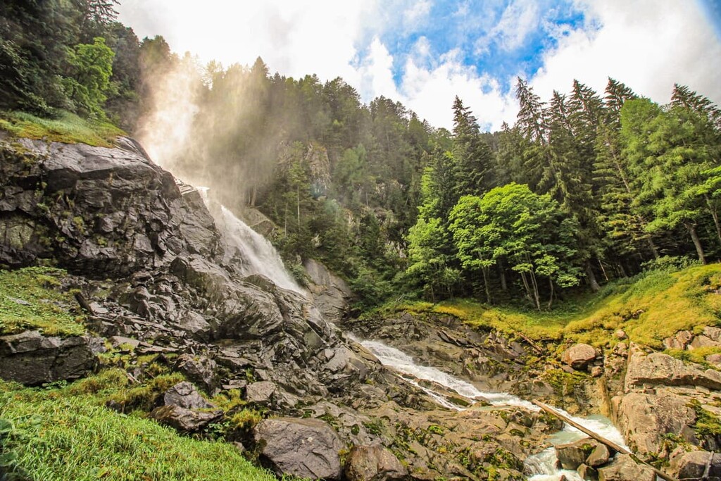
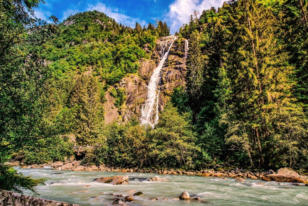
Also, in these mountains, you can admire 30 waterfalls, including the highest—Nardis Waterfall (95 m / 311 ft)—which is found in the Genova Valley.
Finally, from one valley to the other we get through the passes. The main passes here are:
Note: some of these passes are very high and are covered in snow during much of the year. As a result, some can only be crossed with climbing equipment.
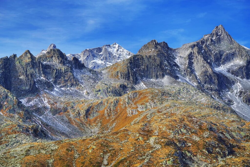
In terms of geology, the mountains of the Adamello-Presanella Alps, which is a subrange of the greater European Alps, consist mostly of granites. If we talk about the age of these layers of rock and the geological era, then to see with our own eyes how these mountains originated, we would have to travel at least 350 million years—from the current day to the Paleozoic era. Although, of course, they didn’t appear in a day or even 1,000 years—it was a very long process.
What distinguishes granite from other rocks—such as the softer dolomite that makes up the mountains of the Brenta Group—is its density, hardness, and durability, so it has been widely used in construction for thousands of years. Seeing this rock is easy. It is everywhere.
You can learn more about the geology of these amazing mountains at the museum and research station of the local alpine association called “The Glaciological Center “Julius Payer” (Il Centro Glaciologico “Julius Payer”). The museum is located on the easy and scenic route to Mandrone Lake, Mountain and Glacier in the Genova Valley. You can read more about it in this article about Adamello-Brenta Nature Park.
The Adamello-Presanella mountain group is one of 68 mountain groups in the Southern Limestone Alps according to the German-Austrian Alpine Club Classification of the Eastern Alps (AVE), where it is included as number 49. According to the second most common classification, the Italian SOIUSA, this group belongs to the Southern Rhaetian Alps.
Then, each of the two subgroups is divided into several more subgroups (also by SOIUSA). Adamello consists of the Adamello, Catena Re di Castello-Blumone, and Catena Carè Alto-Breguzzo parts; and Presanella consists of the Massiccio della Presanella and Massiccio di Nambron parts.
The two highest peaks of the group were first climbed in the nineteenth century, mostly by English climbers.
Douglas William Freshfield, M. Beachcroft, and James Douglas Walker were first to climb Presanella. They were assisted by local Italian alpinists and guides and by some famous guides from the French Alps such as François Devouassoud of Chamonix, France.
The first climber to reach the summit of Monte Adamello was the Austrian climber Julius von Payer, also with local Italian guides.
Both two groups of these adventures also climbed some of the lower mountain, such as Cima Gabbiolo (3,458 m / 11,348 ft), Cima di Vermiglio (3,457 m / 11,345 ft), Cima Meridionale del Dosson (3,439 m / 11,283 ft), and Corno Bianco (3,434 m / 11,266 ft), among others.
This section would also not be complete if I did not list the other highest peaks above 3,000 m (9,842 ft) in both subgroups:
The highest mountain peaks of the Presanella Alps include:
The highest mountain peaks of the Adamello Alps include:
Looking again at the Adamello-Presanella Alps as a whole, there are 89 mountains above 3000 m (9,843 ft), starting with Carè Alto (3,462 m / 11,358 ft) and ending with Corno Giuello (3000 m / 9,843 ft).
By comparison, in the Dolomites, with which the Adamello-Presanello mountains fight for tourists’ attention, there are 52 peaks above 3000 m (9,842 ft), including two peaks on the highest mountain Marmolada—Punta Penia (3,348 m / 10,984 ft) and Punta Rocca (3,309 m / 10,856 ft) and the lowest peak of Zahnkofel (3000 m / 9,843 ft).
The Adamello-Presanella mountain group has about 700 km (434 mi) of hiking trails of various lengths, elevations, and levels of difficulty, designed mainly for experienced hikers for whom walking around 30 km (18.6 mi) over the course of 2–3 days with an elevation gain of 500 to 1,000 m (1,640–3,280 ft) each day and the same descents is ok. However, there are also easier routes for newer hikers.
The Adamello High Trail (Alta Via dell’Adamello) is the longest trail in the whone mountain group, passing from north to south through the Adamello subgroup. The total length of the route is 75–85 km (120–136 mi). It consists of 9 stages that take you from one rifugio to another.
It is a challenging route because some sections are poorly marked, and some require equipment for via ferratas, which are metal cables that you follow up and across cliffs in the most difficult parts of the route. However, you can opt to make this into a shorter trek, focusing mostly on the easier stages. So, this route can effectively be broken up into nine separate hikes that you can choose from for your adventure.
Learn more about the trail from this official PDF document.
The Path of Peace or Peace Pathway is an even longer route through the mountains of Adamello, which thematically goes beyond nature and tells the human military history of these places. It is dedicated to the memory of fallen soldiers of the so-called White War (Guerra Bianca).
At the beginning of the twentieth century, the border between Italy and the Austro-Hungarian Empire passed through these mountains, so during World War I (1914–1918) the range became the front line. Battles took place right on the passes, peaks, and even glaciers of the range, most of which are not easy to climb even for professional climbers today.
Different military actions, as well as the harsh climatic conditions (cold, rockfalls, heavy snowfalls and avalanches), took the lives of hundreds of people during the conflict.
Today, the Path of Peace route, or rather a system of routes, connects memorable places with traces of the war on the front line in two Italian regions: Lombardy and Trentino. In particular, such places include points of interest like old forts; trenches, remnants of military equipment turned into monuments, and so on.
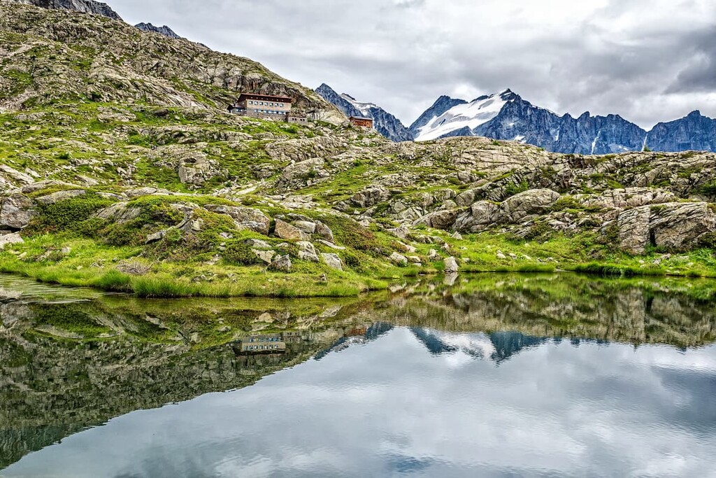
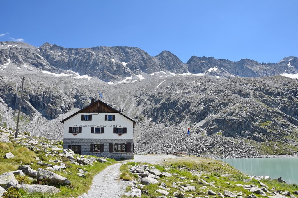
Some tunnels were laid directly in Adamello Glacier, with a few tunnels reaching a length of 5 km (3.1 mi). The main Italian military base in the Adamello mountains was located at the current location of rifugio Garibaldi. Meanwhile, the Austrians used the site of today's rifugio Mandrone. Interestingly, these are now two of the most famous mountain huts for hikers.
The total length of the route varies, but it ranges from 450 to 610 km (279 to 375 mi), from the Tonale Pass to the highest mountain of the Dolomites Marmolada (3,343 m / 10,968 ft). You will need more than 30 days to complete the entire route, but this is not necessary (unless you’re up for a big adventure).
Indeed, the route consists of seven sections, each is further divided into separate stages of around 10–20 km (6.2–12.4 mi) with three of them crossing the whole Adamello Group. The stages in the Adamello region include:
To learn more about these historical events, you can also visit two museums both before and after the hike: the Museum of the White War in Adamello (Museo della Guerra Bianca in Adamello) in Temù, north of the Adamello group, near the main visitor center of the Adamello-Brenta Nature Park; and Trentino Great War museum (Trentino Grande Guerra – Museo Storico Italiano della Guerra) in the town of Rovereto near Trento.
The Genova Valley Waterfalls Trail is a long but relatively straightforward hike along the Sarca River through the Genova Valley to Nardis Waterfall, the highest waterfall in the Presanella.
The trail runs along both the right and left sides of the river crossing it several times. But, don’t worry—there are bridges for the crossings. The waterfall is located about 10 km (6.2 mi) from the starting point of the trail.
If you continue along the river, you will pass many other waterfalls, including Casina Muta, Gabbiolo, Stablèl, Casina Muta, Folgorìda, Làres, and Pedruc. At the end of the trail, there is Albergo-Rifugio Stella Alpina (1,450 m / 4,757 ft, 40 beds), where you can spend the night.
The hike to Presanella Glacier and Denza Lake is an easy loop route to the north side of Cima Presanella and the Presanella Glacier, the latter of which you will see on the route.
This trail begins at the old fort of Presanella, which is accessible by car and winds around the summit of Croz della Stavel (2,685 m / 8,809 ft). On the way, you will see the mountains Cima dei Pozzi (2,890 m / 9,481 ft), Croz della Lana (2,343 m / 7,687 ft), and Monte Cercen (3,280 m / 10,761 ft), among others.
Along this route, you can spend the night in the cozy rifugio Stavel, from which you can make another smaller lap across the Denza Lake.
The 12 Lakes Trail is a fun route in the Presanella Group that travels by more than 12 medium and small glacial lakes to the north of Monte Zeledria (2,427 m / 7,962 ft). This includes Sarrioli, El Bus, Gelato, Serodoli, Tre Laghi, Scuro, Alto, and del Malghetto di Mezzana lakes.
This is a very beautiful, but difficult route because of the many rocks and descents to overcome. Plan a full day for it and be sure to bring enough provisions to ensure that you can make it across the entire route before dark.
The 12 Lakes Trail has a simpler version, The 5 Lakes Trail. Read about it in the article about Adamello-Brenta Nature Park.
The classic climbing route to Cima Presanella from the east through Cima Segantini (2,390 m / 7,841 ft) and Cima Amola (3,068 m / 10,065 ft) is one of the most popular mountaineering objectives in the region. However, this route requires not only ice climbing equipment, but also extensive experience in such climbs because the glacier, snowpack, and other weather conditions could also make it very hard to pass.
You can climb the route in one day or stay overnight at the Brigata Orobica alpine shelter (3,382 m / 11,095 ft, 6 places), the closest refuge to the summit.
A trip to the Adamello-Presanella Alps is not only about cliffs and glaciers, but also about surprisingly diverse and unique flora and fauna, as well as human history related to it. You can learn about it in one of the following nature parks:
If you are going to hike in these mountains, remember that the northern part of the group, together with the neighboring Dolomiti di Brenta, constitutes the Adamello-Brenta Nature Park (620 sq. km / 239.3 sq. mi).
More: the park is also a designated UNESCO Geopark of the Unesco Global Geoparks Network. The system was created to preserve the geological heritage of the Earth. In total, there are just 75 such parks in Europe in 26 countries, and 161 parks in 44 countries worldwide.
As a result, it’s a superb place to hike, climb, ride a bicycle, and learn more about the wonderful natural features of the Adamello-Presanella Alps. For example, there is a great hike to Mount Zeledria (2,427 m / 7,962 ft) from where you can see all of the 12 lakes I mentioned before, or a hike to Mandrone Lake, a mountain, and its glacier.
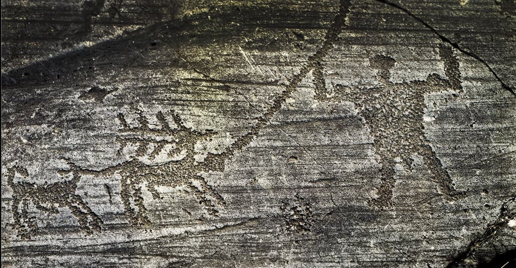
Another reason to come to Adamello-Presanella Alps for hiking is to visit the largest collection of rock drawings (prehistoric petroglyphs) in the world of more than 300,000 pictures all over Camonica Valley, which forms the entire western boundary of the mountain group (90 km / 56 mi). However, most of the pictures could be found in the towns of Darfo Boario Terme, Capo di Ponte, Nadro, Cimbergo, and Paspardo.
This collection of the first 140,000 pictures was recognized as a Unesco World Heritage Site back in 1979 and was the first such site in the whole of Italy, by the way.
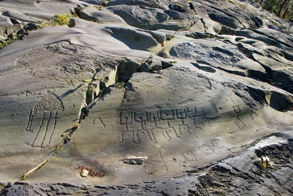
If you were already studying the region of Lombardy, you may have seen one of the drawings. It is the most famous picture called "Rosa camuna" (Camunian rose)", which is used as an official logo for the region. The picture is a representation of some flower similar to the rose by the local Camuni people, which were the population of this area in the Iron Age (1st millennium B.C.).
The Camunni is one of the main tribes who lived in the valley of the Camonica during this period on the current territory of Northern Italy (another tribes are Raeti in the Dolomites, Veneti in the area of modern Venice, Carni in the Carnic Alps, or Ligures in Liguria Region and others). They are mentioned in written sources by ancient Greek geographers and philosophers, such as Strabo.
Around the 1st century AD, these, and other tribes in the Alps, were conquered by Rome, subjected to Romanization, and integrated into the Roman Empire as autonomous entities, and their inhabitants were granted Roman citizenship.
For the convenience of travelers, the drawings have been separated into eight nature archaeological parks, located close to each other in the valley, where you can learn more about who the camunni are, their history, and their way of life.
Particularly, I recommend visiting the National Park of Rock Drawing of Naquane (Parco nazionale delle incisioni rupestri di Naquane). It is actually the first Italian archaeological park located in the Naquane locality, on the eastern side of Valcamonica on the ancient road between Paspardo and Nadro localities.
There are 104 rocks with these ancient drawings in the park. The park itself is quite scenic in the mountains at an altitude of 400–600 m (1312–1968 ft) in a forecast area covered by many chestnut, fir, beech, and hornbeam trees. Its area is 0.1 sq. km (0.05 sq. mi).
Another great park is the Rock Art Natural Reserve of Ceto, Cimbergo, and Paspardo (Riserva naturale Incisioni rupestri di Ceto, Cimbergo e Paspardo) with a total area of 2.9 sq. km (1.1 sq mi), where there is also one of the largest collections. The park has four easy and medium difficulty trails of up to 2-3 hours in the different areas of Foppe di Nadro Area, Campanine di Cimbergo, Paspardo, and Sottolaiolo.
The other six parks are:
The Adamello-Presanella Group, as a part of Adamello-Brenta Nature Park, has several visitor centers called “Park Houses” (“Casa del Parco” in Italian). The main one is located at the entrance to the Val Genova, so it is easy to reach on your way to the mountains:
Address:
Vicolo Cavallotti 20
38080 Carisolo TN
Italy
Opening Hours:
Tickets:
Contact Information:
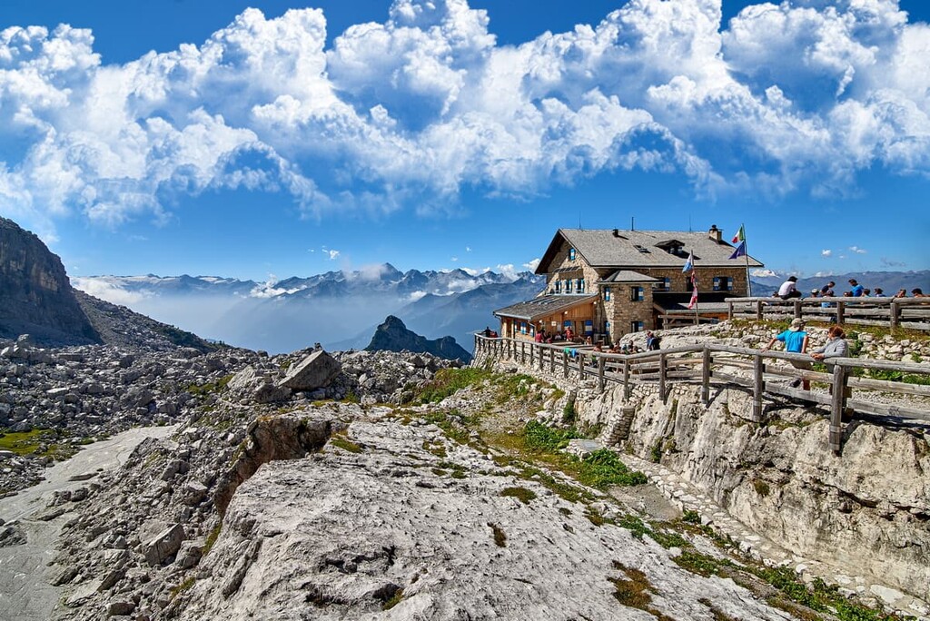
When hiking in the mountains of the Adamello-Presanella you can stay overnight in one of the three main types of accommodation, depending on your preference. This includes rifugios, bivouacs, and campgrounds.
Here’s what you need to know:
The rifugios and campsites are usually open in the summer season from June 20 to September 20, sometimes also in May and October on weekends when the weather is good. Rifugios located near ski slopes are also open in the winter season.
Of course, some of the refugios and bivouacs in the range are better-known than others. If, for example, you want to summit both Monte Adamello and Cima Presanella, here are some of your options:
In total, there are more than 20 rifugios and 15 bivaccos in Adamello Subgroup, and more than 12 rifugios and 5 bivaccos in Presanella. Learn more about mountain shelters and huts at Rifugi.Lombardia.it.
Finally, the largest campgrounds in the mountain group are Cevedale, Novale, Chalet Presanella, Adamello, Val Rendena, and Parco Adamello.
The Adamello-Presanella Alps are literally surrounded by numerous towns and villages where you can start your journey.
Here are the major cities and resorts in the region from south to north in a clockwise direction, so you don’t get lost:
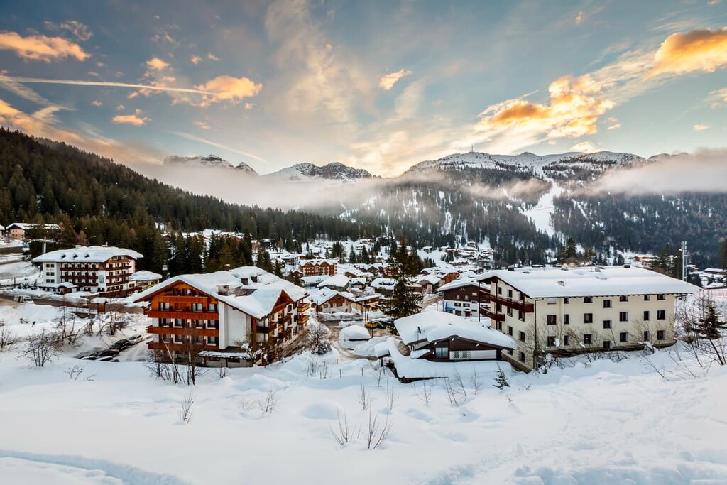
However, the main settlements are Madonna di Campiglio in the north of the group and, I would say, Iseo in the south. Here’s a bit more information on both communities:
Which town to choose? In my opinion, if you are going to this region for the first time and/or want more nature (rather than rocks), it is logical to start your trip at Madonna di Campiglio, from where you can also hike to Dolomiti di Brenta to visit two mountain groups at once.
If you have already been in the Dolomites, or maybe the Presanella, you better go to Iseo Lake to discover and better explore the Adamello region and its famous glacier (although the glacier is best accessible from the same Genova Valley to the north).
Here are the official tourist sites of both villages, where you can find more information: CampiglioDolomiti.it and VisitLakeIseo.info.