
Scan the QR code and open PeakVisor on your phone
The Brenta group include 214 named peaks. The highest is Cima Brenta at 3,151 m. Other notable peaks include Cima Tosa, Crozzon di Brenta and Cima Occidentale di Brenta.
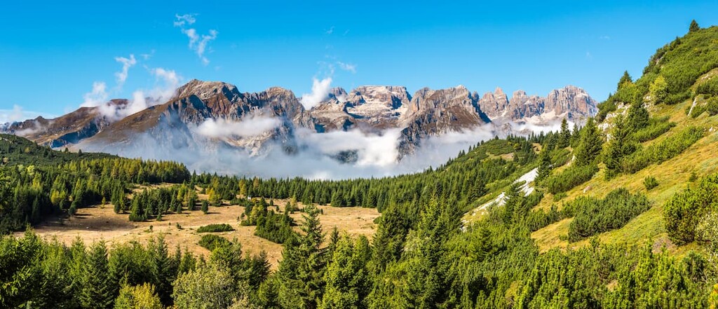
The Brenta group is one of the nine major mountain systems in the Dolomites in northern Italy. The main feature of Brenta is that it is located so far away from the other systems that geologists did not immediately think that it was part of the Dolomites. We could say now that the Brenta group was lucky to be among the "most beautiful mountains in the world," the Italian Alps.
There are 207 named mountains in the Brenta group. The highest and the most prominent mountain is Cima Tosa (3,157 m / 10,358 ft).
However, it is worth noting that there is some controversy over the highest peak of the Brenta Group. Cartographers initially thought Cima Brenta (3,151 m / 10,338 ft) was the range™s highest peak until new measurements awarded Cima Tosa that honor.
Nevertheless, as the ice on the summit of Cima Tosa melts, there is further confusion over whether it™s still the tallest peak in the Brenta group. Many local cartographers still disagree on the issue, so if you want to summit the highest peak in the Brenta group, climb both!
In this article I will tell in detail about these mountains and its other features, including its hiking trails, via ferratas, and beautiful lakes, as well as the most important towns around, which make it an ideal destination for ecotourism and outdoor enthusiasts from Italy and all over the world.
The Brenta group was named so beautifully after one of the major rivers in northern Italy”the Brenta River. It is 174 km (108 mi) long. The river begins southeast of the city of Trento and flows south into the Adriatic Sea within the Gulf of Venice via the city of Padua.
The word "Brenta" itself comes from the Latin word "brinta". In the local dialect of the Trentino region, it means "large reserves of water". They were stored in various tanks in the cities in case of fires. At the same time, there is the local word "brentana" which means flood”also a lot of water.
The Brenta group is also commonly called Brenta Dolomites or Western Dolomites. It is Dolomiti di Brenta in Italian and Brentagruppe in German”two of the most common languages here.
The Brenta Dolomites located entirely in the province of Trento in the Trentino”Alto Adige region. In contrast to Marmolada or Tre Cime di Lavaredo, it has not allowed politicians to divide itself into two or more parts. It is another example of Brenta's autonomy and, I would say, independence.
In particular, the group is located to the southwest of the central part of the Dolomites, if we take as the center their highest mountain Marmolada. From one of the two main settlements at the feet of the Brenta group”the village of Molveno on the lake of the same name”it is exactly 150 km (93.2 mi) to the Malga Ciapela, the starting point for many hiking trips at the foot of Marmolada. To travel this distance by car takes about 3 hours.
Despite its remote location from the other Dolomites groups, the Brenta group is not isolated; rather, it is surrounded by other mountains, the main one being the Adamello”Presanella Alps in the west. Together they make up the Adamello ” Brenta Nature Park. The group is also bordered by the Ortles Alps to the north and the Fiemme Mountains to the east.
The total area of the mountain group of Brenta is 111 kmВІ (42 miВІ). It is 40 km (24.8 mi) long from north to south and 12 km (7.4 mi) wide from east to west.
From Trento, the closest major city to the Brenta group, to Molveno is only 45 km (27.9 mi) or 45 minutes by car.
The most famous and the largest lake in Italy, the Garda Lake, is also located close to the Brenta group. From Molveno to Riva del Garda on the northern shore of the lake is also about 45 km (27.9 mi) and almost an hour by car.
Finally, the Brenta group is located close to Verona in the south (140 km / 86.9 mi, 2 hours drive) and to the city of Bolzano in the north (70 km / 43.4 mi, 1 hour drive).
Now you know where the Brenta is, and you can easily reach these mountains to start your adventure.
With that out of the way, let™s quickly discuss the size of the range. I took the time to measure it and it takes about 3 hours and 30 minutes (184 km / 114.3 mi) to drive around the range to and from Trento. It looks like a nice trip, by the way, so perhaps that™s an adventure that™s worth adding to your itinerary!
If you travel by public transport, use the buses of Trentino Trasporti”the main local bus company here. The trip will take longer than by car, but it is still easy enough to accomplish. There is also the railway line Trento”Bolzano. In that case use Trenitalia or Suedtirolmobil.
The Western Dolomites is the only dolomitic system among a grouping of neighboring granite mountains.
The main peaks of the Brenta consist of dolomite or the main dolomite (dolomia principale in Italian)”the rock that formed some 200 million years ago during the Mesozoic era. Meanwhile, some parts of the range are made of calcareous dolomite or limestone. In other words, no surprise here”the Dolomites are made of dolomite.
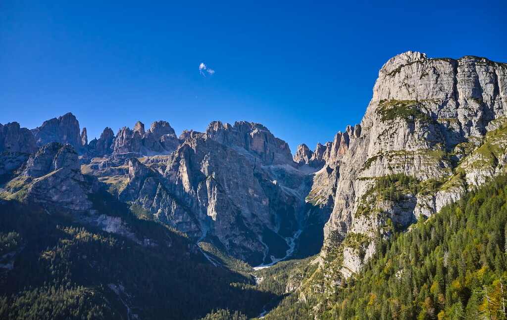
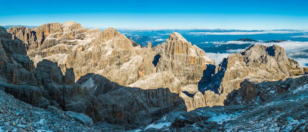
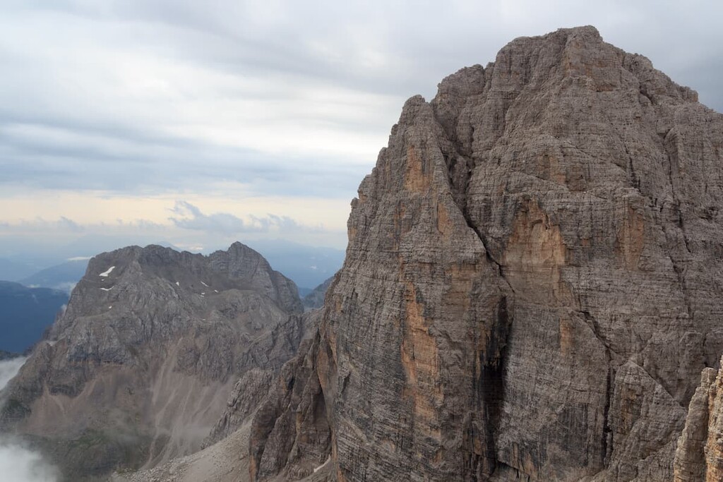
In terms of landscape, the Brenta group is one mountain range that stretches from north to south, with the southern part being wider than the northern part. Its highest peak, Cima Tosa, is also located here, in the south.
In the northern part of the group, there is a vast high mountain plateau, like those found in the Pala or Sella groups. There is evidence that 200 million years ago, these mountains were atolls and coral reefs in an ancient sea.
Otherwise, as everywhere else in the Dolomites, the scenery of these mountains is hard to mistake, as if you fell asleep in your bed in a big city, say New York, and woke up in a typical Alpine hotel with a view of the Dolomite peaks. So, if in the morning, you see the steep vertical pinnacles growing out of alpine meadows and pine forests in the valleys, you know you are in the Dolomites for sure.
There are many valleys formed by streams and rivers flowing down from the mountains: Val di Non, Val di Sole, Val Rendena, Valli Giudicarie, and others”here and further I will name all of them in Italian because it is easy to search for them on the local maps.
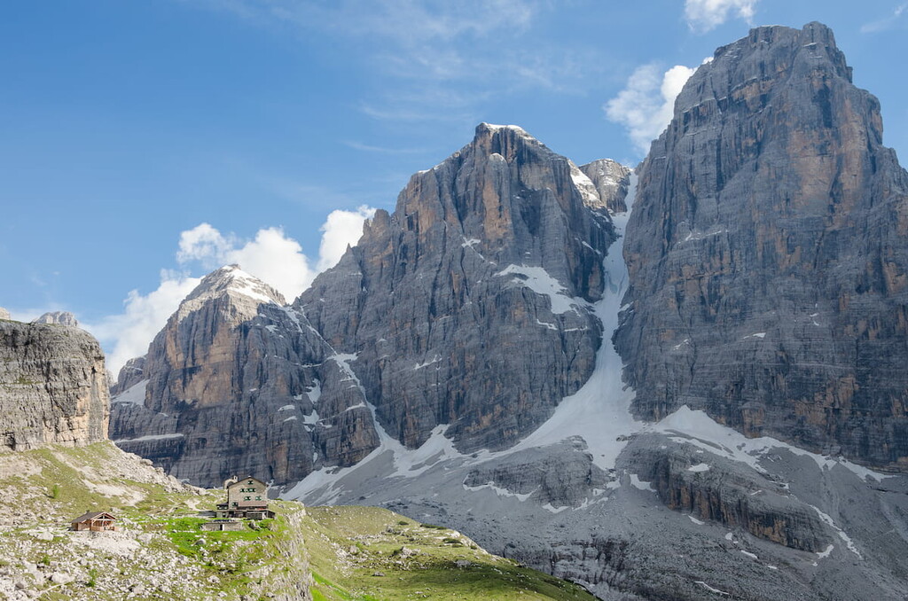
The Brenta was once covered by vast glaciers, of which today almost nothing remains due to global warming. Nevertheless, you can still see 42 small glaciers in the Brenta group with a total area of 1.1 kmВІ (0.3 miВІ).
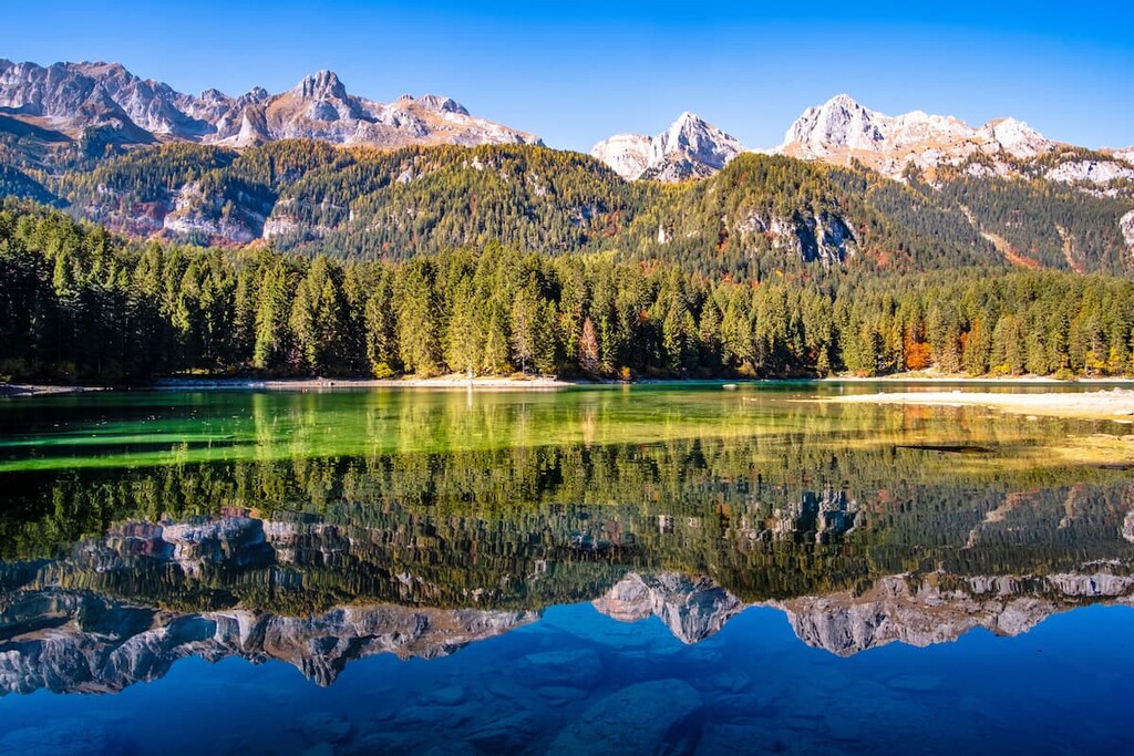
In addition to Molveno Lake, there are several other lakes within or near the Brenta group, such as Tovel Lake and Santa Giustina Lake.
The main passes within the Dolomiti di Brenta are Bocca di Tuckett Pass (2,656 m / 8,714 ft), Bocca di Brenta Pass (2,553 m / 8,376 ft), GrostГЁ Pass (2,440 m / 8,006 ft) and some others.
In total, the Brenta group is an amazing region with almost all natural wonders we could imagine.
The Brenta group can be subdivided into the following few subgroups by the Italian SOIUSA classification, including the following peaks:
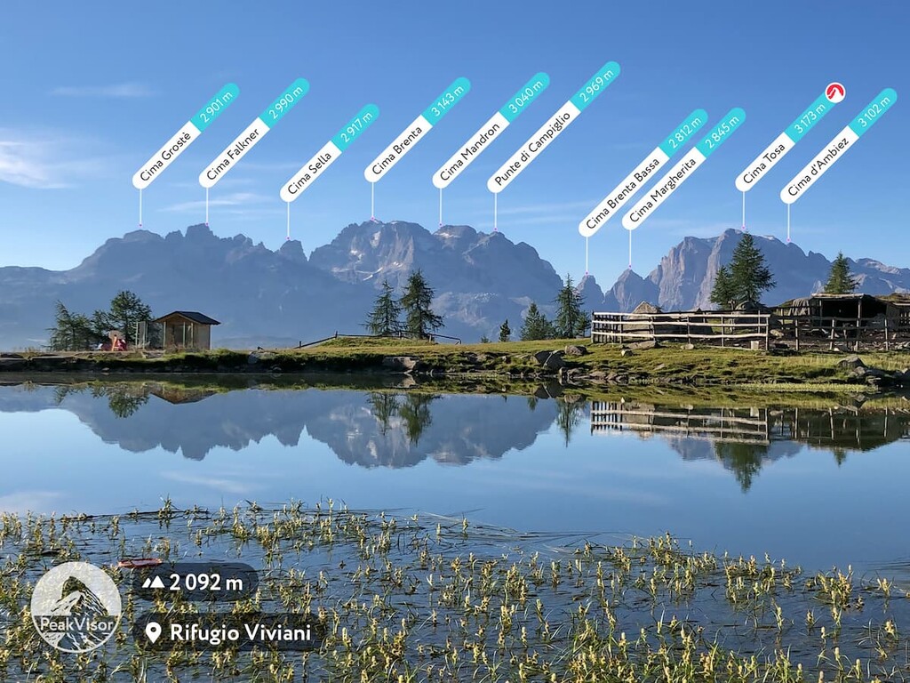
After the Cima Tosa, from where the Garda Lake is visible on a clear sunny day, the nine other highest summits are:
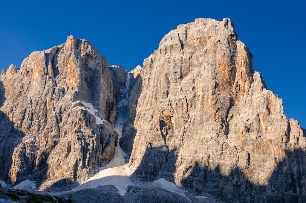
I should also mention one of the most famous peaks in the Brenta group, which is known primarily among climbers”Campanile Basso (2,883 m / 9,459 ft). It looks like a huge stone needle, or I would even say”a rocket, ready to launch into space by NASA, or Elon Musk.
However, the name of the summit in English is more prosaic”њLow Belltowerќ. "Low" compared to the neighboring Campanile Alto (2,937 m/ 9,636 ft) which is, by the way, no less impressive, just more massive.
The first climbers to successfully make the first ascent of the mountain on August 12, 1897, were local Italians from Trentino: Carlo Garbari, Antonio Tavernaro, and Nino Pooli. They climbed along the route called now "Via normale," but nowadays there are endless ways to climb to the top.
That being said, even if you're not a climber but a hiker, don't miss your chance to visit these mountains while hiking in the Brenta Dolomites.
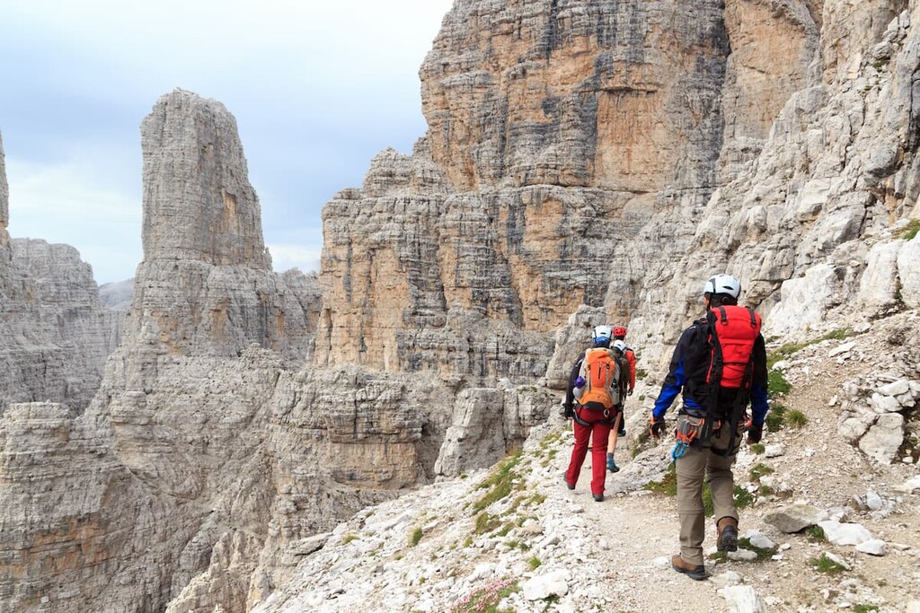
The Brenta group (Dolomiti di Brenta) has more than a dozen hiking trails of varying difficulty.
Most of them together make up the single multi-day route around the entire group called the Dolomiti di Brenta Trek. But there is also a possibility for hiking in the center of the Brenta, as well as the way to getting lost in its northern, wilder, and less touristy parts.
The route consists of 11 sections with 7 additional variants. You can walk one, two or more sections during the day.
All sections of the trail are medium to advanced in difficulty and are designed for experienced hikers. There are also many via ferratas on the trails, so special equipment is needed: helmet, carabiners, and ropes. This also makes the trail a real adventure, which is worth a whole week's vacation, or at least a weekend.
You can complete the entire trek in 6 days (6 nights), as well as its individual sections or sub-variants of up to 2 or 3 days. For example, you can traverse the eastern borders of the group or the western borders, or you can hike only in the north or south.
While walking the route as a loop, you will see all the main mountain peaks, valleys, and passes of the Brenta group.

Advice: The route seems very attractive, but it is quite difficult for the unprepared. In my experience, most people can walk for one whole day in difficult mountain terrain. The question is: Do you have the energy left for another 5 days?
If you™re not already an experienced hiker, as preparation for a trip like this, I recommend that you start exercising a few weeks in advance: running, jumping, push-ups and so on”whatever you like, but make a system and follow it. Then your legs and arms won't fall off on the first climb. (I™ve tested this training system many times.)
This hiking route is in the geographical center of Brenta, between two famous mountain rifugios that can be reached via trails either from Molveno or from Madonna di Campiglio. During this adventure, over the course of three days, you will cross the entire mountain group from east to west, or vice-versa, surrounded by mountains such as Cima Roma (2,829 m / 9,281 ft), Cima Sella (2,913 m / 9,557 ft), Cima Brenta (3,151 m / 10,337 ft), Punta Massari (2,847 m / 9,340 ft).
Half of the route consists of via ferrata, so don't forget to pack your via ferrata gear, too.
An interesting loop hike also in the geographical center of the Brenta group. It starts from rifugio Stoppani on the Passo GrostГЁ (2,444 m / 8,018 ft). The Cima del GrostГЁ (2,901 m / 9,518 ft) of the same name is located nearby. To come to rifugio, you can use a cable car from Madonna di Campiglio.
From there begins a dense network of trails through the rocky terrain of the various peaks. Follow the direction of the beautiful Cima Roma (2,837 m / 9,308 ft). The trail goes up to the summit. The climb takes about 2:30 or 3 h.
There is no trail around the Cima Roma. To make a loop, you will need to go all way back until the side-trail that leads to Bocca della Vallazza Pass right to the neighboring Cima di Vallazza (2,803 m / 9,196 ft). It is in the middle of the whole loop.
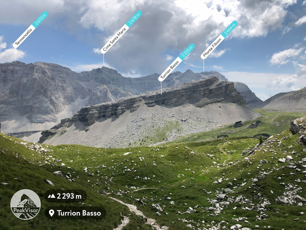
From there, go back to Passo GrostГЁ via Turrion Alto (2,442 m / 8,012 ft) and Turrion Basso peaks (2,385 m / 7,825 ft), as well as Le Crossete (2,406 m / 7,893 ft).
Important note: Some parts of the trails aren't marked well, so be very careful and try not to get lost, use PeakVisor and additional ways of navigation.
At the same time, sometimes to get a little bit lost is a good thing: My friend was walking this particular route, got lost and, as he told me, found some dinosaur footprints! He showed it to me later in the photos. So the Dolomites, is one of the best places in the world to see the tracks of dinosaurs.
The dinosaurs in the Dolomites belonged to both herbivores and carnivorous types. The herbivores were Ornithischian (bird-hipped) order, 5-6 m (16.4-19.6 ft) in length, and weighed 1-2 tons (2000-4000 pounds). Carnivorous dinosaurs, smaller in size, followed them, waiting for an opportunity to attack.
The Monte Zugna (1,861 m / 6,105 ft), the mountain of the town of Rovereto, located not far away, in the Venetian Alps, hosts hundreds of tracks ” the largest deposit of fossilized dinosaur footprints in Italy. The can be seen on the educational trail from the Museo Civico of Rovereto. In the Dolomites, the tracks were also found on the Pelmo and other mountains.
A less touristy route compared to the previous two, this trek runs through the northern part of the Brenta and visits a subgroup called La Campa. The route begins and ends at Tovel Lake.
Along the way, you will enjoy spectacular views of mountains such as Turrion Basso (2,385 m / 7,825 ft), Pietra Grande (2,934 m / 9,629 ft), and the western side of the La Campa subgroup with Cima Val Scura (1,390 m / 4,564 ft), Cima Termoncello (2,673 m / 8,770 ft) and some other peaks, in particular. And, as I noted, you are likely to be alone with these mountains.
The route can be completed in one or two days with an overnight stay in a mountain shelter.
If the dinosaurs footprints in the Brenta Dolomites are not enough for you, remember that Adamello ” Brenta Nature Park is famous for being the only Alpine area still inhabited by the brown bear.
Similar to the Dolomiti di Brenta Trek, in the Brenta group, there is a large and continuous system of via ferratas, the oldest in the Dolomites. The construction of this via ferrata took place from 1937 until the 1970s. It is called the њVia delle Bocchetteќ and runs also from south to north.
The system connects the mountain huts, valleys and passes among pinnacles, vertical walls, and narrow cols ("bocche" in Italian). As with the Dolomiti di Brenta trek, you can only pass individual ferratas (sections) of the trail.
The main and the most famous via ferrata is the Via Bocchette Centrali ("The Central Cols"). It is a mostly horizontal climb always between 2,500 m (8,200 ft) and 2,800 m (9,185 ft). You will climb along the Brenta Alta (2,963 m / 9,724 ft), Campanile Basso (2,948 m / 9,675 ft) and Campanile Alto (2,937 m / 9,636 ft), Torre di Brenta (3,013 m / 9,888 ft), and Crozzon (3,082 m / 10,112 ft) summits.

To get to the beginning of the Via Bocchette Centrali, it will take another two days. On the way you will pass the Via delle Bocchette Alte ” the њsisterќ via ferrata, as well as some others. Usually, the path begins in the nearest town Madonna di Campiglio.
The other most famous via ferrata of this system are named after local climbers: Via ferrata Gustavo e Natale Vidi, Via Ferrata Alpinistica Claudio Costanzi, Via Ferrata Osvaldo Orsi, Via Ferrata Felice Spellini, Via Ferrata Alpinistica Livio Brentari, Via Ferrata Oliva Detassis, Via Ferrata Alfredo Benini, and Via Ferrata Ettore Castiglioni.
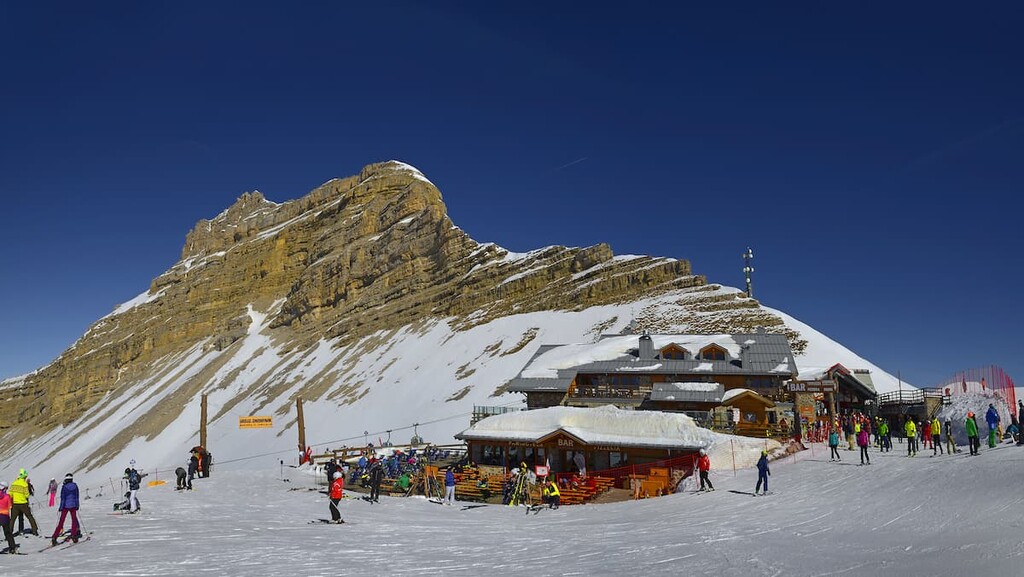
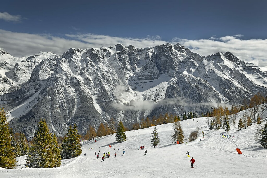
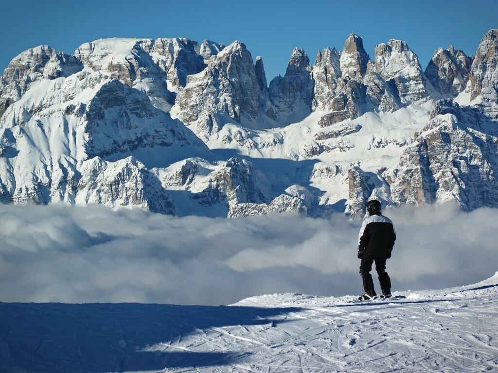
Because of its relatively remote location, the Dolomiti Brenta is not located within the Dolomiti Superski system, even though most of the rest of the mountain groups are. Nevertheless, if you are a fan of skiing and want to visit these mountains in winter, you will not be disappointed.
There are five separate resorts in the range, four of which ”Pinzolo, Madonna di Campiglio, Folgarida, and Marileva” were merged into a single system in 2011, thanks to ultra-modern cable cars. Together they form an even more extensive skiing system with 150 km (93.2 mi) of pistes, the largest in the Trentino region.
Here is some basic information about the slopes:
Most of the trails in this system are located on the slopes of the neighboring Adamello mountain group, but there is also a cable car to the Brenta group. On the east side of the group is another, smaller resort:
The general season for both ski resorts is the same: from late November until early April depending on the snow and weather conditions. The general opening times of slopes are from 8:30 am until 4:30 pm.
There is also a third, very small skiing area Molveno”Pradel, which has just 700 m (2,296 ft) of ski runs and 2 ski lifts. But, it offers a great view into the central part of the Brenta group.
The resorts above are also connected by ski lifts to several other nearby ski areas in the same Trentino-Alto Adige/Südtirol, namely Monte Bondone, and Alpe Cimbra-Folgaria / Lavarone, as well as in the Adamello-Presanella Alps in Lombardy region, including Pejo and Ponte di Legno-Passo Tonale, among others.
Together they form an even larger system known as the Skirama Dolomiti Brenta with a single ski pass, the second largest after the Dolomiti Superski in northern Italy.
Check the Brenta ski map on the larger Trentino-Alto Adige/Südtirol, Lombardy and Veneto ski maps of Italy in the World Mountain Lifts section of the site. It includes information about open ski lifts / slopes in the Brenta Dolomites in real-time with opening dates and hours. There are also year-round cable cars, funiculars, cog railways, aerial tramways, and all other types of mountain lifts.
When you arrive in the Dolomiti di Brenta, you can stay in a B&B or a hotel. Alternatively, you can camp or stay in a farmhouse in one of the towns and villages in the vicinity of the mountain group. There are many accommodation opportunities in the region.
During the hike, the list of available accommodations is traditionally reduced to three basic types: mountain huts (rifugios), bivouacs (bivaccos), and wild camping (why not?).
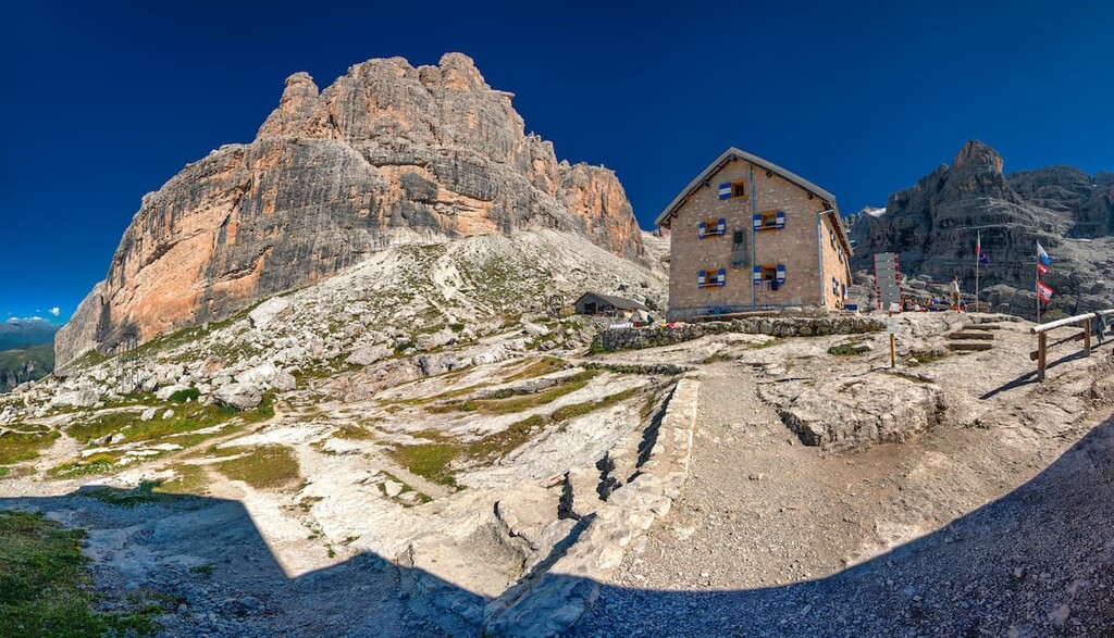
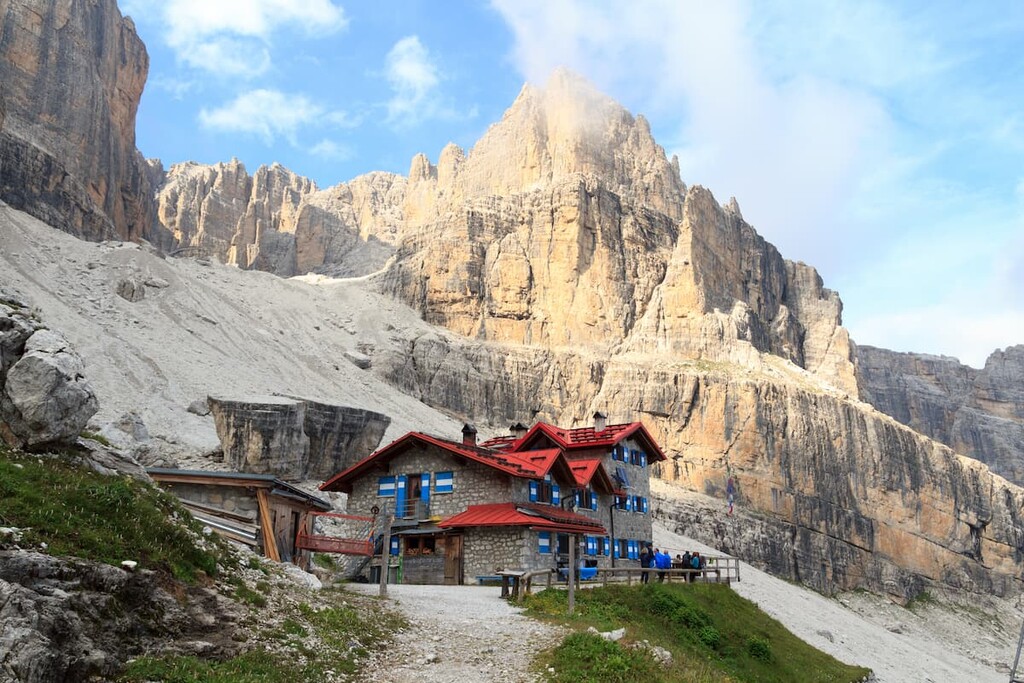
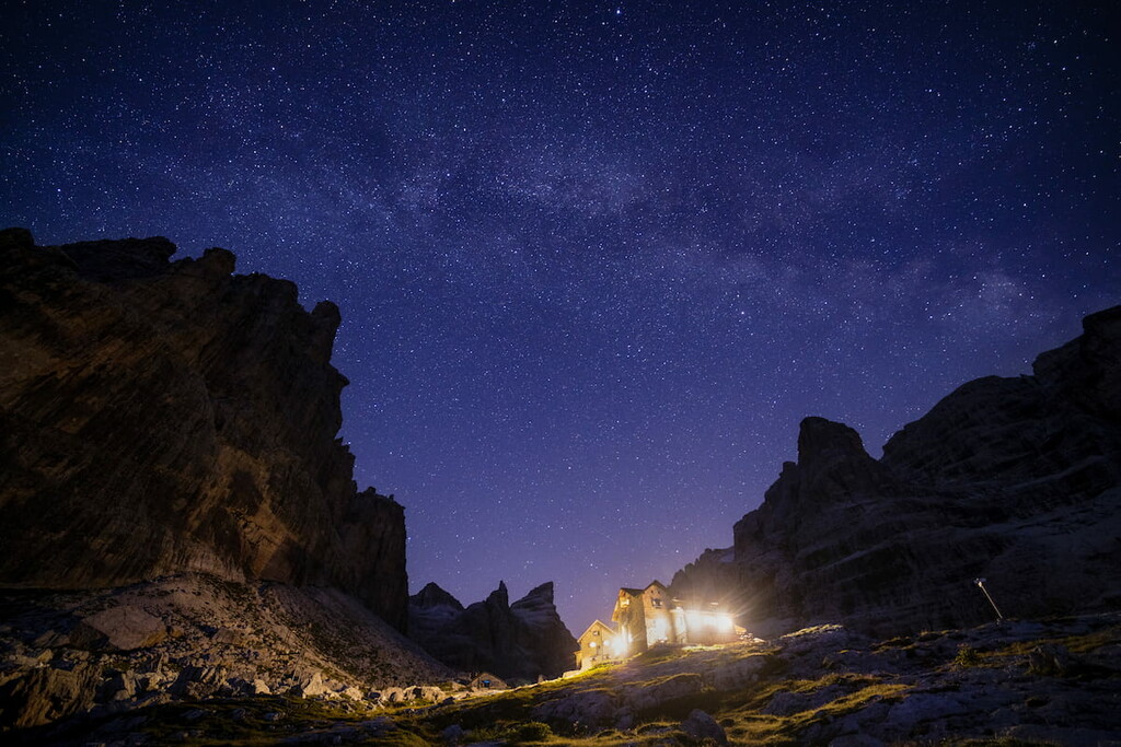
In the Brenta Dolomites, there are 10 main mountain huts (rifugios), where you will find a bed to sleep, shower, food, and drinks during your hiking, biking, and mountaineering adventures on the via ferratas.
All mountain huts in the Dolomites operate under the same system, which is familiar to every traveler who has been here at least once: They are open from June 20 to 21; cost about 20 to €50 to €60 for the night (it is more expensive if you want breakfast and dinner); they offer a hot shower at a price of €1 per liter; and they close between September 20 and 21.
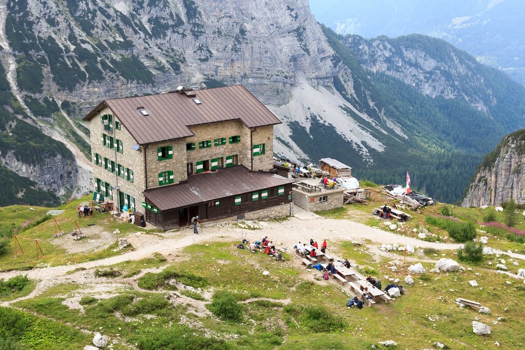
Then, all winter the operators of the huts live on the money (and impressions) that they earned, before starting all over again exactly one year later. What a life!
Here's an exact list of the 10 major rifugios in the Brenta group:
If the adventures in the via ferrata are not enough for you, there are several free alpine shelters in the Dolomites of Brenta where you can stay overnight.
In my experience, the living conditions there are not predictable”some bivouacs are relatively new and others are so old that it's hard to stay in them. Basically, you need a bit of good luck to ensure that you arrive in a suitable accommodation for the night.
Three of the six shelters in Brenta are former alpine cow farms, called њmalgasќ in Italian, that were converted into temporary accommodations for travelers.
The list of bivouacs in the Brenta group includes:
If you are going to sleep in a malgas, try to check up-to-date information from other local sources. For example, I once tried to sleep in a mountain shelter like this in the Dolomites, but it didn't even have a bed, let alone a mattress and blanket. And there was no water around. I was unlucky that time.
Let me remind you that Dolomiti di Brenta is in the region of Trentino. It is officially forbidden to pitch tents unless it is an emergency when the night catches you on the trail. In that case, you can set up a temporary camp at sunset and leave early in the morning. There is a local law that regulates this matter (text in Italian).
Because of this legal loophole, and since 2020, wild camping is becoming more popular, but still it is not a major type of temporary accommodation in the region in general compared to mountain huts and even the bivouacs.
You can get more information on Brenta Dolomites at one of the two main local tourist organizations:
Molveno Holiday
Piazza Marconi, 3, 38018 Molveno, TN, Italy
+390461586086
The Madonna di Campiglio Pinzolo Val Rendena Tourism Board
Via Pradalago, 4, 38086, Madonna di Campiglio TN, Italy
Open every day, from 9 am to 1 pm and from 2 pm to 6 pm.
Sundays: closed in the afternoon
+390465447501
WhatsApp: +390465447502
https://www.campigliodolomiti.it/en
You will probably start your trip to the Western Dolomites in Trento, before reaching other settlements on the way to hiking and biking trails or via ferratas. From the variety of towns that surround the Brenta group, I™d like to highlight five locations, some of which I have already mentioned in this article:
Molveno is a commune located some 40 km (25 mi) from the city of Trento, in the northern part of the picturesque lake of the same name at an elevation (864 m / 2,835 ft).
The municipality has 1,138 residents and it is the center of tourism in the Dolomiti di Brenta on the eastern side of the group. Despite the small size of the village itself, Molveno has everything to offer for outdoor recreationalists, including water sports, paragliding, and more.

The main architectural and cultural attractions in the town are the two churches of San Vigilio and San Carlo Borromeo, built in the thirteenth and seventeenth centuries respectively; the "Napoleonic Forts", ruins of Austrian fortifications built at various times to defend against the French military; and the seventeenth-century Saracini Palace, the aristocratic residence of the local Saracini of Belfort counts from Trento.
A municipality located 30 km (19 mi) west of Trento on the southernmost slopes of the Brenta group at an altitude of 600 m (2,000 ft), Tione di Trento has a population of 3,635 people.
Unlike Molveno, it is not a tourist town at all. In fact, the town was almost completely destroyed by a huge fire that broke out on August 21, 1895, and lasted more than a week. Somewhat ironically, Tione is now famous in the region for its large candle factory.
The main architectural and cultural attraction of the town is the ancient church of Santa Maria Assunta e San Giovanni Battista, which has an outstanding high bell tower built in the eighth century that™s well worth a visit.
Pinzolo is a municipality located 57 km (35.4 mi) from Trento, at an altitude of 800 m (2,600 ft) in the large and picturesque Rendena Valley to the west of the Brenta group. It is the largest town in the valley. Pinzolo is home to 3,118 people now.

Together with Madonna di Campiglio, Pinzolo constitutes a kind of tourist duo; that is, they are considered the centers of tourism in the region to the west of the Brenta group. In addition to the ski slopes and hiking trails, Pinzolo has other activities such as tennis courts, golf fields, an ice rink, swimming pools, and archery fields.
The main architectural and cultural attractions of the city are the Church of Saint Vigilius of Trent built in the 13th century. It has beautiful frescoes inside, too, that no tourist should miss during their travels.
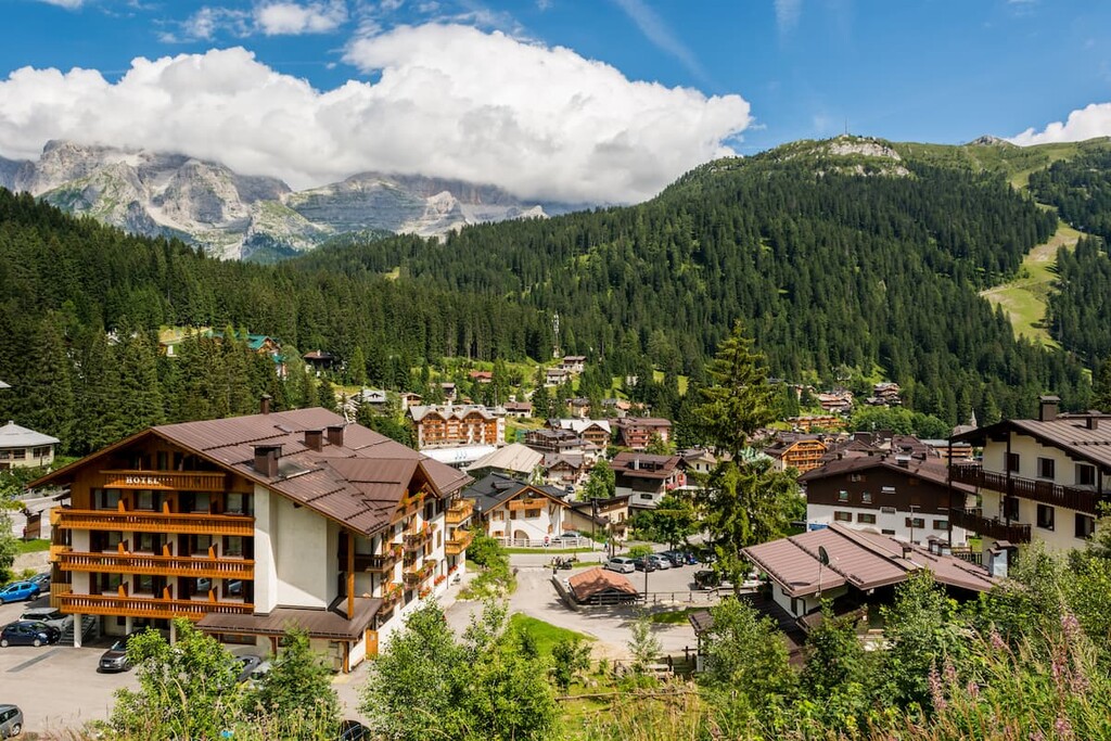
A typical alpine ski village located 70 km (43.4 mi) from Trento, in the same Rendena Valley, at an altitude of 1,522 m (4,993 ft). It is home to 822 people, but during the summer and winter tourist seasons the population increases ten-fold.
Madonna di Campiglio is the main tourist center for the entire area of the Adamello-Brenta Park and the main point of access to both the Brenta Dolomites and the Adamello“Presanella Alps. In the village, you can take the cable car to the Passo Groste, which will take you directly to the northern end of the via ferrata network called Via Bocchette.
The town has no special architectural or cultural attractions, so to not get bored between hiking or skiing trips, visit the Museum of the Alpine Guides and People of Campiglio, which showcases photographs, relics, and equipment used by local Alpine mountaineers. The museum is located in Chalet Laghetto, by a small lake in the center of the village.
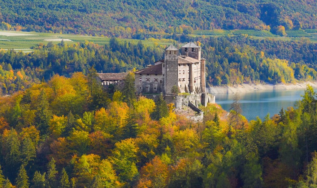
Cles is quite a big commune located 40 km (24.8 mi) from the city of Trento, in the Non Valley at an altitude of 658 m (2,159 ft). It is the largest town at the northern borders of the Brenta group and the most populous I have listed with 7,009 residents.
Like in Molveno, there is also a large lake in the town, but this one is called Santa Giustina. The lake is the center of attraction for local people and tourists, although it is smaller than the lake of Molveno. The 152 m (498.6 ft) high dam on the lake was the highest in Europe until 1950. On the slopes of the lake, there are many vineyards to visit.
The main architectural and cultural attractions of the city are the numerous churches, such as Santa Maria Assunta, San Pietro Apostolo, San Tommaso Apostolo, Santa Lucia, Santa Maria Assunta, and others; the medieval Castle of Cles, located in the center of the valley; and the Assessorile Palace built around 1200.


The highest peak in the Brenta group is Cima Brenta, at 3,151 m.
The Brenta group have 214 named peaks.


