Get PeakVisor App
Sign In
Search by GPS coordinates
- Latitude
- ° ' ''
- Longitude
- ° ' ''
- Units of Length

Yes
Cancel
❤ Wishlist ×
Choose
Delete
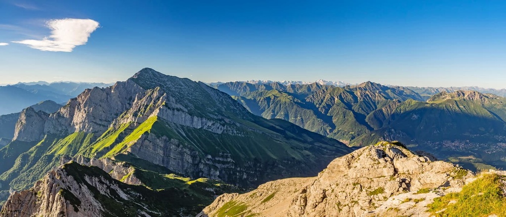
The Bergamasque Alps and Prealps are one of the mountain ranges in the Eastern Alps of northern Italy. The range is home to the Parco delle Orobie Bergamasche, which features rich natural landscapes, as well as endless opportunities for hiking and other outdoor activities. Some of the most famous peaks in Lombardy, such as Grigna Settentrionale, Monte Legnone, Pizzo Arera, Presolana, are found here. The range contains 1009 named peaks, the highest and most prominent of which is Pizzo di Coca (3,050 m / 10,013 ft).
You have probably already noticed that the name of the Bergamasque Alps and Prealps is quite complex. First of all, there are several names. Second, what do they all mean? Here’s what you need to know.
The main name of the mountain range, Bergamasque Alps and Prealps, is a mix of two languages, where Bergamasque is an Italian adjective that means "belonging to the city and province of Bergamo", and Alps and Prealps are English words for the Italian words Alpi e Prealpi.
The word Bergamo itself is a later version of the word Bèrghem. It was the name of a settlement on the site of the modern city of Bergamo that was founded by the Celtic tribe Cenomani before the arrival of the Romans in 49 BCE. We can see the meaning of these words in modern German where the cognate words bèrg means mountain and heim means house.
Additionally, the other part of the range's name, the Alps and the Prealps, refers to the fact that some of the peaks in this range are actually foothills of the main Alps, hence the name Prealps.
It’s worth noting that the different classification systems of the Alps, the Italian SOIUSA and the German-Austrian AVE, have slightly different names for this range. In SOIUSA, the range is called the Bergamasque Alps and Prealps while the AVE refers to it solely as the Bergamasque Alps.
However, in other sources, the word Orobie appears in reference to this range. Remain calm.
This is simply another name for the mountain range in Italian. It comes from the word L’Orobia. This is the name of a historical area in the northeastern Lombardy region (which, to be more precise, is called Uròbea in the local dialect). This region existed before Romans arrived.
The word itself probably derives from the name of the local Celtic tribe Orobi, like the above-mentioned Cenomani or Camuni, who inhabited the Camonica Valley on the eastern borders of the mountain range. They were all part of the larger Raeti tribe that inhabited the north of the province and the west of the Dolomites.
The region of Orobia was partly opposed to the neighboring region of Insubria, which was situated west of it on the border between the present-day provinces of Como, Lecco in what is now Lombardy, and Switzerland.
In turn, the word Orobic (Orobiche in Italian) is an adjective from Orobie. These words are now used somewhat interchangeably.
The two names of the range are also often mixed, as seen, for example, in the name of the Parco Regionalale delle Orobie Bergamasche (Regional Park of Bergamo Orobie).
So in the end, the name “Bergamasque Alps” refers to the same range as the Bergamo Alps, Bergamasque Alps and Prealps, Bergamo Alps and Prealps, Orobie / Orobic Alps, Alpi e Prealpi Bergamasche, Alpi e Prealpi Bergamasche, and Alpi Orobie.
But that's not all.
Note that, in Italian, the main Alps part of the range is sometimes called the Alpi Orobie while the foothills are called the Prealpi Bergamansche. This is because the higher mountains are located in the northeast of the province, that is, in the part that used to be called Orobie, and the lower ones are closer to Bergamo.
Finally, sometimes, but not often, in Italian, Bergamo Alps are also called Prealpi Lombarde Centrali—Central Lombardy Prealps, given the large size of the region where these mountains are located roughly in its geographic center.
So, if you weren’t confused about the name of the range before, hopefully our “brief” explanation helped you get your bearings in the Bergamasque Alps and Prealps.
Do note that the founder of PeakVisor has made substantial contributions to this article. In fact, PeakVisor was first conceptualized and developed in both the Dolomites and in the region of Lombardy, specifically in the province of Bergamo. The PeakVisor team has spent countless days traveling through this range to create the app you see today.
The main bulk of the Bergamo Alps and Prealps is located in the Bergamo province, however, they partly extend into the provinces of Sondrio in the north, Lecco in the west, and Brescia in the east.
The exact borders of the range are as follows: to the north, the borders are located between the Adda River (to be more precise, between the Aprica Pass and Como Lake) and the Corteno Valley; to the east, the borders run between Camonica Valley and Iseo Lake; and to the south and west, the borders are located between the Po River Valley and Lake Como.
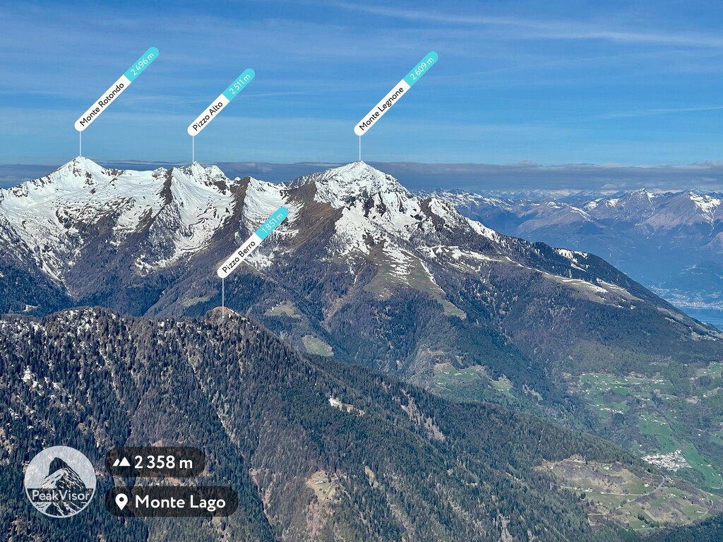
With regards to other nearby groups and ranges, the Bergamo Alps and Prealps are bordered by the Brescia and Garda Prealps to the southeast, the Adamello-Presanella Alps of the Southern Rhaetian Alps to the east, the Sobretta-Gavia Group of the Western Rhaetian Alps to the northeast, and the Bregaglia Range and Bernina Range to the north.

Thanks to its proximity to Orio al Serio Airport, Bergamo, which is the main city of this region, the range itself is well connected to national destinations and other European countries. For this reason, the region has seen a great increase in both domestic and international tourism in recent years.
The fastest way to get here by land is from the other major cities of the province, such as Milan (57 km / 35.4 mi, 1:10 hours by car). You can also get here from Como (87 km / 54 mi, 1:15 hours by car) to the west and from Brescia (53 km / 32.9 mi, 45 minutes by car) to the east.
However, when traveling through the region, keep in mind that the Bergamasque Alps and Prealps is a vast area of about 83 km (51.5 mi) in length from north to south between Bergamo and Morbegno.
Getting from west to east across the range is fairly difficult as it is a journey of about 130 km (80.7 mi) from Varenna on Como Lake to Lovere on Iseo Lake via San Pellegrino Terme, Passo di Zambla, and Clusone.
You can read more about how to get around the range in the guide to Lombardy.
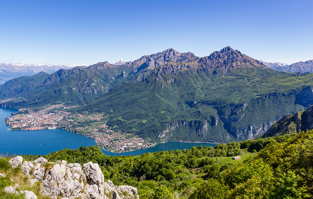
The Bergamasque Alps and Prealps are an enchanting area that’s surrounded by valleys where the sweetness of nature alternates with the wild spirit typical of the Alps.
The range includes several large mountain subranges, the longest and most famous of which stretches from west to east in the northern part of the mountain region from Como Lake to the Camonica Valley.
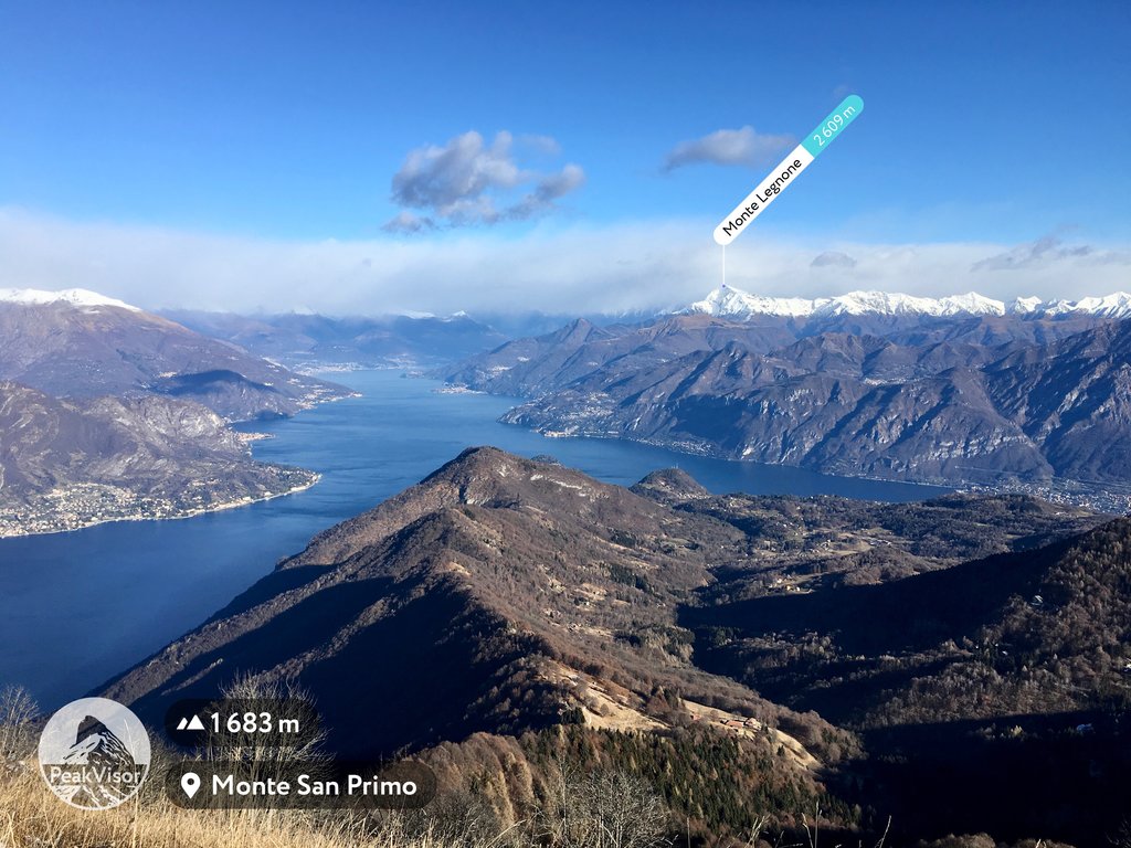
This area is also home to the highest mountain in the range, Pizzo di Coca. However, it is located deep in the mountains, which is not easy to reach. For a slightly more accessible hike, check out the steep and also very prominent Monte Legnone on Comi Lake, which offers breathtaking views of the large chasms and lakes in the region.
In general, the environment of the Bergamasque Alps and Prealps is dominated by the huge Parco delle Orobie Bergamasche, which contains about 6,300 hectares (15,570 acres) of pristine forests and pastures.
It features extraordinary environmental richness and a wide variety of fauna and flora, all of which is easily discovered thanks to the convenient network of mountain huts located in the region.
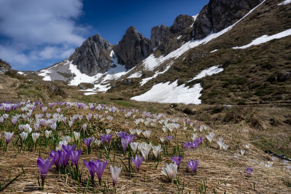
One of the main features of the park is the abundance of streams, creeks and rivers that make you marvel at the natural wonders every step you take. The Dezzo stream in Valle di Scalve and Enna stream in Val Taleggio are must-sees.
We should also note that the highest waterfall in the whole of Italy, the giant Serio Waterfall, is located near the village of Valbondione in the end of the Seriana Valley in the range. Its picturesque gorges carved into the rock over the centuries.
The Bergamasque Alps and Prealp is listed as range number 68 in the classification of the Eastern Alps of the German-Austrian Alpine Club, where it belongs in particular to the Western Limestone Alps, one of the four large subgroups of this part of the Alps. It is also one of the ten largest mountain ranges under this classification system.
The second widespread classification of the Alps, the Italian SOIUSA, categorizes this range in the Southeastern Alps subgroup, which is absent in the German-Austrian classification. It is part of the Eastern Alps in this system and is listed as number 29.
We can divide the Bergamasque Alps and Prealps into two subgroups:
The Bergamasque Alp are located on the northern border of the province, while the Prealps begin just outside the city of Bergamo. They are separated by the three largest and the most famous valleys in the province of Bergamo: Brembana, Seriana, and Camonica.
It is very important to know for navigation in these mountains that, according to the same SOIUSA classification, the Bergamasque Alps are further divided into Eastern and Western sections.
There are subgroups and ranges within these two sections. The main subgroups are listed below in their Italian names. Note that, in Italian, gruppo means group, sottogruppo means subgroup, catena means chain, node means junction, and costiera means coastline.

Eastern Bergamo Alps (Alpi Bergamasche Occidentali / Catena Telènek-Coca-Poris)
Western Bergamo Alps (Alpi Bergamasche Orientali / Catena Corno Stella-Tre Signori-Legnone)
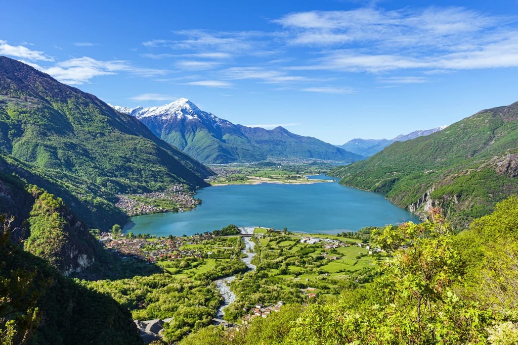
The Bergamasque Prealps are divided into three parts from west to east (vice-versa): Western, Central, and Eastern:
Western Bergamo Prealps (Prealpi Bergamasche Occidentali / Catena Campelli-Resegone-Grigne
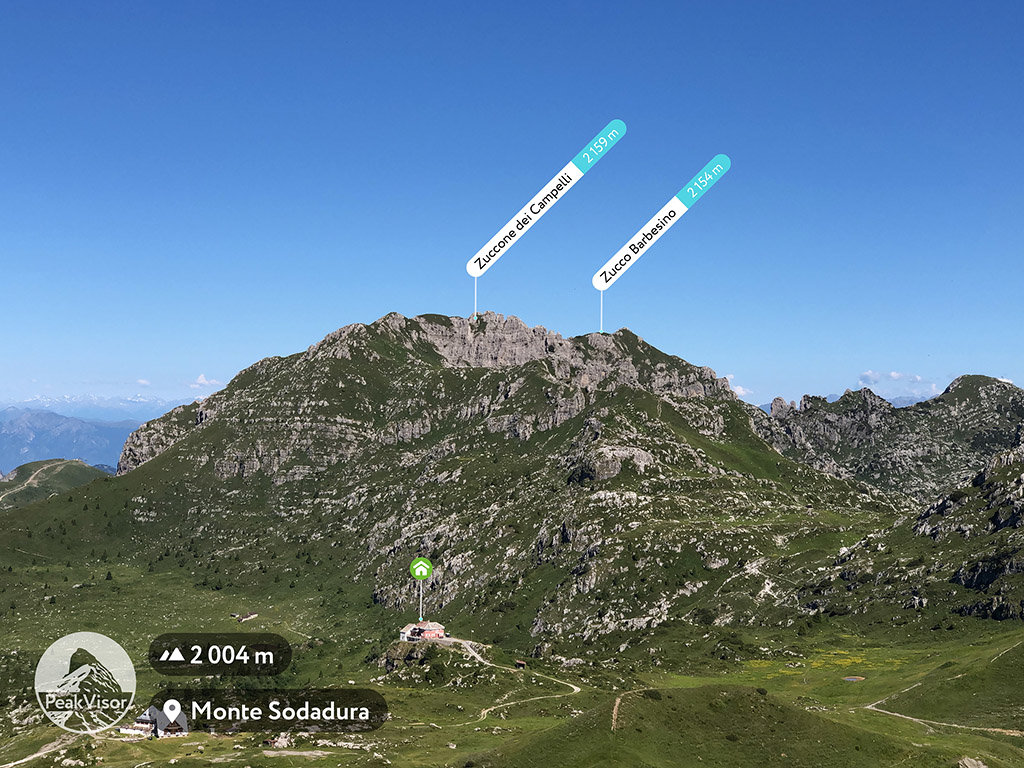
Central Bergamo Prealps (Prealpi Bergamasche Centrali / Catena Arera-Alben)
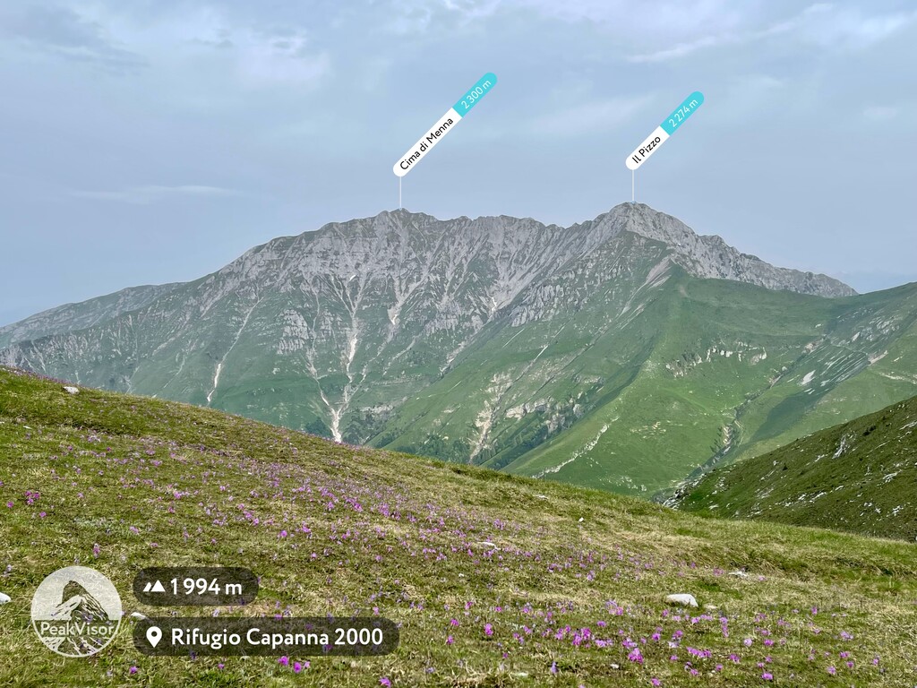
Eastern Bergamo Prealps (Prealpi Bergamasche Orientali / Catena Presolana-Pora-Concarena)

The highest and most prominent mountain in the range is famous Pizzo di Coca at 3,050 m (10,013 ft) in elevation and with 1,878 m (6,161 ft) of prominence. The peak is one of 199 ultra-prominent mountains in Europe.
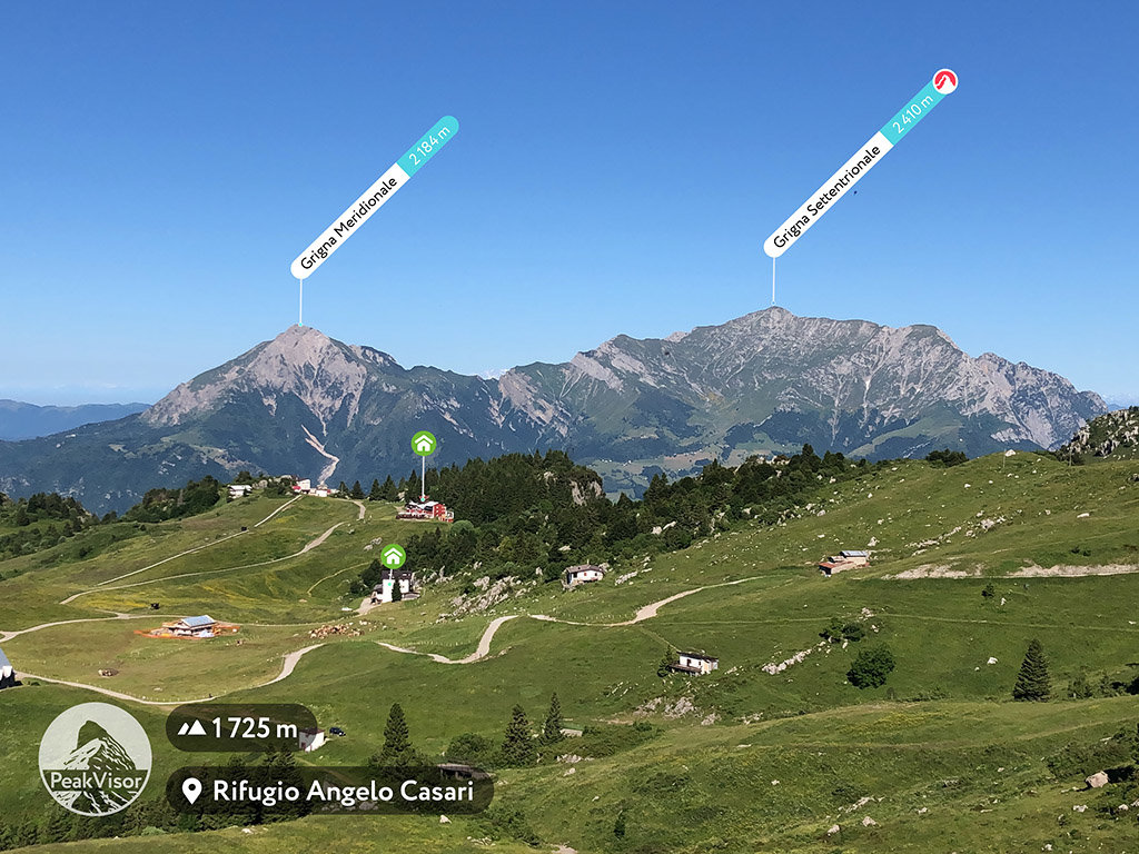
Despite its relatively modest elevation, Grigna (2,410 m / 7,906 ft) is another ultra-prominent mountain in the Bergamasque Prealps (1,687 m / 5,534 ft of prominence). It is actually a mountain with two peaks: Grignone (2,410 m / 7,906 ft), which is higher, and Grignetta, which is slightly shorter (2,177 m / 7,142 ft).
The range also has a funnily named mountain called Pizzo dei Tre Signori (2,554 m / 8,379 ft), which translates as the Peak of Three Gentlemen. This name comes from the historical division of the area between the State of Milan, the Republic of Venice and the canton of Grisons in Switzerland.
Bergamo is a starting point for many trails, hikes, and climbs. Understandably, some of the most prominent modern day climbers live in the region and some of history’s most famous mountaineers are also from the area.
Up next, we’ll talk about two such climbers: a local climber from Bergamo and a Russian climber who found a new home in these mountains. These two climbers were not selected randomly. Rather, they were chosen because they’ve climbed the highest mountains on the planet together more than once.
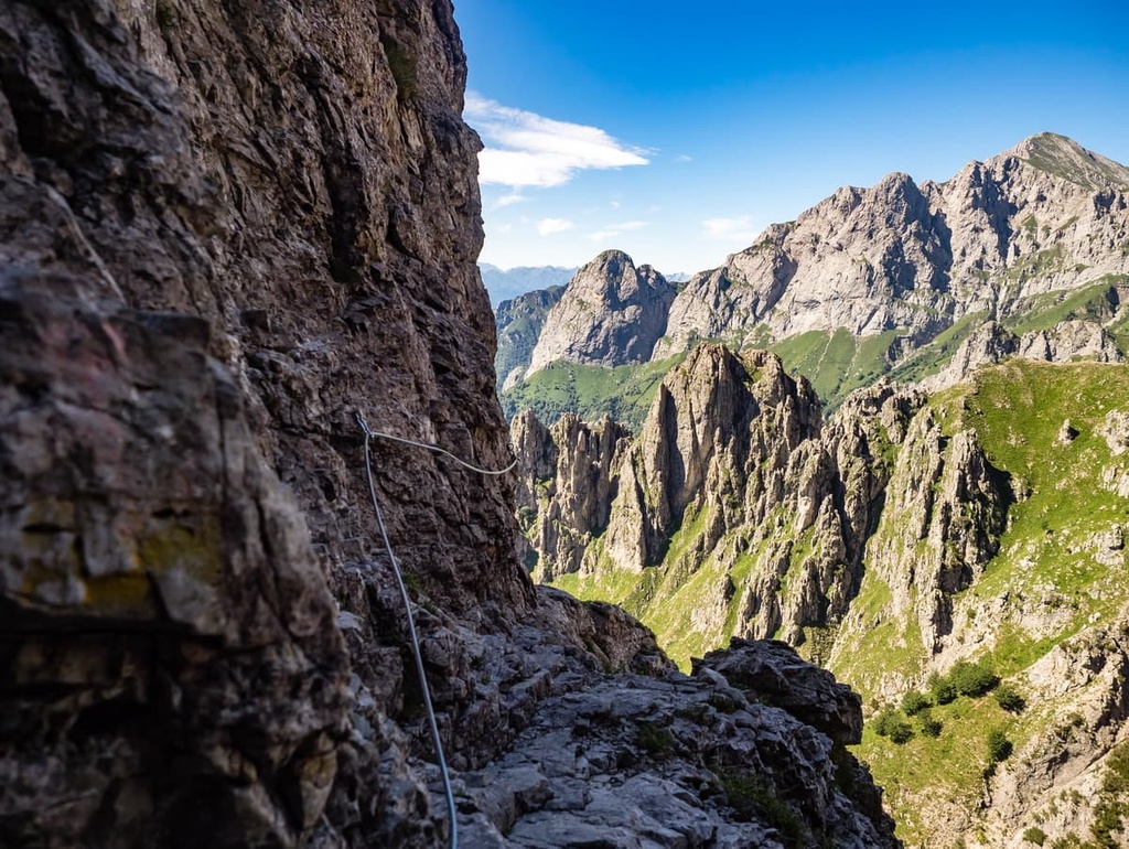
Italian climber Simone Moro (b.1967), was born in the borough of Valtese in Bergamo. He is a highly skilled alpinist whose passion has taken him to some of the most remote corners of the globe.
Among many other achievements, Moro has summited Shishapangma, Lhotse, and Everest (four times), opened a new route on Nanga Parbat, and even climbed Broad Peak in 29 hours.
His expeditions, he says, “combine the concepts of altitude, difficulty, solitude, uncertainty, adventure, and the unknown into a unique mountaineering project.” Moro is also an experienced helicopter pilot.
In 2013, Moro and two other rescue experts carried out the world’s highest long-line rescue operation on a helicopter, on Lhotse, at 7,800 m (25,590 ft). On November 12, 2015, he set a new flight altitude world record in a turboshaft powered helicopter (Category E-1a Max Takeoff weight less than 500 kg / pounds).
Moro is also deeply involved with charitable work. In 2009, he bought a helicopter with his own money to carry out SAR (search and rescue) operations in the Nepalese Himalayas for Nepalese people.
He has flown the helicopter several times to rescue alpinists, Sherpas, trekkers and people in remote areas. He also built a school for 396 Sherpa children in the Nepalese village of Syadul in 2003.
Denis Urubko (b.1973), also the unofficial holder of a “snow leopard” title, is a Russian-born alpinist-rescuer who loves toying with death, but judging by his successes, the risks are well calculated.
Urubko climbed all 14 peaks above 8,000 meters (26,246 ft) over the course of nine years (2000–2009), and all of the ascents were done without oxygen! Given that Urubko suffered from asthma in childhood, his no-oxygen climbs are even more incredible. He also climbed all five 7,000ers of the former USSR in just 42 days, which must have been one heck of a summer in 1999.
Urubko was awarded the Golden Ice Axe of Asia prize four times and holds various other awards for his illustrious sports career. He teamed with Simone Moro to climb Lhotse, Everest, Marble Wall (in the Tian Shan), and the Pamir Mountains.
His extensive experience gave plenty of material for many articles and books on mountaineering. In 2016, he opened an international Urubko Camp to encourage young people to climb. The camp welcomes people from Europe and Asia. Urubko trains these new climbers, sponsors them, and organizes their trips into the mountains.
Other fun facts about Urubko include that when he was traveling in the Kodar Mountains in 1991 and just made a mistake with his navigation (which just proves how lucky we are to have apps like PeakVisor) as it was not clearly marked on the map.
Urubko was unaware about the mistake, he climbed up a difficult rock wall for about 2,600 m (8,530 ft) with a heavy rucksack on the back. Then, when he made it to the top, there was nobody from his team. Thus, he called it Sakhalin (similar to the name of an island in the Far East of Russia), a testament to the fact that it was a wild, remote, and lonely place.
When it comes to climbing all fourteen 8,000ers, only a few have done so without oxygen like Urubko, such as Reinhold Messner.. The famous Spanish climber Inaki Ochoa (1967–2008) used to say: “If you are using oxygen, you are not a climber, you are an astronaut, a scuba-diver, but not a mountaineer.”
It is interesting how Urubko’s climbing practice has evolved over the years. In his early years, climbing was an adventure, an exploration of the world around. Then he entered a ‘sport’ stage mainly devoted to testing his limits as a human. Now, Urubko preaches climbing as art, “you climb and explore the human soul and creative spirits inherent in any human. But mind you, this art intertwines with the first two stages, otherwise it is nothing but rant.”
The main hiking area in the Bergamasque Alps and Prealps is Parco delle Orobie Bergamasche, which is located in the heart of the range. But in total there are more than 30 regional and local nature parks and reserves in the area. You can learn about them in the guide to Bergamo province.
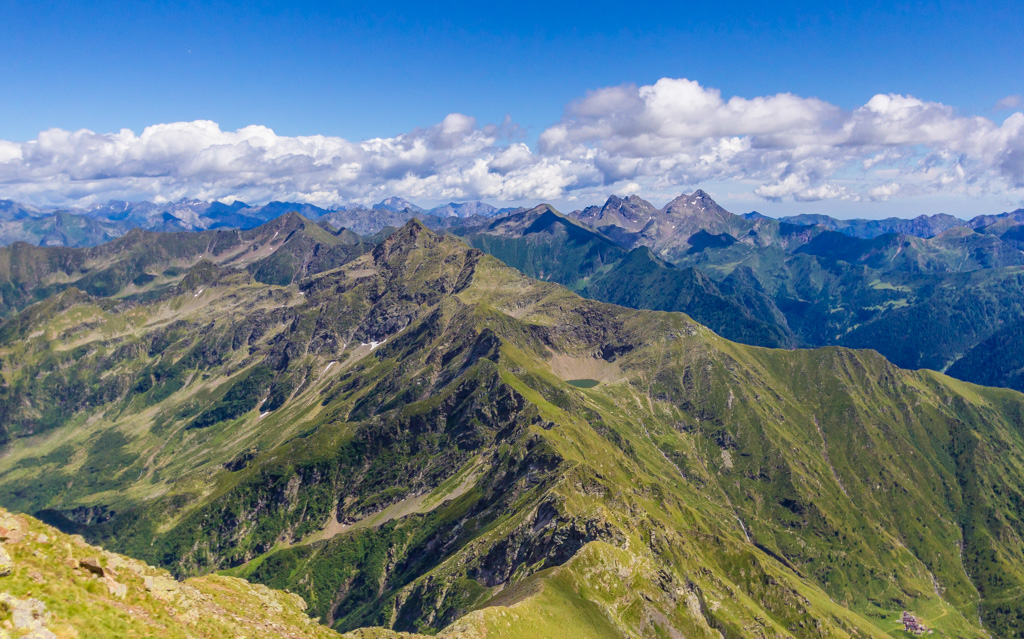
However, we should also mention Parco delle Orobie Valtellinesi (Orobie Valtellinesi Park), which is located on the northern slopes of the main Bergamasque Alps in the Valtelline Valley. It is considered a separate park despite its proximity to the aforementioned area.
Both within these parks and elsewhere, you can find a range of excellent hiking trails. Here’s a quick look at some of the best hiking routes in the Bergamasque Alps and Prealps for you to consider on your next trip.
This is an easy but long (about 20 km/miles) hike from the town of Albino to Bergamo through a series of small and picturesque Alpine villages that includes Selvino, Monte di Nese, Olera, and Monterosso. These towns are located at the foot of Bergamo Hills Park, where the trail ends.
Along the way, you will also climb several peaks, including Corna Bianca (1,228 m / 4,028 ft) and Il Costone (1,195 m / 3,920 ft). The route offers beautiful panoramic views of the park and the Padana Plain. Another of its features is the long (and even scary) cable car (15 minutes) from Albino to Selvino.
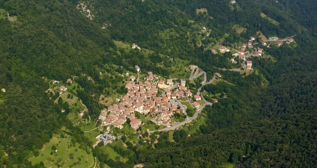
Bergamo Hills Park, including Canto Alto peak, from Il Costone mountain
According to many local hikers, this is one of the best routes in the vicinity of Bergamo. You can start either in Entratico in the Cavallina Valley or in the village of Cenate Sotto in a smaller side valley.
If you start in Cenate Sotto, the route goes through the Riserva Naturale Oasi WWF di Valpredina (Nature Reserve WWF Oasis of Valpredina). This trail will take you to the summit of the relatively low Monte Misma (1,161 m / 3,809 ft), which is nevertheless a great viewpoint.
From the top, you can see not only the city itself, the Seriana Valley, the Resegone and Grigna but also the entire main mountain range of the Bergamasque Alps and Prealps as well as the mountains on Lake Iseo and the distant Adamello-Presanella Group. In other words, this tail offers a lot of excellent scenery for such a casual hike that’s located so close to Bergamo.
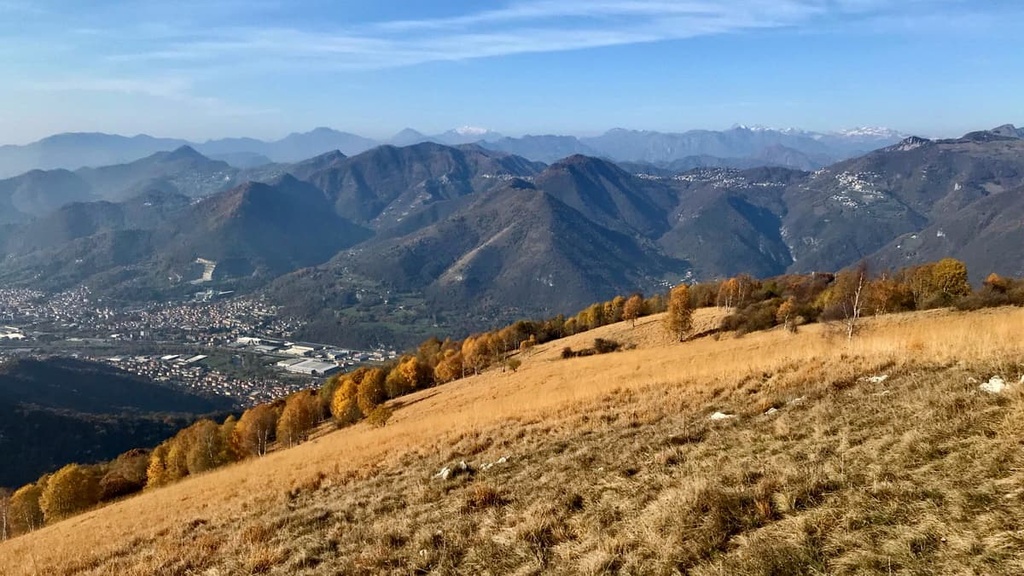
The Ornica—Pizzo dei Tre Signori is a route to the top of the Peak of the Three Lords (2,554 m / 8,379 ft). It was given this name because it stands at the junction point of the provinces of Bergamo, Como, and Sondrio.
This trail provides stunning views of the Brembana Valley and the surrounding mountains. You’ll begin in Ornica, and once you get to the summit, you can relax and cast your eyes across the expansive landscape below.
The Sentiero del Viandante (The Wayfarer’s Trail) is a long but relatively easy hike of about 40 km (24.8 miles) along the entire eastern shore of Lake Como—a great opportunity to see its most picturesque shores.
Along the way, you can set off on side trips into the mountains to get an even better view of the lake and of Monte Albiga (917 m / 3,008 ft). This shorter trail starts from the village of Varenna and involves about 600 m (1,968 ft) of climbing.

This hike is about 15–20 km (9.3–12.3 mi) long and it takes you into one of the three main valleys north of Bergamo, the Imagna Valley. It is considered less touristy than the neighboring Brembana Valley.
At the beginning of the route, there is a picturesque bridge over the Brembo River, Ponte di Attone, which is located in the municipality of Almeno. In the middle of the trail, you’ll make an ascent of Monte Ubione (895 m / 2,936 ft) and then spend the night at the bivacco Monte Ubione.
The trail ends at the large village of Berbenno, which is a popular gathering place among local cyclists.
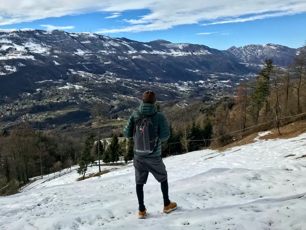
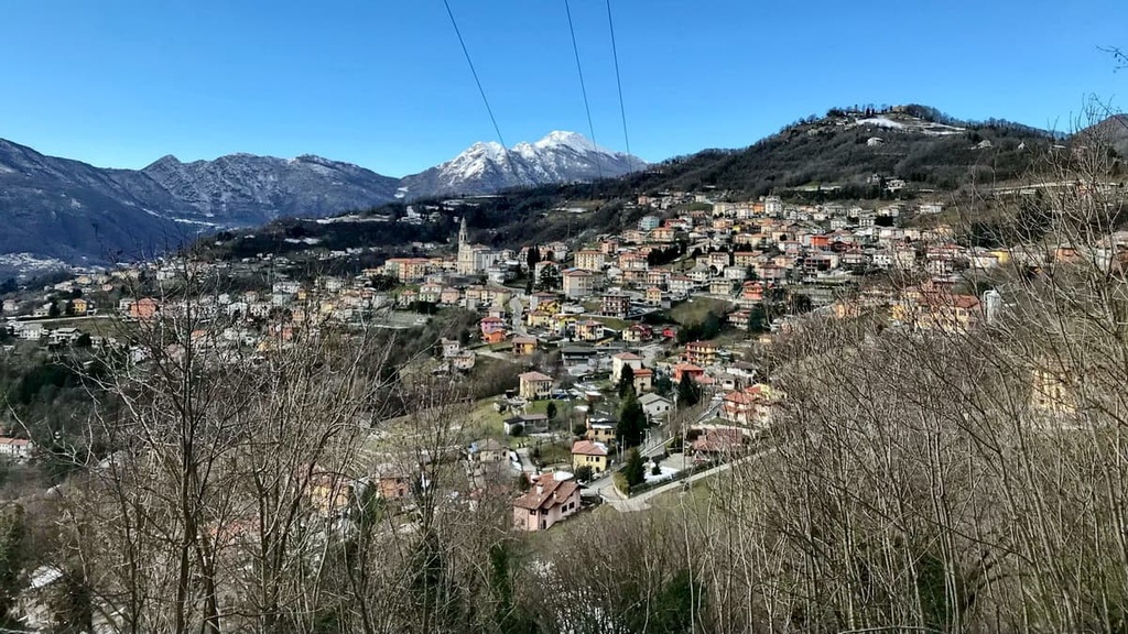
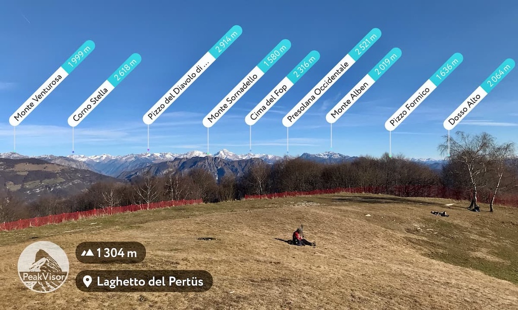
This is another casual day trip through the Imagna Valley that takes you along the ridge separating the province of Bergamo and the province of Lecco. It also brings you to the small but picturesque Lake Pertüs on the pass of the same name.
From the ridge, you have a panoramic view of the valley, of Lake Como, and of the distant peaks of the Alps, among which with PeakVisor you can even see Piz Bernina (4,048 m / 13,280 ft), the highest peak of the Eastern Alps.
From the pass, continue to Monte Tesoro (1,431 m / 4,694 ft) and Passo Valcava for even more great views. The route can also be done in the opposite direction.
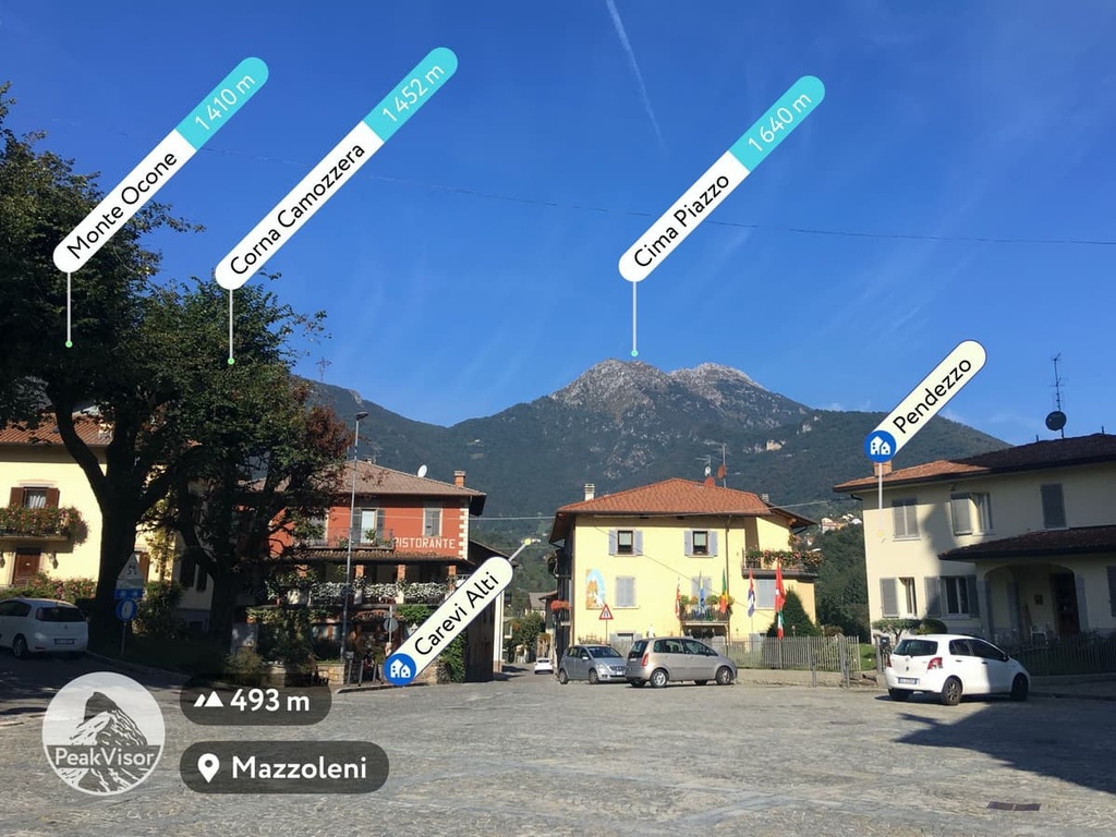
This is another scenic route in the Imagna Valley from the remote village of Fuipiano at the top of the valley. It takes you through the alpine meadows of Costa del Palio to the summit of Monte Resegone (1,875 m / 6,151 ft) and to the small remote village of Brumano.
The main feature of the route is its remoteness. In fact, from this side, there are substantially fewer people climbing the Resegone than from Lecco.
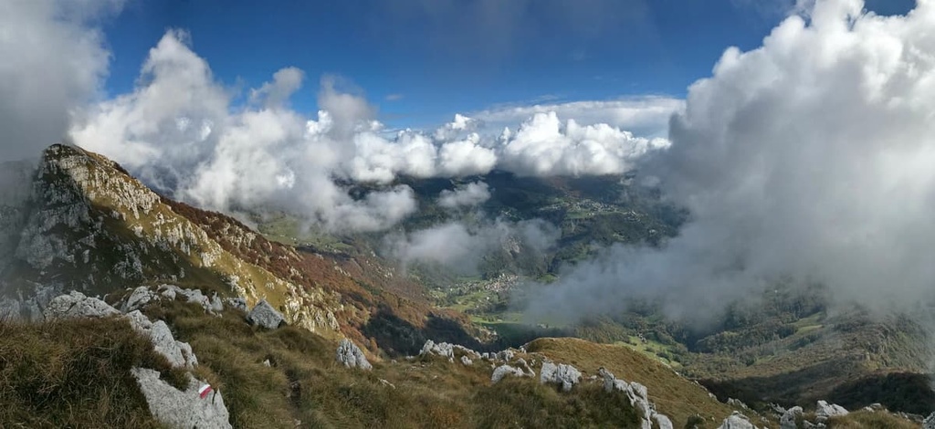
Want to travel through three valleys in one day? With the Valle Imagna—Valle Brembilla—Valle Brembilla, you can!
This route begins in the Fuipiano Valle Imagna and goes to Valle Brembana via Pizzo Grande (1,574 m / 5,164 ft) at the top of Valle Brembilla. Alternatively, you can go from Berbenno in Valle Imagna via Pizzo Cerro (1,285 m / 4,215 ft) and rifugio Lupi di Brembilla at the bottom of Valle Brembilla.
In any case, scenic views are guaranteed with good weather on this route. The photo below is a view of Monte Ubiale (972 m / 3,188 ft) in Val Brembilla.
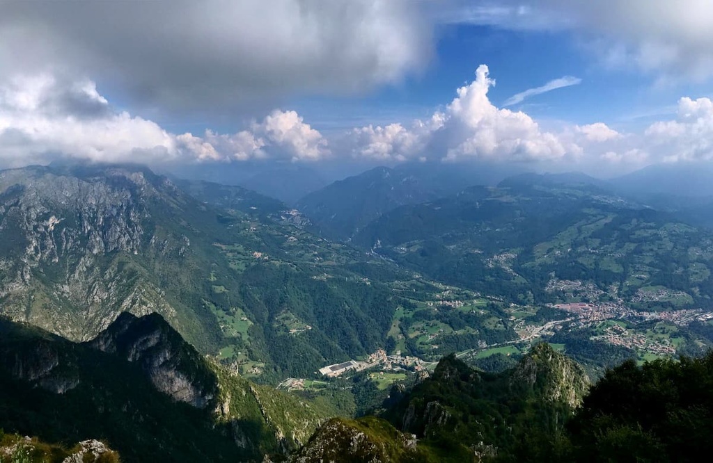
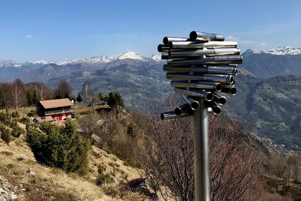
If you are coming from the city of Bergamo, you can easily find the mountain path No. 108 from Cusio or No. 107 from Ornica. Both of them lead to path No. 101 to Salmurano Pass.
Close to the rifugio Cesare Benigni, you’ll also find a tiny bright lake called Piazzotti. It is a body of azure blue water set between large boulders with an extraordinary view of the Central Alps and the Orobie. Cima di Valpianella (2,349 m / 7,706 ft) is also located just a mere 15 minutes walk from the mountain hut, so it’s worth checking out if you’re in the area.
Piazzatorre village is also known as the “Pearl of the Alta Val Brembana” because it’s one of the most wonderful places both in winter and summer.
If you are a mountain explorer, it is a perfect place to visit as it contains several hiking trails for visitors to enjoy. Furthermore, it’s quite common to see beautiful chamois and roe deer while trekking in the area from Passo di Monte Colle to Monte Secco (2,266 m / 7,434 ft) or from Piazzo to Laghi Gemelli.
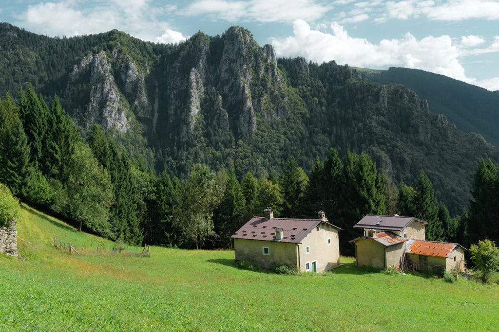
Among the dozens of hikes in the Upper Brembana Valley, this one stands out because it takes you from the village of Piazza Brembana to the ski resort of Foppolo via the village of Isola di Fondra.
From there, you can cross either Dordona Pass or Tartano Pass to reach the Valtellina Valley through the smaller valleys of Val Madre and Val Tartano. This was the same path that people used over centuries to mine for valuable resources in the region.
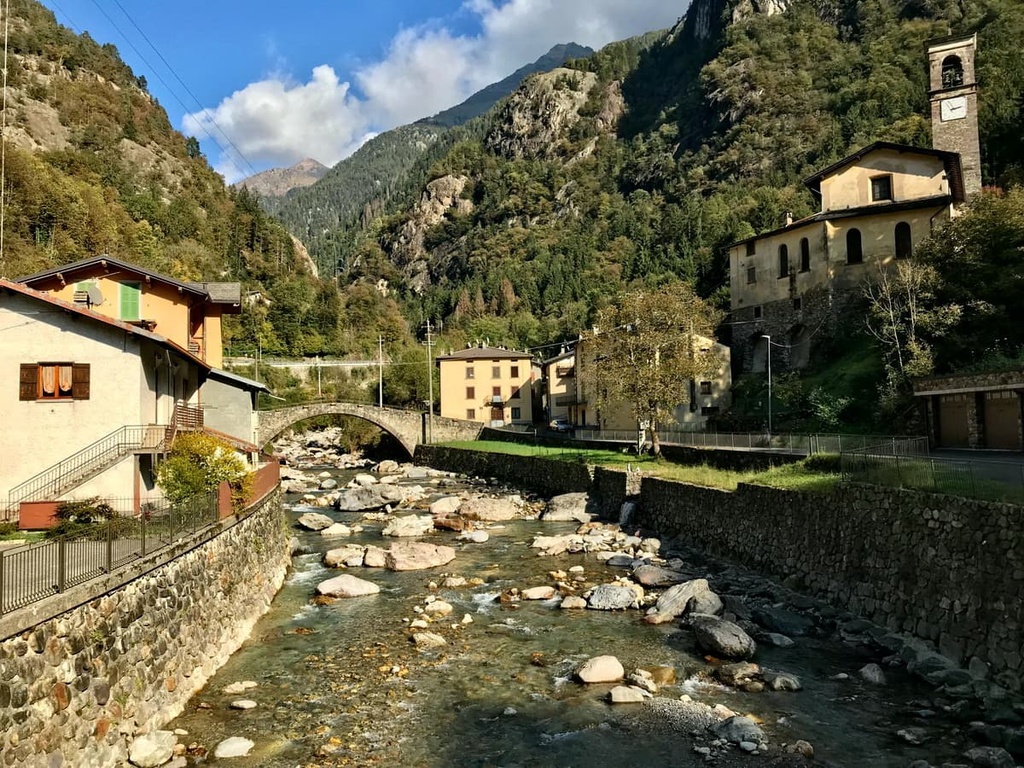
In our opinion, this is the number one route of all those described in this article. It runs in the very heart of the Bergamo Alps Park through a series of artificial (but incredibly beautiful) lakes, including Lago Piano Casere, Lago Colombo, Lago di Aviasco, Lago Nero, Lago Campelli, Lago Sucotto.
This route also takes you to see a handful of peaks around the lakes, such as Pizzo del Becco (2,506 m / 8,821 ft), Pizzo Farno (2,506 m / 8,821 ft), Pizzo Pradella (2,626 m / 8,615 ft), Monte Cabianca (2,601 m / 8,533 ft), Monte Madonnino (2,502 m / 8,208 ft).
The route begins in Branzi, also in the upper part of the Brembana Valley. After Laghi Gemelli, you’ll head to Monte Aviasco (2,408 m / 7,900 ft) before summiting Pizzo Torretta (2,543 m / 8,343 ft) and Monte dei Frati (2,500 m / 8,202 ft) next to it.
You’ll then finish the route in Gromo or Ardesio at some great family hotel or B&B. You can then relax after your amazing hike and eat casoncelli alla bergamasca for dinner—one of the main dishes in the province of Bergamo. It is a pasta stuffed with a mixture of bread crumbs, eggs, ground beef, and salami or sausage with a lot of Parmesan cheese and local olive oil on top. What’s not to love?
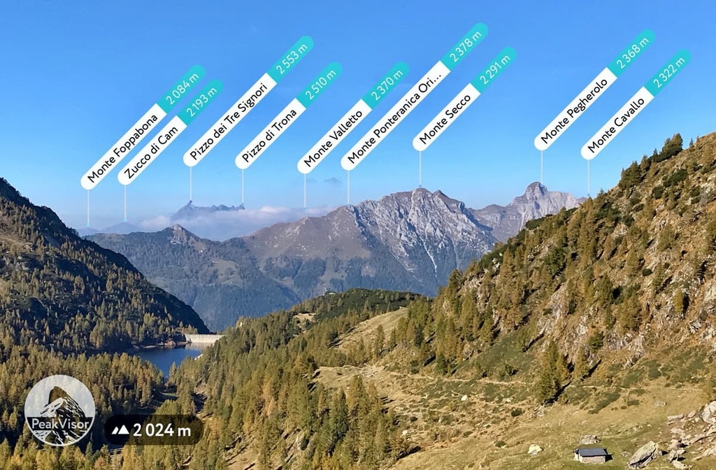
This is the trail to Pizzo del Diavolo di Tenda (2,914 m / 9,560 ft), the highest peak of the Brembana Valley.
This route is only recommended for expert hikers due to its rugged terrain. You’ll start the hike from Carona where there are three different trails leading to the mountaintop.
The ascent takes about 4 and a half hours through the Via Normale trail (Normal Route—the easiest path to the summit). The first part of the trail proceeds to rifugio Longo and goes to the dam of Lake Diavolo before reaching Selletta Pass and Valsecca Pass.
Here, you’ll find the spring of the Brembo River. Until this point, the path is quite casual, however it will eventually become steeper. You’ll also soon reach the intersection of three trails and you’ll need to get on the Via Normale to continue your ascent. Another option is to reach the peak by climbing up Mount Diavolino (2,810 m / 9,219 ft), a minor summit of Pizzo del Diavolo that follows a more difficult, albeit more direct route.
It is hard to find Endine Lake on the map of the Bergamasque Alps and Prealps compared to Como and Iseo lakes, but if you manage to do it, it’s worth visiting, especially if you’re traveling with kids.
You can easily enjoy a half-day walk or bike ride around the lake and picnic in Parco Biali near the village of Monasterolo del Castello on the eastern shore of the lake. This is also a great place to go birdwatching for loons, herons, and ducks. In summer, you can swim in the lake, though there aren’t many good beaches in the area.

This is a magnificent route in the southwestern part of Lake Iseo from the town of Sarnico to Tavernola Bergamasqa. It takes you to the highest local mountain, Bronzone (1,334 m / 4,376 ft).
Like Monte Misma, the summit of Bronzone offers a great panoramic view of the Bergamasque Alps and Prealps, as well as of Lake Iseo itself.
It’s best to hike this trail in spring or summer, when the daylight hours are longer, so you can make it all the way before dark. Or you can sleep overnight at rifugio Gombo Alto after descending from the summit.
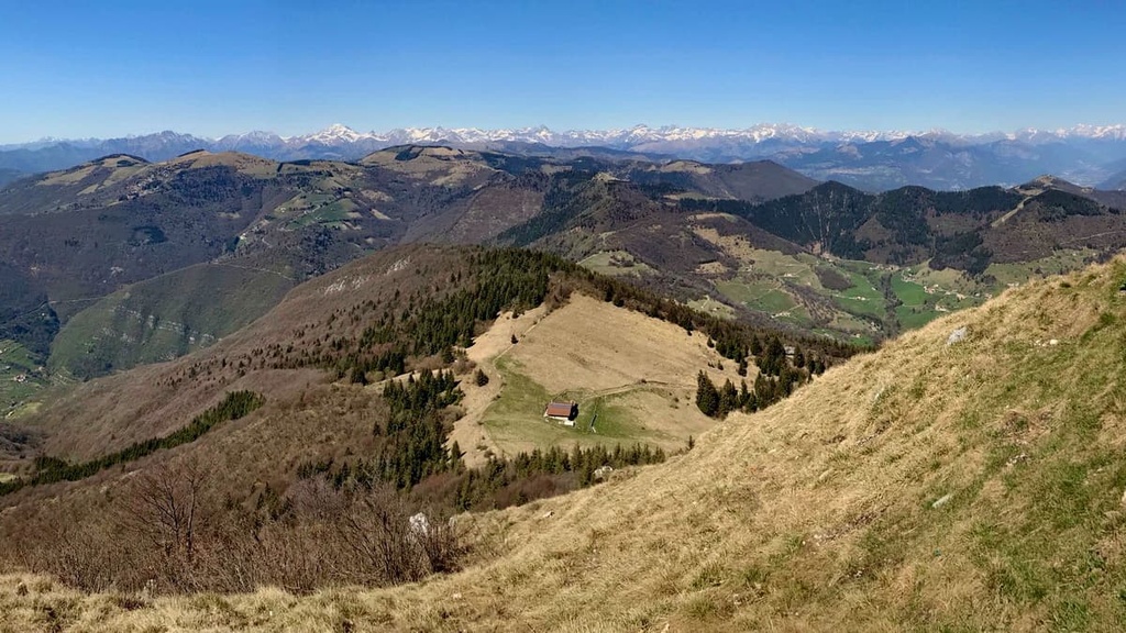
This is another good route in the region that you can follow to the northern part of Lake Iseo from Lovere, which is listed as one of the most beautiful villages in Italy (Borghi più belli d'Italia).
This hike takes you to Monte Colombina (1,458 m / 4,783 ft) and the spruce forests of the Parco dell’Alto Sebino on the high plateau in the village of Bossico. The route can be extended to two days, going on to Monte Alto (1,719 m / 5,639 ft) with an overnight stay in rifugio Pian De La Palù or rifugio Magnolini near it. The route can be done even in winter if there is not much snow. You can also follow the path to return to Camonica Valley.

From this pass in Val Seriana, there are a few easy trekking paths, which are perfect for families and for anyone that wants an easy-going half day out with friends to enjoy the mountainous terrain.
The two best-known routes in the region lead to baita Cassinelli (Cassinelli Hut) and baita Cornetto (Cornetto Hut). They both give you the chance to get closer and have a privileged view of Mount Presolana (2,511 m / 4,957 ft), which takes on a wonderful pinkish color at sunset, just like the Dolomites.
There are dozens of small, medium and large ski areas and resorts in the Bergamasque Alps and Prealps, which makes it a good choice for winter sports enthusiasts.
The most popular places, which are located within the mountain range or right on its borders, are Colere, Lizzola, Presolana, Monte Pora, Spiazzi di Gromo, Foppolo, Piani di Bobbio, Carona, Pescegallo, Aprica, Borno Monte Altissimo, Schilpario, Selvino, Oltre il Colle, San Simone (Brembo Ski), and Piazzatorre.
If you want real-time information about the ski areas in the range, check out the World Mountain Lifts page for Italy and the Lombardy region.
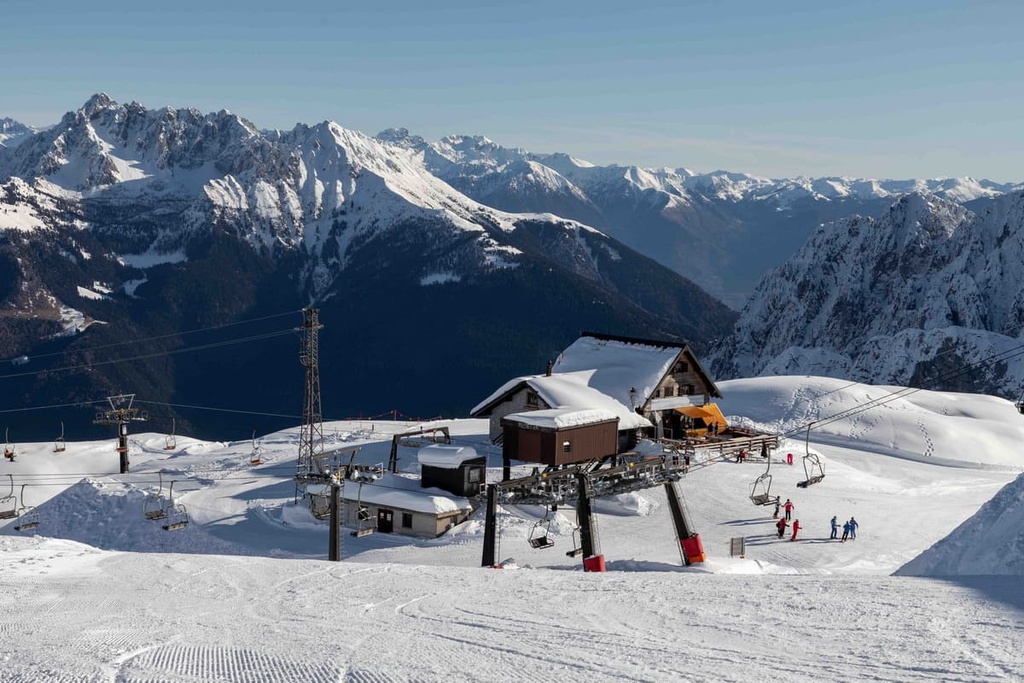
If you need information or help during your travels to the Bergamasque Alps and Prealps, head to one of the Visit Bergamo information points. These are located at Bergamo Airport and in the city of Bergamo.
Info Point Aeroporto di Bergamo
Aeroporto Orio al Serio, via Aeroporto, 13, Bergamo, BG, Italy
+39035320402
Opening Hours:
Ufficio I.A.T. Bergamo—Città Bassa
Piazzale Guglielmo Marconi (Bergamo train station square), 24122, Bergamo, BG, Italy
+39035210204
Opening Hours:
Ufficio I.A.T. Bergamo—Citta Alta
13 Via Gombito, 24129, Bergamo, BG, Italy
+39035242226
Opening Hours:
Before your trip, be sure to check out the official VisitBergamo.net website. You can also visit In-Lombardia.it for additional information.
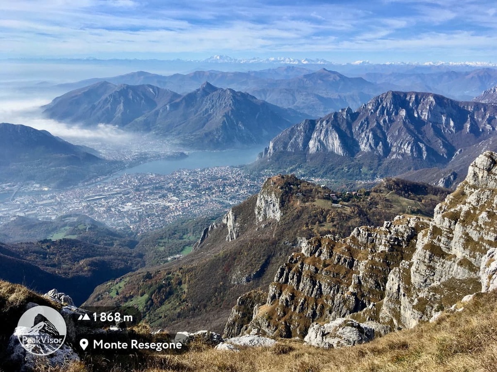
The areas inside and around the Bergamasque Alps and Prealps are very accessible for tourists. You can quickly find any type of accommodation that you’re looking for including luxury hotels, apartments, hostels, and mountain huts at any time of year.
If you want to spend the night in the mountains, there are three main types of accommodations that you should be aware of: huts, bivouacs, and campsites.
Here is a list of the main places mainly in the province of Bergamo, which occupies most of these mountains. You will also find similar huts, campsites, and bivouacs in the provinces of Lecco, Sondrio and Brescia.
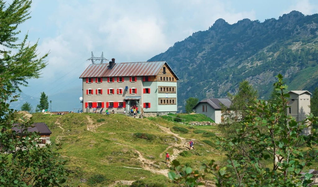
For any further information about accommodation, visit the official websites of Bergamo, Lombardy, or of the numerous outdoor associations in the region, like CAI Bergamo.
Additionally note that most mountain huts in the Bergamo Prealps are open throughout much of the year. On average, rifugios in the area are open from about March-April to December.
This makes these mountains very different from the Dolomites, for example, where the huts are open strictly from June 21 to September 21.
This is due to the warmer climate and lower elevation of the region. In other words, you can hike here at low elevations even in winter, including mountains as high as 2,000 meters (3,280 feet). This is also facilitated by a fairly high average temperature of about 5 degrees Celsius (41 degrees Fahrenheit).
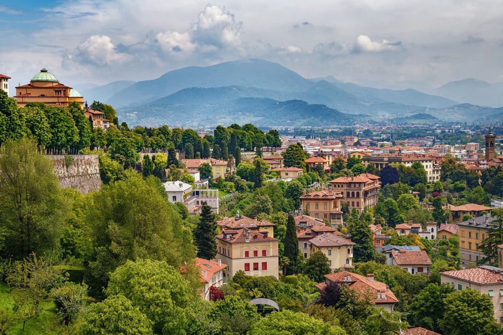
Bergamo, which gave its name to these mountains, is the main city and center of all activities in this area.
Located at the edge of the Lombard Plain, at the junction of the Brembana and Seriana valleys, with a population of just under 120,000 people and covering only 40 sq. km (15 sq. mi), this quaint little city has surprisingly a lot to offer. Bergamo is also one of the most interesting cities in Lombardy thanks to its strong economy and rich cultural heritage.
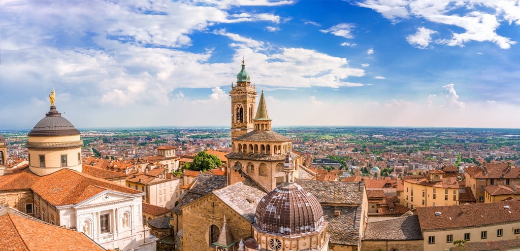
The city is neatly divided into two parts: Bergamo Bassa (249 m / 816 ft), which is flat, modern and lively; and Bergamo Alta (365 m / 1,197 ft), which is hilly, and features many Medieval structures.
However, there are many more towns and resorts in the range besides Bergamo. Here’s a quick overview of the main towns and resorts in the range, categorized according to their relative location:
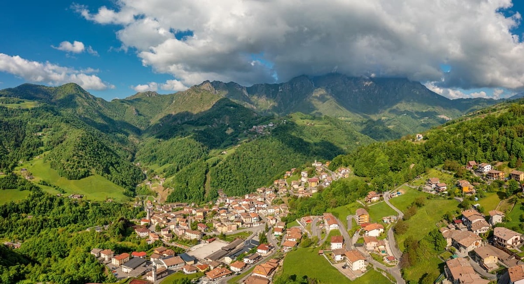
However, the size of the city is not necessarily an indicator of its popularity or attractions.
For example, the longest trail in the Bergamo Alps, Sentiero Orobie, starts and ends in the small town of Ardesio in the Seriana Valley. From there, it is possible to walk in one day to both the famous lakes in the center of the Bergamo Alps and the Presolana massif. Additionally, the Camonica Valley has no large settlements at all, but there are several archeological parks with cave paintings that are worth checking out.
For more information, head to the region’s official tourist website: VisitBergamo.net.
Explore Bergamasque Alps and Prealps with the PeakVisor 3D Map and identify its summits.
