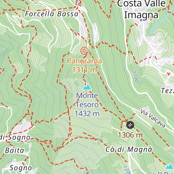
The Monte Tesoro is a summit of the Bergamasque Prealps. It is 1,432 metres above sea level and is located in the municipality of Carenno on the mountain ridge that goes south from the Resegone towards the plains at the hills of Bergamo. It divides the valley of San Martino from the Valle Imagna between the passes of Pertus and Valcava, dividing, therefore the provinces of Lecco and Bergamo.
Its broad summit is easily accessible from several fronts.
A road from the Valle Imagna, ends at Forcella Alta, 1,300 m asl, just a 20-minute walk to the top.
From the main road at the Valcava pass, by a trail that starts from Combeli at about 1,300 m asl and that reaches the summit along the broad southern ridge.
From the San Martino valley the trail starts at Boccio in the town of Carenno, and rises through the vast forests of the western slope.
Lastly from Colle di Sogno in the town of Torre de' Busi, the most "alpine" of the trails, however easy, along the sunny south-west slope, almost devoid of tree cover.
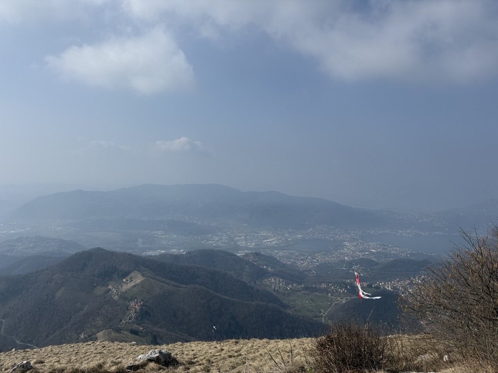
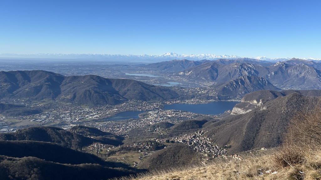
The summit offers an excellent view, especially over the Adda river valley, on the nearby plains and on the Bergamasque Prealps behind which the Rhaetian Alps can be seen.
At the summit, there is a shrine with a 15-metre high metal cross erected in 1985 in memory of Italian soldiers killed in action.
There's a hiking trail (T2) leading to the summit. Monte Tesoro is one of the 9 peaks along the multi-day Dorsale Orobica Lecchese (percorso alto).
By prominence Monte Tesoro is
# 44 out of 608 in Bergamo # 15 out of 253 in Lecco # 61 out of 987 in the Bergamasque Alps and Prealps
We use GPS information embedded into the photo when it is available.
3D mountains overlay
Adjust mountain panorama to perfectly match your photos because recorded by camera photo position might be imprecise.
Move tool
Rotate tool
Zoom
More customization
Choose which peak labels should make into the final photo and what photo title should be.
Next
Photo Location
Satellitte
Flat map
Relief map
Latitude
Longitude
Altitude
OR
Latitude
°'''
Longitude
°'''
Apply
Register Peak
Peak Name
Latitude
Longitude
Altitude
Register
Teleport
PeakVisor
This 3D model of Sagarmatha National Park in Nepal was made using the PeakVisor app topographic data. The mobile app features higher precision models worldwide, more topographic details, and works offline. Download PeakVisor maps today.
Download OBJ model
PeakVisor
The download should start shortly. If you find it useful please consider supporting the PeakVisor app.
PeakVisor for iOS and Android
Be a superhero of outdoor navigation with state-of-the-art 3D maps and mountain identification in the palm of your hand!