
Scan the QR code and open PeakVisor on your phone
Bergamo is home to 622 named mountains. The highest is Pizzo Coca at 3,052 m.
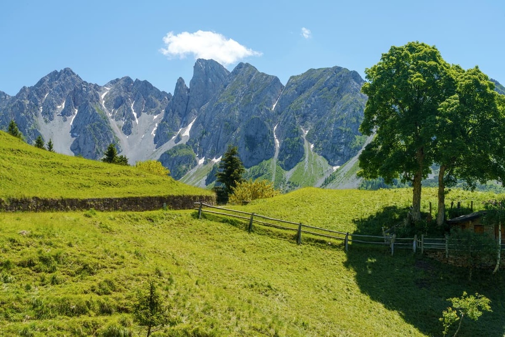
Bergamo is one of 12 provinces in the Lombardy region of northwest Italy. The main feature of the province is its mountainous terrain as it is dominated by the Bergamo Alps with their incredible wildlife and many hiking trails. The province’s capital, the city of Bergamo, is also noteworthy as it’s a UNESCO World Heritage Site that’s just a short distance from Milan. There are 622 named mountains in Bergamo, the highest and most prominent of which is Pizzo di Coca (3,052 m / 10,013 ft).
The name of the province of Bergamo comes from the name of its capital, the city of Bergamo, which is the largest in terms of geography, population, economy, culture, and so on.
According to one version, the word Bergamo comes from the Latin words Bergomum or Bergame, which means “citadel” or “fortress,” that is, a small town in the hills that’s surrounded by fortified walls.
According to other sources, the name of Bergomum is of pre-Roman origin and it comes from Bèrghem. This was the name of a settlement on the site of the modern city of Bergamo. It was created by a Celtic tribe called Cenomani before the arrival of the Romans in 49 BCE.
In modern German, the word ‘Bèrghem’ could roughly translate to “mountain house” from its components berg, meaning house and heim, meaning home. This version makes sense, considering also that the whole of Lombardy and most of Italy was conquered by a Germanic tribe called the Lombards after the fall of the Western Roman Empire by the year 476 CE.
Regardless of which version of the etymology of Bergamo is actually correct, they both reflect the essence of the place—a fortified settlement on high hills. By the way, Bergamo is located at an elevation of 249 m (817 ft), and it is, indeed, an old fortified city.
The province of Bergamo is located in the north of the region of Lombardy. It is the second-largest province, covering an area of 2,754 sq km (1,063 sq mi). It is smaller than its neighboring province of Brescia (4.785 sq km / 1.847 sq mi), which is located to the east.
Other provinces surrounding Bergamo include Sondrio to the north; Lecco, Monza and Brianza, and Milan to the west; and Cremona to the south.
In terms of geography, the province's borders are defined by natural features, including:

Throughout the rest of this guide, you’ll also hear from the founder of PeakVisor. Along with the Dolomites, the province of Bergamo and all of the region of Lombardy have played a crucial role in the creation and development of the PeakVisor app. As a result, PeakVisor’s founder has some unique insight into the region that you can’t find elsewhere.
Thanks to its proximity to Orio al Serio Airport, Bergamo, which is the main city of the province, is well connected to the rest of Italy and to other European countries. For this reason, both domestic and international tourism is on the rise in Bergamo.
The fastest way to get here by land from the other major cities of the province is from Milan (57 km / 34.1 mi, 1:10 hours by car ) to the southwest, Como (87 km / 54 mi, 1:15 hours by car) to the west, and Brescia (53 km / 32.9 mi, 45 minutes by car) to the east.
You can read more about how to get around the region itself, including the province of Bergamo, in the guide to Lombardy. For example, there are many bicycle paths along rivers and lakes that are well worth checking out.
The mountainous territory of Bergamo is characterized by steep peaks and deep valleys that gently subside to become the Padana Plain.
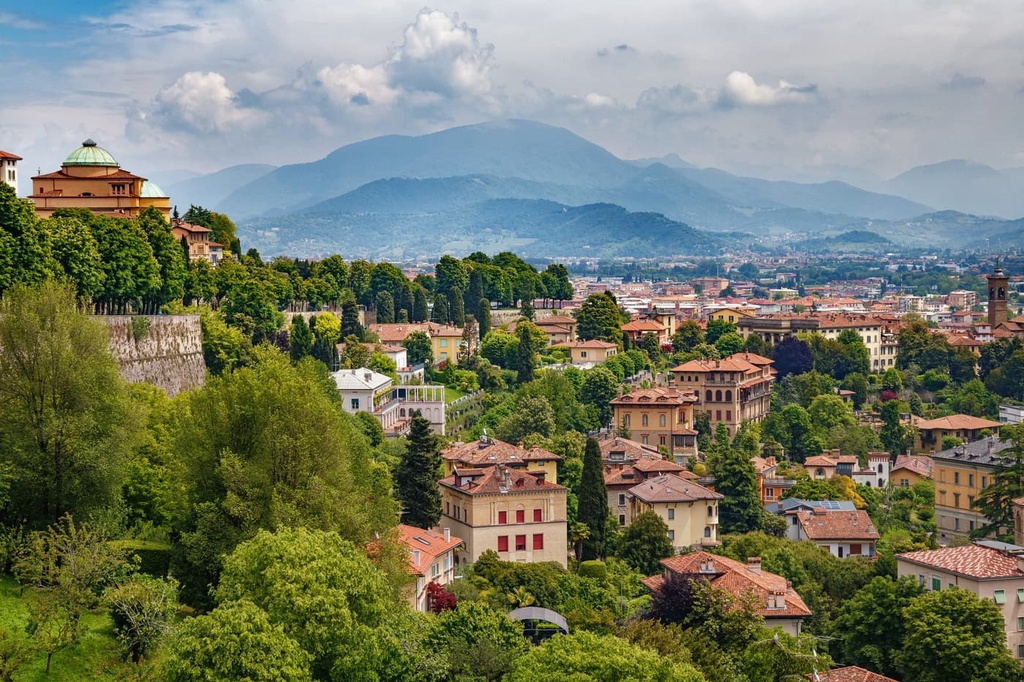
So, in general, the territory of the province is also characterized by frequent differences in elevation. In fact, Bergamo city itself is divided into two levels: Bergamo Alta (High Bergamo), which is the historic city center on a high hill that’s encircled by walls and that was built by the Venetians, and Bergamo Bassa (Low Bergamo), which lies on the flatland.
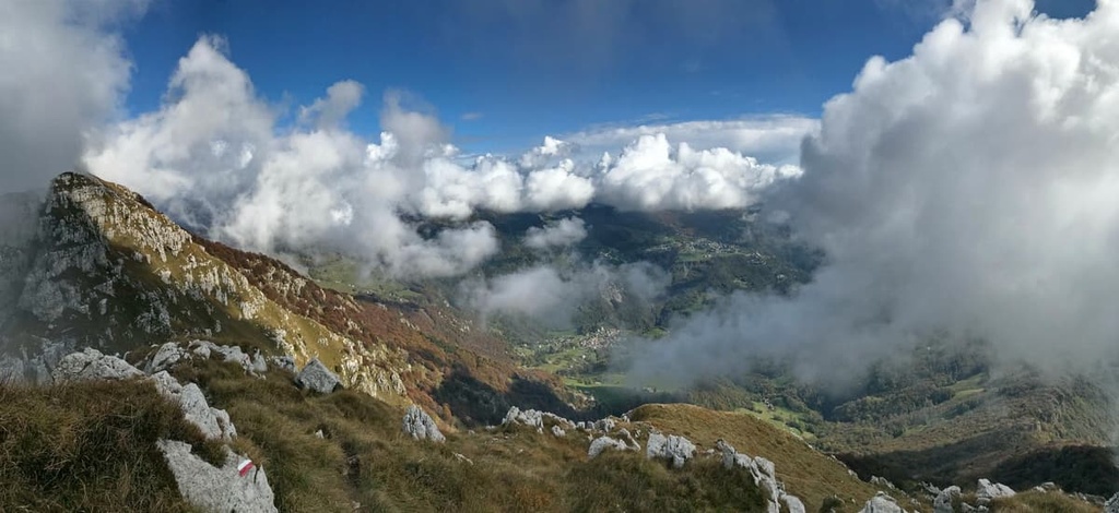
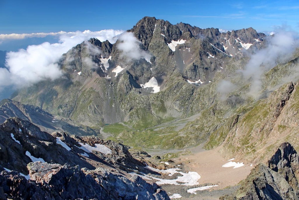
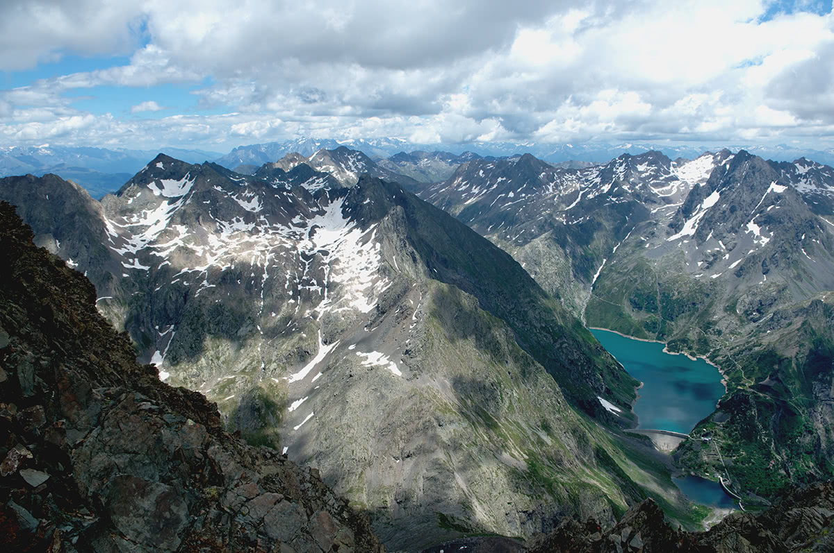
The province is blessed by the majestic presence of the Bergamo Alps, which extend for 80 km (50 mi) and are divided into two sections: the Bergamo Prealps and the proper Bergamo Alps.
The Bergamo Alps are also called the Orobie Alps (Alpi Orobie in Italian). They are separated from the Prealps by the Brembana Valley, Seriana Valley, and Camonica Valley.
The main feature of the Orobie Alps (Bergamo Alps) is the scarcity of passable routes in the region. This is due to the high elevation of the range’s passes, which are crossable primarily via narrow steep trails and mule tracks.
The only pass accessible by car is Passo San Marco (1,991 m / ft), which lies on an ancient road that was created by the Venetian Republic to connect the area with Switzerland.
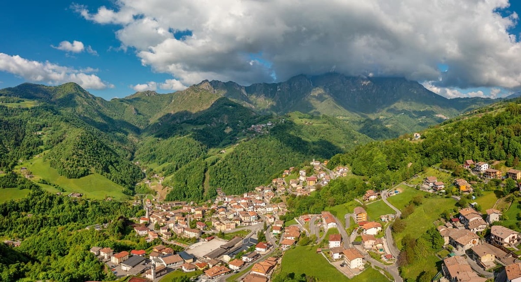
Another key feature of the province’s landscape is its large valleys. The main valleys in Bergamo include Imagna, Brembana, Seriana, Scalve, Calepio, Camonica, Sassina, Torta, Secca, Canale, Nembo, Paisco, Taleggio, and Presolana.
However, this list is not complete because there are more than 50 valleys in the entire province.
The abundance of water is another key feature of Bergamo.
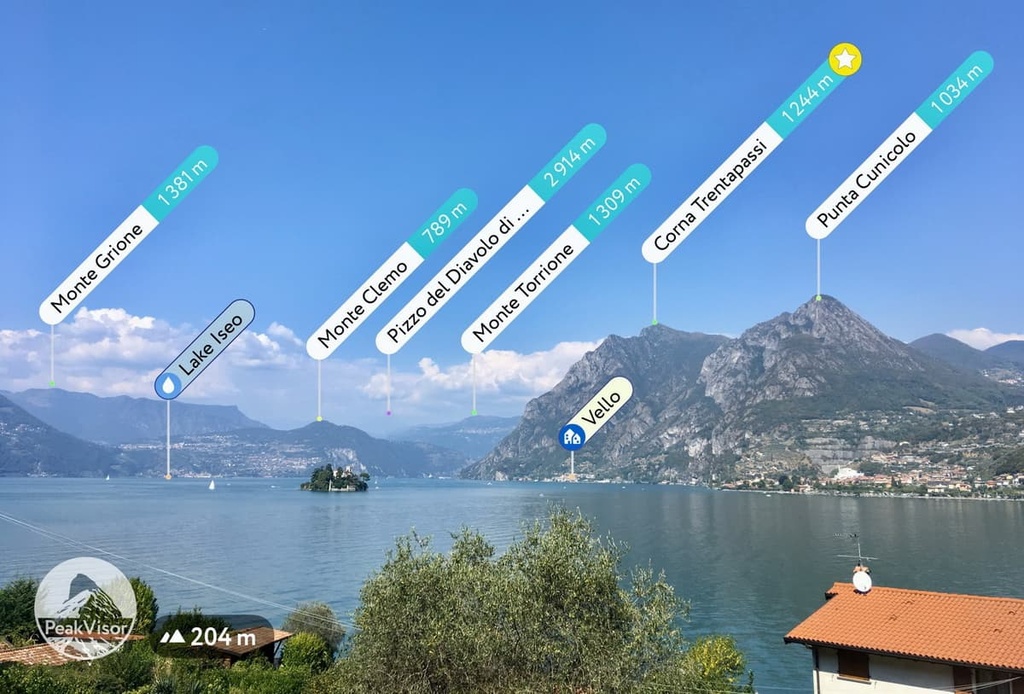
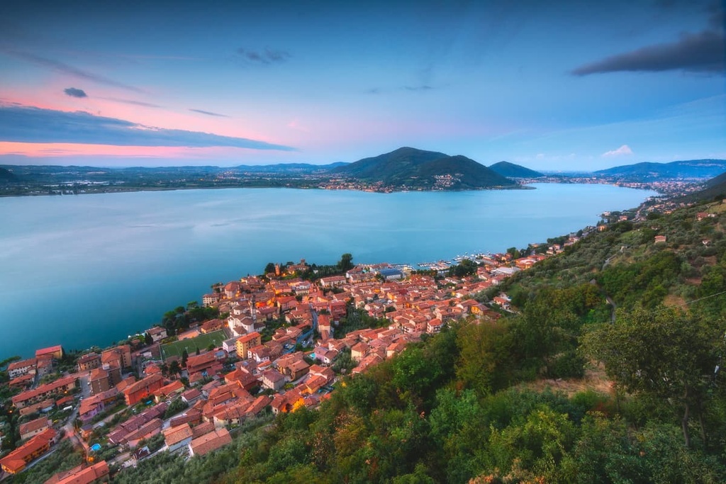
On the eastern and western sides of Bergamo, the province is bounded by the Oglio River and the Adda River, respectively which, together with their tributaries, the Serio and the Brembo, constitute the major water supply network of the area. The Oglio River in Cavallina Valley feeds the lake of Endine. The only water source for Iseo Lake is a tributary of the Oglio River.
In Bergamo, rivers and mountains have both played a pivotal role in the development of the province’s major communities.
The mountains were used as a source for iron and timber over the centuries. Wood from the province’s forests were used to produce charcoal and wooden artifacts to embellish the local churches. The textile, metal, and paper industries flourished along the major river banks in Bergamo and contributed to the strong development of the province.
Besides these resources, there are also numerous gorges and ravines in the Bergamo Mountains that create beautiful canyons that perfectly fit for paddling—like the one along the Nero River in Seriana Valley or Brembo Rive in Brembana Valley.
The province of Bergamo is also home to the tallest waterfall in Italy, the Serio Waterfall, which is located near the village of Valbondione. There are also mineral water springs and St. Pellegrino thermal baths in the province.
Last but not least, Bergamo used to be an area that was filled with glaciers, but the only one that survived on the Bergamasque side of the Orobie is the Trobio Glacier between Pizzo dei Tre Confini (2,824 m / 9,265 ft) and Mount Gleno (2,882 m / 9,455 ft).
The geology of the Bergamasque Alps and Prealps differs from that of other mountain ranges in the region.
A variety of geological processes have taken place in the region for 300 million years (and counting), starting in the Permian period, when a mountain complex similar to the contemporary Andes existed on the site of the current Bergamo Alps.
In the beginning, the geology of the region was influenced by strong volcanic activity. However, rocks found in the Orobie Alps include verrucano lombardo (Late Permian) and marine sediments like sandstones, marls (Lower Triassic), limestones, and dolomites (Middle Triassic). The most recent rocks in the region date back 30 million years and are of igneous origin.
The folding and overlapping or overcrossing of older rocks with more recent ones—mostly, in an east-west direction and in the central area of the range—is another interesting aspect of the Bergamasque Alps and Prealps.
Glaciers also have contributed to the modeling of the Bergamo Alps. During some periods in the past, these glaciers occupied most of the region, carving the bottoms of the valleys. In particular, the landscape of the largest valley in the province, the Seriana, with its steep slopes, was shaped by glaciers.
The province of Bergamo has an incredibly long and varied, but not always simple, human history. Here’s an overview of its most important moments:
The area that is now Bergamo and its adjacent regions have been inhabited since the Bronze and Iron Ages (3,300–332 BCE). This is evidenced by the more than 300,000 rock drawings left by the Camuni people, the ancient inhabitants of the Camonica Valley, which forms the eastern border of the province.
Later, in Antiquity, the Celtic tribe of Cenomani lived directly on the territory of the modern city of Bergamo.
The city and its people became part of the Roman Empire in 49 BCE. At that time, it was inhabited by about 10,000 people—just a fraction of today’s population of 120,000 residents. In the province today there are 1,115,000 people (2021), which is almost 12 times more than at the time of the Roman Empire.
Starting in the sixth century, Bergamo was part of the Kingdom of the Lombards (568–774), which was formed by Germanic tribes that had settled in Italy and took over not only the province but all of Lombardy and up to 80 percent of present-day Italy except for Rome, Sardinia, Sicily, and some other areas.
After that, from the eleventh century onward, Bergamo was an independent commune in the Lombard League, another provisional state formation.
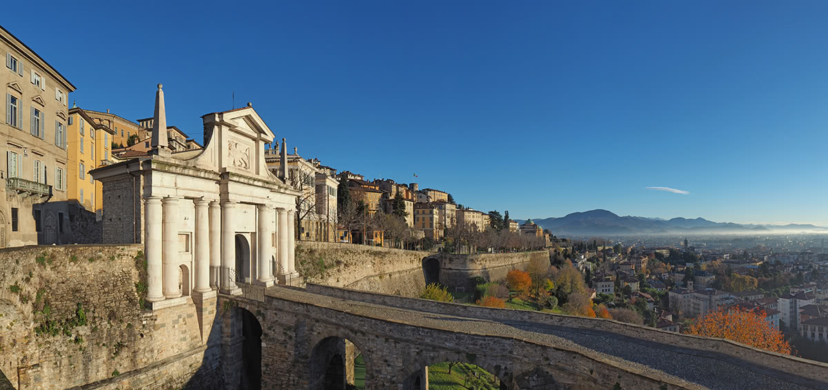
In 1428, an important year in the history of the province, Bergamo passed from the Duchy of Milan to the Republic of Venice. At the same time, the Venetians built the fortified walls around the Old Bergamo, which are now a UNESCO World Heritage Site.
During the twentieth century, Bergamo became a part of the new Republic of Italy, which was formed in 1946 and continues to exist to this day.
Today, as part of Lombardy, the province of Bergamo is one of Italy’s most populated, well-organized, and well-developed areas, where a huge variety of goods are produced.
Some of the many companies located in Bergamo include Italcementi, which is the world's second-largest cement producer, Itema, a textile producer for all types of clothes, and Bianchi, the most famous producer of Italian road bicycles.
At the same time, the province is known as a unique natural region, which makes it one of the centers of tourism in Lombardy. Bergamo is one of the cultural centers of the region. In particular, the provinces of Bergamo and Brescia have been declared cultural capitals of Italy for the whole of 2023.
The territory of the province is divided into roughly two equal parts: approximately one-third of the province is dominated by the Padana Plain and the rest is home to the Bergamo Alps, which are also known as the Bergamasque Alps (Alpi Bergamasche) or the Orobie Alps (Orobic Alps/Alpi Orobie).
The Bergamo Alps are range number 68 in the classification system of the Eastern Alps of the German-Austrian Alpine Club, where it belongs in particular to the Western Limestone Alps, one of the four large subgroups of this part of the Alps. It is the westernmost and also one of the ten largest mountain ranges in the Western Limestone Alps.
In this classification system, The Bergamo Alps are bordered by the Garda Mountains of the Brescia and Garda Prealps to the southeast, the Adamello-Presanella Alps to the east, the Sobretta-Gavia Group to the northeast, and the Bregaglia Range and Bernina Range to the north.

To the west of the Bergamo Alps, there are the Lugano Prealps and the Lepontine Alps which are part of the Western Alps in the SOIUSA classification system.
The second commonly used classification of the Alps, the Italian SOIUSA, places the Bergamo Alps in the subgroup of the Southeastern Alps and they are ranked as number 29.
In this system, the Bergamo Alps border the Brescia and Garda Prealps to the southwest, the Southern Rhaetian Alps to the northeast, and the Western Rhaetian Alps to the north.
The SIOUSA system further divides the range into two subgroups, including:
The Bergamo Alps are located on the northern border of the province, while the Prealps begin just outside the city of Bergamo.
It is very important to know for navigation in these mountains that, according to the SIOUSA system, the Bergamasque Alps are further divided into eastern and western subranges, and the Bergamasque Prealps are divided into easter, wester, and central subranges.
Here’s a look at how the peaks of Bergamo are organized according to the SIOUSA system. We’ve also included some of the notable peaks in each subrange for your reference.
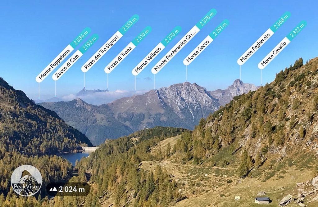
Bergamo Alps (Alpi Orobie): Pizzo Coca (3,050 m / 10,006 ft), Pizzo Redorta (3,038 m / 9,668 ft), Pizzo di Scais (3,038 m / 9,967 ft)
Bergamo Prealps (Prealpi Orobie): Concarena (2,549 m / 8,362 ft), Presolana (2,521 m / 8,270 ft), Pizzo Arera (2,512 m / 8,241 ft)
Keep in mind that each of these five subgroups in these two ranges of the Alps and Prealps is divided into many more sub-subgroups.
Hikers, climbers and other outdoor enthusiasts who approach the Bergamo Alps for the first time may feel lost when it comes to planning a trip because they find themselves spoilt for choices.
In total, there are more than 30 different hiking areas in the province, most of which are located in large regional nature parks, small local parks, nature reserves, and the like.
The largest nature park in the province is the Parco delle Orobie Bergamasche (Orobie Bergamasche Park) which is located in the heart of the Bergamo Alps and covers 688.98 sq km (sq mi) of land. However, a proper trip through the park requires at least a few days of free time, which not all visitors have.
A good alternative to Orobie Park is Bergamo Park Hills Park (Parco dei Colli di Bergamo), which is another natural area to refresh body and soul without moving too far away from the city. One of the park entrances can be reached by bus from the city center. The majority of the trails are feasible in 1–2 hours in duration and are fairly casual.
Attractions in the region include:
On the Padan Plain, some of the best hiking areas in the province include:
Alternatively, in the mountains and valleys of the province, some of the best hiking areas include:
If you’re looking for views of rivers and lakes, consider one of these parks instead:

The main trails in the province are located in the above-mentioned parks and reserves. The province offers everything from day hikes to the most popular summits to casual trails for family trekking. Up next, we’ll discuss some of our personal favorite hikes that you can consider for your next trip to Bergamo.
Day trails in Bergamo usually lead to the tops of the most popular mountains and often begin and end at mountain huts or mountain passes.
They come in varying degrees of difficulty, so the word "day hike" is not always a guarantee of simplicity. Some of the routes below require basic mountaineering training and via ferrata equipment.
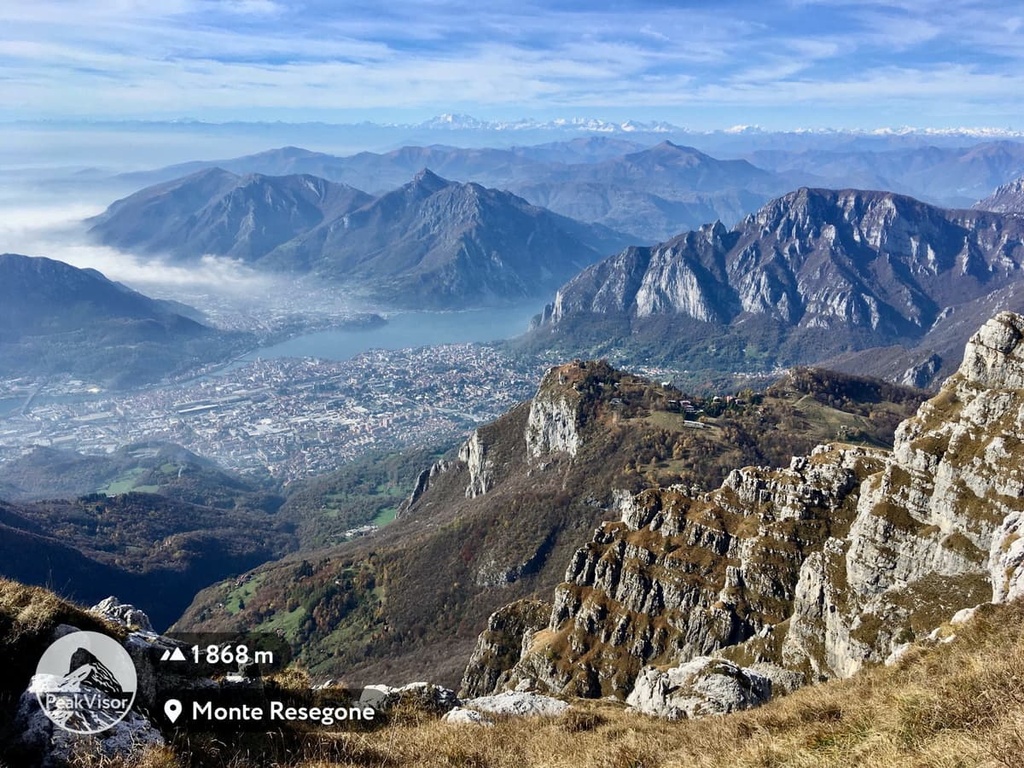
Piani d’Erna—Monte Resegone
An most-do trekking trail in the region is the one that starts from Piani d’Erna (Erna Plains) in the province of Lecco and goes up to the peak of Resegone (1,875 m / 6,151 ft). It is a 5-hour trail of medium difficulty.
Valbondione—Pizzo di Coca
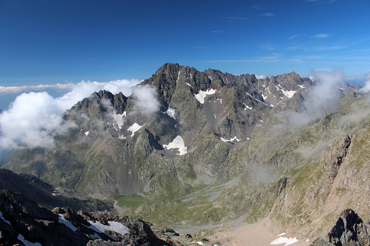
The trail to Pizzo di Coca is one of the most famous in the area. Located in the Northern Val Seriana, it is the highest peak of the Orobie Mountains with an elevation of 3,052 m (10,013 ft). The summit is suitable for both new and experienced hikers depending on the side trips that you take. The major trailhead is in Valbondione.
From the trailhead, hikers should take trail No. 301, which traverses the Serio River, a rocky corridor, and a lush forest. It takes 1 and a half hours to reach the Pizzo di Coca hut, over 2 hours to hours to reach Coca Pass, and over 3 hours to the mountaintop through Lake Coca.
In total, it takes about 5 hours to get to the peak and about 4 hours to descend. The difference in elevation on the trail is 2,200 m (7,217 ft) and the trail is about 18 km (11.1 mi) long.
For most of the route, the walking is fairly casual. The itinerary becomes technically demanding toward the end of the trail between the ‘Bocchetta del camoscio’ and the summit. There are some exposed areas where hikers must be highly concentrated to avoid falling.
Nevertheless, this challenge is completely rewarded by the stunning 360-degree views from the top of the peak. Once there, you are on the roof of the Orobie!
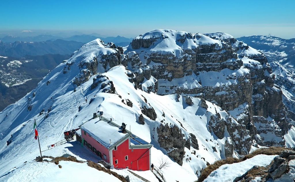
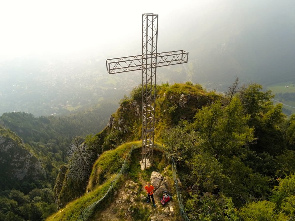
Passo Presolana—Vetta della Presolana
This peak is called “The Orobie Queen” (2,517 m / 8,257 ft) for the majestic shapes and the unforgettable view that hikers can enjoy from its top, but as every queen, it is not approachable for all the ordinary mortals, at least if they do not have specific skills. Indeed, the trail (CAI 315) that goes directly to the peak is an experience for expert hikers only.
The first part of the trail until Savina Chapel can be substituted with another trail, which is easier than the standard one. But, after the Chapel, the path inevitably takes the shape of an Alpine trail of moderate difficulty with rocky crags and exposed areas. Making a stop at Grotta dei Pagani is mandatory, in our opinion, anyway!
Numerous Alpine huts and free shelters along the way, like bivacco di Clusone (2,050 m / 6,725 ft) right behind the Grotta, will give you the chance to take a break until you reach the top where a huge metal cross stands out against the clear sky.
Nature trails are simple and relatively short trails that are usually up to 5–8 km (3.1–4.9 mi) long that are suitable for most hikers. Often they are also dedicated to the flora and fauna of the surrounding area and they may have educational signs so you can learn more about the area.
Hike to Forra dell’Adda
This hike features unrivaled natural beauty with an important artistic legacy. The three glacial erratic rocks that shape one of the most spectacular spots of this canyon and are located on the river are also one of the so-called “Scorci Leonardeschi,” places that inspired Leonardo DaVinci’s famous painting “The Virgin of the Rocks”.
Sentiero del Castagno in Imagna Valley
Sentiero del Castagno is a 1 and a half hour long loop trail in Corna Imagna village in Imagna Valley close to Bergamo.
Technically, this is not an old hiking path, but a trail created to relaunch the chestnut industry in the area. This trail offers casual hiking on easily walkable mule tracks through picturesque boroughs, meadows, and chestnut forests.
The only negative aspect is that this trail is not particularly well marked and the risk of getting lost is quite high (so don’t forget to bring a map!).
Flower Trails
The Flower Trails are three trails that branch off rifugio Capanna 2000 in the Seriana Valley at 2000 m (6,561 ft) in elevation.
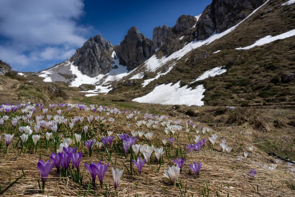
They provide ample opportunities to enjoy the blossoming alpine flower species in the region, like the rare Allium insubricum with its red hanging flowers, the lilac Aquilegia einseleana, or the amazing Athamanta cretensis. Despite the elevation, the difficulty level is quite low on these trails.
Sentiero delle Orobie (Orobie Trail) is a set of several trails that cross the Orobie Alps.
The trail is divided into two big routes, each including several trails:
Although the average elevation of the hiking routes is around 2,000 m (6,561 ft), the hikes themselves are fairly simple, at least during the summer season when they are not covered in snow. Most intermediate hikers should find it quite easy to walk them.
There are only a few spots that can be handled by expert hikers only, like the railroad of Sentiero della Porta. However, this can be easily avoided by taking an alternative route.
Ideally, this is a multi-day hike of up to 15 days in length. Accommodation won’t be a problem thanks to the presence of several mountain huts at each stop. Nonetheless, it is possible to travel along only the single sections of the trail, entering the trail from villages located on the valley floor.
Historic trails are usually long trails that were laid out by people centuries ago for industrial and commercial purposes. Over time, thanks to the efforts of tourist services and individual enthusiasts, many of them have evolved into popular hiking trails. Here are some of the best historic trails in Bergamo.
Iron Trail
The history of Bergamo province and its development are closely connected to the use of mineral resources. The evidence of iron extraction in the region goes back to time immemorial.
Mining activity on the Orobie Alps was started by the Celtic and Gaul populations and flourished until recent times. A relic of this past has been left in the Iron trail, a 25 km (15.5 mi) trail that you can hike in 7 to 8 hours.
On the whole, the walk is not particularly rugged. It starts in Mezzoldo then it traverses along a mule track located in the middle of broadleaf and conifer forests before it goes through small boroughs, each hiding unimaginable architectural treasures.
Charcoal Trail
The widespread forests of Bergamo have been an inexhaustible source of charcoal production that, together with iron extraction, was far more profitable than livestock and agriculture for centuries.
It is possible to retrace this regional forestry history by walking along the Charcoal Trail, which is located just beside the Presolana Valley.
The trail leads to Mount Scanapà (1,669 m / 5,475 ft) and, especially during the summer season, it is quite busy because of the hikers and bikers who walk on this trail to get to the nearby Scalve Valley. This hike is a loop trail that’s suitable for hikers of any level. It is about 8 km (5 mi) long and is feasible in about 3 hours.
Via Priula
Via Priula stands as evidence of the past rule of the Venetian Republic in Bergamo. The path was created by the Venetian merchant Alvise Priuli in the sixteenth century to connect Venice to Milan, France, and Austria. Unfortunately, not everything went according to his initial plan, but at least now we can have some glimpses into the history of this area.
Today Via Priula is a 36 km (22.3 mi) long hiking trail that connects Morbegno and Bergamo. It is feasible in 2–3 days, some parts are suitable for beginners and some are best only for expert hikers.
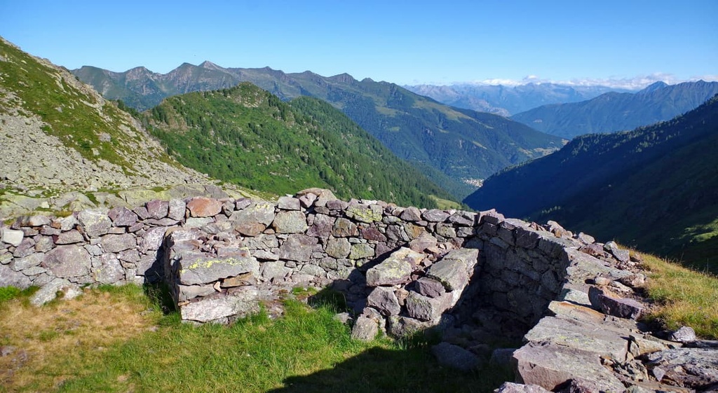
There are many things to see on this trail. They include Passo San Marco, which still hosts a station house, and a peculiar architectural object called Chiavi di Botta, which consists of a set of arches anchored to the walls with chains so that a street could have been built on them.
The popularity of outdoor activities in Bergamo is constantly growing, so making the mountains accessible to people with disabilities is a must. In Bergamo, this is possible thanks to the efforts made by the local CAI association. Here are some of the best accessible trails in the province to check out.
Colli di Bergamo Park
Most of the accessible trails in Bergamo are located in the Colli di Bergamo Park or the areas nearby, like the Greenways Trail, which is a cycle and pedestrian path running along the Morla River, a stream that springs in the Baderem Valley, and traverses Bergamo running away towards the plain.
The trail is paved in concrete, so it is wheelchair accessible. It provides access to the northeastern side of Colli di Bergamo. Here, everyone has the chance to enjoy the mountains inside the city and to discover lesser-known spots of the region.
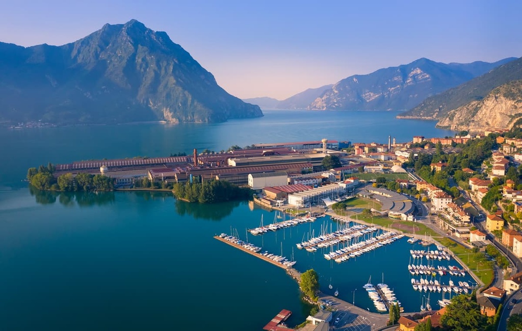
Hiking Trails on Monte Isola
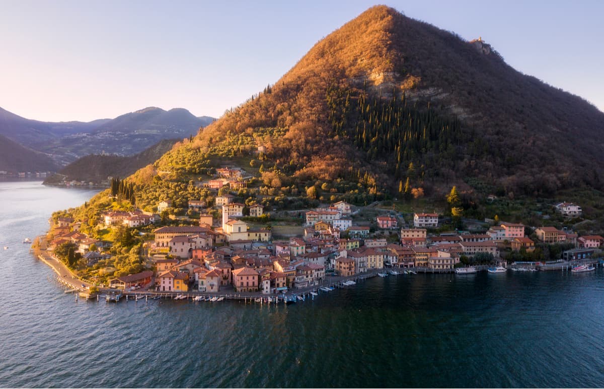
Monte Isola (600 m / 1,968 ft) is a mountain-like island in the middle of Lake Iseo, which was named the third most beautiful European destination of 2019.
The trails on Isola Island branching off from the mountain slopes are numerous and suitable for hikers of any level, and they all lead to panoramic views and historical destinations. Some of them are accessible to people with disabilities as well.
In particular, the Madonna della Ceriola Hike is recommended for visitors looking for a flat, accessible hike. From the municipality of Cure, the path ventures onto a traditional mule track and then joins the Via Crucis, which leads to the sanctuary in less than 1 hour.
From the sanctuary’s terrace, you can see Piramidi di Zone, also called “the fairy’s chimneys,” which is a peculiar rock formation in Brescia that’s visible at the distance when the sky is clear.
Sensole Trail is an alternative route to consider and it is wheelchair accessible. The path is home to many bars, restaurants, and picnic areas. Even the usual large number of locals and tourists cannot dwarf the beauty of the natural landscape. The path travels through groves of olive trees and is dominated by the presence of an ancient fort.
Presolana Pass and Vivione Pass
On the Presolana Pass in the Scalve Valley, there is an interesting accessible trail that leads to Orsetto Castle and is great for people who prefer a mostly flat trail.
But accessibility isn’t the only benefit of this route. In fact, it is also famous because of the curious events that have happened here. For example, “The Couple Jump” is a panoramic balcony encircled by an iron fence. Here, in the spring of 1871, two young Polish artists disappeared from the area only to be found dead a few days later.
The Orsetto Castle is also shrouded in mystery. Its name derives from a legend that tells of the presence of a bear that once spread fear and terror in the valley. A young man attempted to defeat this bear but died trying and his soul came back in the form of a white squirrel who showed his friends how to defeat the bear with a spell.
It takes about 1 and a half hours (one way) to complete the trail from Albergo Franceschetti to Orsetto Castle. These accessible trails are not only suitable for people whose mobility is more or less reduced, but they are also a great option for parents who want to share their passion for hiking with young children.
Among other trails recommended to families in the region, there is the Passeggiata dei Laghetti delle Valli Trail, which is a 2 hour long trail on Vivione Pass in the Scalve Valley.
The first part of the hike follows trail No. 416 first and then No. 415. The trail ends on Mount Busna (2,135 m / 7,004 ft) where hikers can enjoy the view on the two Valley Lakes while having a picnic with the whole family.
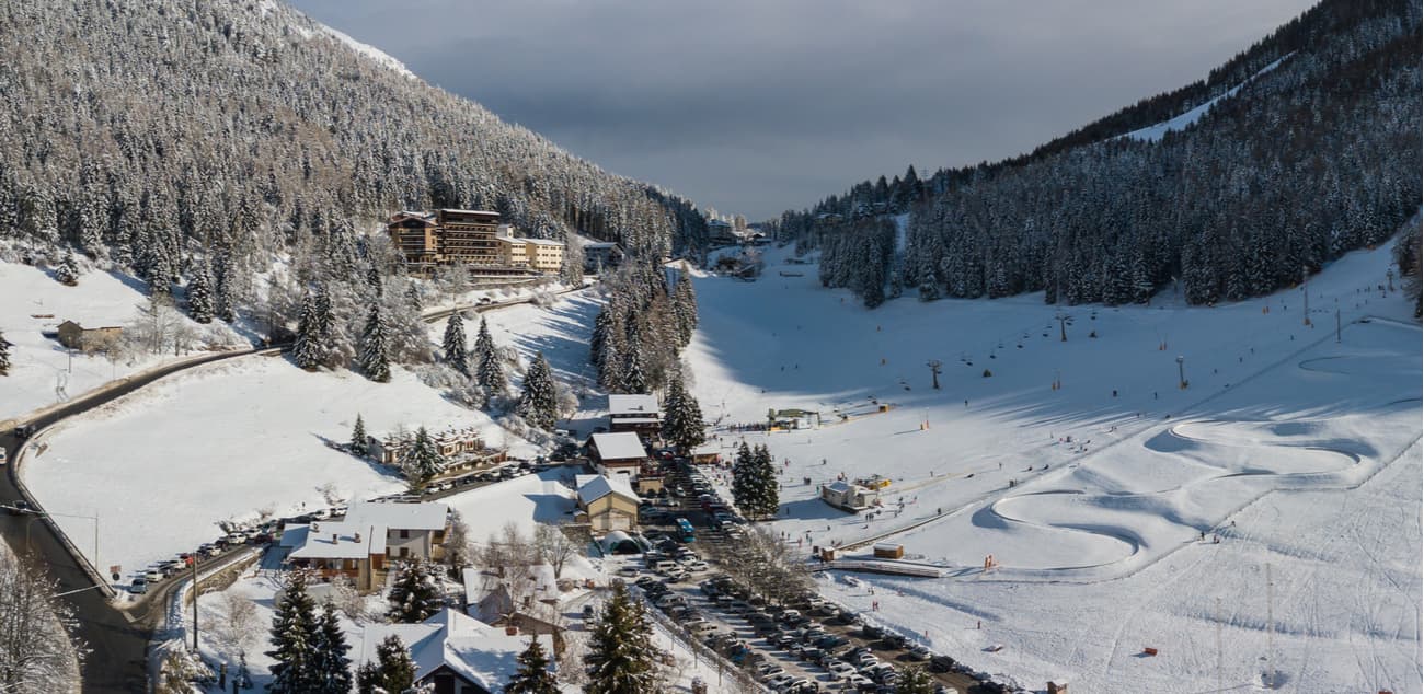
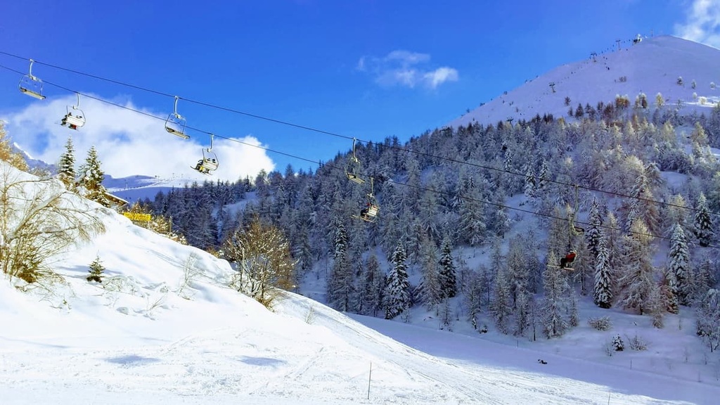
There are dozens of small, medium and large ski areas and resorts in Bergamo province alone, which makes it a good choice for winter sports fans.
The most popular places, which are located within the province or right on its borders, are Colere, Lizzola, Presolana, Monte Pora, Spiazzi di Gromo, Foppolo, Piani di Bobbio, Carona, Pescegallo, Aprica, Borno Monte Altissimo, Schilpario, Selvino, Oltre il Colle, San Simone (Brembo Ski) and Piazzatorre.
Use PeakVisor’s World Mountain Lifts page for Italy to navigate through the ski areas in Lombardy, including the Bergamo province. On the page, you can also get real-time information about each resort’s ski lifts and trails.
In order to get more information about the city of Bergamo, its namesake province, and its natural and cultural attractions, be sure to check out the province’s Visit Bergamo information points. These are located at Bergamo Airport and in the city itself.
Info Point Aeroporto di Bergamo
Aeroporto Orio al Serio, via Aeroporto, 13, Bergamo, BG, Italy
+39035320402
Opening Hours:
Ufficio I.A.T. Bergamo—Città Bassa
Piazzale Guglielmo Marconi (Bergamo train station square), 24122, Bergamo, BG, Italy
+39035210204
Opening Hours:
Ufficio I.A.T. Bergamo—Citta Alta
13 Via Gombito, 24129, Bergamo, BG, Italy
+39035242226
Opening Hours:
Before your trip, you can also visit the official VisitBergamo.net website. You can also use In-lombardia.it website for additional information.
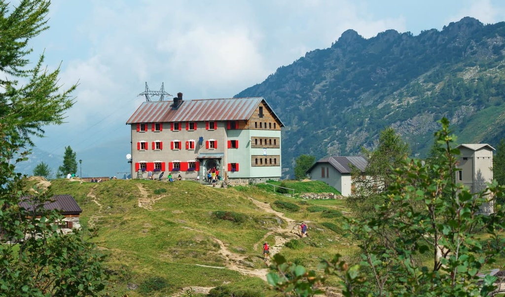
In Bergamo province, there are plenty of mountain huts and camping sites as well as bivouacs so that you can spend the night and fully enjoy a multi-day hiking experience without worrying about your accommodation.
Here is a list of some of the best places to stay in the province:
Before and after hiking or other outdoor activities in the province, you can also easily find any type of accommodation in almost any city, town or village in Bergamo.
For any further information about accommodation options, visit the aforementioned official website of the province and the region of Lombardy or, one of the numerous outdoor association's websites like CAI Bergamo (Italian Alpine Club in Bergamo).
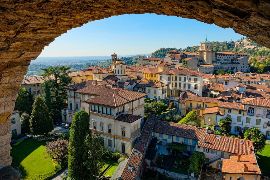
Bergamo is the main city of the province, which is located in its southern region near the Padana Plain. However, even its lower part of the city (Bergamo Bassa/Lower Town) rises 249 m (816 ft) above sea level and its higher part (Bergamo Alta/Upper or Old Town)—= is at an elevation of 365 m (1,197 ft).
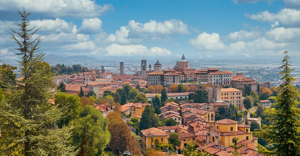
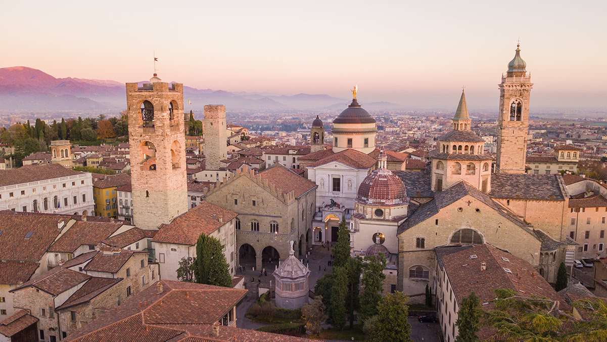
The city of Bergamo is full of all kinds of cultural and architectural attractions, the main one being the fortress walls around the Old Town, which were built by the Venetians in the Middle Ages between the sixteenth and seventeenth centuries. Since July 9, 2017, the entire Old Town has been designated as a cultural heritage site by UNESCO.
Additionally, you can hike along the city walls of Bergamo either on foot (it takes 10–20 minutes, depending on your pace) or on a cable car, which itself is another city attraction.
There are actually two cable cars. The first one connects the lower part of Bergamo with the upper part of the city. The difference in height of this cable car is 85 m (278 ft), with a maximum gradient of 52%. On top, the perspective over the valley changes completely, and the views are sure to impress.
The second cable car leads from the old town into an area located even higher and further into the Bergamo hills. But you need to walk the whole town between two cable cars because they are not connected.
While we're on the subject of cable cars, there is also good news for those who want to visit Brembana Valley.
In 2017, €5 million were allocated to give new life to the funicular in San Pellegrino Terme (Funicolare San Pellegrino—Vetta); the updates were finished in September, 2020. After 29 years of inactivity, the cable car finally took citizens and tourists from the town of San Pellegrino to the locality of Vetta once again.
Other great and notable cable cars in the province of Bergamo include the Aprica, the Pescegallo—Valgerola from rifugio Cesare Benigni, the Pian delle Betulle from Margno, the Alpe Cainallo from Esino Lario, the Piani di Bobbio, and the Piani di Artavaggio.
However, as you see yourself, Bergamo is not the only interesting city in the province. Other important cities include:
For more information, check out the official tourist site of the city and province of Bergamo: VisitBergamo.net.


Yes. Bergamo has 622 named mountains. The highest is Pizzo Coca at 3,052 m.
The highest mountain in Bergamo is Pizzo Coca, at 3,052 m.
Bergamo has 622 named mountains.


