
Scan the QR code and open PeakVisor on your phone
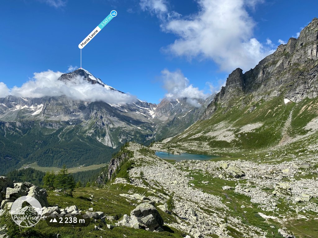
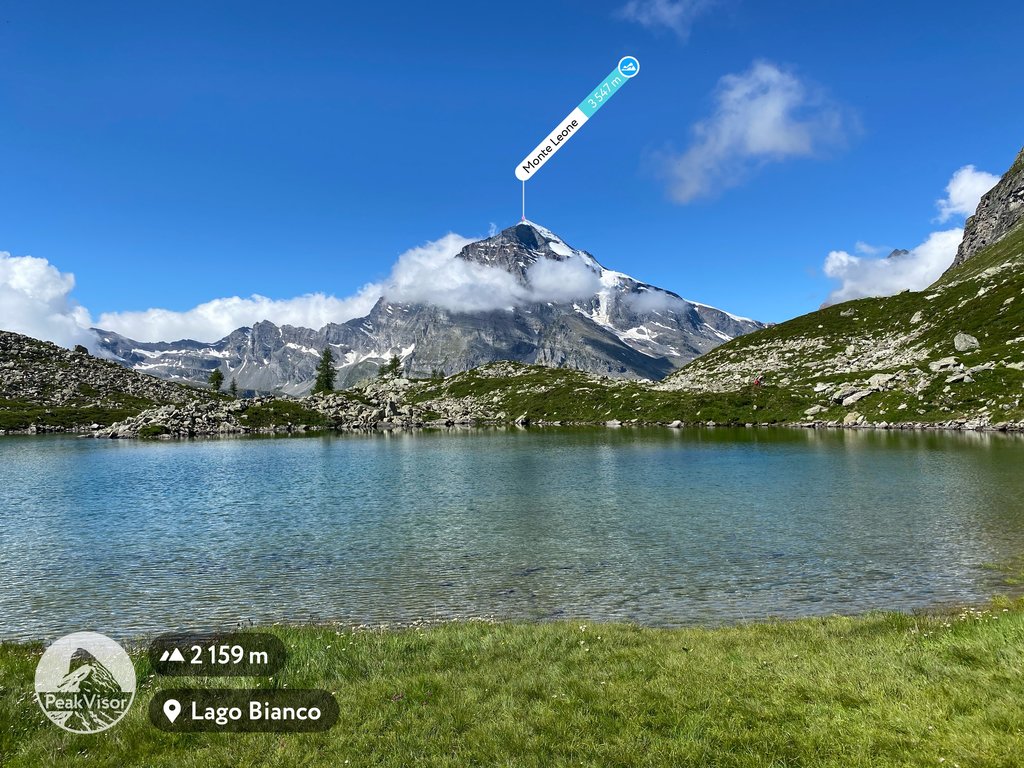
The Lepontine Alps include 1,764 named peaks. The highest is Monte Leone at 3,553 m. Other notable peaks include Breithorn, Rheinwaldhorn and Güferhorn.
The Lepontine Alps is one of the large mountain ranges in the Western Alps, located mainly in southern Switzerland and partly in northern Italy. The main feature of the range is its highest mountain Monte Leone (3,553 m / 11,656 ft), which stands at the head of a series of impressive glaciers, covering many other peaks in the range. It is also famous for the vast Leventina Valley and several high mountain passes that have always served as important north-south European links in this part of the Alps, being also popular recreational routes, for example, for cyclists. Monte Togano (2,301 m / 7,549 ft) is the most prominent mountain of the range. In total there are 1764 named mountains in the Lepontine Alps.
As with many other ranges and groups in the Alps, the name of the Lepontine Alps comes from the name of the local tribe that inhabited these mountainous areas before the arrival of the Romans. In this case, it appears to have been the Celtic tribe Lepontii (other variants: Leponti, Leponzi, Lepontini).
The name of the range in Italian, German, and French: Alpi Lepontine, Lepontinische Alpen, and Alpes lépontines, respectively.
The Lepontine Alps is one of the four easternmost major ranges of the Western Alps, along with the Lugano Prealps to the south and the Glarus Alps to the north. To the east, it borders the Western Rhaetian Alps, to the southeast—the Bergamasque Alps and Prealps, and to the southwest and northwest—the Pennine Alps, and the Bernese Alps, respectively. In total: five ranges around.
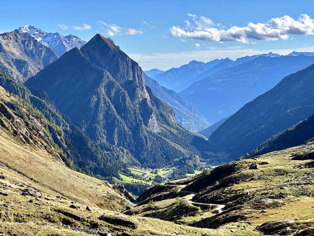
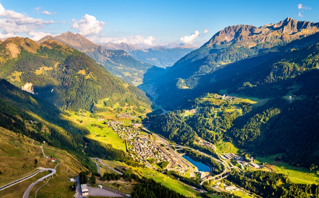
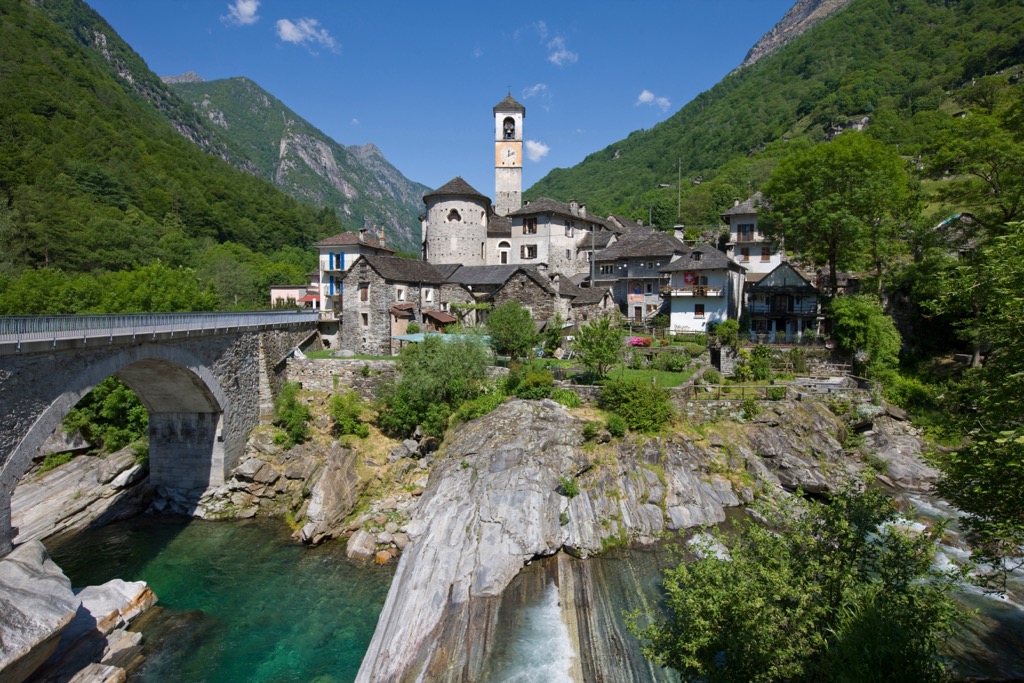
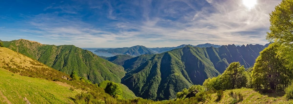
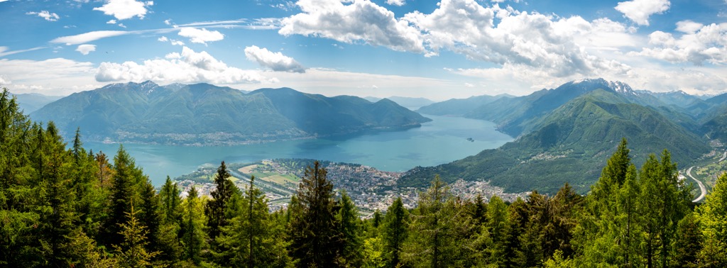
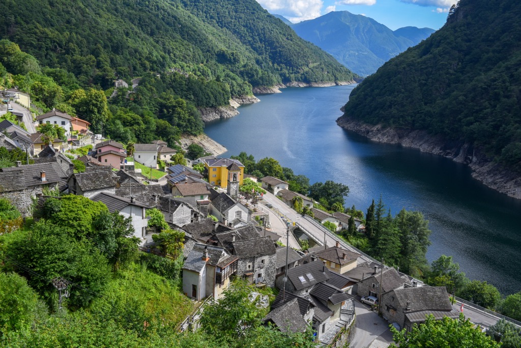
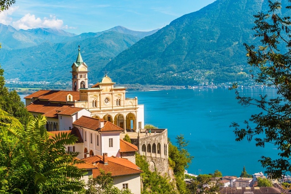
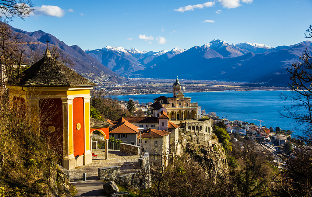
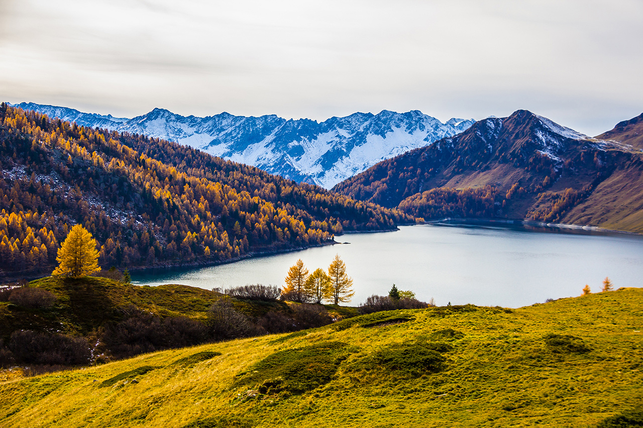
In addition to the mountains, which I'll discuss below, the vast Leventina Valley (Val Leventina or Valle Leventina in Italian) is the main natural feature of the north of the Lepontine Alps. The valley was formed by the Ticino River. The other major rivers in the range are the Rhône, Reuss, Rhine, and Toce. The Lepontine Alps also touch two of Italy's five major lakes—much of the western shore of the Maggiore and northern Como.
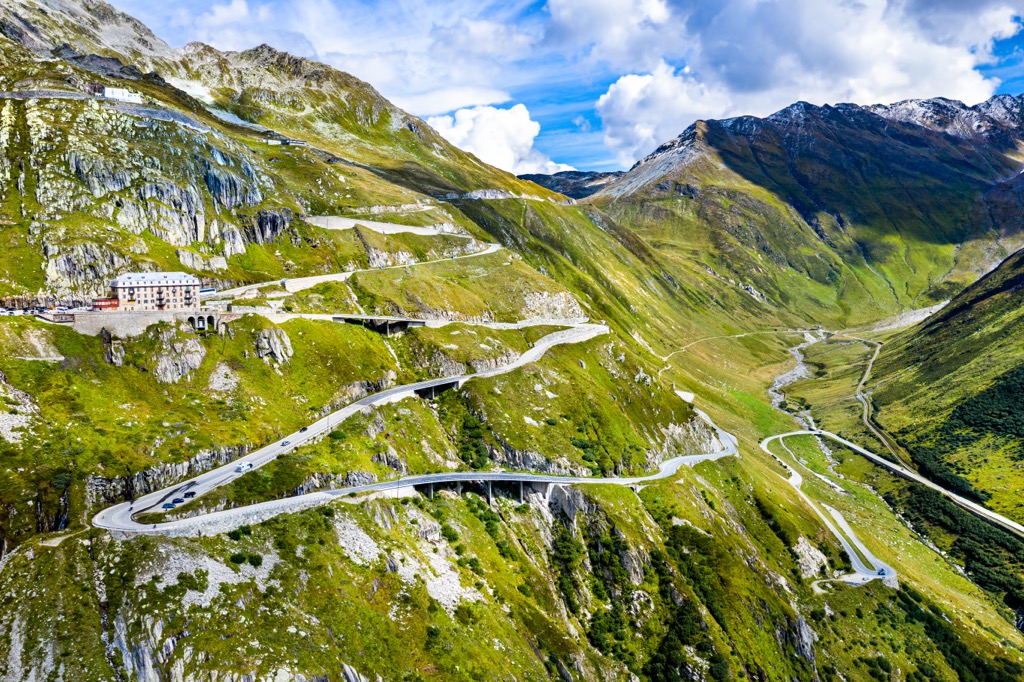
Other features of the landscape of these mountains should certainly include the three famous high road passes (from west to east): Simplon Pass (2,006 m / 6,581 ft), Gotthard Pass (2,106 m / 6,909 ft), and Splügen Pass (2,114 m / 6,936 ft). All three are popular routes among bicycle enthusiasts, thanks to their scenic serpentines. As one of them, living in the north of Italy, I will specifically mention the latter, connecting the village of Chiavenna in the province of Sondrio in the Lombardy region with the Swiss municipality of Medels im Rheinwald (former Splügen of the same name) in the Swiss canton of Graubünden.
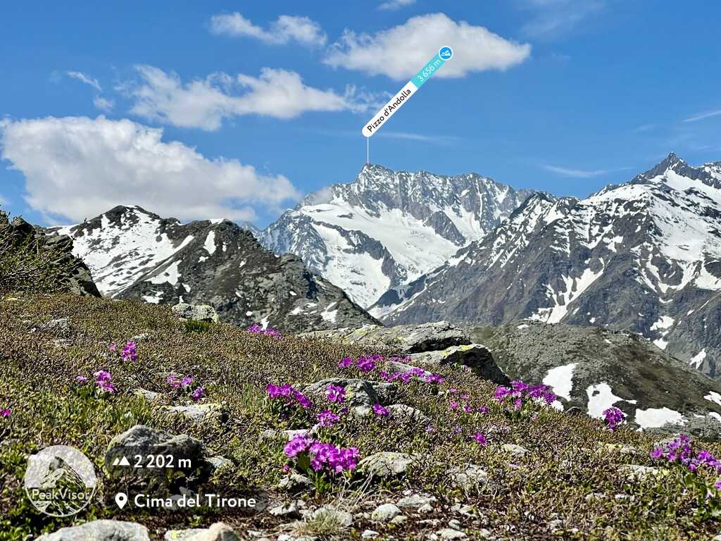
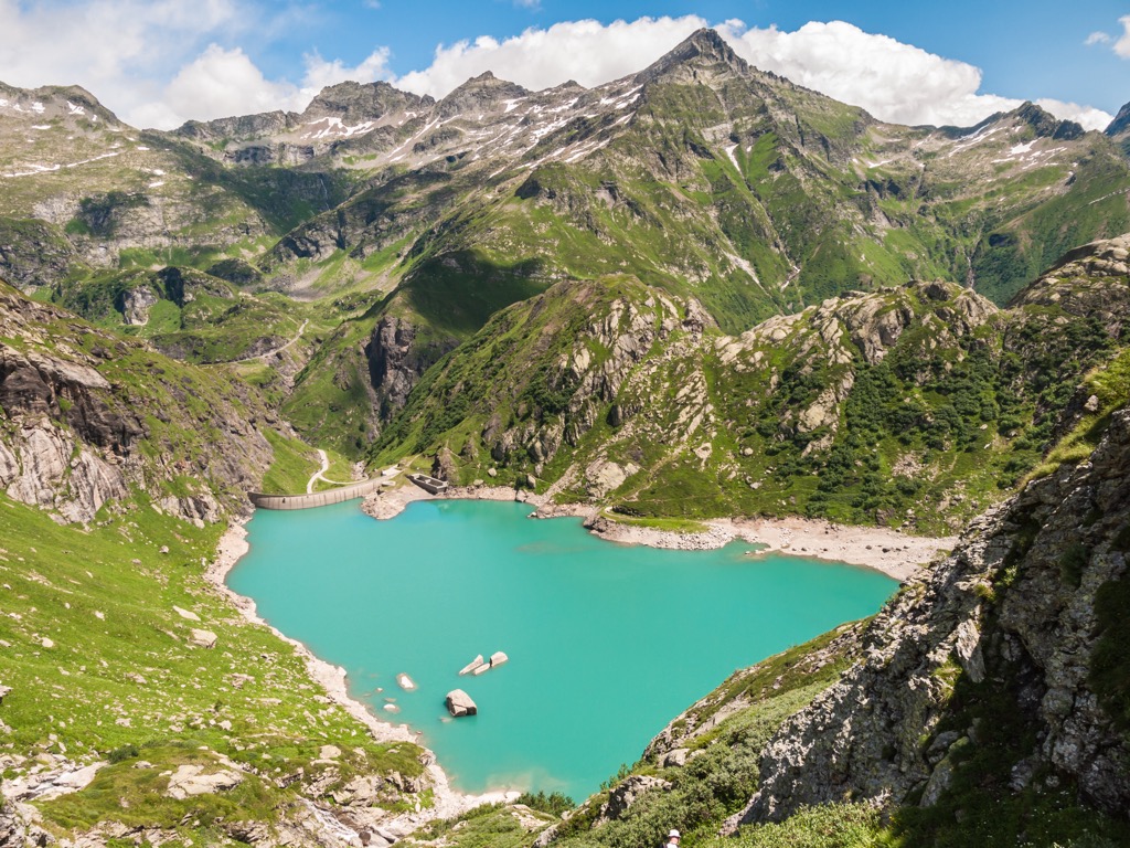
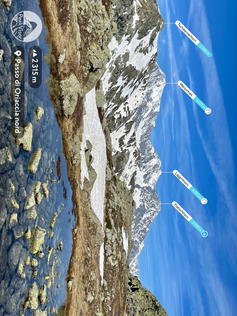
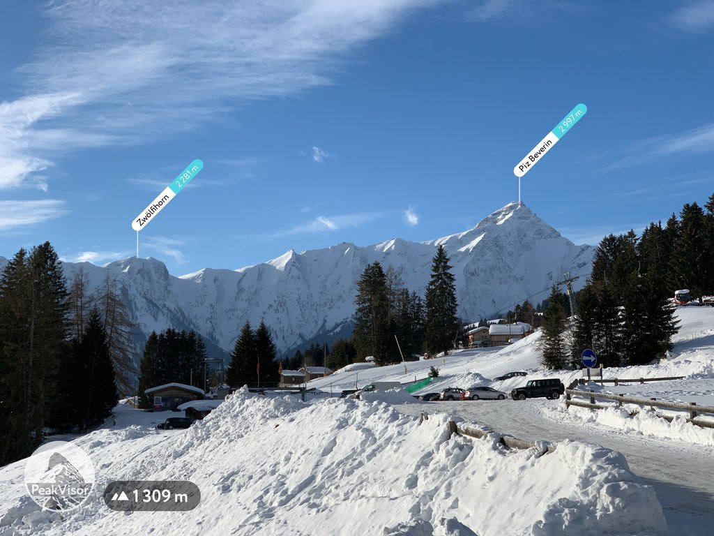
Speaking about the snowy peaks, the next three mountains following Monte Leone are also covered by vast glaciers, which also adds to their fame, including Rheinwaldhorn (3,402 m / 11,161 ft), Güferhorn (3,379 m / 11,085 ft), and especially Blinnenhorn / Corno cieso (3,374 m / 11,069 ft) with a gentle slope resembling an open palm. In total, there are 146 glaciers in the Lepontine Alps with a total area of 42.2 sq km (16.2 sq mi), which is a lot.
Administratively, in addition to the cantons of Ticino and Graubünden in Switzerland, the mountain range is also located in the cantons of Valais and Uri, and in Italy, in addition to Lombardy, part of it is located in the neighboring region of Piedmont.
The closest major cities to the Lepontine Alps are Como and Lugano in the south, and Luzern in the north. The first is Italian and the last two are Swiss. The range can be reached by local trains, but further you will have to travel by bus or car, especially in Italy. In Switzerland, the railroads inside the mountains are much better developed.
In terms of geology, the Lepontine Alps is a unique region where the deepest tectonic levels of the Western and Central Alps come to the surface. Among geologists, it is known as the Lepontine Dome. If you are one of them and understand terms like "tectonic half-window", "metamorphism", "basement nappes", and others, learn more about it in the article "Tectonics of the Lepontine Alps" in the Swiss Journal of Geosciences.
The Lepontine Alps is one of the eight major mountain ranges in the Northwestern Alps (Alpi Nord-occidentale) of the Western Alps (Alpi Occidentali) in the Italian classification of Alps SOIUSA, where it has number 10 of 36 ranges in both parts of the Alps, including the second, eastern.
Internally it is divided into four large subranges with their respective groups:
As can be seen from the names, the first covers the area around the highest mountain of the range, as well as Gotthard Pass, but the other two require a little explanation. Alpi Ticinesi or Ticino Alps in English are all the western part of the range, so it is also often called the Western Lepontine Alps, and the Adula Alps, is the eastern part.
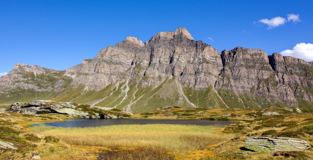
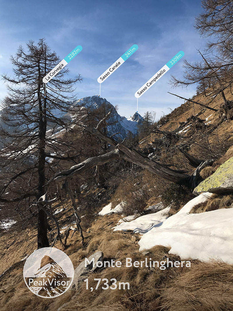
Besides the highest Monte Leone (3,552 m / 11,653 ft), the most prominent Monte Togano (2,301m / 7,549 ft) and the above-mentioned glaciers, among the individual famous mountains and peaks are Basòdino (3,276 / 10,749 ft), Piz Medel (3,203 m / 10,509 ft), Scopi (3,200 m / 10,499 ft), and others above 3,000 m (9,842 ft) of which there are over 50. An interesting peculiarity: most of them have a similar name: they start with Piz or Pizzo ("peak" in Italian) or end with a "horn".
Among them, there are also very unusual mountains in shape, such as Witenwasserenstock (3,084 m / 10,119 ft), which looks exactly like a freestanding ski jump.
For this section, I asked the PeakVisor founder, who is even more local in the area, to tell briefly about the main hiking areas and destinations in the Lepontine Alps:
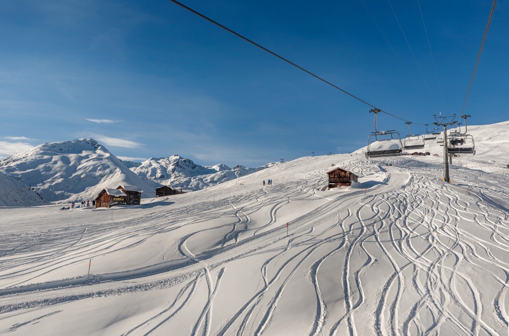
For skiing and snowboarding enthusiasts, there are more than 30 ski resorts in the Lepontine Alps, which are located throughout the range, but mainly in its northern part, where you will find most of the resorts, including also the largest of them. It is also one of the main areas for skiing in the Swiss Alps.
The largest ski resort in the Lepontine Alps is Obersaxen/Mundaun/Val Lumnezia with more than 120 km (12 mi) of slopes and more than 15 ski lifts.
Other major areas for skiing in the Lepontine Alps with more than 25 km (16 mi) of slopes and more than 5 ski lifts each include the following in descending order of size:
The main ski resorts near Como and Lugano in the south of the range are Piana di Vigezzo and Mottarone with 20 and 10 km (12 and 6 mi) of slopes and more than 3 ski lifts each, respectively.
Check the Lepontine Alps ski resorts map on the larger Switzerland and Italy ski resorts maps in the World Mountain Lifts section of the site. It includes information about open ski lifts / slopes in Lepontine Alps in real-time with opening dates and hours. There are also year-round cable cars, funiculars, cog railways, aerial tramways, and all other types of mountain lifts.
Before or after the hike, visit one of the official information points in the Lepontine Alps located throughout the mountain range. Here is the central one in Lugano:
Lugano Center Info Point
Piazza della Riforma, 1, Palazzo Civico, 6901, Lugano, Switzerland.
Monday to Friday: 9:00 am to 12:00 pm, 1:00 pm to 5:30 pm, Sunday and holidays: closed
+41582206506
The official tourist sites of the regions: Ticino.ch, Valais.ch, Myswitzerland.com/urigotthard, Visitgraubunden.com, Visitpiemonte.com, and In-lombardia.it.
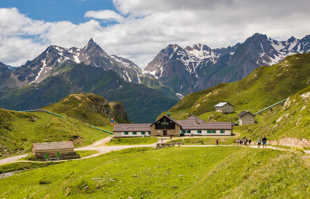
As in other parts of the Alps, the main type of lodging in the Lepontine Alps is mountain huts. Given the large size of the range, there are more than a hundred of them, so you are sure to find one or two on the trail. But, of course, you have to find out their exact location beforehand. They are marked on the 3D map in the app.
For example, there is a hut right next to Monte Leone at an elevation of 2,848 m (9,343 ft), which has the same name—Capanna Monte Leone or Monte Leone Hütte. It celebrates its 30th anniversary in 2022. Like the others, it is open on a standard schedule from late June to September. The hut has 20 beds in the common rooms and 16 in the winter bivouac, which is open year-round. Half board (dinner, bed, and breakfast) for adults costs 62 euros, which is the standard price for such services in the Italian Alps (I mean, it's not more expensive in Switzerland, although it usually is).

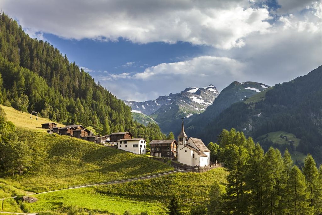
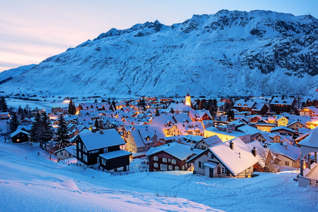
The area of the Lepontine Alps is relatively high and is slightly inhabited with vast areas of wilderness. There are no big towns here, only Alpine villages, especially inside the range. The largest cities are located on its borders. These are Locarno and Bellinzona, the capital of Ticino, in the south; Domodossola and Omegna, Italy, in the southwest; Brig, Switzerland, in the west; the Italian Chiavenna and Colico in the southeast; Chur, Switzerland, in the northeast. The nearest large city in the north is the Swiss Lucerne.


The Lepontine Alps are part of the Alps.
The highest peak in the Lepontine Alps is Monte Leone, at 3,553 m.
The Lepontine Alps have 1,764 named peaks.


