Scan the QR code and open PeakVisor on your phone
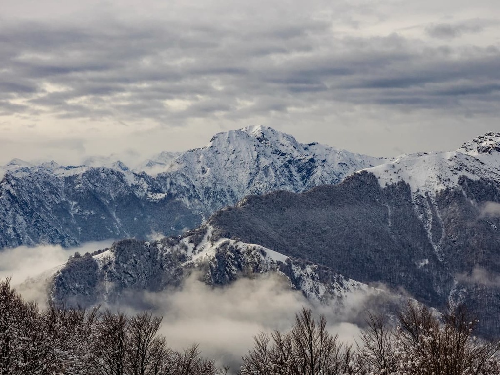
Lose yourself in nature at the largest wilderness area in Italy with a trip to Val Grande National Park. There are 75 named peaks in Val Grande National Park. The highest and the most prominent mountain in the park is Monte Togano (2,301 m/7,549 ft).
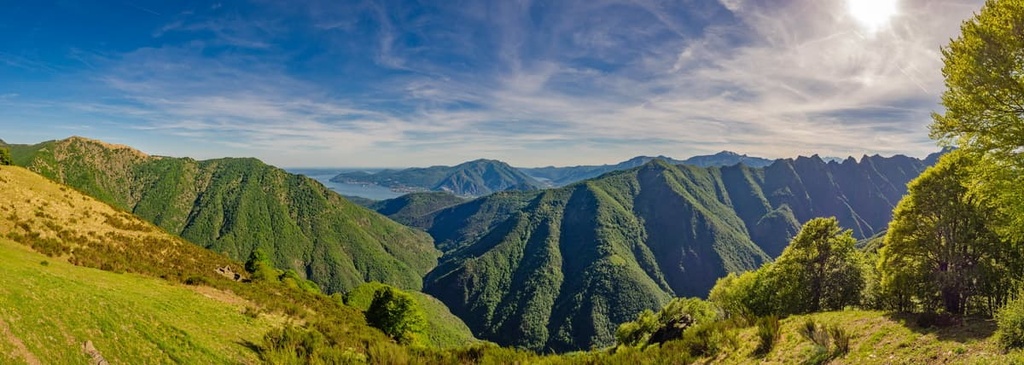
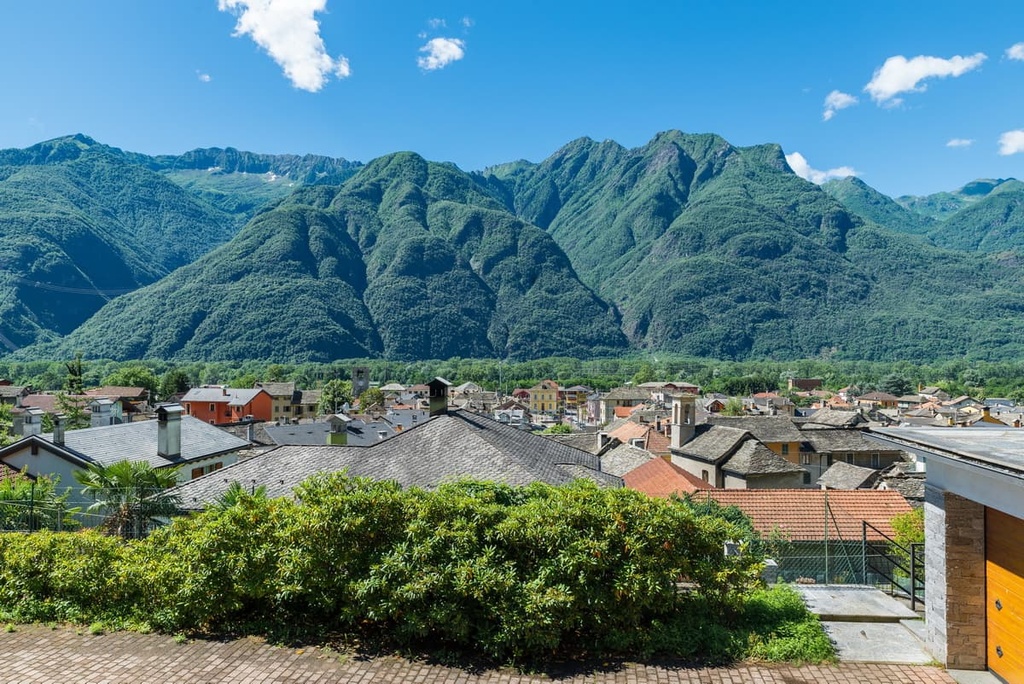
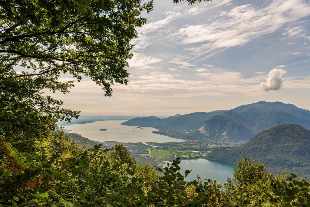
Located in Northwest Italy, Val Grande National Park (Parco Nazionale della Val Grande) encompasses an area of 150 sq. km (58 sq. mi) near the Swiss border. It’s part of the province of Verbano-Cusio-Ossola (Provincia del Verbano Cusio Ossola) within the Piedmont (Piemonte) region. Located just to the south of the park is Lago Maggiore (Verbano), the second-largest lake in Italy.
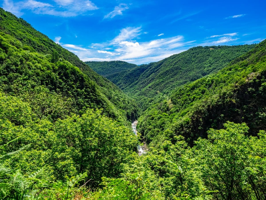
The main feature of Val Grande National Park is the Ticino Alps, which is a section of the greater Lepontine Alps. The park is considered to be part of the High Alps due to its unforgiving landscape, lack of resources, and lofty elevation. There are no significant settlements in Val Grande National Park and it’s regarded as the largest wilderness area in Italy.
The park consists of two main valleys: Val Grande and Val Pogallo. Both valleys join the San Bernardino stream, which runs through the center of the park. The park forms part of the drainage basin for the Po River, the longest river in Italy.
Due to its location within the Alps, Val Grande National Park is just a short drive from several other protected landscapes.
The Antrona Valley Natural Park (Parco Naturale dell'Alta Valle Antrona) is situated 60 km (37 mi) to the west of Val Grande National Park. Alpe Veglia and Alpe Devero Natural Park (Parco dell'Alpe Veglia e dell'Alpe Devero) is also located approximately 42 km (26 mi) to the northwest of Val Grande.
The closest national park to Val Grande National Park is Gran Paradiso National Park (Parco Nazionale del Gran Paradiso), which is located approximately 100 km (60 mi) to the southwest along the border of the Aosta Valley and the Piedmont regions. The Matterhorn (4,478 m/14,691 ft), one of the tallest and most famous peaks in the Alps, is located approximately 65 km (40 mi) east of Val Grande National Park.
The largest significant city near Val Grande National Park is Verbania, which is situated roughly 16 km (10 mi) to the south. Italy's second-most populous city, Milan, is located approximately 100 km (62 mi) to the southeast.
Val Grande National Park, along with the rest of the Alps, formed during the Alpine orogeny, a mountain-building event that began in the Late Mesozoic era between 252 million and 66 million years ago.
The park consists solely of metamorphic rocks. However, the metamorphic rock types are incredibly varied. The park is part of the Sesia Val Grande UNESCO Global Geopark due to its geological importance.
One of the main reasons Val Grande National Park is part of the Sesia Val Grande Geopark is due to the fact that it contains outcrops of the deepest parts of the Earth's crust that have risen to the surface. In parts of the park, it's possible to see the feeding system of a fossil supervolcano from caldera rocks that extend down to 25 km (15.5 mi) below the surface.
The deepest parts of Earth's crust are exposed atop some of Val Grande National Park's highest peaks. Many of the most famous mountains in Val Grande National Park, like Cima Pedum (2,111 m/6,925 ft), Cima Sasso (1,916 m/6,286 ft), and Cima della Laurasca (2,193 m/7194 ft), are topped with amphibolites, serpentinites, and peridotites.
These metamorphic rocks are extremely hard and difficult to erode. In fact, the mountains in this area form part of the “Zona Ivrea-Verbano.” Zona Ivrea-Verbano is a term used for a portion of deep continental crust that originates from the transition zone in the Earth's mantle, approximately 35 km (22 mi) below the surface.
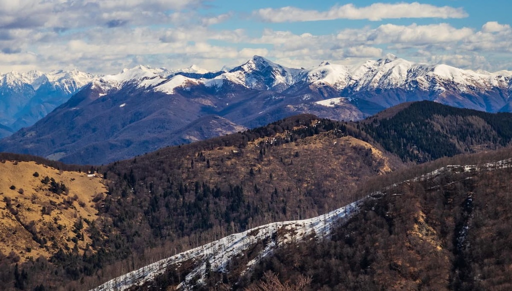
Today, Val Grande National Park is considered to be a part of the High Alps as it contains 25 summits over 2,000 m (6,561 ft) in elevation. Apart from the park’s tallest and most prominent mountain, Monte Togano (2,301 m/7549 ft), other notable summits in Val Grande National Park include Pizzo Proman (2,098 m/6,883 ft), and Cima della Laurasca (2,193 m/7,194 ft), and Cima Sasso (1,916 m/6,286 ft).
An isolated area with mile after mile of uninterrupted wilderness, Val Grande National Park is an essential habitat for many species of flora and fauna.
The woodlands and mountains of Val Grande National Park provide excellent nesting grounds for a range of rare bird species. The woodlands are home to black woodpeckers, western Bonelli's warblers, and red-backed shrikes. Meanwhile, birds of prey like golden eagles, kestrels, and peregrine falcons circle overhead.
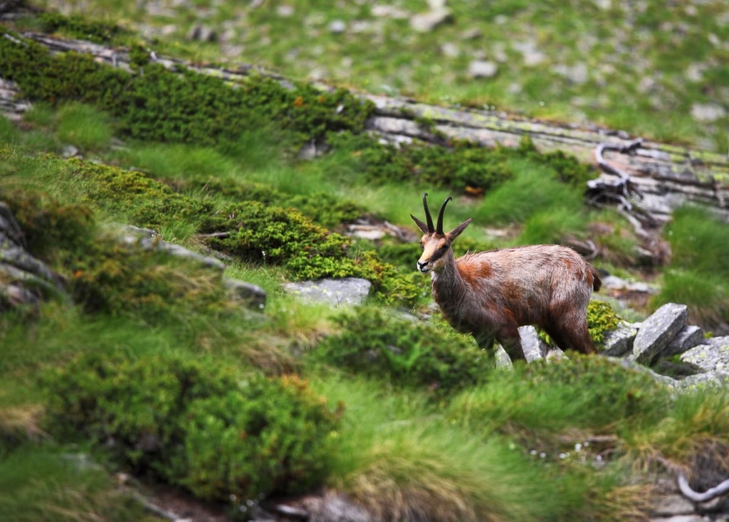
The park supports several large mammal species, most notably roe deer and chamois. Predatory mammals are also present across the park, including badgers, beech martens, and foxes. Small mammals, like dormice, are common in the park's forests.
In the park’s streams and rivers, the most common fish are trout and bullhead catfish. Several bird species wait to snap up fish from the water on the river banks, including white-throated dippers and grey wagtails.
You'll also find a few endangered and endemic insect species within Val Grande National Park. The Carabus lepontinus beetle is only found on the slopes of Monte Zeda (2,156 m/7,073 ft). Other notable and rare insect species include Rosalia longicorns, variable chafers, and hermit beetles.
The most famous residents of Val Grande National Park are vipers, which are ingrained in local legends. Thankfully, the chances of encountering these elusive creatures are low, as they usually stay out of sight in bushes and under rocks.
Val Grande National Park is primarily carpeted in mixed broadleaf forests. Chestnut trees are particularly prevalent, while beech trees comprise the majority of woodlands in the Upper Val Grande. Coniferous forest spruces and white firs are also present but much less widespread.
High up on the mountain slopes, shrubs, ferns, and mosses cover the landscape. Green alders, rhododendrons, and blueberry bushes are common at high elevations in the park, too.
Mountain pastures coat the slopes even higher up the mountainsides. Notable species in these areas include Alpine columbines, great yellow gentians, and perforate bellflowers.
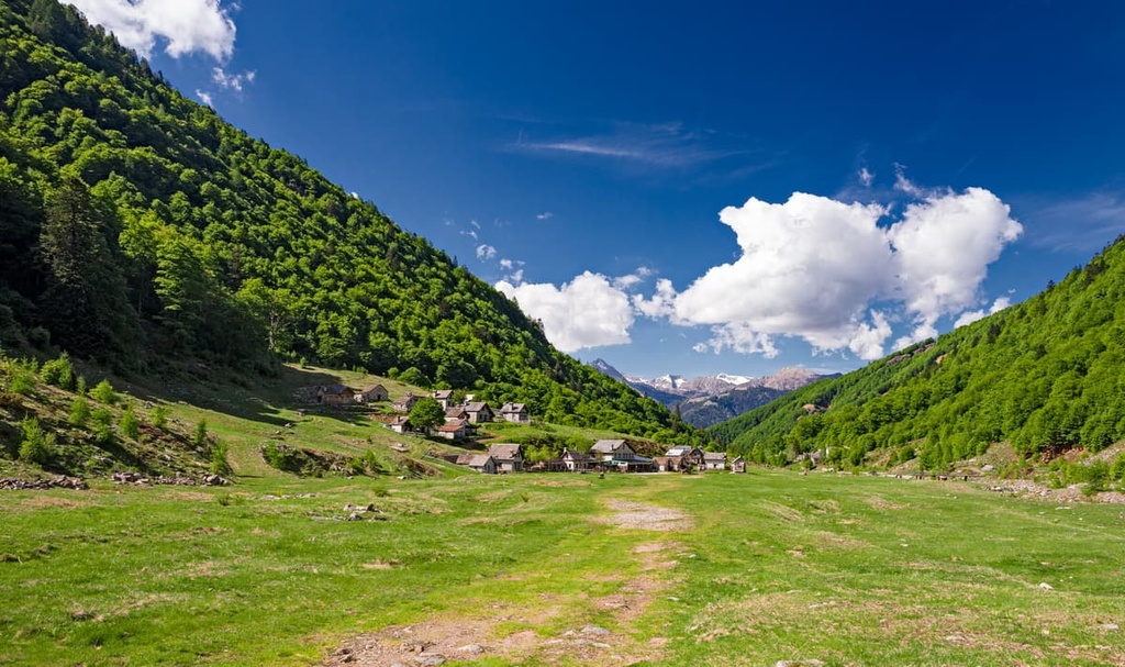
Due to the region's inhospitable nature, the human history of Val Grande National Park is relatively short. While many of the municipalities surrounding Val Grande, like Miazzina and Malesco, date back to Roman times or even the Iron Age, Val Grande was uninhabited until the eleventh century.
Prior to 1,000 CE, Val Grande may have been visited by hunters, but there were no settlers due to its rugged landscape and lack of arable land. One of the earliest records of visitors in Val Grande dates back to 1,014 CE, though the records refer to the area as an "uncultivated forest."
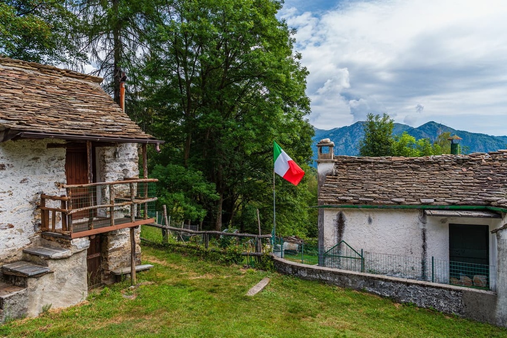
The first visitors to spend significant time in Val Grande were shepherds, who stayed in prehistoric cavern shelters called balmes. Early inhabitants of Val Grande often made rock engravings, likely to tell their story. Notable petroglyphs include a tree-like symbol engraved on the slopes of Pizzo Marcio (1,924 m/6,312 ft) and the "boulder altar" of Prà Alp just below Casa dell'Alpino (1,260 m/4,133 ft).
Between the tenth and twelfth centuries, large-scale deforestation in Val Grande began to make way for pastures. By the fourteenth century, woodcutting had become a significant source of income for local communities, and it became an industry that would continue to dominate the region until the mid-twentieth century.
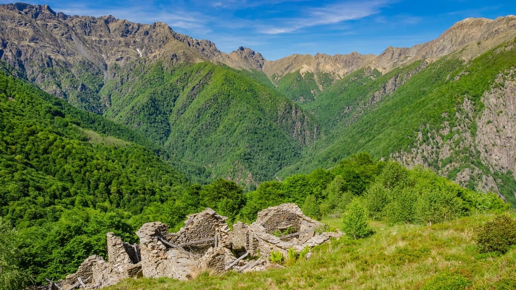
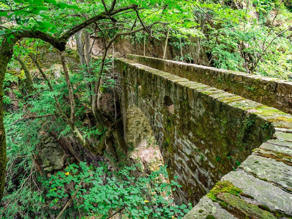
Remnants of this industry are still visible today, as abandoned cableways and charcoal kiosks are dotted across the valley. Many of the former pastures have now been reclaimed by beech forests.
Val Grande National Park played an important role for the Italian Resistance during the Second World War. In June 1944, the Val Grande and Val Pogallo were the sites of skirmishes between the Italian Resistance and Nazi troops. Within Val Pogallo, there's a memorial to 17 partisan troops who lost their lives on 18 June 1944. Several hundred partisan troops also died in Val Grande during Nazi mopping-up operations.
Val Grande National Park was established in 1992 to protect one of the wildest landscapes in Central Europe. Ente Parco Nazionale Val Grande manages the park.
Val Grande National Park is one of the most unforgiving hiking destinations in Italy. There are no settlements in the park's interior and mobile phone service is both spotty and unreliable. Hikers should study the area carefully and bring along a topographic map on all hikes in the park.
The park recommends using the official hiking map of the Val Grande National Park, 1st edition 2015, scale 1:30.000, which is available here. Ensure you come well prepared and inform someone else of your itinerary. Pay attention to local weather conditions, and call "118" in case of an emergency, if possible.
Many of the trails within Val Grande National Park are not marked. If you're not familiar with the area or are inexperienced, bring along a local guide. The park authority recommends visitors only undertake hikes between March and November due to heavy snowfall.
Read on to learn about some of the main hiking areas and trails in Val Grande National Park.

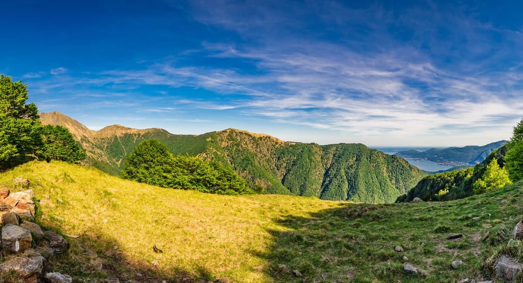
Pian Cavallone (1,564 m/5,131 ft) is easily one of the most popular areas to visit in Val Grande National Park. Pian Cavallone consists of a 400 m (1,312 ft) long plain 1,500 m above sea level, which affords spectacular views of Lago Maggiore and its surroundings.
This plain sits between Val Pogallo and Valle Intrasca. You'll also find one of the most important refuges in the Verbano Mountains, the Rifugio CAI Pian Cavallone (1,530 m/5,019 ft), near Pian Cavallone
Another reason Pian Cavallone is so popular is the fact that it’s relatively easy to reach, thanks to the multiple tourist-friendly hiking trails that traverse the region. One of the easiest ways to reach Pian Cavallone is from Porta Chapel (1,050 m/3,444 ft).
You can pick up this trail by parking at the chapel and following the R5 marked trail. The walk is suitable for casual hikers. The walk from Porta Chapel to Pian Cavallone takes an hour and 30 minutes to complete with an elevation gain of 478 m (1,568 ft).
Hikers looking for a more strenuous walk should check out the route to Pian Cavallone from the small hamlet of Cicogna, which follows red and white markers. This trek is a great way to see how nature has reclaimed the landscape, as it features plenty of picturesque abandoned cottages and cableways to admire en route.
You'll also pass the Bivacco Curgei (1,338 m/4,389 ft) on the way to Pian Cavallone. This route is only suitable for intermediate hikers as it involves crossing steep hillsides. The walk takes about 3 hours to complete with an elevation gain of roughly 1,000 m (3,280 ft).
A visit to the abandoned mountain village of Alpe Prà is a must of many hikers in Val Grande National Park. This area features narrow paths that weave up steeply up the slopes of Cima Sasso (1,916 m/6,286 ft), with breathtaking views of the surrounding mountains and valley below.
Near the popular Casa dell'Alpino (1,260 m/4,133 ft) bivouac, you'll also get a chance to see the "boulder altar" of Prà Alp, the site of one of the park's most famous rock carvings.
The best way to reach Alpe Prà is from Cicogna along the red and white marked trail. From the church square, you'll walk steeply uphill through woodlands until you reach Alpe Prà. Then, continue onto Casa dell'Alpino and enter the beech forest behind the hut.
After exiting the forest, you'll be treated to views towards Val Pagallo. From here, you can see several mountains, including Cima della Laurasca (2,193 m/7,194 ft), Monte Zeda (2,156 m/7,073 ft), and Monte Torrione (1,984 m/6,509 ft).
Then, you can retrace your steps to Cicogna or continue and loop around Val Pagallo. If you retrace your steps, the walk takes an hour and a half to complete with an elevation gain of 518 m (1,699 ft). The looped trail around Val Pagallo takes about 6 hours to complete.
Alpe Ompio is one of the most accessible abandoned Alpine hamlets in Val Grande National Park. The area is ideal for relaxing with a picnic overlooking Lago di Mergozzo. It’s also a suitable place for anyone that wants to undertake a strenuous walk to the summit of Monte Faiè (1,352 m/4,435 ft).
You can reach Alpe Ompio by hiking from Corte di Bignuno. Park your car where the road widens after the stairs to the courtyard. Then, you'll follow a wide mule track uphill through meadows and chestnut forest on the slopes of Monte Faiè.
Highlights from this walk include the Overgugno chapel (652 m/2,139 ft) and an avenue lined with cherry, walnut, and ash trees. The walk from Bignuno to Alpe Ompio takes approximately 2 hours 30 minutes to complete and it has an elevation gain of 425 m (1,394 ft).
Due to its accessibility and its views, Monte Faiè is one most popular mountain to climb in Val Grande National Park. It forms part of the Corni di Nibbio, separating Valle Ossola from Val Grande. Monte Faiè’s summit provides some of the park's best panoramas, as it provides views across to Val Grande, Lago Maggiore, and Lago di Mergozzo.
The best way to climb Monte Faiè is from the end of Alpe Ompio carriage road. Follow the wide mule track to Rifugio Fantoli (1,000 m/3,280 ft). At the "Tree Man" Nature Trail information panel, you’ll follow the path to the left of the refuge onto the mountain ridge, using the nature trail information panels as markers.
Take care when trying to reach the summit, as the final stretch is steep and exposed. The walk to the summit of Monte Faiè takes about 2 hours to complete with an elevation gain of 432 m (1,417 ft).
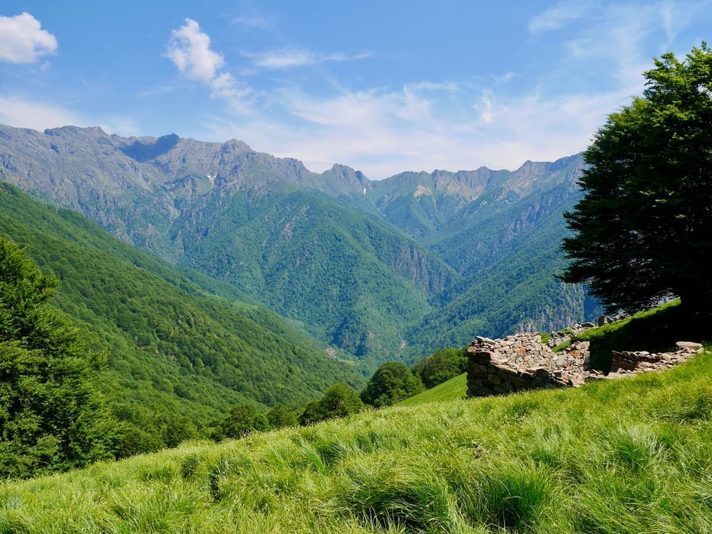
Corte Buè is an abandoned village with a large courtyard. It’s located on the northeastern side of the Corni di Nibbio ridge at over 850 m (2788 ft) above sea level.
The village is popular with hikers as it provides views of several mountains, including Cima Pedum (2,111 m/6,925 ft). Corte Buè is also home to the Bivacco Serena (888 m/2,913 ft), a popular refuge for hikers.
There are two main routes to Corte Buè. You can reach Corte Buè from another abandoned village, Bignuno. From Bignuno, you'll follow the red and white marked mule track uphill and into the valley, passing yet another abandoned village, Pezza Blena.
The trail undulates along the hillside through beech forests before reaching Corte Buè. The hike to Corte Buè from Bignuno takes around 2 hours 30 minutes to complete with an elevation gain of 333 m (1,092 ft).
It's also possible to reach Corte Buè from the end of the Alpe Ompio carriage road. Park at Ruspesso, and then follow the mule track to the left of Rifugio Fantoli (1,000 m/3,280 ft), onto the ridge leading to the summit of Monte Faiè (1,352 m/4,435 ft). The track then diverges and leads down the mountains opposite side, through beech forests towards Corte Buè.
The route from Ompio to Corte Buè is the quickest. The hike takes about 2 hours to complete with an altitude difference of 200 m (656 ft).
Cimone di Straolgio (2,151 m/7 057 ft), with its gentle slopes and vibrant wildflowers, is one of the most accessible mountains in Val Grande National Park.
The best way to hike up Cimone di Straolgio is from Fondo Li Gabbi (or Fondighebi) within Val Loana. From the car park, you'll walk to Bivacco Scaredi (1,845 m/6,053 ft). From Bivacco Scaredi, you'll follow a mule track uphill to the Chapel of Terza (1,859 m/6,099 ft). The views from the chapel towards Monte Rosa (2,786 m/9,140 ft) are spectacular.
From the chapel, there's a relatively new path that zigzags up the southern slope of Cimone di Straolgio to Alpe Straolgio, where you'll find a viewpoint on a rocky outcrop. You'll return by descending to Alpe La Balma before rejoining your original path.
This is a demanding T3 Alpine trail only suitable for experienced hikers. The hike to Alpe Straolgio takes around 6 hours to complete and it has an elevation gain of 961 m (3,152 ft).
There are several challenging yet scalable mountains within Val Grande National Park. Monte Zeda (2,156 m/ 7,073 ft) is the principal peak on the ridge that separates Val Grande from Lago Maggiore.
With its knife-like ridge and pyramidal summit, Monte Zeda is an attractive mountain that draws hikers from across Europe. Monte Zeda is also one of 13 peaks on the Sentiero BOVE, a long-distance Alpine ridge trail that takes around 3 or 4 days to complete.
When not scaled on the Sentiero BOVE, hikers usually tackle Monte Zeda from the east ridge. From the village of Aurano, follow signposts for Passo Folungo and il Colle. Park along the road near il Colle, and follow the old military road to the Passo Folungo (1,369 m/4,491 ft) scenic viewpoint.
From Passo Folungo, the path runs up the southeast side of Monte Zeda. Walk onto the east ridge to reach the summit of Monte Vadà (1,814 m/5,951 ft). You can then return to the military way to reach Bivacco del Pian Vadà (1,711 m/5,613 ft).
The summit of Monte Zeda is just a short walk from the refuge. It's marked with a summit cross, and there's also a box with a summit register. The hike up is a T4 trail with red and white markers that's only suitable for experienced hikers. The trek up Monte Zeda is approximately an 8-hour round trip.
Pizzo Proman (2,098 m/6,883 ft) is the highest summit on a ridge that forms part of the western boundary of Val Grande alongside neighboring peaks Cima Corte Lorenzo (1,574 m/ 5,164 ft) and Pizzo del Lesino (1,990 m/6,528 ft).
Pizzo Proman is usually scaled from the small village of Colloro. This T3 trail is only suitable for experienced hikers, and it takes about 4 hours to complete one way. The trail is called the Colma di Premosello.
From the village, follow the red and white marked trail towards Alpe Lut and the chapel of Madonna di Lut, where there are breathtaking panoramas of Val d’Ossola.
Continue along the red-white marked path, passing Alpe la Piana and Alpe La Motta. At Alpe della Colma, there's the Rifugio Alpe Colma (1,728 m/5,669 ft). The path then turns southeast onto the slopes of Moncucco (1,970 m/6,463 ft).
The summit of Pizzo Proman provides sublime views of the Po River Basin and surrounding mountains massifs, including Monte Rosa (2,786 m/9,140 ft), Monte Leone (3,553 m/11,656 ft), and the Pennine Alps.
Cima della Laurasca (2,193 m/7,194 ft) is the highest peak within Val Loana. The trail to its summit forms a part of the long-distance Sentiero BOVE. Its pointed summit is easily identifiable from the valley floor, making it popular with hikers. The mountain forms part of Val Grande National Park’s northern boundary.
Cima della Laurasca is climbed along the P17 path, a T4 Alpine trail that leads first up Cima della Laurasca, then to the Bivacco Bocchetta di Campo (1,994 m/6,541 ft) and finally to the summit Cima Pedum (2,111 m/6,925 ft). The walk takes about 2 hours 30 minutes to complete one-way and is only suitable for experienced hikers.
You can pick up the trail from the village of Malesco. Follow the signposts from the village center towards "Val Laona" and "Scaredi." Once you reach the path, it's well signposted and generally easy to follow.
There are several exposed sections along the trail as it weaves up the mountainside. The last 200 m (656 ft) of the walk to the summit of Cima della Laurasca is steep and unmarked.
The walk then continues over a ridge between Val Pogallo and Valle Aperta to the summit of Cima Pedum.
While there are no major settlements within Val Grande National Park, the surrounding area boasts picturesque lakeside towns, bustling metropolises, and quaint mountain villages. Read on to find out about the main cities and towns near Val Grande National Park.
Hikers looking to stay in a major city near Val Grande National Park should visit Milan. Italy's second-largest city, Milan is one of Europe’s most culturally significant metropolitan areas. It’s also considered to be one of the world's fashion capitals.
The crowning jewel of Milan's historic landmarks is the Duomo di Milano, the third-largest cathedral in the world. Interestingly, marble used in the construction of the cathedral comes from Mergozzo on the edge of Val Grande National Park.
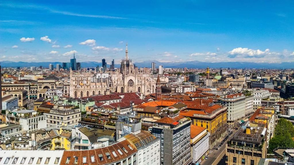
Milan is located approximately 112 km (70 mi) from Val Grande National Park, and it’s easy to reach by car. Milan is home to some of the finest hotels in Italy, including the Gran Duca di York, The Westin Palace, and Klima Hotel Milano Fiere.
Other significant cities near Val Grande National Park worth visiting include Varese, Como, and Gallarate.
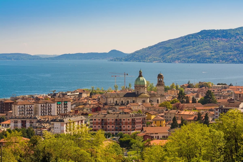
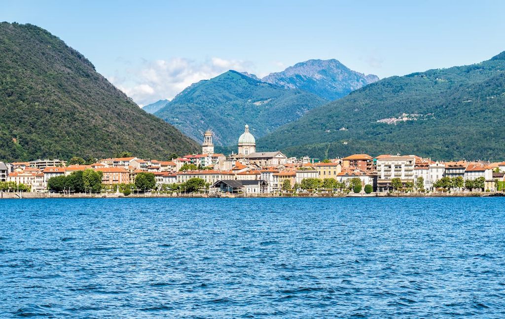
Sat on the shores of Lago Maggiore is the capital of Verbano-Cusio-Ossola, Verbania. Verbania is a historic and beautiful city, with many architectural wonders, like the Villa Taranto Botanical Gardens. No trip to Verbania is complete without a visit to Isola Bella, a stunning eighteenth-century palace perched on one of the Borromean Islands.
Verbania is located approximately 16 km (10 mi) to the south of Val Grande National Park. With a population of over 30,000 people, it's the closest significant settlement to the park. Popular hotels in Verbania include Grand Hotel Majestic, Europalace Hotel, and Hotel Ancora.
Other settlements along Lago Maggiore near Val Grande National Park include Stresa, Baveno, and Arona.
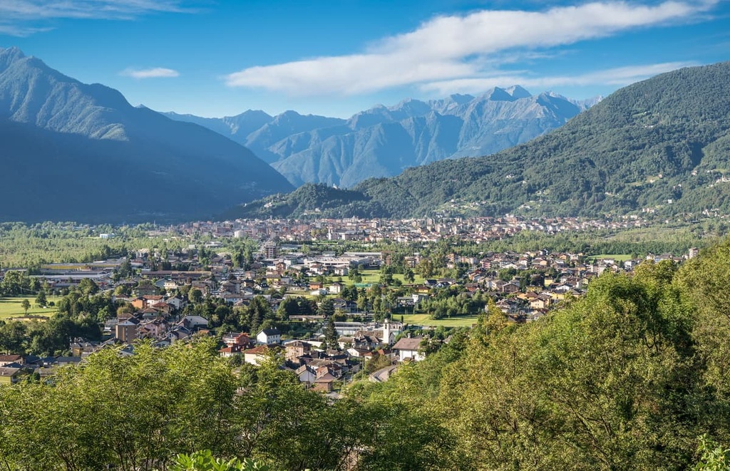
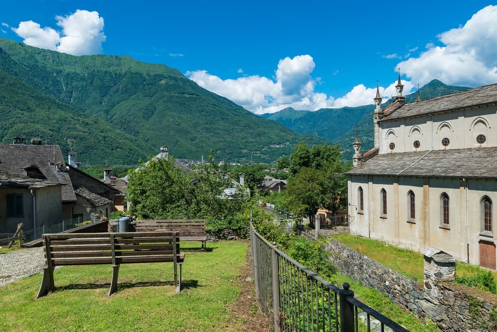
Located less than 10 km (6 mi) north of Val Grande National Park is Santa Maria Maggiore. Santa Maria Maggiore is one of Val Grande's main mountain resorts. It’s recognized with an Orange Flag (Bandiera Arancione) by the Italian Touring Club (TCI) due to its amenities and welcoming locals.
Santa Maria Maggiore has a unique culture, and it hosts a number of interesting events like the International Chimney Sweep Gathering and the largest Christmas market in Piedmont. Popular hotels in Santa Maria Maggiore include Hotel Miramonti, Hotel La Scheggia, and Hotel Oscella.
Other notable Alpine towns and villages near Val Grande National Park include Malesco, Vogogna, and Premosello-Chiovenda.
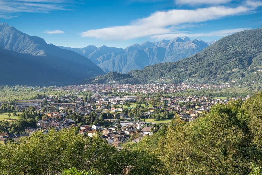
Domodossola is the main city in Ossola, though it is often overlooked by visitors to Val Grande National Park. A historic settlement, Domodossola was a chief town in Lepontii when the Romans conquered the area in 12 BCE. During the Second World War, Domodossola declared Val d’Ossola an Italian partisan republic, which became a symbol for anti-fascist movements in Italy.
You’ll also find some noteworthy attractions in Domodossola. The Sacred Mount Calvary of Domodossola (Sacro Monte Calvario) is a seventeenth-century Roman Catholic sanctuary and UNESCO World Heritage Site. Domodossola is also located approximately 10 km (6 mi) from the popular ski resort, Domobianca.
Thanks to the Domodossola railway station and E62 road, Domodossola is easily accessible for Swiss travelers from Birg and Locarno. Accommodation options in Domodossola include Eurossola, Hotel Corona, and Residence Briona.
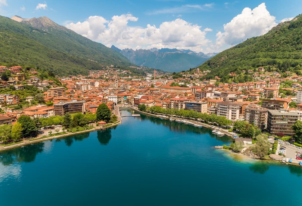
Resting on Lago d'Orta 25 km (15.5 mi) to the south of Val Grande National Park is Omegna. One of Piedmont's largest settlements, this picturesque town is known for its vibrant weekly lakeside market that’s hosted every Thursday.
While in Omegna, ensure you take the ferry across Lago d'Orta to visit some of the other villages and attractions dotted around the lake, including San Giulio Island, Pella, and Pettenasco. Hotels in Omegna include La Francisca, Al Poggio, and Albergo Croce Bianca.