
Scan the QR code and open PeakVisor on your phone
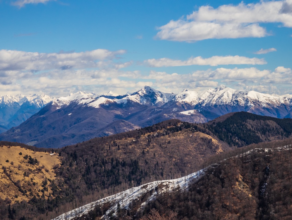
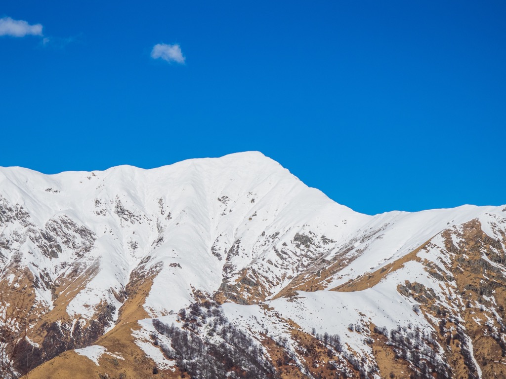
The Ticino Alps (Tessiner Alpen) are a mountain range encompassing the western portion of the Lepontine Alps. They are among southern Switzerland's finest hiking and skiing destinations. The range also features one of the Alps' largest wildernesses, as well as the serene Lago Maggiore. There are 618 named mountains in the Ticino Alps; Basòdino (3,273 m / 10,738 ft) is the highest, while Monte Togano (2,301 m / 7,549 ft) is the most prominent.
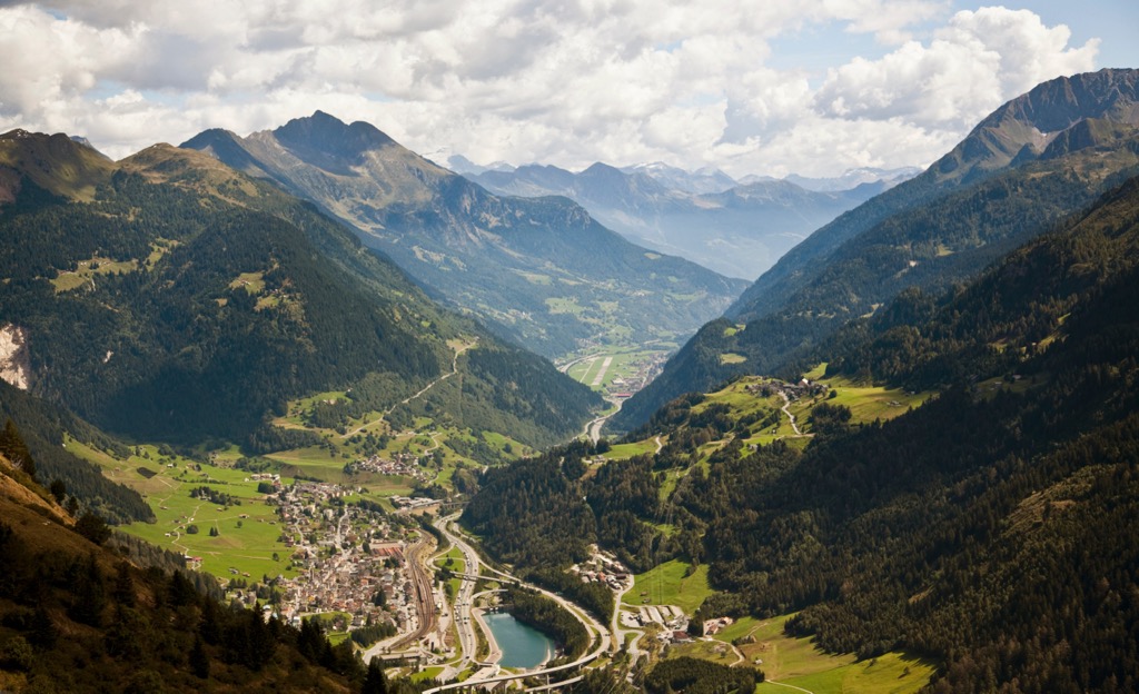
The Ticino Alps take their name from Ticino, Switzerland's southernmost canton. They cover an area of approximately 2,500 sq km (965 sq mi) across Ticino and northeastern Verbano-Cusio-Ossola in Italy.
The Ticino Alps are part of the Western Alps and are bounded by several other mountain ranges. To the east, across the Ticino River, is the eastern half of the Lepontine Alps, the Adula Alps. To the north, over the Oberalppass (2,044 m / 6,706 ft) and the Monte Leone and San Gottardo Alps, are the Glarus Alps. The Furkapass (2,436 m / 7,969 ft) to the northwest separates the Ticino Alps from the Uri Alps.
To the west, the Valle d'Ossola and the Toce River form a boundary between the Ticino Alps and the mighty Pennine Alps (Walliser Alpen). To the south-southeast of Lugano are the Lugano Prealps.
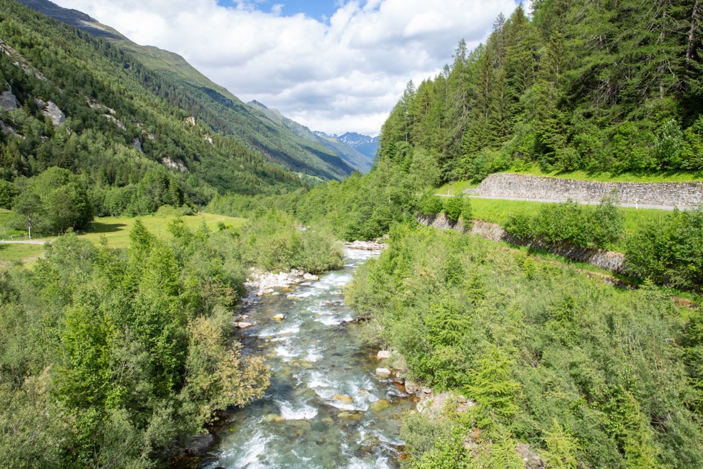
The Ticino Alps' major rivers and lakes help to form its boundaries. The Ticino River, a main tributary of the Po, runs along the range's northern and eastern edges. With a surface area of 212.5 sq km (82 sq mi), Lago Maggiore makes up its southeastern edge. The 76 km (47 mi) long Toce River constitutes the Ticino Alps' southwestern border.
Most of Val Grande National Park (Parco Nazionale della Val Grande), described as one of the largest wildernesses in the Alps, falls within the Ticino Alps. The largest settlements in and around the Ticino Alps are Bellinzona, Verbania, Domodossola, and Locarno.
Four principal mountain chains form the Ticino Alps:
The Basodino-Cristallina-Biela Chain snakes its way along the Swiss-Italian border and is the highest in the Ticino Alps. The group takes its name from its three main summits: Basòdino, Pizzo Cristallina (2,912 m / 9,553 ft), and Pizzo Bièla (2,863 m / 9,393 ft).
The chain is located between Val Formazza to the west and Val Bavona to the east. Its northern limit is the Passo San Giacomo (2,636 m / 8,648 ft). Other notable summits in the group include Kastelhorn (Corno Castello) (3,128 m), Pizzo San Giacomo (2,924 m / 9,593 ft), and Pizzo del Forno (2,696 m / 8,845 ft).
The Onsernone Group is located directly south of the Basodino-Cristallina-Biela Chain. It takes its name from the central Val Onsernone.
The northern limit of the Onsernone Group is the Passo della Fria (2,499 m / 8,198 ft), with Valle Maggia to the east and Val Vigezzo to the west. The highest summits of the Onsernone Group are Pizzo dell'Alpe Gelato (2,613 m / 8,572 ft), Pizzo di Medéi (2,551 m / 8,369 ft), and Pizzo di Porcaresc (2,467 m / 8,093 ft).
The Togano-Laurasca-Limidario Chain forms a barrier between the Val Vigezzo and Lago Maggiore. It runs partly along the Swiss-Italian border before bending southwards through Italy.
The group takes its name from its three main summits: Monte Togano, Cima della Laurasca (2,193 m / 7,194 ft), and Monte Limidario (2,189 m / 7,181 ft). Most of the chain is within Val Grande National Park.
The Campo Tencia-Zucchero-Madone Grosso Chain is the primary mountain group in the eastern Ticino Alps. The chain is located entirely in Switzerland, with Valle Maggia to the west and the Val Leventina and Valle Riviera to the east.
The Campo Tencia-Zucchero-Madone Grosso Chain is named after its three main summits: Pizzo Campo Tencia (3,071 m / 10,075 ft), Madone Grosso (2,746 m / 9,009 ft), and Monte Zucchero (2,736 m / 8,976 ft).
The Ticino Alps and the rest of the Alps are relatively new, having formed approximately 66 million years ago during the Alpine Orogeny.
The Alpine Orogeny is a mountain-building event caused by the African, Arabian, Indian, and Cimmerian tectonic plates to the south colliding with the Eurasian Plate to the north. Convergent movement between these plates created the basis of the modern Alps.
One of the unique geological features of the Ticino Alps is the Lepontine Dome, a region of tectonic uplift across the Leptonine Alps and Glarus Alps.
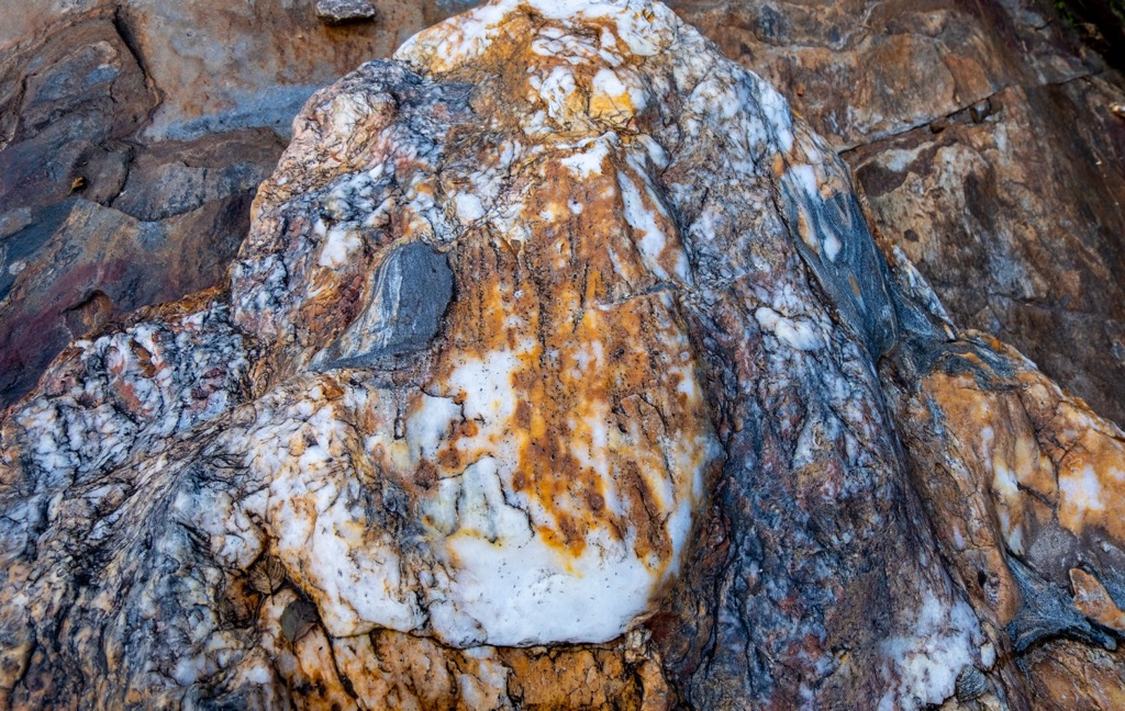
Areas of the Alps north of the Periadriatic Seam, Southern Europe's main fault line, consist of three rock thrust sheets called nappes: the Helvetic, the Penninic, and the Austroalpine.
These three nappes are stacked on one another across the Lepontine Alps. The top Austroalpine nappe has almost completely eroded, leaving behind Helvetic sedimentary limestones, shales, and marls, as well as Penninic metamorphic phyllites, schists, and amphibolites.
Sesia Val Grande Geopark, within Val Grande National Park, is home to one of the Alps' most geologically significant regions.
Here, a large exposed section of the Earth's crust has provided geologists with critical insights into the formation of the Alps. It's also possible to identify the remnants of a supervolcano system that once had a caldera 25 km (15.5 mi) deep.
The Ticino Alps are home to one of the Alps' largest wilderness regions, providing a snapshot of biodiversity in the High Alps.
Common large mammal species in the Ticino Alps include roe deer, chamois, and ibexes. At the other end of the scale, dormice and wild mice are among the smallest mammals. Beech martens, badgers, foxes, and weasels are the most numerous carnivores.
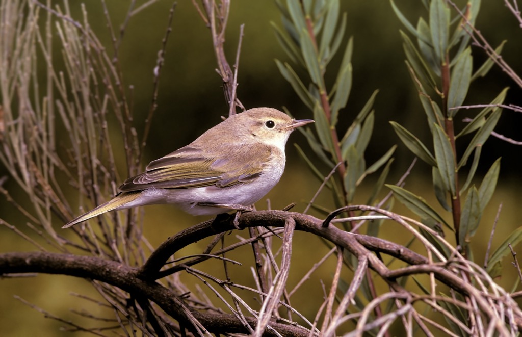
Golden eagles, Eurasian eagle owls, and peregrine falcons are a few of the impressive birds of prey within the Ticino Alps. Black woodpeckers, black grouses, western Bonelli's warblers, and red-backed shrikes thrive within the forests of the Ticino Alps.
Common European adders are widespread across the Ticino Alps and are the only venomous snake species in the region. However, these snakes prefer to hidden under rocks or in bushes and are rarely seen by visitors.
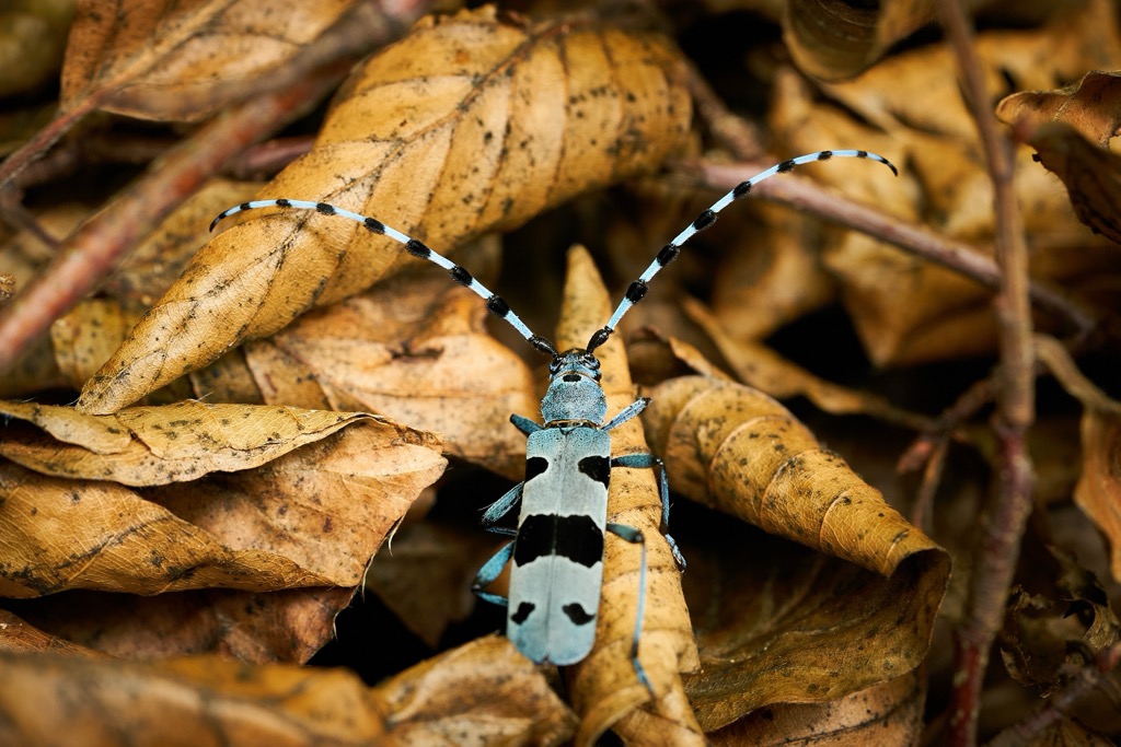
Thousands of insect species inhabit the Ticino Alps, some of which are endemic. For example, the Carabus lepontinus beetle species is only found on the slopes of Monte Zeda (2,156 m / 7,073 ft). Several protected insect species, like Rosalia longicorns, Russian leather beetles, and variable chafers, also call the Ticino Alps home.
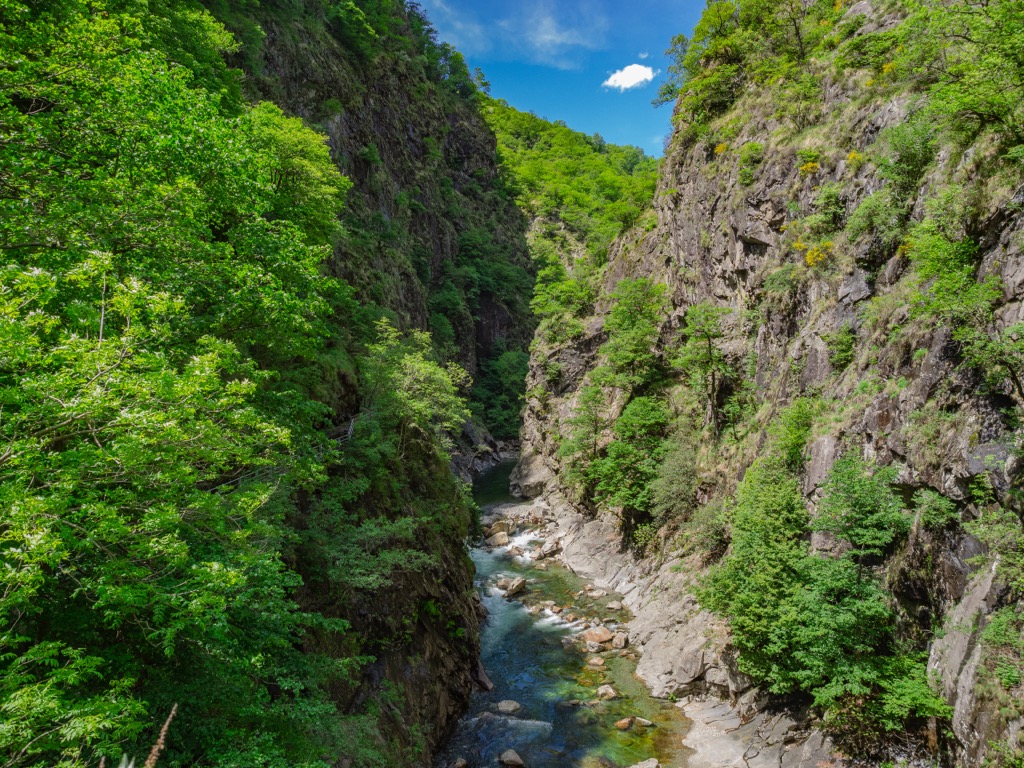
The Ticino Alps' waterways and lakes contain many aquatic creatures, most notably river trout and bullheads.
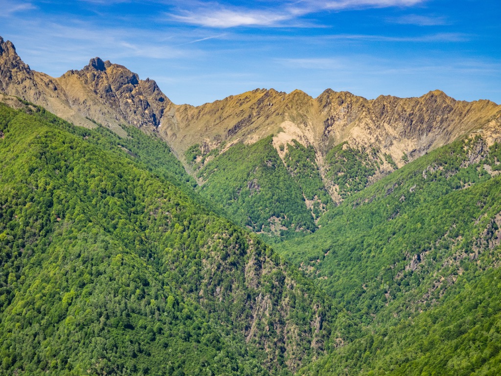
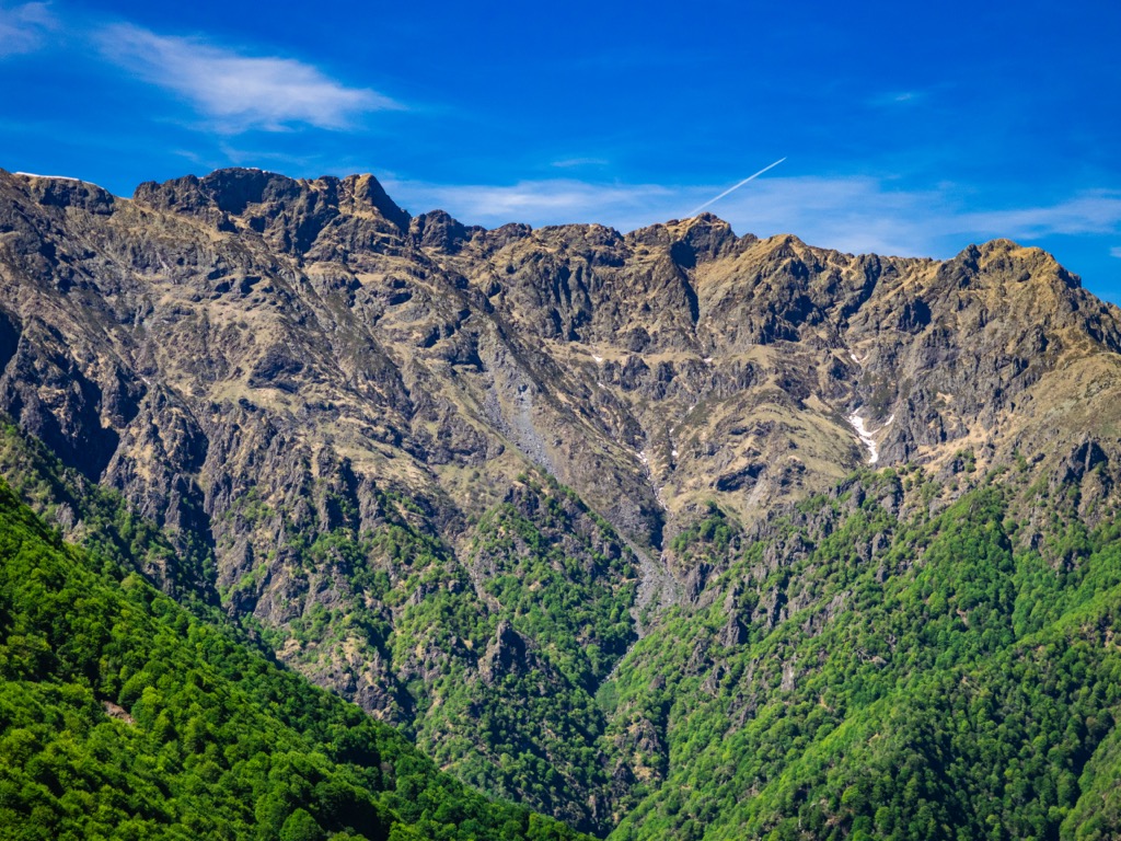
Large areas of the Ticino Alps are forested. Around 36% of Val Leventina, Ticino's main valley, is carpeted in woodlands.
Low in the valleys, mixed broadleaf forests, mainly composed of chestnut trees, are most common. Mixed coniferous forests dominate the landscape at higher elevations, comprising beeches, firs, and spruces.
Lago Maggiore's thermal impact means the Ticino Alps have a wealth of flora. Blueberry bushes and rhododendrons grow above the treeline on the shrublands and alpine pastures.
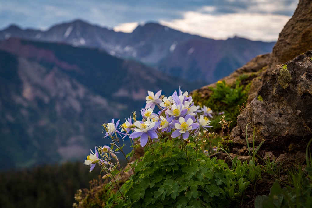
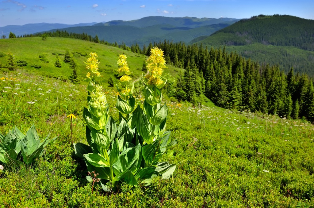
Some of the rarest flowering plants in the Alps flourish on the Ticino Alps' pastures, including Alpine columbines, great yellow gentians, perforate bellflowers, and mountain arnicas. Edelweiss, the national flower of Switzerland, is a common sight at high altitudes.
In some marshy areas of the Ticino Alps, like Scaredi Alp in Val Grande National Park, you may spot wetland specialist plant species, like Alpine tulips and cotton grass.
Since the Iron Age, humans have been leaving their mark on the beautiful landscape of the Ticino Alps.
Humans have lived in the Ticino Alps for thousands of years — rock engravings in the Val Grande date back over 3,000 years. These engravings are prevalent throughout Val Grande National Park, ranging from simple cup-like markings to intricate anthropomorphic drawings.
A Celtic tribe named the Lepontii were the first permanent settlers in Ticino, the namesake of the Lepontine Alps. They were the sole inhabitants of the region until Ticino became part of the Roman Empire in the 1st century CE.
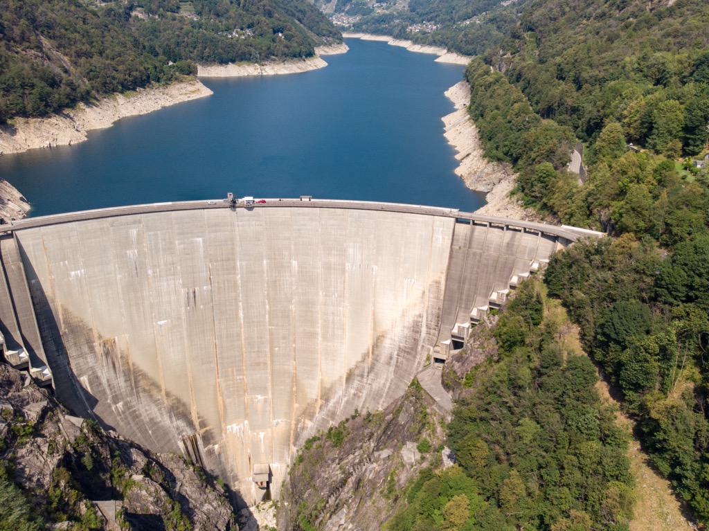
One of the Ticino Alps' recent claims to fame is the Verzasca Dam in Val Verzasca; James Bond jumps off the dam in the opening scene of the 1995 film Goldeneye. Today, it's a popular bungee jumping spot for daredevils looking to recreate the iconic scene… or just an adrenaline rush.
Many of the first ascents of the Ticino Alps' main summits occurred in the mid-19th century, during the golden and silver ages of alpinism. Basòdino was first scaled in 1863. However, most first ascents across the Ticino Alps are not as well documented as in other Alpine regions.
Nevertheless, one well-documented ascent is of Pizzo Campo Tencia in 1867. The Swiss Alpine Club (SAC) yearbook describes the ascent in detail over 40 pages. Pizzo Campo Tencia's first ascent was by G. Studer, W. Lindt, and F. Aebi, along with two guides, P. Sulzer and Caegn.
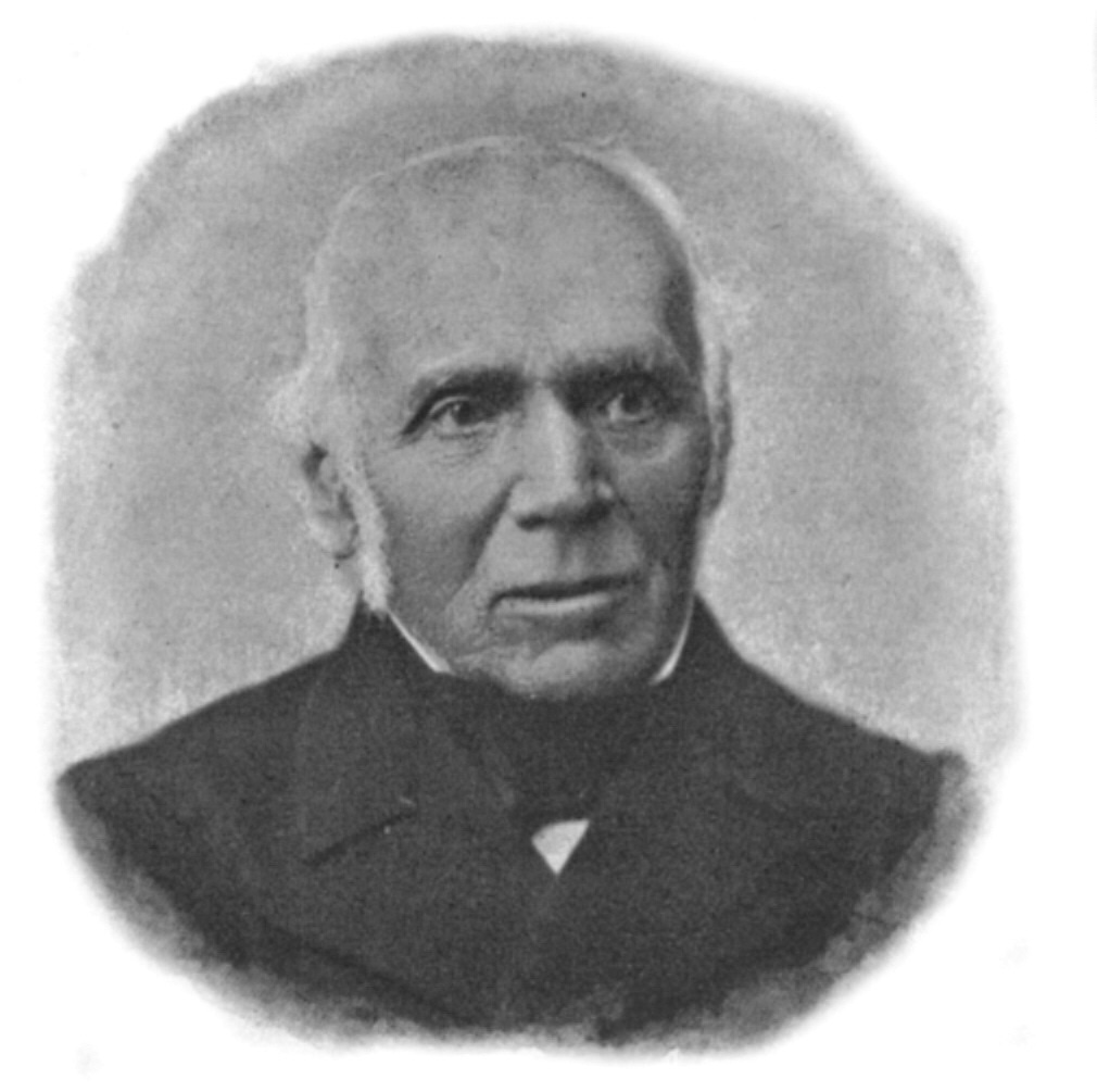
Gottlieb Studer was one of the founders of the SAC. He climbed over 650 mountains in his lifetime and is credited for the first ascent of the Bernese Alps' Wildhorn (3,250 m / 10,662 ft) in 1843. Studer and Sulzer were also part of the group that first summited the Bernese Alps' Großes Wannenhorn (3,906 m / 12,814 ft) in 1864.
Val Grande National has little to no settlements within its boundaries, earning it the reputation as one of the largest wilderness areas in the Alps. After nearly 40 years of deliberation, Val Grande National Park was established in 1992.
The Ticino Alps can be extremely isolated, especially around Val Grande. When hiking in the Ticino Alps, bring plenty of provisions and appropriate equipment. Map out your route, check local weather forecasts, and inform others of your itinerary.
Here, you can find the Swiss Alpine Club’s rating for hiking and mountaineering, referenced in this article.
The PeakVisor mobile app is the ultimate tool for planning your adventure in the Ticino Alps. It provides information on local hiking trails, ski tours, mountain huts, weather forecasts, lift schedules, and more. For nearly a decade, we've been working hard to create a comprehensive app for all outdoor expeditions, whether you're a hiker, skier, or alpinist.
Basòdino (3,273 m / 10,738 ft) is the highest summit in the Ticino Alps and the second-highest mountain in the Lepontine Alps after Rheinwaldhorn (3,402 m / 11,161 ft).
Basòdino is arguably more popular for ski tours but is also a demanding yet rewarding trek for experienced hikers. Basòdino's normal route is rated T5 and PD on the SAC hiking and ski tour scales. Melting glaciers have rendered the Basòdino ascent increasingly difficult over the last few years.
Basòdino's normal route involves hiking from San Carlo to Capanna Piano delle Creste (2,108 m / 6,916 ft) and then from the refuge to Tamierhorn (Punta di Tamia) (3,087 m / 10,127 ft) via the mountain's eastern side.
From Tamierhorn, hike to Passo d'Antabia (3,033 m / 9,950 ft) and Basòdino's southern summit. From Basòdino's southern summit, cross a narrow ridge to its main peak. You'll be treated to sublime panoramas of Valle Maggia and Val Formazza from the summit.
You can descend in a northeasterly direction via the Ghiacciaio del Basòdino (2,879 m / 9,445 ft) and Capanna Basòdino CAS (1,859 m / 6,099 ft). This hike is approximately 20 km (12.4 mi) in length.
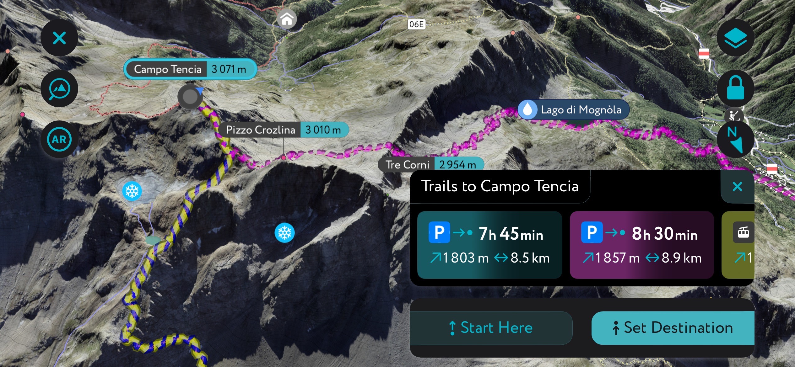
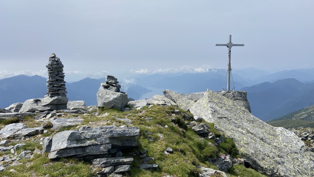
Pizzo Campo Tencia (3,071 m / 10,075 ft) is the highest mountain located entirely within Ticino and the fifth-highest summit in the Lepontine Alps.
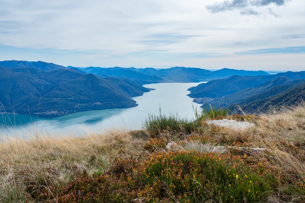
It's the highest peak encircling the Val Leventina, affording uninterrupted views of the eastern Ticino Alps. Lago di Morghirolo (2,264 m / 7,427 ft) and Ghiacciaio di Crozlina (2,770 m / 9,088 ft) are just north of the summit, adding to the area's beauty.
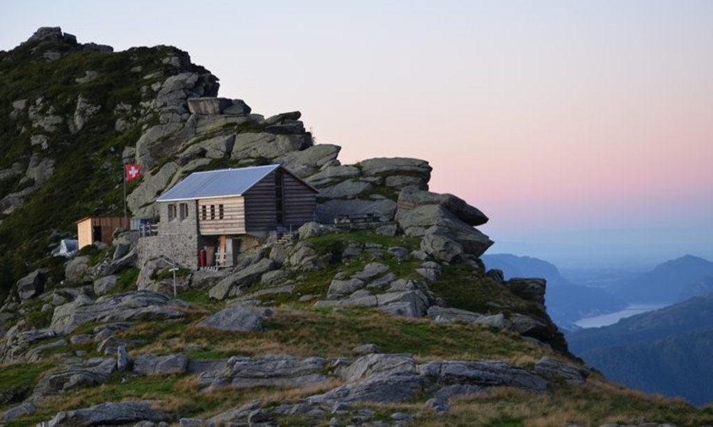
Pizzo Campo Tencia's normal route is a tricky T4+ graded trail starting from Capanna Campo Tencia (2,140 m / 7,021 ft). The first-ever ascent of Pizzo Campo Tencia was much more complicated than now — the shrinking Ghiacciaio di Crozlina has revealed easier ways of scaling the mountain.
From the Capanna Campo Tencia mountain hut, follow the well-marked trail towards the mountain's northeastern pillar at 2,540 m (8,333 ft) in elevation. Then, you'll need to scramble towards Bocchetta di Crozlina (2,864 m / 9,396) before turning left on the northwest ridge to reach the summit.
To descend, follow the white-blue-white markings towards Rifugio Pradòi (2,149 m / 7,050 ft) and then onto Capanna Soveltra (1,534 m / 5,032 ft). Note that there is no accommodation at Capanna Soveltra — the hut burned down in 2017.
You'll then continue to the endpoint in Prato, where there's a bus to Locarno via Bignasco. On the way to Prato, you can take a detour to Pizzo Campala (2,645 m / 8,677 ft). This walk is approximately 13 km (8 mi) in length.
Cima dell'Uomo (2,390 m / 7,841 ft) and Pizzo di Vogorno (2,442 m / 8,011 ft) sit at the northern end of the Italy's second-largest lake, Lago Maggiore.
The views from both summits are sensational. You'll have unimpeded vistas of Lago Maggiore and mountains along Val Leventina's western ridge, including Pizzo Molinera (2,298 m / 7,539 ft) and Pizzo di Claro (Visagno) (2,727 m / 8,946 ft). From Pizzo di Vogorno, the views of the Pennine Alps' Monte Rosa Chain, the second highest in the Alps, are particularly special.
It's possible to climb these mountains separately or together on a satisfying, long trek called the Mornera Route, which is T4-graded. This trail also includes a detour to Madone (2,395 m / 7,857 ft), which separates Cima dell'Uomo and Pizzo di Vogorno.
You can pick up this trail from the Mornera cableway station (Funivia Monte Carasso - Mornera), which takes you to an elevation of over 1,100 m (3,608 ft). From the station, follow the signposts for Albagno, through the Valle di Gorduno, to the Capanna Albagno (1,870 m / 6,135 ft).
Then, continue onto the Bocchetta d’Erbea (2,251 m / 7,385 ft) and Bocchetta della Cima dell’Uomo (2,276 m / 7,467 ft). The trail here has white-red-white markings. There's a short rock climbing section to reach Cima dell'Uomo's summit.
Then, head downhill towards Colletto di Torasella, passing just below Madone and Bocchetta di Rognoi (2,219 m / 7,280 ft). Traverse a ledge with chains before climbing a slope to Pizzo di Vogorno's summit.
To descend, pass by the Capanna Bardughè (1,642 m / 5,387 ft), following the white-red-white marking to Vogorno village. This route is approximately 13 km (8 mi) in length.
Pizzo Leone (1,659 m / 5,442 ft) is another popular mountain near Lago Maggiore. It stands on Lago Maggiore's northeastern shoreline, providing sweeping views south across the Swiss-Italian border.
The best way to scale Pizzo Leone is from the parking area above Porera to the mountain's northeast. It's a straightforward trail that both hikers and mountain bikers will enjoy.
The trail starts by heading away from Pizzo Leone to Corona dei Pinci (1,294 m / 4,245 ft), which offers vistas across Lago Maggiore to Monte Gambarogno (1,734 m / 5,689 ft) and the Valle Maggia. If you fancy a shorter walk, you can skip Corona dei Pinci.
The trail then leads across the picturesque Alpe di Naccio on the way to Pizzo Leone's summit cross. From the summit, you'll have excellent views of the Lugano Prealps. This walk is approximately 10.6 km (6.5 mi) in length.
The Sentiero Bove is a multi-day looped hiking route that meanders along the ridges of Val Grande National Park from Cicogna. It's named after 19th-century Italian explorer Giacomo Bove.
The Sentiero Bove is a ridge walk that includes many of the finest mountains in Val Grande National Park, including Monte Zeda (2,156 m / 7,073 ft), Cima Sasso (1,916 m/6,286 ft), and Pizzo Proman (2,099 m / 6,886 ft) and Cima della Laurasca (2,193 m / 7,193 ft).
This multi-day hike is approximately 31 km (19.2 mi) long and is usually completed in 3 or 4 days. It's a demanding trek suitable only for experienced hikers — the second stage is graded EEA by the Italian Alpine Club (CAI).
The first stage leads from Cicogna to the Rifugio CAI Pian Cavallone (1,530 m / 5,019 ft). It leads over the Rio Pogallo stream and Alpe Curgei. This section is very steep in places but is the most straightforward day of the Sentiero Bove.
The second stage leads from the Rifugio CAI Pian Cavallone to the Bivacco Scaredi (1,841 m / 6,040 ft). It's the most challenging stage of the Sentiero Bove and can take 12 hours to complete.
Start by climbing Pizzo Marona (2,051 m / 6,729 ft), then traverse the Passo del Diavolo (1,878 m / 6,161 ft) on the way to Monte Zeda. The trail continues to La Piota (1,927 m / 6,322 ft), around Cima Crocette's summit (1,896 m / 6,220 ft), and under Monte Torrione (1,984 m / 6,509 ft).
Past the Bocchetta di Terza (1,836 m / 6,023 ft) and Val Pogallo, you'll have the option to climb Cima Marsicce (2,135 m / 7,004 ft). After the Bocchetta di Cortechiuso (2,066 m / 6,778 ft), you'll descend to the Bivacco Scaredi. Bivacco Lidesh (1,590 m / 5,216 ft) and Bivacco Cortechiuso (1,883 m / 6,177 ft) are two easily accessible bivouacs on this stage.
The Sentiero Bove's final stage returns to Cicogna. Start by going along Cima della Laurasca's western slopes to the Bocchetta di Scaredi (2,095 m / 6,873 ft) and the Bocchetta di Campo (1,770 m / 5,807 ft), where there's a bivouac.
You'll soon reach the Strette del Casè, one of the Sentiero Bove's most dangerous sections. From here, descend to Ghina, then Alpe Cavrua, and back to Cicogna.
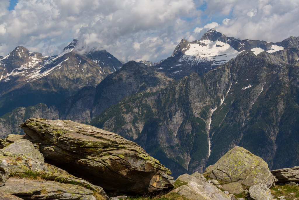
Despite being not as high and heavily glaciated as the nearby Pennine Alps, the Ticino Alps still boasts over 300 km (186 mi) of ski slopes.
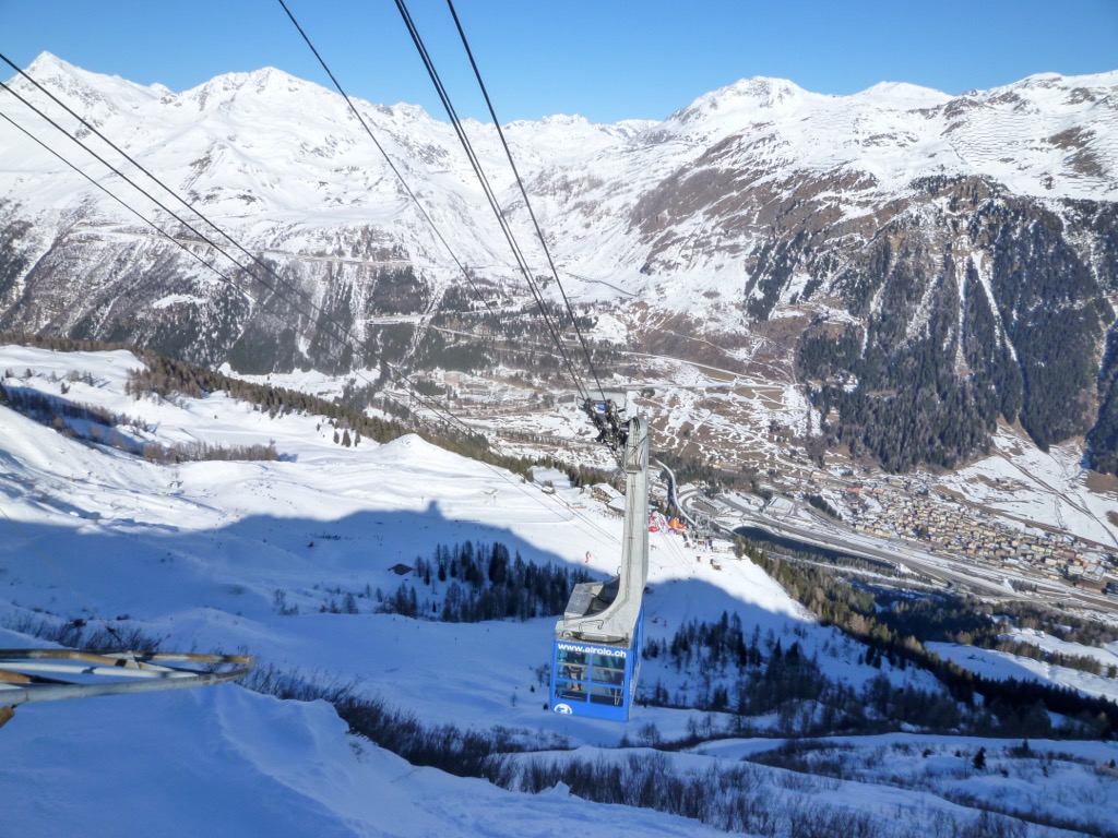
You'll find five main ski areas in the Ticino Alps:
Countless exciting ski tours of varying difficulty await you in the Ticino Alps. Thousands of ski tours are available through the PeakVisor App on both sides of the Swiss-Italian border. The Ticino Alps are in the middle of one of our most heavily mapped regions.
Let's take a peek at a couple of the most popular ski tours in the Ticino Alps and some of the PeakVisor App's features that make it perfect for planning your next expedition.
Monte Limidario (2,189 m / 7,181 ft), or Gridone, is one of the highest summits overlooking Lago Maggiore within the Ticino Alps. Despite its height of over 2,000 m (6,561 ft), it can be reached easily by foot or skis.
One of the best ski tours of Monte Limidario begins at the car park near Il Bosco Sacro di Mergugno. The route passes over the Bocchetta di Valle (1,948 m / 6,391 ft) and by the Rifugio Al Legn (1,802 m / 5,912 ft). Due to narrow ledges, you should take care when navigating the mountain's crest. This ski tour is approximately a 7.4 km (4.6 mi) round trip.
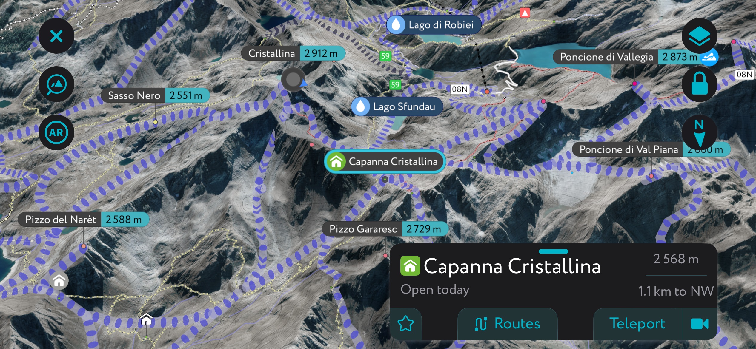
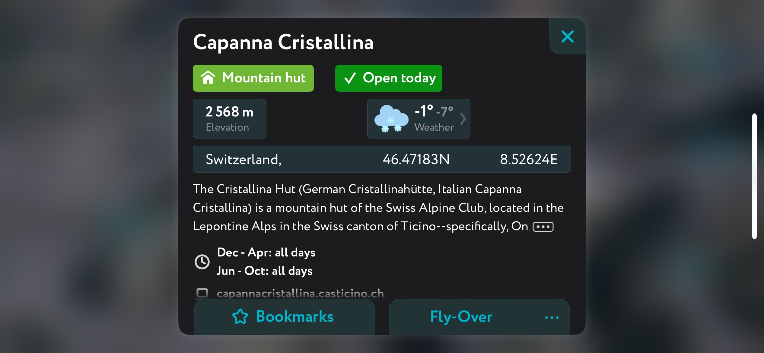
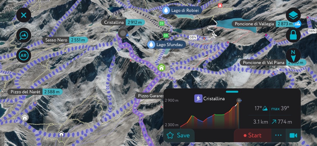
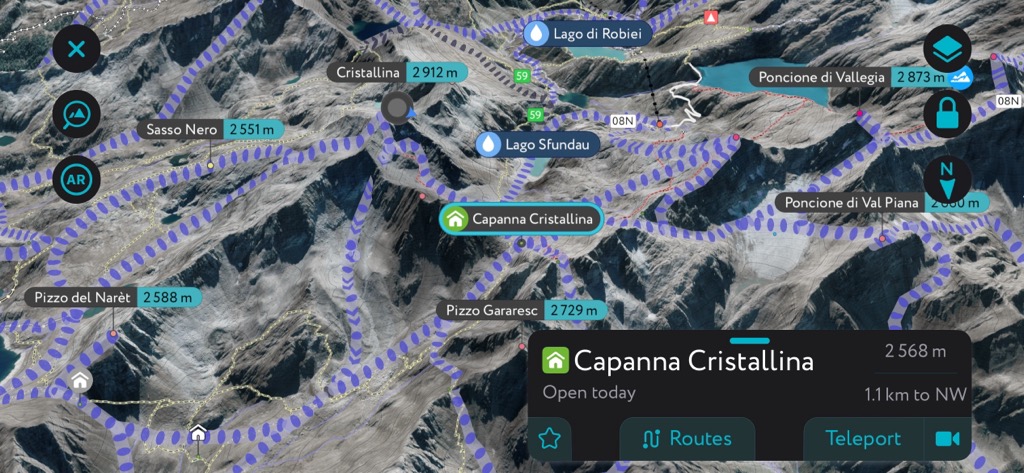
Pizzo Cristallina (2,912 m / 9,553 ft), or simply Cristallina, is one of the classic ski tour locations in the Ticino Alps. Its mountain hut, Capanna Cristallina (2,568 m / 8,425 ft), is one of the highest and largest in the range and is easily accessible on skis from several directions.
The normal route to Capanna Cristalina starts from Ossasco to the north and is graded PD+ by the SAC. The route passes over the Alpe di Cristallina and then on the west side of the Val Torta.
In poor conditions, staying on the valley's east side is safer before climbing onto the Passo Cristallina (2,568 m / 8,425 ft) to reach Capanna Cristallina. This ski tour is approximately a 16 km (10 mi) round trip.

We've significantly improved the PeakVisor App to make it an essential tool when hiking or skiing anywhere worldwide.
Our detailed 3D maps provide info on local weather forecasts and snow depth to ensure your ski tour goes smoothly. You can also learn all you need about mountain huts, including opening hours, dining options, contact details, and more.
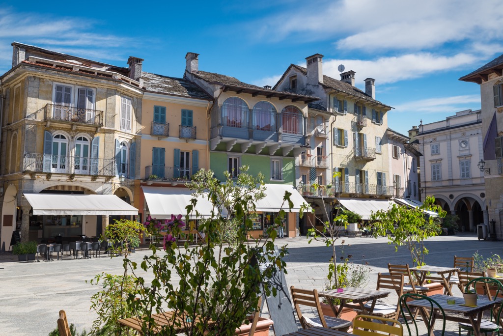
From lakeside resorts to quaint alpine villages, the Ticino Alps offer a wide variety of settlements where you can relax after a long day in the mountains.
Milan Malpensa Airport is the nearest international airport to the Ticino Alps, located approximately 110 km (68 mi) to the south.
The Swiss Federal Railways' Gotthard Line serves several towns in the Ticino Alps, including Bellinzona, Biasca, and Airolo. The Rete Ferroviaria Italiana's (RFI) Milan–Domodossola railway serves Verbania and Domodossola.
Bellinzona is the capital of the Ticino canton and the largest settlement in the Ticino Alps. It has a population of over 43,000 people. Bellinzona is located on the southeastern boundary between the Ticino Alps, Adula Alps, and Lugano Prealps.
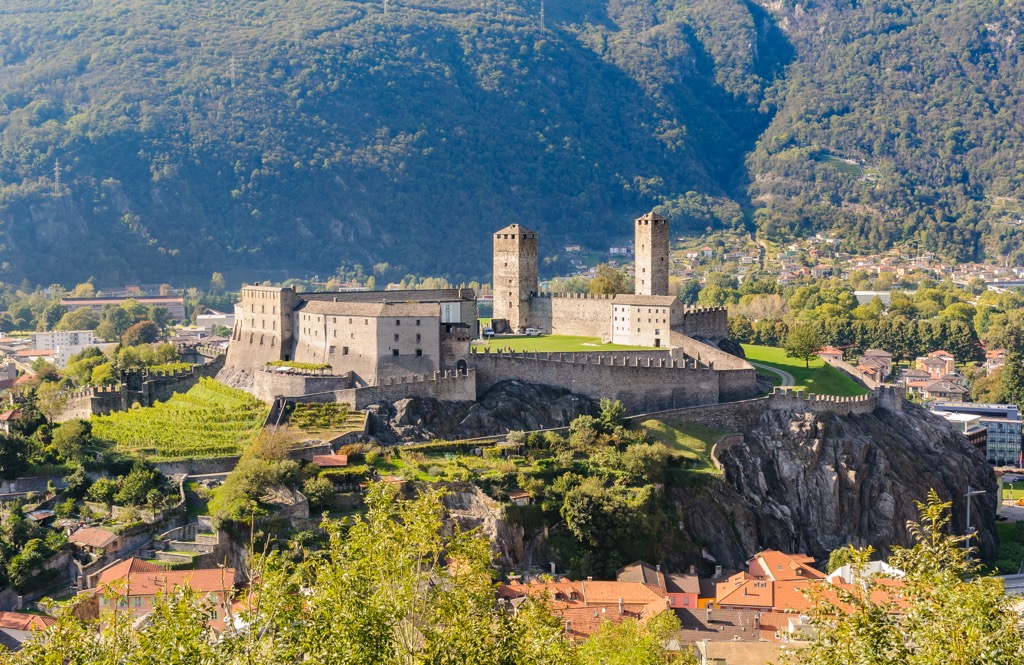
Bellinzona is a historic city famed for its three UNESCO-protected castles: Castelgrande, Montebello, and Sasso Corbaro. Most of each castle's fortifications were built between the 13th and 15th centuries.
Bellinzona's position offers easy access to many popular mountains across three ranges. The Ticino Alps' Pizzo di Vogorno, the Lugano Prealps' Monte Tamaro (1,961 m / 6,433 ft), and the Adula Alps' Pizzo di Claro (2,727 m / 8,946 ft) are all within 15 km (9.3 mi) of Bellinzona.
Verbania is the capital of Italy's Verbano-Cusio-Ossola province, with a population of over 30,000. It's located on the shores of Lago Maggiore on the Ticino Alps' southern tip.
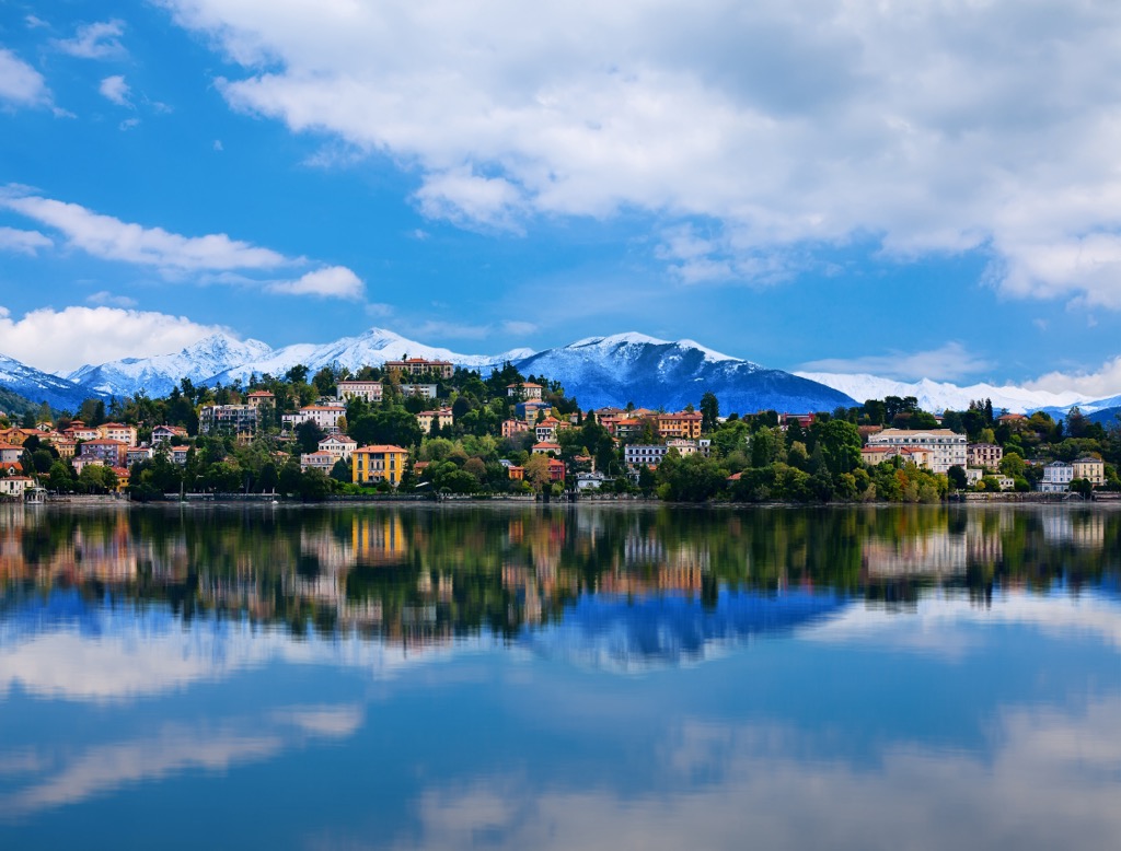
Verbania is one of the oldest settlements in the region, dating back to the 1st century Roman Empire. Today, its beauty and lakeside position make it a popular spot for a romantic getaway.
Verbania is less than 10 km (6.2 mi) south of Val Grande National Park, making it the perfect place to relax after hiking on the Sentiero Bove.
Domodossola is the third-largest settlement in the Ticino Alps, with a population exceeding 17,000. It's located within the Valle d'Ossola on the range's western edge.
Domodossola is a pilgrimage site that attracts Catholics from around the world. It's home to the UNESCO-protected 17th-century Sacro Monte Calvario.
Domodossola is located within 15 km (9.3 mi) of several popular peaks in the Pennine Alps, like Seehorn (2,439 m / 8,001 ft) and Camoscellahorn (2,612 m / 8,569 ft), as well as the Ticino Alps' Monte Togano.
Cannobio may be smaller than Locarno, but it's arguably the most attractive settlement on Lago Maggiore's shoreline. It features one of the lake's best promenades and charming cobbled streets lined with 17th-century buildings.
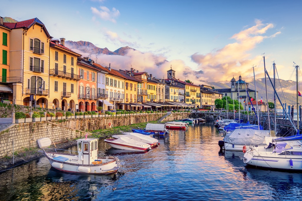
One of Lago Maggiore's most famous resorts, Cannobio is home to a pristine Lido where you can soak up the sun. One of the town's top attractions is the Sanctuary of the Santissima Pietà, which was the site of a supposed miracle in 1522.
Cannobio is less than 10 km (6.2 mi) from several popular mountains, including Monte Limidario and Pizzo Leone, from which you can appreciate panoramas of Lago Maggiore.


