
Scan the QR code and open PeakVisor on your phone
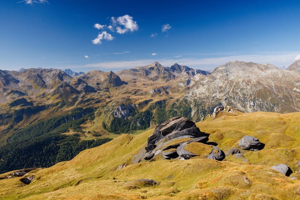
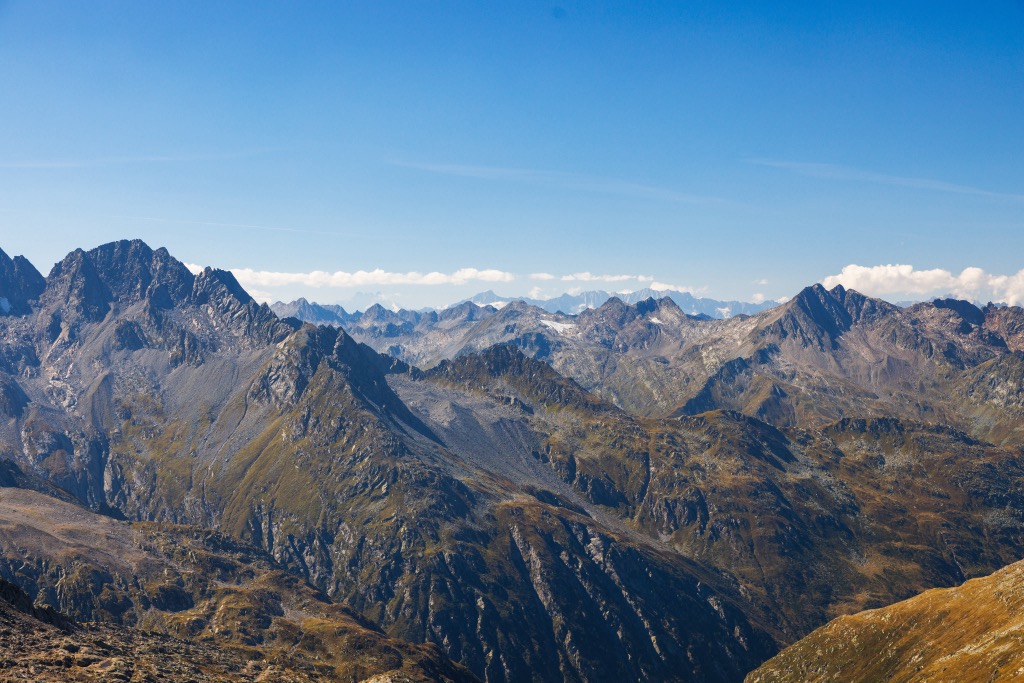
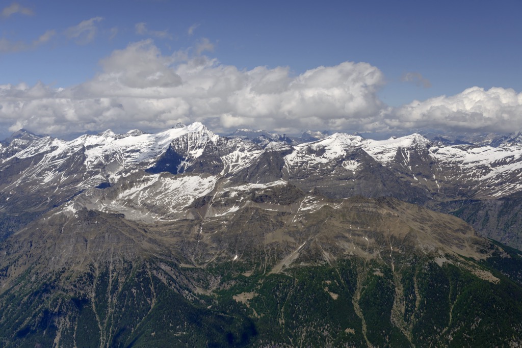
The Adula Alps (Adula-Alpen), also known as the Misox Alps, form the eastern portion of the Lepontine Alps. Located almost entirely within southeastern Switzerland, the Adula Alps are spread across the cantons of the Grisons (Graubünden), Ticino, and Uri. The range's southern extent reaches just across the Italian border into Lombardy. World-class climbing opportunities, countless high-mountain trails, and the headwaters of the Rhine await visitors to the Adula Alps. There are 461 named mountains in the range; the highest and the most prominent is the Rheinwaldhorn (3,402 m / 11,161 ft).
The Adula Alps span from the Splügenpass (Passo dello Spluga) (2,115 m / 6,939 m) in the east to Gotthardpass (Passo del San Gottardo) (2,106 m / 6,909 ft) and the Lukmanier Pass (Passo del Lucomagno) (1,915 m / 6,282 ft) in the west.
The Adula Alps have a maximum length of approximately 70 km (43 mi) and extend from Arbedo in the southwest to Bonaduz in the northeast. The main ridge is over 35 km (21.7 mi) long, with all the highest summits clustered at the center within 5 km (3.1 mi) of Rheinwaldhorn.
Seven mountain ranges surround the Adula Alps:
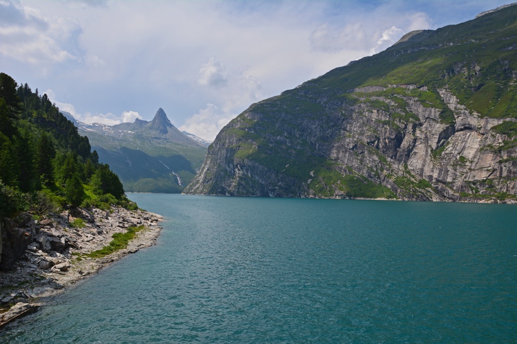
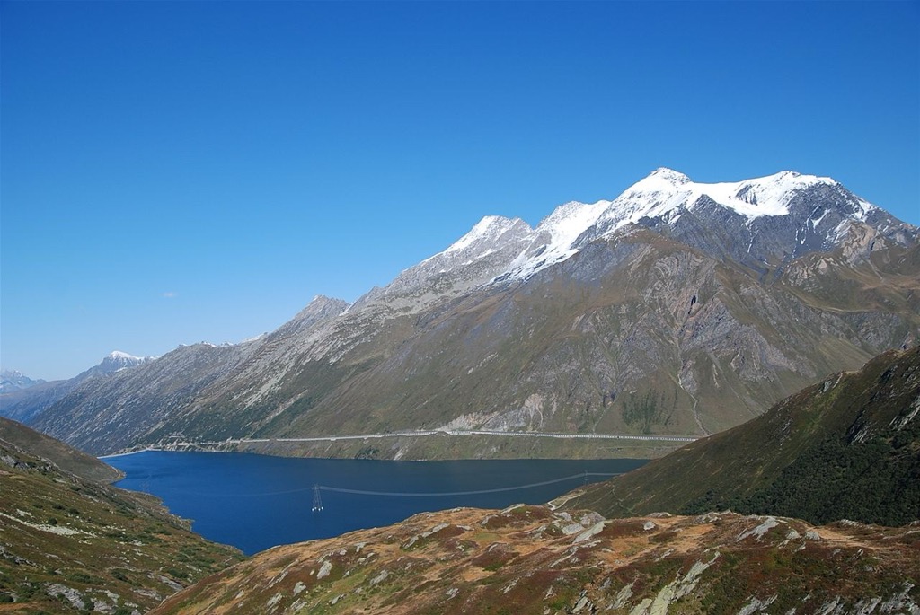
The largest body of water within the Adula Alps is Zervreilasee (1,858 m / 6,095 ft), with a surface area of approximately 1.61 km2 (0.62 sq mi). Other notable reservoirs include Sufnersee (1,398 m / 4,586 ft) and Lago di Luzzone (1,606 m / 5,269 ft).
Several source rivers of the Rhine, Western Europe's second-longest river, spring from high in the Adula Alps, including Vorderrhein, Hinterrhein, and Valser Rhein.
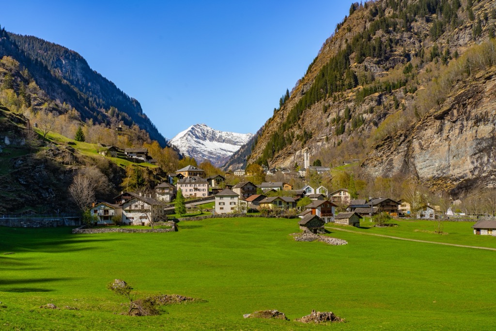
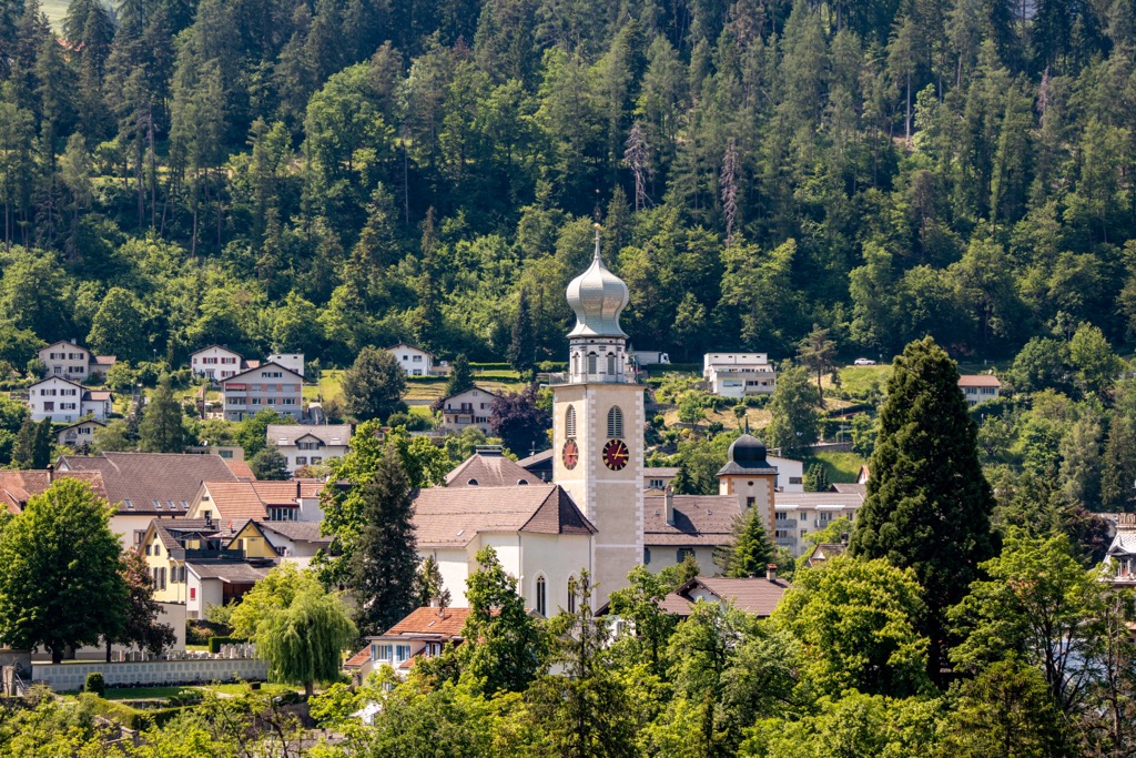
Significant towns and villages in the Adula Alps include Biasca, Thusis, and Disentis. Just east of the Adula Alps is Switzerland's largest nature park, Parc Ela.
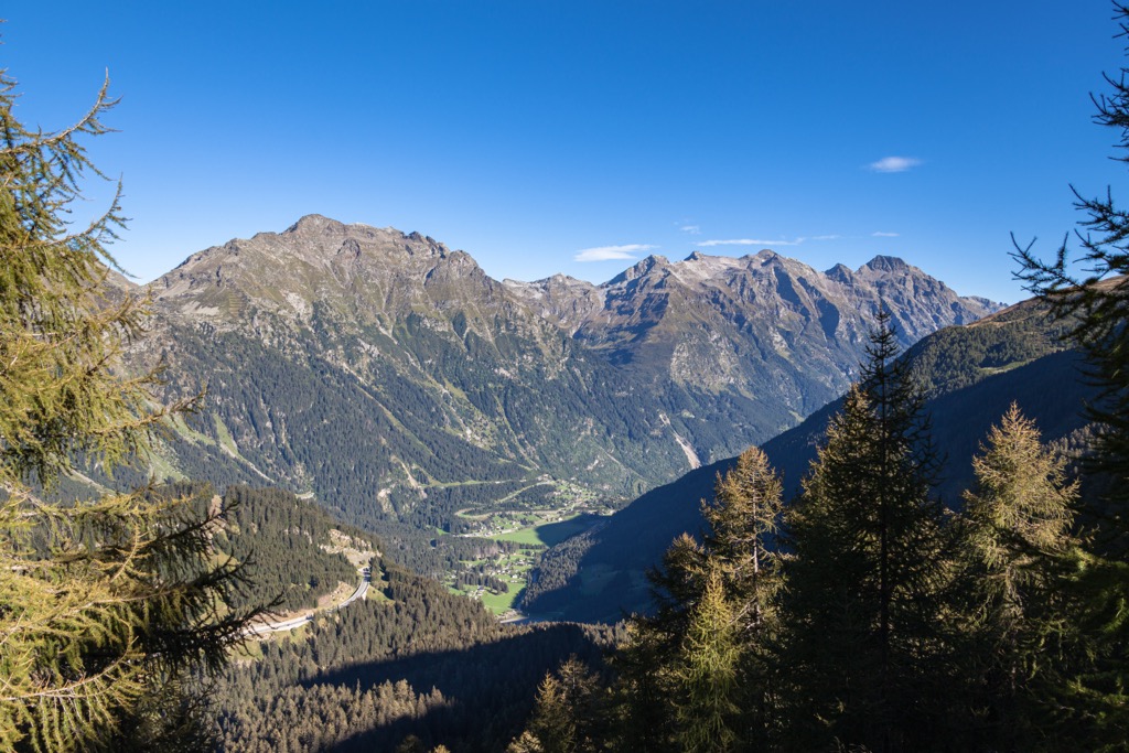
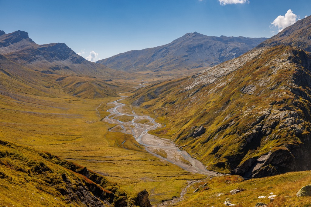
Five large valleys define the Adula Alps. Here's a brief overview of each valley and any notable peaks surrounding them.
Val Malvaglia runs along the Adula Alps' western border and into the lower Valle di Blenio. It's home to the picturesque Bacino di Val Malvaglia (985 m / 3,231 m) reservoir just above Malvaglia village.
Some of the Adula Alps' highest summits, like Rheinwaldhorn, Grauhorn (3,260 m / 10,695 ft), and Cima Rossa (3,161 m / 10,370 ft), overlook Val Malvaglia.
Val Calcena is located just east of Val Malvaglia and is approximately 26 km (16 mi) in length. Parco Val Calcena, Switzerland's smallest regional nature park, is situated in the valley. The Calancasca is Val Calanca's main river.
Puntone dei Fraciòn (3,202 m / 10,505 ft) and Zapporthorn (3,155 m / 10,351 ft) are the highest mountains bounding the Val Calanca.
Valle Mesolcina is on the Adula Alps' eastern edge. Known as Misox in German, this valley is where the Adula Alps get their alternative name. It sits at the southern end of the Adula Alps' main ridge without any 3,000ers in the vicinity.
The most famous mountains around Valle Mesolcina are Pizzo di Claro (Visagno) (2,727 m / 8,946 ft), Cima de Nomnom (2,633 m / 8,638 ft), and Piz di Renten (2,000 m / 6,561 ft).
Safiental is the main valley in the northeastern Adula Alps. It is within the Beverin Nature Park, and its river is the Rabiusa.
The eastern edge of Safiental is much higher than the west, with several mountains that near or exceed 3,000 m (9,842 ft), including Piz Beverin (2,998 m / 9,835 ft), Bruschghorn (3,056 m / 10,026 ft), and Alperschällihorn (3,039 m / 9,970 ft).
Valsertal is the central northern valley of the Adula Alps. It's approximately 16 km (10 mi) in length and is home to the Valser Rhine River. The Therme Vals, the only hot springs in the Grisons, is located in the Valsertal.
Significant mountains surrounding Valsertal include Güferhorn (3,379 m / 11,085 ft), Fanellhorn (3,123 m / 10.246 ft), and Piz Fess (Bös Fess) (2,881 m / 9,452 ft).
The Adula Alps formed approximately 66 million years ago during the Late Mesozoic Era. They are the result of the Alpine Orogeny, a mountain-building event that helped create the entire European Alps.
The main event in the Alpine Orogeny was the collision of African, Arabian, Indian, and Cimmerian tectonic plates to the south with the Eurasian Plate to the north. Convergent movement between these plates created the Alps.
The Alpine Orogeny is ongoing in some areas of the Alps. It helped form many of the largest mountain ranges globally, including the Himalayas, the Pyrenees, and the Carpathians.
The Lepontin Dome, a region of tectonic uplift across the Glarus Alps and the Lepontine Alps, characterizes the specific geology of the Adula Alps.
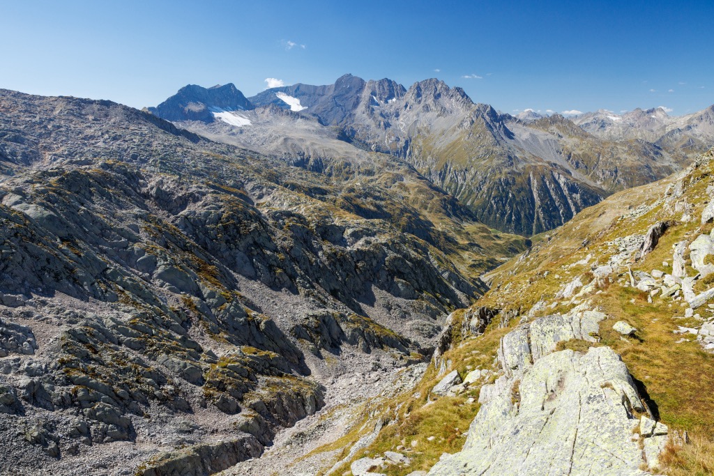
Today, the Adula Alps consist primarily of metamorphic and sedimentary rocks, such as schists, marls, limestones, and phyllites. Large gneiss deposits are also found across the Adula Alps — a quarry in the Val Calanca produces over 10,000 cubic m (353,146 cubic ft) of gneiss annually.
Adjacent to Switzerland's largest nature park and home to the source of Europe's second-longest rivers, the Adula Alps is one of Switzerland’s wildest regions.
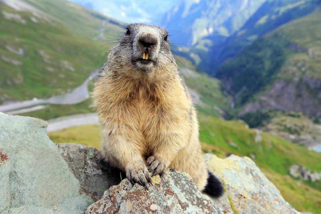
The Adula Alps are home to roughly 70 mammal species. Red deer is the largest mammal in the range, weighing as much as 90 kg (200 lbs). Herds of ibex and chamois are common sight in the Adula Alps. Wolves, extirpated from the Swiss Alps in the 19th century, have recently returned and have been widespread in the region since 2009. Other notable mammals include marmots, mountain hares, wild boar, roe deer, stone martens, and pipistrelle bats.
The Adula Alps' varied habitats support an array of bird species. Bearded vultures and golden eagles, with wingspans exceeding 2.2 m (7.2 ft), live high in the mountains.
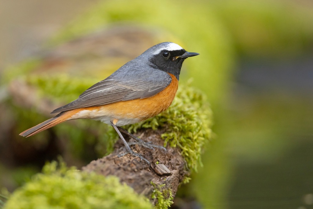
Nesting the Adula Alps' valleys and woodlands are redstarts, wrynecks, blue tits, and chaffinches. Great spotted woodpeckers, green woodpeckers, and cuckoos can be heard across the range's forests.
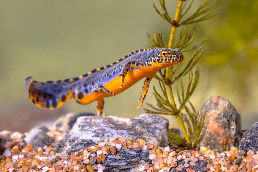
Meanwhile, the Adula Alps are home to around ten amphibian and reptile species, including slowworms, Alpine salamanders, alpine newts, and smooth snakes.
Adders, also known as common European vipers, are the only venomous snakes in the Adula Alps. They can live in forests and boulder fields up to 3,000 m (9,842 ft) in elevation.
Neighboring Parc Ela is home to a third of all insect species in Switzerland, and the Adula Alps are equally diverse. Around 200 butterfly species and 200 wild bee species inhabit the area.
The Adula Alps' forests change in composition with elevation. Deciduous forests composed of oaks, poplars, birches, and beeches are prevalent in the Subalpine zone below 1,200 m (3,937 ft).
Higher up, between 1,200 m (3,937 ft) and 1,400 m (4,593 ft) in elevation, mixed coniferous forests comprising firs, spruces, Cembra pines, and larches dominate the landscape.
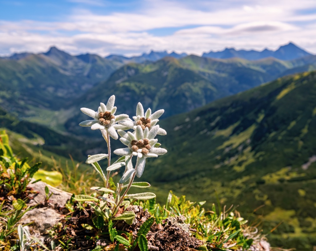
Even higher above the tree line in the Alpine zone, forests give way to alpine pastures and shrublands. Surprisingly, an array of wildflowers thrive in these harsh conditions, with some growing at over 3,000 m (9,842 ft) in elevation. Wildflowers that grow across the Adula Alps include bird's-eye primroses, edelweiss, trumpet gentians, creeping avens, Alpine snowbells, and mountain arnica.
The Rheinwaldhorn, known as l'Adula in Italian, is where the Adula Alps get their name. The name Adula comes from the Romansh language, meaning the northeastern corner of the Lepontine Alps. This Rhaeto-Romance language is one of three official languages of the Grisons, with around 60,000 native speakers.
The word Adula dates back to the Roman Era. Several Roman historians, including Tacitus, Strabo, and Ptolemy, mention "ADU'LA MONS" in their writings. That said, the term may have had a broader meaning and may not have referred to the mountains.
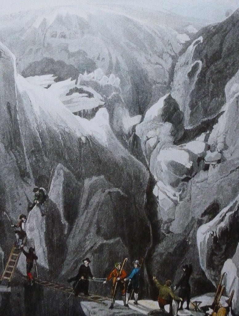
The Rheinwaldhorn has a unique climbing history as it was first summited much earlier than most of the Swiss Alps.
Placidus a Spescha, a Benedictine monk from Disentis, was the first to climb Rheinwaldhorn in 1789. He started his ascent from the Zapporthorn side before continuing along the northern ridge.
However, no recorded attempt to climb the Rheinwaldhorn was made for 70 years until renowned Swiss mountaineer Johann Jakob Weilenmann scaled it solo in 1859.
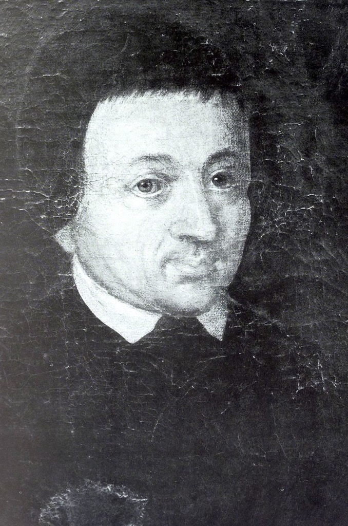
Placidus a Spescha is credited with climbing several of the range’s highest mountains, including Piz Terri (3,149 m / 10,331 ft) in 1802 and the Adula Alps' second-highest summit, Güferhorn, in 1806.
However, extensive glaciation likely prevented Spescha from exploring several of the other highest mountains in the Adula Alps, like Piz Medel (3,210 m / 10,531 ft). In fact, Piz Medel wasn't successfully summited until June 9, 1865.
The Adula Alps and their surroundings are Switzerland's largest area without significant human intervention. Since 2000, a movement has been underway to establish a national park in the region called Parc Adula. On November 27, 2016, the local population voted against the establishment of Parc Adula.
The Adula Alps are superb for climbers, skiers, and hikers, but the range's isolated peaks make exploration potentially hazardous.
Ensure you bring the correct hiking equipment and plenty of provisions. Check local weather forecasts, map out your route, and inform others of your itinerary. Here, you can find the Swiss Alpine Club’s rating for hiking and mountaineering, referenced in this article.
The PeakVisor App is the perfect companion app for exploring the Alps, with info on local weather reports, mountain huts, ski tours, mountain passes, and much more. We've been working nonstop for nearly a decade to turn the PeakVisor App into a one-stop shop for all alpine adventures, from relaxing winter sports getaways to exhilarating high-altitude treks.
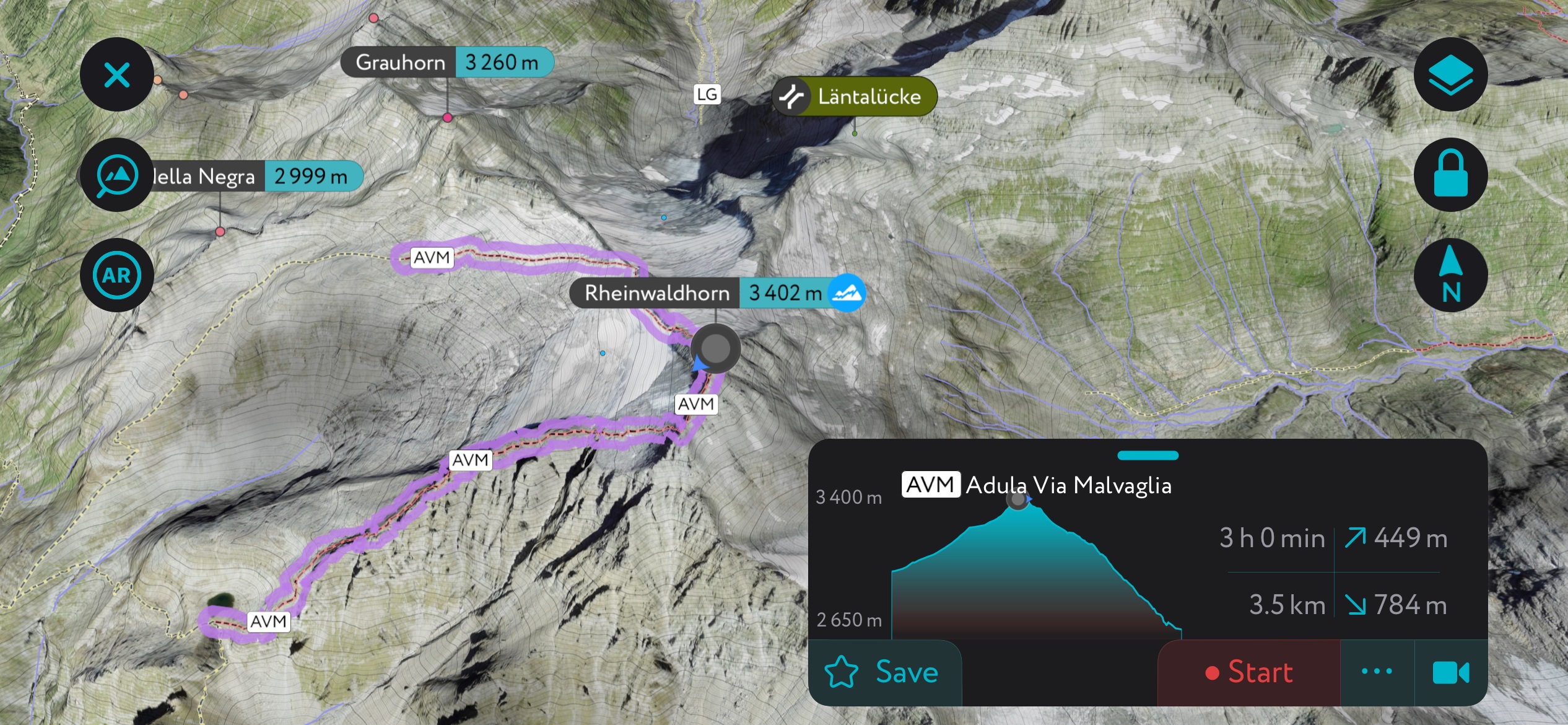
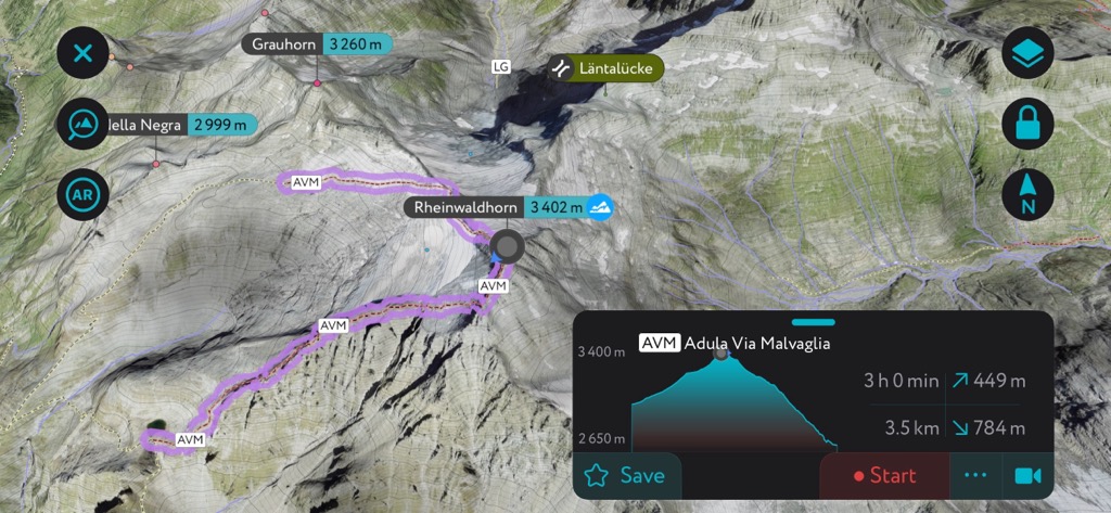
The Rheinwaldhorn (3,402 m / 11,161 ft), known as l'Adula in Italian and Piz Valragn in Romansh, is the highest mountain in Ticino and the second-highest in the Lepontine Alps.
The Rheinwaldhorn's height and position at the center of the Adula Alps make it one of the finest lookouts in the Lepontine Alps.
Despite its height, the Rheinwaldhorn isn't a particularly technical mountain. Most of the mountain's danger comes from hidden crevasses and rockfalls. You can climb Rheinwaldhorn from several directions — there are three normal routes.
The western normal route starting from Capanna Adula CAS (2,012 m / 6,601 ft) is among the most popular. The route begins by heading northeast over the Ghiacciaio di Bresciana (3,177 m / 10,432 ft) towards Cima della Negra (2,999 m / 9,839 ft) before curving southwards onto Rheinwaldhorn's northern ridge.
From Rheinwaldhorn's summit, you can see the whole of the Lepontine Alps, with Monte Leone (3,554 m / 11,660 ft) and Pizzo Tambò (3,279 m / 10,757 ft) visible. This out-and-back trail is approximately 8 km (4 mi) in length.
Piz Medel (3,210 m / 10,531 ft) is the sixth-highest summit in the Adula Alps and the highest mountain between the Lukmanier Pass (Passo del Lucomagno) and Crap la Crusch (2,268 m / 7,440 ft).
Below Piz Medel is Passo della Greina (2,354 m / 7,723 ft), an important mountain pass connecting the Grisons and Ticino. Piz Medel features two glaciers: Glatscher da Medel (2,820 m / 9,251 ft) to the north and Vadrecc di Camadra (3,092 m / 10,144 ft) to the southwest.
The mountain is a popular hiking destination, and it's excellent for ski tours in the winter. Piz Medel's standard route is a straightforward, rewarding climb rated F on the Swiss Alpine Club (SAC) mountaineering scale.
Piz Medel's normal route begins at the Camona da Medel CAS (2,524 m / 8,280 ft), which is to the mountain's north. The trail leads to the Fil Liung's (3,057 m / 10,029 ft) foot before climbing onto Glatscher da Plattas.
You'll hike to the summit along Piz Medel's eastern ridge from Glatscher da Medel's (2,820 m / 9,251 ft) plateau. The views from Piz Medel are sublime, especially of Val Blenio. This out-and-back trail is approximately 3 km (1.8 mi) in length.
Pizzo di Claro (Visagno) (2,727 m / 8,946 ft) is the southernmost summit on the Adula Alps' main ridge within the Parco Val Calanca.
Its attractive pyramidal shape and summit view north across the rest of the range make it a popular mountain. Near the summit is the picturesque Laghetto di Canée. Pizzo di Claro is the home mountain of Bellinzona and Claro village.
Every October, Pizzo di Claro hosts the "Pizzo di Claro: 2500+," an uphill race from Claro to the south summit. Around 200 people attempt this 9.2 km (5.7 mi) race annually.
While Pizzo di Claro is not exceptionally high, the low floor of the Leventina Valley means a vertical climb of 2,500 m (8,202 ft) to reach the summit.
Due to its popularity, Pizzo di Claro can be climbed from all directions on well-defined paths. The SAC rates most paths up Pizzo di Claro T3.
The shortest route to Pizzo di Claro starts with a cable car ride from Lumino village to Monti di Saurù (1,328 m / 4,356 ft). Follow the southern ridge north past Capanna Brogoldone (1,904 m / 6,246 ft) and over Pizzo di Morinere (2,254 m / 7,395 ft) to reach Pizzo di Claro's summit. You can also take a short detour to Piz de Molinera's (2,288 m / 7,506 ft) summit for incredible views towards Pizzo di Claro.
Pizzo di Claro's summit panoramas are sublime, with Monte Rosa (Dufourspitze) (4,634 m / 15,203 ft) to the west, Monte Disgrazia (3,678 m / 11,738 ft) to the east, and Torent Alto (2,956 m / 9,698 ft) to the north. This out-and-back trail is approximately 6.4 km (4 mi) in length.
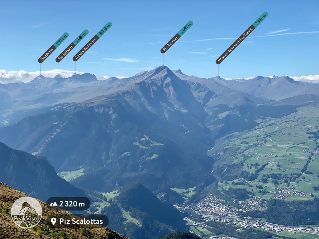
Piz Beverin (2,998 m / 9,835 ft) is located at the heart of Beverin Nature Park. It's one of the park's most famous landmarks due to its distinct pyramidal shape and craggy summit.
One of the highlights of this walk (if you have a head for heights) is the exposed 8 m (26 ft) tall ladder, which leads from Piz Beverin's south ridge to its true summit. Piz Beverin is equally popular with hikers and skiers.
It's possible to climb Piz Beverin from Alp Tumpriv, Mathon, or Glaspass (1,843 m / 6,046 ft). Piz Beverin is a challenging mountain — its trails are graded T4 on the SAC hiking scale.
You can climb Piz Beverin from Mathon to the east on a long day hike. Alternatively, you can drive and park at the car park in Mursenas, shaving a few kilometers off your hike.
The trail approaches from the south and includes Piz Beverin's famous ladder. From the summit, you'll be treated to one of the best views of Thusis to the northeast. You'll descend via Beverin Pintg (2,591 m / 8,500 ft). This trail is approximately 16 km (10 mi) in length.
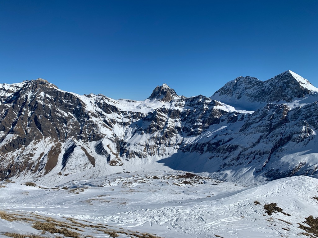
Scopi (3,190 m / 10,465 ft) is the Adula Alps' ninth-highest summit, standing isolated to the northeast of the Lukmanier Pass (Passo del Lucomagno) (1,915 m / 6,282 ft). To the southeast of Scopi is Glatscher da Casatscha (2,904 m / 9,527 ft), one of the last remaining glaciers in the northwestern Adula Alps.
Scopi is a unique 3,000er. The Swiss Army operates a radar and air traffic control building on its Summit. To the northwest, there is an army-operated cable car, which is closed to the public.
Despite its army operations, climbing Scopi is not restricted. Hiking and skiing are popular activities on Scopi; however, skiing is only advised when there is minimal avalanche risk.
You can pick up a marked trail to Scopi from Lai da Sontga Maria (1,908 m / 6,259 ft) near Lukmanier Pass. This challenging trail weaves steeply uphill directly to Pizzo Scopi.
From the summit, you'll have beautiful views across Lai da Sontga Maria to Pizzo dell'Uomo (2,663 m / 8,736 ft) and Piz Rondadura (3,016 m / 9,895 ft). This out-and-back trail is approximately 11.5 km (7.1 mi) in length.
The Greina Alta is the finest long-distance trail in the Adula Alps. It cuts from northwest to southeast across the Greina Plateau, which would've been at the heart of the Parc Adula. The entire Greina Alta is approximately 48.9 km (30 mi).
The Greina Alta, usually completed in four days, starts in the Curaglia and ends in Zervreila. Along the way, it connects three SAC huts: the Camona da Medel CAS (2,524 m / 8,280 ft), the Capanna Michela Motterascio (2,172 m / 7,125 ft), and the Läntahütte (2,090 m / 6,856 ft).
The Greina Alta is suitable only for experienced hikers who are comfortable with heights. Several sections are rated T3 and T4 by the SAC.
The Greina Alta's first stage is from Curaglia to the Camona da Medel. It starts by heading south across Val Platta and over the Piz Ault's (2,471 m / 8,106 ft) summit. The trail turns east at the Fuorcla dalla Buora (2,292 m / 7,519 ft), meandering to the Camona da Medel. The first stage of the Greina Alta is approximately 11.5 km (7.1 mi) in length.
The Greina Alta's second stage is from the Camona da Medel to the Capanna Motterascio. It crosses the Fuorcla Sura da Lavaz (2,703 m / 8,868 ft) and the Passo Greina, then passes over Crap de la Crusch before reaching Capanna Motterascio. The second stage of the Greina Alta is approximately 12.4 km (7.7 mi) in length.
The Greina Alta's third stage is from Capanna Motterascio to Läntahütte. The trail passes along the shores of Lago di Luzzone (1,606 m / 5,269 ft) before passing through Val Scaradra and over the Passo Soreda (2,759 m / 9,051 ft) to reach Läntahütte. The third stage of the Greina Alta is approximately 14.7 km (9.1 mi) in length.
The Greina Alta's fourth and final stage is from Läntahütte to Zervreila. You'll start by crossing the Furggeltipass (2,712 m / 8,897 ft) with Zervreilahorn (2,898 m / 9,507 ft) towering overhead. Finally, you'll cross the bridge over Zervreilasee to reach Zervreila. The fourth stage of the Greina Alta is approximately 10.3 km (6.4 mi) in length.
The Adula Alps' ski resorts facilitate winter sports across the range, with over 100 km (62 mi) of slopes and dozens of ski lifts.
Notable ski resorts and areas in the Adula Alps include:
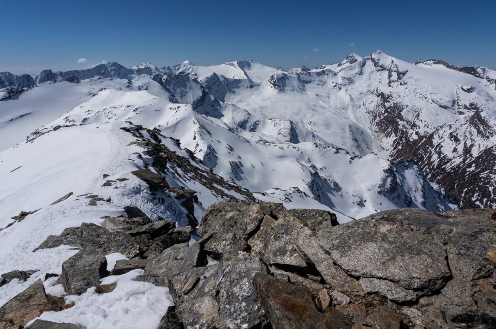
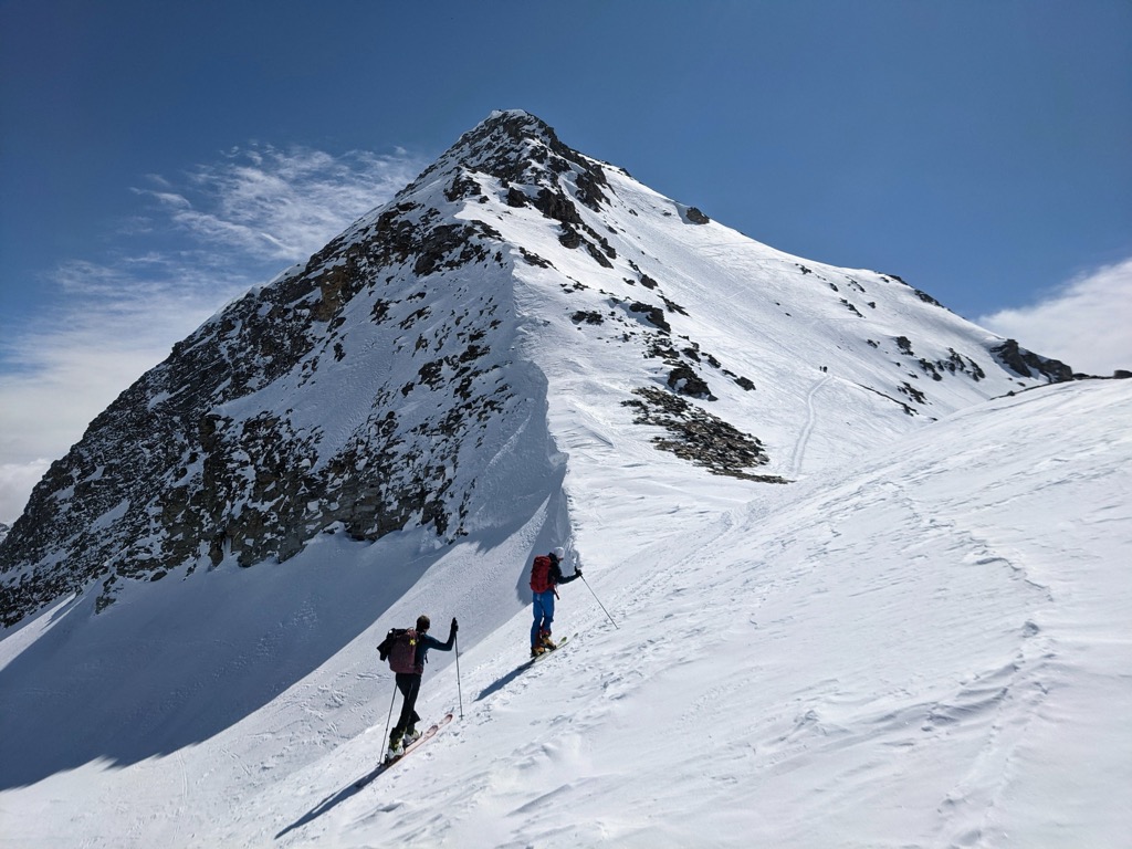
With numerous glaciers and excellent winter sports infrastructure, the Adula Alps provides some of the best ski touring opportunities in the Lepontine Alps.
The Swiss Alps are among our best-mapped areas, and the PeakVisor App offers thousands of ski tour adventures.
Let's take a quick peek at a couple of the finest ski tours in the Adula Alps and several features on the PeakVisor App that'll make planning your next excursion easier than ever.
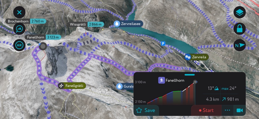
Fanellhorn
Located just south of the resort town of Vals, Fanellhorn (3,123 m / 10,246 ft) is one of the classic ski tours in the Lepontine Alps. From December to April, countless visitors ascend Fanellhorn on a varied and exciting ski tour from Zervreila.
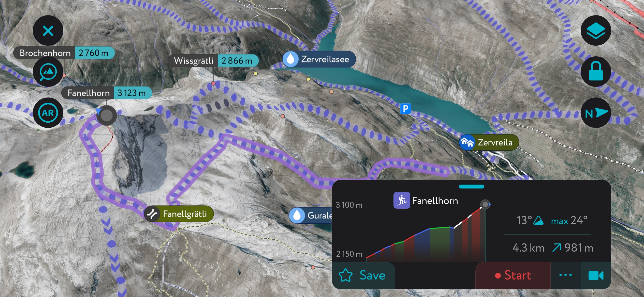
Skiers usually ascend Fanellhorn via Wissgrätli (2,866 m / 9,402 ft) before looping back and following the same route to descend. The route features plenty of northern exposure, so conditions tend to stay quite soft throughout the winter. However, it can also be crusty in early spring, when south faces are ideal. The Fanellhorn is approximately a 13.6 km (8.4 mi) round trip.
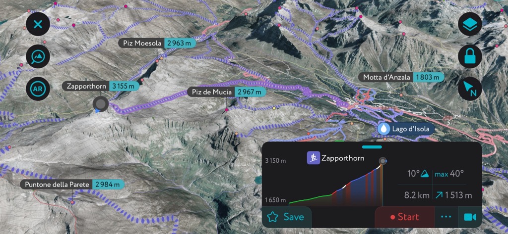
Zapporthorn
The Zapporthorn (Pizzo Zapport) (3,155 m / 10,351 ft) is the highest summit in the Zapportgrat massif. It's a classic ski tour popular with beginners and experts alike.
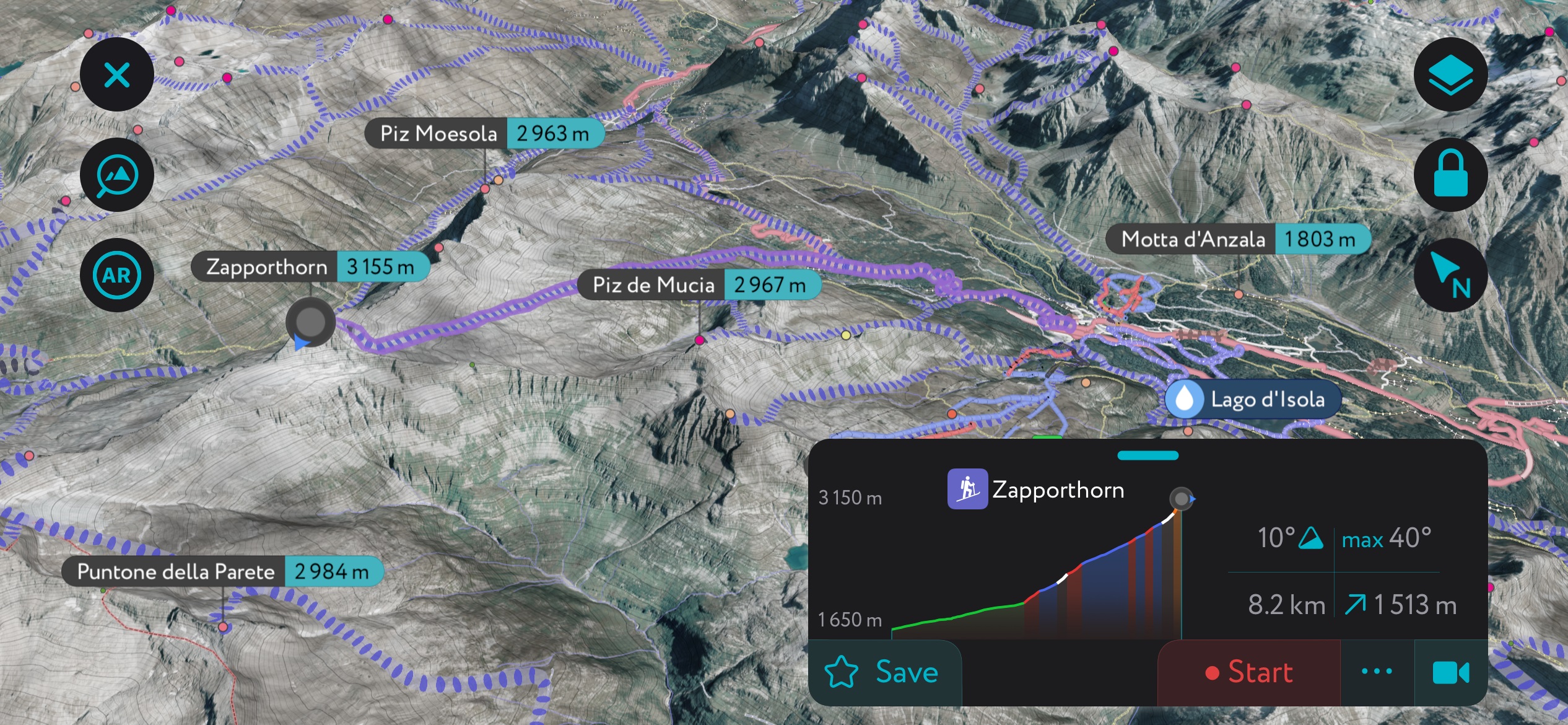
The Zapporthorn's slopes are primarily gentle and broad, but greater difficulty awaits higher up the mountain. Near the summit is a steep couloir, which is tricky to navigate, especially if there's little snow. This ski tour starts from San Bernardino and is approximately a 16.4 km (10.2 mi) round trip.
We've added several features that make the PeakVisor App even better for planning once-in-a-lifetime ski excursions.
Our new weather forecast and snow depth features ensure you have the right conditions for skiing and hiking. You'll also find information on mountain hut opening hours, including dining options, to help you plan your downtime between adventures.
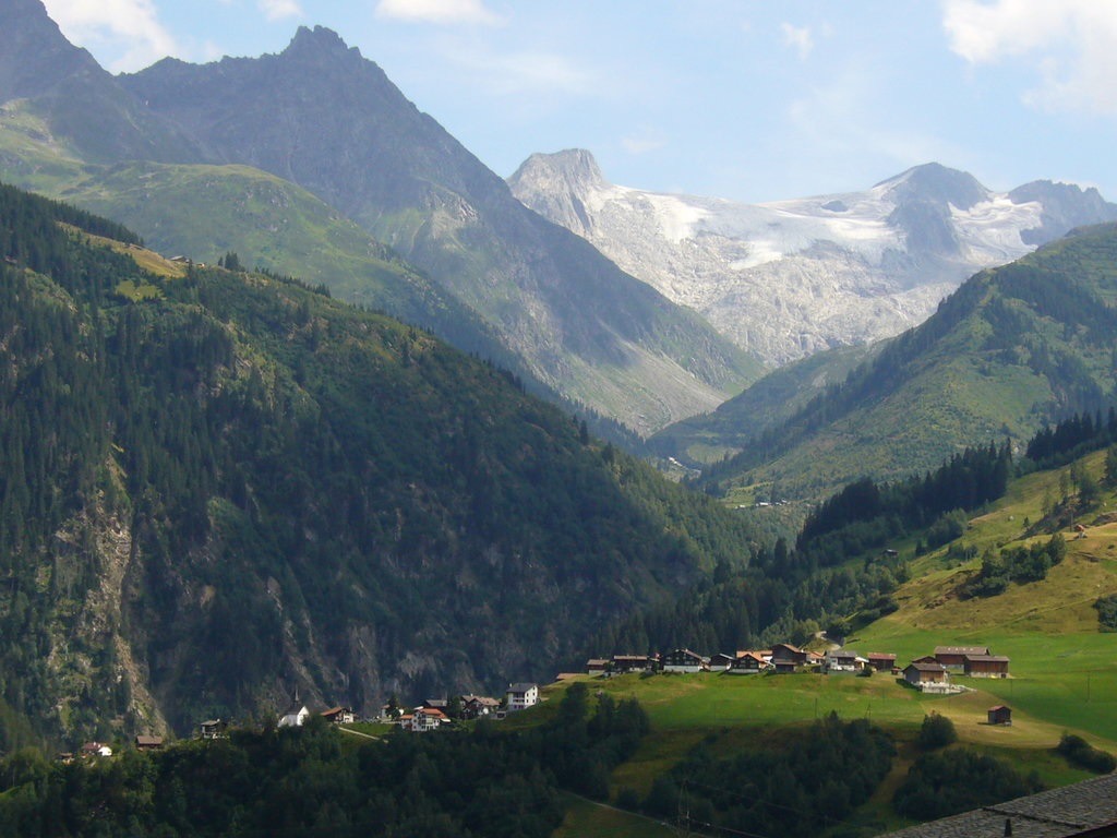
Tucked away in sweeping valleys between snow-covered summits are the largest settlements in the Adula Alps.
The closest international airport to the Adula Alps is Zurich Airport, which is located approximately 95 km (59 mi) to the northwest. Samedan Airport, a private airport for chartered airplanes, is located approximately 35 km (21.7 mi) to the southeast near St. Moritz.
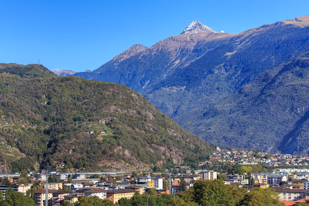
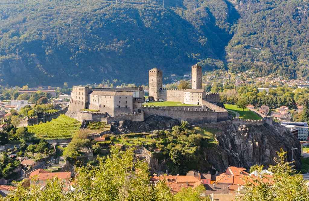
Bellinzona is Ticino's capital city, with a population of over 43,000. It's just south of the Adula Alps, less than 25 km (15.5 mi) from Biasca. It's a historic city home to three castles: Castelgrande, Montebello, and Sasso Corbaro. All three castles are UNESCO World Heritage Sites.
Pizzo di Claro, one of the most popular hiking destinations in the Adula Alps, is Bellinzona's home mountain. Other popular mountains, like Cima dell'Uomo (3,010 m / 9,875 ft) and Monte Tamaro (1,961 m / 6,433 ft), are within 15 km (9.3 mi) of Bellinzona.
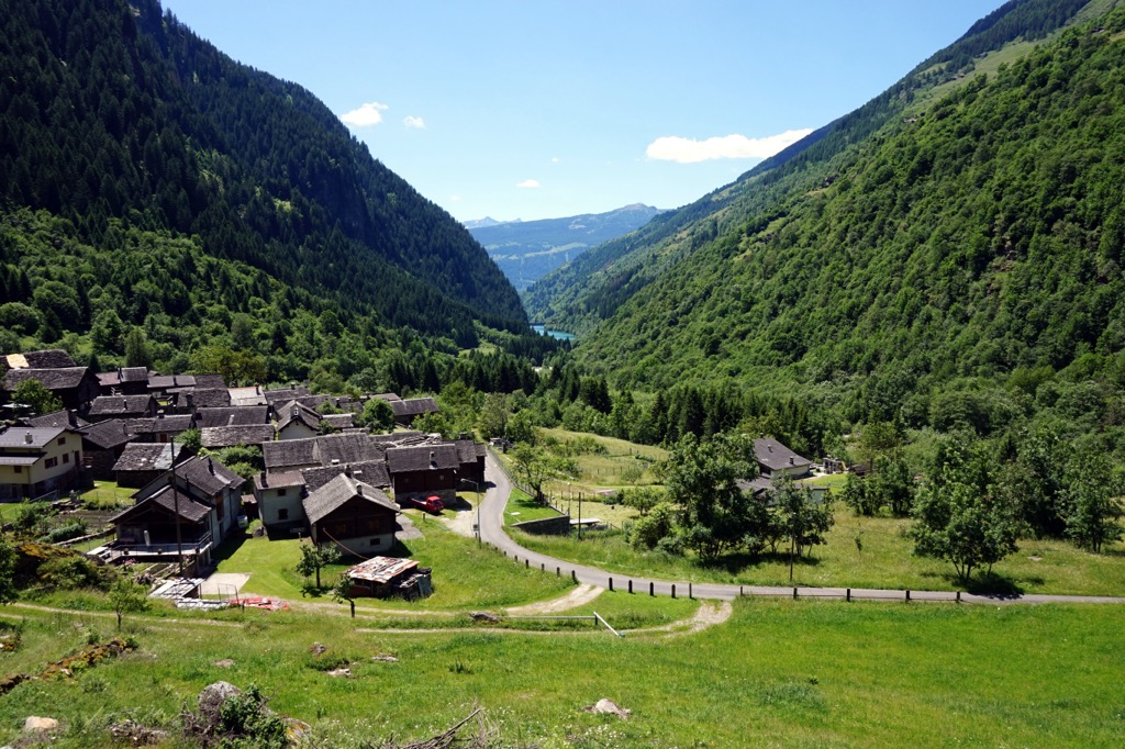
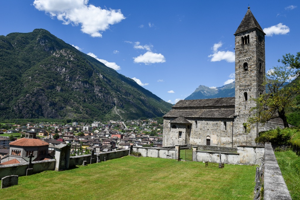
Biasca is the Adula Alps' largest town, with over 6,000 people. Dating back to the 10th century, Biasca is known for its many historic churches. These churches include the Parish Church of San Pietro, which dates back to the migration period following the fall of the Holy Roman Empire.
Biasca's position on the southeastern edge of the Adula Alps means it's within 15 km (9.3 mi) of Rheinwaldhorn and Pizzo di Claro.
Thusis is the second-largest town in the Adula Alps, with a population of just over 3,200. It's located at the center of the Hinterrhein Valley, at the convergence of the Hinterrhein and Nolla rivers.
The Tschappina Heinzenberg and Arosa ski areas are located on either side of Thusis. Thusis' location on the Adula Alps' western edge means it's within 15 km (9.3 mi) of popular mountains like Piz Beverin and Piz Fess (2,881 m / 9,452 ft).
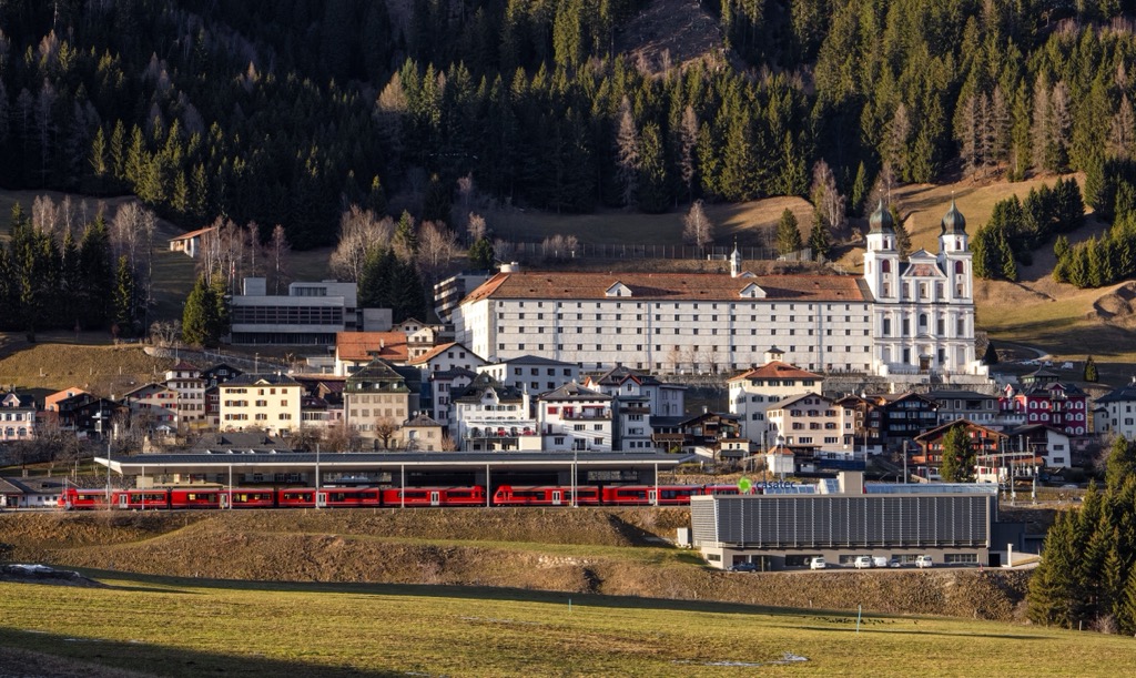
Disentis, officially Disentis / Mustér, is a village on the northwestern border of the Adula Alps. It's famous for being the site of one of Switzerland's oldest Benedictine monasteries, Disentis Abbey, which dates back to 720. Placidus a Spescha, the first person to scale Rheinwaldhorn, was a monk at Disentis Abbey.
Disentis provides easy access to the best mountains in the northwestern Adula Alps, with Piz Muraun, Piz Medel, and Scopi less than 15 km (9.3 mi) away.
The small town of Ilanz rests on the northern boundary of the Adula Alps, with a population of over 2,200. Due to its location at the head of the Vorderrhein Valley, it's considered the first town of the Rhine.
Ilanz's position in the northern Adula Alps means many of the mountains in and around the Valsertal are easily accessible, including Piz Terri (3,149 m / 10,331 ft), Fanellhorn, and Piz Tomül (Wissensteinhorn) (2,946 m / 9,665 ft). Plus, Ilanz is adjacent to the Obersaxen / Mundaun / Val Lumnezia ski resort.


