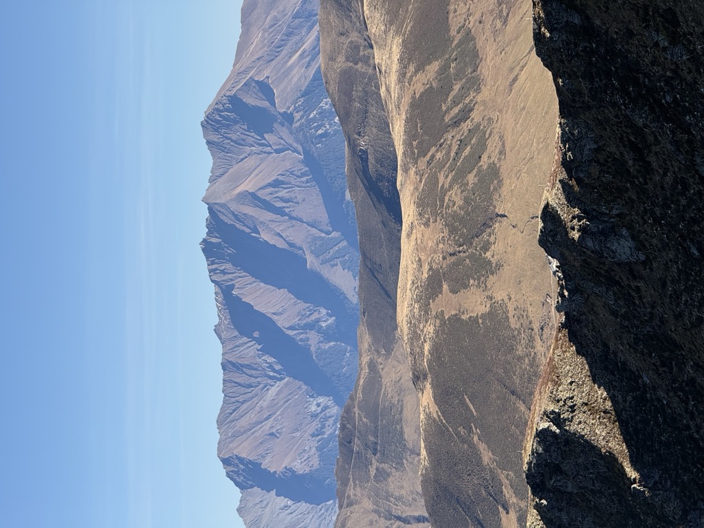
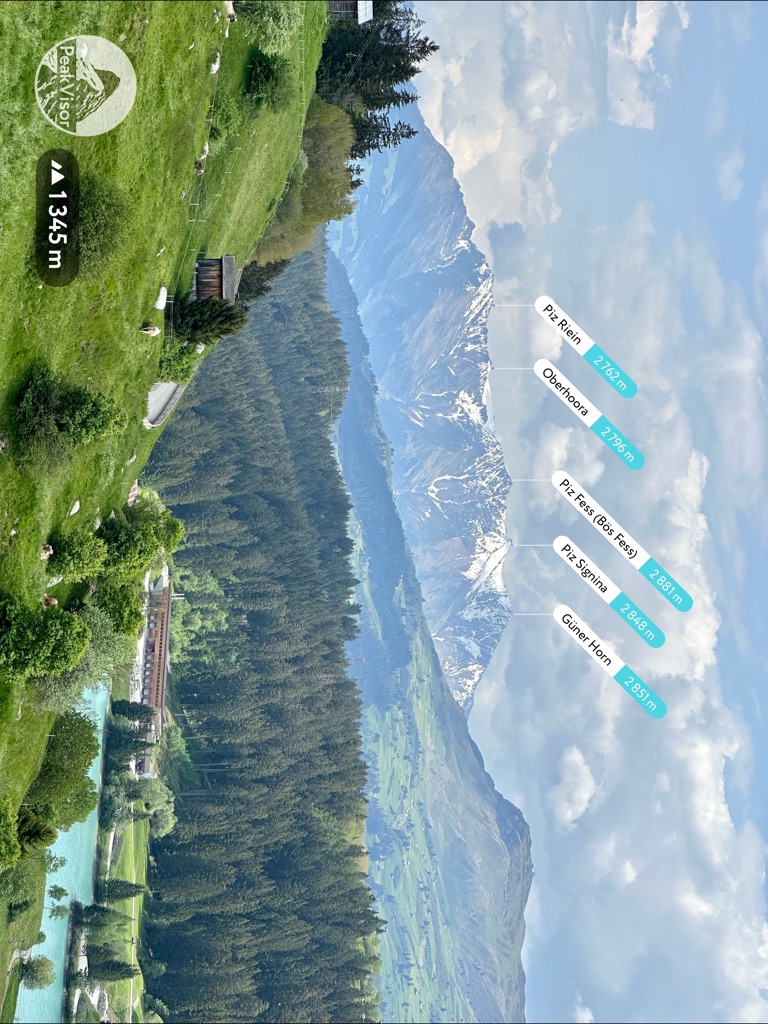
Piz Fess is a mountain of the Lepontine Alps, situated between the Val Lumnezia and Safiental in the canton of Graubünden. Piz Fess is the culminating point of the Signina range (Romansh: Cadeina dil Signina).
The mountain has two summits, a gentle summit named the Guter Fess ("Good Fess"; 2,874 m) and a not so gentle one named Böser Fess ("Angry Fess"; 2,880 m). In 1894 the pinnacle was still described as unclimbable, but the next summer Karl Viescher from Basel and the local guides Wieland Wieland and J. Christoffel reached the sharp summit.
There's a trail leading to the summit.
By elevation Piz Fess (Bös Fess) is
# 34 out of 168 in Beverin Nature Park
By prominence Piz Fess (Bös Fess) is
# 11 out of 458 in the Adula-Alpen # 60 out of 2367 in Grisons # 13 out of 412 in Surselva # 8 out of 168 in Beverin Nature Park # 34 out of 1744 in the Lepontine Alps
We use GPS information embedded into the photo when it is available.
3D mountains overlay
Adjust mountain panorama to perfectly match your photos because recorded by camera photo position might be imprecise.
Move tool
Rotate tool
Zoom
More customization
Choose which peak labels should make into the final photo and what photo title should be.
Next
Photo Location
Satellitte
Flat map
Relief map
Latitude
Longitude
Altitude
OR
Latitude
°'''
Longitude
°'''
Apply
Register Peak
Peak Name
Latitude
Longitude
Altitude
Register
Teleport
PeakVisor
This 3D model of Sagarmatha National Park in Nepal was made using the PeakVisor app topographic data. The mobile app features higher precision models worldwide, more topographic details, and works offline. Download PeakVisor maps today.
Download OBJ model
PeakVisor
The download should start shortly. If you find it useful please consider supporting the PeakVisor app.
PeakVisor for iOS and Android
Be a superhero of outdoor navigation with state-of-the-art 3D maps and mountain identification in the palm of your hand!