
Scan the QR code and open PeakVisor on your phone
Surselva is home to 415 named mountains. The highest is Tödi at 3,614 m.
The Surselva Region is the westernmost district of Switzerland's Grisons (Graubünden) canton. Home to some of the highest summits in the Glarus Alps and Lepontine Alps, Surselva is among the finest hiking and skiing destinations in the canton. There are 415 named mountains in Surselva. The highest and the most prominent mountain is Tödi (Piz Russein) (3,614 m / 11,856 ft).
The Surselva Region covers an area of approximately 1,373.5 sq km (530.3 sq mi). It centers around the Surselva Valley (Bündner Oberland) and its right-hand side valleys.
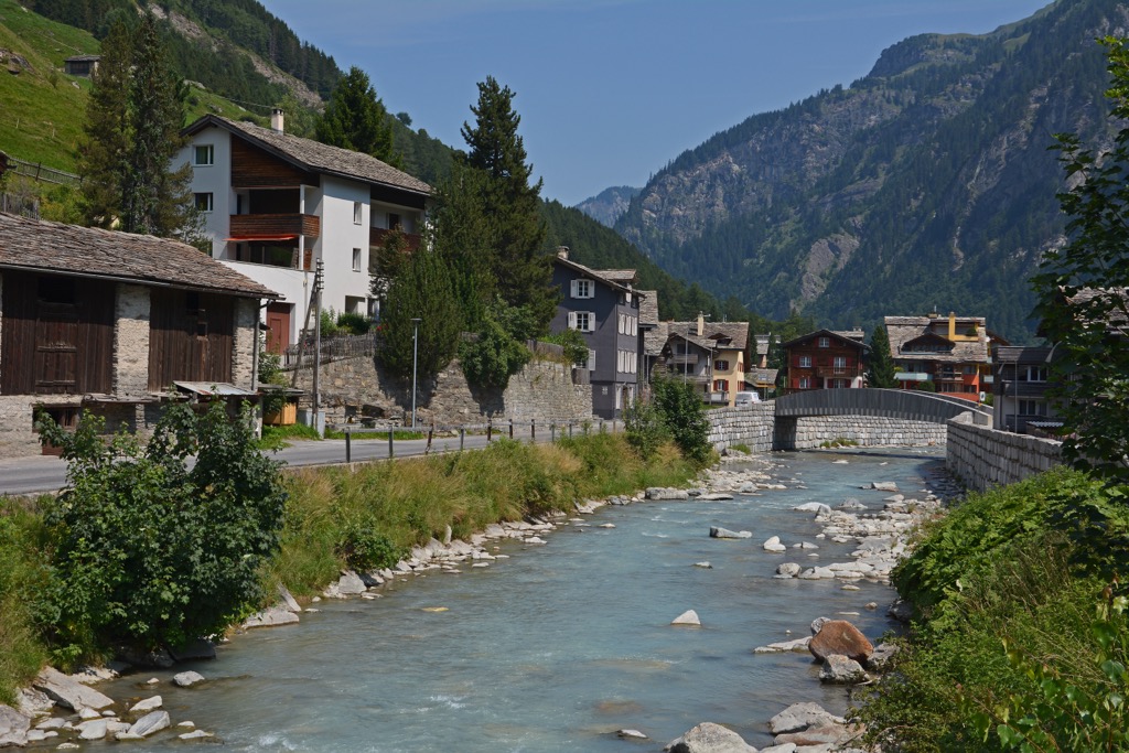
The Vorderrhein, also called the Anterior Rhine, flows through the Surselva Valley. It’s one of the Rhine's two main source rivers, alongside the Hinterrhein.
The Surselva Valley extends for approximately 60 km (37.2 mi) from the Oberalppass (2,044 m / 6,706 ft) in the west to near Reichenau in the east, where the Vorderrhein and Hinterrhein meet.
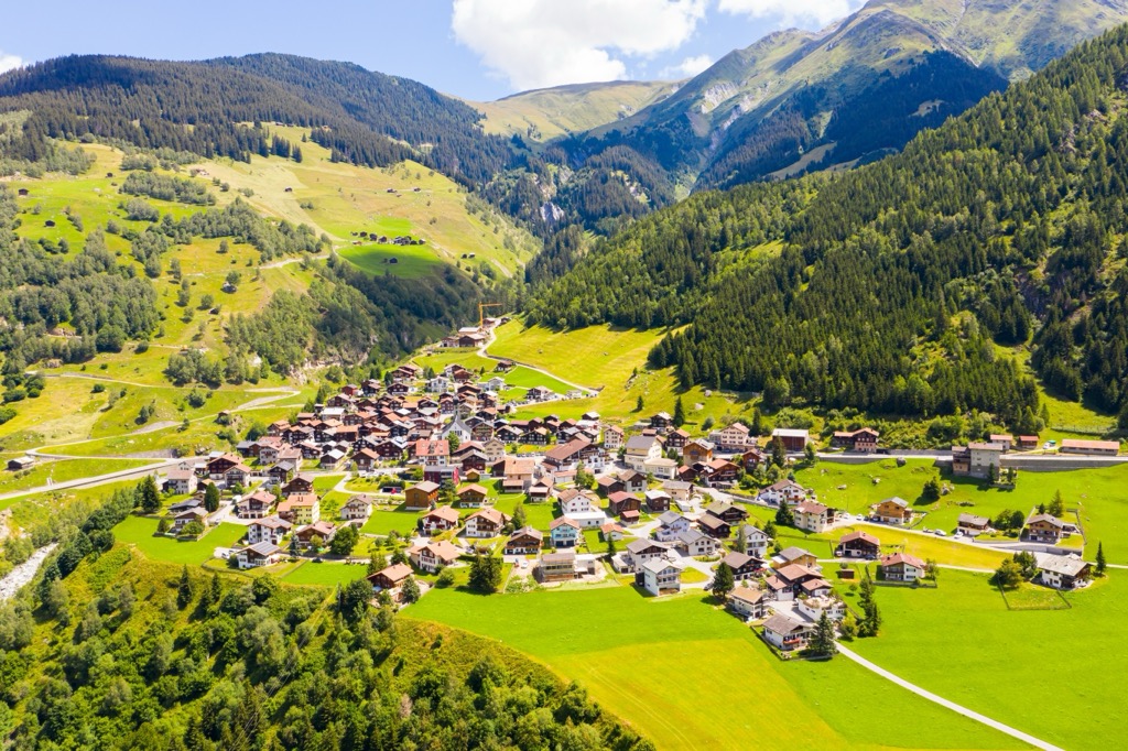
Several notable settlements exist within the Surselva Valley, such as Disentis/Mustér, Ilanz/Glion, and Trun. Ilanz/Glion is the most populous municipality, while Disentis/Mustér is the most famous settlement due to its Benedictine monastery, which dates back to 720.
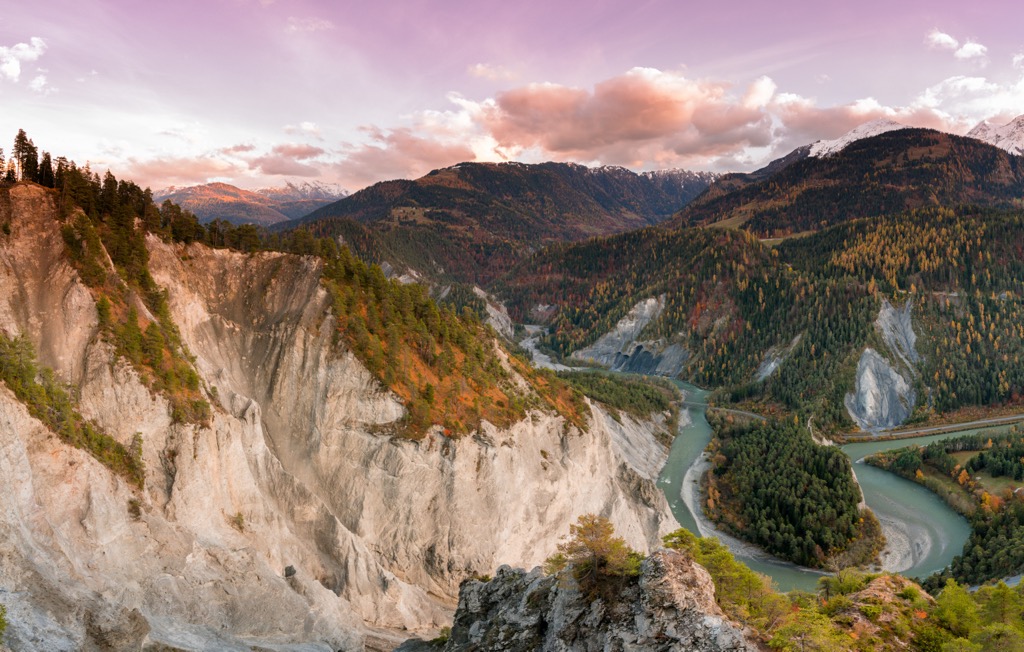
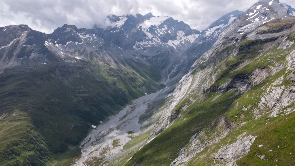
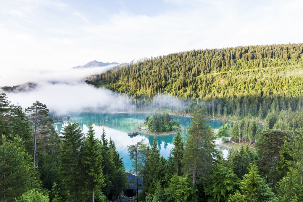
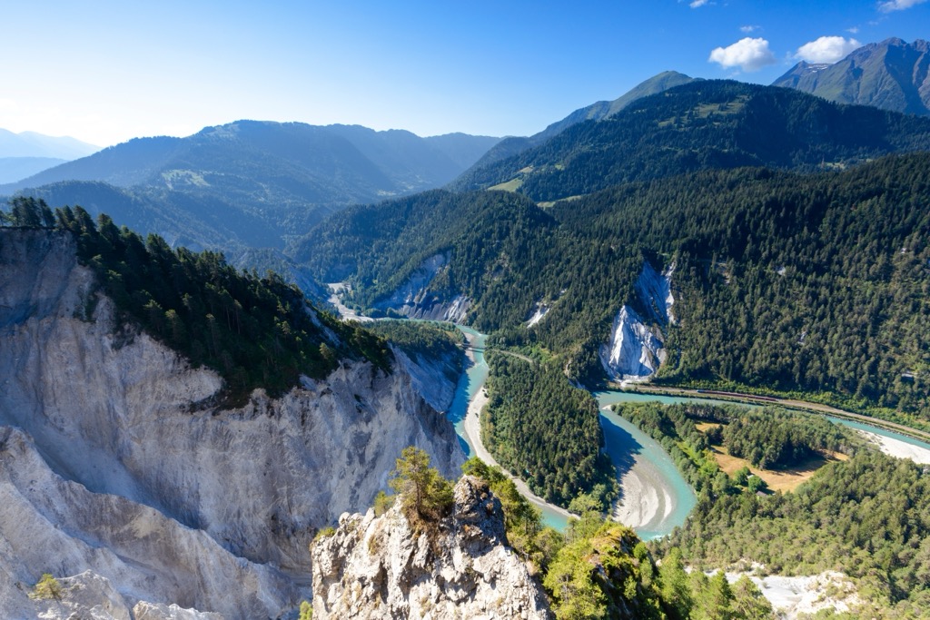
The Surselva Region includes the Ruinaulta (Rheinschlucht), a 13 km (8 mi) long canyon near the confluence of the Vorderrhein and Hinterrhein. It features 350 m (1,148 ft) tall sandstone cliffs and is jokingly nicknamed the Swiss Grand Canyon.
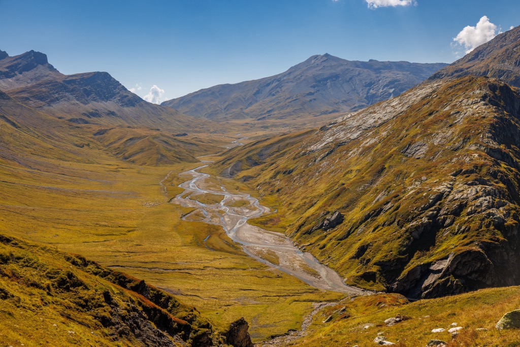
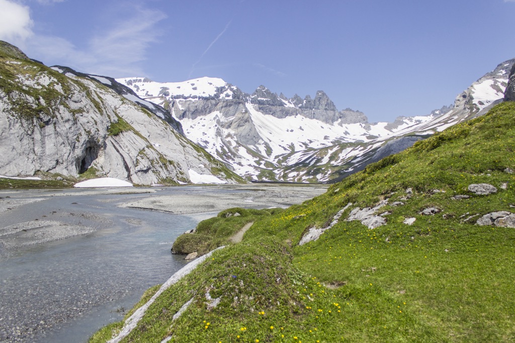
Another noteworthy geographical feature in the Surselva is the Greina Plateau (Plaun la Greina), one of the largest plateaus in Switzerland at 6 km (3.7 mi) long and 1 km (0.6 mi) wide. This tundra landscape is located at an elevation of 2,200 m (7,217 ft).
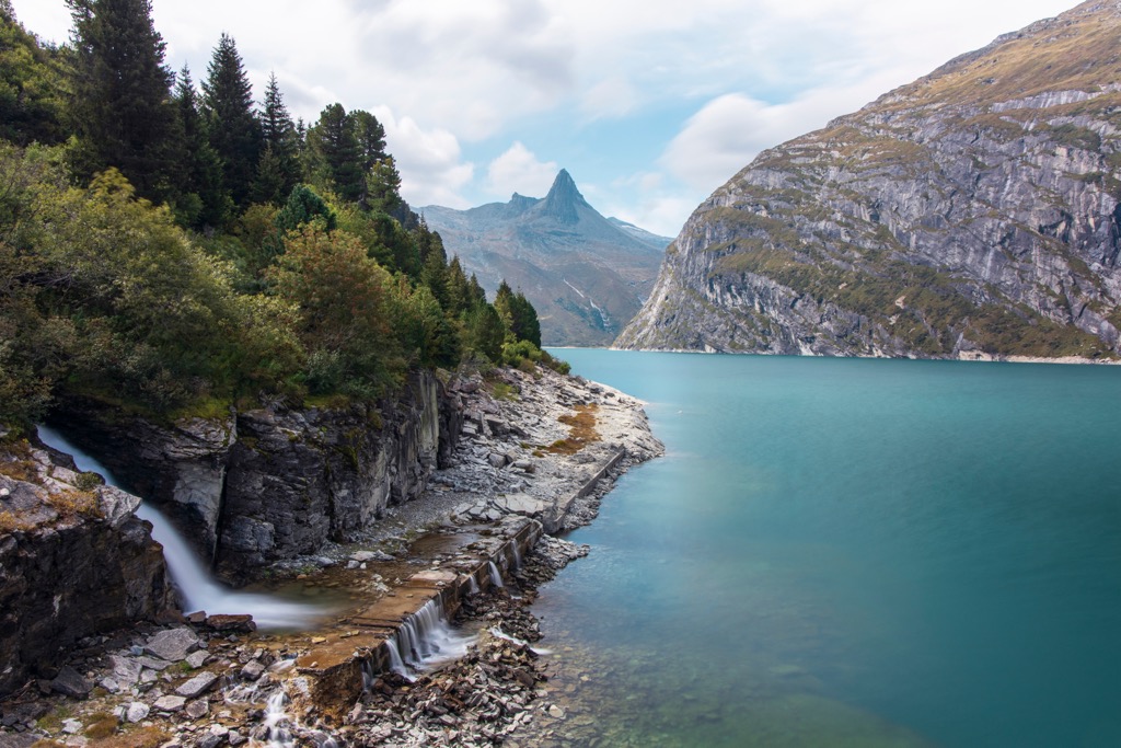
The Surselva is home to several lakes, including Zervreilasee, Lai de Sontga Maria, Lai de Curnera, and Lai de Nalps. Lai de Sontga Maria is the largest lake in the Surselva Region, with a surface area of 1.77 sq km (0.68 sq mi).
The western half of Beverin Nature Park (Naturpark Beverin), which centers around Piz Beverin (2,997 m / 9,833 ft), is located within Surselva.
As mentioned, the Surselva Region includes several right-hand side valleys, including Val Lumnezia, Val Medel, Val Sumvitg, Val Frisal, Valsertal, and Safiental.
Here's a quick look at some of the most important side valleys of the Surselva Region.
The Val Lumnezia is Surselva's largest side valley, covering approximately 165 sq km (63 sq mi) in eastern Surselva. It’s home to just over 2,000 people and includes settlements like Vrin, Cumbel, and Vignogn.
The world-class ski resort of Obersaxen-Mundaun is located within Val Lumnezia. Notable mountains around the valley include Piz Terri (3,148 m / 10,331 ft), Piz Mundaun (2,064 m / 6,772 ft), and Piz Riein (2,762 m / 9,062 ft).
The Val Medel is 15 km (9.3 mi) in length and spans from Disentis/Mustér in the north to the Passo del Lucomagno (1,915 m / 6,283 ft) on Lai da Sontga Maria in the south.
The lower part of the valley features a 3 km (1.8 mi) long gorge called Medelserschluch. The Froda River, which goes on to form the Rein da Medel, flows through the upper valley. Notable mountains around the Val Medel include Piz Medel (3,210 m / 10,531 ft), Scopí (3,190 m / 10,466 ft), and Piz Gannaretsch (3,040 m / 9,974 ft).
The Val Sumvitg, or Somvixertal, is over 15 km (9.3 mi) long, running from the Glarus canton boundary near Sumvitg to the Greina Plateau. At the northern end of the Val Sumvitg is the highest mountain in Surselva and the Glarus Alps, Tödi (3,614 m / 11,856 ft).
The Val Sumvitg is a V-shaped valley through which the Somvixer Rhein flows. Famous mountains surrounding it include Piz Nadéls (2,788 m / 9,150 ft), Piz Vial (3,168 m / 10,393 ft), and Piz Tgietschen (2,858 m / 9,377 ft).
The Safiental is the easternmost side valley of the Surselva. It's roughly 25 km (15.5 mi) and features the Ruinaulta. It has a population of around 1,000 and includes villages like Safien, Valendas, and Versam.
The Safiental falls partly within the Beverin Nature Park and is flanked by Piz Beverin and Bruschghorn (3,056 m / 10,026 ft) to the east and Piz Tomül (2,945 m / 9,665 ft) and Piz Fess (2,881 m / 9,452 ft) to the west.
The Valsertal, or the Vals Valley, is approximately 16 km (10 mi) in length. Valsertal is located in southeastern Surselva, splitting from the Val Lumnezia at Uors.
The Valser Rhine drains the Valsertal, which flows into Zervreilasee at the valley's southern end. The Valsertal has two main settlements: Vals and St. Martin.
The only hot spring in the Grisons, Therme Vals, is within the Valsertal. Notable mountains around the Valsertal include Fanellhorn (3,123 m / 10,246 ft), Zervreilahorn (2,898 m / 9,508 ft), and Piz Aul (3,121 m / 10,240 ft).
The Val Frisal is a 3 km (1.8 mi) long valley located at 1,900 m (6,233 ft) above sea level north of Brigels. At the valley's western end is the Puntegliasgletscher (2,452 m / 8,045 ft).
Famed for its natural beauty, the Val Frisal is surrounded by the impressive Kistenstöckli (2,748 m / 9,016 ft) and several 3,000ers, including Bifertenstock (3,419 m / 11,217 ft), Piz Frisal (3 292 m / 10,801 ft), and Cavistrau (3,251 m / 10,666 ft).
The Surselva Region encompasses parts of the Glarus Alps and the Lepontine Alps. Both ranges formed around 66 million years ago during the Alpine Orogeny.
This mountain-building event occurred when the Arabian, African, Indian, and Cimmerian tectonic plates to the south collided with the Eurasian Plate to the north.

Convergent movement between these plates formed the Alps and many other significant mountain ranges globally, like the Himalayas, the Atlas Mountains, and the Hindu Kush.
Surselva means 'above the forest' in Romansh, referring to the forests that carpeted the valley following the Flims Landslide.
Rock debris from the Flims Landslide limited surface soil and water in the region, making the land useless for farming and resulting in sprawling, untouched forests.
The Flims Landslide occurred approximately 10,000 years ago, around 8,000 BCE, and is the biggest known landslide in history. The landslide is named after the town of Flims.
Around 10 billion cubic meters (353 billion cu ft) of rock fell during the Flims Landslide, creating the Ruinaulta Canyon. The landslide’s sheer scale is evident north of Flims on the western face of Fil de Cassons (Cassongrat) (2,677 m / 8,783 ft).
One unique geological feature of the Glarus Alps and the Lepontine Alps is the Lepontine Dome. Due to their location north of one of Europe's major fault lines, the Periadriatic Seam, these ranges feature a complex of three rock thrust sheets called nappes.
These three nappes are the Helvetic, Penninic, and Austroalpine. All three domes can be found stacked atop one another in the surrounding area. Interestingly, the Austroalpine nappe is wholly eroded in the Lepontine Dome due to tectonic uplift.
As a result, the Lepontine and Glarus Alps are composed primarily of Mesozoic limestones, shales, and marls from the Helvetic nappe and phyllites, schists, and amphibolites from the Penninic nappe.
Slate is also common across the Surselva due to the Grisons slate belt. The Val Lumnezia is mainly slate embedded with dolomite and quartzite. Tödi and its surrounding massif are primarily composed of gneiss, as well as slate, limestone, and dolomite.
Surselva's untouched forests, lofty mountains, and winding rivers provide habitats for an array of flora and fauna.
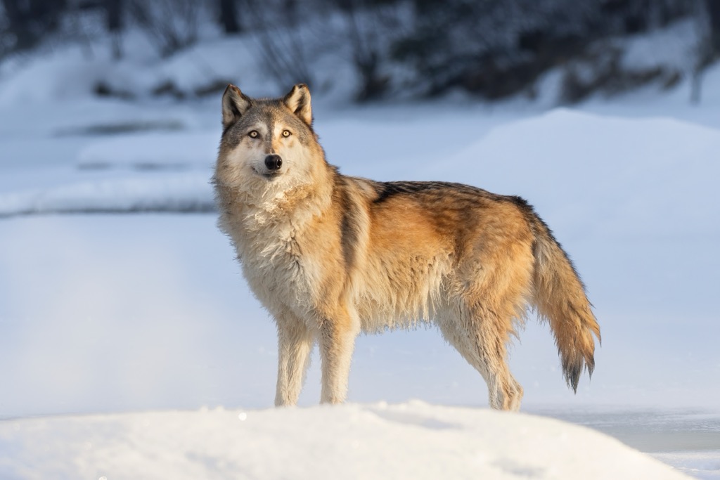
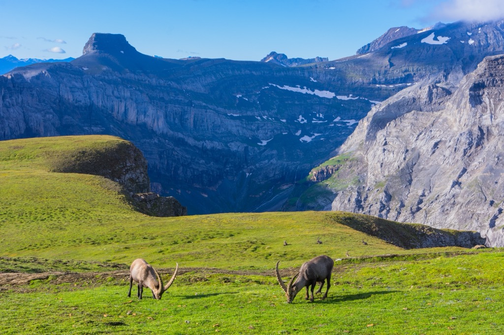
Various mammal species can be spotted across Surselva, including ibex, chamois, snow hares, horseshoe bats, and marmots. Red deer are among the largest mammals in the Surselva Region.
There are 12 wolf packs in the Grisons. Brown bears are uncommon in Surselva; however, the occasional bear has wandered into Surselva from a bear sanctuary in Trentino, Italy.
Bearded vultures and golden eagles are among the most impressive birds that soar over the Surselva Region’s valleys, with wingspans exceeding 2 m (6.5 ft).
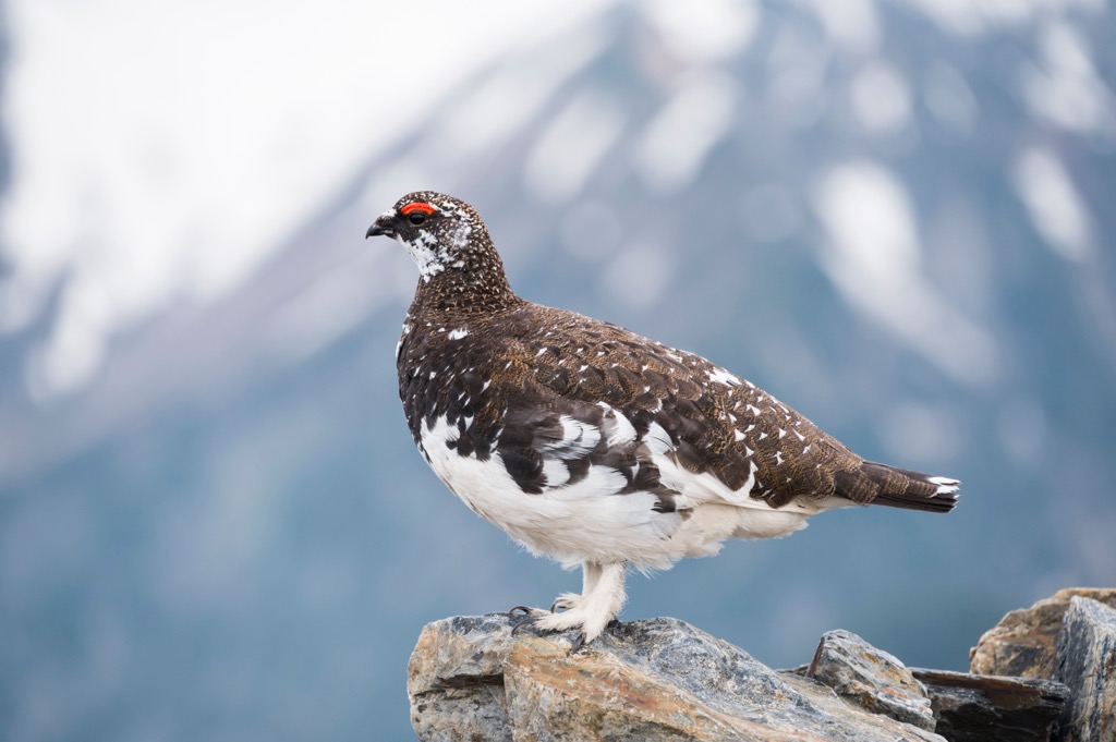
One of the rarest birds in the Surselva is the western capercaillie — there are thought to be only 450 to 500 left in Switzerland. Other notable birds in the Surselva include red-backed shrikes, western Bonelli's warblers, rock ptarmigans, and black woodpeckers.
Insects are the most numerous animals in the Surselva Region, and many vibrantly colored species are on display, including rosalia longicorn beetles, six-spot burnet moths, and purple emperor butterflies.
As the Surselva's Romansh name suggests, forests cover a large portion of the region. For example, roughly 34% of the Surselva Valley and 26% of the Val Sumvitg are forested.
The composition of the Surselva's forests changes with elevation. Broadleaved trees, primarily oak species, like sessile and downy oaks, form the forests at low elevations.
Higher up on mountain slopes in montane zones, mixed coniferous forests of Norway spruce, European beeches, European larches, Scots pines, and silver firs dominate the landscape.
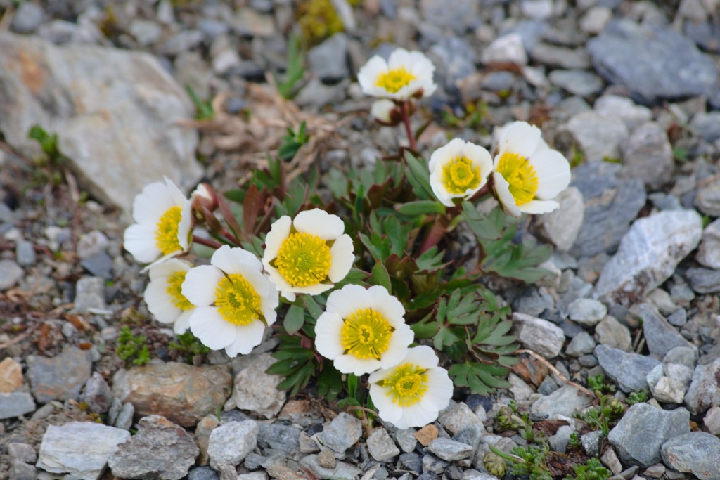
Above the tree line at around 2,200 m (7,217 ft), the forests make way for alpine meadows and shrublands. Here, some flowering plants flourish at elevations as high as the summit of Tödi, including Alpine rock-jasmine, glacier crowfoot, and arctic Alpine forget-me-nots.
Other common flowering plants at high elevations include Alpine gentians, edelweiss, and alpenroses.
Home to a majority Romansh population and one of the birthplaces of modern alpinism, Surselva's history is sure to spark the interest of visiting hikers and skiers.
Many of the Surselva's highest summits were scaled earlier than other significant peaks in the Swiss Alps, before alpinism's gold and silver ages in the mid-19th century.
Most of these early ascents were by Placidus a Spescha, a Benedictine monk from Distenis Abbey (Kloster Disentis) and mountaineering pioneer widely regarded as one of the first Swiss alpinists.
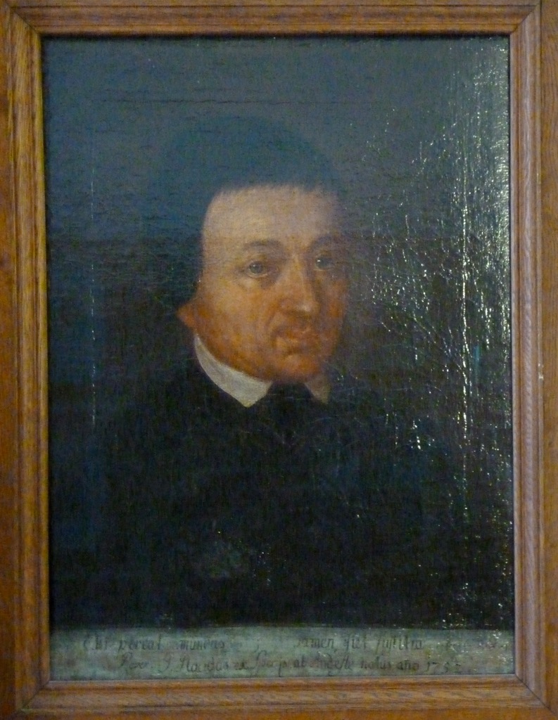
Placidus a Spescha first scaled Rheinwaldhorn (3,401 m / 11,161 ft), the highest mountain in the Adula Alps, in 1789. No one else successfully scaled Rheinwaldhorn for another 70 years until Johann Jakob Weilenmann in 1859.
Placidus a Spescha was the first to summit many of Surselva's highest peaks, including Oberalpstock (3,328 m / 10,919 ft) in 1792, Piz Urlaun (3,359 m / 11,020 ft) in 1793, Piz Terri (3,148 m / 10,338 ft) in 1803, and Güferhorn (3,3179 m / 11,086 ft) in 1806.
One summit that proved out of Placidus a Spescha's reach was Tödi. In 1824, accompanied by two chamois-hunters, Augustin Bisquolm and Placi Curschellas, Placidus made a final attempt to scale Tödi.
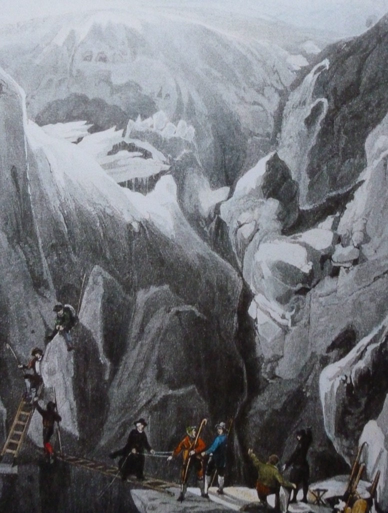
Climbing the mountain’s south side, the group stopped at a mountain gap now called Porta da Spescha (3,349 m / 10,988 ft), where Placidus watched on as Bisquolm and Curschellas reached the summit on September 1st via the southwestern flank.
Aged 70 or 71, it's likely that the final climb was too taxing for Placidus a Spescha. It was his sixth attempt at reaching Tödi's summit.
Despite failing to reach his goal, Placidus a Spescha did manage to make it to the neighboring summit of Stoc Grond (3,421 m / 11,227 ft) in 1788, which is only 193 m (633 ft) lower than Tödi.
Romansh, a Gallo-Romance language that's one of the Swiss national languages, is Surselva's principal tongue. Just under 60% of the population speaks Romansh; they speak Sursilvan Romansh, the most common Romansh dialect, with over 17,800 speakers.
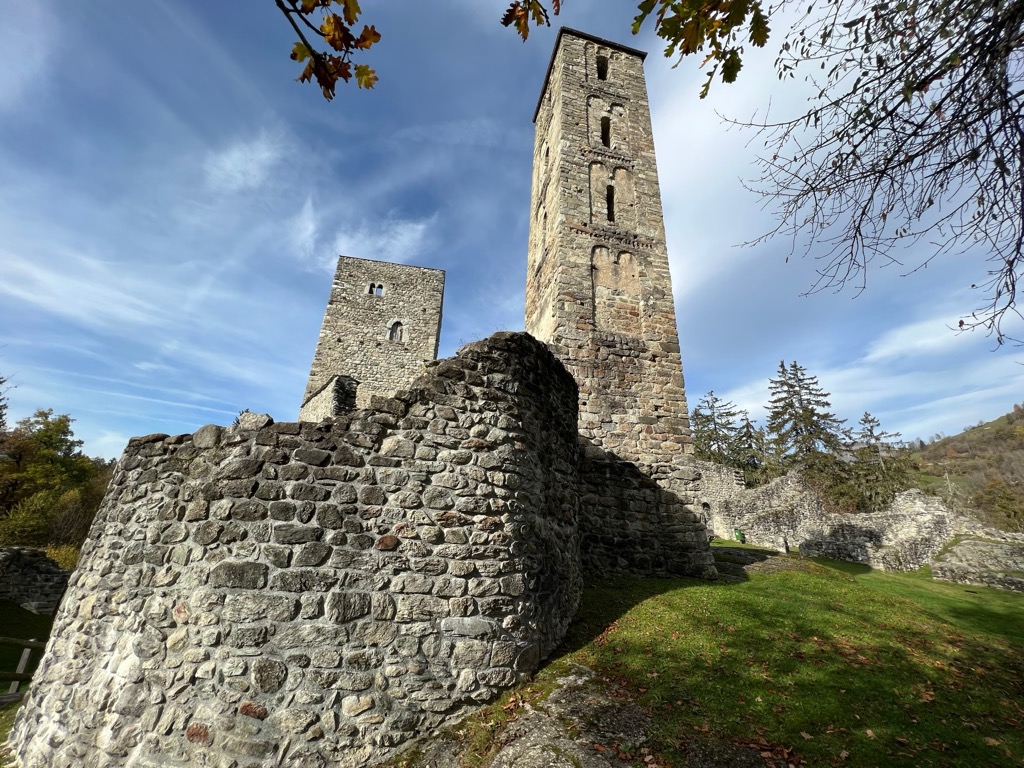
Surselva is one of the Swiss regions with the most well-preserved ancient castles. One such castle is Jörgenberg Castle (Casti Munt Sogn Gieri) which was built in 765.
One familiar sound that rings out across the valleys of the Surselva is the drone of Tibas. A tiba is a traditional trumpet-like instrument originally used by shepherds to communicate. It’s shorter and straighter than an alphorn. Today, it's a part of the region's heritage, with locals playing it every year in a different valley in August on the eve of Assumption of Mary.
The Surselva and the wider Grisons canton have some unique culinary delights worth sampling. Capuns are dumplings made from spätzle dough filled with meat wrapped in a chard leaf. Pizzoccheri is a short ribbon noodle resembling tagliatelle originating from the Val Poschiavo in the nearby Bernina Region.
The best traditional markets for buying locally-sourced ingredients in Surselva are in Ilanz and Vrin.
There's no shortage of hiking opportunities in Surselva, with over 1,200 km (745.6 mi) of marked trails weaving across the region.
Bring appropriate hiking equipment and provisions when hiking in the Surselva. Map out your route, check local weather forecasts, and inform others of your itinerary.
Here, you can find the Swiss Alpine Club's rating for hiking and mountaineering, referenced in this article.
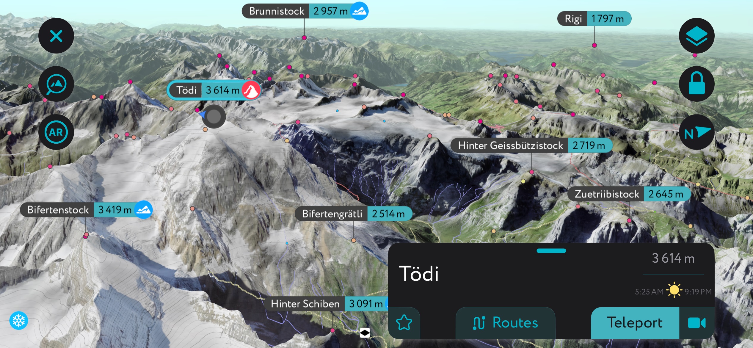
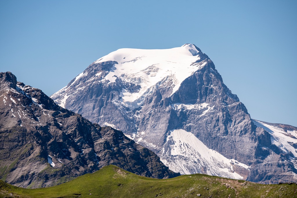
Located just over 65 km (40 mi) south of Zurich is Tödi (Piz Russein) (3,614 m / 11,856 ft), the highest mountain in Surselva and the Glarus Alps. Tödi is significantly higher than nearby peaks, with an isolation of over 42 km (26 mi).
Tödi's summit forms a triangle of three summits, with Tödi to the west, Sandgipfel (3,404 m / 11,168 ft) to the north, and Glarner Tödi (3,574 m / 11,726 ft) to the east.
Visible from Zurich and towering over other peaks in the region, Tödi is a long-term goal for many aspiring alpinists. Indeed, it's possible to outdo one of the fathers of modern mountaineering, Placidus a Spescha, by reaching Tödi's summit.
Tödi's two main routes aren't particularly difficult for experienced climbers and are rated WS (slightly difficult) on the Swiss Alpine Club's (SAC) mountaineering scale. However, both routes are long, with at least a six-hour ascent each, depending on the exact route.
One of Tödi's normal routes is from Fridolinshütte (2,111 m / 6,925 ft) to the northwest over the Biferten Glacier (Bifertenfirn) (2,129 m / 6,988 ft). The other normal route is from Camona da Punteglias (2,310 m / 7,582 ft) to the mountain’s southeast via the Porta de Gliems (3,250 m / 10,666 ft).
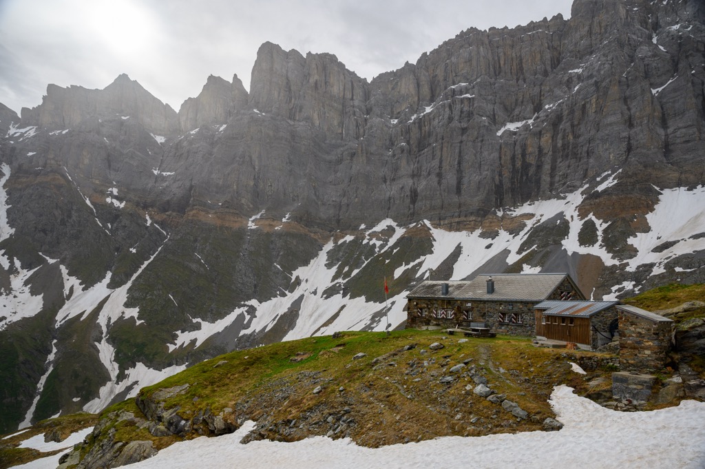
Piz Fess (2,881 m / 9,452 ft), with its jagged ridge and dual peaks, is an impressive mountain. It's the highest mountain in the Cadeina dil Signina, a sub-range of the Lepontine Alps that lies between the Val Lumnezia and Safiental. Pixz Fess rests on the western edge of Beverin Nature Park.
Piz Fess’s two peaks are Chli Fess ("Little Fess") and the Bös Fess ("Evil Fess") (2,881 m / 9,452 ft). Chli Fess is the gentler, easy-to-reach summit. Bös Fess was considered unreachable until local guides W. Wieland and J. Christoffel finally conquered it in 1895.
While not as demanding as its insidious big brother, Chli Fess is still a challenge — its normal route is graded T3 on the SAC hiking scale.
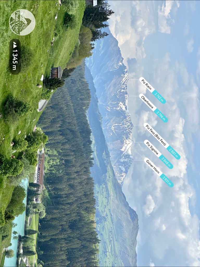
You can take the normal route to Chli Fess's summit from the church in Tenna to the Piz Fess’ northeast. The trail leads across the Tällialp to Tällihütte, over the Tällibach, and to the summit. If you want to bag some additional summits, you can take short detours to Oberhoora (2,796 m / 9,173 ft) and Piz Riein (2,762 m / 9,062 ft).
From Chli Fess, you'll have amazing views of Piz Beverin, the Val Lumnezia, and the Safiental. This out-and-back hike to Piz Fess is approximately 12.6 km (7.8 mi) in length.
Piz Mundaun (2,064 m / 6,772 ft) is one of the most frequently visited mountains in Surselva.
In the winter, Piz Mundaun is one of the principal summits of the famous Obersaxen-Mundaun ski area. On a clear day in summer, it affords one of the finest panoramas in the Swiss Alps, with views reaching from Finsteraarhorn (4,274 m / 14,022 ft) in the Bernese Alps to Piz Linard (3,410 m / 11,188 ft) in the Silvretta Alps to the town of Chur.
Piz Mundaun's views and ski opportunities have earned it the nickname Bündner Rigi, which roughly translates to "Queen of the Grisons."
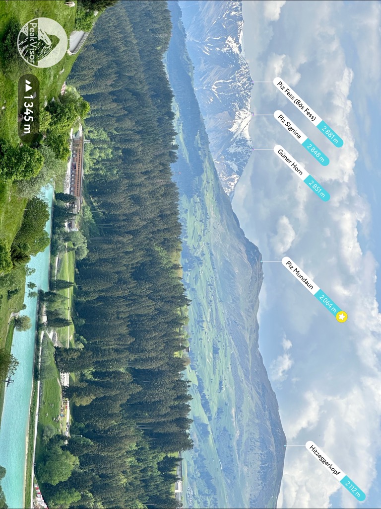
Piz Mundaun's most popular trail leads over four summits ending with Péz Sezner (2,310 m / 7,975 ft), which is marked with a summit cross and has a log book you can sign.
You can pick up the trail to Piz Mundaun from the Berggasthaus Bündner Rigi (1,620 m / 5,314 ft) following the Mundaun Sasolas. Or, you can skip straight to the summit by catching the ski lift from Cuolm Sura.
From Piz Mundaun's summit, you'll follow the ridge line over four summits in this order: Piz Plauncas (2,096 m / 6,877 ft), Hitzeggerkopf (2,112 m / 6,929 ft), Stein (2,172 m / 7,126 ft), and Péz Sezner. This out-and-back trail is approximately 7.5 km (4.6 mi) in length.
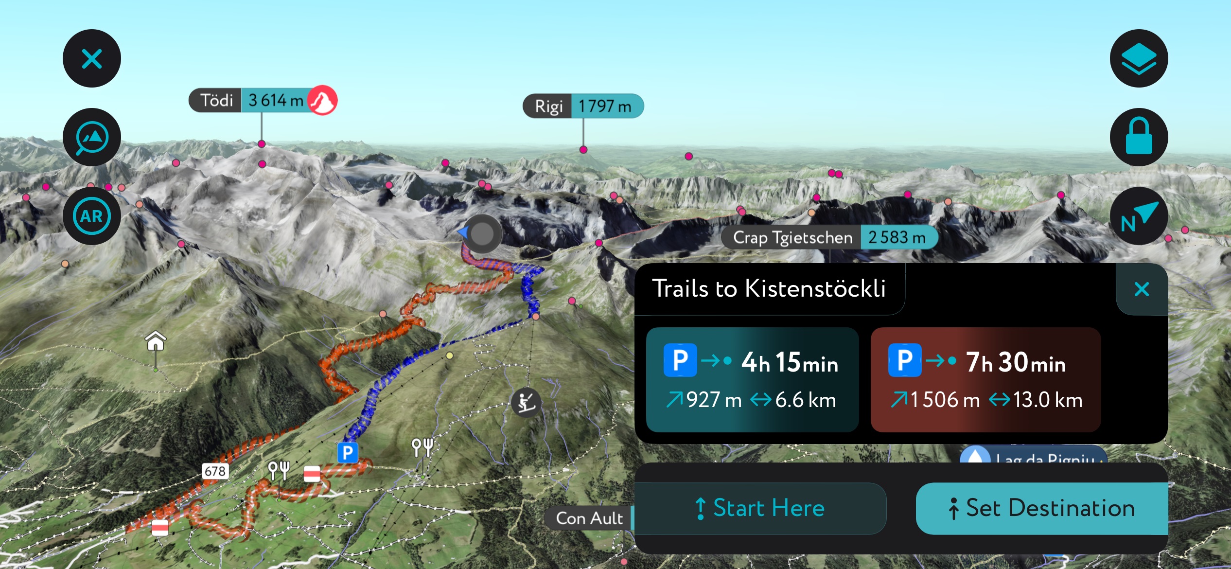
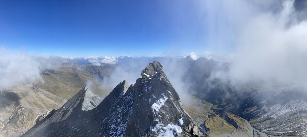
Kistenstöckli (2,748 m / 9,016 ft), also known as Muot da Rubi in Romansh, is one of the most striking mountains in Surselva. It's a table mountain with a square summit overlooking the Val Frisal on the Grisons-Glarus border.
Kistenstöckli's normal route is a tricky T4-graded trail from Breil/Brigels. Fixed chains along the route make the climb a little easier.
It's recommended you spend the night at the charming Bifertenhütte (2,481 m / 8,143 ft) on your way to the summit. Around three-quarters of the way to the summit, you'll be treated to a spectacular view of Piz d'Artgas (2,786 m / 9,140 ft).
Kistenstöckli provides sweeping views of the gorgeous Val Frisal and Limmerensee across the Glarus border. Numerous large cairns dot the summit, adding to the mountain's beauty.
You'll descend from Kistenstöckli via the Alp Quader. This hike is approximately 10.5 km (6.5 mi) in length.
If you're looking for an easier way to reach Kistenstöckli, you can hike to the summit via the Kirstenpass (2,639 m / 8,661 ft) on a T2-graded trail.
Piz Terri (3,149 m / 10,331 ft) is a stunning mountain with its iconic pyramidal peak and steep schist faces. In addition to being a beautiful mountain, Piz Terri's summit delivers epic panoramas.
From the summit, you can see Lago di Luzzone and one of Switzerland's largest plateaus, the Plaun da Greina, to the west. To the east is the Val Lumnezia, and to the north is the Val Sumvitg.
You'll need a head for heights and some climbing experience to reach Piz Terri — its normal route is graded T4+ by the SAC. You can pick up the trail to Piz Terri from the Terrihütte (Camona da Terri) (2,239 m / 7,349 ft).
The trail leads east over a suspension bridge and across the Plaun da Greina before entering the Val Canal. Climbing scree and grass slopes, you'll pass the Lageth la Greina and the slowly disappearing Glatscher dil Terri on the way to Piz Terri's saddle.
To descend, head back to Piz Terri's saddle and follow the alpine trail to the Capanna Michela Motterascio (2,172 m / 7,126 ft). This walk takes around six hours to complete.
The Senda Sursilvana is one of the most popular long-distance high-altitude trails in Surselva. It traverses the breadth of the Surselva Region, following a similar course as the Via Alpsu road from Andermatt to Chur.
The Senda Sursilvana is 116.3 km (72.2 mi) long and has five stages. It’s best to undertake this long-distance journey between May and October.
The first stage leads from Andermatt to Sedrun and is approximately 15 km (9.3 mi) in length. From Andermatt train station, you'll head to the Oberalppass, where you enter the Surselva Valley. The trail skirts the northern edge of Oberalpsee, over the Pass Tiarms (2,147 m / 7,047 ft), and through the Cuolm Val.
The second stage runs from Sedrun to Sumvitg, passing through Segnas and Disentis, mostly following the course of the Vorderrhein. The second stage is 18 km (11.1 mi) in length.
The third stage is from Sumvitg to Breil/Brigels and is 14 km (8.6 mi) in length. It leads across the Sumvitg municipality to Rabius and then Cartascha. Passing through forests, you'll reach the exit of Val Zinzera, where you'll hike for around three hours to Schlans. After reaching Dardin, it's a short walk to Breil/Brigels.
The fourth stage from Breil/Brigels to Laax is the longest, at 32 km (20 mi). It passes by the Lag da Breil and into the Val da Pigniu. You'll then cross the Schmuer stream near the Panixersee.
After Panix village, you'll walk up to Darpagaus, which offers superb views of the Surselva Valley and Piz Mundaun opposite. Finally, pass through Siat and Falera to reach Laax.
The fifth and final stage leads from Laax to Chur and is 25 km (15.5 mi) in length. This stage is almost entirely in the zone of the Flims Landslide. One of the best ways to see the Ruinaulta along this trail is from the Il Spir lookout at Conn. The trail continues along the Ruinaulta through Digg, Tamins, and Felsberg before reaching its final destination in Chur.
The Surselva Region is a popular skiing destination with over 190 km (118 mi) of pistes catering to skiers of all abilities. It's also home to the world's only solar-powered ski lift, located in Tenna.
There are three main ski areas in the Surselva Region:
Home to dozens of glaciers, sweeping valleys, and snow-capped mountains, the Surselva Region is superb for skiing off the beaten track.
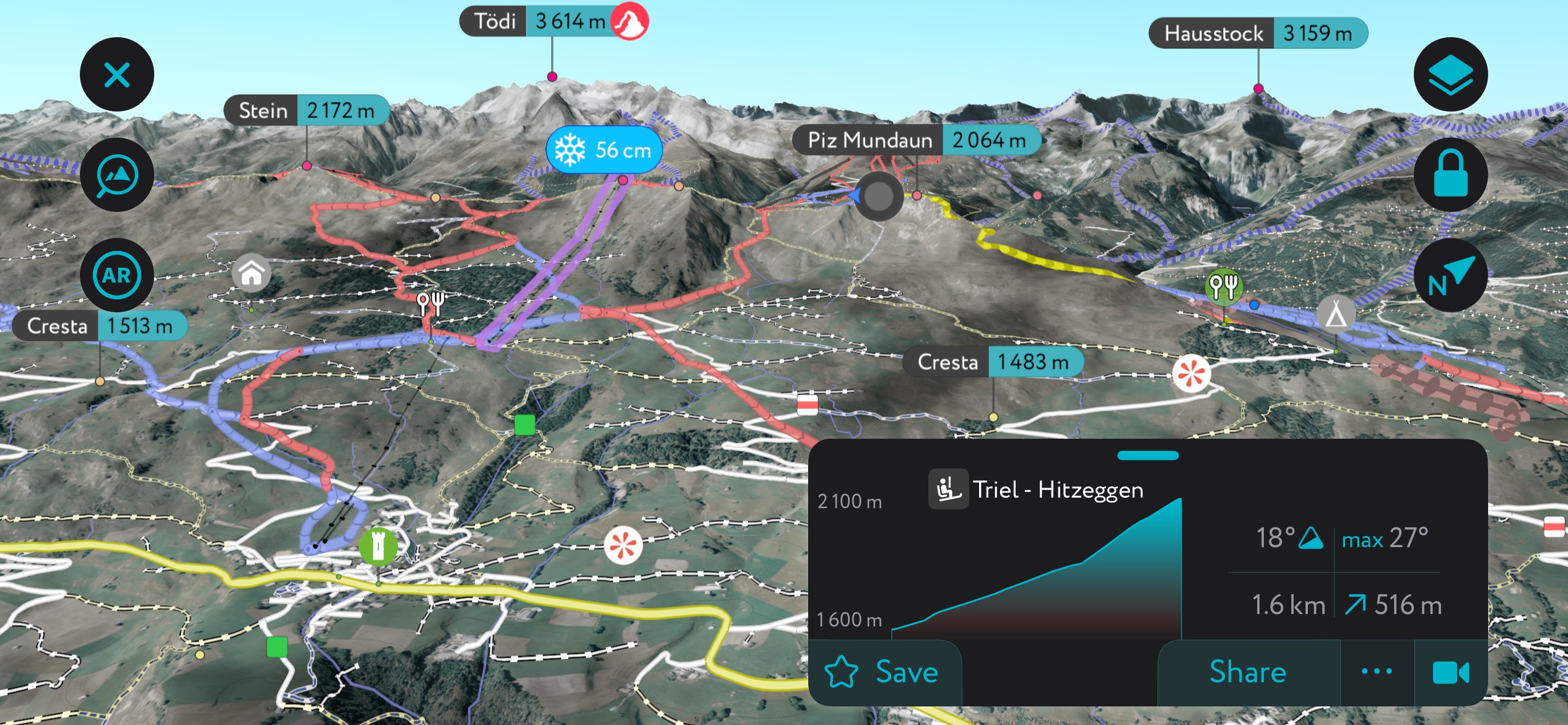
The Surselva Region is within one of our most thoroughly mapped areas — the PeakVisor App features thousands of ski tours across the Swiss Alps.
Here's a brief look at a couple of the most popular ski tours in the Surselva Region and some of the features that make the PeakVisor App perfect for planning your next adventure.
You can learn more about the SAC ski tour scale referenced in this section here.
Separating the sublime Safiental from the Valsertal, Piz Tomül (Wissensteinhorn) (2,946 m / 9,665 ft) is a popular mountain for ski tours. It's the highest summit in the Lepontine Alps north of the Tomülpass (2,411 m / 7,913 ft) and offers breathtaking views of nearby mountains, including Pizzo Tambo (3,279 m / 10,758 ft).
The most accessible ski tour to Piz Tomül's summit is from Turrahus (1,702 m / 5,584 ft) and over the Tomülpass on the mountain's east side. Due to the steepness of Piz Tomül's eastern slopes, you'll need safe snow conditions.
This ski tour is graded WS+ on the SAC ski touring scale and is approximately an 8.5 km (5.2 mi) round-trip.
Located between the Valsertal, Safiental, and Rheinwald, Bärenhorn (2,929 m / 9,610 ft) provides unbeatable views of the Zervreilasee and the surrounding summits. It's popular with hikers in summer, and in winter, it's a classic ski tour destination.
You can ski up Bärenhorn from several directions, but the easiest tour is from Splügen to the southeast. The tour leads onto the Safierberg (2.482 m / 8,146 ft) pass, skirting the summit of Schollengrat (2,807 m / 9,209 ft) on the way to Bärenhorn. This ski tour is graded PD+ and is approximately a 14.4 km (9 mi) round-trip.
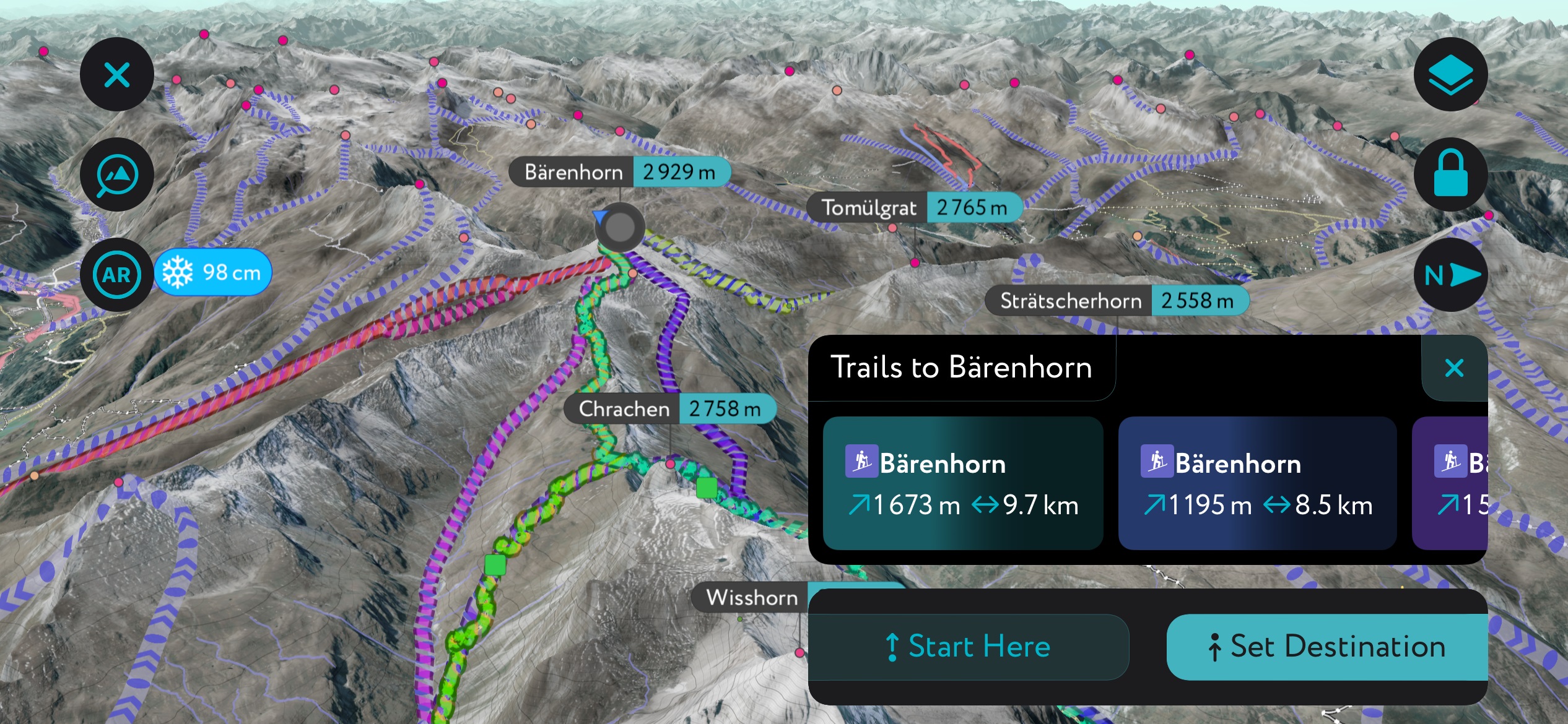
We've recently updated the PeakVisor App to make it even more helpful in planning ski tours throughout the Alps and beyond.
Get the latest information on local weather forecasts and snow depth to ensure perfect conditions for your next expedition. Plus, there are details on mountain huts, including opening hours, dining options, and overnight stays.
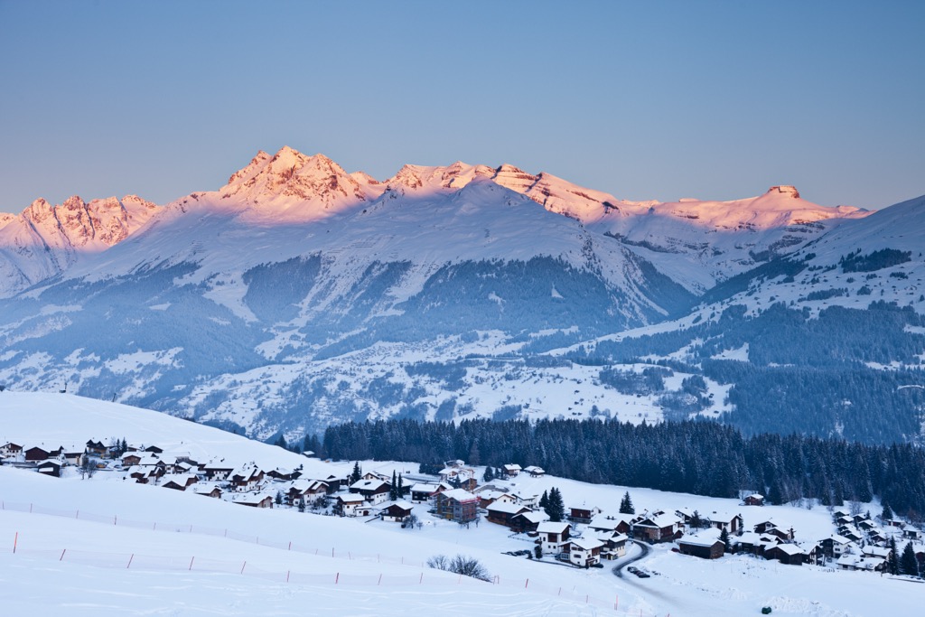
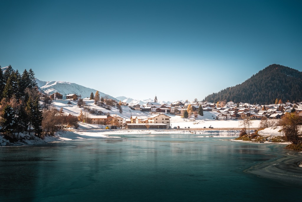
Tucked away in the valleys of the Surselva Region are many picturesque Alpine villages and towns from which you can plan the perfect adventure in the Lepontine Alps or Glarus Alps.
The nearest major international airport to the Surselva Region is Zurich International Airport, located approximately 80 km (50 mi) north.
Chur is the Grisons' capital and largest town, with a population of over 35,000. It's located roughly 18 km (11.1 mi) west of the Surselva Region within the Plessur Region.
Chur is said to be the oldest town in Switzerland, dating back over 5,000 years. One of Chur's highlights is its old town, which is entirely pedestrian.
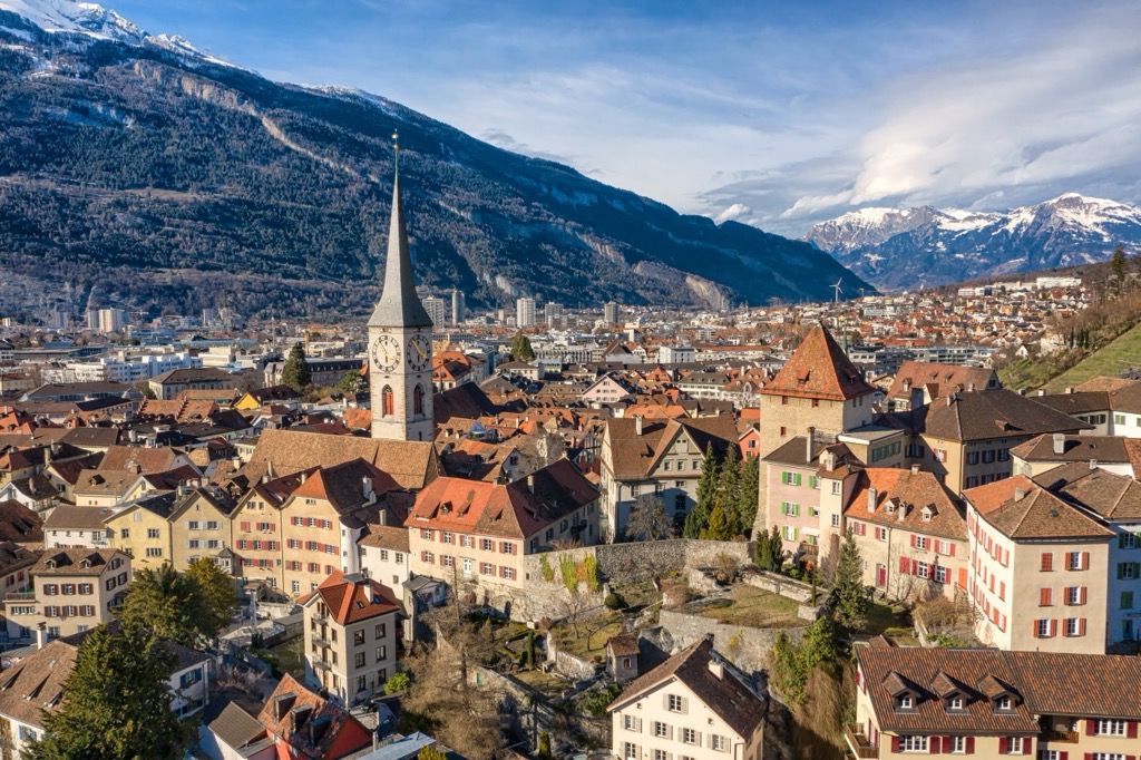
Top attractions in Chur include the triple-naved St. Mariä Himmelfahrt Cathedral and the Rätischen Museum, where you can view Placidus a Spescha's geological collection.
Chur's location on the Surselva Region's eastern edge means it's within 25 km (15.5 mi) of famous mountains for skiing and hiking like Piz Fess, Bündner Vorab (3,027 m / 9,934 ft), and Crap Sogn Gion (2,252 m / 7,369 ft). The Flims-Laax-Falera ski area is located just outside Chur.
Chur is accessible by rail from Zurich, approximately 120 km (74.5 mi) away.
Ilanz, or Glion in Romansh, is the largest settlement and municipality in the Surselva Region, with a population of over 4,700 people.
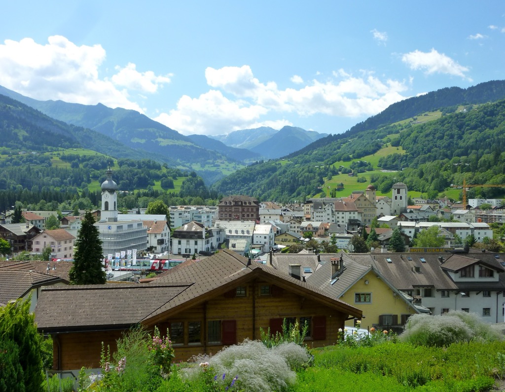
Once the capital of the Rhaetian Grey League in the 14th century, Ilanz is now a hub for outdoor adventures, with activities like rafting on the Vorderrhein and hiking in the Val da Pigniu. Ilanz is also home to some fascinating historical sights, like the 10th-century Church of St. Zeno in Ladir.
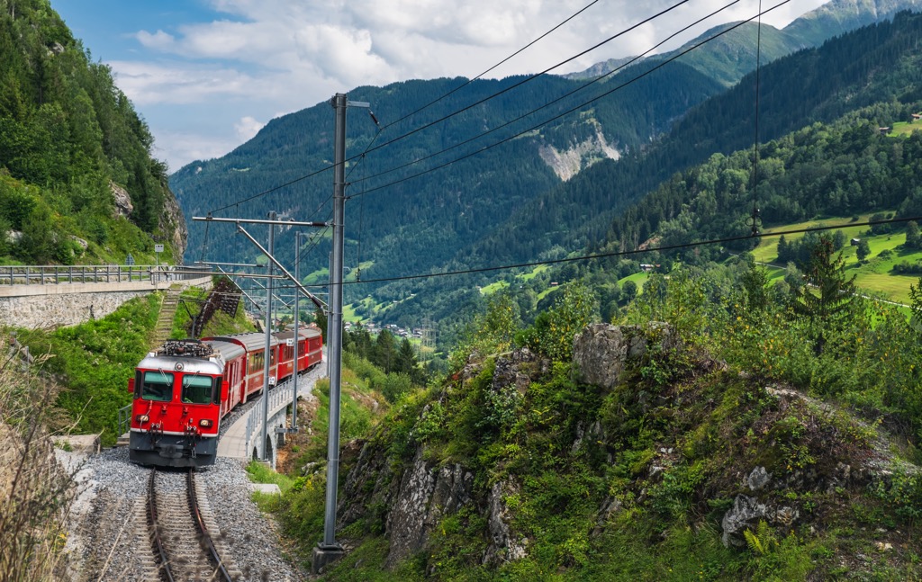
Ilanz is within 20 km (12.4 mi) of popular mountains like Piz Fess, Piz Tomül, and Piz Terri. The Reichenau-Tamins–Disentis/Mustér railway connects Ilanz's three railway stations with Disentis, Scuol, and Reichenau.
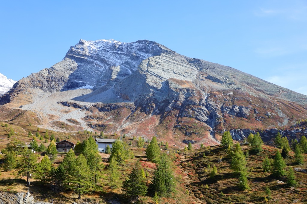
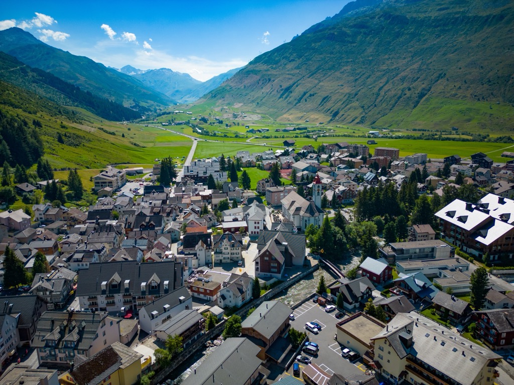
Disentis, or Mustér in Romansh, is a popular tourist resort in Surselva and one of the region's main settlements. Its population is over 2,000.
Disentis is home to Disentis Abbey, one of Switzerland's oldest Benedictine monasteries, dating back to 720. Mountaineering pioneer Placidus a Spescha was a monk at Disentis Abbey.
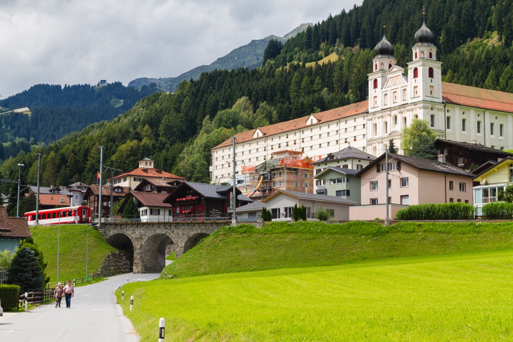
Six ski lifts and over 160 km (99.4 mi) of hiking trails in the Disentis municipality make it an excellent area for hiking and skiing. Within 15 km (9.3 mi) of Disentis, you'll find mountains like Oberalpstock, Piz Ault (3,027 m / 9,934 ft), and Tödi.
The Disentis municipality has four train stations, with regular services connecting it with St. Moritz, Zermatt, Scuol, and Andermatt.
Brigels, or Breil in Romansh, is a town and municipality with a population of over 1,700 people. Outside Birgels is the Brigels-Waltensburg-Andiast ski area, the second-largest ski area in the Surselva Region.
In addition to the ski area, Brigels is home to the Chaplutta Son Sievi, a Swiss national heritage site that dates back to at least the 11th century.
Popular mountains within 15 km (9.3 mi) of Brigels include Piz Mundaun, Bifertenstock, and Hausstock (3,158 m / 10,361 ft). Brigels is on the Reichenau-Tamins–Disentis/Mustér railway line, which connects to Ilanz, Scuol, and Disentis.


Yes. Surselva has 415 named mountains. The highest is Tödi at 3,614 m.
The highest mountain in Surselva is Tödi, at 3,614 m.
Surselva has 415 named mountains.


