
Scan the QR code and open PeakVisor on your phone
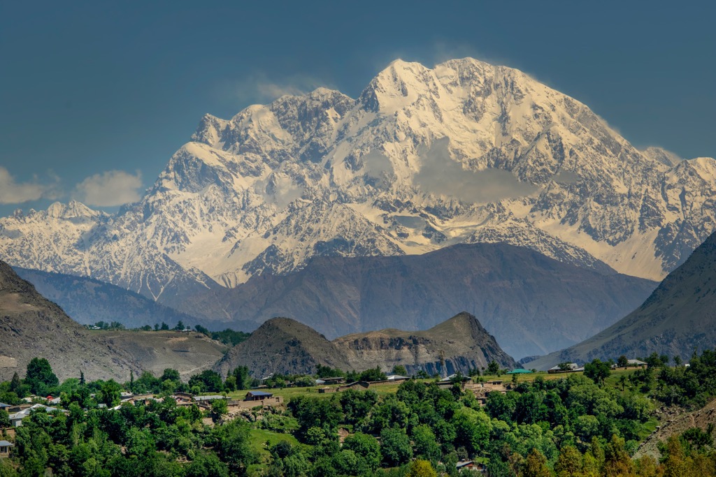
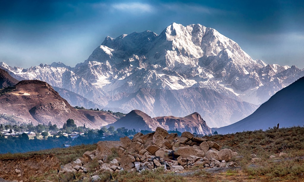
The Hindu Kush is Asia’s third-largest mountain range and contains the tallest mountain outside the Himalaya-Karakoram system. The Hindu Kush chain extends 800 km (500 mi) through Afghanistan, Pakistan, and Tajikistan and represents the border between Central and South Asia. The range contains 3477 named mountains; twenty are ultra-peaks with a prominence greater than 1,500 m (4,921 ft). Tirich Mir is the tallest (7,708 m / 25,289 ft) and most prominent peak (3,918 m / 12,854 ft).
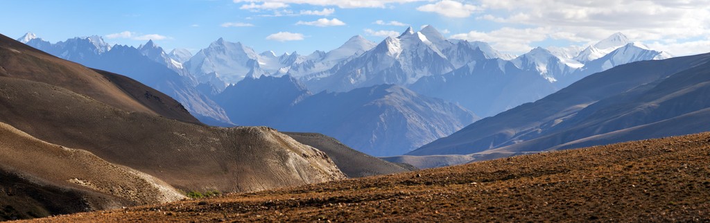
The Hindu Kush range lies west of the central Himalayas and extends approximately 800 km (500 mi) in length and up to 240 km (150 km) wide through Afghanistan, Pakistan, and Tajikistan.
The range is oriented northeast to southwest. To the east, the Hindu Kush passes near the Pamir Range, where China, Kashmir, and Afghanistan touch. From there, it angles southwest through Pakistan and into Afghanistan, where it peters out into the low peaks of western Afghanistan. The range also intersects southeastern Tajikistan.
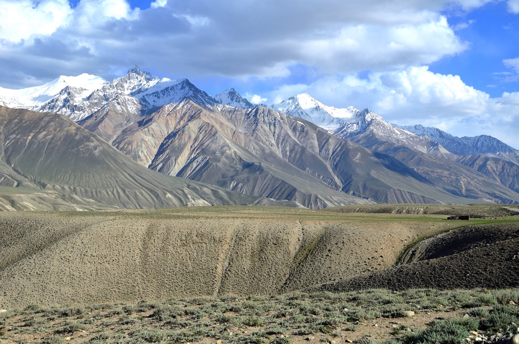
The Hindu Kush mountains are typically divided into three sections. The eastern section spans from Karambar Pass to the Dorāh Pass near Tirich Mir (7,708 m / 25,289 ft). The mountains are rounded and dome-like at the eastern reaches but become increasingly jagged and prominent further west into the central zone.
The central section extends from Dorāh Pass to the Shebar (Shībar) Pass northwest of Kabul. The western section, sometimes called the Bābā Mountains, drops into Kermū Pass.
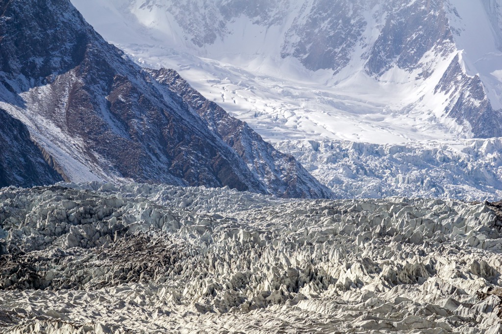
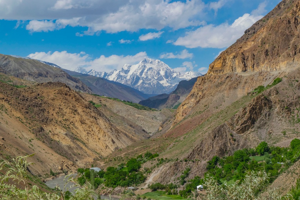
The range splits the northern valley of the Amu Darya, the Oxus River, from the southern Indus River valley and is one of Central Asia’s major watersheds. Many considerable glaciers, such as Kotgaz, Niroghi, Atrak, and Tirich, flow down from high-altitude peaks like Tirich Mir, Noshaq, and Istor-o-Nal. Some of these glaciers extend for dozens of kilometers into the valleys.
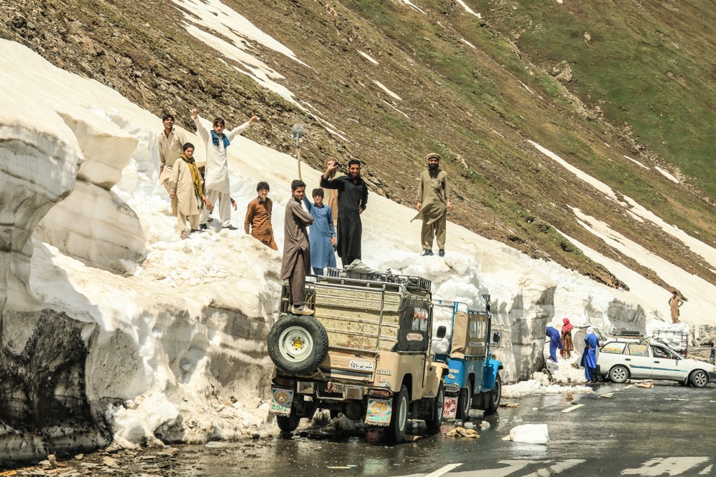
The Hindu Kush’s high mountain passes, called “kotals,” have allowed the flow of military might, goods, and culture between central and south Asia for more than 1,000 years.
The geology of the Hindu Kush is similar to that of the neighboring Karakoram and Himalayan Ranges to the east. The Hindu Kush began lifting around 50 million years ago as the Indian and Eurasian tectonic plates collided. These ranges are all part of the Alpide Belt, a defining geologic feature of our era. The Alpide Belt is a series of mountain ranges stretching from the Atlas Mountains in Morocco to the peaks of Southeast Asia.
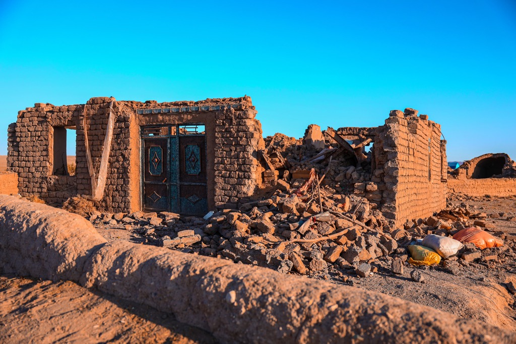
The Indian and Eurasian plates continue to collide and uplift the Hindu Kush. The region is one of the most seismically active zones in the world, with many earthquakes occurring at depths of 160 to 225 km (100 to 140 mi) below ground. The Chaman Fault, a strike-slip fault, has been particularly active and deadly over the years.
September and October 2023 have marked a tectonically active period. As of the writing of this article, many Afghans are sleeping outdoors, fearful of buildings crumbling during nighttime quakes. Thousands of Afghans have died from the tremors, several of which have measured over 6.0 magnitude.
Metamorphic rocks comprise most of the range, including metamorphosed granodiorite from 115 million years ago and metamorphosed sedimentary rocks like amphibolite and greenschist facies. Granite from the Cenozoic age, formed in the last 65 million years, is also present and is notable for its high muscovite mica and tourmaline content.
The range contains relatively few mineral deposits. Examples of resource extraction include the mining of lapis lazuli in the Monjān River valley, beryl in the Konar River valley, and coal near Karkar in Afghanistan. Natural gas is extracted from the northern plains along the western Hindu Kush, and iron ore is present in some areas.
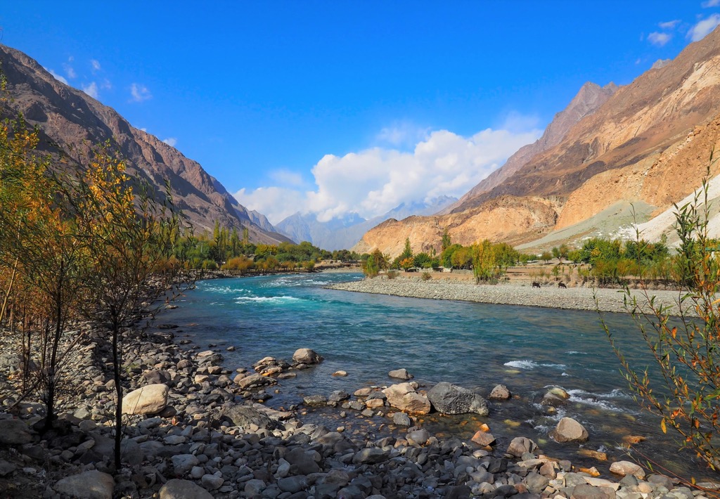
The Hindu Kush is the headwaters of several rivers, including the Amu Darya (Oxus), Panj, Kabul, and Swat Rivers.
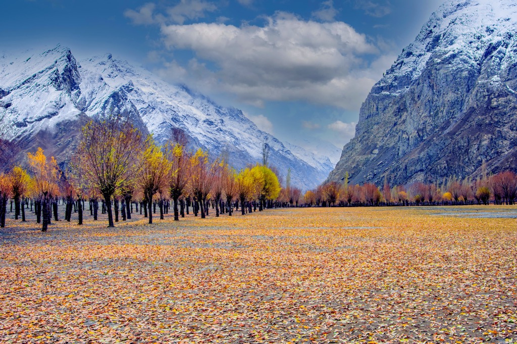
The Hindu Kush range spans an enormous distance and throughout many regions and altitudes, resulting in a wide range of climatic and ecological conditions. Peaks around Swat Kohistan and the eastern Hindu Kush receive monsoon summer winds, creating rainy summers between July and September and dry winters. The central and western regions lie along a Mediterranean climatic zone featuring hot, dry summers and cold, wet winters.
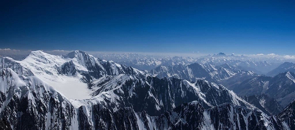
Glaciers are heaviest at the range’s furthest eastern point, such as around Chiantar Glacier, and in high sections around Tirich Mir and Saraghrara. These glaciers are spectacularly large by Western standards, with some flows extending for dozens of kilometers. Glaciers are present but more sporadic in the west. Glaciers cover about 4% of the total Hindu Kush region.
Formations known as ablated snow hummocks develop as weather conditions shift between frigid nights and bright sunlight and rapid evaporation during the day.
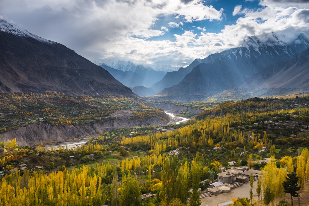
Vegetation in the Hindu Kush mountains varies greatly from thick forests, alpine meadows, lush valleys, and bare rock and soil. Forests cover most of the southern slopes of the eastern and central zones, utilizing the moisture that comes from snowy winters and summer monsoon rains. Above the treeline, the landscape shifts to rolling grasslands called Pamir. Deep valleys with rock walls sometimes support lush green oases created by meltwater from glaciers and snowfields.
The northern mountains in the Chitral district of Pakistan receive less rain on lower slopes and display sparse vegetation. Juniper and birch are the main tree species in this region. Deodar cedar and blue pine grow across the eastern and central spurs of the range. Bare soil and rock cover about 30 % of the Hindu Kush area, while Pamir and other grasslands cover 38%.
In the western section, there is little native forest. Locals cultivate poplar, willow, and Russian olive for fodder. Irrigated mountain zones also support cultivated species like plane trees, mulberry, jujube, and walnut. The valleys around Swat and Dir districts support rice paddies. Agriculture covers about 5% of the Hindu Kush.
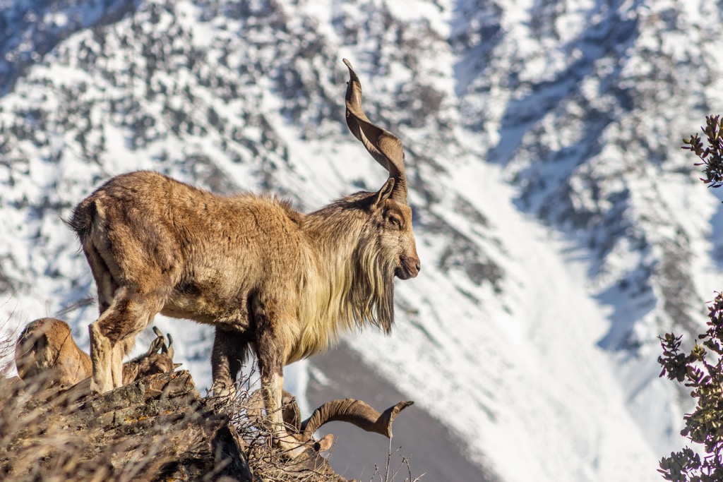
Wildlife in the Hindu Kush mountains is adapted to the mountains’ extreme heights and climatic conditions. Two species of wild goats, the Siberian ibex and markhor, thrive on high crags. Wild sheep, such as Marco Polo and urial sheep, graze the high pamir grasslands. Some black and brown bears remain in remote valleys, and the Chitral Valley provides crucial habitat for the elusive snow leopard. Vultures and eagles soar above the range, and brown trout are abundant in waterways along the northern slope.
Human hunting and activity have affected wildlife populations. Ongoing efforts aim to institute wildlife preserves, particularly in non-populated areas. However, the rural nature and unstable governments throughout much of the Hindu Kush make this problematic.
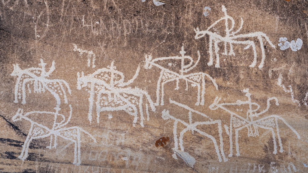
Humans have traversed the Hindu Kush range for tens of thousands of years. Early hominids passed through in successive waves starting about 100,000 years ago. Ultimately, humans settled in more forgiving and fertile zones like the Indus River Valley.
The region’s earliest descriptions date back to the mid-7th century and come from accounts from Central Asian invaders and a Chinese Buddhist monk. The range’s current name first appeared in records around the turn of the first millennium.
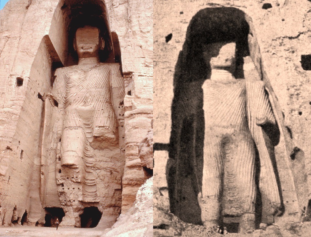
Marco Polo passed through the area in the 13th century, and military powers utilized the high mountain passes. Alexander the Great crossed Khawāk Pass, the Mongol leader Timur used Thalle Pass, and Ghengis Khan cut across the range via Kushān Pass and Kipchak Pass.
The use of mountain passes allowed the flow of culture and ideas more than political control. One example is the Indo–European language that was brought by Central Asian invaders and preceded the Indo-Iranian languages spoken in the region today.
During the 1800s, Russia and Britain disputed control of the region. The establishment of Afghanistan in the early 1880s essentially banished the two foreign powers for a time. Political lines drawn through the range, such as the Wakhan Corridor, are erratic. They come from agreements reached in the late 1800s between Afghanistan and the British. The Durand Line remains in use today as the border between Pakistan and Afghanistan.
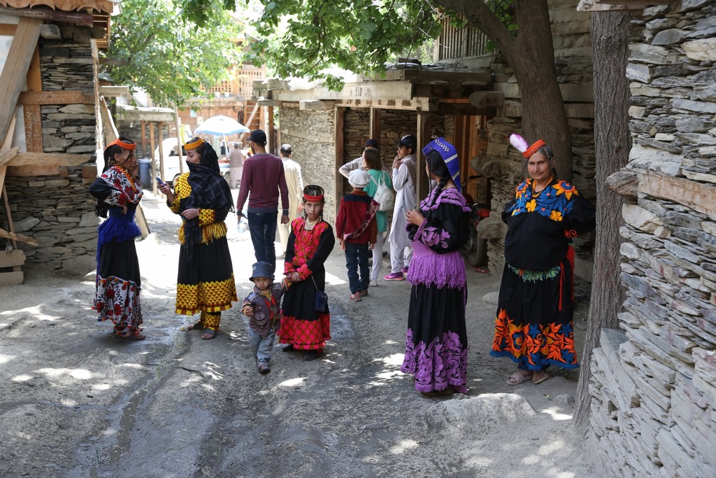
Today, many ethnic and religious groups live along the Hindu Kush range. These include the Mountain Tajik (Ismā’īlī Muslims), Tajik (Sunni Muslims), Uzbek, Hazāra (Persian-speaking), Pashtun nomads, and Indic Gujar nomadic herders. The Kohistani, a large ethnic group, live in Pakistan between Kashmir and Kabul.
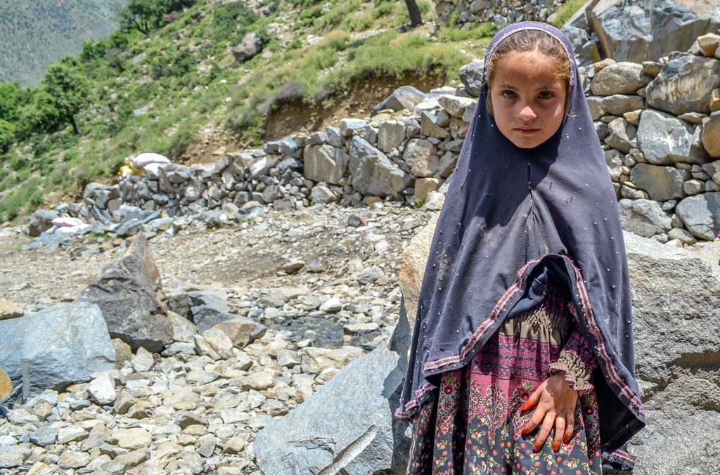
Other present groups include the Kalasha and Nūrestāni – two cultures stemming from the same ethnic group. A significant difference today is in their religious practices. The Nūrestānis were forced to convert to Islam in the late 1800s, while the Kalasha adhere to a polytheistic religion with a tradition of animal sacrifice.
The primary resources derived from mountains are forage, timber, and water. Some people use the meadows and grasslands for herding and grazing sheep and goats. When water is available, locals practice small-scale agriculture for crops such as wheat, barley, millet, maize, potatoes, peas, beans, mulberry, walnut, almond, jujube, apricot, and apple. Hydroelectric power plants supply energy to villages in the mountains of Pakistan.
The best season for trekking in the Hindu Kush is between June and September. Several tour agencies exist and can connect visitors with experienced guides and porters. Some peaks require advanced technical skills, while most treks across mountain passes are moderate and don’t require extensive mountaineering experience.
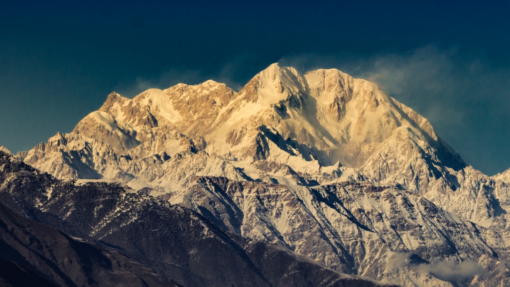
At 7,708 m (25,289 ft), Tirich Mir is the queen of the Hindu Kush. Located in the Chitral District of Pakistan, the nearest village to the mountain is Tirich in Mulkow. Here, locals can be hired as guides and porters but will only accompany trekkers to a certain point on the mountain.
A popular way to experience Tirich Mir is to undertake a challenging eight to nine-day trek to the Tirich Mir base camp, called Babu camp, which sits at 4,724 m (15,499 ft). Naturally, only experienced mountaineering teams will be able to push onto the technical and dangerous summit.
Noshaq is the second tallest peak in the Hindu Kush range and can be reached in an hour’s drive from Ishkashim. From here, it's a three-day trekking loop to the base camp, situated at 4,660 m (15,288 ft).
The summit is relatively non-technical on its easiest route, but this is still a massive peak requiring a skilled and prepared mountaineering team. A notable challenge is a section of steep rock from 6,400 to 6,700 m (21,000 to 22,000 ft). There are fixed ropes throughout, but the climbing is hard at elevation.
Approaching from the Pakistan side, the trail begins up the Lower and Upper Tirich Glaciers to the same base camp used for Tirich Mir. This route climbs through two icefalls that require technical climbing and mountaineering skills.
The Darkot Pass is a moderate to challenging trek that takes about two weeks. It spans from Chitral to Hunza, passing Tirich Mir and other breathtaking peaks of the central mountains along the way. The route begins in green valleys before climbing in elevation through rugged terrain and across a glacier to reach the Darkot and Atar Passes.
The Three Passes of Ishkomen is a moderate to challenging trek that takes around two weeks. The route begins in the Asumbar village of Ishkoman. In addition to the stunning landscape, this route offers the chance to connect with local communities along the way. Accommodation on treks is typically camping with nights at hotels on either end.
Lahore offers one of Pakistan’s international airports and is a good landing spot for northern Pakistan. Smaller cities, such as Chitral, provide access to the mountains and villages nestled at the base of the mountains. Although the range extends into Afghanistan, traveling and approaching from Kabul is unsafe or impossible.
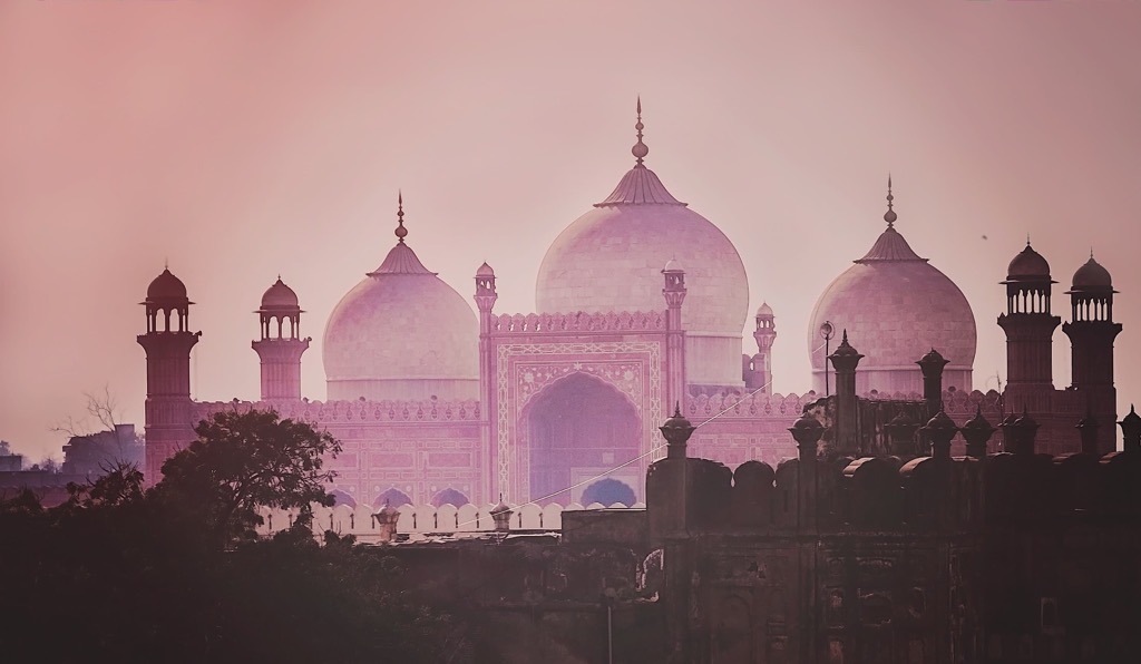
Home to 11.13 million people, Lahore is nearly the size of New York City but largely unknown to Westerners. Lahore is a cultural hotspot and a great city to become familiar with the region's culture. There are several mosques, one of the most impressive being the Badshahi Mosque. The Lahore Museum offers a glimpse into the region’s multi-cultural and dynamic history. At the same time, the Fakir Khana Museum, the country’s largest private museum, has an extensive collection of artwork and crafts. The city is also known for its lush gardens, parks, and food scene.
Chitral, Pakistan, is home to 50,000 people and is a scenic and culturally rich destination reachable via a regional flight or vehicle. Those hoping to explore outside will have easy access to the surrounding rivers, forests, and mountains.
Those wanting a cultural experience can visit the Kalash Valley, home to the Kalasha culture and the location of several festivals throughout the year. The Chitral Museum in town displays artifacts and antiques and dives into the culture and history of the Chitral and Kalash people. The Garam Chashma hot springs are also a popular attraction.
Jeeps are the primary form of transport, and the city offers all basic amenities, including shopping centers, hospitals, guesthouses, and hotels. Summer brings abundant locally-grown fruits like peaches, apricots, damson, apples, pomegranates, grapes, and pears. Restaurants offer local dishes representing a mix of Mughal and Central Asian influences. Milk and dairy are often used in local dishes.


