
Scan the QR code and open PeakVisor on your phone
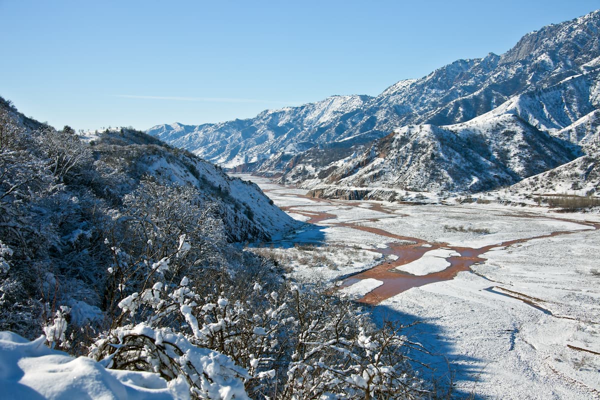
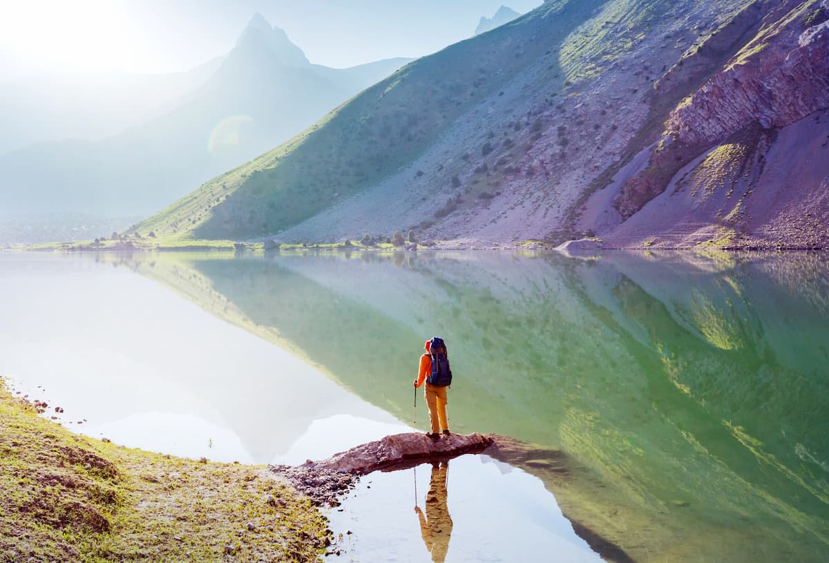
The great, mysterious, lost in the wilderness of Central Asia - the Pamir Mountains have always stirred minds. Sharp peaks seemed unattainable, deep rocky gorges appear impregnable, winding roads going into the clouds can hardly be called reliable. Mountain peaks rising to the sky remember the Persian kings, the mysterious Bactria and the troops of Alexander the Great. Here made their way Tamerlane and Babur, Marco Polo and dozens of pioneer explorers of glaciers and mountains. And on the roads laid above the abyss, caravans carried Chinese silk, lapis lazuli and rubies mined in the local mines. Today we know much more about the Pamir, but we never cease to be amazed by its beauty and diversity. Here, every tourist wakes up to a spirit of adventure.
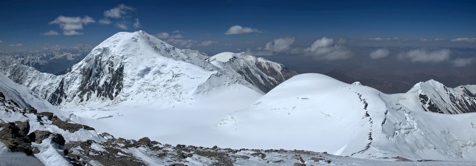
Geographically, the Pamir act as a giant mountain chain located almost in the center of the Asian continent. Its mountains and plateaus form a tectonic node spreading throughout Asia through the Hindu Kush in Afghanistan, the Tien Shan Range in Kyrgyzstan, the Kunlun in China, and the Himalayas themselves. Second only to the Himalayas in Tibet, the Pamir are the highest mountains in the world with human dwellings. The area is isolated and has no access to the sea. The high mountains in the Pamirs form a variety of landscapes, from subtropical to alpine. The rugged and often impassable land has preserved the unique cultural identity of each of the regions separated by mountains and gorges. In the Pamir, everyone will find something unique. Cultural lovers are free to explore the millennia-old history and mountaineers have no shortage of challenging and exciting climbing routes.
The Pamir is shaped as a quadrangle on the space image. The high elevated edges of the highlands are particularly characteristic. In the north stands the Zaalai Range with Lenin Peak as the highest point, in the north-west it is the Academy of Sciences Range with Ismoil Somoni Peak. In the south, the Shakhdara Range with Marx Peak and the Wakhan Range with Snowy Boulder Mount. Most part of the latter belongs to Afghanistan. The Chinese Pamir is represented by the Kingtau Range with Budunseltau Mount, the Ulugarttag Range with Chakragil Peak and the Kongurmuztag Range with Kongur Mountain, Muztag-Ata and Kongurtube Peaks.
The Pamir is surrounded by the giant mountains of Asia: the Himalayas, the Karakoram, the Hindu Kush (aka the killer of the Indians), the Gissaro(Hissor)-Alai, the Tien Shan and the Kunlun. The Pamir Mountains divide Tajikistan, Kyrgyzstan, China, Pakistan and Afghanistan. And everywhere they appear to travelers different but invariably fascinating.
Currently, the Pamir is a part of a bigger mountain entity called the Pamir-Alai System that stretches from west to east for 900 km, from north to south for 400 km. It adjoins the Pamir from the northwest, separating the Pamir from the Hissor Range (also spelt as Gissar).
It consists of mountain ranges and highlands between the Fergana Valley in the north and the upper Amu-Darya in the south. The Pamiro-Alai includes three heterogeneous regions:
The northern ridges of the Pamir-Alai are the Alai and Turkestan Ranges which border the Fergana Valley from the south. The Zeravshan (aka Zarafshon) Range stretches to the west from the south of Zeravshan town, it starts off these ranges near the Matchinsky mountain junction (over 5,600 m). These three ranges are characterized by serrated ridges, sharp peaks and mountain glacial relief forms. A mighty Hissor Range starts from the southern side of the Zeravshan ridge.
To the south of the Hissor Range lies the Tajik Depression, which has many relatively low folded ridges stretching from north-east to south-west and south-south-west, it is slightly curved and has a convex turned to the north-west.
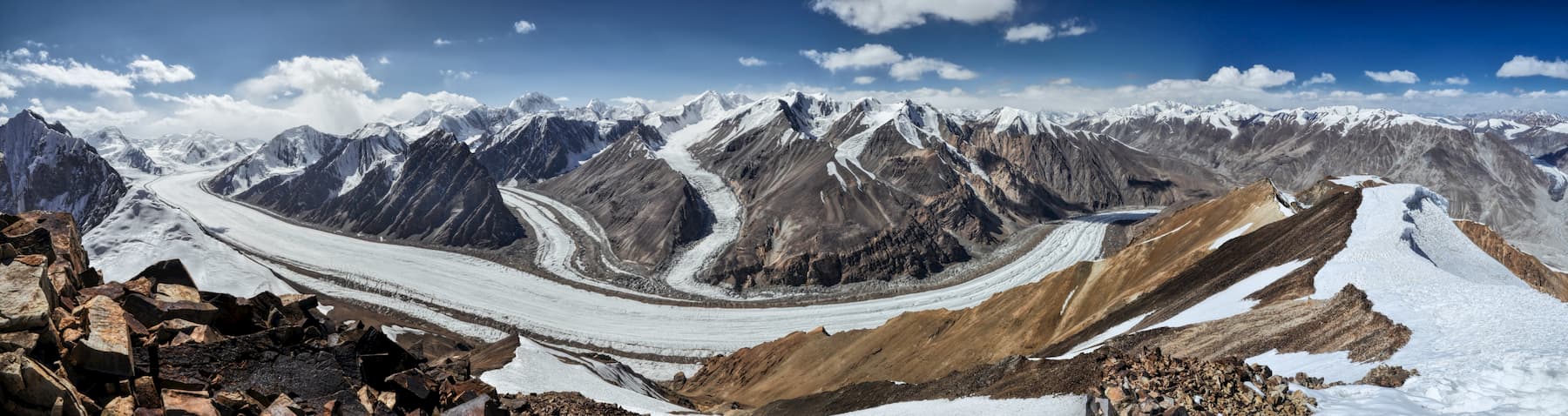
Overall, the Pamiro-Alai is the largest area of mountain glaciation: there are more than 10,600 glaciers on an area of 9820 sq.km.
In this article, we shall focus on the Pamir classics only.
The Pamir borders are more or less agreed upon. Conventionally, the borders are drawn in the west along the Panj River, although it becomes unclear where to attribute a narrow strip of mountains in Afghanistan west of the Panj if not to the Pamir. The northern border is usually drawn along the Alai Valley in Kyrgyzstan covering the northern spurs of the Zaalai mountain range and offering a smooth transition to the Tien Shan zone. The eastern border runs along the edge of the Takla-Makan desert and includes the Kashgar and Tarim river basins. The Sarykol Ridge in the Uigur Autonomous Region of Xinjiang in western China limits the eastern edge. The southern border turns again along the Panj circling the Wakhan Ridge from the south and continuing to the Takla-Makan desert along the valley of the Tashkurgan River thus including the Hindu Kush Range. In these borders, the width of the Pamir from west to east is about 420-440 km, and from north to south is about 250 km.
Before the massive exploration of the Himalayas it was the Pamir which was often referred to as the "roof of the world". When you start collecting information about the mountains, you realise there is a plethora of rooftops of the world in Central Asia: the Himalayas, Tibet, Mt. Everest, and the Pamir itself. The criteria here is surely to be over 7K meters tall and to be meaningful for the life and survival of the local peoples.
The Pamir climate ranges from cold desert to semi-desert with average temperature from 0°C to -8°C. The average summer temperature is from 2°С to 10°С (36-50F). But temperatures vary greatly with the region. You can get summer daytime highs of 23°C (74F) and winter lows of -17°C (1F) in the eastern Pamir, to +27°C (81F) in summer and -6°C (21F) in winter in the western Pamir. Isolated outposts in the eastern Pamir record temperatures below -50°C (-58F) in winter. Anyway, rain or sunshine, a warm cap covering the ears is on a must-take list of any traveller here.
Covered with snow throughout the year, the Pamir has long and very cold winters and short, cool summers. As the region is sunny and dry, daily temperature variations are particularly high. The average annual rainfall in the Pamir ranges from 40 to 150 mm. In addition to cold and dry conditions, strong and steady winds are the main obstacle for many plants to flourish although the habitat is well suited for cushion-like plants.
In the western valleys, convection storms combined with cyclonic storms are common in summer. Many of the region's weather conditions are associated with the so-called Afghan winds that form in the northwest of Afghanistan and are amplified over the horseshoe-shaped ridges of the lower Pamir. They bring summer dust storms and subsequent rains to the western mountains. Snowfalls are quite significant in the western valleys.
The Eastern Pamir has a striking similarity to the forestless western part of the Tibetan Plateau, whereas the Western Pamir represents a stark contrast. The forced emigration of people living in the high mountains, which began in the late 1930s, stopped the overgrazing and logging of firewood that was massive on the adjacent ridges. After that, juniper and bushes revived, which stopped the erosion.
The alpine flora of the Pamir is also influenced by Iranian-Afghan, i.e. Central Asian flora. Most of the Pamir flora, and that is approximately 620 species, consists of the Central Asian species, which are common on the Tibetan Plateau. The dominating species falling into this category are the white sage (Krascheninnikovia ceratoides), juniper, acantholimon diapensium, ladies’ slipper, sedge grass, rush, dragonhead and others. Areas above 2000 meters are covered with willows, thorns, oleander, poplars and birches.

The high-mountainous plains of the Eastern Pamir are the main breeding ground for mountain goats and argali. Brown bears and wolves feed on marmots, but meeting them, as well as snow leopards,can be dangerous for humans. If you don’t know how to behave if you meet those predators, read the guidelines by hunters’ association that we give in our articles on bear and tiger behaviour. Lammergeiers or bearded vultures and Himalayan griffins often live on the highest peaks, while partridges and pheasants are found on the lower slopes of the mountains in the west. A large number of migratory waterfowl flying between Siberia and South Asia visit the eastern Pamir as well.
The colder and drier Eastern Pamir is home to fewer bird species, although brown-headed gulls and mountain geese nest at an altitude of 4,000 m along the shores of some of the region's high mountain lakes. Two species of pheasants nest on rocky slopes: Himalayan snowcock and Tibetan snowcock. The Western Pamir are richer in species due to the greater diversity of terrain and proximity to the Central Asian floral province.

In mountaineering and tourism literature it is common to distinguish the following areas – the Northern, Southern, Central, Western, Eastern, and Chinese Pamir. Strictly speaking, the Eastern Pamir is actually the Central Pamir – it is a vast mountain desert, raised to a great height and surrounded on all sides by even higher ridges. But it so happens that this area is most often called the Eastern Pamir.
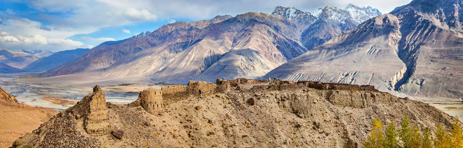
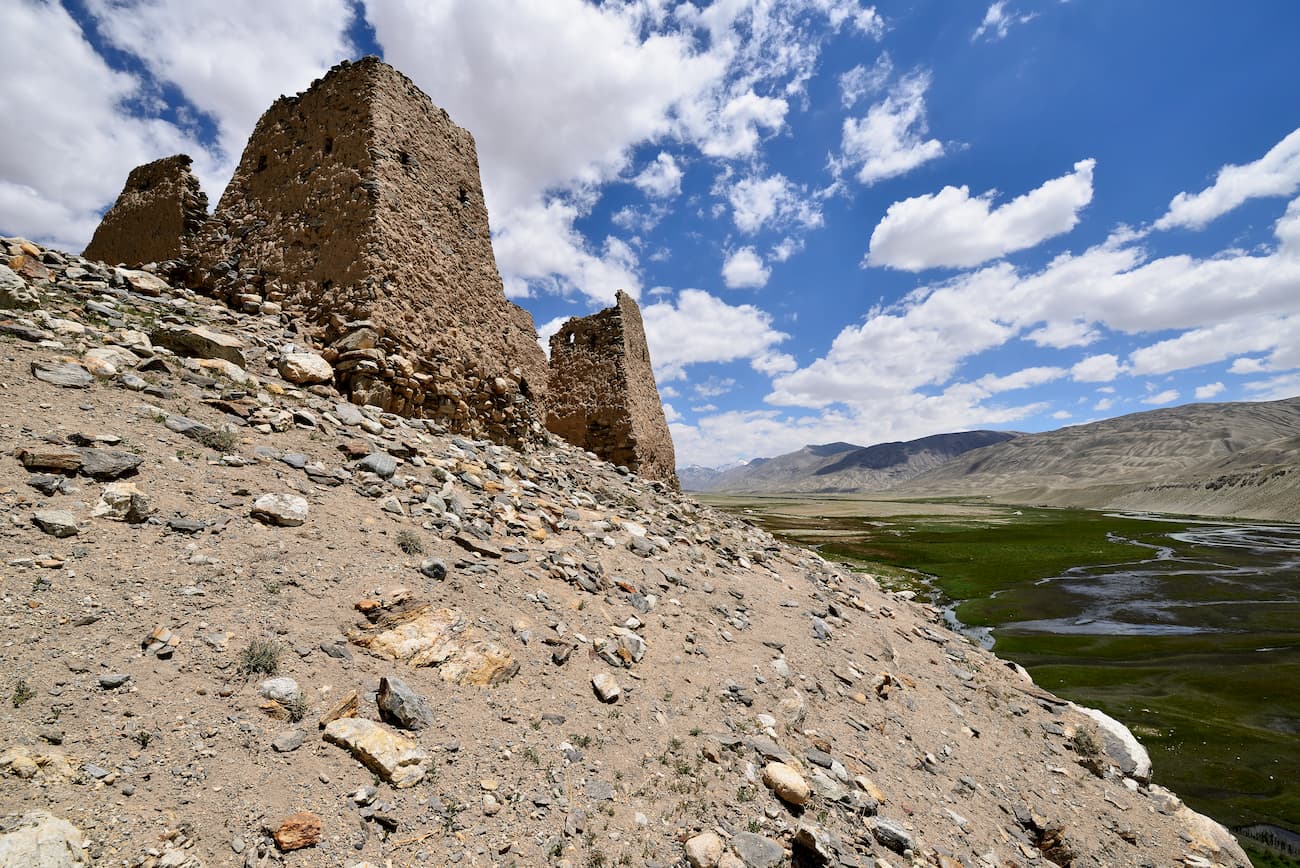
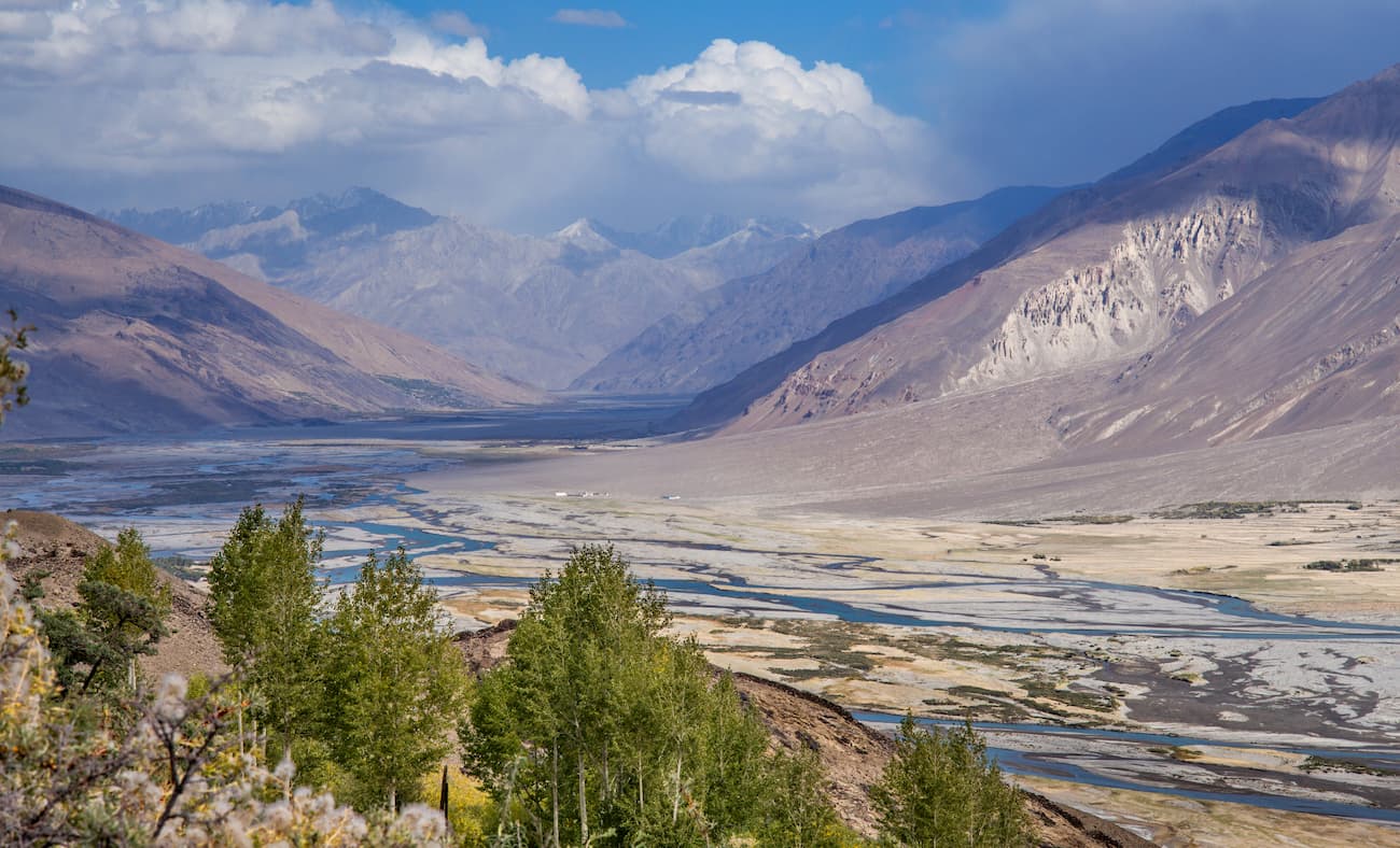
Most often, when you hear the word Pamir, people are referring to the Gorno-Badakhshan region of Tajikistan - this is where the main part of this mountain system is located. The main tourist center of the Pamir is Khorog town. The northern Zaalai Mountain Range, which is also a part of the Pamir system, is located in Kyrgyzstan. The Pamir Mountains in China are usually called the Chinese Pamir or the Kashgar Mountains. In Afghanistan, the spurs of the Southern Pamir are located in the Badakhshan province. Between Tajikistan and Afghanistan, there is the Wakhan Corridor, a narrow flat valley surrounded by high ridges. This Corridor runs along the Wakhan and Panj rivers.
The areas of access are also different. The Northern Pamir including the Zaalai, Zulumart and Saukdara ranges is accessible from the north of the Alai Valley, mainly from the city of Osh in Kyrgyzstan. The north-western Pamir is accessible from Dzhirgital town in Tajikistan. The Central Pamir can also be reached from Tajikistan, but from the towns of Vanch or Savnob. Speaking of accessibility, it is worth mentioning that if you are travelling from the Tajikistan side and wish to visit the majestic Lake Sarez or the Afghani Pamir, you should have a stamp in your passport, this is usually done in Khorog. You can also get a permit to visit the Pamir in Dushanbe, but as it is not a stamp in your passport, the access to the aforementioned areas will be denied.
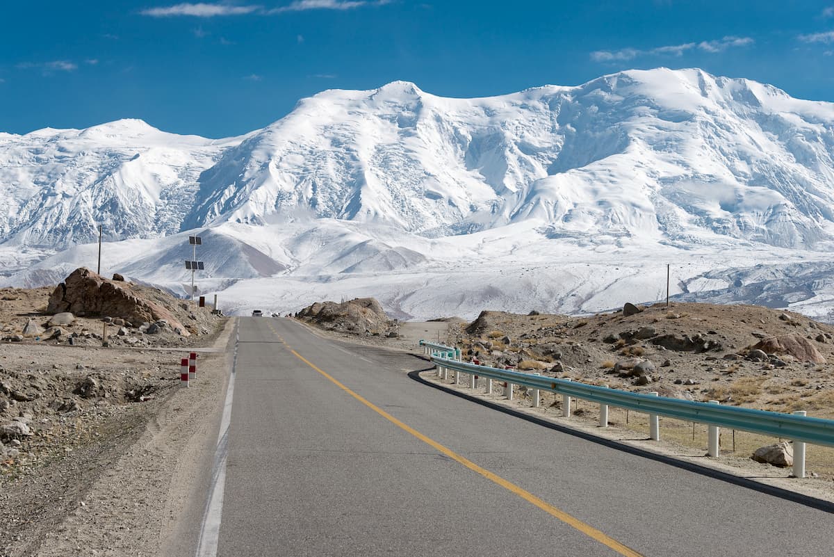
Today, the cities of Osh and Dushanbe are connected by the Pamir Road, one of the highest roads in the world, the first sections of which were laid in the late 19th century. It is literally a road of life as it connects far away regions of the two countries and runs over mountain passes that are more than four kilometers high. Speaking of road building, since the Pamir is still a young mountain system, earthquakes and tectonic movements are quite frequent which hinders any massive road building.
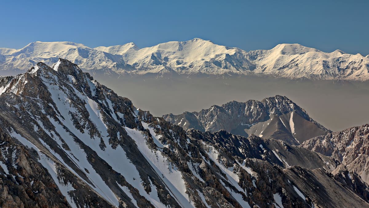
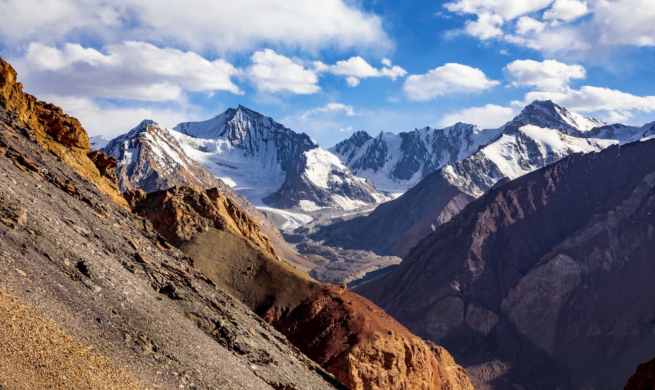
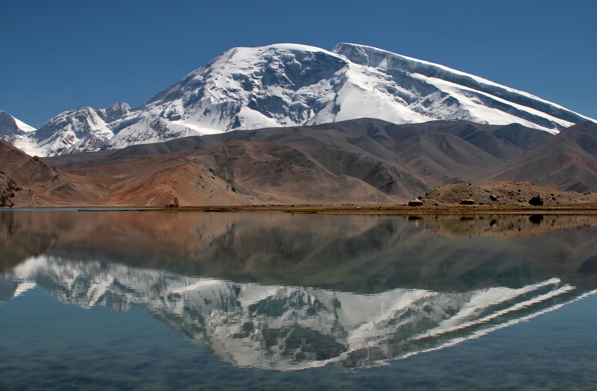
The Pamir Mountains have long been considered the highest in the world. However, the invention of new measurement methods put them in the first dozen after the Himalayas, the Hindu Kush, the Karakoram, the Andes. The most impressive peaks of the Pamir are in the Chinese Pamir. They are Kongur Tagh (7,649 m) and Muztagh-Ata (7,546 m). The highest peaks in the Tajik Pamir are Ismoil Somoni Peak, formerly called Communism Peak (7,495 m) and Korzhenevskaya peak (7,105 m). Lenin Peak (7,134 m) stands tall at the Tajik-Kyrgyz border.
The northern outpost of the Pamir, the Zaalai Range, stretches for 200 kilometers along the Kyrgyz territory from west to east from the confluence of the rivers Muksu and Kyzylsu to Peak Irkeshtam on the border with China, and cuts into the lands of the Celestial Empire for another 50 kilometers. Here converge the Zaalai Range and the northern part of the Pamir-Alai Mountains – the Turkestan and the Alai Ranges – separating the Pamir and the Tian Shan.
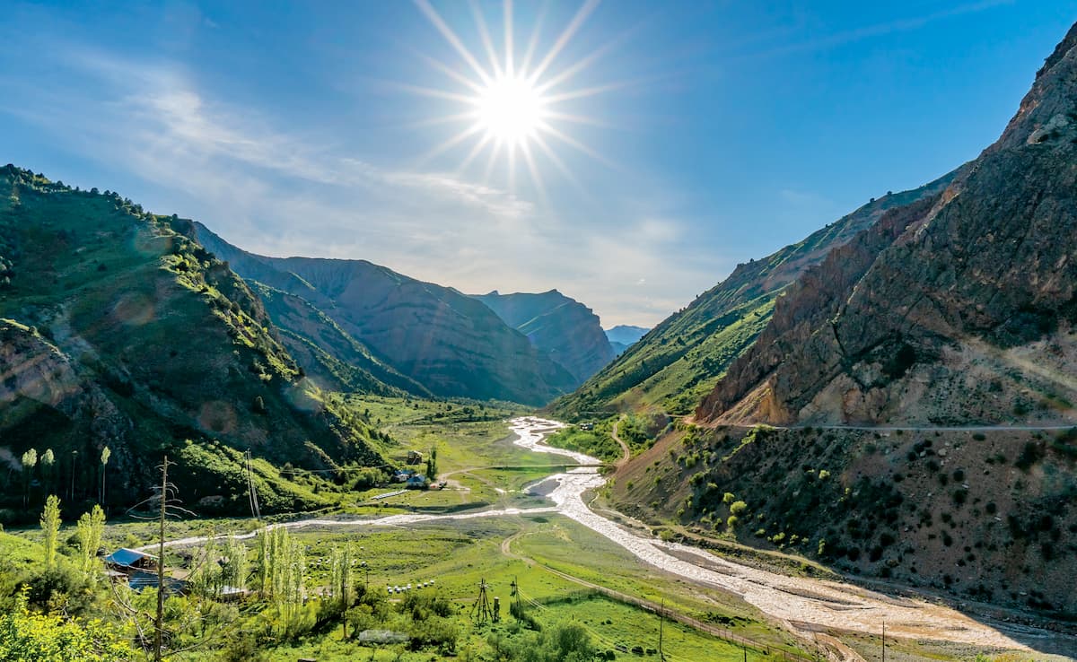
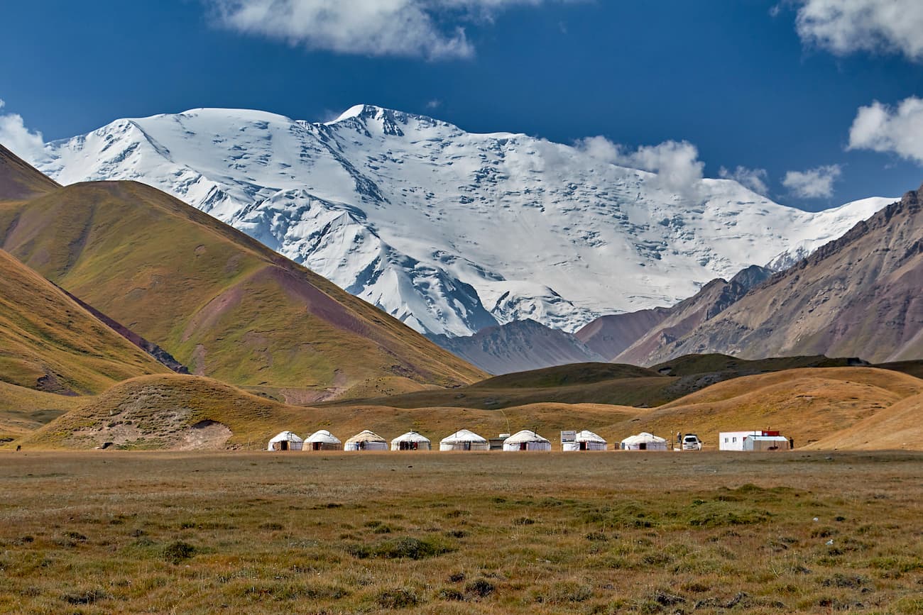
Quite pleasant climate, stable weather for mountain regions and plenty of sunshine makes the Pamir Mountains of Kyrgyzstan comfortable both for summer holidays and for visiting up to late autumn. It also offers routes for every taste – from active family holidays with elements of ethnographic and ecological tourism on camping sites and yurts to serious sports hikes for experienced climbers.
Although the average height of the Zaalai Range is a little over 5 km, it is here that one of the seven-thousanders of the Pamir – Lenin Peak (7,134 m) and many six-thousanders are scraping the skies with their rugged tops. The number of glaciers is astounding – there are more than 500 treacherous ice bodies in this part of the Pamir. The most impressive are the Korzhenevsky, Dzerzhinsky, Kuzgun, East Kyzylsu, Oktyabrsky, Nura, Malaya and Bolshaya Saukdara.
The spurs are divided by many passes - the Zaalai, Surkhangou, Minjar, Constitution, Abris, Dzerzhinsky, 60th anniversary of October, Separate, Spartacus, Bunch of Peace, Western and Golden Calf, Beletsky, 30th anniversary of Victory. Some of them are easy to reach even if you are just in a good physical shape and don’t have any special mountaineering training, you can go the so-called light trekking. Some passes are rather challenging and require a professional approach. The daredevils invariably get dizzying views of the endless Pamir as a reward.
The Kyzylart and Tersagar Passes divide the Zaalai Range into eastern, central and western parts.
Stretching from Kyzylart to China, The Eastern Zaalai is a rare protected area. Because of the proximity of the state border, active exploration of these places began only in the 1990s. The local six-thousanders – the peaks of Kurumda (6,613) and Zarya Vostoka (Dawn of the East) (6,349) – have been conquered by the very few chosen since steep slopes and strong winds hamper even the most experienced climbers. Dawn of the East was first climbed in 2000 by a team of Russian climbers led by Alexander Novik, while Kurumda gave up a year later to Kyrgyz athletes led by Alexander Gubaev. There are still many peaks in these harsh mountains that have not yet been conquered or even named, they are marked only by numbers. Also, there are many unexplored passes and nameless glaciers that are waiting for their heroes. However, only those who take seriously both the charms and dangers can survive here. The gusts of winds coming at you on the glacier passes can knock you off the path whereas the somewhat monotonous and similar wide ridges and cupola-shaped peaks might seem pretty confusing in their similarity, and google maps will be of little or no help because a) the connection is poor or non-existent, and b) power supply is hard to find in these remote regions. You will have to make an effort and stockpile equipment including power banks and satellite communication. It is a reasonable fee for the title of a pioneer and discoverer of the Pamir peaks.
The Central Zaalai is located between the Tersagar and Kyzylart passes. This part is a literal confirmation of the famous lyrics from Vysotsky’s song "the only better mountains are those you have never been to before". The range here is an almost continuous string of peaks separated by passes covered with a white blanket of ice and snow. Here you can test your powers on relatively low routes and trekking tours when climbing Petrovskiy Peak (4,700m), Yukhina Peak (5,130m), Razdelnaya Peak (6,148m), or you can aim at six-thousanders, e.g. Peak Zhukov (6,842 m), Peak Oktyabrsky (6,780 m), Peak Dzerzhinsky (6,717 m), Peak Unity (6,640 m), Peak Kyzylagyn (6,683 m) and Peak Lenin (7,134 m) are the highest in Kyrgyzstan.
Naming in the Central Asia of the Soviet dissent is particular – the mountains are named in honour of the Soviet revolutionaries and communist leaders or ideologists, viz. Karl Marx, Engels, Lenin, Revolution, Dzerzhinsky, Frunze, Oktyabrsky (to commemorate the October revolution in 1917), 60 Years of October, Soviet Officers, 26 Baku Commissars and many more. There used to be Stalin and Communism peaks but they names were foregone due to political agenda. This is a deeply rooted tradition of respecting the elders. Even now when you travel in Tajikistan for example, you can come across commemorative plaques with names of respected people who help the local communities. The names will come with the suffix ‘aga’ meaning ‘the elderly’.
In general, when you start researching the Pamir, you come across many names for the same peaks. Pamir mountains are probably amongst the most frequently renamed ones.
Lenin Peak shrouded in the clouds was first documented in 1871 by a Russian geographer and traveler Alexei Fedchenko. Until 1928, it was named Kaufman Peak in honor of the Governor-General of Turkestan. With the advent of the Soviet power, it was renamed Lenin Peak. In 2006, the Tajik government unilaterally gave it the name of Abu Ali ibn Sina (Avicenna). In spite of its neighbors, or probably to spite them, in 2017 Kyrgyzstan offered to name it Manas Peak. However, tourists and climbers are more familiar with the old name, Lenin Peak. By the way, it is best seen from the Kyrgyz side. Today, 16 routes lead to the peak: nine on the southern slope and seven on the northern one. The most accessible way to the peak leads from the north through Mount Razdelnaya. It does not require any special skills and a great mountaineering experience, which makes Lenin Peak the most accessible 7K-peak in the world.
Another small note on Lenin Peak – it was depicted by a great Russian painter Nickolas Roerich who was called the Master of the Mountains. You can read about his other famous mountains here.
In general, there are many hiking routes in the Central Zaalai. To the south of the snow-white peaks, the relief of the ridge is smoother. You can admire the mountain colossuses rising to the sky and enjoy the local nature without special equipment and skills. However, as for any rest in the mountains you will need a tent and some common sense in evaluating your general fitness skills. One more must-have is a warm cap that will cover your ears as it gets pretty chilly at night even in summer.
The Western Zaalai, which lies to the west of the Tersagar Pass, features sharp peaks and deep. Mountains here are covered with eternal snows, which makes the contrast with green lower pastures all the more staggering. You can see mountain juniper and many deciduous shrubs and even birches growing here. Hiking and trekking opportunities are great, there are plenty of snowy passes and good peaks to climb. Alternatively, you can relax in the lowlands admiring the grey-haired giants from the green groves. The highest point of the Western Zaalai is the picturesque and majestic Sat Peak (5,900 m). As to the passes, many offer a mind-blowing panorama of the North-Western Pamir – the seven-thousanders of Ismoil Somoni (Communism Peak) (7,495 m) and Korzhenevskaya peak (7,105 m).

The Darvaz, Vanch, Yazgulem and Rushan Ridges as well as the Peter the Great Range and the northern part of the Academy of Sciences Range are usually referred to as the Western Pamir. This is the home for the world-famous giants - Ismoil Somoni Peak (former Communism Peak) (7,495), Korzhenevskaya peak (7,105), Russia Peak (6,875), Izvestia Peak (6,841), Moscow Peak (6,785), and Garmo Peak (6,602).
There is astounding diversity of landscapes in the Western Pamir: the bright vast panoramas of alpine meadows are replaced by lifeless rocky gorges and severe monochrome glaciers. Differences in height here exceed 4 kilometers. For example, the Vanch Valley is located at an altitude of 1,882 m, and the nearby Arnavad Mountain reaches 5,992m. Vudor Mountain (6,132m) of the Yazgulem Range rises 3,900 m above the valleys of Yazgulem and Bartanga.
The Academy of Sciences Range in the Western Pamir features the highest peak of Tajikistan and stretches from north to south for over 110 km. 24 summits of the range exceed the height of 6,000m, the highest peak is Ismoil Somoni (7,495m), the runners-up are Korzhenevskaya peak (7,105 m) and Russia Peak (6,875m). The eternal snow covering the Academy of Sciences Range feeds many large glaciers: the Fedchenko and the Garmo Peak glaciers. The total glaciation area is 1,500 sq.km. The ridge was discovered by Nikolai Korzhenevsky in 1927 and named after the Academy of Sciences of the USSR.
Ismoil Somoni Peak has a long history of naming and renaming: at different times it was called Stalin Peak and Communism Peak, according to a more convenient political agenda. It is the most breathtaking peak of the north-western Pamir. It is considered to be the highest point of the former Soviet Union, and today it is the highest summit of Tajikistan. The members of the Soviet-German scientific expedition were the first to climb the peak in 1928. Until 1962, it was named Stalin Peak but during Khrushchev’s times, the politics took a U-turn and Stalin fell out of favour, thus the mountain was renamed into a more politically correct Peak of Communism. After Tajikistan became independent, the mountain got a new name again and was named Ismoil Somoni Peak in 1999, in honour of the founder of the first state of the Tajiks. The locals also call the peak ”Uz-tergi” which literally “makes your head go round” Covered with eternal snow, the summit is located at the convergence of the Academy of Sciences Range and Peter the Great Range. Today, it is on the 50th place among the highest mountains of the world.
Ismoil Somoni Peak hosts the Pamir firn plateau, one of the longest on the planet. It occupies the western and north-western slopes of the mountain. The Fortambek, Moskvin and Walter glaciers cover the northern and north-western slopes. The southern walls of the peak are steep and inhospitable. There have been created and tested more than 30 routes to the summit. The most difficult are those starting from the Belyaev Glacier. Here is a steep rock wall about two kilometers long with a 600-800 meter section called "bosom" which has an almost perpendicular inclination. The base camp is located at an altitude of 4,200 m at the confluence of the Walter and Moskvin glaciers (the eastern tributaries of the Fortambek Glacier), it is the closest starting point to the peaks of Communism (Ismoil Somoni) and Korzhenevskaya.
The neighboring seven-thousander is Korzhenevskaya peak (7,105 m), it is located 13 kilometers away, in the northern part of the Academy of Sciences Range. This amazingly beautiful peak is also called "Kuh-i-Santolok" in the local language, which is translated from Tajik as "the Morning snow". The peak is named after Yevgeniya Korzhenevskaya, the wife of a discoverer and Russian geographer N. Korzhenevsky. This summit was conquered later than all the other seven-thousanders of the Soviet Pamir – only in 1953. There are about 10 routes to the top. The safest and the least difficult route runs along the Southern Ridge from the Korzhenevskaya Glacier.
Peter the Great Range is a mountain range in the Western Pamir in Tajikistan, between the rivers Surkhob and Obikhingou. It retreats to the west from the Academy of Sciences Range in the vicinity of Ismoil Somoni Peak, where the famous Pamir firm plateau is located.
The length of the ridge is about 200 km, the average height is 4,300 m in the west and 6,000 m in the east. The highest point is Moscow Peak (6,785 m). The ridge is characterized by saw-like ridges, deep gorges and high seismicity.
The glaciation of the eastern part of Peter the Great Range is very powerful. On the northern slope of the range from Ismoil Somoni (Communism) Peak to Leningrad Peak at an altitude of 5,500 to 6,000 m stretches an 11-km-long Pamir firm plateau. Ice cliffs from the plateau feed the Walter and Fortambeck glaciers that flow north. The Shapak and Khodyrsha glaciers flow even farther north, while the Byrs and Shini-Bini glaciers flow westward into the Sugran Valley. The large Sugran glacier flows from the northern slopes of the range into the Sugran Valley. There are also two large glaciers, the Garmo and Gando, which run to the south of the watershed and westwards from the Peter the Great range. All in all, there are currently 487 glaciers with a total area of 479.7 sq. km.
There are three distinctive parts of the Peter the Great Range: eastern, central, and western.
The peaks in the central part of the Peter the Great Range reach a height of 5,900 m. The highest peaks here are Agasis (5,877 m), Agashidze (5,900 m) and Tindal (5,895 m). From the northern slope of the wall formed by these peaks flows the Muzgazy (Oshanina) glacier, and from the southern slopes to the east and west descend large glaciers called Devlohan and Peter the Great respectively.
The western part of the Peter the Great Range extends for 114 km from east to west from the Tupchek Plateau to the confluence of the Obikhingou and Surkhob Rivers. The highest summit, Peak 4793, is located 3.5 km south of Lake Kyzylkul on the right side of the Shurok River Valley. The nature of the western part of the Peter the Great Range is close to the nature of Gissar-Alai. There is a lot of greenery and colorful rocks.
The eastern part of the range is the highest. This 38-km-long section stretches from east to west from Ismoil Somoni Peak, located at the junction of the Peter the Great and Academy of Sciences Ranges, to the Pedestrian Pass (4,255 m) which connects the north-south-oriented valleys of the Kirghizob River (the right tributary of the Obikhingou) and the Sugran (the left tributary of the Muksu River). Several high peaks are located in the upper reaches of the Harvihush river, they are peaks 4762 and 4744. Those yet nameless heights might be waiting for you to pin your name on them.
The Didal glacier, which is about 4.8 km long and has an area of 1.6 sq. km, descends northeast from Peak 4762. It is a pulsating glacier. On July 21, 1974, a powerful ice-stone mudflow of about 50,000 cubic meters was caused by the collapse of the advanced end of the Didal glacier. The mudflow rolled down the Didal river valley. After this collapse, the end of the glacier continued to move at a speed of 10 meters per day and a second larger collapse occurred on August 13. The mass of ice with a volume of 2 million cubic meters passed through the Didal valley at a speed of 60-70 km per hour to a height of 2200 m and filled 3 km of its bottom. The movement of the end of the glacier lasted for a year, until August 1975. Its total elongation was 1300 m. The locals say that similar catastrophic glacier collapses have occurred in the past.
The Vanch Ridge stretches over 85 km from the southern end of the Academy of Sciences Range to the Panj River, between the Vanch and Yazgul Rivers. Mountains here are over 5000 m and once you strike a 4K-mark, you enter the realm of glaciers which total area is about 164 sq.km. Typically for the Western Pamir, the ridge is composed of granites, sandstones and conglomerates. The slopes are steep and cut by gorges, yet the juniper, rosehip, and hawthorn that cover the slopes make them quite spectacular. The highest peak is a no-name Peak 5,603 m and the next contender is High Yazgulem (5,588m).
The 200-km-long Darvaz Ridge stretches from south to west first along the Obikhingou river, then the Vanch River, then the Panj River. Territorially, it belongs to the Gorno-Badakhshan Autonomous Region of Tajikistan. The name derives from a Persian name ‘darvaza’ meaning ‘a mountain pass’. The Darvaz Ridge is adjacent to the Academy of Sciences Range and has an average height of 5,480 m near its high neighbor and the average of the rest of the Darvaz is 4,950 m. The highest points of the range are Mount Garmo Peak (6,602m) and Mount Arnavad (6,083 m)
The northern slope of the ridge is strongly dissected by the left tributaries of the Obikhingou river, the southern slope is steep, with short massive spurs. As to the greenery, steppe and shrub vegetation prevails on the slopes. Maple and walnut grow on the northern slopes, whereas juniper and almond cover the southern slopes. Eternal snows and majestic glaciers start above there are subalpine and alpine meadows, from a height of 4,200-4,500 m and higher. There are about 550 glaciers with a total area of about 520 sq.km on the Darvaz Range. The largest of them is the dendritic Glacier of Geographical Society, it is located on a junction of the Academy of Sciences and Darvaz Ranges, in the upper reaches of the river Vanch.
Merging with the south-eastern spurs of the Darvaz ridge, the Vakhsh ridge stretches along the left bank of the middle reaches of the Vakhsh River. It serves as a watershed between the rivers Vakhsh and Kyzylsu. The length of the ridge is about 80 km. The maximum height is 3,141 m. The ridge is composed of sandstones, limestones, conglomerates and clays. On the slopes, there are ephemeral semi-deserts and subtropical steppes.
The Ishkashim Ridge lies in the southwestern part of the Pamir, at the western part of the Shakhdara Ridge. It is administratively located in Gorno-Badakhshan Autonomous Region, Tajikistan.
The range stretches for 95 km in north-south direction along the right bank of the Panj River from the mouth of the Gunt River in the north to the steep turn of the Panj River in the area of the town of Ishkashim in the south. The average height of the northern part of the ridge is 4,630 m and the southern part is on average 5,560 m. The highest point is Mayakovsky Peak (6,096 m), the next highest is Berga Peak aka Khirsakhvol (6,091m). The ridge is composed mainly of gneiss, amphibolites and other metamorphic rocks of pre-Cambrian age.
The Ishkashim is famous for its thermal mineral springs, the most popular spa here is Garmchashma balneological resort that is located about 3,000m a.s.l. and treats people for skin, lung, cardio-vascular, musculoskeletal and gynecological diseases. The mean temperature in the hot thermal springs is +59°С. The maximum time you are allowed to spend in the hot tub is 15 minutes, otherwise, it might cause high blood pressure. There are also cold mineral springs here, such as Zund, Khosguni, Chursh and Narzan.
Serving as a watershed between the rivers Shakhdara and Panj, the Shakhdara Ridge lies in the south of the Western Pamir. It is administratively located in Gorno-Badakhshan Autonomous Region of Tajikistan. It starts off the western part of the meridional Ishkashim Range. To the east, it continues by the Wakhan Ridge. The length of the Shakhdara Ridge is 105 km, the highest point is Karl Marx Peak (6,726 m). Other high peaks in the range are Engels Peak (6,510 m), Tajikistan Peak (6,565m), and Mayakovsky Peak (6,096 m) since some researchers count the aforementioned Ishkashim Ridge as a constituent part of the Shakhdara Ridge.
There is a wide plateau stretching along the foot of the northern slope of the ridge, while the southern slope is deeply indented by narrow gorges. The slopes are covered by high steppes and meadows. There are over 300 glaciers with a total area of 269 sq.km.
The Shugnan Ridge is a mountain range in the Western Pamir. It is administratively located in the Gorno-Badakhshan Autonomous Region of Tajikistan. It serves as a watershed of the Gunta River and its left tributary, Shakhdara. The length of the ridge is about 80 km. The highest peak is Skalistiy (5,707m). There are many glaciers, the total area of glaciation is about 150 sq.km. There are high steppes and meadows on the slopes.
The 120-km-long Rushan Ridge in the west of the Pamir runs between the Gunt and Bartang Rivers. In the east, it joins the North Alichur Ridge. The highest point is Patkhor (6,083 m). The ridge has rather rugged terrain, sharp alpine forms and considerable glaciation.
The Yazgulem Ridge is a mountain range in the Gorno-Badakhshan Autonomous Region of Tajikistan. It is located between the Yazgulem and Bartang Rivers, the main city to start your travelling here is Khorog.
The length of the range is about 170 km. The average height is 4500-6000 m. The highest point is Qullai Istiqlol (Independence Peak) (6,940 m). The ridge is rich in glaciers, the total area of which is about 630 sq.km. The slopes are dominated by thinned semi-desert and alpine vegetation.
The peaks of the Yazgulem Ridge are of alpine type, there are many pointed peaks and high walls. The most famous peaks from west to east: Snowy (6,128 m), Vudor (6,132 m), Chiringyad (5,854 m), Argonauts (5,871 m), Lyapnazar (5,990 m), Rockzow (6,251 m), Commune of Paris (6,350 m) and 26 Baku Commissars (6,848 m), Qullai Istiqlol (Independence Peak) (6,940 m), Shipka (6,237 m), Sovetskih Alpinistov (6,366 m), Shvernik (6,128 m), Havraz (6,124 m), Pasor (6,020 m), Kholodnaya Stena (5,947 m).
By the way, according to a legend, it was in the valley of Yazgulem during the eastern campaign of Alexander the Great that the Greek army camped. The history aficionados have been searching Eschata or Alexandria the Furthest, the last city built by the Greeks on the way to the east, for many years. As the legend goes, after the great king married a Bactrian princess Roxalane, many of his soldiers followed the lead and began to take local girls as wives. The proof of the fact that the Yazgulians are the descendants of Alexander the Great's comrades-in-arms is their appearance – unlike other peoples of the Pamir and neighboring states, the Yazgulians are tall, have light skin and hair, blue or green eyes, which points at a different genetic pool. Scientists suggest that the amazing mutation is the result of inbreeding – the consolidation of rare genes in populations isolated from the outside world. It is not so important which version you like more, it only adds to the charms of exotic Pamir.
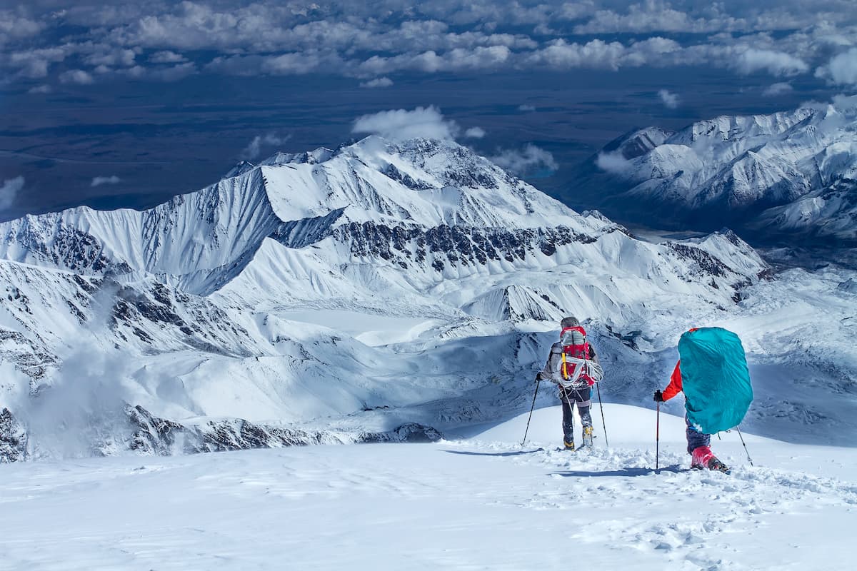
When you get to these lands, you literally get lost in time and space. It is common to meet a shepherd grazing a flock of sheep, just as his ancestors did centuries ago. Yet, most tourists come here not for pastoral scenery, fresh fruit and historical riddles. Experienced mountaineers are attracted by the stone giants towering above the valleys and deep gorges which are often prone to rock fall.

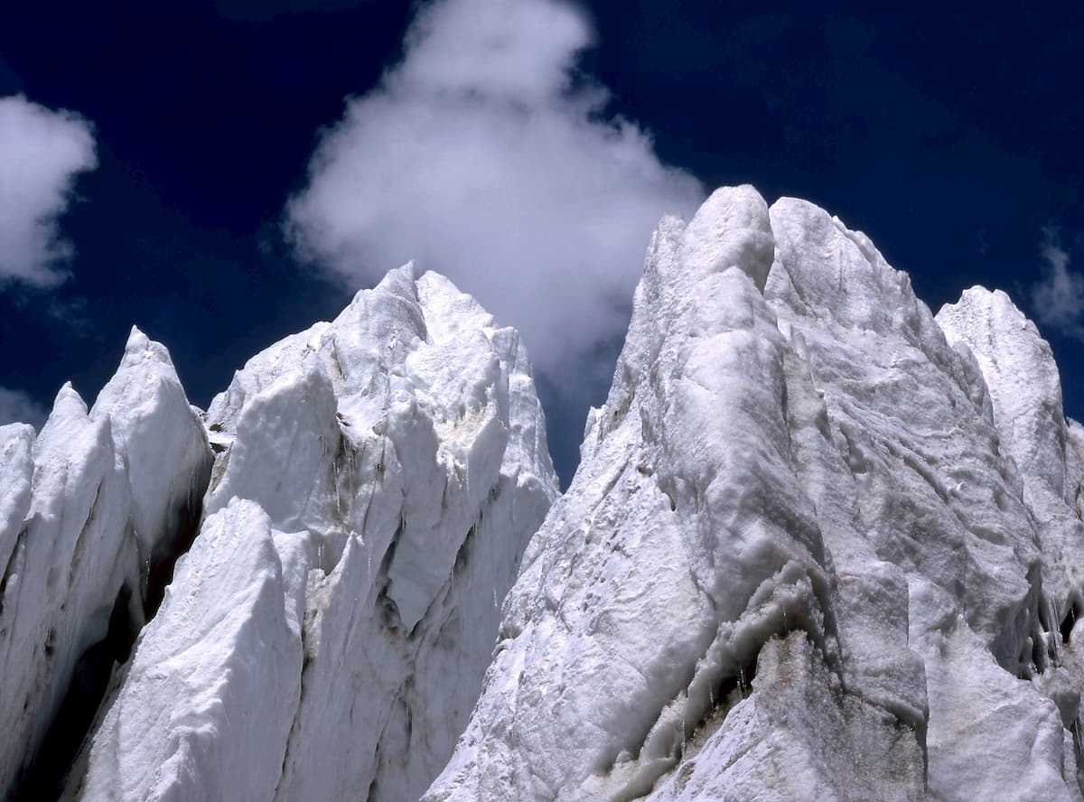
Glaciation of the ridge is especially significant in its highest - eastern part. The largest in Eurasia, the Fedchenko glacier lies under the northern walls of the 26 Baku Commissars and Qullai Istiqlol (Independence Peak) peaks. The second largest Pamir glacier, the Grumm-Grzhimailo (37 km long), flows down from the northeastern slopes of Revolution Peak. Other large glaciers are concentrated in the same mountain junction: on the western spurs and slopes - the Rokzow (17.4 km) and Yazgulem (19.5 km) glaciers, on the southern slopes - the Yazgulemdara (12.9 km), Khabarvivkhats (11.5 km) and Bashurvdara (13.3 km) glaciers.
The glaciation in the central and western parts of the Yazgulem Range is not so grandiose. The largest glaciers are located here on the northern slopes of the central part of the range, namely Darabuguz (7.9 km), Roshtdara (9.9 km) and Birdzhrafdara (7.9 km).
The southern slopes of the Yazgulem Range are best approached by the Bartanga Valley on the road from Rushan. The northern slopes of the ridge are difficult to access. From the west, you can still reach the peaks of Vudor and Chiringyad through the valley of the Yazgulem River, but in the upper reaches this valley is difficult to pass. There have been no people living in it since the 1960s, and bridges and trails have collapsed. Therefore, the northern slopes in the central part of the Yazgulem Ridge are usually accessed through passes either from the Bartanga valley or from the Vančha valley (e.g. through the MVTU Pass).
The 150-km-long South Alichur Ridge is another gem of the Gorno-Badakhshan Autonomous Region, it is in the south of the Pamir between the Alichur and the Pamir Rivers. The average height is not that great, just 5100m with the highest point of Kyzyldanghi Mountain (5,706 m). Alpine relief and desert vegetation dominate the range. There are 256 glaciers, the total area of which is 72 sq.km.
The 160-km-long Wakhan Ridge was originally called the Emperor Nicholas II Ridge. It runs in the south of the Pamir, in two countries: Tajikistan and Afghanistan. It serves as a watershed of the Pamir and Istyk rivers in the north, the Wakhandarya and the Oksu in the south.
The average height is about 5,000 m and the highest point is Snowy Boulder Mount (Snezhnaya Glyba) (6,421 m). The ridge is composed of eroded and metamorphic rocks. The slopes are cut by trough valleys; ice and firm fields cover about 94 sq.km.
The ridge has very high passes. The most famous are the Benderskiy Pass (4,612 m) and the Urta-Bel Pass (4,584 m) which are located in the eastern, more accessible part of the ridge. In the western part of the ridge, the Pamir River gorge is almost the only passage.
The Khazratishokh (aka Kрozretishi, Khazretishi, Khazretisha) is a mountain range in southern Tajikistan, adjacent to the western part of the Darvaz Range. The length of the ridge is about 55 km. From the west, it is bounded by the Obiminhou and Obiravnou valleys. The maximum height is 4,088 m.
The Muzkol Range stretches in a latitudinal direction from the confluence of the Kudara and Murghab rivers in the west to the meridional section of the Southern Akbaytal Valley in the east. The total length of the ridge is 136 km. The average height of the western section is 5,370 m, the eastern section is 5,720 m and the highest point is Soviet Officers Peak (6,233 m). Other high summits are Two-Headed Peak (Dvuglaviy) (6,148m) and Northern Muzkol (6,128). In general, fourteen peaks of the Muzkol Range are higher than 6000 m. There are about 440 glaciers with a total area of 328.7 sq km. The range is separated from the Pshartian Ridge in the south by valleys of the West Pshart and East Pshart rivers.
In terms of relief and glaciation character, the Muzkol Ridge is divided into two parts – the western and eastern, separated by the Depshe Pass (4,346).
The western Muzkol extends from west to east for 50 km and serves as a watershed between the Kokuybel river in the north and Lake Sarez in the south. Its average height is 5,370 m and its highest peak is 5,859 Summit. This section of the ridge houses 74 glaciers with a total area of 55.9 sq. km. The largest glacier is 6 km long and is located on the northern slope of the Muzkol Ridge north of the northwest tip of Lake Sarez. Its tongue descends to a height of 3,970 m.
The eastern part of the Muzkol range has a complex orography. In the west, it serves as a watershed between the left tributaries of the Kokuybel River – the Bozbaytal and Zortashkol Rivers(in the north) and the Murghab River with its right tributary – the West Pshart River (in the south). To the east, it divides the basin of the drainless Lake Karakul (in the north) from the Murghab River (in the south). Finally, in the very east, the ridge serves as a watershed between the right tributaries of the Murghab – the South Akbaytal (in the north) and the East Pshart rivers (in the south). There are 267 glaciers with a total area of 272.8 sq. km. In the basin of the Bozbaytal River, at the junction of the Muzkol and Zortashkol ranges, there is the largest glacier on the Muzkol range - the glacier of the Soviet Officers. It is 7.8 km long and has an area of 13.4 sq. km. with a vast feeding area and a short clean tongue.
On the Muzkol Ridge the height of the snow border is 5,200-5,300 m, and the ends of the glaciers usually go down to the height of 4,400-4,800 m.
From the east and north-east, the Muzkol Range is surrounded by the Pamir Road, so there is a short access to the eastern part of the range. In the col between the northern spur of the Muzkol Range and the western spur of the Sarykol Ridge, there is the highest pass of the Pamir road – the Akbaytal Pass (4,655 m).
The Pshartian or Pshartskiy Ridge is a 60-km long mountain range in the east of the Pamir, Tajikistan. It is located on the right bank of the Murghab River. It is separated from the Muzkol Ridge by the valleys of the West Pshart and East Pshart rivers. The maximum height reaches 5440 m (another no-namer), and the next in height is Kiyazek Peak (5,401m). The predominant type of landscape is the rocky highlands. On the northern slope of the ridge crest, there is glaciation.
The North Alichur Ridge (former name was the Bazardara range) is located between the Murghab River and Lake Sarez in the north and the Alichur River and Lake Yashilkul in the south. It serves as an eastern extension of the Rushan Ridge. It has a rather eerie-looking terrain since the rocky highlands are mainly dominated by whitish rocks made of clay shale, granitoids, sandstone and limestone and the lower parts of the slopes feature thinned vegetation of cold alpine desert prevails. There are about 470 glaciers, the total area of which reaches 295 sq.km.
The North Tanymas is a mountain range in the east of the Pamir in Tajikistan, adjacent to the Zulumart Range in the east. The range stretches for 80 km in a latitudinal direction. About 140 peaks exceed the height of 5,000 m, two peaks are over 6,000 m; the highest point of the range is Gorbunov Peak (6,030), next are Mount Krutoy Rog \(6,025 m) and Belyandkiik (5946). To the north, two large spurs depart from the range: the Kyzkurgan and the Balandkiik. To the south, there runs the 25-km-long Aral Ridge parallel to the spurs; it is separated from the North Tanymas by the Nalivkin glacier.
The lower part of the slopes and valleys are occupied by alpine deserts, steppes and alpine meadows, while the higher part is occupied by perpetual snow landscapes. The height of the snow border on the slopes of the northern exposure is 4,800-5,200 m, and of the southern exposure is 4,900-5,300 m. The total glaciation area is 430 sq.km.
There are about 25 passes with a height of 5,000 – 5,400 m and 4 passes with a height of 4,500 – 5,000 m. Crossing paths go through passes Kyzkurgan and Jailau in the central part and Yangidavan in east; these passes have 1B category. The main approaches to the North Tanymas are from the north from the valley of the Balandkiik River and its left tributaries. Optionally, you can go from the west from the Fedchenko glacier or from the south from the valley of the Tanymas River and its left tributaries and the valley of the Kokdjar River. If you consider the latter option, take the road to the village of Kudar, there is a road sign on the Pamir road. By the way, don’t be surprised to see a lot of pins or badges on road signs, it is a cute tradition to pin a small sticker or a lapel pin of the big road sign boards.
The Sarykol Ridge stretches for 350 km along the border between Tajikistan and China. It goes from the valley of the Markansu River to the spurs of the Hindu Kush, encircling from the north a hollow with Shorkul and Rankul lakes. It serves as a watershed in the basins of the Tarim River, Lake Karakel and Amu Darya River.
The height of the ridge ranges from 4500 to 5800 m, the highest point is Mount Lyavirdyr (6,351 m), the next in height is Peak Krasnih Komandirov (5,821 m). It is composed mainly of crystalline slates and granitoids. In the lower part of the slopes there is thinned vegetation of cold alpine desert. Once you hit 5,000 m, you step into the realm of eternal glaciers. On the territory of the Tajik part of the ridge, there are 240 glaciers with a total area of 144 sq.km.
The name of the range is given according to the river Sarykol at its foot. In translation, it means a "yellow river”.
The Zulumart is in the east of the Pamir in Tajikistan, it is adjoining the Zaalai Range in the north.
The range stretches north to south for 150 km. Most of its peaks exceed 5,000 m, with five peaks in the northern part exceeding 6,000 m. The highest summits are Oktyabrsky Peak (6,780 m), Peak 6290, Vera Slutskaya Peak (5,925 m). There are two spurs in the north-east: the Kommunar Ridge (22 km long, the ultimate height is 5,801) and the Karachim Ridge (23 km long, the highest point is 5,765 m). To the north of Frunze Peak, strikes off the Beleuli Range (up to 5,819 m). The latter is branching into the Saukdara Ridge (30 km long, 6,300 m high) and Kaindy Ridge (45 km long, heights up to 5,400 m). To the south of Zulumart, there is the North Tanymas Range linked to the Zulumart by the Kokuy Pass. The total glaciation area is 460 sq.km.
The Karakul - Posor highway passes through the Dilutek Pass. The main approaches are as follows: from the east take the Eastern Pamir road along the valleys of the rivers Karajilga, Baigashka, Kokuybel; from the west, go along the valleys of the rivers Saukdara, Balandkiik, Tanymas.
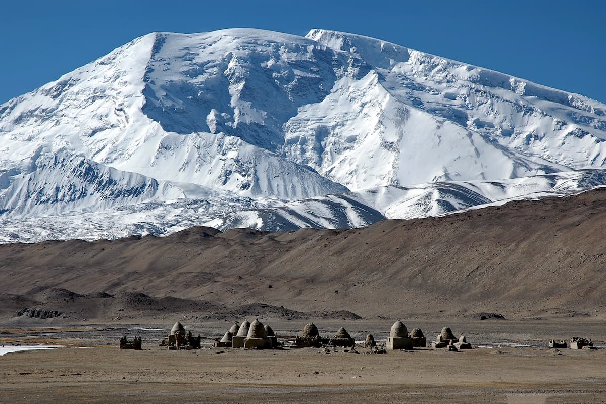
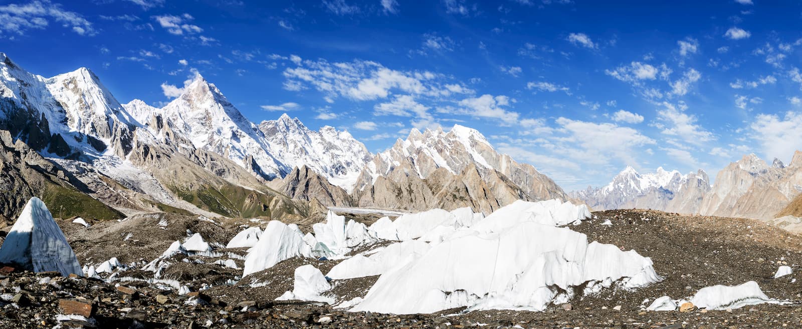
The Chinese Pamir or the Kashgar Mountains is probably even a less explored place than post-Soviet Pamir. Many peaks here still remain anonymous, and if you look at them from the deserts nearby, they seem to be mirages. The Karakoram highway connecting Pakistan and China approaches the area from the north and west, which makes it easy to get here from Kashgar, a city in the Xinjiang Uyghur Autonomous Region of China (XUAR). Ten peaks of the range exceed the mark of 7,000 metres, those include the giants Kongur (7,719 m), Kongurtube (7,595 m) and Muztagh-Ata (7,546 m).
The weather here is less stable than in other regions of the Pamir, it is often changing due to monsoons from the Indian and Pacific Oceans. As a result, there is little open ice, peaks and passes are covered with deep snows and avalanches are very frequent. Particularly strong winds strike the crest of the Kongurtag Range. That's why climbers need to get ready by carefully selecting their gear and attire.
The Kashgar Mountains have four regions:
The Kingtau (King Tau) Range is the most northwestern and unexplored ridge of the Kashgar Mountains. It is also sometimes called the Aksay area. In 1997 and 1998, two German expeditions made successful ascents to the peaks of Budunseltau (6,220 m), Aksaibash (6,146 m) and Kaltasel (6,026 m). No other expedition has conquered the Kingtau yet.
The Kingtau Range stretches for 75km first from west to east and then southeast. In the west it starts from the Markansu Valley where it joins the southern spurs of the Zaalai Range, and in the southeast it ends at the Ulugart Pass (5,109 m). The continuation of the mountain range behind the Ulugart Pass is called the Ulugarttag Range.
A wide (15-20 km) and flat Sarykol valley lies to the south of the Kingtau Range at an altitude of 3600 m. The southern and southwestern spurs of the range are very short, just 5-6 km, they are turning to this valley. The northern and northeastern spurs are, on the contrary, long and branched; they form a mountain system up to 30 km wide. According to a national map, there are 4 peaks in the Kingtau Ridge that are over 6000 m high. The other peaks on the main ridge are between 5600 and 6000 m. Large glaciers on the northern and northeastern slopes reach 8-11 km in length.
The most obvious entry to the Kingtau is through the Sarykol valley to the southern slopes of the range. The Karakoram Highway leads to the confluence of Kengshibersu and Mojisu rivers (the two sources of the Gozdarya river). It takes about 3 hours by car from Kashgar to this place. A dirt road leads to the river valley behind the bridge over the Mojisu. It is 40 km as the crow flies from the bridge to the nearest (southeast) edge of the Sarykol valley. You can also enter the northern slopes of the range if you take one of the roads that runs from Karakoram Highway near the town of Upal.
The Ulugarttag is a range in the northern part of the Kashgar Mountains. It connects the Kingtau Range in the north-west with the Kongurmuztag Range in the south-east. It is separated from the Kingtau Range by the Ulugart Pass and from the Kongurmuztag Range by the Gozdarya Gorge.
The main line of the Ulugarttag Range begins 13 km southwest of the Ulugart Pass at the southern edge of the Sarykol Valley and stretches for 57 km first east and then southeast, ending at the Gozdarya canyon north of Aklangam (6,977 m).
To the south-west of the Ulugarttag, at an altitude of 3300-3400 m, there is a wide valley of the Mojisu River. In the lower (southeastern) part of this valley there are two lakes – Lung and Chakiraghylkel, the latter is about 5.5 km long and up to 1.5 km wide. Lake Lung has no clearly delineated borders as it is essentially a spill of the Kengshibersu, the right source of the Gozdarya. Its area therefore depends on the amount of water in the river.
The Ulugarttag Range forms a continuous chain of peaks from 5,800 to 6,500 m high. The height of the saddles between them does not drop below 5,600 m. There are 9 six-thousanders in the Ulugarttag.
At present the Eastern Chakragil Peak (6,501 m) is the highest unconquered independent peak of the Pamir. Only the eastern head of Kokosel Peak in the Kongurmuztag Range can dispute this title. However, it is difficult to consider this summit as a separate peak because the saddle height between the eastern (6,849 m) and western (6,858 m) summits of Kokosel Peak is 6,750 m with a distance of 1,800 m between them. As for Eastern Chakragil, it stands 4,400 m away from Chakragil Peak Main (6,760) and is separated from it by a saddle 6,030 m high.
The northeast wall of Chakragil Peak (6,760 m) and the north wall of Eastern Chakragil Peak (6,501 m) rise above the glade (2,900 m a.s.l.) in the pocket of the left moraine of the Oytag Glacier. The elevation gain is more than 3600 m. From the glade, these peaks look truly magnificent. On the glade among spruce forest, there is a recreation area with a paid entrance. There is an observation deck and many stalls with food and souvenirs. There is a road to the glade along the valley of the Oytag River.
The easiest way that would bring you the deepest into the Ulugarttag is from Kashgar through the east of the Gozdarya Valley along its left tributary Oytag. Once you cross the bridge over the Oytag River, turn right from Karakoram Highway and take a good dirt road to the recreation area at the Oytag and Bul-Ush glaciers at the foot of the northeast wall of Chakragil Peak. You can stop earlier, there is a path from the mouth of Atoynakjilga river, along its valley to the Left and Right Atoynak Glaciers.
There is another easy access to the southwestern slopes of the Ulugarttag Range. The Karakorum Highway leads to the confluence of Kengshibersu and Mojisu rivers. It takes about 3 hours by car from Kashgar to this place. A dirt road leads to the river valley behind the bridge over the Mojisu. You can go to the Kingtau from this point as well.
It is more difficult to travel from Kashgar to the foot of the northeastern spurs of the Ulugarttag. Once you pass the town of Upal, turn right from the Karakoram Highway and take a rather worn-down dirt road, accessible only for off-road vehicles, to the entrance of the Yelchimuinaksu River valley. This valley has many branches and is deeply cut into the mountains, so it is very convenient to enter the area.
However, the mentioned direct road is not well known even by local drivers, the name of Yelchimuinak is not familiar even to the inhabitants of Upal and the surrounding villages. It might be the case that it has variants of pronunciation and is closer to Yelchimoinok or something like that. However, this name is much better known in the large village Bastanterek located at the foot of Ulugarttag 20 km northwest of Yelchimuinak. From Bastanterek to Yelchimuinak you can also drive by dirt road, but the road through Bastanterek is longer.
The Kongurmuztag Range is located in the southeast of the Chinese Pamir. It stretches from the Gozdarya Gorge in the north to the Tashkurgan Valley in the south. From the west, it is bounded by the Kengshibersu Valley, and from the east by the Khantereksu River.
The Kongurmuztag Range has two large eastern spurs. The first spur branches off from the nodal peak Karayalak (7,245 m). At the base of the spur is the highest peak of the Pamir - Kongur (7,719 m). The second spur branches off from the unnamed nodal peak 5411. Thus, the whole mountainous area is divided into the following sections:
The Kongurmuztag Range is very attractive for lovers of climbing high mountains. Passing in close proximity to the ridge (from north and west) Karakoram highway provides convenient and short access from Kashgar.
What is interesting, you will often find two heights for the same mountain - the local Chinese map altitude and SRTM database of radar sounding of the Earth. Sometimes the difference can reach up to 100 meters, like for Kongurtube Mount - 7,595 m on a Chinese map vs. 7,491 on SRTM, or Kokodag Mount - 7,210 m vs. 7,155m and many more.
The radio altimeter method is based on spatial averaging of altitudes in the vicinity of the measured point. Therefore, the SRTM altitude is systematically underestimated at the tops (in the local maximums of the elevation). On average, there is a dependence – the sharper the peak, the bigger the error. We can confidently say that if the height on the map is lower than the SRTM height, it is a map error.
The Kongurtag Ridge is a grand wall that stretches from Aklangam Peak (6,977 m) in the west to Kongur (7,719 m) in the east. The northern slope is much steeper than the southern one. The height of the wall on the northern slope reaches 4000 m (from 3,700 to 7,700 m). The Kongurtag Ridge rises 5,500 m above the nearby village of Goz (2,260 m).
Glaciers on the northern slope of the Kongurtag Ridge are of Turkestan type, i.e. they are predominantly avalanche-type. They are strongly shrouded and framed with long moraines with green pockets. Those pockets feature pastures, good trails, and many streams. One of the three largest glaciers of Kongurmuztag, the Karayalak glacier (18.3 km), flows northwards from the Kongurtag Range to a height of 2,750 m.
From the north, only two routes are laid to the tops of the Kongurtag Ridge and both to Kongur. Steep and grandiose walls of Yamanjar and Kongurtube peaks stand unconquered.
Kongur (sometimes spelt as Qungur) is the highest peak of the Pamir. In the Uigur and Kirghiz languages it means a "brown mountain", whereas in Chinese the name means "Kirghiz mountain". Despite its high altitude, the Kongur remained unexplored until 1900 due to its remoteness and location behind other high peaks. It took another 56 years before it was discovered and then yet another 25 years before the peak was finally reached by the British team led by Chris Bonington. The mountain is a towering wall and its summit is a steep, uneven pyramid. Its northern wall rises 4 km above the foothill and the valley of the Gozdarya river remains five kilometers down. There are several dozen glaciers on Kongur, several of the largest reach the length of 15 km. The Karayayliak and the Chimgen glaciers going down Kongur are most impressive glaciers of the Kashgar Mountains.
The Agalistan Mountains are the area of an alpine type with pointed rocky peaks, sharp ridges, deep abysses between the peaks. The first maps of Agalistan were made by Clermont Screen, a British consul in Kashgar, a great travel enthusiast and pioneer in exploring these mountains. From 1922 to 1924, he made 6 hikes in the Kashgar Mountains which he described in his article "The Kongur Alps" (1925).
Both from the south and from the north, there is a lot of greenery. On the southern slopes grow juniper and dwarf acacia, and buckthorn bushes are not uncommon here. Spruce forests grow on the northern slopes of the Tegermensu and Kaying valleys, which is an exceptional case for the Pamir.
There are many complex and beautiful peaks in the Agalistan. The overwhelming majority of them, including the highest peaks of Shivakte-3 (5,981 m), Shivakte-4 (5,859 m), Goz (5,696 m), Shivakte-1 (5,601), are not conquered yet.
The southern section of the Kongurmuztag Range is as heterogeneous as the others. There are many lakes. The largest of them, Lake Yanghikel, is located in the upper reaches of the Yanbulaksu Valley. The lake is 1,350 m long, up to 600 m wide and the height of the water cut is 4,579 m. Despite the huge height of the Yanghikel banks are covered with meadows with an abundance of beautiful flowers.
To the west of the Tegermensu Valley, the mountains acquire a different view. They abruptly break off to the east into the Muztagh-Ata crater – the bowl of the Koksel glacier and descend gently to the west. These western spurs are characterized by wide ridges with rock cliffs to the left and right of the flat ridge. An exception is the Karakoram Range, the southern spur of Dolkun-Muztag Mount (6,355 m). The peaks of this ridge are sharp.
To the west of Mount Dolkun-Muztag, in a northward curving arc there line up 6849 Peak (Muztag-Ata Southern, the unmarked eastern summit is 6858 on the map), Koskulak (7,028 m), Muztag-Ata (7,546 m), and North Muztag-Ata or Kuksai Peak (7,184 m). The southern shoulder of Muztag-Ata is indicated on maps as Kalaxong Peak (7,279 m). The foothills of the western spurs of these mountains are deserted.
The southern section of the Kongurmuztag Range, west of the Tegermensu Valley, is of great interest to mountain hikers and climbers. Routes to the peaks here are very different – from technically simple ones to the seven-thousanders on their western slopes, to the most difficult wall routes. From the cirques of the Koksel glacier only one route to the big peaks has been laid so far – the route of D. Mazur to Muztagh-Ata along the eastern ridge (2000). The two-kilometer steep walls and ribs of peaks 6858, Koskulak and Muztagh-Ata, which break to the Koksel glacier, are still waiting for their conquerors.
Of great interest are also the glacier-cutting northern walls of the gentle western ridges of Koskulak (7,028 m) and peak 6849. On these walls only two routes have been laid so far and both to Koskulak – the Volkov route along the northern ridge (2005) and the B. Shamalo route (2005) along the northern wall. The steep northern wall of Peak 6849, which is more than 1,5 km long, remains a virgin.
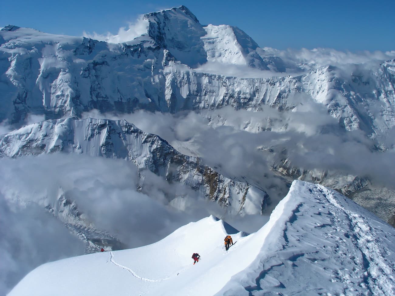
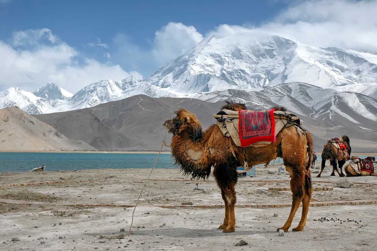
Called as the father of the icy mountains, Muztagata (also spelt as Muztagh-Ata) rises to the south of Kongur almost without any foothills. It is a larger-than-life giant with a height of 7,546 m is considered one of the most accessible seven-thousanders on the planet due to its gentle western slope and dry weather. It is usually accessed via one of two routes: either the one closer to the northern slope or the one closer to the south. The latter is the safest and most popular. It is not very complicated technically, but climbing can be hindered by unexpected weather changes and the pressing altitude, deep snow and strong winds. Conquerors need excellent physical training, good equipment and competent acclimatization.
Before you start climbing, you should stop at Lake Karakel and take in the dizzyingly beautiful view of Muztagh-Ata summit.
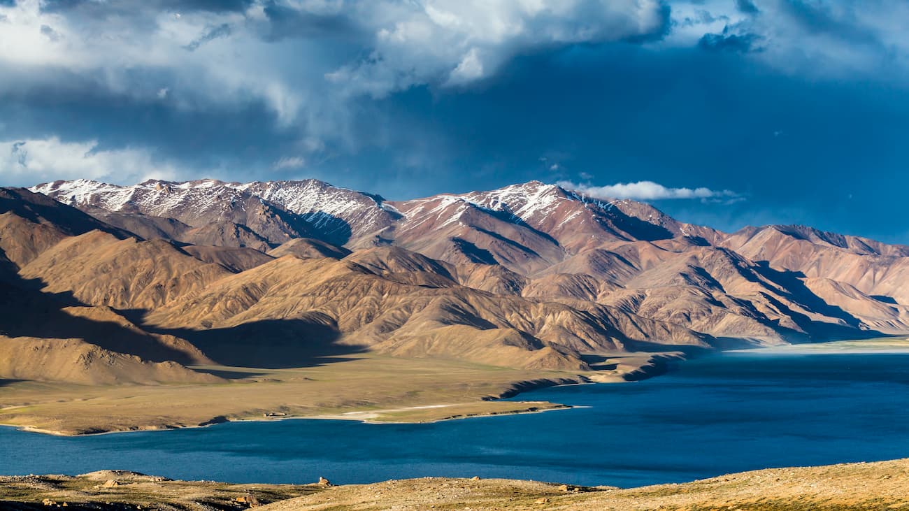
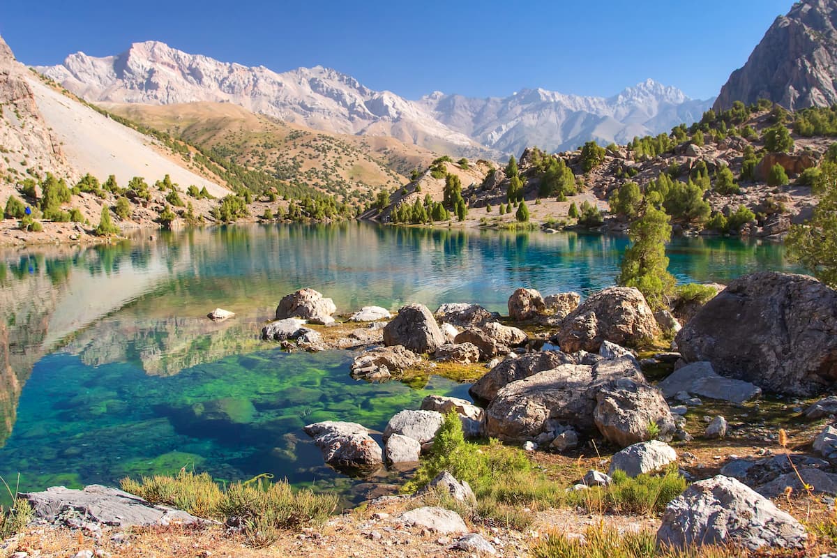
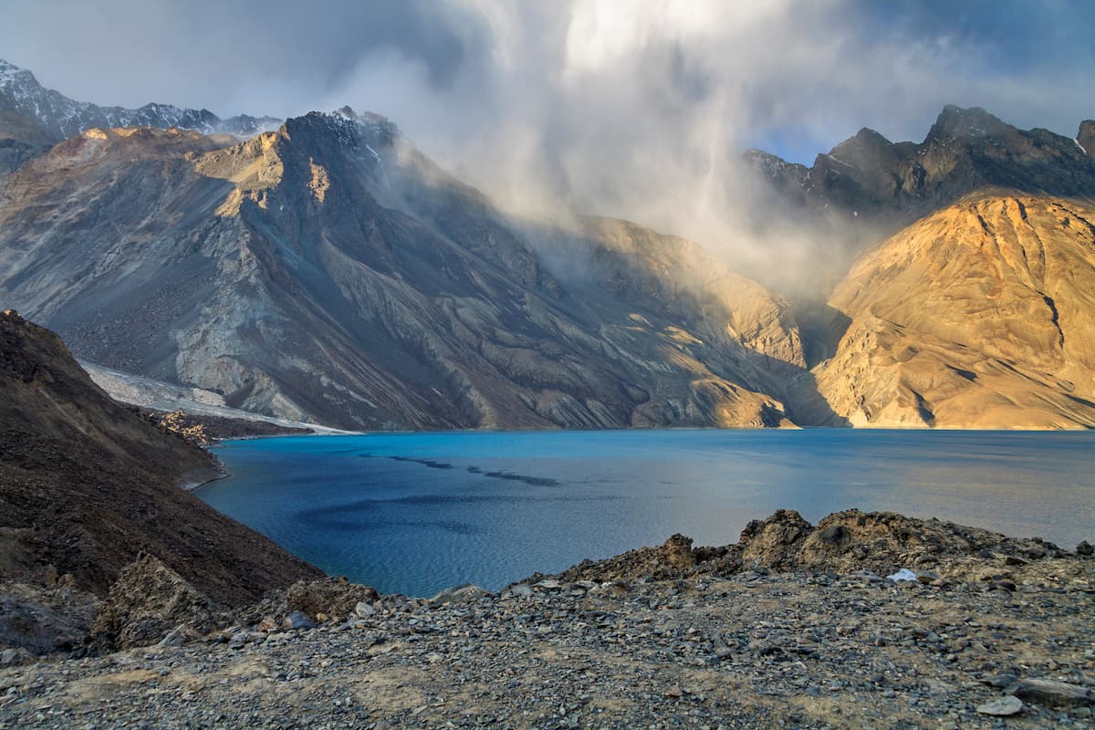
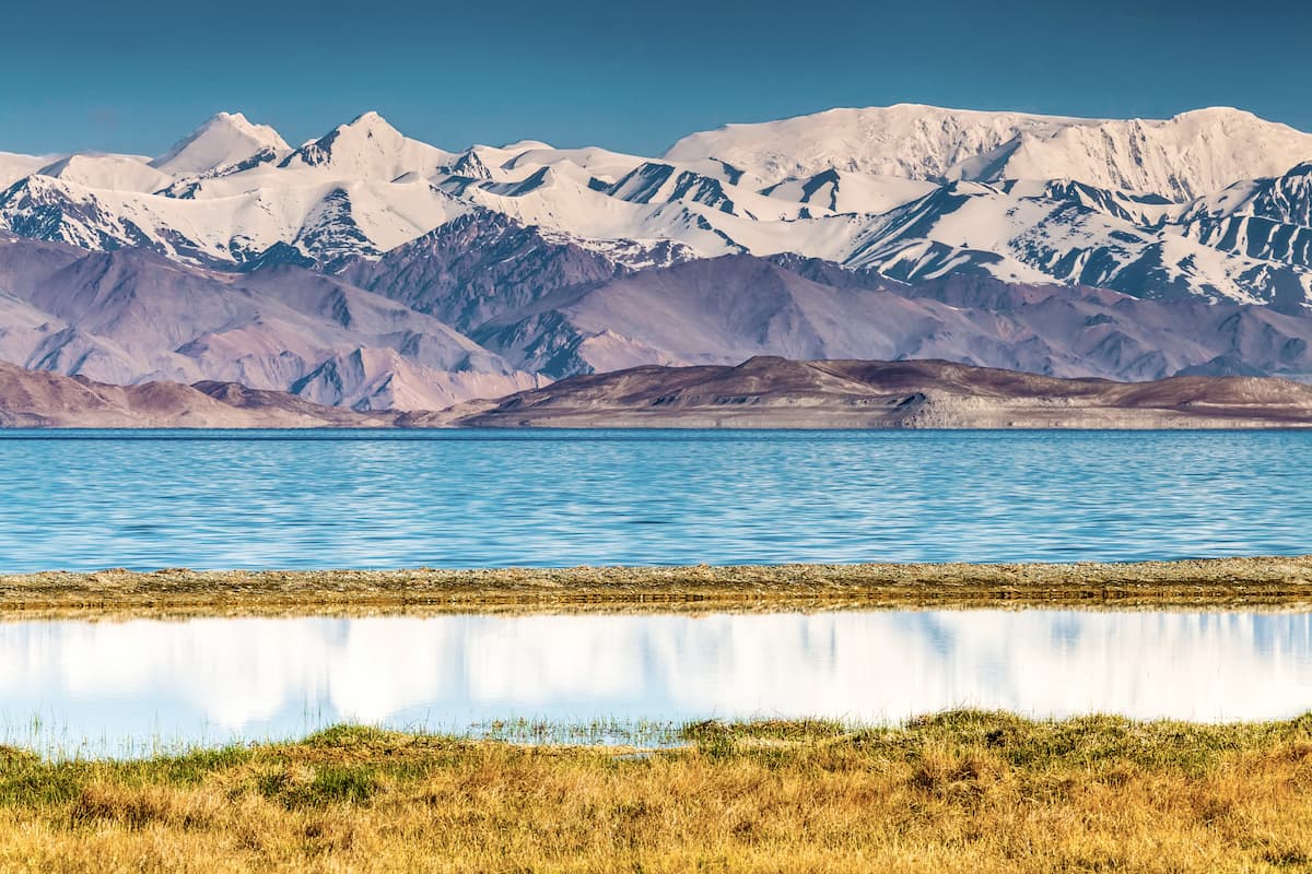
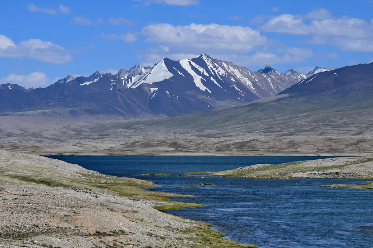
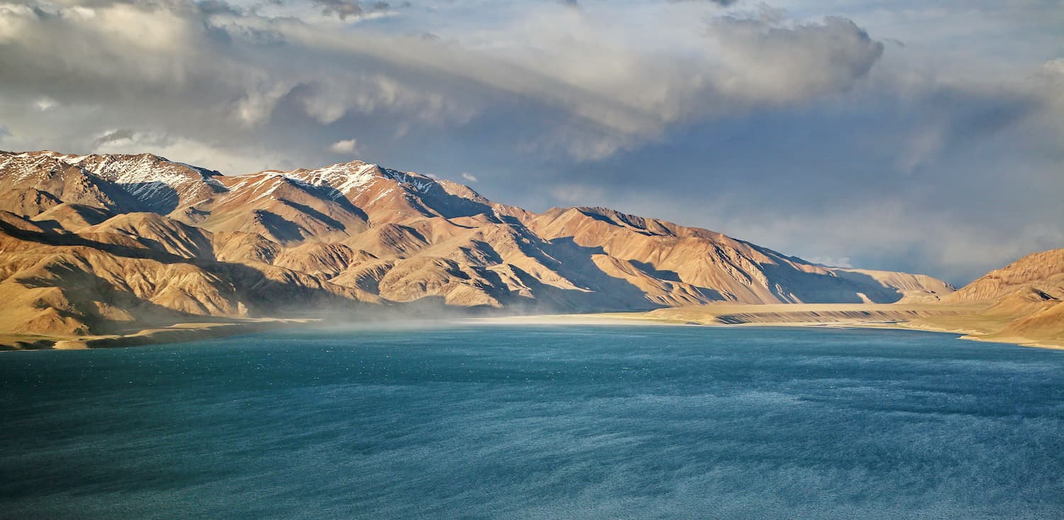
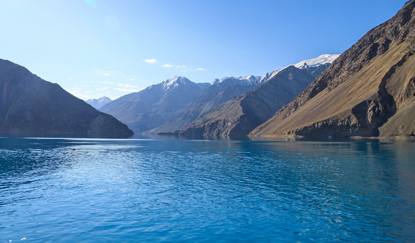
In the Eastern Pamir, there are many large lakes with crystal clear water and a mirror-like surface. In the Central and the Western Pamir, lakes are most often found in the pockets of moraines. Salty and drainless lakes occupy tectonic potholes. Large lakes occur less often, they are either man-made or accident-generated reservoirs, like Lake Sarez. Mostly, lakes are formed by melting of glaciers. Lake Sarez and Lake Yashilkul were formed by the melting of glaciers and mudflows.
The seven biggest lakes are
Lake Sarez is the deepest lake in the Pamir. The water reservoir is 505 meters deep and is located at an altitude of 3,263 meters. It was formed in 1911, when a 9-point earthquake caused a landslide and blocked the Murghab River, thus creating a rocky dam over half a kilometer high. The water flooded the village of Sarez overnight, which gave the name to the lake. It took 37 years to fill the basin of the lake that now spreads over 70 km and has a total area of 17 sq.km. Now there is a danger of this naturl ally made dam to be washed away since the river Murghub is still flowing at its bottom and keeps washing off the rocks. That is why there is a research station keeping an eye on Lake Sarez.
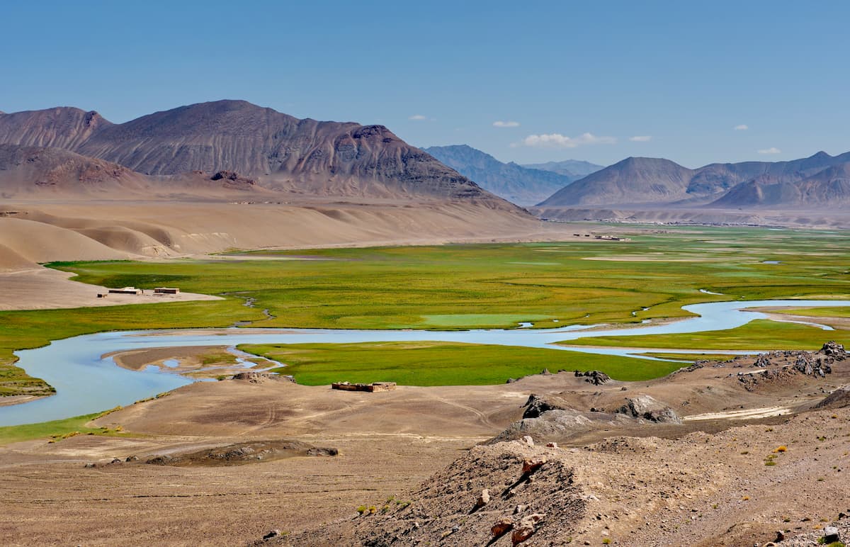
The high-mountainous lake Karakul is the largest in the Pamir. Having studied the geological structure of its bottom and space images, a number of scientists came up with a hypothesis that it filled the shock crater from a meteorite that fell here 230-190 million years ago. It is rather easily accessible as the East Pamir Highway connecting Osh and Khorog goes along the eastern bank of the lake.
The lake is fresh, rich in fish and a waterfowl. The Pamir River flows out of the lake. The lake is of moraine origin. There has been a dramatic decline in the water level for the last 100 years due to increased erosion activities of the Pamir River flowing from the lake. The first European to get acquainted with the lake was an English explorer named Wood, who in 1838 made a journey to the sources of the Amu-Darya River and named the lake after Queen Victoria (1819-1901). Nowadays the local name of the lake is Zorkul, in Tajik "a big lake".
In 2000 Lake Zorkul with the adjacent territory was included in the State Natural Reserve Zorkul, organized to preserve the unique East Pamir nature. It is almost the last refuge for nesting of a large enough colony of mountain geese (up to 700 individuals).
Lake Yashilkul is another natural mishap that happened in the 13th century. Due to the mountain collapse, the Alichur River was blocked off, which caused the formation of the lake. This version is confirmed by the deciphered Arabic inscriptions on the rocks above the lake. The water in Yashilkul is cold not higher than +14C, clean and transparent, and through its thickness you can see flocks of fish in shallow waters and algae shoots between the stones. Another supposedly living fauna is a huge animal called Tyuya-su - "water camel", which lives in the lake, this animal is mentioned in many local legends.
At the mouth of the Alichur river in the eastern part of Yashilkul is a hot sulphurous spring Issyk-Bulak. The water in it comes from four griffins located along the foot of a granite massif. The water temperature reaches +71C. The spring is surrounded by dilapidated clay structures (possibly mazars or mausoleums), and the local residents consider it holy. There is a small clay structure with a pool to collect water from the hot spring.
On the northern side of the lake, steep granite rocks approach almost the water itself, leaving only a narrow strip of shore a few meters wide. If you move along the northern shore, you can reach the rubble that formed the lake. The car track on the north side leads only to the inflow of the Big Marjanai River into the lake, and then, up to the rubble, there is only a hiking trail. In order to get to the northern bank of the Yashilkul, you have to cross the shallow Alichur River at its inflow into the lake.
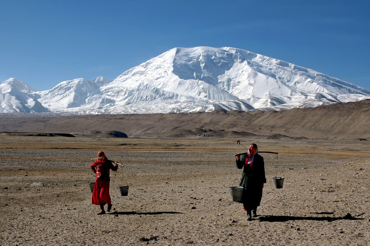
The story goes if you want your cattle to get fat in just 10 days, bring it to the Pamir. It might be true because of the abundant lavish green meadows. In the languages of the ancient local peoples, the root of the word "Pamir" meant in general a mountainous highland plain or pasture.
Some historians believe that in ancient times this region was inhabited by the ancient Aryan people whose blood now flows in many Indo-European peoples. They believed that the Pamir were the northern border of the world, and called it Hara or Hara Brzati, which translated as "Mount High". Later, when the Aryan tribes migrated farther south and west, the name "Hara Brzati" was transformed to "Alburz" and was transferred to a ridge in the north of Iran.
Other researchers are looking for the origins of the name "Pamir" in the Zoroastrian religion which was already widespread here in the first millennium BC. For fire worshippers the god of sun and light Mihra (Mitra) was of great importance. The Pamir, Hindu Kush and Karakoram peaks grow as a wall in the east of the spacious valley of the Panj River. For the locals, the sun has always risen behind them. Hence the name "Poi Mihra" - "the foot of the sun", "the foot of light". Over time, the word evolved into "Pamir". By the way, one of the sources of the Panj river originating from Lake Zorkul precisely by the eastern mountains, was also called Pamir. Probably, the river got its first name, then it spread to the whole region.
Supporting the Zoroastrian theory, there is a confirmation found in the Zoroastrian holy book "Avesta” that "Ayrana Waja", or the Aryan space, the ancestral homeland of ancient Aryan tribes, created by the supreme god Ahura Mazda, was in the Pamir in the upper reaches of the Amu-Darya river. However, Khorezm (aka Horazm Region in Uzberiskan) and the Caucasus also remain equivalent versions.
In the Indian tradition, people interpreted the word "Pamir" as the abbreviation of two words "upa Meru", i.e. "the country over Meru". According to Mahabharata, the greatest epic of the peoples of India, translated from Sanskrit as "The Great Legend of the Descendants of Bharata", named after King Bharata, upa Meru is a divine mountain.
In the Middle Ages, the Pamir were probably referred to the Alai valley. It can be seen from the data of geographer ibn Ruste who describes the river Vakhshab (modern name Surkhab) flowing from the land of Turks-Kharlukh through the regions of Pamir, Rasht, Kumed (historical Darband, modern Nurabad), and then between two mountains on the border of Vashgird (modern Faizabad) and Tamliyat (a town in the north of Khatlon Region).
In Arabic chronicles of that time, the Pamir appears as "Bamir" or "Fameer" because there is no "p" in Arabic. Famous Baghdad historian and geographer al-Yakubi wrote that in the 9th century there was a city "Bamir". Persian explanatory dictionaries of that time do mention the village of Famir located near the desert. Judging by the descriptions, modern historians place this town also in the Alai valley, at the exit to the highlands.
There is also a version that the "Pamir" was formed from the combination of "poi Marg" - "footsteps of death". The mountains were named so because a lot of trade caravans went missing, unable to cope with the passes through narrow steep gorges.
The Pamir was mentioned in the stories of the Venetian merchant Marco Polo in the 13th century, calling these lands Pamir. It is also found on the Russian maps of the 19th century as "Pamir-Kalyanu" and "Pamir-Hurda". In the Russian Empire, until the end of the 19th century "Pamir" served as a designation of all the highland valleys of Central Asia.
The lapis lazuli and rubies of the ancient Egyptian tombs are often attributed to the Pamir origin. The region was actually not interesting for political leaders of antiquity, until the 2nd century BC when large caravans started to traverse from China and India to the Mediterranean Sea. The Pamir, or better say, the Panj Valley, became a part of the Great Silk Road. Since then, it was the bone of contention among many world empires: the Persians - Achaemenids, the Greeks and their heirs the Seleuquidians, and later the Sassanids, the Turks, the Chinese, the Arabs, the Mongols, the Timurids, they all ruled in the Pamir for a short while.
Things got much more exciting when the Russian and the British empires started their Great Game in the 19th century for the access and resources of Central Asia. The fight officially ended in 1895 with a border being established between Bukhara Emirate and Afghanistan along the Panj River. That was a brutal cut making the small peoples of Asian highlanders the citizens of different states. Two more big divisions happened with the ascent and descent of the Soviet Union in 1920 and 1991. The 20th century was rather turbulent for the Pamir due to the border disputes between China and the Soviet Union, the establishment of military bases of the United States, Russia and India. All this was generated by a renewed interest in trade and natural resources exploration.
Today, the Pamiris (a term that unites dozens of small peoples) are trying to preserve their distinctive languages, culture and religion. The history of this ethnos has more than two millennia. Some scientists believe that the Pamirs are descendants of the ancient Aryans who remained in the mountains during the Indo-European migration. Their closest relatives are the legendary Scythians. The Pamiris continue to speak heterogeneous Pamir languages of the Eastern Iranian group of the Iranian branch of the Indo-European language family. Most of the people here profess Ismailism, a Shiite branch of Islam, which absorbed the concepts of Hinduism and Buddhism.
The unstable political situation in the region makes many tourists from all over the world refuse to travel to the Pamir, and there are reasons to do so. On July 29, 2018, several tourists were victims of a terrorist attack while cycling in the Danghara Region of Tajikistan in the Pamir. Five attackers intentionally drove a car into a group of seven cyclists and then attacked them with knives. Four cyclists were killed: two from the United States, one from Switzerland and one from the Netherlands. The attack made several Western countries update their tourism guidelines to reflect the increased threat of terrorism-related violence.
The Pamir is mainly located in Tajikistan, there are a couple of sensitive issues to keep in mind when travelling there.
Mountaineering camps in the Pamir used to be based on the Lukovaya (Onion) Glade that lives north of Lenin Peak, on the Suloyev Glade and on the Moskvin Glacier (north of Ismoil Somoni Peak), on the Bivachny glacier (southeast of Ismoil Somoni Peak), in the upper reaches of the Vanch River (camp Vysotnik), on the Yazgulemdar River (south of Qullai Istiqlol (Independence Peak) Peak) and in the southwestern Pamir in the area of Marx and Engels peaks.
In recent years, mountaineering camps have been mainly organized on Lukovaya Glade and on the Moskvin glacier. Every year, numerous expeditions set up their camps at the foot of the western slope of Muztagh-Ata as well.
Travel in the Pamir region requires a GBAO permit valid for 45 days. This will be checked on various military checkpoints along the Pamir Highway. GBAO permit is an official document permitting entry into and travel within Tajikistan and the Gorno-Badakhshan Autonomous Region (GBAO), which requires a special permission in addition to the Tajikistan E-Visa. You can only apply for an e-Visa GBAO only if you are outside the territory of Tajikistan.
GBAO is obtained in addition to a tourist Tajikistan visa. If you are travelling to Afghanistan and exit Tajikistan and re-enter, you will need to obtain another GBAO permit.
A GBAO permit can be obtained
Providing you don’t need a Tajik visa, you can get a GBAO permit only by visiting an embassy or do it through a tour operator, you cannot apply online.
Migration Police (OVIR) Dushanbe Address: Mirzo Turzunzade Street 5; Tel. 227 67 22 (no English). Opening hours: 8am-5pm. Amonat Bank is just round the corner on Bukhoro St.
Migration Police (OVIR) Khorog Address: Khorog, Lenin Street 115. Opening hours 8 – 13 and 14 – 17 Monday – Friday, 8 – 12 Saturday. Among the top recommended OVIRS are those in Khujand, Khorog, and Murghab whereas Dushanbe is not getting many positive comments.
There are some rumours about bribing the officials for a faster track. It might not be needed, don’t offer any additional money unless specifically asked.
As to the exact date of entry to the region, you can enter on the day the GBAO permit starts or on a later day. You can leave on the day the GBAO permit ends or any day before that. You cannot enter before the entry date on the GBAO permit, and you cannot leave after the exit date.
You can extend a GBAO permit for 30 days, you will get a new stamp on a new visa page in your passport.
If you apply for the GBAO permit online, there is nothing to fill in, the GBAO permit will be valid for the whole GBAO area, with a few exceptions. At the embassy, you might still be asked to fill in a form. To cover all possibilities, put the following on the form: Khorog, Murghab, Darwaz, Ishkashim, Vanj, Rushan. Once you are in possession of the complete GBAO permit, you can travel freely (except for Sarez and perhaps Zorkul – see below).
Apart from the GBAO permit, special permission is required for travel only for Sarez.
All other areas should be covered by the GBAO permit, although it is prudent to check with the Tajik border guards or local travel agent in Khorog before travelling to Zorkul. The Sarez permit can be obtained at the Committee for Emergency Situations at Lohuti Street in Dushanbe, opposite the Tajik Sodirot Bank, or through a tour operator.
For Zorkul, you can obtain the permit in Khorog and Murghab. In Murghab, the building is down near the hospital: your homestay provider should be able to point you to the right place. Alternatively, ask at the tourist information office and they’ll point you in the right direction.
We shall be delighted to learn how you conquered the Pamir, let us know your feedback at peakvisor@routes.tips


