Scan the QR code and open PeakVisor on your phone
Stretching more than 2,500 km (1,864 mi) in northwestern China, the Kunlun Mountains (昆仑山) are one of Asia's longest mountain ranges. The range is steeped in Chinese mythology and features 76 named peaks. Liushi Shan (昆仑女神峰 7,167 m/ 23,513 ft) is the highest point, while Tekilik Shan (铁克勒克山 5,450 m/ 17,880 ft) is the most prominent mountain.
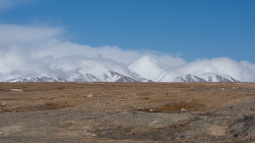
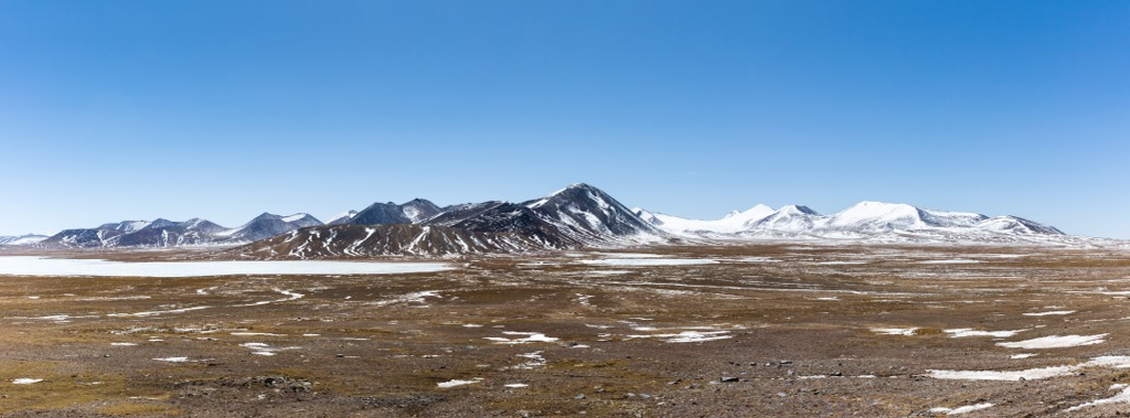
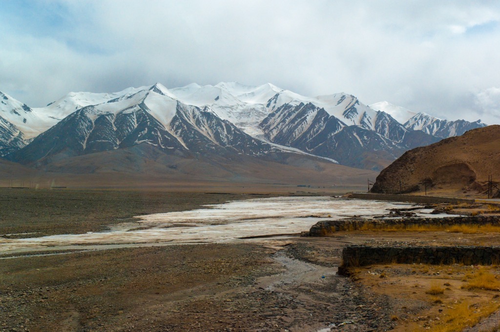
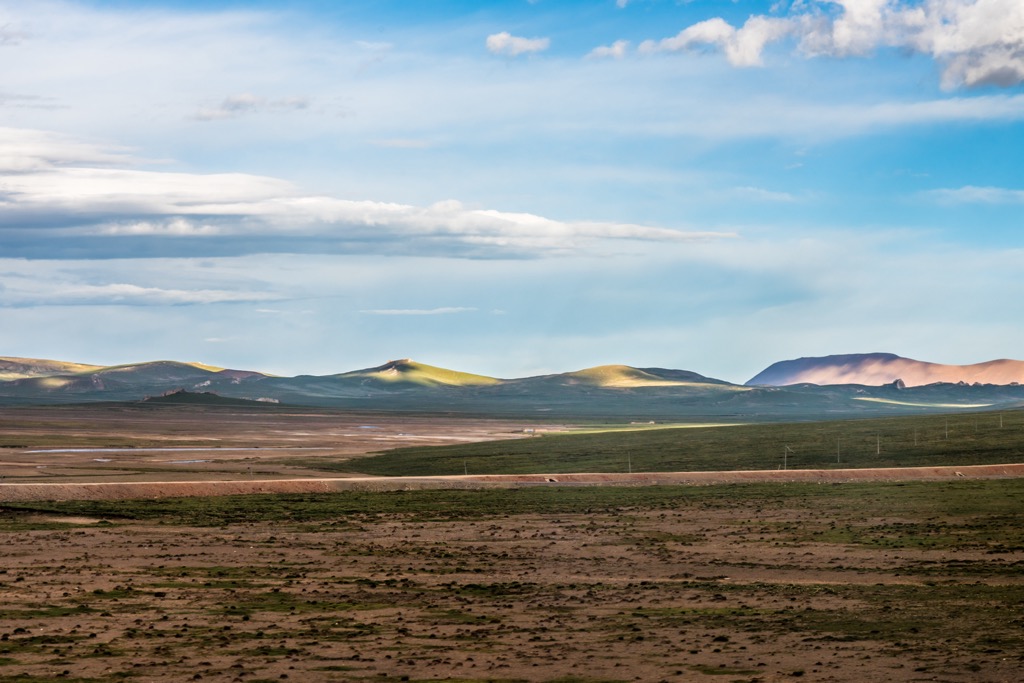
The Kunlun Mountains run along the northern edge of the Tibetan Plateau in China, extending into the Xinjiang Uygur Autonomous Region and Qinghai Province. Situated in the least populated region in the country, soaring peaks and sun-blasted deserts characterize this range.
Through their entire length of 2,500 km, the mountains are crossed by just two roads—National Highway 109 in the east and National Highway 219 in the west. The closest cities are Golmud (格尔木) in Qinghai and Kashgar (喀什) in Xinjiang. The Qinghai-Tibet Railway also crosses the mountains at the Kunlun Mountain Tunnel, the world's longest permafrost tunnel.
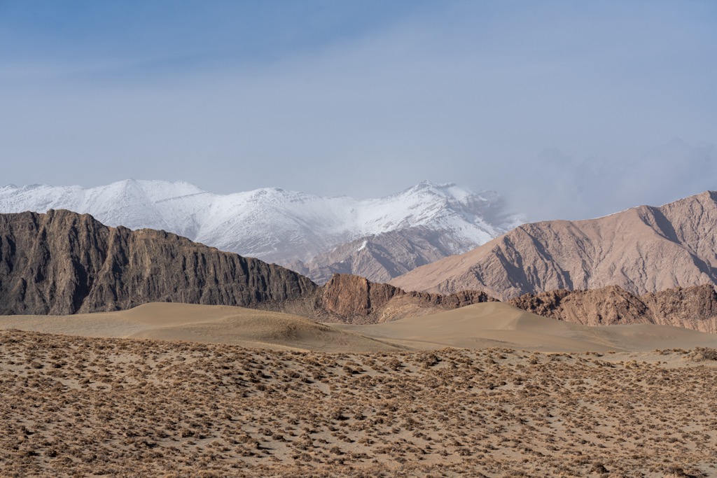
The width of the Kunlun Mountains varies between 150 km and 350 km (93 mi and 217 mi). To the west lies the Pamir Mountains, and to the southwest is the Karakoram. To the north side is the Tarim Basin (塔里木盆地), containing the vast Taklamakan Desert (塔克拉玛干沙漠).
Instead of a single mountain range, the Kunlun is comprised of eleven separate ranges, including the Hol Xil Mountains (可可西里山, also known as Kekexili), Bayan Har Mountains (巴颜喀拉山) and Amne Machin Mountains (阿尼玛卿山, also known as Aemye Ma-chhen).
The mountains’ location at the center of Asia results in a continental climate almost entirely free from the influence of oceanic monsoons. Precipitation generally increases with altitude, from as little as 50 mm (2 inches) annually in the driest places to over 600 mm ( 24 inches).
Most of the rivers in the mountains are endorheic, meaning they drain internally and never reach the sea. The exceptions are the Yangtze and Yellow Rivers—the two longest in China—which originate in the eastern Kunlun Mountains.
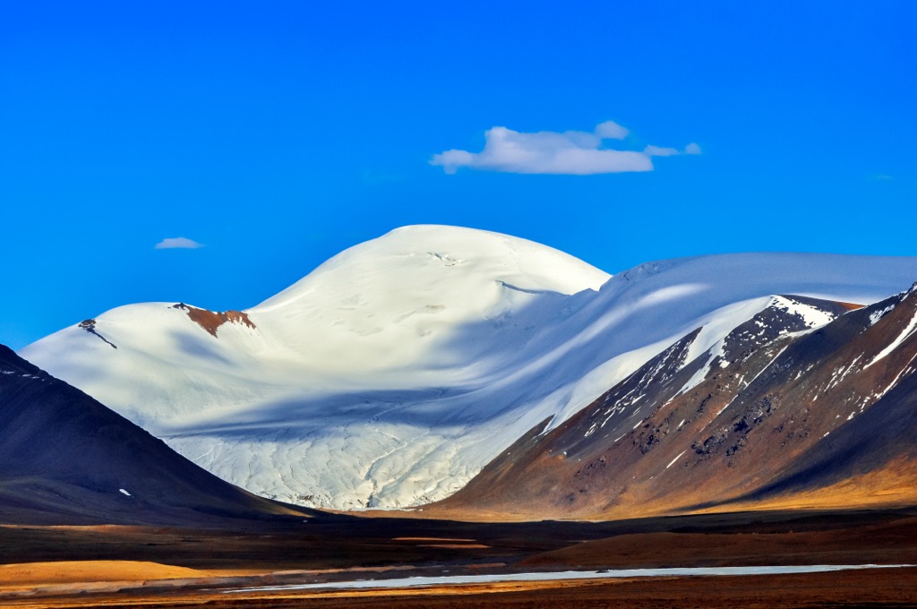
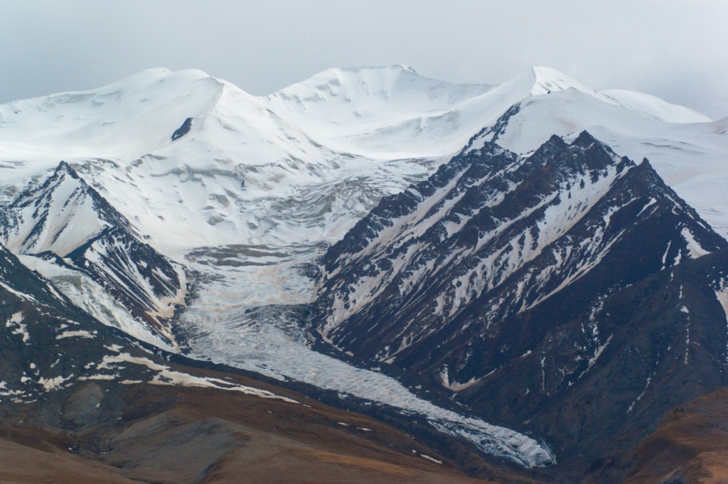
The snowline is 4,500 m and 6,080 m (14,764 ft to 19,948 ft) above sea level. Due to extreme altitude, the region has about 7,000 glaciers whose meltwater nourishes pastures and oases.
The Kunlun Mountains began forming in the early Triassic Period about 250 million years ago. Before that, the region was part of the Paleo Tethys Ocean, situated along the northern edge of the ancient supercontinent, Gondwana.
When a strip called the Cimmerian Plate broke away from north Gondwana, it collided with Siberia and closed the Paleo Tethys Ocean. Sediments from the ocean were eventually forced upwards to become the Kunlun Mountains.
Some parts of the Kunluns came into being much more recently, like the deposits of the mountains’ inner depressions, mostly under 26 million years old.
In terms of orogeny (mountain building resulting from the collision of landmasses), the Kunluns can be divided into the East Kunlun Orogenic Belt and the West Kunlun Orogenic Belt, which the Altyn Tagh Fault separates in the middle.
The Kunlun Volcanic Group, a series of about 70 volcanic cones scattered along its entire length, is the result of accumulations of emissions from volcanic vents around the craters. The last eruption was observed in 1951 at Ashi Volcano, among China's youngest volcanoes. Earthquakes occasionally occur, including one in 2001 measuring 8.1 on the Richter Scale that produced a 350 km (217 mi) surface break.
In Golmud, within Qinghai province, an area of 1,403 km² (542 mi²) has been designated the Mount Kunlun UNESCO Global Geopark with three scenic regions. Attractions include Yuzhu Peak, glacial formations, and granitic features.
The mountains have rich mineral deposits, the most notable being the highly-prized Kunlun and Hetian Jade.
The predominant habitats are alpine grassland, alpine steppe, and rock desert. The harsh conditions are not conducive to plant growth, especially trees. Plants are mainly hardy grasses such as Stipa purpurea, Littledalea racemosa, and Carex moorcroftii. Willow thickets are common near watercourses.
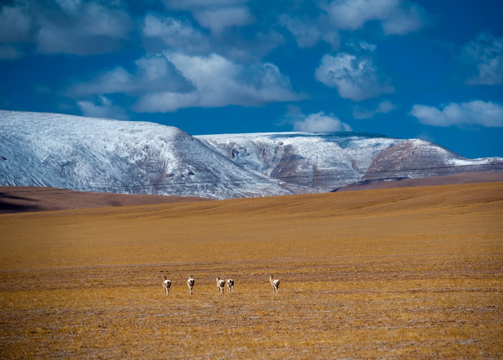
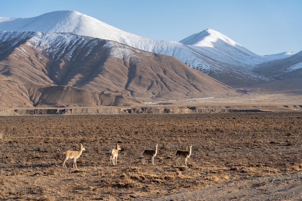
Despite the limited biodiversity, there is a large proportion of endemic highland animals exist. Examples include the Tibetan antelope (or chiru), wild yak, Tibetan wild ass (or kiang), and snow leopard, all first-class protected species in China.
The Tibetan antelope, with the finest wool in the world, was a prime target of poachers. Its population once dropped to 70,000 from over a million but has rebounded to 300,000 thanks to stringent conservation efforts.
The wild yak’s current population is estimated to be 10,000-15,000 individuals, though its domestic cousin numbers in the millions. Interbreeding between the two and human-wildlife conflict pose a significant threat to the wild yak.
The Tibetan wild ass lives in cohesive herds of up to 400 animals led by a matriarch. Its coat changes from chestnut brown in summer to dark brown in winter. Some 60,000 animals currently exist in the wild.
The snow leopard, dubbed the “ghost of the mountains” for its elusiveness, is distributed throughout 12 Asian countries. However, its total wild population is only 4,000-6,500. It cannot roar like other big cats—instead, it mews, growls, yowls, and chuffs.
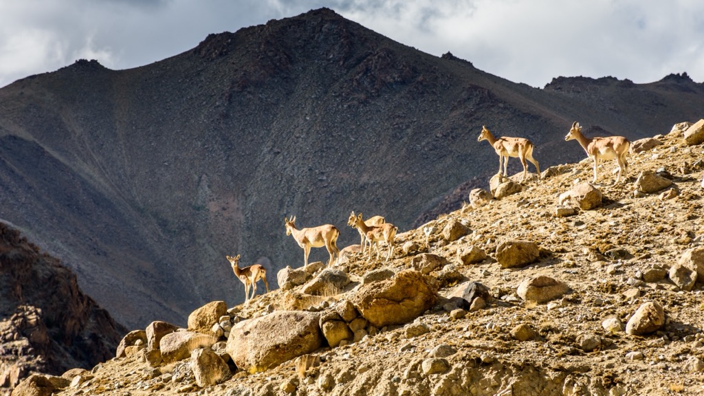
The more humid western reaches also harbor animals such as the ibex, Ladakh urial, and blue sheep, typically found in higher crags. Wolves, brown bears, argali sheep, and migratory waterfowl also exist.
The Kunlun Mountains, which have featured prominently in Chinese mythology for millennia, are the Chinese version of Mount Olympus. They are regarded as the center of the world and the abode of mythical figures such as Pangu (盘古), who created the universe, and Nüwa (女娲), who mended a hole in the sky with smelted stones.
Archeological sites in the area yielded stone tools that date back as many as 10,000 years. On the northern slopes of the Kunluns, an ancient burial ground in Hotan (和田), Xinjiang, was carbon-dated to be about 4,400 years old. The discovery of both Caucasians and Mongoloids suggested a significant racial mix.
Ancient rock art has been discovered in various places in the Kunluns. The most important site is Yeniugou (野牛沟), a canyon in Golmud with about 200 individual images estimated to be over 3,000 years old.
The northern foothills of the Kunluns were part of the southern route of the ancient Silk Road. Record from the Han dynasty (206 BC–220 AD) mentioned 36 independent oasis kingdoms in the foothills, such as Khotan (于闐) and Jingjue (精绝, now called Niya 尼雅).
However, those small states gradually became engulfed by warfare and desertification. During the Age of Discovery, the Silk Road went into decline as new sea routes offered cheaper and faster alternatives.
Considered the ancestor of all mountains, the Kunlun range is a revered sanctum for Buddhists and Taoists. These peaks are the birthplace of two Taoist sects, the Kunlun School and the Quanzhen School (全真派), the most well-known Taoist denomination.
Nowadays, the major transport hubs of Kashgar and Golmud constitute the population centers, while nomadic settlements of various ethnicities such as Uyghur, Tibetan, Mongolian, and Han dot the Kunlun foothills.
Only a tiny fraction of the Kunlun Mountains is accessible, but there is still plenty to see. The following attractions are all reachable from Golmud.
About 160 km (99 mi) south of Golmud, this mountain pass is the only way to travel by road between Qinghai and Tibet. The Qinghai-Tibet Railway and Qinghai-Tibet Highway (part of National Highway 109) go through the pass.
At an altitude of 4,767 m (15,640 ft), the pass offers arresting vistas of majestic peaks. To the west is Yuxu Peak (玉虚峰 5,980 m/ 19,619 ft), which is reputed to be the home of Yuxu Goddess or the sister of Yudi, the Lord of all Heavens. It is the holiest mountain of the Kunlun Taoist Sect.
10 km (4 mi) east of Kunlun Pass is Yuzhu Peak (6,178 m/ 20,269 ft), a popular destination for climbers since it requires little technical expertise. It is the training ground for China's national mountaineering team.
The southern side is a relatively straightforward glacier climb from the base camp at 5,050 m (16,568 ft). In comparison, the northern route from the base camp at 4,300 m (14,764 ft) is more complicated, with steeper slopes and many crevasses, ice pinnacles, and arêtes. Climbers need to obtain a permit from the Qinghai Mountaineering Association.
Covering a space of 45,000 km² (17,400 mi²) in the hinterland of the Qinghai-Tibetan Plateau, Hoh Xil or Kekexili is the country’s largest UNESCO Natural Heritage Site. Its average altitude of 4,600 m (15,092 ft) means sub-zero temperatures all year round.
Known as “no man’s land,” Hoh Xil has pristine habitats from steppes to marshes that support 230 animal species, including the Tibetan antelope. Around late May every year, tens of thousands of pregnant antelopes arrive in Hoh Xil to calve, leaving in August with their offspring.
At the eastern end of the Kunlun Mountains, the city of Golmud (格尔木) is part of Haixi Mongolian and Tibetan Autonomous Prefecture (海西蒙古族藏族自治州) in Qinghai province. Covering an area of nearly 120,000 km² (46,332 mi²) in two unconnected parts, it is slightly smaller than Greece, though its urban area occupies less than 0.1%. The population is about 200,000.
Besides the Kunluns, nearby sights include the Qarhan Salt Lake (茶卡盐湖) and Golmud Populus Euphratica Forest (格尔木胡杨林). Apart from being a major stop on the Qinghai-Tibet Railway, Golmud also has an airport.

Kashgar is a city in the Tarim Basin region of Southern Xinjiang. It is one of the westernmost cities in China and is located near the borders of Afghanistan, Kyrgyzstan, Tajikistan, and Pakistan.
For over 2,000 years, Kashgar has been an oasis city and has played a vital role as a trading post and strategically important location on the Silk Road between China, the Middle East, and Europe. Thus, it is one of the oldest continuously inhabited cities in the world.
With over 500,000 people, the Uyghur ethnic minority comprises 85% of the city’s population. Throughout history, Kashgar has been ruled by various empires, such as the Chinese, Turkic, Mongol, and Tibetan dominions. It has also been the site of numerous battles between different Steppe groups.
Kashgar is at the edge of the Tarim Basin, one of the harshest desert climates in the world. The city receives about 70 mm (2.7 in) of rain annually.