
Scan the QR code and open PeakVisor on your phone
Xinjiang, formally the Xinjiang Uygur Autonomous Region, is a massive landlocked region in northwest China home to some of the world’s highest and most remote mountain ranges. The most prominent mountain in Xinjiang is Pobeda Peak (Jengish Chokusu) and the highest peak is K2, the second tallest mountain on earth. There are a total of 505 named mountains in the region.
Xinjiang is the largest administrative region in China, covering over 1.6 million square kilometers (620,000 sq mi) in the far northwest corner of the country.
While it’s part of China, Xinjiang is unique in the country for its ethic diversity and central Asian cultural heritage. Over half the population comes from ethnic minority groups and nearly 60% practice Islam. Parts of the region are closer to Istanbul than they are to Beijing.
Xinjiang borders Mongolia, Russia and Kazakhstan to the north, Kyrgyzstan, Tajikistan, and Afghanistan to the west, and Pakistan, India, and Tibet to the south. The region also borders the Chinese provinces of Qinghai and Gansu to the east.
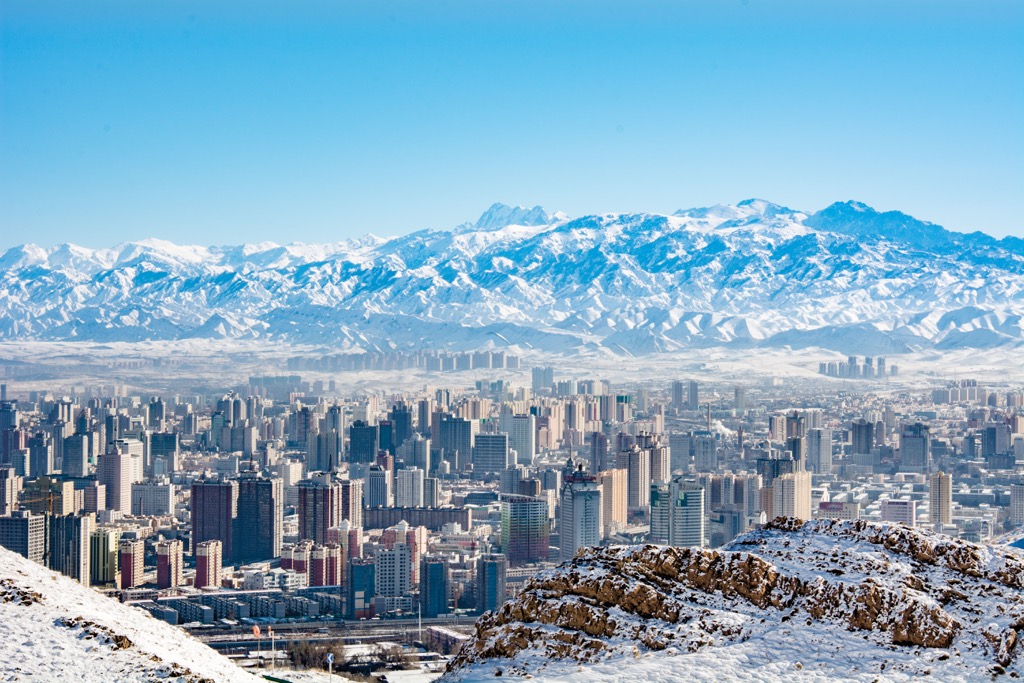
Xinjiang is home to about 25 million people, which makes it the third least-densely populated region in the country after Qinghai and Tibet. The capital and largest city is Ürümchi. With 4 million people, Ürümchi is the largest city in Central Asia.
The largest ethnic group in Xinjiang are the Uyugers, a Turkic ethnic group who speak their own language and practice Islam. They make up just under half of the population in Xinjiang. Another approximately 15% of the population is composed of other ethnic minorities, including Kazakhs, Hui, Kyrgyz and Mongol people.
The remaining roughly 40% of Xinjiang’s residents are Han, part of the ethnic group that dominates east China. Much of the Han population are migrants from further east in the country.
In terms of landscape, Xinjiang is characterized by massive deserts, rugged mountain ranges, and lots of harsh, uninhabited terrain. Less than 10% of the land area is fit for human habitation.
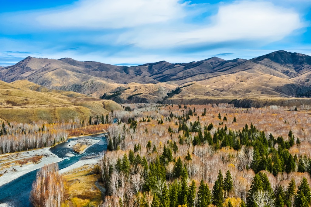
The region is divided into northern and southern portions by the Tian Shan, which run west-to-east across Xinjiang, dividing the Junggar Basin in the north and the Tarim Basin in the south.
In addition to the Tian Shan, there are several other major ranges in Xinjiang, including the Altai Mountains which run along the border with Mongolia in the north, the Pamir and Karakoram ranges in the southwest, and the Kunlun Mountains on the Tibetan border to the south.
These are some of the highest mountain ranges in the world. K2, the second highest peak on earth, sits in the Karakorum on the border between China and Pakistan.
In addition to some of the highest mountains in Asia, multiple locations in Xinjiang can also claim to be the geographical center of the continent.
Two locations near the Dzungarian Gate, a mountain pass in northern Xinjiang, were identified as potential candidates for the “continental pole of inaccessibility,” the point on land farthest from coast in any direction. (Calculations to find the pole change depending on how the coastline is defined).
Local geographers also calculated a point southwest of Ürümchi as the pole of inaccessibility in the 1990s. There’s a monument calling it the “center of Asia” in that spot today.
Xinjiang is a massive, geologically diverse region of alternating mountain ranges and deep basins. The forces that formed Xinjiang’s mountain ranges are still very active and make the region a frequent earthquake zone.
The Tian Shan, Kunlun, and Pamir ranges in Xinjiang were all formed by the collision of the Indian subcontinent with the Eurasian continental plate, which formed much of the Himalaya and the Tibetan Plateau. Xinjiang is a geologically young region.
The region is particularly important for mining and resource extraction. The Tarim Basin in Xinjiang contains the largest reserves of oil and natural gas in China, and there are major deposits of coal in the northern part of the region. Iron, chrome, zinc, copper, and nickel are also mined in Xinjiang.
Xinjiang is also unique in China for its water systems. Most of the region is endorheic, meaning the water in its rivers and lakes stays within its drainage basins and can’t flow out to sea. Most river systems in Xinjiang empty into salt lakes or spread out into alluvial fans, creating marshes or oases at the foot of mountain ranges, where most of the population lives.
In contrast to east China where the massive Yangtze and Yellow rivers dominate the landscape, only one river in Xinjiang flows out to sea. The Irtysh River flows west into Kazakhstan and Russia where it empties into the Ob River and eventually, the Arctic Ocean.The largest river in the region is the Tarim River, which flows along the northern edge of the Taklamakan desert. It’s the longest inland river in China.
The Taklamakan desert is the largest of Xinjiang’s three deserts. It covers 337,000 sq km (130,000 sq mi) and holds sand dunes up to 90 m (300 ft) tall. It’s also home to the lowest point in China, the Turpan Depression, which is 155 m (509 ft) below sea level.
Xinjiang is a harsh, challenging environment, and the plants and animals that thrive there reflect that. There are a number of large mammal species and big game hunting was once a tourist draw to the region, but hunting is severely restricted in China now.
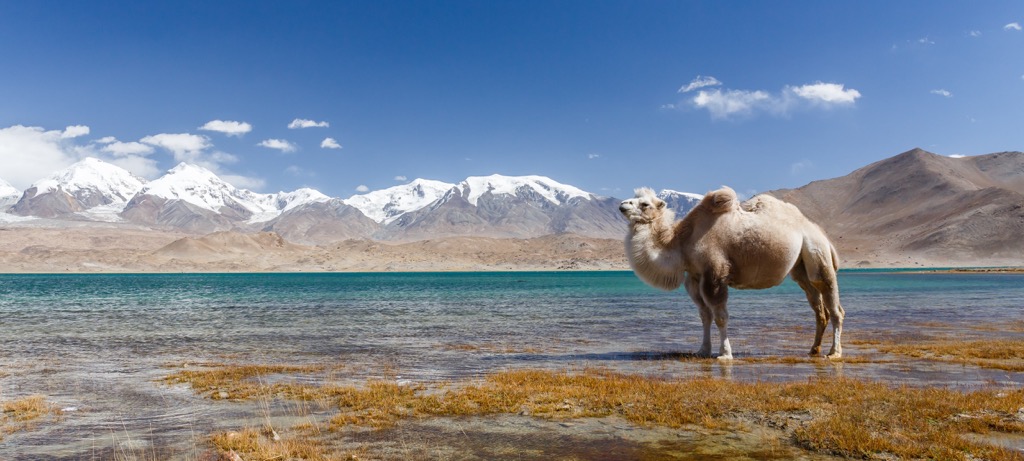
Some of the large mammals in Xinjiang include antelope, elk, ibex, bears, wolves, wild sheep, leopards, wild horses and wild camels. Much of Xinjiang is desert with limited vegetation, but there are some forests in the mountains, particularly drought-tolerant pine trees.
The Tian Shan are home to some diverse forests with poplar and willow trees. In total, about 3,000 plant species have been identified in Xinjiang.
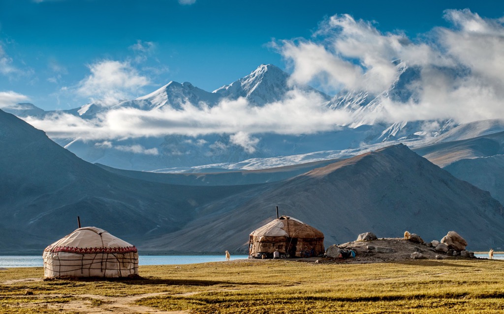
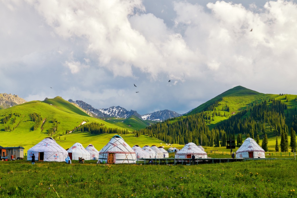
Xinjiang is a historically diverse region outside the bounds of the traditional core of Chinese territory. It’s long been home to various peoples originating all over north, east, and central Asia. Xinjiang people have traditionally lived in nomadic or semi nomadic groups.
One of Xinjiang’s prominent early nomadic groups was the Xiongnu. Around 200 BCE, they formed a confederacy of nomadic tribes and controlled a wide stretch of territory from Xinjiang into parts of modern day Siberia.
The Xiongnu eventually lost control of the Tarim Basin to the Han dynasty, marking the first time the Chinese empire gained control of Xinjiang. At the time, the Tarim Basin was home to diverse groups including the Saka, Tocharians, and Tibeto-Burmese peoples. The area was a major source of jade and it was controlled by the Han dynasty as a protectorate, called the “Western Regions.”
The Chinese empire lost control of the region when the Western Jin Dynasty fell in 316 CE and Xinjiang was ruled by a succession of smaller local kingdoms. The Tang dynasty briefly regained control in the mid 600s CE, but by the next century parts of Xinjiang were under the control of the Tibetan Empire and the Uyghur Khaganate.
Until around the 10th century CE, residents of Xinjiang practiced a number of religions including Buddhism, Zoroastrianism, and Manichaeism. During the mid 10th century, the Kara-Khanid Khanate, which occupied Xinjiang at the time, converted to Islam and introduced the religion to Xinjiang resdients.
Parts of Xinjiang voluntarily joined the Mongol alliance under Ghengis Khan and avoided being ransacked by the Mongol armies. Over the next several hundred years, control of various parts of Xinjiang alternated between the Yuan dynasty, smaller Mongol kingdoms, or Turkic groups.
The Qing dynasty regained control of Xinjiang in the mid 1700s from the Mongol Dzungar Khanate and led an extermination campaign against the Dzungar people. There was frequent unrest between local minority groups in northwest China and the imperial government, and in 1862 a major revolt broke out.
The Dungan Revolt caused a massive demographic calamity in northern China. Over 20 million people died as a result of violence, famine, migration and plague. Northern Xinjiang was three-quarters depopulated by the revolt.
A short-lived Turkic Muslim state called Yettishar (also called Kashgaria) was declared in Xinjiang during the Dungan Revolt, but Qing government retook the area in the late 1870s. They declared the area a formal province and gave it its current name, which means “new frontier.”
Under the Republic of China, which took over from the Qing dynasty in 1912, Xinjiang was mostly controlled by warlords and dealt with a series of uprisings. The Red Army took control of the province in 1949 and it officially became an autonomous region in 1955.
Since the early 1990s, separatists movements have grown in Xinjiang from residents seeking independence from the central Chinese government, particularly Uyghurs. The government responded with a massive wide-ranging crackdown starting in the mid 2010s, which some characterize as genocide.
Uyghurs’ movements are heavily controlled and a report to the UN from the World Uyghur Congress estimated that up to a million people are being held in internment camps in Xinjiang. There are also reports of forced sterilization, suppression of Uyghur language and Islamic religion, and various other human rights abuses.
The central government is encouraging Han people to settle in Xinjiang, diluting the power of ethnic minorities like the Uyghurs in the region.
Xinjiang is a challenging destination, but it offers amazing hiking for anyone willing to make the trip. Here are some of the best places to hike in Xinjiang.
Traveling in Xinjiang as a foreigner has become increasingly difficult in the past several years. There are frequent roadblocks and government checkpoints, and officials will often turn foreigners back to major cities, saying certain areas are not open for tourism.
Always be prepared with your documents and be ready to answer questions about where you’re going and what your plans are. Traveling with a Chinese tour agency will help get around with fewer questions and hassles, although you should still expect some bureaucracy at times.
If you’re traveling in Xinjiang, especially solo, be patient and expect that your plans might change at times. Beyond shifting government regulations, traveling in Xinjiang can be difficult because of language barriers and lack of transport. English is not widely spoken and some Mandarin is very helpful.
With the exception of K2, the hiking destinations outlined below are established tourist sites, and they should be easier to access without an official tour group or Mandarin language skills.
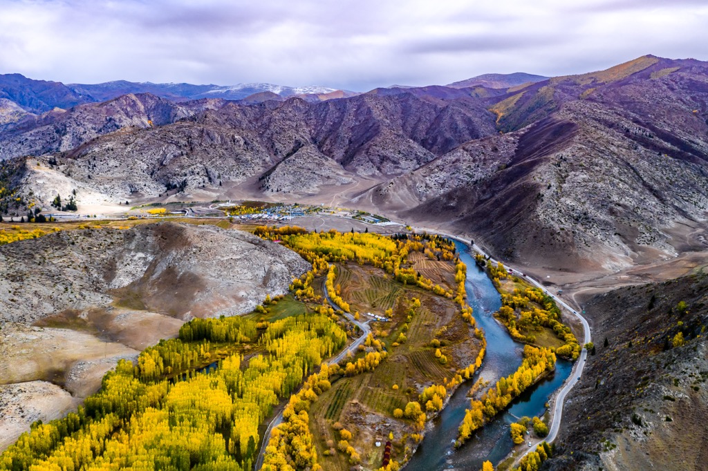
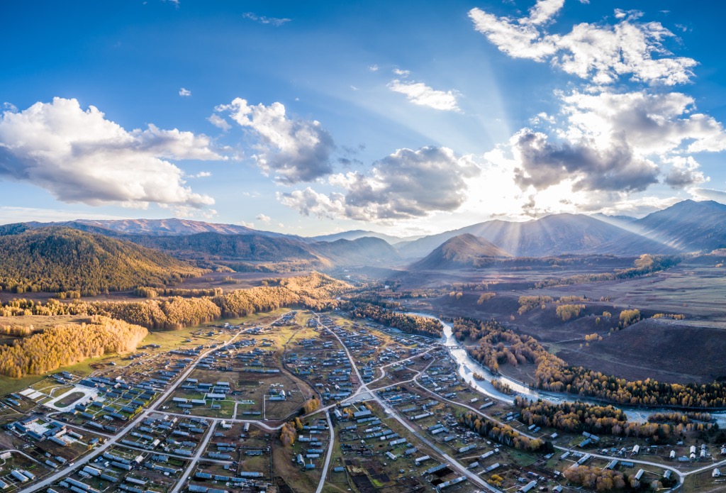
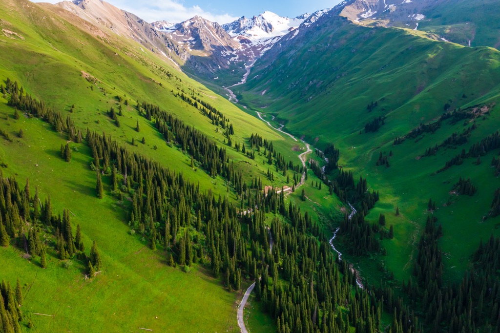
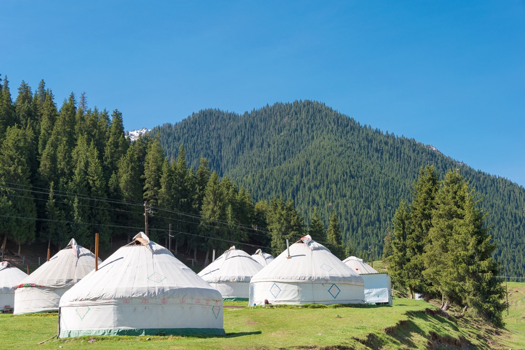
Located in the Tian Shan just 70 km (40 mi) south of Ürümchi, Nanshan is one of the most accessible hiking destinations in Xinjiang (where accessibility can be a major challenge).
This is a verdant area of vast grasslands and forests, with snow-capped mountains peaking out in the distance. While the valleys and slopes are steep and dramatic, the altitude isn’t extreme, topping out around 2,300 m (7,500 ft). It’s suitable for less experienced or acclimated hikers.
If you visit Nanshan in the summer, you’ll likely see nomadic herders and their cattle and sheep grazing in the grasslands.
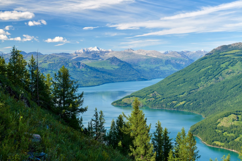
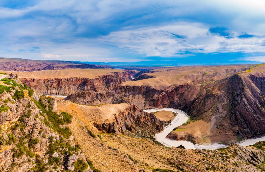
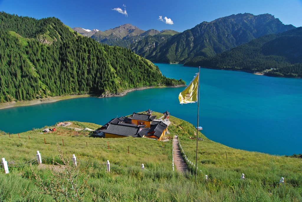
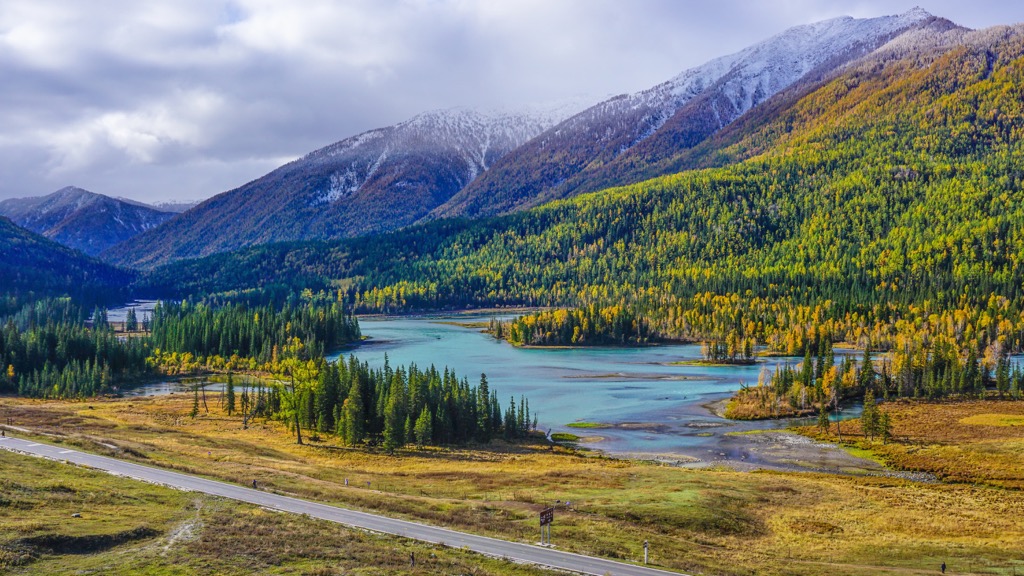
Kanas Lake is located in the far northern tip of Xinjiang, near the border with Russia, Mongolia, and Kazakhstan. The area is considered a national geopark and it’s one of the major tourist destinations in Xinjiang.
Kanas Lake is famous for its electric blue water, which contrasts with vibrant green hillsides in the summer and bright golden foliage in the fall. The lake sits in a dramatic valley.
The area is also known for the local Tuva and Kazakh people, who have traditional villages within the park.
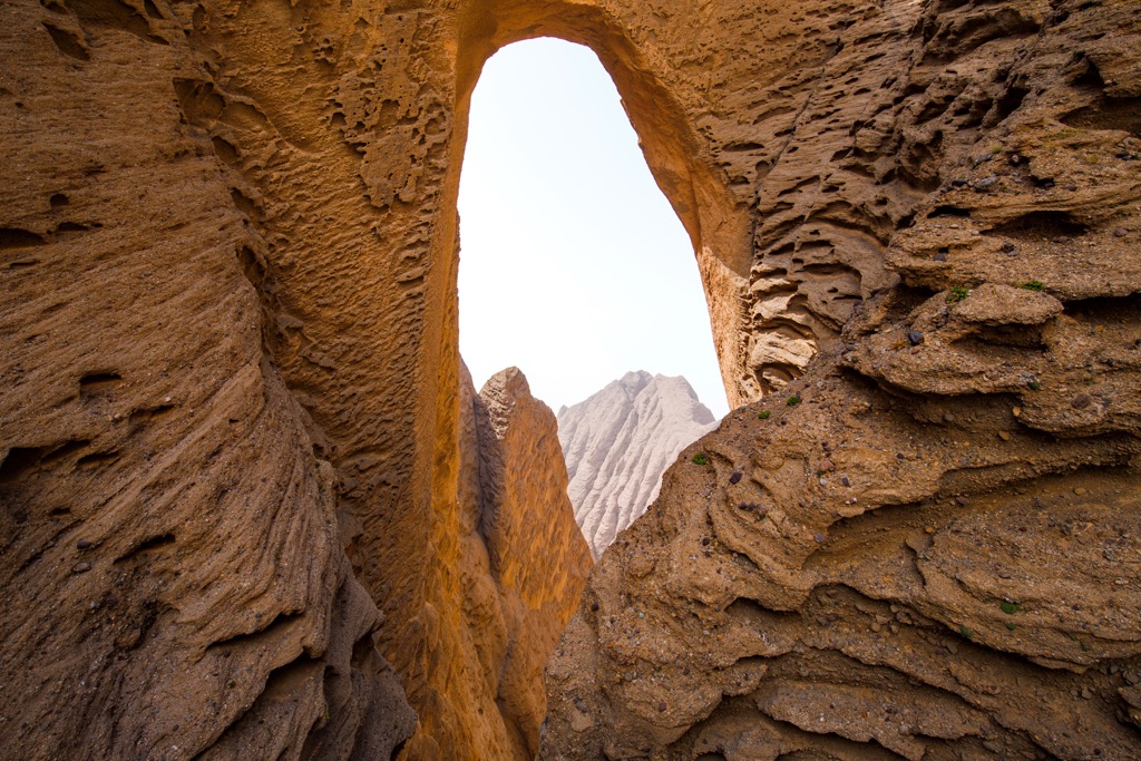
At 460 m (1,500 ft), Shipton’s Arch is the tallest rock arch in the world. It’s four times higher than the next tallest arch (The Fairy Bridge in Guangxi, China) and it’s so remote that its location was a mystery for decades.
Shipton’s Arch was added to the Guinness book of world records as the world’s tallest natural arch, but it was removed when the record keepers couldn’t confirm its location. A National Geographic expedition in 2000 relocated the arch and it’s since become a minor tourist destination.
Shipton’s Arch is tucked in a remote area north of Kashgar, accessible by a two hour drive from the city and a 1-2 hour hike through steep, narrow canyons.
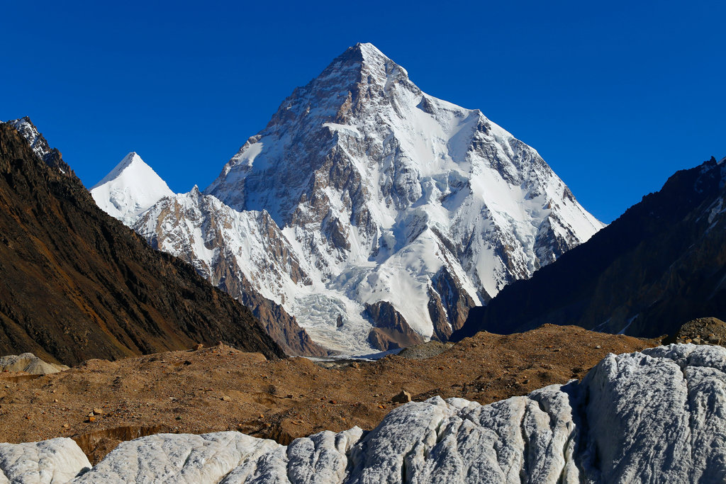
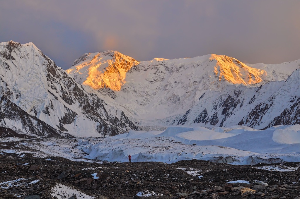
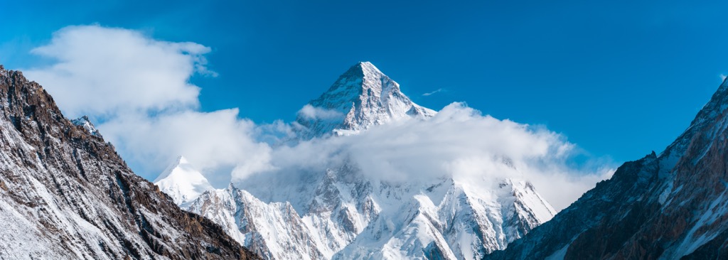
K2 is earth’s second-highest peak, and it’s considered one of the most challenging of the 8,000 m peaks. The Chinese side of K2 is an especially technical ascent and it’s difficult to access, so it’s not climbed very frequently.
Even if you’re not a pro mountain climber, it’s possible to get close to K2 and experience the majesty of the Karakoram range by trekking to base camp. While the Pakistani side is more popular, there are several tour agencies that run treks to the northern basecamp on the Chinese side of K2.
Ürümchi is Xinjiang's capital and largest city, home to 4 million people. The area has been inhabited by successive groups of people for thousands of years and it was a major Silk Road trading post.
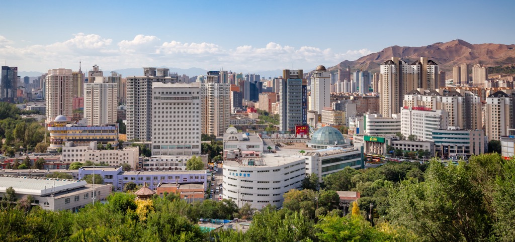
There are several historic mosques in Ürümchi but the main tourist site is the Grand Bazaar, a modern shopping attraction modeled on a traditional bazaar. If you’re looking to get out of the city, Tianchi Lake (Heavenly Lake) is only a two hour bus ride away and offers incredible mountain views.
Despite its long history with Xinjiang’s local people, the vast majority of Ürümchi’s residents are Han Chinese who have migrated there as part of a government resettlement program.
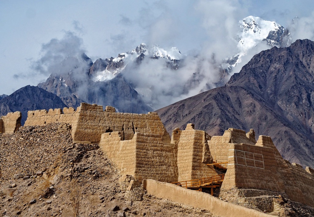
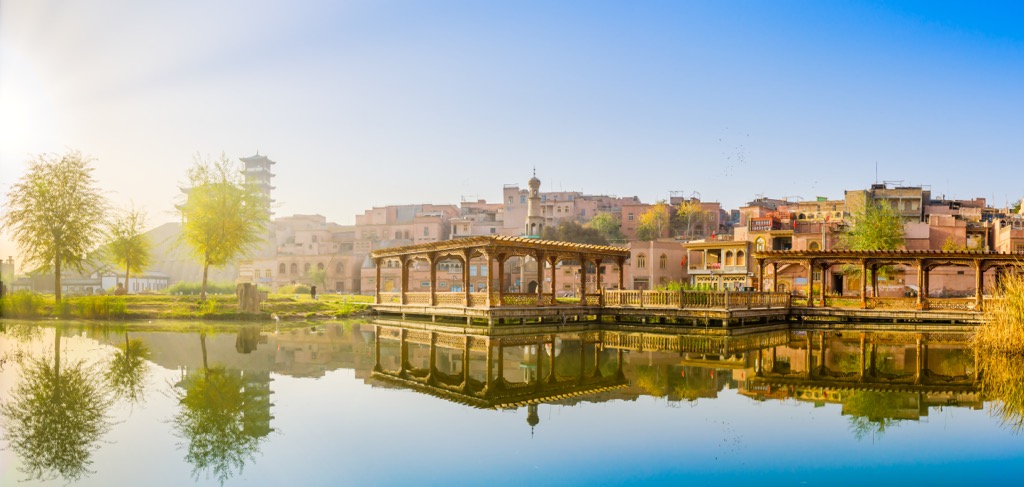
Kashgar is located at the foot of the Pamir Mountains, and it’s the westernmost major city in China. It’s an oasis city and it was a historically important point on the Silk Road for hundreds of years.
Kashgar is home to about half a million people, most of whom are Uyghur muslims. The city still has a decidedly Islamic, central Asian feel and a number of historic sites.
There are well-preserved mosques and mausoleums dating back to the 17th century, traditional tea houses, and a few remaining ruins of the ancient city. There’s also a picturesque “old town,” a rebuilt version of the city’s ancient architecture that was constructed in the late 2000s.


ultra
8000ers
china-ultras
pakistan-ultras
ultra
8000ers
china-ultras
pakistan-ultras
ultra
8000ers
china-ultras
pakistan-ultras
ultra
8000ers
china-ultras
pakistan-ultras
ultra
snow-leopard-award
china-ultras
kyrgyzstan-ultras
ultra
8000ers
china-ultras
pakistan-ultras


