Scan the QR code and open PeakVisor on your phone
Shrouded in mystery and associated with many military conflicts, Afghanistan in reality is a great mountainous land with picturesque natural landscapes. Afghanistan is a country of contrasts, majestic snow-capped peaks are found side by side with hot and dry deserts. There are many ancient citadels and fortresses belonging to Hinduism, Buddhism, Islam and many already extinct cultures, some of which, despite the 30-year civil war, have survived to this day. Afghanistan is also thought to be the cradle of Zoroastrianism which requires good deeds for help in his cosmic struggle against the evil spirit.
Afghanistan is utterly irresistible for adrenaline junkies who go for the thrill of conquering the hostile wild mountain peaks. But besides this, one can spend quite tranquil holidays here, enjoying the unforgettable beauty of marvellous natural scenery as well as the indigenious local culture.
Afghanistan is one of the oldest countries in the world. The earliest mention of it dates back to the sixth century B.C. Throughout its history, the country has undergone many external conquests and a great deal of military action within the country. Even now a civil war is raging there and the current conflict between radical groups makes the country one of the most dangerous countries in the world.
The area of present-day Afghanistan is 652,864 sq. km. The country has a population of 37.5 million people (as of 2021). It consists of 29 provinces and two districts of central subordination. The capital is Kabul.
Afghanistan is located in Southwest Central Asia, in the northeast of the Iranian Plateau. It is the crossroads of South and Central Asia. It is also where the roads between East and West converge. It neighbours Iran to the west, Pakistan to the east and south, Turkmenistan, Tajikistan, and Uzbekistan to the north, and shares borders with China and India in the easternmost part of the country.
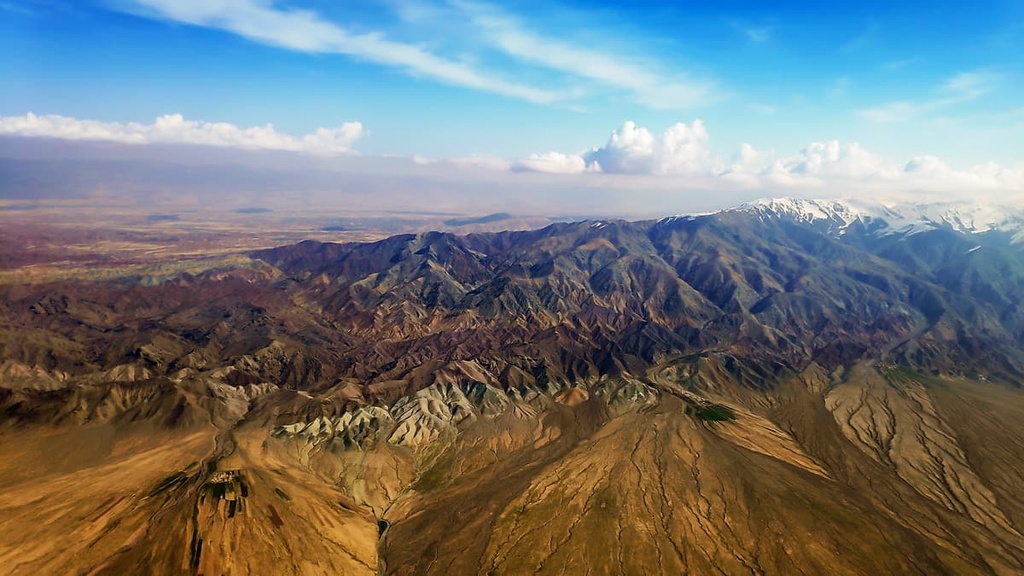
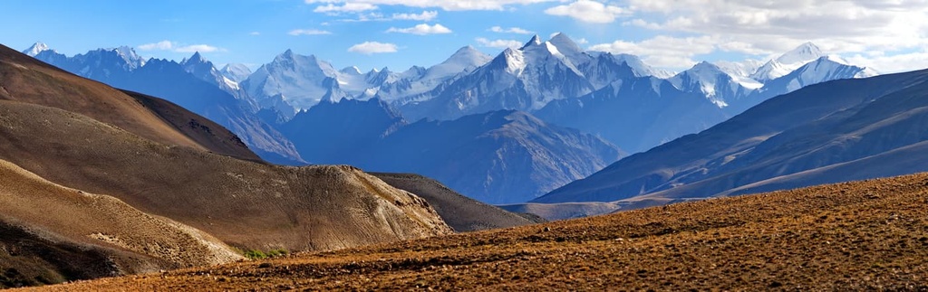
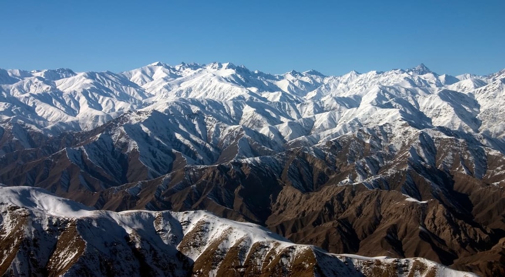
There are 1,596 named mountains in the country. Mountains cover as much as 80 percent of the land. The highest of these, Mount Noshaq (7,492m) rises majestically in the Hindu Kush Range on the border with Pakistan. However, the southern and eastern slopes of the mountain belong to Pakistan. The most important mountain range in the country is the Hindu Kush, which is considered a logical extension of the Himalayan Mountains.
The eastern regions of Afghanistan are crossed by the highest massive ranges of the country - the Hindu Kush Range (over 4000-5000m a.s.l.) and the Wakhan Ridge (over 6000m a.s.l). The tops of the mountains are covered by glaciers.
To the west of the Hindu Kush Range is the Hazarajat Plateau, which exceeds 3,000m a.s.l., and some of the peaks reach 4000m. Its slopes are highly dissected and considered difficult to reach. The winds prevail here and the mountains are gradually eroding due to weathering, forming debris called damans at the foot of the slopes. In the northeast of Afghanistan, there are the Paropamisus Mountains.
In the southeast of the country, there is a plateau which is less than 2,000m high. There are several oases, the largest of which is located in the vicinity of Kandahar.
In the southwestern part of the country, there are hilly plateaus of 500-1,000m high. Afghanistan's deserts - the Dashti-Margo clay-rubble desert and the sandy Registan desert - occupy large areas.
In the northern part of Afghanistan stretches the Bactrian Plain. It has numerous rivers in the foothills of the Paropamisus and the Hindu Kush, and gradually turns into a desert in the northernmost part of the country.
The lowest point of the country is the Amu Darya River with flows at an elevation of 258 m a.s.l. (846ft).
The main rivers in Afghanistan are the Amu Darya, Kabul, Gherirud, Murghab and Hilmend rivers. The Kabul River is considered the main river in the eastern part of Afghanistan. The Hilmend is one of the most beautiful rivers in the country. It flows through the Iranian Highlands.
All rivers, except for the Kabul River and the left tributaries of the Panj River, either flow into drainless lakes or gradually end in the sands before they have a chance to reach a larger river. Many rivers are equipped with dams that form reservoirs. Beginning in the mid-summer, they become considerably shallower, some of them even dry up. This is due to the large watershed which meant to irrigate the fields, as well as due to evaporation of water in the hot season. The main food sources of large rivers are the melting snow and glaciers in the mountains. Spring and summer are the time of floods. Oases can be found in some river valleys.

Mountain rivers are usually not navigable. The navigable section of the Kabul River is only about 120 km.
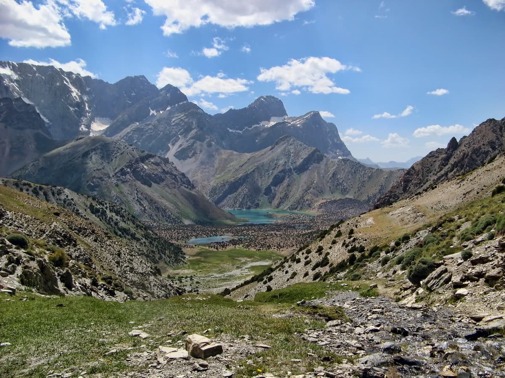
There are few lakes on the territory of the country. The largest lakes are located in the Hindu Kush mountains. These are Lake Shiva, Sarykul and Bandi Amir. There are salt lakes in the west and southwest of Afghanistan - the Namaksar, Sabari and Daghi-Tundi. They dry up in summer.
The landscapes of Afghanistan are greatly influenced by the altitude belt.
The lowest parts in the depressions are filled with salt marshes and shatts aka takyr. Takyr means ‘smooth, even, or bare’, it is a type of relief occurring in the deserts of Central Asia, similar to a salt flat in the southwestern United States. A takyr is usually formed in a shallow depressed area with a heavy clay soil, which is submerged by water after seasonal rains. In the plains, where deserts predominate, wormwood, camel's thorn, saxaul, tamarix, sablebrush grow in the south, and sedge and broom grass in the north. In the steppes, which are occupied by plateaus, acantholimon and astragalus grow in abundance.
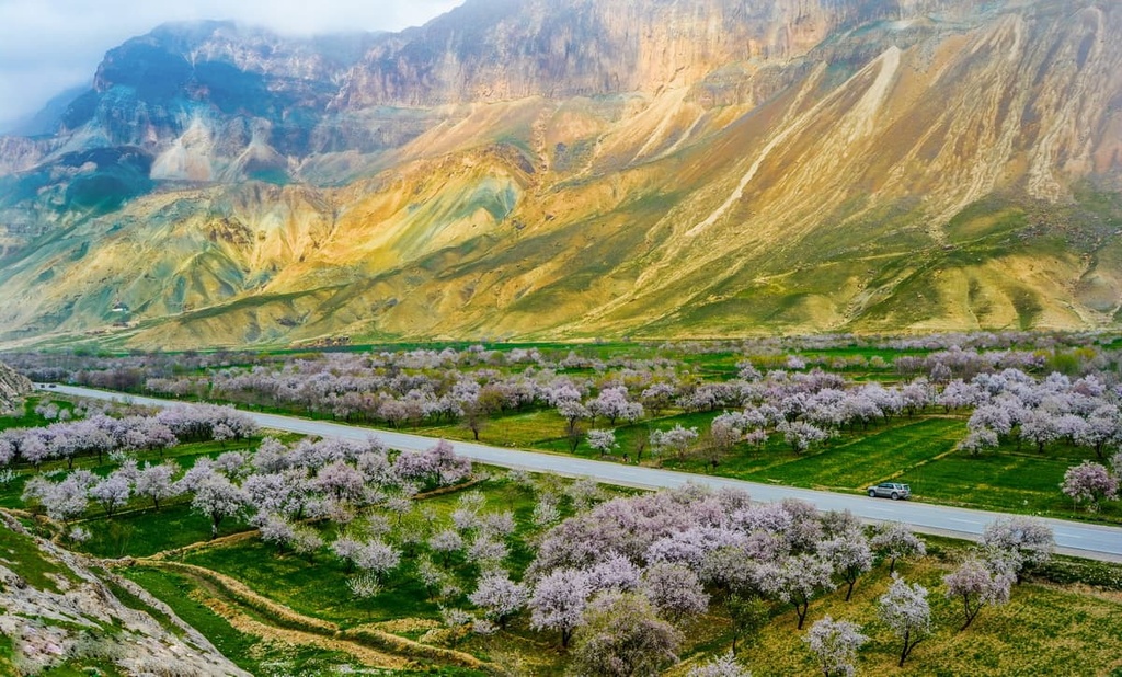
In the Indo-Himalayan region (in the east and southeast) at an altitude of 750m to 1500m, the steppe zone begins to alternate with forest areas where acacias, palms, figs and almonds are common. Blossoming of almond trees in springtime brings a special, one might say, delicate beauty to the landscapes of harsh Afghanistan.
Walnut trees can be found on the western slopes and pomegranate groves grow on the southern slopes.
Forests in Afghanistan occupy about 5% of the territory and are concentrated mainly in the east of the country, in the middle belt of the Hindu Kush Range. At an altitude of 2,400-3,500m, there are mainly broadleaved forests dominated by such Himalayan tree species as evergreen oaks and others. On the southern slopes, which are considerably drier, there are juniper forests. Above 3500m, there can be found coniferous forests composed of fir, cedar, and Himalayan pine. The higher you go, the sparser the vegetation: you can see rhododendrons and junipers. Above 4,000m, the mountains are covered with subalpine and alpine meadows. In spring, the slopes and valleys of Afghanistan are covered with bright flowers.
The river valleys are covered with riparian woodlands. Willow, oleaster (Russian olive), Asiatic poplar, tamarisk, salt cedar (Tamarisk gallica), and reed dominate in the Amu Darya River valley, whereas tamarix, laur leaf and white poplar, and buckthorn reign supreme in the valleys of mountain rivers.
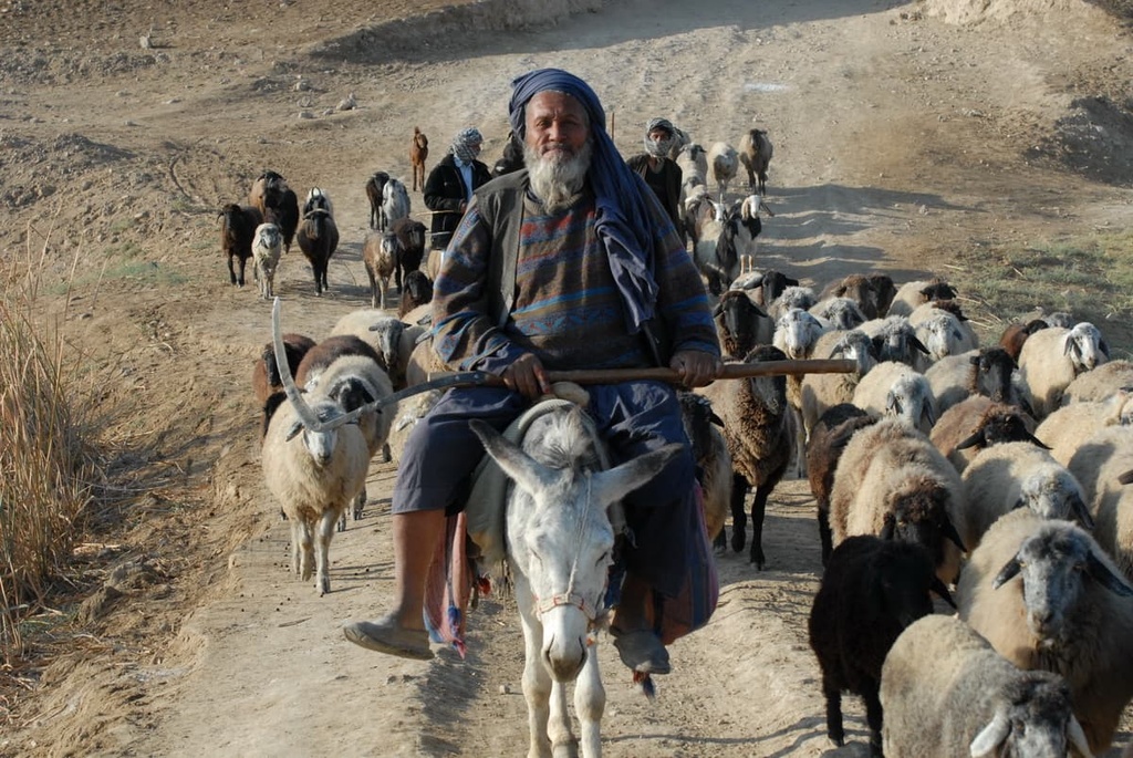
The animal life in Afghanistan varies greatly depending on the terrain. Open spaces of steppe and desert plains, as well as plateaus are home to saiga antelopes, gazelles, wolves, steppe foxes, hares, wild donkeys, jackals, spotted hyenas, marmots, voles, gophers, and sandflies.
Donkeys are treated by the locals as pack animals. Donkeys are used to transport people and goods in places where no off-road vehicle can pass.
In the mountains, there are mountain goats, argali (Marco Polo’s sheep), irbis, bears, etc. Turanian tiger, reed cat, and wild boar live in river valleys. Deserts and dry steppes are rich in reptiles: agamas (Agamidae fam), monitor lizards (Varanidae fam), steppe python, as well as poisonous snakes (moccasin, cobra, viper, and epha). There are many poisonous insects and insect pests (caracurts, scorpions, locusts, phalanges, etc.) in Afghanistan. You can read more about poisonous species and how to behave if you see them here.
Among birds there are many predators, such as golden eagle, vulture hawk, kite (Milvus), kestrel, Indian laggar falcon, Himalayan vulture. In deserts, you can find moorhens, desert hens and skylarks.
The rivers are inhabited by commercial fish species - catfish, trout, carp, barbel, and asp.
Afghanistan's climate is subtropical continental and arid. Sharp fluctuations in temperature during the day are very common. Due to the sharp differences in altitude and lowlands, there are strong winds, and in the summer, dust storms are very frequent.
The air temperature can vary significantly in different parts of Afghanistan. For example, Kabul, which is 1,800m a.s.l., has cold winters and warm summers. Jalalabad, which is located at an altitude of 550m, is naturally warmer all year round. Kandahar, which is 1,000m a.s.l., has more humid air.
In January, the average temperature on the plains is 0° to - 8°C (32-18F), it can reach its minimum of -20 - -25°C though (-4 to -13F). In July, the average temperature on the plains is about 24-32°C (75-90F). The maximum recorded temperature is + 45°C (113F).
There is relatively little rainfall during the year, mountains enjoy several times more rain than in the plains. The rainy season lasts from about October to April. In the southwest, however, there may be no precipitation at all (e.g., in Sistan).
Few are the countries in the world that can boast of such a blend of cultures. Afghanistan in its millenia-long history has had many wars and different rulers. There are so many archeological and cultural heritage sites that the country may be called a Mecca for historians. Unfortunately, what time could not destroy is now being demolished by the efforts of militant humans.
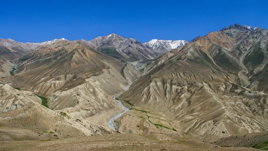
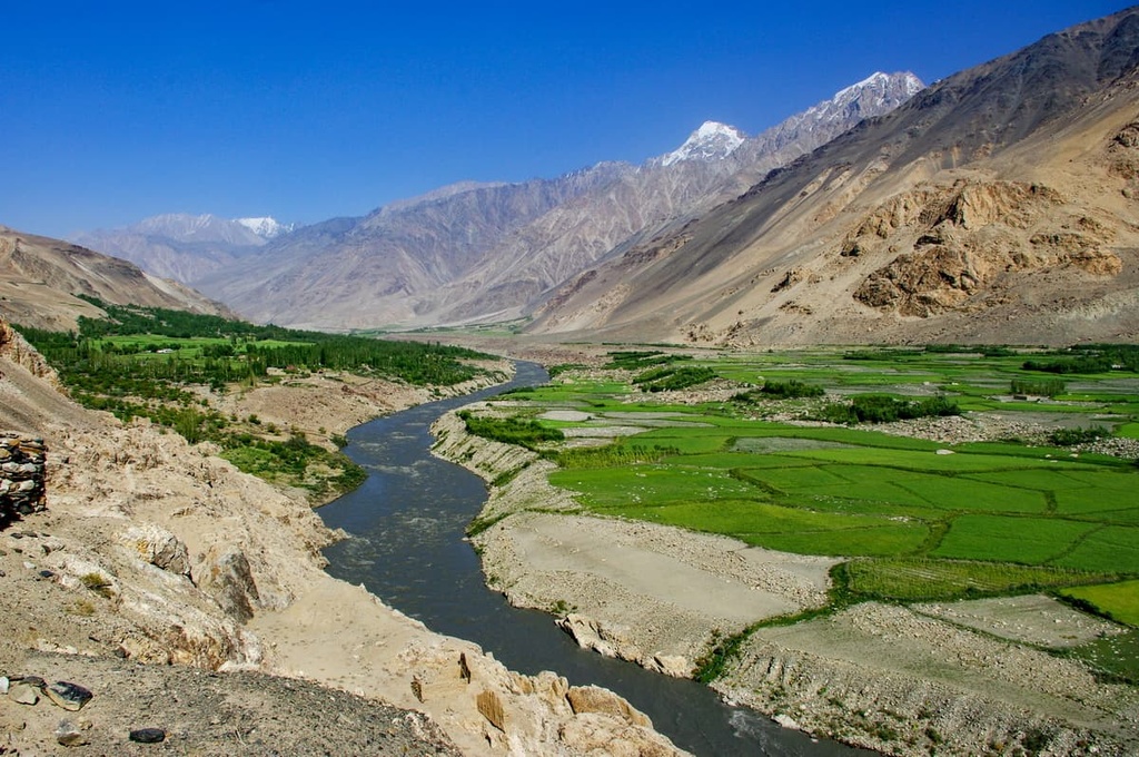
Afghanistan fascinates travellers by the pristine beauty of its majestic mountain ranges, mysterious gorges, endless valleys, and mountain lakes.
The Hindu Kush Range is a huge mountain system located at the junction of the Himalayas, the Pamir and the Karakoram. It stretches from central and western Afghanistan into northwestern Pakistan and far southeastern Tajikistan. The Hindu Kush Range begins in the northeastern part of the Pamir Mountains. That is where the border between China and Pakistan is located. Then its ridges pass through the territory of western Afghanistan and the lands of Pakistan. In the south, the Hindu Kush joins the Spin Ghar Range.
Hindu Kush is a Persian name meaning "an Indian Mountain". But because the Hindu Kush is difficult to travel, some call it "Hindu killer". The Hindu Kush consists of parallel ridges which spread over 800km in length and about 350km in width. The main ridges include the Baba Ridge, the Hindu Kush (Central, Eastern and Western) and the Paghman. The glaciers of the system are the Chiantar, Artak, Tirich, Kotgats and others. Most of the Hindu Kush mountain system is located on the territory of Afghanistan. Its eastern part belongs to Pakistan, where there are its highest peaks, including the highest point of the Hindu Kush - Mount Tirichmir (7,708m).
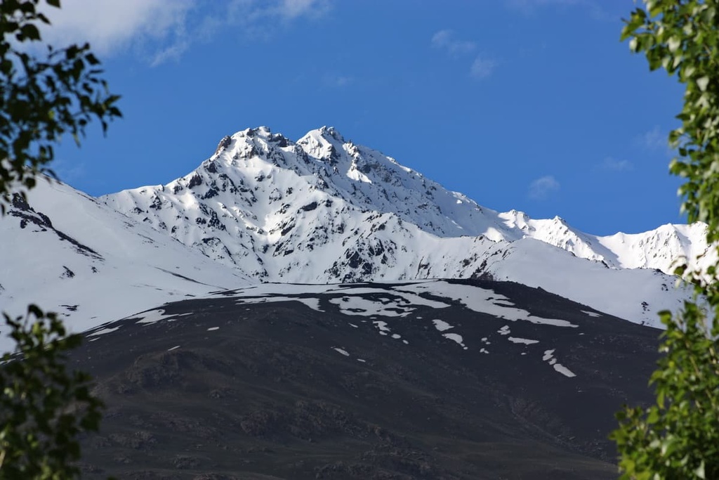
Mount Noshaq (7,492 m), also spelt as Noshak or Nowshakh, is the highest peak of Afghanistan, though it is not entirely placed in the country. The north and west sides of the mountain are in Afghanistan whereas the south and eastern sides are in Pakistan. Besides, the easiest access to Noshaq is from Chitral city, Pakistan. Noshaq is also the westernmost 7,000m (22,966 ft) peak in the world.
The first people to summit the mountain were two Japanese climbers named Toshiaki Sakai and Goro Iwatsubo who did so in 1960, while the first Afghani to climb the mountain achieved the feat in 2009.
Noshaq is located to the northeast of Kabul, in the Central Hindu Kush Range where mountains rise up to 6 - 7km. When climbing Mount Noshaq, you should be very careful. On the way, you will have to overcome minefields located at an altitude of about 3000m. It is recommended to take an experienced local guide to help you bypass all the dangerous places. When determining the starting point of the ascent to Noshaq, it is safest to use the access roads along the Pamir highway near the border with Tajikistan. If it were not for the permanent military landscape, the western ridge of Noshaq could have become a very popular place for expeditions and for mass amateur climbing. Its poor accessibility makes Noshaq quite tempting to climb. Noshaq is now in the 52nd place in the list of interesting peaks for climbing.
Other seven-thousanders are rarely visited in the Hindu Kush, but they are no less majestic: Mount Kohe Shakhawr (7,084m and according to some reports, 7,116m), Kohe Urgunt (7,039m), Akher Chagh (7,020m), Kohe Tez (7,015 - 6,995m).
Mount Kohe Bandaka (Kohe Bandaki) is a difficult mountain to climb, as tourists are exposed to falling rocks and avalanches on the way.
The closest major city to the Hindu Kush Range is Kabul, which is connected to the mountain system by the Salang Pass. The Salang Highway Tunnel passes nearby. However, it is more preferable to start the trip to these Hindu Kush Range mountains from Ishkashim village because if you drive through Kabul, you may encounter the Taliban divisions. You will first need to settle all the formalities of staying in Afghanistan in Ishkashim.
When planning a route, there are important points to consider when crossing borders. At the border with Pakistan, you will need to show a special permit which should be obtained in advance in Kabul. Otherwise, an attempt to cross the border without a permit can lead to great trouble, which in the extreme case may end up in the shooting of a tourist group.
The ascent is spectacular, there are many glaciers on the way up. You should be careful when passing them, especially if your path is near some cracks. Under the sun rays, the snow in some parts becomes friable, and the glacier is kind of melted, so deep cracks in the glaciers start to form. Closer to the tops, you will have to walk mostly on snow. The snow crust is treacherous, you can fall through the snow up to the waist. On the way to Akher Chagh and Kohe Urgunt peaks, you will have to pass difficult sections of unstable ice peaks, the so-called seracs. You can rest before or after the ascent at the Arek base camp.
Precipitation in the mountains is extremely low, and as a result, vegetation is very sparse here. This cannot be applied however to the subsoil, which is rich in coal, iron and polymetal ores. There are also deposits of sulphur, lapis lazuli, graphite, and gold ores. Despite the abundance of mineral resources, mining on a large scale is still not fully developed.
The Karakoram Range extends 476km from eastern Afghanistan in a southeasterly direction along the watershed between Central and South Asia. And if you include the eastern ridges Chang Chengmo and Pangong, adjacent to the Tibetan Plateau, the length of the Karakoram will extend to about 800 km. The width of the mountain system is thought to be between 466 and 240km. The Karakoram Range is home to the largest concentration of high mountains in the world and the most numerous glaciers outside of high latitudes. The Karakoram Range has the Pamir Range to its northwest, the Kunlun Mountains to its northeast, the Himalayas to its southeast, and the Hindu Kush to its west. The Karakorams cover the borders of Afghanistan, China, Tajikistan, and India, thus making the remote region an area of tremendous geopolitical significance. The highest peak of this mountain system is K2 (8,811m), which is the second-highest peak of the world.
The name "Karakorum" is Turkic and means "black mountain". "Kara" is black, and "korum", "kurum" are stony placers. In Sanskrit, the mountain region is called Krishnaghiri, which also means "black mountains."
Opposite to the Karakorum Range is the Spin Ghar (the name in Pashto language) or the Safed (Safid) Koh Range (the name in Dari language) which means the ‘white mountains’. It lies south of the Hindu Kush and stretches for 160km from eastern Afghanistan (the Lowrah Valley) to Khyber Pakhtunkhwa province in Pakistan (the Vale of Peshawar). Its highest peak is Mount Sikaram (4,755m) on the Afghanistan–Pakistan border. The Spin Ghar/Safed Koh is home to the East Afghan conifer forests that usually grow at elevations of 2,000m (6,600 ft) to 3,400m (11,200 ft) a.s.l.
The Spin Ghar/Safed Koh in many respects is the most remarkable range of mountains on the north-west frontier of Pakistan. It stands like a 4km wall, straight and rigid, towering above all surrounding hills, from the mass of mountains which overlook Kabul on the south-east to the frontiers of India, and preserving a strike which - being more or less perpendicular to the border line - is in strange contrast to the usual conformation of frontier ridge and valley.
The Paropamiz aka Parapanis or Paropaniz or Paropamisus Range stretches in the north-west of Afghanistan and in the southern part of Turkmenistan, the foothills of the Karabil and Badkhyz Highlands. The Paromapiz Range stretches for 600 km, its width reaches 250 km. The most important ridges constituting the Paropamiz in Afghanistan are the Siahkok Ridge in the south and the Safed Koh Ridge in the north. They are separated by a deep valley of the Herirud River. The Herirud Valley is notoriously famous for its vast screes.
The Sulaiman Range is composed of medium-high mostly desert-like mountains. They are located in the eastern part of the Iranian Plateau. One part of the Sulaiman Mountains is located in Pakistan, the other in Afghanistan, south of the Hindu Kush, in the Zabul province. The length of the mountains is 600 km, and the height reaches 4,100 m in the Haisar Range.
The Pamir Range is a vast mountain system located in the south of Central Asia. It extends through several countries - India, Afghanistan, China and Tajikistan. The name Pamir is translated from Iranian as "The Roof of the World". Currently, the Pamir is a part of a bigger mountain entity called the Pamir-Alai System that stretches from west to east for 900 km, from north to south for 400 km. It adjoins the Pamir from the northwest, separating the Pamir from the Hissor Range (also spelt as Gissar).
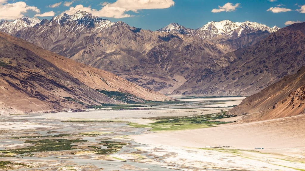
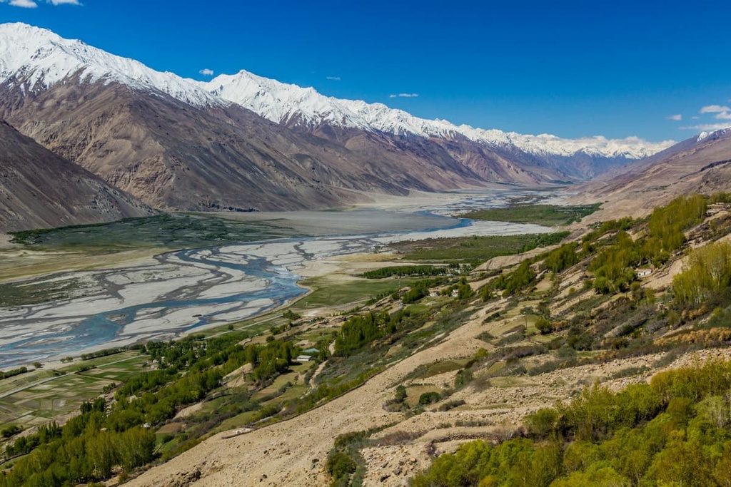
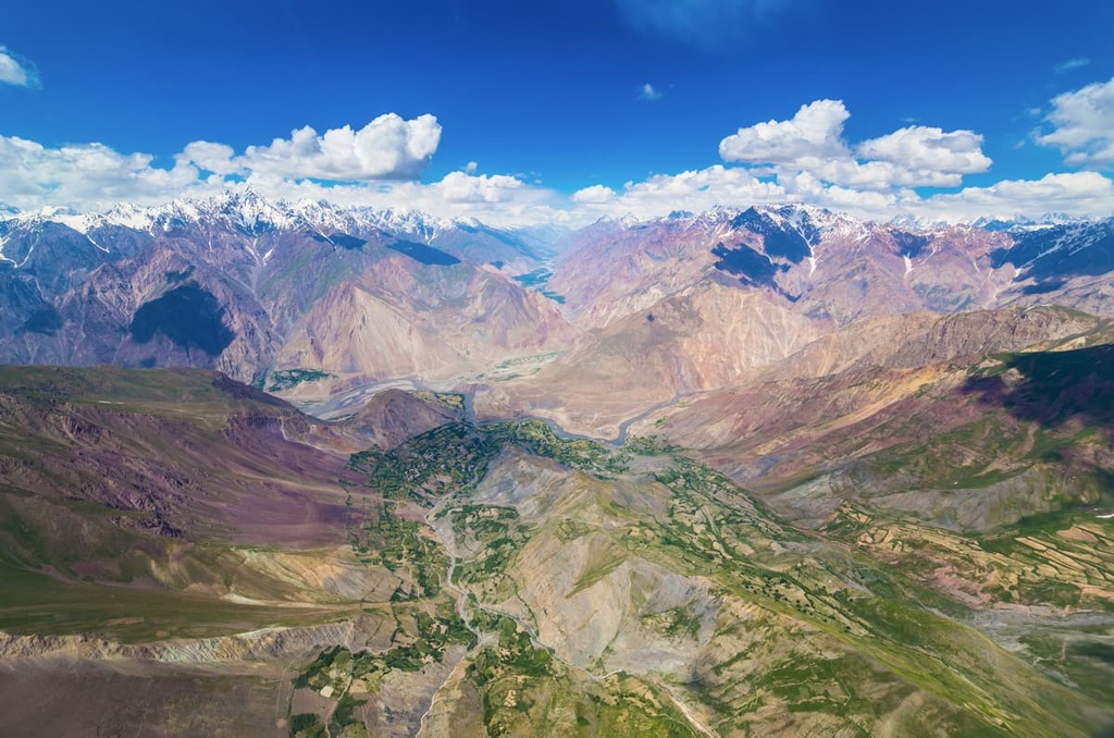
In the south of Pamir lies the Wakhan Range, stretching its mountains and highlands for 160 km. The altitude reaches 5,000-6,200 m. In Afghanistan, the spurs of the Southern Pamir are located in the Badakhshan province. Between Tajikistan and Afghanistan, there is the Wakhan Corridor, a narrow flat valley surrounded by high ridges. This corridor runs along the Wakhan and Panj rivers, it is more than 200 km long and less than 20 km wide in the narrowest part. By the way, the Pakistani border areas with Wakhan are marked on Indian maps as territories occupied by Pakistan. The terrain here is very picturesque.
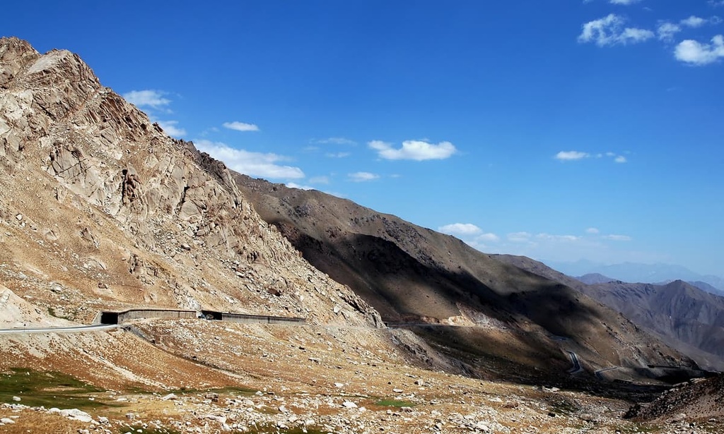
The mountain passes in Afghanistan are the true roads of life.
Afghanistan's high mountains are covered with snow all year round. This is the dream come true for fans of mountain skiing and snowboarding. Likewise, the unspoiled nature of the local highlands attracts hikers and trekkers.
The mountainous province of Bamyan, located in the centre of Afghanistan, on the Great Silk Road, is considered the best place in the country for alpine skiing.
In ancient times it used to be a Buddhist region. Now, thanks to the snow-capped peaks of the Hindu Kush, it is a new Mecca for skiers as it hosts the main ski resort of Bamyan.
This is where the Afghan Ski Challenge championship is held. Competitors have to show their strength and endurance not only on the downhill but also on the uphill. Due to harsh life conditions, local athletes train daily while climbing the mountains, so visitors to the country have not yet had the chance to win them over.
In addition, Bamyan is considered to be a fairly peaceful and safe place in Afghanistan, compared to other parts of the country.
Freeriders have an opportunity to do off-piste skiing. It is highly advisable to challenge the off-the-beaten-track routes only with a mountain guide. Local guides are well acquainted with places of potential danger and choose interesting and at the same time more comfortable and safe routes.
Despite many years of active wars, Afghanistan is making a good effort towards saving the heritage of the ancient world civilizations. The government is also establishing natural reserves to preserve the natural beauties and cultural sites amidst the chaos going on in the country.
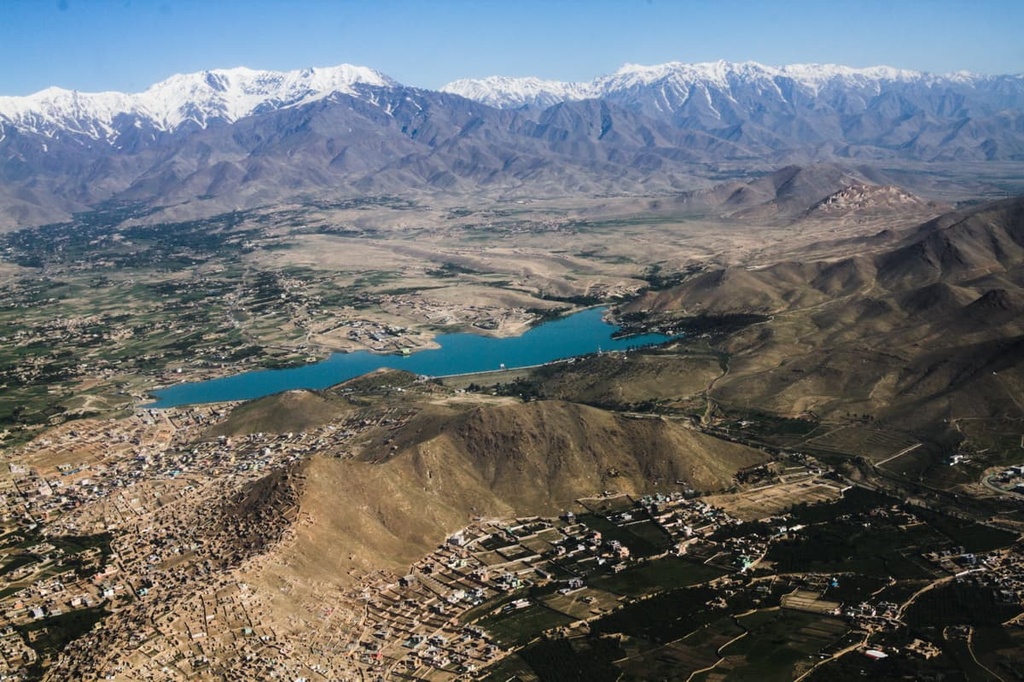
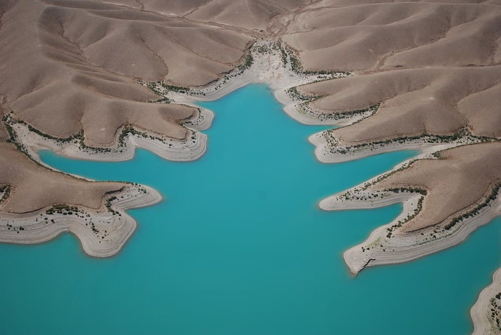
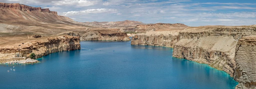
The country's first national park is Bande Amir. Here there is a series of lakes surrounded by mountain ranges. The amazing colour of the water varies from bright blue to deep almost inky blue. The lakes look especially beautiful against the background of white rocks that have some pinkish hues. The lakes of Bande Amir are included in the UNESCO World Heritage Sites list, as well as in the list of the most beautiful coloured lakes in the world. Due to the unstable situation in Afghanistan, the creation of the national park was delayed for several decades. Still, in 2009, Bande Amir National Park was finally launched in operation
There are other specially protected natural areas in Afghanistan:
The most famous landmark of Afghanistan, but unfortunately not preserved to this day, used to be the two giant statues of Buddha. The images of the deity were 55m and 37m long. They were built directly on the surface of the mountain in the 6th century by craftsmen who used elements of Indian Gandhara art in their creation. The sculptures were located very close to the Bamyan Valley which is considered the most convenient passage through the Hindu Kush mountains, about 200 km to the northwest of Kabul city.
They were a symbol of the glory and prosperity of Afghanistan. No matter what wars took place in these places, the statues remained intact. However, in 2001, the Taliban declared that people should not worship idols. And the Buddhist statues were destroyed.

Mullah Dadullah is believed to be the main person responsible for the Taliban's destruction of the statues in 2001. The destruction took place after a decree by Taliban leader Mullah Mohammad Omar dated February 26, 2001: "God is one, and these statues are put up for worship, which is wrong. They must be destroyed so that they will not be the object of worship now or in the future”.

Then a wave of condemnation for such a vandlic act swept through the world. And yet UNESCO does not plan to restore them, citing the fact that this very costly project would not have the same historical meaning as the original statues had.
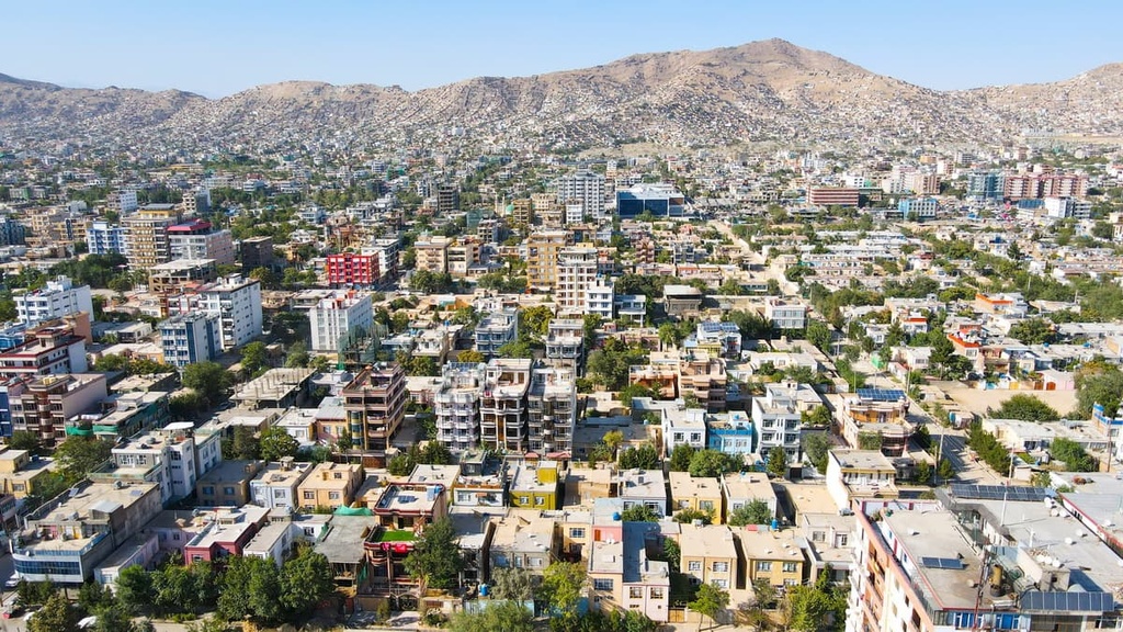
Kabul is a very ancient city, nestled among the Shir Darwaza and Asmai Mountain Ranges, in the oasis of the Kabul River. It is one of the highest altitude capitals in the world. It is located at an altitude of 1,850m a.s.l.
Kabul was first mentioned in ancient sources at the beginning of the 2nd century AD. Before Islam came to the country, Kabul was the centre of Hinduism, Buddhism and Zoroastrianism. This is what scientists say referring to archaeological finds. There are legends about the origin of the city name. According to one of them, a padishah was riding his horse when suddenly it stopped at the lake blocking his way. In the middle of the lake, there was a mysterious island. From there came the sounds of beautiful music. The music enchanted the padishah. So, he ordered to prepare the crossing. They brought straw from all the nearby villages and poured it into the lake, laying a layer of earth on top. When the crossing was ready, the padishah went to the island. He liked the place so much that he decided to found a town here and named it Kapul, which means "Straw Bridge". Later, the name was changed to Kabul. The remnants of the former lake have been preserved and are situated in the outskirts of the city.
It used to be a picturesque and interesting capital, but multiple wars have destroyed its former beauty. Nowadays, there are only 10-metre-long fences, checkpoints at every turn, littered terrain, and polluted river waters. There are practically no old buildings in the city, but rather mazes of different slums. The city is gradually being rebuilt, but without a clear plan. There are practically no tall buildings here.
And yet it is here that the greatest number of interesting objects in Afghanistan are located.
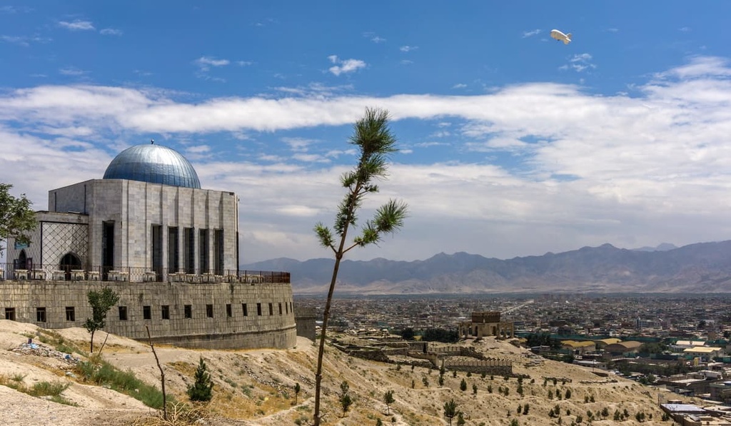
Kabul Zoo welcomes visitors from early morning until six in the evening. You can visit the Babur Gardens surrounding the Tomb of Babur, the founder of the Mughal Empire (early 16th to mid-18th century). During his reign, the city of Kabul reached its peak of prosperity.
Other popular attractions are the Dar-ul-Aman Palace, the National Museum, and the National Gallery.
The National Museum was established in 1919 at the Bagh-i-Bala palace; it has been the Louvre partner since the times of the first excavations of the Delegation Archeologique Francaise en Afghanistan (DAFA) in 1922. The local visitors pay 20 Afs for entrance and 40Afs for photos, but the foreigners will pay 100 and 200 Afs respectively (approximately $2.5 and $5) on all days except Friday 8am to noon, then the entrance is free. The museum is closed Thursday,
The National Museum and the National Gallery were once severely damaged by the Taliban, who looted most of the museum's exhibits and destroyed some of the paintings. Both the museum and the gallery have reopened their doors to visitors after the restoration.
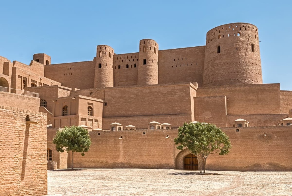
Should you wish to get closer to nature, visit the Paghman Gardens, Lake Karg, the ancient fortress of Bala Hissar, which was built about 1500 years ago. It was this fortress that the rulers of Afghanistan used for centuries as a safe haven. During the Anglo-Afghan war in the 19th century, many of Bala Hissar’s structures were destroyed. Nowadays the fortress houses the Afghan military.
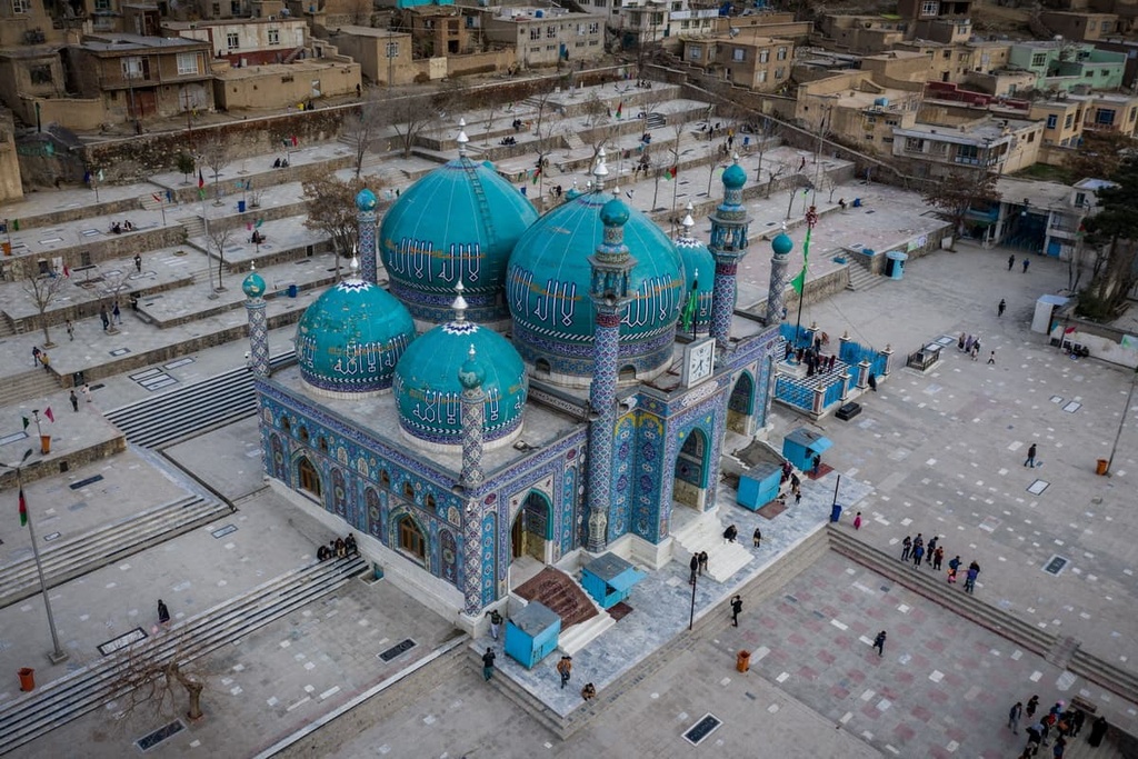
There are several mosques in the city. The most famous of them are Masdjidi-Shahi-do-Shamshira and Pul-e-Khishti mosques.
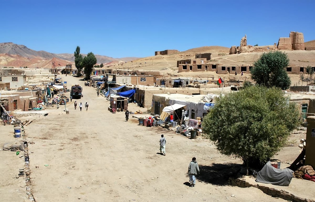
Herat (Harat) is the third largest city of Afghanistan with the population of over half a million people (as of 2020). Herat and the province of the same name is settled in western part of the country, in the valley of the Hari Rud River, south of the Paropamisus Mountains. It is not as high in the mountains as Kabul; it is just 925m a.s.l. Herat is situated on the Silk Road between the Middle East, Central and South Asia. Its historic Persian influences has given it the nickname as Afghanistan's Little Iran. Now it serves as a regional hub in the country’s west.
There are many sights and monuments to see here as well. Alexander's Citadel, built back in the days when this area was conquered by Alexander the Great, has a museum inside.
The ancient Musalla Complex includes six mosques, a minaret, and a mausoleum. There are also underground hammams.
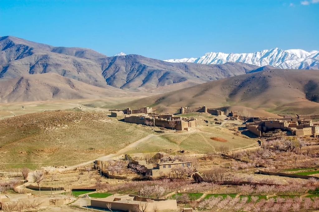
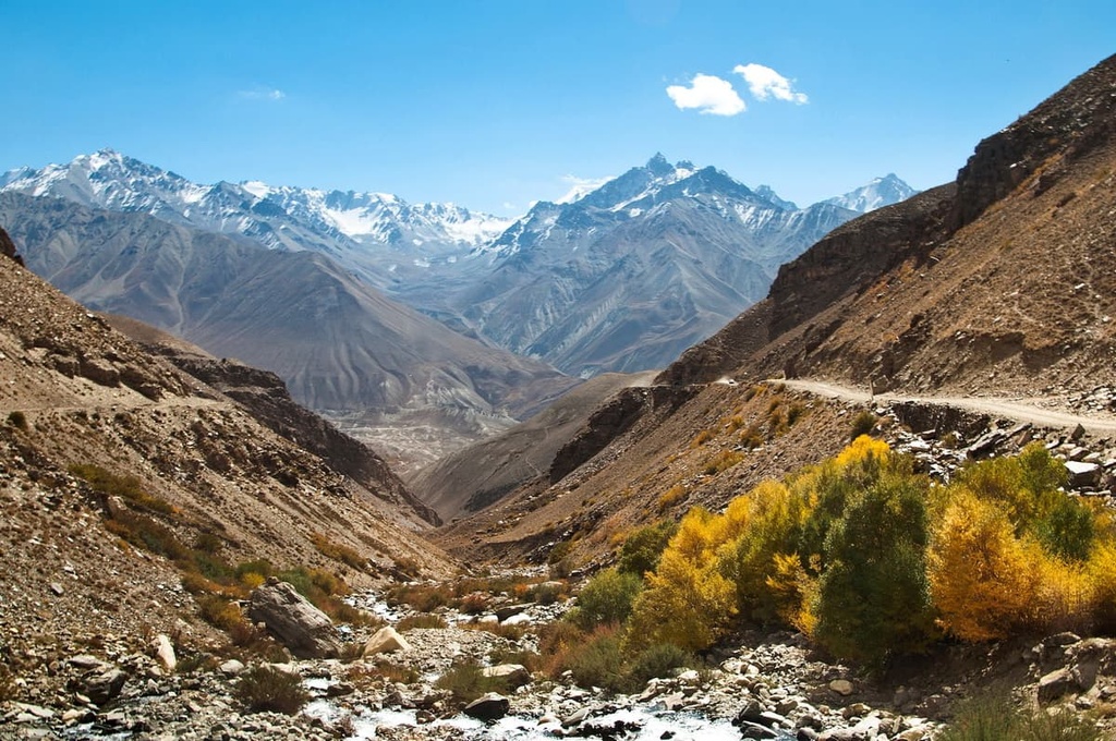
The road from Herat Province to Bala Morgab offers fabulous scenery.
Mountain scenery on the road from Herat to Bala Morgab

Ghor province neighbours Bamyan province to the east, Helmand to the south, Herat to the west, and Faryab to the north.
One of the key attractions is the Djama Minaret. It is located about 10 km from the village of Djam in an impassable gorge. Its height is 60 metres. It is the second highest minaret after the Qutb Minar in India. It is a UNESCO World Heritage Site and an outstanding example of ancient Islamic architecture.
The best way to get to Afghanistan is by air (for safety reasons).
There are four active international airports: Hamid Karzai in Kabul, Kandahar, Mazar-e-Sharif, Herat. Flights fly to Afghanistan from the UAE and Turkey.
There are also overland crossings, but they might prove to be quite difficult to use. One of the most convenient overland ways to enter the country is from Tajikistan.
You can get from Kabul to the major cities of Afghanistan by plane or bus. Other settlements are reached by buses, cabs and minibuses. You should bear in mind that the road between Kandahar and Kabul takes 6 hours and is quite dangerous. Therefore, it is better to travel it during the time when it is being patrolled.
Passenger railway service is virtually non-existent. However, there are three railway lines in the north of the country. The first is between Mazar-i-Sharif and the border town of Hairatan in Balkh province, which then connects with Uzbek Railways of Uzbekistan (opened 2011). The second links Torghundi in Herat province with Turkmen Railways of Turkmenistan (opened 1960). The third is between Turkmenistan and Aqina in Faryab province of Afghanistan (opened in 2016), which extends south to the city of Andkhoy. А new rail link from Herat to Khaf in Iran for both cargo and passengers was recently completed.
When travelling in the country, it is important to be vigilant and take care of your safety.
In the mountains, beware of the poisonous spiders, scorpions and snakes. Watch where you step or sit as you move along the trail. And always check your shoes in the morning before slipping them on.
There are many mines in the country, as well as ammunition. In this regard, it is advisable not to touch suspicious objects and even stones. For excursions and mountain climbing, it is best to take a local guide who knows the safe routes.
In the cities, there are a lot of flies because of poor sanitation. Toilets of the western type can rarely be found here. You need to be prepared for this.
The quality of water leaves much to be desired. It is advisable to buy bottled water, and bring the most necessary medicines with you.
Women are advised to pay attention to their appearance before they go out. It is advisable to cover the head with a scarf (in rural regions it is also highly recommended to cover your face as well), wear skirts below the knee (preferably go for maxi length), and cover the exposed parts of the body with clothing. This will avoid the disapproving looks of the locals and show your respect for the local culture.
Despite so many peculiarities of staying in the country, Afghanistan is slowly beginning to recover from the years-long hostilities. It has always been tricky to travel to Afghanistan, but the country is opening up and welcoming more and more tourists who want to visit this country and get acquainted with local attractions, culture, historical monuments and nature of the indescribable beauty.
Let us know about your adventures in Afghanistan at