
Scan the QR code and open PeakVisor on your phone
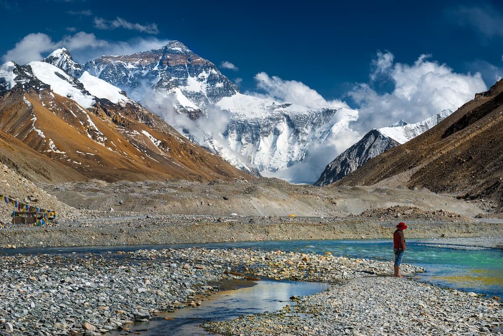
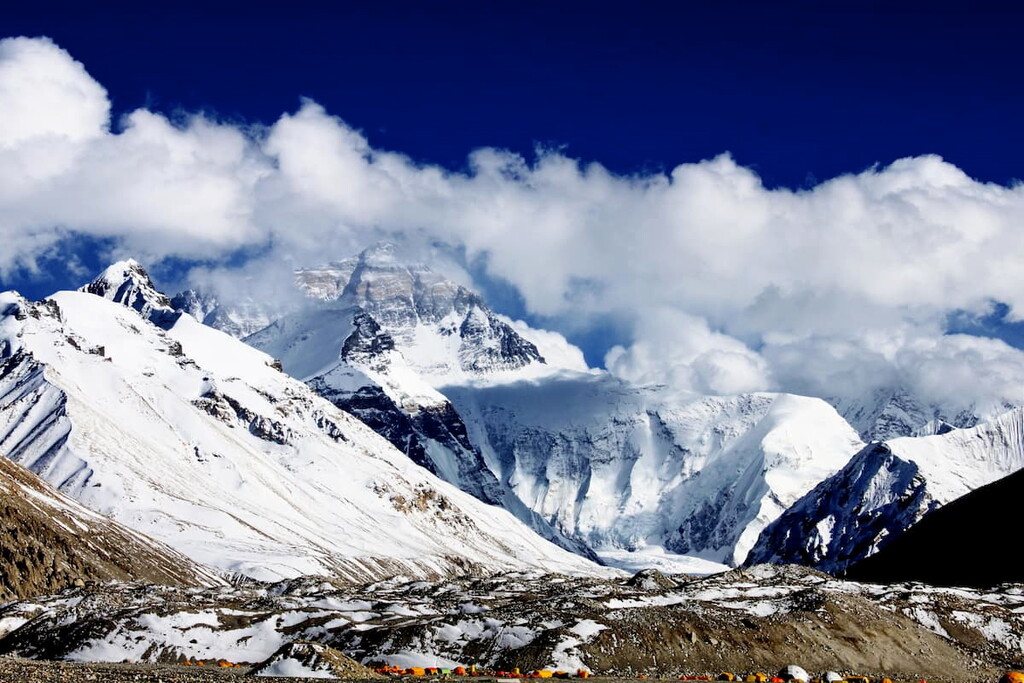
Located in east-central Asia, the Tibet Autonomous Region is a large, high-elevation region known for its stunning mountain landscapes and rich cultural heritage. Tibet contains 1121 named mountains, the highest and most prominent peak in the region is Mount Everest (Chomolungma), the world’s highest peak at 8,848 m (29,032 ft) in elevation.
The region of Tibet (officially the Tibet Autonomous Region/Poi Ranggyong Jong) is situated on the Tibetan Plateau, east of the Central China plain. Sitting on the western edge of China, Tibet is sometimes referred to as being part of both eastern and central Asia.
The Tibet Autonomous Region is bordered to the north and east by the provinces and autonomous regions of Sichuan, Qinghai, and Xinjiang, and to the southeast by Yunnan Province. It is also located to the north of Nepal, Bhutan, Myanmar, and India, though China does also claim parts of the Indian state of Arunachal Pradesh as part of Tibet and the border with the union territory of Ladakh is also a matter of some international dispute.
Tibet is home to some of the tallest peaks in the world. Located on the region’s border with Nepal lies Mount Everest, the tallest mountain on the planet. Several other mountains in the region make the list for the tallest 10 peaks in the world, including Makalu, Lhotse, Cho Oyu, and Shishapangma.
Due to the fact that Tibet’s borders are disputed, determining a precise area and size for the land called Tibet is difficult. However, the Tibet Autonomous Region, which is claimed by China, has a total area of 1,228,400 square kilometers (474,300 square miles), making it the second largest administrative subdivision in China after Xinjiang and before Inner Mongolia.
That being said, Tibet is a sparsely populated area with an average population density of just 3 people per kilometer (7.7 per square mile), ranking it second to last in terms of population density in China’s administrative subdivisions.
Average elevations in Tibet sit at around 4,572 m (15,000 ft), though they also extend up to the summit of Mount Everest. Geographically, Tibet can be divided into two distinct regions: the lakes region in the west and the river region, which almost completely surrounds the lakes region on three sides.
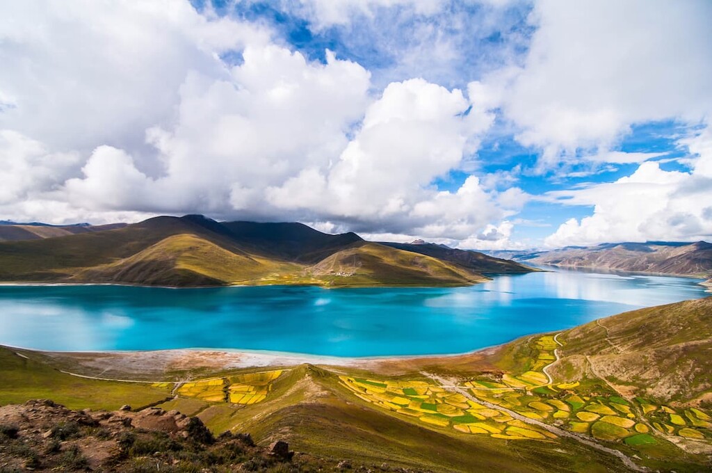
The “Lakes Region” of Tibet spans from Pangong Tso Lake located in Ladakh, near the source of the Indus River, to the sources of the Salween, Yangtze, and Mekong rivers. Other lakes located on the western edge of the region include Lake Rakshastal, Lake Manasarovar, and Yamdrok Lake.
Despite its name, the Lakes Region is actually characterized as an arid and windswept desert. This landscape is also referred to as the Changtang as well as the Northern Plateau by the Tibetan people.
The Lakes Region has a total area that’s roughly equal to that of France and it spans a distance of about 1100 km (700 mi), and the high mountains that surround it to the west and south have led the plateau to develop an arid alpine climate. Indeed, annual precipitation in the region totals just 100 millimeters (4 inches). The high mountain ranges are separated by plateaus almost completely free of plant or animal life.
Both freshwater and saltwater lakes can be found throughout the region with a vast majority of them containing no river outlet. Amidst the many lakes also lie a plethora of hot springs. While the hot springs can be found throughout the region, the highest concentration of them lies west of Tengri Nor.
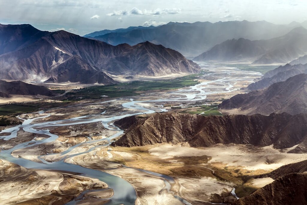
The “River Region” of Tibet is far more fertile than the Lakes Region. Mountain valleys are scattered throughout the region including the valley of the Yarlung Tsangpo River. The major tributaries to the Yarlung Tsangpo, including Nyang, Mekong, Yangtze, Yellow, and Salween rivers, also run throughout this region.
Besides fertile mountain valleys, the River Region is also home to the deep valleys carved out by these iconic rivers. The Yarlung Tsangpo Canyon, along the Yarlung Tsangpo River, is not only the deepest canyon in Tibet, but also one of the deepest canyons in the entire world. The canyon is also thought to be one of the longest canyons in the world.
Fertile valleys in the region include those of Lhasa, Shigatse, Brahmaputra, and Gyantse. Within the river region lies the South Tibet Valley, which was formed by the Yarlung Zangbo River and spans 1200 km (746 miles) in length and 300 km (186 miles) in width.
There are very few protected areas in the Tibet Autonomous Region. Due to the remote nature of much of the landscape and regional travel restrictions, much of the Tibetan plateau receives very few visitors. Some of the few protected areas in the region include:
The Tibetan Plateau has been referred to as the “Roof of the World” as it is one of the world’s largest high-elevation plateaus. In fact, elevations in the plateau often exceed 5,000m (16,400 ft).
The plateau was formed by the collision of numerous continental fragments during the Paleozoic and Mesozoic eras. The uplift of the plateau was caused by these continental fragments being thrust into the Eurasian plate. The continental crust of the plateau is thought to be around 65 km thick, when other parts of the world average only 30 km (18.6 mi) thick.
Furthermore, the geological history of the region is closely intertwined with that of the Himalaya. The Himalaya is a relatively young mountain range and it consists predominantly of sedimentary and metamorphic rocks.
The collision of the Indo-Australian Plate with the Eurasian Plate resulted in the formation of the tallest peaks in the world. To this day, the Indian plate is being driven into the Eurasian plate around the location of the Tibetan Plateau.
This continual motion has resulted in the high elevations of the plateau and the immense thickness of the continental crust. Both the plateau and the Himalaya are still rising to this day at a rate of about 5 mm (0.2 in) per year.
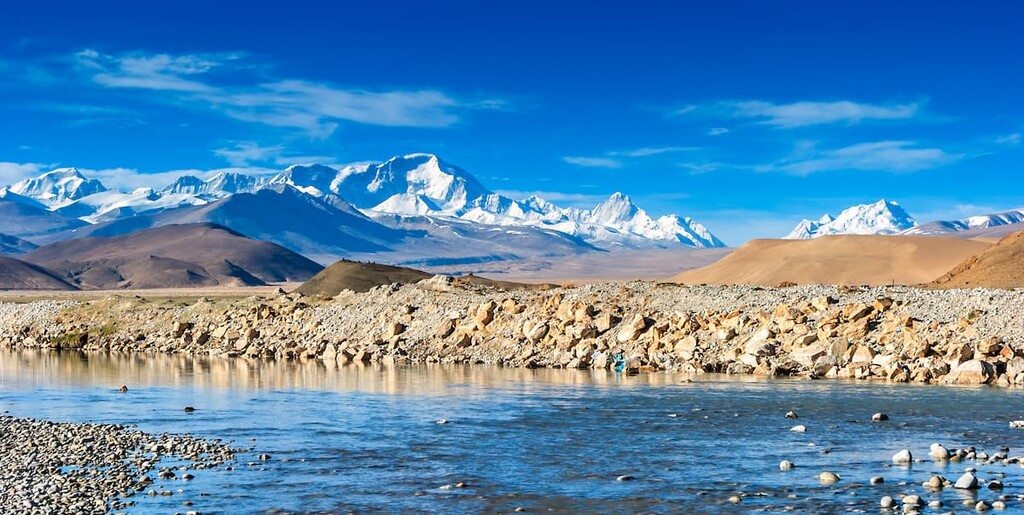
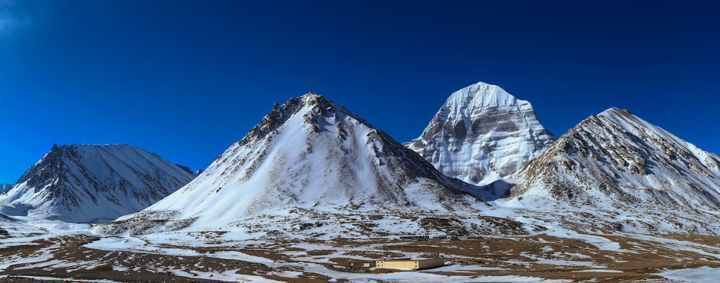
There are four major mountain ranges found throughout Tibet. From north to south these ranges include the Kunlun Mountains, Karakoram Range-Tanggula Mountains, Nyenchen Tanglha Mountains, and the Himalaya.
Major peaks in Tibet include Mount Everest, Lhotse, Namcha Barwa, Cho Oyu, Shishapangma, and Makalu.
The Tibetan Plateau is home to a wide variety of plant and animal life, specially in the river region. Over 5,000 species of plants can be found throughout the region despite the high elevations and harsh weather typical of parts of Tibet.
Common plants in the lower elevation regions of Tibet include the giant cypress, picea smithiana, Asiatic longleaf pine, Cyathcaceae, ferns and the mulberry. One of the most well-known plants in all of Tibet is a cypress tree in the Nyingchi Area called the King Cypress. This tree is over 2,500 years old and is a sacred tree to the people of Tibet. The largest forested sections are found in the southeastern region of Tibet.
Wildlife in Tibet varies wildly based on location and elevation. Some of the most well-known species include the yak, Tibetan antelope, Tibetan mastiff, kiang, golden monkey, snow leopard, gazelle, red deer, brown bear, Bengal tiger, among various wild birds.
Some of the most endangered species within Tibet include the Tibetan antelope, Tibetan yak, Bharals, and snow leopards.
The Tibetan antelope, or chiru, is endemic to the region and inhabits regions ranging from 3700 to 5500 meters (12,140 to 18,045 ft) in elevation. However, it is at risk of becoming even more endangered than it currently is due to illegal poaching.
In fact, the chiru is known for its fantastically soft underfur, which is used to make shahtoosh, one of the softest and most expensive wools on the planet. However, shahtoosh imports are illegal in many countries in order to protect the chiru.
Additionally, Bharals, also known as the Himalayn blue sheep, are found primarily in the northern region of Tibet, within the Kunlun Mountains. The Tibetan wild ass (kiang) is also often found in the northern region of the Tibetan Plateau.
It is estimated that the Tibetan Plateau has been inhabited for around 30,000 to 40,000 years. Around 3,000 years ago, Neolithic peoples immigrated to the area from what is now northern China.
By the sixth century CE, the Tibetan Plateau was home to various different kingdoms which formed a unified state around the seventh century. In 763 CE, the powerful kingdom captured the capital of China, Changan.
Prior to Buddhism, the predominant religion of the kingdom was Bon. Later, in the eight century, Buddhism was introduced and the first monastery was built in 779 CE. Afterward, Buddhists were heavily persecuted, the Tibetan region split up into warring states.
During the thirteenth century, the powerful Mongols from what is now Mongolia, conquered Tibet and made Sakya Lama the temporal ruler of Tibet. Sakya Lama also acted as a spiritual advisor to the Mongol Emperor of China. After further rebelling, Tibet became a secular state.
After a civil war in Tibet, the Buddhist leader of the yellow sect was given the title of the Dalai Lama. In the seventeenth century, the Mongols again entered the region and made the Dalai Lama the spiritual leader of Tibet.
From the eighteenth to twentieth century, Tibet isolated itself from much of the world until it was invaded by the British. During this time the Dalai Lama fled to Mongolia while the Chinese feared that they, too, would fall under British rule. Later, when the Chinese occupied Tibet, the Dalai Lama with (later thousands of other Tibetans) fled to India, where they formed the largest and the most important commune outside Tibet, also known as "Little Lhasa".
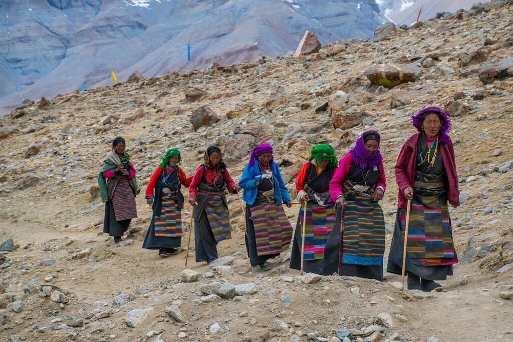
Under Chinese control, Tibet became an autonomous region in 1965. Today the Dalai Lama still lives in India and the region is administered by China. Pastoral nomads still make up around 40% of the population of Tibet while many local communities raise livestock and harvest crops.
These days, travel to Tibet is highly restricted. As of the time of writing, only citizens of China (including Hong Kong) can enter the region without a visa. However, non-Chinese travelers must obtain a visa and must pre-arrange a tour to be able to enter the autonomous region.
Therefore, if you’re interested in visiting Tibet, be sure to plan your travels well ahead of time and recognize that independent travel to the region is not possible for international visitors. Given the difficult accessibility of the main Tibet on both the geographical and political maps of the world, a trip to Tibet in India might be a good alternative.
I asked Ivan Kuznetsov, an outdoor writer from the Dolomites, Italy, and Karelia, Finland, to tell more about "Little Lhasa". He spent September 2016 there.
"When I traveled to India at the beginning of autumn, I decided to start my journey by the Indian Himalayan Region to avoid the heat, to live in the mountains and hike through them. But unexpectedly, I found myself in two countries at once: India and Tibet, which is difficult to get to, and also partly in Nepal, because its presence is also strongly felt in the north of India.
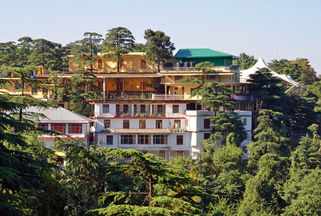
We are talking about the small high mountain town of McLeod Ganj, which is a suburb of the larger Dharamshala, the capital of the Kangra district in the Himachal Pradesh region, which is located at an altitude of 2,082 m (6,831 ft). Here lives the largest Tibetan community outside Tibet itself, numbering between 80,000 and 100,000 people. They have moved here gradually over the past 63 years since Tenzin Gyatso, the 14th Dalai Lama, came here. The site wasn’t chosen by chance: This former British colonial summer picnic town had longstanding ties to Tibet.
In McLeod Ganj, the Dalai Lama founded the Central Tibetan Administration, also known as the Tibetan Government-in-Exile. This is also where the Dalai Lama’s residence called Tsuglagkhang Complex is located. It includes a series of objects: his private residence, where the Dalai Lama lives actually; Namgyal Monastery also known as Dalai Lama Temple, where services and teachings are held; the Tibet Museum; the Library of Tibetan Works and Archives of a huge number of literary works and arts; Buddhist stupas; cafes, and others. For this reason, McLeod is called “Little Lhasa,” and the U.S. government has even recognized it as true Tibet.
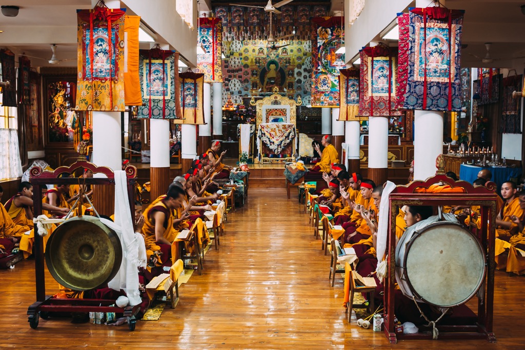
At the end of September, in the last days before I left for McLeod Ganj, I was able to attend a large, multi-hour service at the temple, which seemed to be attended by the entire Buddhist population of the city. Buddhists sat everywhere and prayed and then took several laps around the temple to roll the drums. Anyone could attend the ceremony.
However, I spent the rest of the month at Thosamling Nunnery, Institute and Retreat Center in the village of Sidhpur, another suburb of Dharamshala, 15 km (9.3 mi) from McLeod down in the plain. It is also home to a large community of Tibetans, to whose prayers I awoke each morning, due to the presence of another important center for Buddhism in the area, the Norbulingka Institute, named after the Dalai Lama’s summer residence of the same name in the original Lhasa, Tibet. Its main purpose is to promote Tibetan arts and culture, through various courses and activities.
Of my impressions of life in "Little Lhasa" I can briefly say this: the Thosamling Institute located in the middle of the rice fields was for me an island of tranquility in dirty and noisy India for a man from Europe. It was my first trip to India and Asia in general.
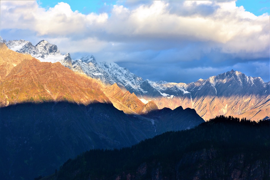
I was also saved by the magnificent views of the snow-capped peaks of the Dhauladhar Range (that’s how the name translates: The White Range) of the Middle Himalayas, which you can get from everywhere: Karan Khal (4,550 m / 14,927 ft), Mun Peak (4,650 m / 15,255 ft), Dhauladhar Matter Horn (4,799 m / 15,744 ft), Dhaula Trishul (4,982 m / 16,345 ft), and Talang Jot (4,759 m / 15,613 ft).
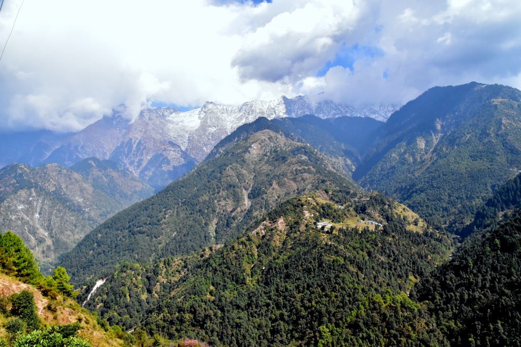
The mountain range reaches a height of 5,883 m (19,301 ft) at the highest peak Hanuman Tibba between the towns of Manali and Solang. However, the most famous mountain and nearby McLeod Ganj is low by Himalayan standards Triund Hill (3,271 m / 10,554 ft). It is the most popular two-day, overnight camping trail on the hill. The short route stretches over two days because of the weather: at least during the summer tourist season in the McLeod Ganj area, clear skies (and mountain peaks) can only be seen for a couple of hours a day at about 6 am, then it gets covered with clouds until evening but more often the next morning. And again, and again...
Another popular hike is to Bangsu Waterfalls, which can be made in one day in 4–5 hours to and back. But I did not like it: the trail as well as the low waterfalls themselves are not something unusual for those who often hike in the Himalayas, Asia, Europe, or the US. In addition, there are always many other hikers at the waterfalls.
The McLeod Ganj is also considered one of the best places in the Indian Himalayas for birdwatching. There is an eponymous Dhauladhar Wildlife Sanctuary nature park, home to many species of birds and other animals. The park is also traversed by a popular trail of the same name.
At the end, a bit of practical information for those who are also going on a trip here: Mcleod Ganj is 485 km (mi) from Delhi. It takes about 10-11 hours to reach it by night bus. I recommend buying a morning bus ticket from the state-run Himachal Road Transport Corporation (HRTC) instead of the tourist bus which runs all night and is even more tiring. There are also two rail lines to Kangra and Nagrota, and the Kangra Airport is about 20 km (12.4 mi) and 15 km (9.3 mi) from Dharamshala, respectively.”
Tibet is home to some of the most high altitude hikes and treks in the world. Here are some of the most popular places to check out in the region:
Located in the very east of Tibet lies the Yubeng to Glacier Lake trail. This route totals 11 km (6.9 miles) in length with 807 m (2647 ft) of elevation gain. The trail winds through the forest up a rocky and steep climb getting above the treeline. The alpine lake sits in a deep basin as Kawagarbo and other peaks tower steeply around the lake.
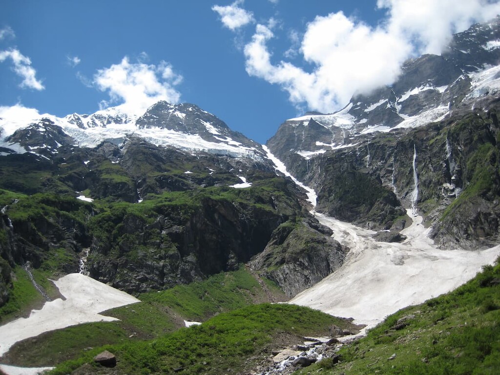
The Ninong to Yubeng trail is 14.5 km (9 miles) long with 619 m (2,030 ft) of elevation gain, one way. This well-traveled trail winds through the valley with the river flowing below. Steep and rocky cliffs tower on either side mark the beginning of the route. The top of the trail, near Yubeng, is far more remote, offering panoramic views of the valley and river below.
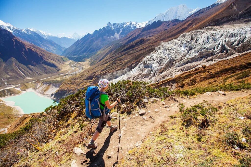
There are numerous guided treks throughout Tibet, with most exploring the Himalaya and the surrounding peaks. Tibet is home to some of the highest elevation treks in the world, including one that leads to Advanced Everest Base Camp on the northern side of the mountain.
Other popular routes include the Gyama Valley Trek, Tsurphu to Yangpachen Trek, Mount Shishapangma Base Camp Trek, and the Gandem to Samye Trek.
All of these treks are led by trained professionals, often along with local guides and porters. Though extremely strenuous, these multi-day treks allow visitors to travel to ancient monasteries and experience the local culture through homestays.
Looking for a place to stay during your visit to Tibet? Here are some of the best cities to check out:
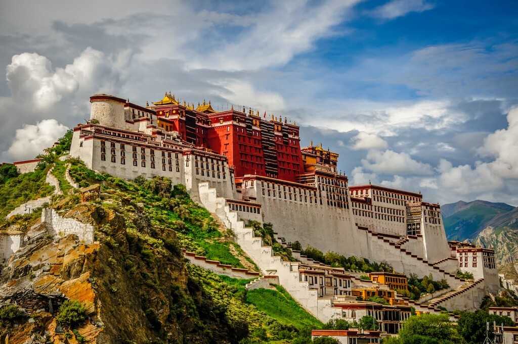
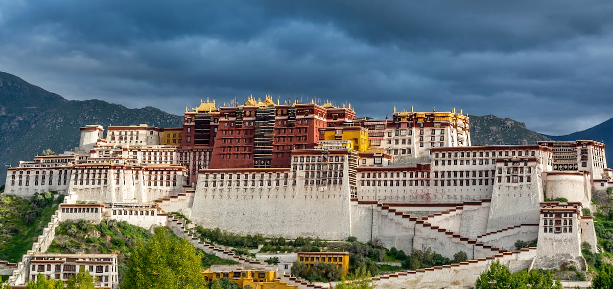
Lhasa, which is translated to mean “Place of Gods,” is the administrative capital for the Tibet Autonomous Region. The city sits at an elevation of 3,656 m (11990 ft), making it one of the highest cities in the entire world.
Lhasa has acted as both the religious and the administrative capital of the region since the seventeenth century and is deeply significant to Tibetan Buddhsit. Today the city is home to around 900,000 people. While the main city is bustling with markets and visitors, the outskirts of the city are home to traditional agricultural practices. The city is connected by the Qinghai-Tibet railway, the tallest railroad in the world.
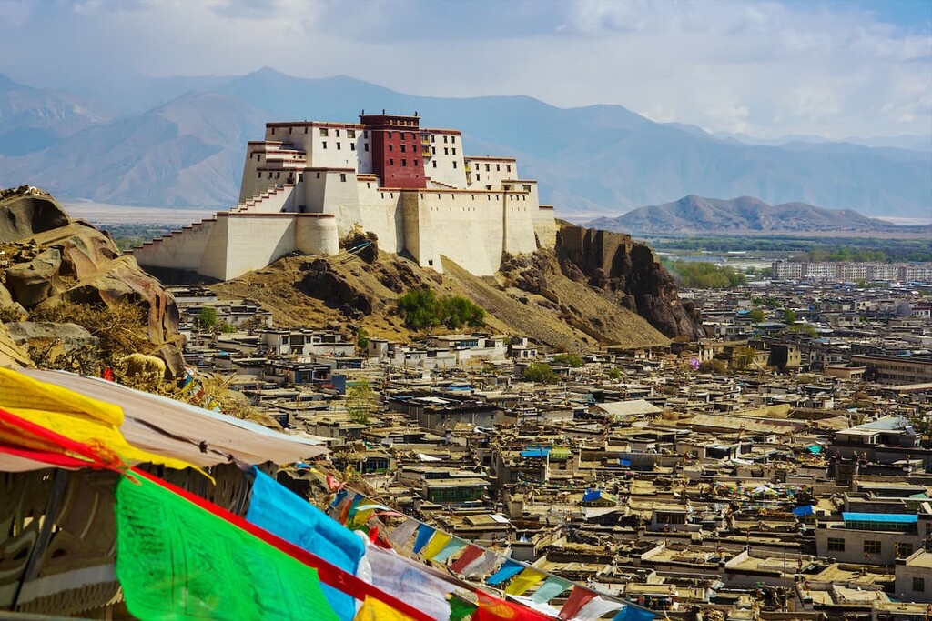
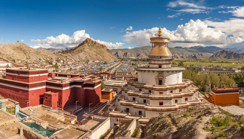
Shigatse is the second most populous city in Tibet and it sits at an elevation of about 3,860 m (12,660 ft). The city lies along the confluence of the Yarlung and Tsangpo rivers. Shigatse is also home to 845,000 people, and, as a result, it acts as a gateway into Nepal and western Tibet.
From Shigatse, visitors have stunning views of Mount Everest towering high above in the distance. Shigatse is home to many landmarks and monuments that hold religious significance. For example,the local Tashilhunpo Monastery was founded in 1447 by the first Dalai Lama and it is still in use to this day.
Located between Lhasa and Shigatse lies Gyantse, a city nestled in the Nyang Chu Valley. This town has a population of around 60,000 and sits on the fertile farming lands of the valley. Today many trekkers pass through the town along the popular trekking route to Shigatse.
Major landmarks in the town include the restored Gyantse Dzong, including its multi-tiered Kumbum. This landmark of the Palcho Monastery was built during the 1400s and still contains over 10,000 religious and cultural murals.


ultra
8000ers
china-ultras
nepal-ultras
ultra
8000ers
china-ultras
nepal-ultras
ultra
8000ers
china-ultras
nepal-ultras
ultra
8000ers
china-ultras
nepal-ultras
ultra
8000ers
china-ultras
nepal-ultras
ultra
8000ers
china-ultras
nepal-ultras


