
Scan the QR code and open PeakVisor on your phone
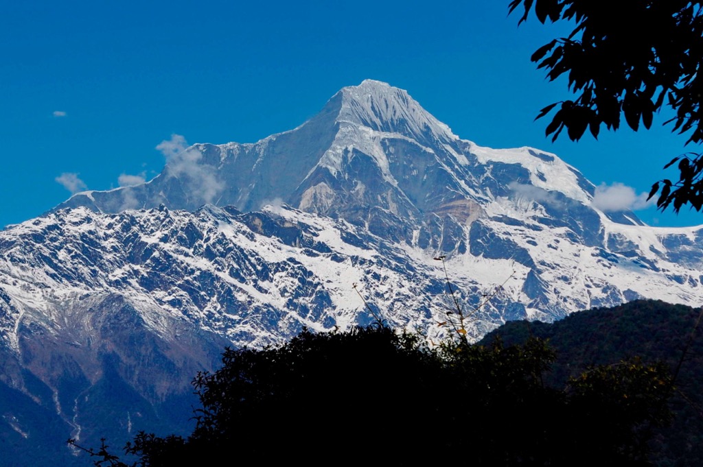
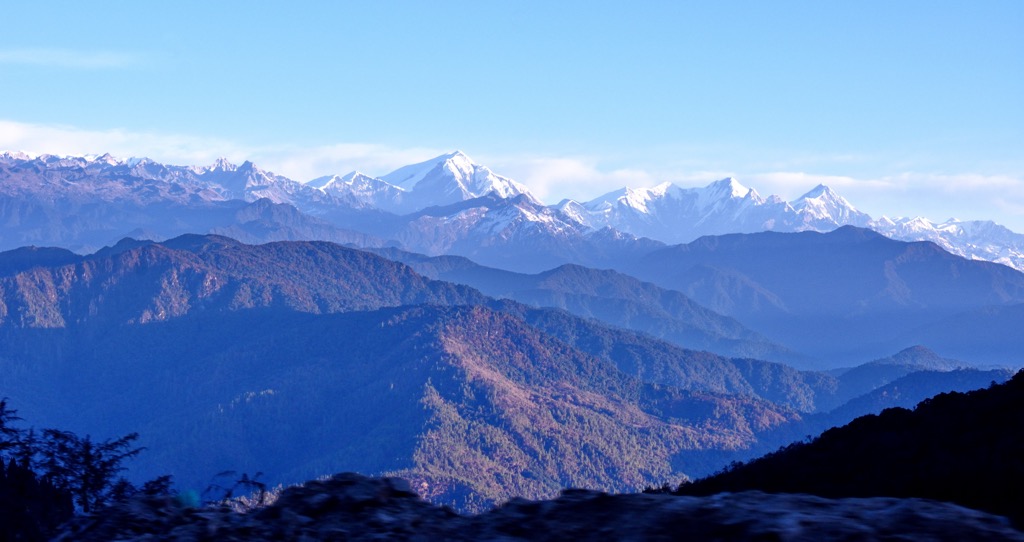
When folks picture India, they imagine a country shaped like a top. Most people are unaware that India’s borders also include another region to the East, a fabled land of icy peaks and lowland rainforest. There are 51 named mountains in the state, according to PeakVisor. In reality, there are far more; however, the vast majority of these are remote, unnamed peaks, many of which are above 5,000 m (16,500 ft) and have likely never seen an ascent. The tallest and most prominent peak is Kangto (7,042 m / 23,104 ft), which has been climbed only once, by a Japanese team in 1981 (exact year varies with different sources).
Arunachal Pradesh is the northernmost state within India’s northeastern outpost and is almost entirely surrounded by Myanmar, Bangladesh, Bhutan, and, significantly, a disputed border with China. With 17 people per square kilometer, Arunachal Pradesh is by far the least populated state in India, where the average population density is 431 people per square kilometer.
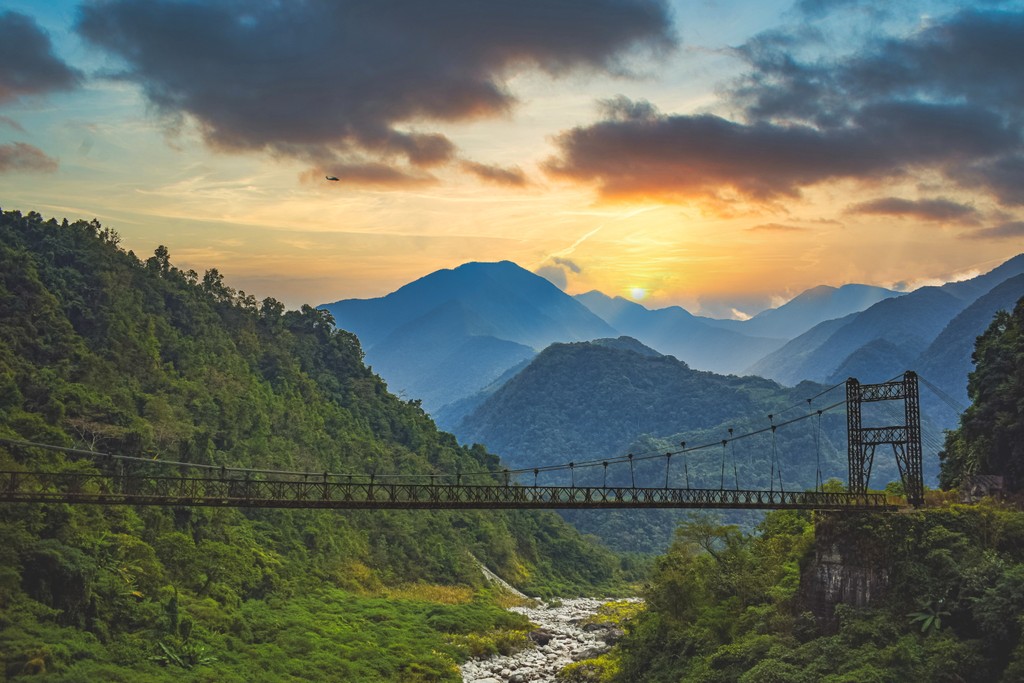
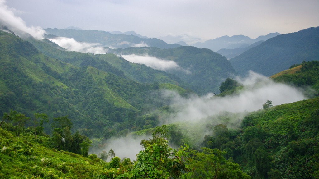
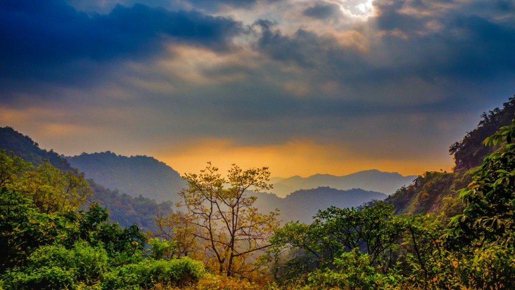
Northern Arunachal Pradesh consists of the Eastern Himalayas. The name “Arunachal Pradesh” translates to “land of the dawn-lit mountains,” apparently the original name for the region in Sanskrit. The eastern exposure offers a fabulous sunrise in parts of the range.
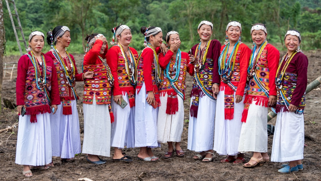
The region is ethnically diverse, with dozens of prominent tribes and over 100 sub-tribes. Rather than the Indo-Aryan ethnic group of northern mainland India and the Han Chinese to the northeast, the inhabitants’ physical appearance is generally that of Tibetan peoples. Spoken languages, of which there are over 100, are mainly Tibetan in origin; the vast majority of residents speak Tani languages, a branch of the Sino-Tibetan language family.
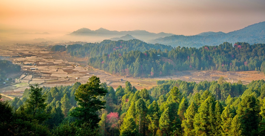
The Arunachal Pradesh state encompasses the Himalayas in the north, with foothills leading to the higher peaks throughout almost the rest of its landscape. A fraction of the state’s southern portion features the flat valley terrain that defines the Brahmaputra river basin to the south.
The East Kameng Valley is characterized by its rugged terrain and the dominance of the great Kangto range to the north. This range effectively blocks any direct access to Tibet from this region.
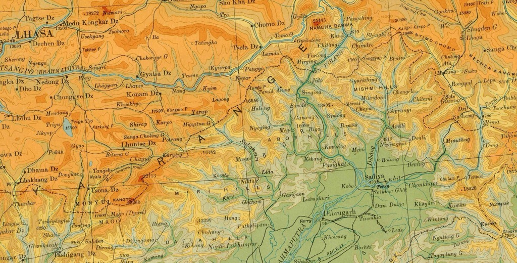
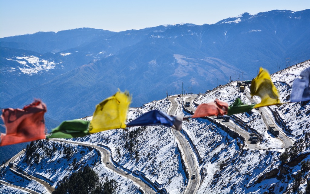
The McMahon Line, the border between Tibet and British India as established in the 1914 Simla Convention, was drawn along the crest of this range. The peaks along the McMahon Line include Gorichen (6488 m / 21,286 ft), Kangto I (7042 m / 23,104 ft), Kangto II (6953 m / 21,630 ft), Chomo I (6878 m / 22,566 ft), Chomo II (6710 m / 22,014 ft ), and Nyegi Kangsang (6983 m / 22,910 ft). This boundary has been a subject of geopolitical significance concerning India's border disputes with China.
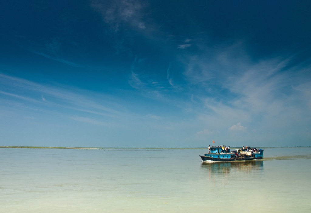
The headwaters of the Brahmaputra, the world’s 9th largest river by discharge, stem from the Arunachal Pradesh. The Brahmaputra reaches its massive discharge level due to the subtropical lowlands' incredible rainfall and the Himalayas' snowpack.
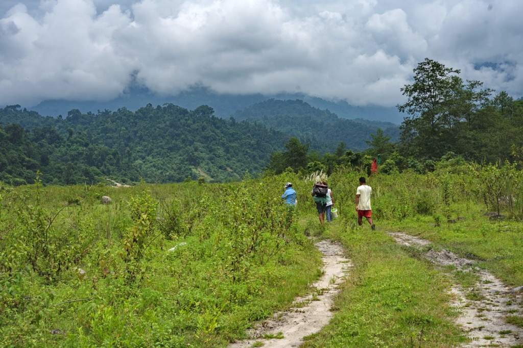
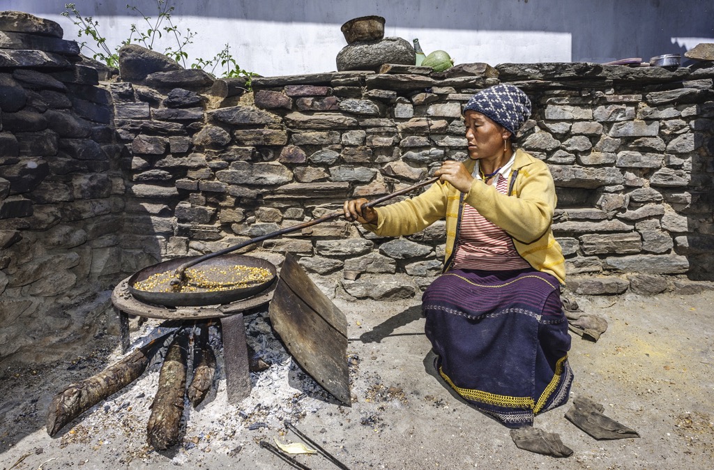
Much of the population lives in the lowlands in southern Arunachal Pradesh, but the foothills farther north are also populated. The high mountain terrain in the north is extremely remote. Throughout the mountain, indigenous tribes have established culturally distinct territories. Like species, these cultures have become ‘endemic,’ often confined to a specific elevation or region. Some of these distinct ethnicities number no more than a few tens of thousands.
Arunachal Pradesh’s capital is Itanagar, a city of about 60,000 in the south, just within the lower foothills of the Himalayas above the Brahmaputra river valley. Like much of India’s countryside, agriculture is the primary driver of the economy at present. However, the state is better positioned for an influx in tourism than other parts of India.
Arunachal Pradesh offers Himalayan mountainscapes, verdant jungles, enormous biodiversity, and a striking cultural experience. The state is gaining a reputation as a wild place as adventure tourism takes off. Better developed infrastructure could eventually facilitate more tourists but also take away from the current, relatively raw tourist experience.
There is some instability within the state government, as well as a border dispute with China. While the risk of outright conflict is low, military presence exists, and there have been flare-ups in tensions.
The Alpide Belt is the product of the collision of the northward-moving African, Arabian, and Indian plates with the Eurasian plate. The orogenic period began about 65 million years ago and continues today, mainly along the boundary of the Indian and Eurasian plates. The Himalayas and the Tibetan plateau, the product of this ongoing collision, are the Alpide Belt’s newest addition.
However, within the context of geologic time, all of the mountains along the Belt are relatively the same age. The Alpide Belt is a defining geologic feature of our age, similar to the way Pangea was about 200-300 years ago.
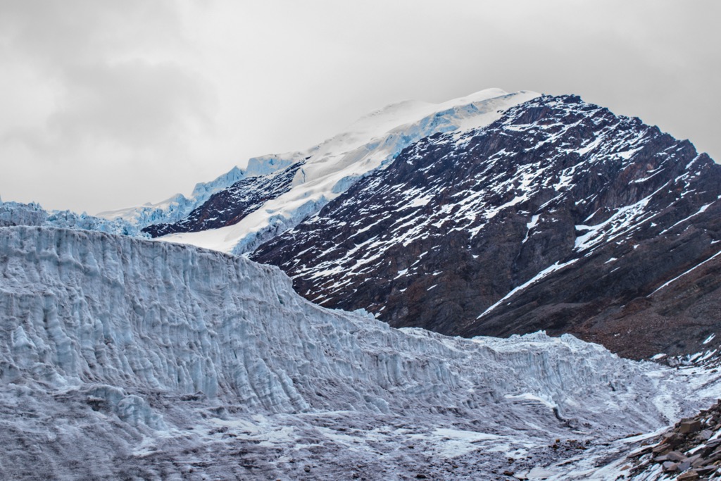
While not as glaciated as the higher parts of the Himalaya Range further west, glaciers have still sizably impacted the Arunachal Pradesh. Over the past two million years, successive ice ages have carved out U-shaped valleys throughout the range, as well as cirques high up in the mountains.
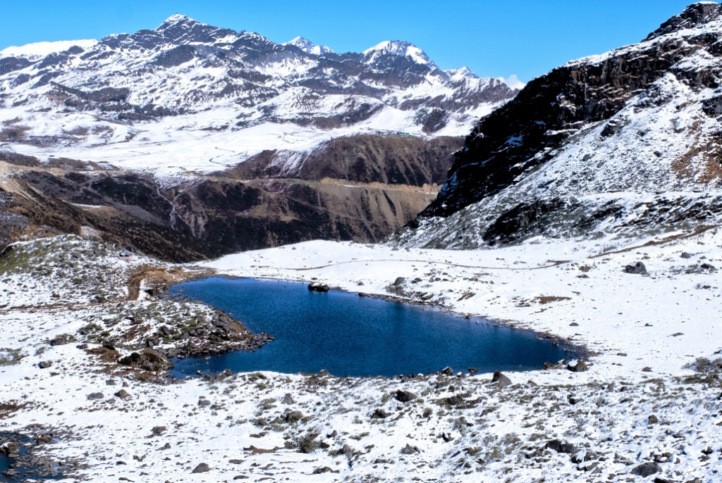
Naturally, some glaciers remain - after all, there are several 6,000+ m peaks in the state. In Arunachal Pradesh specifically, however, glaciers have melted far into the alpine. On the Chinese side of the range, which is the north-facing side, many glaciers still flow into valleys below 5,000 m (16,500 ft). Some of these reach 10 km (6.2 mi) in length. Both sides of the range feature many glacial lakes.
The region has lost about 40% of its ice cap in the last hundred years as temperatures warm, on par with the rest of the Himalayas.
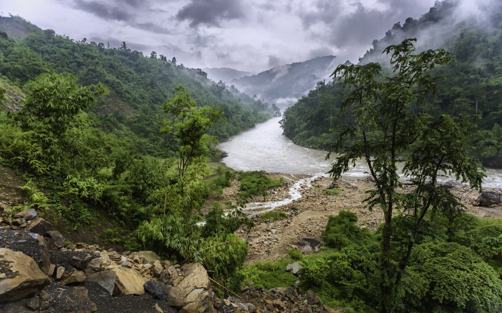
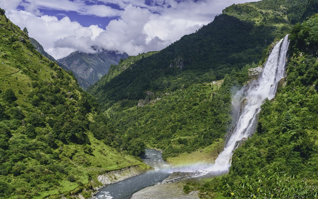
Several rivers, including the Siang, Subansiri, and Kameng, drain Arunachal Pradesh. All the state’s rivers flow into the Brahmaputra, one of the largest rivers in the world by discharge. The Brahmaputra and its headwaters transport tremendous amounts of sediment; the Brahmaputra is a braided river with several channels, often more than 5 km (3.2 mi) wide.
Because the Indian plate is colliding with the Eurasian plate, Arunachal Pradesh is host to many earthquakes, some of which are extraordinarily powerful. There are several noticeable earthquakes each year, usually about 10-30 over magnitude 1.5.
The most powerful - and deadliest - on record is the 1950 Assam–Tibet earthquake, which killed almost 5,000 people and featured a magnitude of 8.6. It’s the largest collision quake ever recorded. The earthquake reportedly produced an incredible soundtrack of cracking sounds from deep within the earth over the course of several minutes.
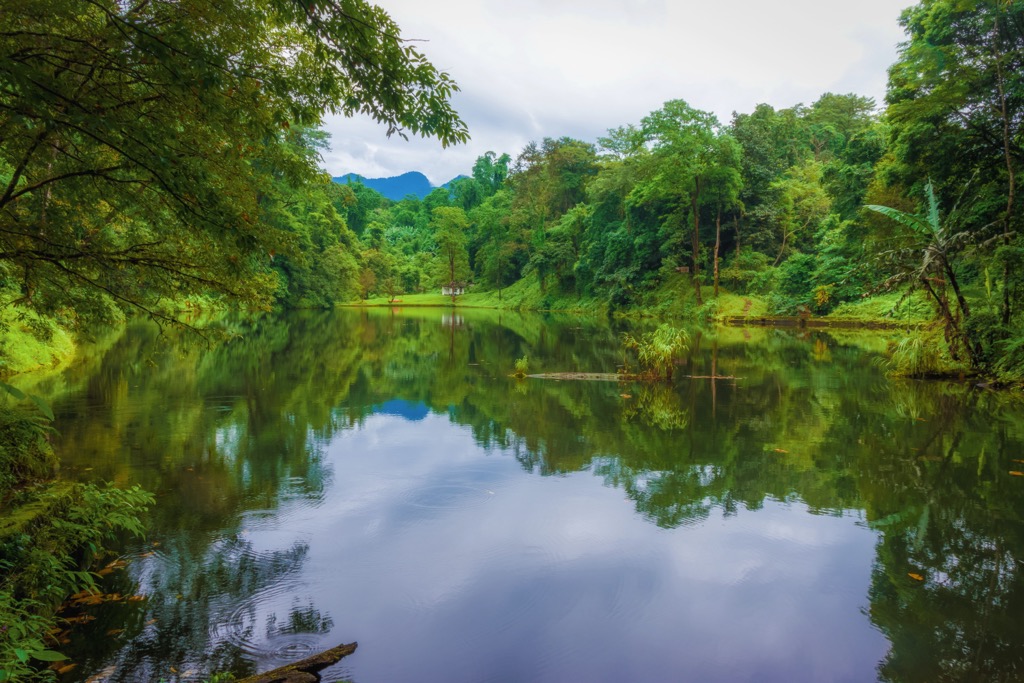
Arunachal Pradesh is one of the world’s biodiversity hotspots. Massive ranges in elevation have fostered species diversification, and a relative absence of industry has sustained much of the pristine environment. Approximately two-thirds of the state is covered in forests, with a substantial stretch of marshy rainforest located along the foothills.
Subtropical evergreen forests, subtropical pine forests, and mixed broad-leaved and pine forests occupy the lower elevations. Higher altitudes feature temperate forests; further up, subalpine and alpine vegetation takes over, dominated by rhododendron, oak, pine, maple, and fir.
The region also boasts an extensive array of medicinal plants, such as ginseng and yew, widely used by the indigenous population.
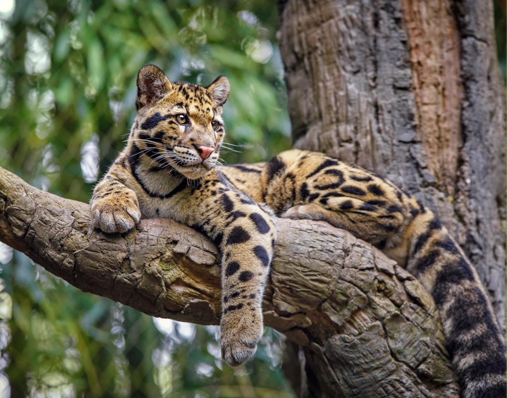
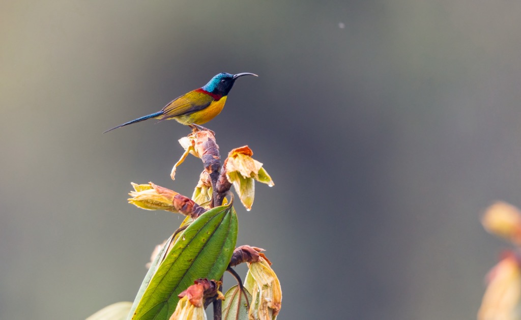
The state's wildlife includes a diverse range of charismatic mammal species, including tigers, clouded leopards, snow leopards, elephants, wild buffalo, serow and goral goats, various deer species, and primates like hoolock gibbons, slow lorises, macaques, and capped langurs. Bharals (wild sheep), black bears, and red pandas live at higher elevations. Rare creatures like musk deer and takin (Budorcas taxicolor) are also inhabitants of Arunachal Pradesh. Moreover, the state boasts more than 700 bird species.
It’s difficult to sum up the climate of Arunachal Pradesh because there is such a range in altitudes, with entirely different weather throughout. Lower elevations in the south are subtropical, with incredibly wet summers due to the Asian monsoon and drier, mild winters. In some places, total rainfall can exceed four or even five meters (160 - 200 in).
The mountains are characterized by a summer monsoon when the high elevations receive most of the snowfall that eventually becomes compacted into glaciers. Winters are obviously extremely harsh and impassable. Trekkers and climbers generally utilize the spring and fall for the best conditions.
Biodiversity developed over time as a result of India’s favorable subtropical climate. However, in recent times, vast, continuous forests have been a bastion for species extirpated from many other parts of India. More than a third of Arunachal Pradesh consists of this type of forest. The region’s topography is simply so rugged that it hasn’t been subjected to the heavy industry and human settlement that has dominated planet Earth in the last 100 years.
The forest’s preservation stands in stark contrast to China’s Yunnan Province, on the other side of the Himalayas. It’s a similar ecosystem and a biodiversity hotspot featuring similar species. However, species like tigers, leopards, and elephants have long been extirpated due to population density and agriculture.
Most of Arunachal Pradesh is protected solely on account of its remote nature and lack of people. However, there are also a few federally protected areas like national parks. These include the Namdapha National Park, Mouling National Park, Pakhui (Pakke) Tiger Reserve, Dibang Wildlife Sanctuary, and Kane Wildlife Sanctuary.
There are better spots than Arunachal Pradesh if you want to see just tigers. There are only a couple dozen tigers in the whole state, per a 2018 census report. The region is on the cusp of their range due to the altitude and the minor cold season. Madhya Pradesh and Karnataka are home to more than 500 tigers each.
The lack of governmentally protected space could be a risk factor in the future as people and industry relocate to Arunachal Pradesh (surely in the name of economic progress).
There is evidence that humans arrived in Arunachal Pradesh around 100,000 years ago. Early populations likely settled and thrived in the region’s climate, which was well-suited for human life. It was also rich in water and game.
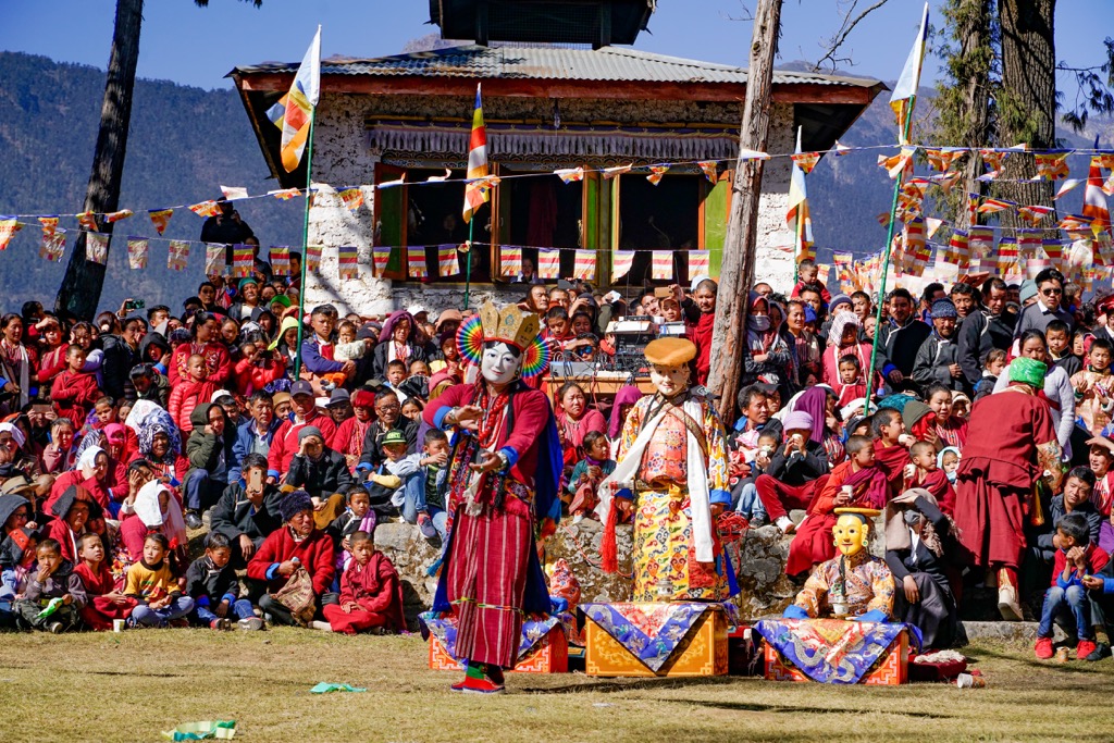
Arunachal Pradesh is known for its incredible ethnic and cultural diversity, which has evolved mainly over the last 3,000 years. The state is home to numerous indigenous tribes and communities, each with its own unique traditions, languages, and customs. Tribes traditionally practiced subsistence agriculture, hunting, and gathering. Some prominent tribes include the Nyishi, Apatani, Adi, Galo, Monpa, and Mishmi, although more than two dozen are in the state.
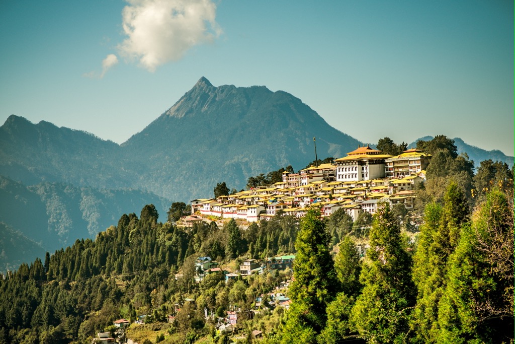
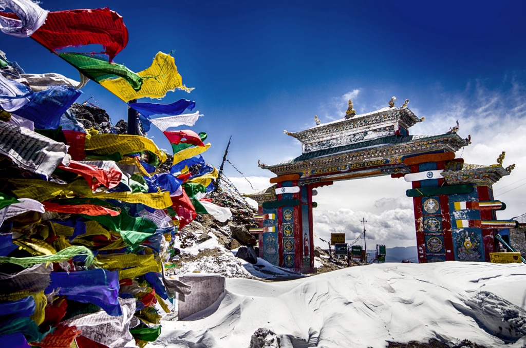
Due to its proximity to Tibet and the Tibetan plateau, Arunachal Pradesh has historically had cultural and religious ties with Tibetan Buddhism. Several Tibetan Buddhist monasteries and gompas (temples) exist throughout Arunachal Pradesh, the most famous being Tawang at the western terminus of the Trans Arunachal Highway. Today, about 12% of the population still identifies as Buddhist.
During the British colonial period, Arunachal Pradesh was mostly isolated from the rest of India. The British maintained a policy of relative non-interference in the region. The state served as a buffer zone between the British Indian Empire and Tibet, already under Chinese control. Nevertheless, the British founded the town of Pasighat and built railways. They also introduced Christianity (30% of Arunachal Pradesh identifies as Christian).
After India gained independence in 1947, Arunachal Pradesh was formally made a union territory in 1972 and became a full-fledged state of India in 1987. Arunachal Pradesh has been the subject of territorial disputes with China, which claims most of the state as part of South Tibet. These disputes have led to border tensions and occasional military standoffs. Despite China’s claims, the current border of control remains at the McMahon Line, the boundary between Tibet and British India established in the 1914 Simla Convention.
As the 21st century progresses, agriculture remains the economy’s primary driver. However, the region is shifting gear into healthcare, education, and adventure tourism.
The region's climbing is infinitely wilder than the famous 8,000 peaks to the west. Most mountains have never seen an ascent. Just approaching the base of these mountains is a massive challenge. There is nowhere near the level of infrastructure as the famous peaks and approaches often involve weeks of bushwacking through thick forests.
Limited information exists on the hikes of Arunachal Pradesh; you’ll have to do more research upon arrival. It’s remote and wild. The most famous hikes - and the easiest to research on the internet - are highly involved treks that take many days or weeks. Fortunately for Westerners, English is the official language. All infrastructure, i.e., road signs, is in English, and most service people speak it fluently.
Therefore, only experienced hikers should venture to Arunachal Pradesh’s backcountry. Hikers should come prepared for rain; some areas receive more than 4 meters (160 in) annually. A GPS device like a Garmin inReach is highly recommended. Rescues may be difficult but more likely than in less wild places; purchasing rescue insurance is also recommended.
Generally, for hikes in the lower regions, winter is the only time it is possible to hike. The weather is simply too hot, humid, and wet during the summer. Conversely, the higher elevations are off-limits during the winter and can only be accessed during the warmer months (spring and fall may be best to avoid the monsoon).
Guiding services also exist, although to a lesser extent than in somewhere more developed for tourism, like Nepal. However, you can find guiding services for both well-known treks I have listed below. You will likely have to plan well in advance for this.
Despite all this, thousands of trails exist, from ancient farm trails to established trekking routes. These are only a couple of ideas to get you started, but there are several lifetimes worth of hiking adventures in Arunachal Pradesh.
The hike starts right on NH-13 outside of the mountain town of Seppa. Get ready for an epic. It’s 1,800 m (6,000 ft) of vertical elevation gain, 17 km (11 mi), and will likely take the whole day to complete. The route is just outside the Pakke Tiger Reserve, so you can camp and fish (though double-check with the authorities in Seppa).
Just a bit further down NH-13, you can witness the confluence of the Bichon and Kameng Rivers from near the road if you’d like to get your confluence fill but don’t have the energy for a long trek.
This route traverses three distinct valleys and two rivers, ultimately leading to the heart of Ziro. The trail can also be completed in reverse or as an out-and-back. One way, it’s about six days, while the out-and-back would likely take two weeks (a rest day or two on one end).
Ziro has an association with the Apatani tribe and has earned UNESCO's recognition as a recommended World Heritage Site.
The beautiful Ziro Valley features expansive paddy fields surrounded by dense forests. Often referred to as the "land of ancient tribes," the trek meanders through thick forests, lush green landscapes, and fields adorned with massive ferns and white bamboo. This is a proper jungle trail; while actually witnessing a leopard is unlikely, as they are highly elusive creatures, the symphony of jungle sounds showcases melodies of frogs, crickets, cicadas, and birds like magpies and kingfishers. A colorful assortment of orchids and hornbills amongst the greenery adds to the enchantment.
The trek caters to both beginners and experienced trekkers and is best enjoyed between October and March. December through February may come with frosty nights, but the trek is impossible during the summer monsoon; it’s too hot, humid, and rainy.
The Bailey Trail takes trekkers through pristine and remote forests in the Eastern Himalayas, replete with pine, oak, and rhododendron trees. At 4711 m (15,456 ft), Sela Pass is the highest point.
The trek features high mountain passes, crosses glacial rivers, passes crystal-clear lakes, and visits villages inhabited by the Monpa Tribe. The vistas of the Gorichen and Kangto peaks will leave even experienced trekkers in awe.
The trail has historical significance; it retraces the path taken by British officers Lt. Col. F. M. Bailey and Capt. H.T. Morshead during their survey of the Arunachal-Tibet border in 1911-12. The officers undertook a perilous journey along the Tsangpo River in Eastern Arunachal, crossing into Tibet and surveying areas such as Chayul and Tsona Dzong.
Upon completing the survey, which was later instrumental in the demarcation of the McMahon Line by Sir Henry McMahon in 1914, Lt. Col. Bailey and Capt. Morshead re-entered Indian territory at Tulung La in western Arunachal. Their descent led them to Mago village, crossing over Sela and reaching Pota. From Pota, they continued their journey by descending from Poshing La and finally arriving at Thembang. This historic route became known as the "Bailey Trail."
Nowadays, the trek takes about ten days and is done as a point-to-point rather than both ways. It’s a demanding trek, likely for experts only. There are plenty of guiding outfitters, but even then, this is a physical adventure. There are nights at high altitudes where sleep will be elusive, and it will be cold and possibly snowy. Unlike the Talle Valley Trek, this is a true Himalayan mission.
Getting around Arunachal Pradesh is time-consuming. Basically, there is one road (National Highway 13 / formerly NH 229 / also known as the Trans Arunachal Highway) from west to east at the base of the Himalayas. For different mountain destinations, you must drive south out of the mountains, get on this road, drive to the next valley you want to visit, and return to the Himalayas. Itanger and Ziro are suitable bases at the foot of the mountains. Countless small towns and villages in the mountains feature dozens of cultures and ethnicities.
All foreign visitors need a Protected Area Pass (PAP) to access Arunachal Pradesh. Don’t feel too bad, though - all domestic visitors also need an Inner Line Permit (ILP). Prospective visitors may arrange these permits from all major cities across India. Unfortunately, major cities in India tend to be very far from Arunachal Pradesh, so you may have to hop on another flight after arriving in the country.
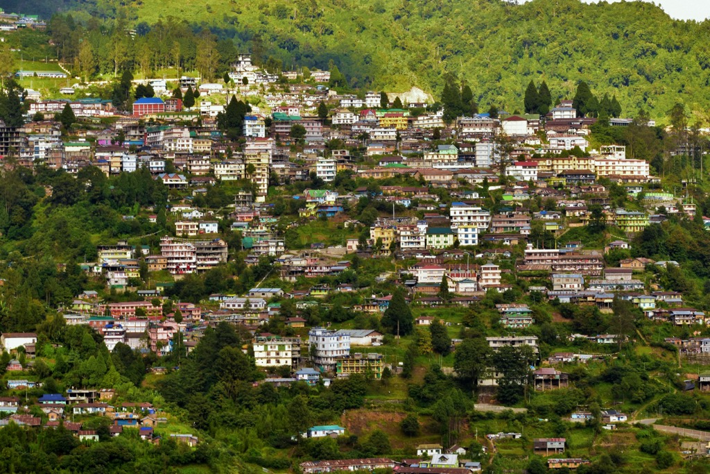
Nestled at the Himalayas base, Itanagar is Arunachal Pradesh's capital. Westerners may find the city itself to be underwhelming and a bit bizarre - it’s not exactly the kind of place you travel halfway across the world for. That said, Itanagar is an ideal starting point for extended getaways to the state. Everything is in English, and you can take a train, rent a car, get supplies, and generally plan for your next step.
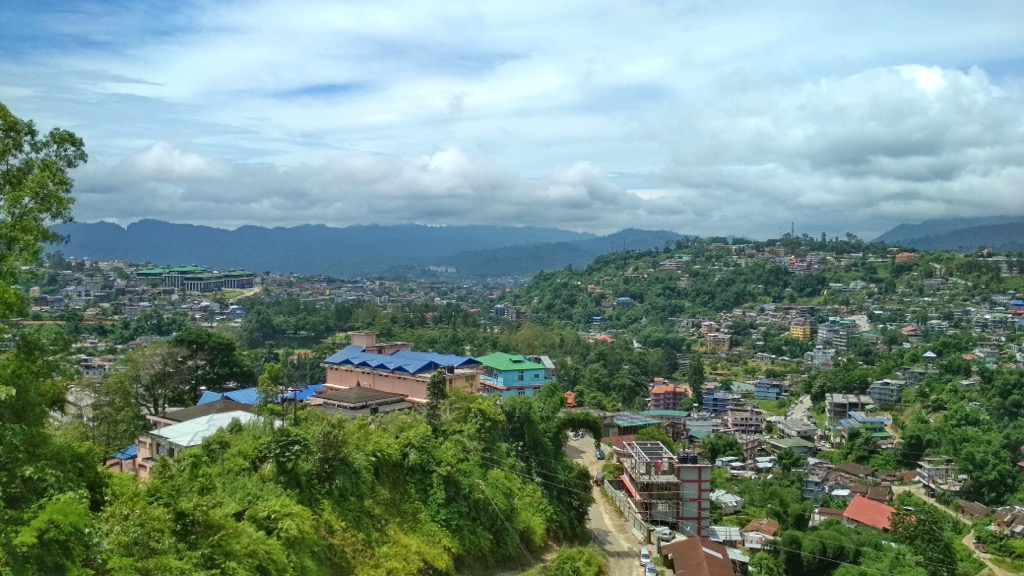
The city is predominantly Nyishi People but is incredibly diverse, reflecting the state of Arunachal Pradesh. Itanagar is renowned for its handicrafts and boasts a lively marketplace. The city also showcases a notable Tibetan architectural influence, and several brilliant temples are scattered throughout the city. Sites to visit include the renowned Ita Fort, the Jawaharlal Nehru State Museum, the Buddha Temple, and Ganga Lake. The city also celebrates vibrant festivals, including the Tamladu, Reh, and Losar (New Year).
Nature and wildlife enthusiasts should take the chance to visit the Itanagar Wildlife Sanctuary, which offers a peak at the state’s extraordinary biodiversity. Fishing and rafting are popular. You can start some treks directly from Itanagar, such as the Itanagar-Pashighat trekking route, which passes through Ziro and Daporijo.
Ziro, perched at 1,700 (5500 ft), is a paradise for nature enthusiasts and adventure seekers. The natural beauty of this remote hill town, adorned with terraced rice fields, lush bamboo forests, and trails flanked by towering pines, makes it one of India's more photogenic valleys. Ziro is (somewhat) conveniently located on NH-13 and features more moderate temperatures than lower areas such as Itanagar.
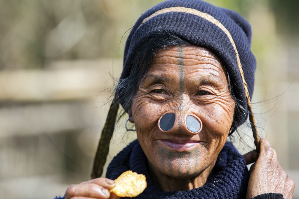
The town is on a list of prospective entries for UNESCO World Heritage classification for its cultural diversity, namely the Apatani (Tani) People. The Apatani Tribe, the oldest indigenous community in Arunachal Pradesh, has inhabited the region for centuries.
Women adorn massive nose rings and extensive dark facial tattoos covering their foreheads, noses, and chins. Their agro-farming techniques, which incorporate high-altitude fish farming, are considered some of the most advanced and have garnered significant attention from the global agro-fishing community.
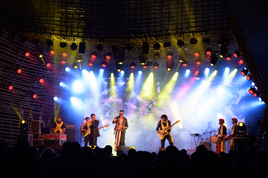
Ziro’s Talley Wildlife Sanctuary is home to the elusive clouded leopards and other mammals. The town is also the starting point of some treks, like the aforementioned Ziro → Talley Valley Trek. The Ziro Music Festival now draws a big crowd. The town was once nearly unknown to international tourists but is now becoming more popular.
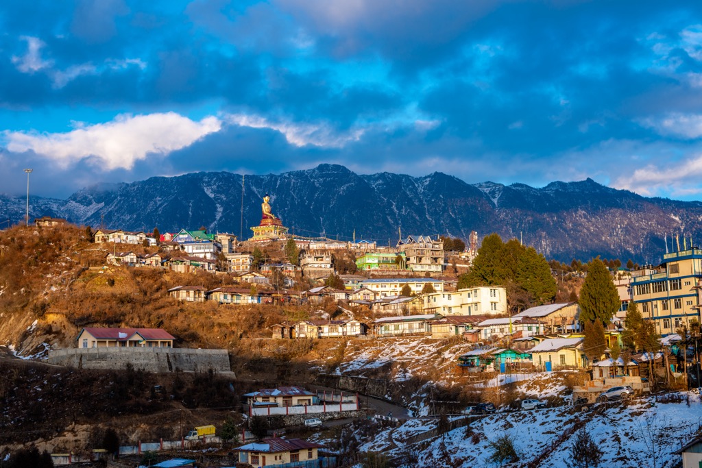
Bomdila sits at 2,217 meters (7,273 feet) and is the administrative headquarters of West Kameng District in Arunachal Pradesh. The town is about three-quarters of the way to Tawang from Itanagar. Bomdila is home to several indigenous tribes, including the Aka (Hrusso), Miji (Sajalong), Monpa, Sherdukpen, and Khawas.
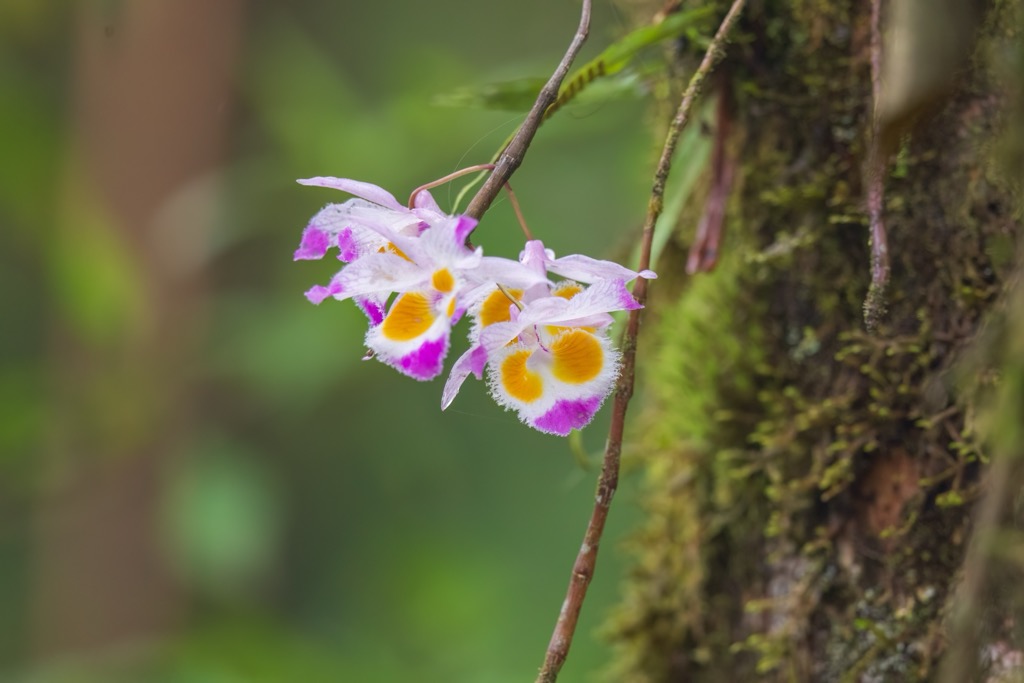
Craft centers, monasteries, an ethnographic museum, and an emporium are worth exploring. Climbing the hills in and around Bomdila also provides views of snow-clad mountain peaks, including Kangto and Gorichen Peaks, the highest peaks in Arunachal Pradesh. Bomdilla is home to many apple orchards, which peak during the winter (dry) season.
Bomdila Monastery was established in 1965 and is located near the Tipi Orchid Research Center in the West Kameng district. It holds spiritual significance and is the destination of actual Buddhist pilgrims in addition to tourists. Upper Gompa is also beautiful, with its hilltop location and epic views. Meanwhile, Lower Gompa features authentic Tibetan architecture.


