
Scan the QR code and open PeakVisor on your phone
Dhauladhar WLS has 14 named peaks. The highest is Shikhar Beh at 6,200 m. Other notable peaks include Shikar beh, Makerbeth and Hanuman Tibba.
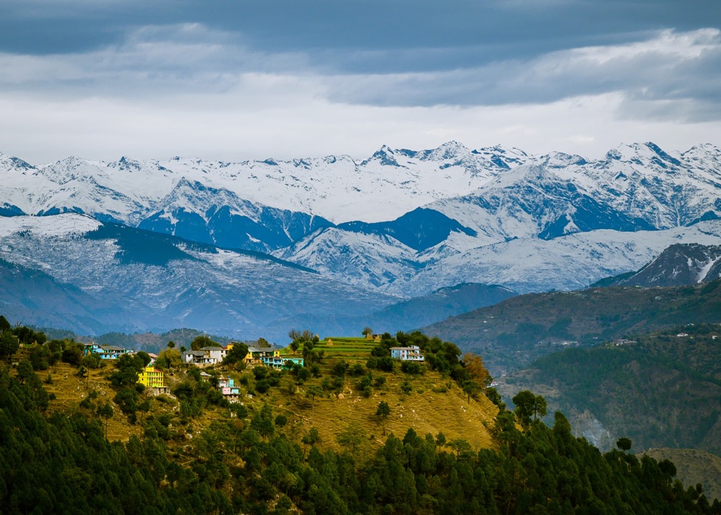
Dhauladhar Wildlife Sanctuary is one of 29 such natural areas in the state of Himachal Pradesh in northwest India in the Himalayas. The two main features of the natural area are two mountain ranges: a wall-like Dhauladhar (धौलाधार) range with just an amazing landscape, which gave it its name, and the neighboring Bara Bhangal Range, occupying most of the reserve, which is notable for diverse and unique plants and animals you can explore while hiking and doing other outdoor activities. The latter also hosts the highest and the most prominent mountain of the Dhauladhar WLS, Shikhar Beh (6,200 m / 20,341 ft). In total, there are 14 named mountains.
The meaning of the first part of the name of the natural area is simple: Dhauladhar means "The White Range" in Hindi, the main language of India, and is spelled धौलाधार.
The second one needs to be dealt with in a little more detail. Wild Life Sanctuary or WLS is one of the most common types of protected areas in India on a par with national parks, something like nature reserves in Europe, North America, and other parts of the world, but with its own features, the main one of which is the primary role of the animals and plants in the organization of their protection, and everything related to humans only follows. The world “sanctuary” also resonates with India as a whole, a country with very strong religious traditions.
In the state of Himachal Pradesh, there are 29 such areas, and in India, there are more than 550.
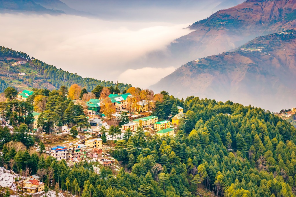
Dhauladhar Wildlife Sanctuary occupies the entire northeastern part of Kangra District, one of the 12 in the state of Himachal Pradesh in northwest India, following its exact boundaries. It borders the districts of Chamba in the west, Lahaul and Spiti in the north, Kullu in the east, and Mandi in the southeast.
The district gets its name from the vast Kangra Valley at an average elevation of 2,000 m (6,561 ft), formed by the Beas River. The river originates in the center of the Himachal Pradesh and flows to the south for 470 km (290 mi) until it merges with the Sutlej River in the state of Punjab. The valley is covered with numerous tea plantations—check the package of tea at home, perhaps it is from this valley.
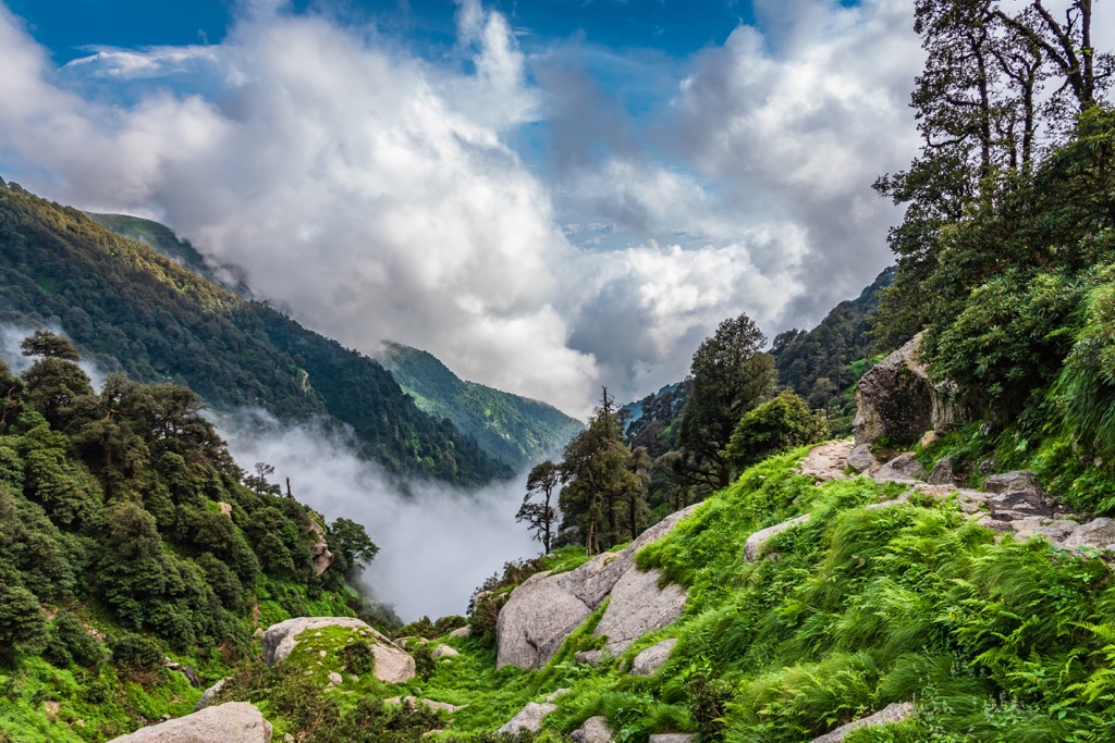
The Dhauladhar Range with snow-white peaks almost all year round towering over the Kangra Valley, which gave its name to the sanctuary, is not the only one on the territory of the reserve. The second and the main one is Bara Bhangal Range in the east, running perpendicularly, that is, in the north-south direction.
To the east of Bara Bhangal are two more large valleys, Kullu and Parbati, north of which is Spiti Valley.
The two ranges are separated by the Chamba Valley formed by the Ravi River, beyond which lies the even longer Pir Panjal Range, running parallel to Dhauladhar, which ends up in the Dagni Dhar Range in the the Kishtwar district of the Jammu and Kashmir union territory of India. North of the Pir Panjal Range through the Pangi and Lahul valleys lies the Zaskar Range in Greater Himalaya in the namesake Zaskar Districts of the same Jammu and Kashmir.
To the southeast of the Dhauladhar is Shiwalik Range or Shiwalik Hills, or the Outer Himalaya, that is, the foothills of the Himalayas to the south.
Next to Dhauladhar WLS are several other similar natural areas that cover the rest of the range, in fact almost all of it, namely Kugli WLS and Tundah WLS to the west, Manali WLS in Kullu Valley to the east, and Nargu WLS to the southeast. There is also Kalatop Khajjiar WLS on the western borders of the range near the city of Chamba.
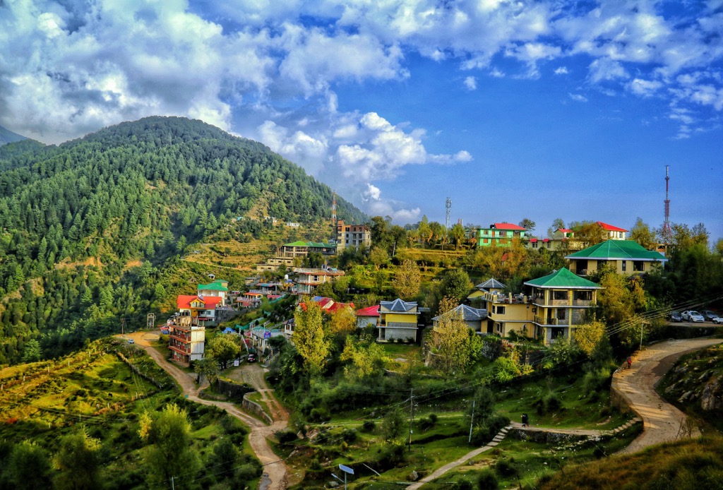
The main city of the Kangra Valley and the namesake district is Dharamshala, located in its western part. The city can be reached by direct morning or overnight bus from New Delhi in about a 12-hour drive with one big stop for lunch or overnight dinner (it doesn't look as good as it sounds — here and everywhere in the guide remember it is India). At least that’s how I got to the city.
I recommend buying a morning bus ticket from the state-run Himachal Road Transport Corporation (HRTC) instead of one of the tourist buses which runs all night and is even more tiring than a day trip. In the mountains, you're also bound to get carsick if you have a weak stomach, so prepare for that as best you can. In my experience, it's better just to not eat anything all the way.
So better travel by train or a plane. There are two railway lines to Kangra and Nagrota, and the Kangra Airport is about 20 km (12.4 mi) and 15 km (9.3 mi) from Dharamshala, respectively. But still I'm not sure if Indian trains are better than buses, but at least you get carsick during the last part of the trip to the mountains, which you still have to travel by bus, but not the whole route from New Delhi. The planes should be fine but I didn’t use them inside India.
The nearest bigger city is Pathankot to the west, which is also connected by rail and air.
The reserve is also accessible from the east. The nearest small towns on this side of the protected area are Mandi, Kullu, Naggar, and the most famous of them, Manali, one of the three capitals of this part of the Indian Himalayas Region together with Dharamshala, as well as Shimla to the south of them. They can also be reached from New Delhi by bus, train, or probably plane.
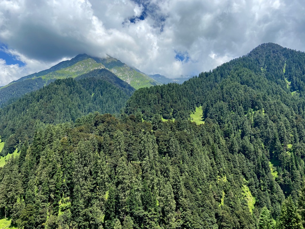
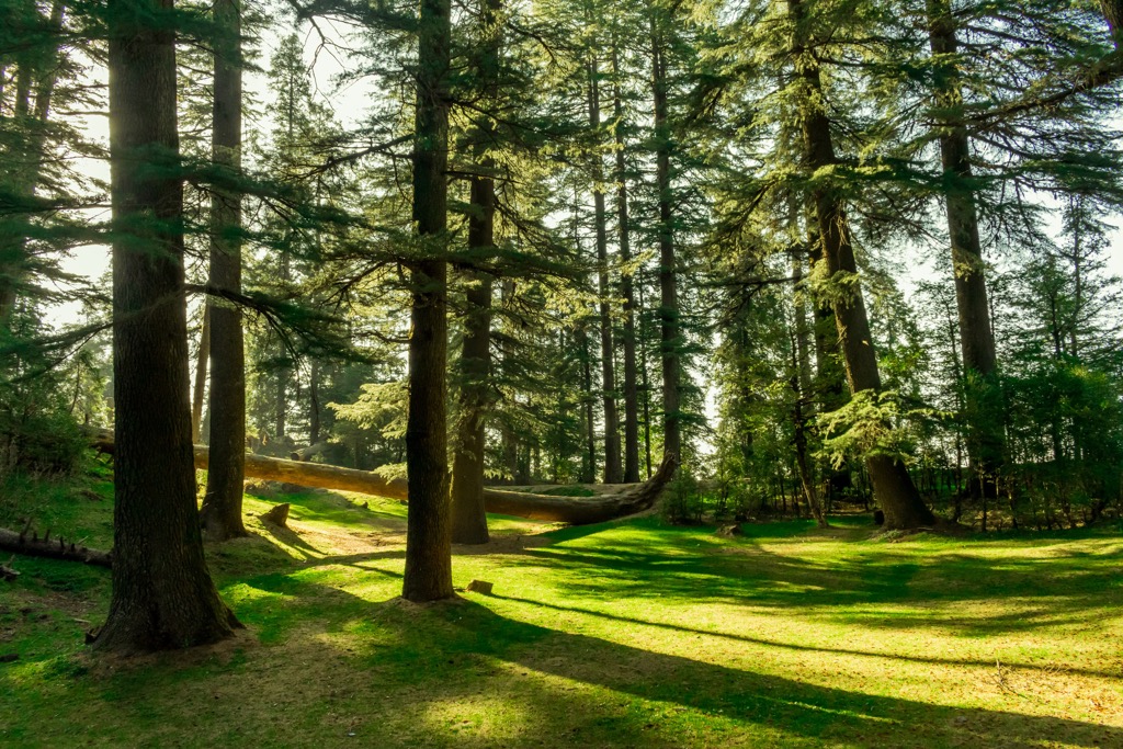
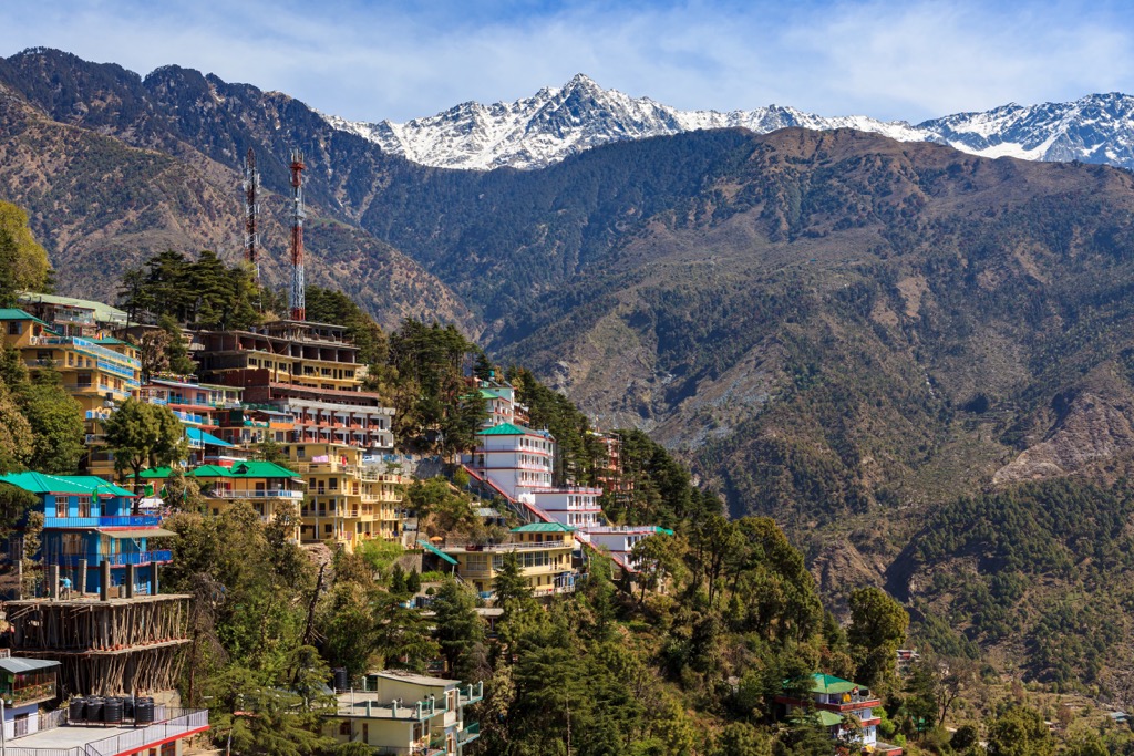
Dhauladhar Wildlife Sanctuary is covered by a predominantly high altitude forest at 700 to 1,400 m (2,296 to 4,593 ft) consisting of many different trees and plants, characteristic of the area and Himachal Pradesh as a whole, including deodar cedar, sal tree, hazelnut, pink rhododendron and tree rhododendron, Khair (the Hindu name for senegalia catechu), chir pine, birch, ban oak, fir, blue pine and chilgoza pine, spruce, sea buckthorn, wild iris, and many others.
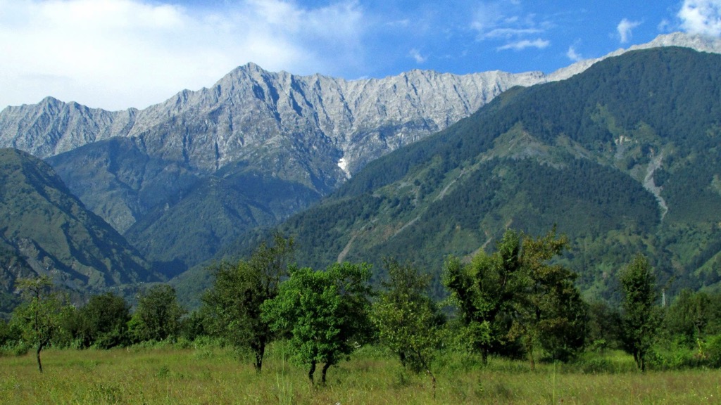
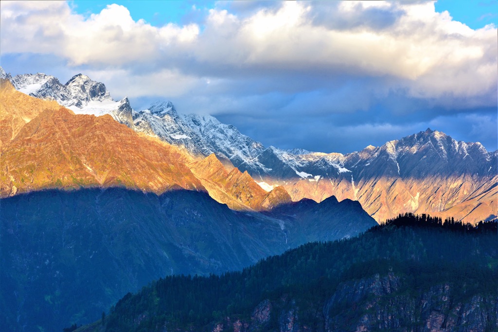
The higher part of the mountains is devoid of trees, where beyond the backdrop of alpine meadows remain only bare rocks and peaks covered by snow year-round because of their height above 4,000 m (13,123 ft) (hence the name Dhauladhar Range).
However, I should say right away that the peculiarity of the local weather is such that you can see them only until 6–7 in the morning. After that, the mountains are steadily covered by a mist day after day. At sunset, there is also a very beautiful sun, which shimmers inside itself from bright yellow to pink via orange. At least, that’s how I watched it during the whole of September I spent in the Himalayas. Speaking a bit more of the weather: in the summer it also rains a lot, which explains, among other things, such lush and diverse vegetation. Explaining the rain is useless—you have to experience it once, but it is like a wall of water that suddenly comes down and then also quickly ends. In short, imagine the heaviest rain in your (non-Asian life) and multiply it by ten times roughly and you get rain in the Himalayas. But I got away from the subject…
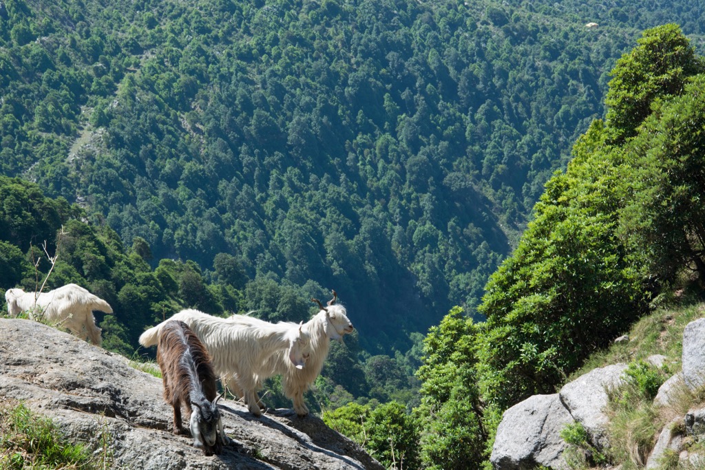
The sanctuary, as well as the northwest corner of the state, is home to a bar-headed goose, golden emperor butterfly, barking deer and sambar deer, red fox, black-naped hare, mountain hawk, common noctule bat, brambling, Himalayan tahr and ibex, red flying squirrel, golden ringed dragonfly, golden mahseer, white-throated dipper, as well as leopard cat, and Himalayan brown bear.
I have purposely mixed the different animals as they are presented in nature without the classification into species and subspecies adopted in zoology. Because you will also see them mixed up in Dhauladhar, including leopards and bears, which are not rare to find here, as I was told by the local residents of the valley.
But separately I should mention the birds, which are the most abundant in the area. For this reason, Dhauladhar WLS is considered one of the best places for birdwatching in the Western Himalayas. This is also the kind of animal that is easier to see with the naked eye or binoculars (and of course hear) compared to the rest and they do not carry any danger—unlike snakes, which are many here within the villages, so look under your feet, especially if you walk in open shoes, but the other can not be worn in summer from May to October—it is very hot and humid.
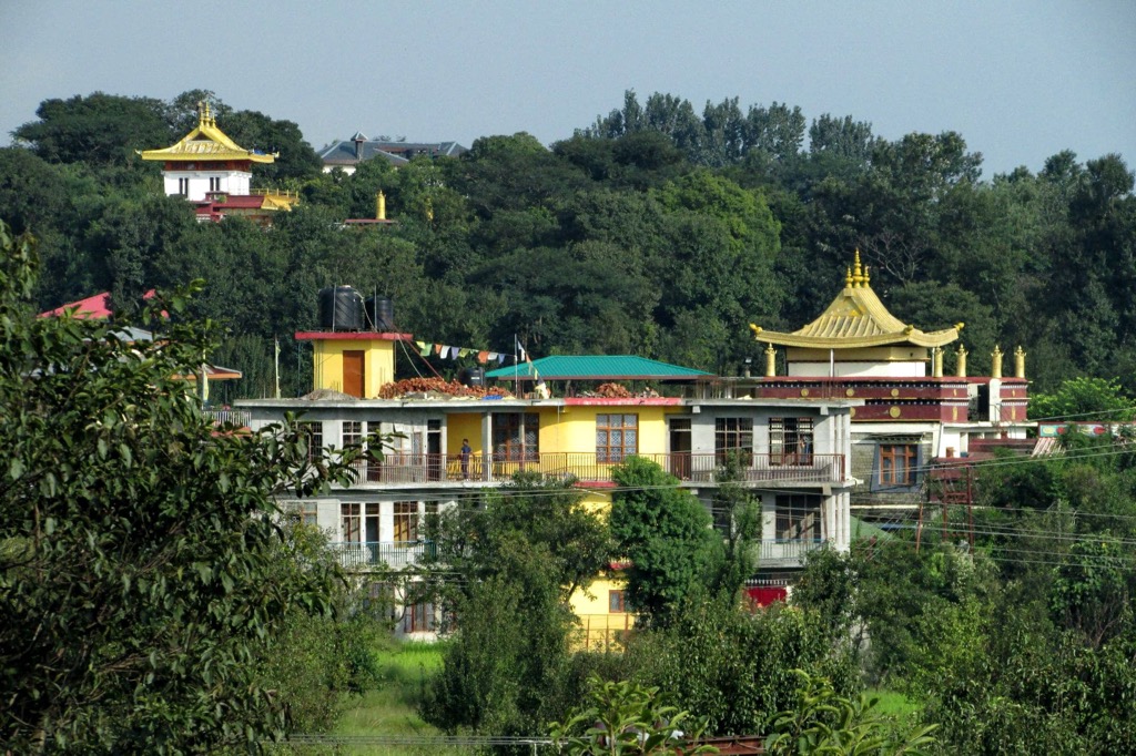
In case you are not going deep into the mountains, you can see many Himalayan animals at Dhauladhar Nature Park, a zoo located in the village of Gopalpur 20 km (12.4 mi) east of Dharamshala on a straight road in the eastern Kangra Valley.
The Dhauladhar Range belongs to the Middle Himalayas in their classification from north to south. In the classification of the Himalayas from the west to the east it is in the Western Himalayas. In the administrative classification, they are also called Himachal Himalayas, which actually include all the above-mentioned mountain ranges.
As I said before, the most of the Dhauladhar Range with the eponymous highest peak Dhauladhar Matter Horn (4,799 m / 15,744 ft) and the most famous one, Triund Hill (3,271 m / 10,554 ft), which is best seen from the Kangra Valley, is not in the wildlife sanctuary, so it covers only its eastern part.
The highest and the most prominent mountain of the Dhauladhar WLS, Shikhar Beh (6,200 m / 20,341 ft), belongs to Bara Bhangal Range. It is also its only Ultra-mountain with a prominence of 2,234 m (7,329 ft). By this measure it is also the 9th in all the mountains of India, not only the Himalayas.
The other highest mountains of the Dhauladhar WLS, exceeding 5,000 m (16,404 ft), are also located in the same Bara Bhangal, namely: Makerbeth (5,995 m / 19,668 ft), Hanuman Tibba (5,883 m / 19,301 ft), Sha Jot (5,845 m / 19,176 ft), Ladakhi (5,501 m / 18,047 ft), Aliās Goh (5,302 m / 17,395 ft), and Muri Tibba (5,280 m / 17,322 ft)—six peaks in all. The other half of the 14 named mountains in the reserve do not fall below 4,000 m (13,123 ft), except for the lowest Bhagmachhar at 3,545 m (11,630 ft)—by comparison, this is higher than the highest mountain in the Dolomites, Marmolada (3,343 m / 10,967 ft), in my home mountain range in the Italian Alps.
The Dhauladhar and Bara Bhangal mountains consist mostly of dark granite, but also of slate, limestone and sandstone used locally to build houses and other structures.
All the mountain ranges on the territory of the Dhauladhar WLS, as well as Himalayas in general, are considered difficult to hike and are more suitable for experts than amateurs. Most of their routes are high altitude and with rocky terrain and lasts more than one day with an overnight stay in the mountains. At the same time, in the Himalayas, there is no such developed infrastructure of cable cars, mountain huts, and so on, as, for example, in the Alps.
To hike the trails, you usually hire local guides or join groups of hikers on organized commercial treks from Himalaya Trekker, Snow Monk Camp, Bikat Adventures, Holiday Dada, and other companies—It is better to ask those who have already went hiking with them, which one to choose. Either way, going into the mountains alone is not a good idea — take a couple of friends with you, at least one of whom will be a local.
The Indian Mountaineering Foundation (IMF) is also the main national organization which manages trekking in the high Himalayas. Its main center with climbing walls is in New Delhi. It is also recommended to leave information about you and your trek in a special system that takes into account all the treks in the Himalayas.
Among the main trails in the Dhauladhar WLS are first the trail through the entire reserve from east to west, from Manali in the Kullu Valley to west to the small Bara Bhangal village in the Chamba Valley. It is 75 km (47 mi) long through the high and often snowy Kaliheni Pass (4,800 m / 15,748 ft), so the trail is also known as the Kalihani Pass Trek. Its other two attractions are Kalihani glacier lake, one of several large ones in the mountain range, and Kaliheni Glacier itself of the same name.
Another similar yet twice as short route, the Jalsu Pass Trek, crosses the eastern part of the Dhauladhar Range from north to south. In all, there are about a dozen more passes in this and other two ranges of the Dhauladhar WLS through which other trails pass.
From the Bara Bhangal village itself, which is located at the very end of the Chamba Valley, you can take several short trails leading to the north of the sanctuary. The valley itself could be also hiked via the relatively short 18 km (11 mi) long called Lake Wali Mata Trail.
However, most of the short and easy trails are located in the south of the Dhauladhar WLS, leading to various natural and architectural landmarks such as Dehnasar Lake among the first and Dev Ajaypal Temple or Hanumangarh Fort among the latter. The southern part of the park is generally much more accessible than the northern part—only a couple dozen km (mi) from the small towns of Chauntra and Jogindernagar (by Indian standards) on the main road 154 between Dharamshala and Kullu Valley.
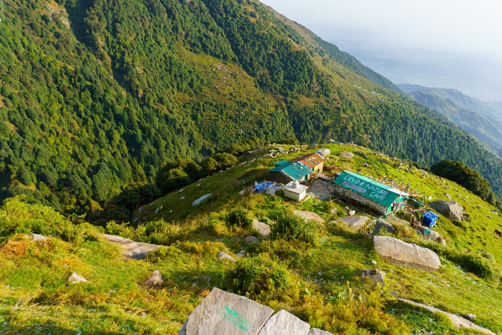
But the most famous and accessible trail of the entire Kangra District is located in the west of the Dhauladhar Range. It begins at Dharamkot village above McLeod Ganj of Dharamsala and leads to Triund Hill. The trail is about 17 km (10 mi) one way, so it is usually covered in two days with an overnight stay at a campground at the top, where there is also a small café with hot tea, snacks, and so on. You don’t have to bring your own tent—you can rent one right on-site. Another reason to camp overnight, which I mentioned earlier, is that the mountains are only visible in the early morning hours.
The hike up Triund Hill can be extended a few more days. You can go further up into the higher mountains to Indrahar Pass (4,342 m / 14,245 ft), which separates the Kangra and Chamba districts and the namesake valleys.
From the mountain pass begins another popular Seven Lake Trek, which, as the name suggests, covers 1/3 of the more than 20 glacial lakes in the Dhauladhar Range, including Nag Dal, Kali Dal, Nag Chhatri, Chandrakup, Dam Ghodi Tal, Lam Dal, and Kareri, as well as several more passes above 4,000 meters (13,123 ft). The length of the route is 5–7 days.
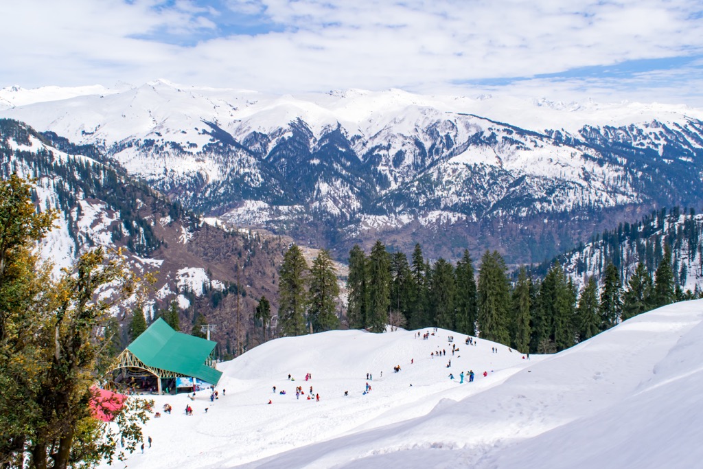
There is a small ski resort in Manali, Solang Nullaha, with 2 km (1.3 mi) of runs going down from the Hanuman Tibba mountain and 1 ski lift. The nearest and only large ski resort in the Indian Himalayas is Gulmarg in the Jammu and Kashmir region. It has more than 30 km (15 mi) of slopes and more than 8 ski lifts in total between the elevations of 2,600 and 3,985 m (8,530 and 13,074 ft).
Both ski areas are also popular for heli-skiing—an off-piste skiing from the helicopter instead of a regular ski lift. In Manali you can find local guides and order heli-ski tours in Himalaya Heliski, and in Gulmarg at the ski resort itself, or Kashmir Heli-ski, or Himalayan Heli, and other companies.
Check the Asia ski resorts map in the World Mountain Lifts section of the site. It includes information about open ski lifts / slopes in Asia in real-time with opening dates and hours. There are also year-round cable cars, funiculars, cog railways, aerial tramways, and all other types of mountain lifts.
Before or after your hike, visit the official Kangra Districts Visitor Center to get more information on site, pick up a paper map, ask for advice, and more.
Tourist Information Center Dharamshala
M. C. Office, Dharamshala, Kangra District, Himachal Pradesh, 176304, India
+9101892223325
The main type of accommodation while hiking in the Indian Himalayas is the tent you carry with you, which you set up before sunset and put away after sunrise. Permanent multi-day camping in the mountains is prohibited, as well as, of course, leaving trash, damaging plants and animals, and so on. That said, it is also recommended that you pitch your tents in places where they have already been set up before by others—you can easily find them on the approach to the main sights.
In the cities of the Kangra District, you can easily find various lodgings, the main of which are guest houses—something in between a B&B and a hotel. But the latter can also be found in India in large numbers. A word of advice: Study the place carefully with photos and reviews before you book and trust your intuition even more (in India it is generally useful). Indians love to call the most common hotels "villa" or "resort complex" and the like giving them more status through the name.
The most budget type of accommodation is in hostels, but I do not recommend them to stay. At least not in the cheapest of them, which is another thing to check—a high price does not always equals high quality, especially in India. For example, the last few days before going home I had to spend in a dark and damp windowless room with a barely working shower, which only strengthened my mixed impressions of the whole trip.
Along the way, the main cities and resorts in the Kangra District have already become known. But here's a little more about them, as well as some new places and attractions.


The highest peak in Dhauladhar WLS is Shikhar Beh, at 6,200 m.
Notable peaks in Dhauladhar WLS include Shikhar Beh, Shikar beh, Makerbeth, Hanuman Tibba and Sha Jot.


