
Scan the QR code and open PeakVisor on your phone
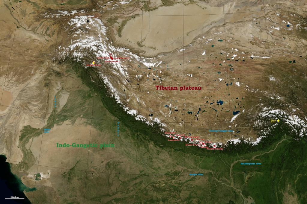
The Qomolangma National Nature Preserve (QNNP), also known as the Chomolungma Nature Reserve, is a protected area located along the greater Himalayan mountain range in the Tibet Autonomous Region of the People’s Republic of China. The preserve covers an area of 33,819 sq km (13,058 sq mi) and contains 155 named mountains, including five of the world’s fourteen 8,000-meter peaks. The highest and most prominent mountain in the park is Mount Everest (8,849 m / 29,029 ft), the world’s highest summit.
The Qomolangma National Nature Preserve (QNNP) is home to the tallest mountains on Earth. Most famously, the park contains the north face of Mount Everest (8,849 m / 29,029 ft), the world’s highest peak; this mountain gives the preserve its name, Qomolangma, the Tibetan name for Everest.
In addition to Everest, four other 8,000-meter peaks also lie at least partially within its borders: Lhotse (8,516 m / 27,939 ft), Makalu (8,485 m / 27,837 ft), Cho Oyu (8,201 m / 26,906 ft), and Shishapangma (8,027 m / 26,335 ft).
Qomolangma National Nature Preserve consists of four counties: Tingri, Dinggyê, Nyalam, and Gyirong. To the south, it borders Nepal, and many of the aforementioned peaks lie on the China-Nepal border and thus are shared between the QNNP and other wilderness regions in neighboring Nepal. These include Manaslu Conservation Area, Makalu Barun National Park, Sagarmatha National Park, Langtang National Park, and Annapurna Conservation Area. Collectively, these cross-border preservation areas encompass a region larger than Switzerland.
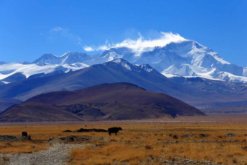
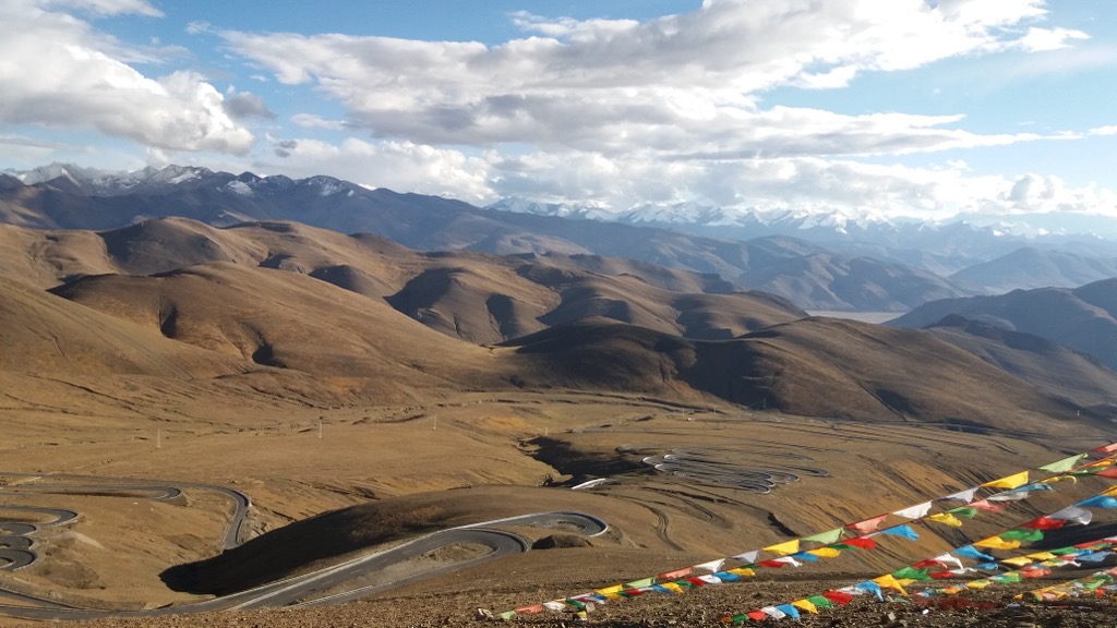
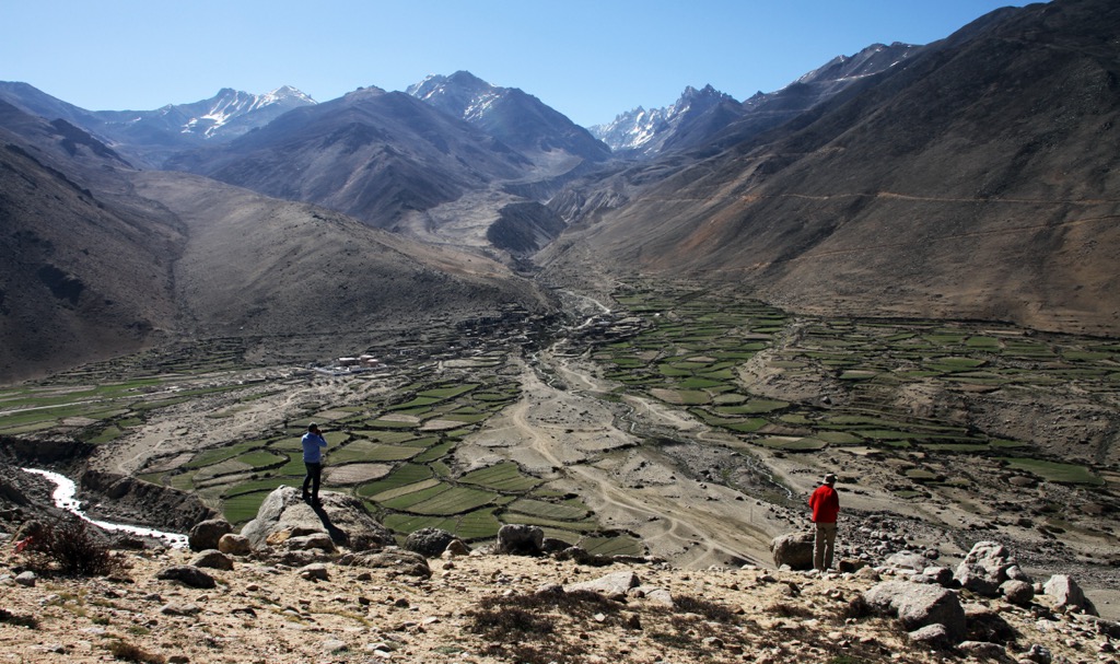
Mountains dominate Qomolangma National Nature Preserve’s topography; even the lowest elevations are still quite high, at 4,000 meters (13,123 ft). Therefore, the majority of the preserve is alpine terrain, scarred with deep valleys grooved out by glaciers and rivers separating the towering peaks. Alpine and valley glaciers, remnants of past ice sheets, grip the mountainsides and continue to sculpt the landscape.
Fields of barley and other hardy plants cling to life in the park. At 4,300 meters (14,107 ft), QNNP contains some of the highest agricultural fields in the world. Further up, these fields give way to vast stretches of rock and scree and, later, snow and ice.
The annual average temperature in the QNNP is a chilly 2.1°C (35.8°F). Winters are brutally cold, with temperatures dropping well below freezing. Air pressure also decreases with increasing altitude, making it difficult for humans and animals to get enough oxygen.
Precipitation patterns vary depending on location. The southern slopes receive more sunlight and moisture due to the influence of the summer monsoon, while the northern slopes are colder and drier.
The Qomolangma National Nature Preserve's location on the Tibet-Nepal border at the apex of the Himalaya places it at a geological crossroads. The Himalaya—Earth’s highest mountain range—was formed through the collision of the Indian and Eurasian tectonic plates, which began around 50 million years ago.
The impact and pressure between these two plates crumpled their continental crust, buckling the Indian plate above the Eurasian plate. However, due to their low density and high buoyancy, neither plate was completely subducted (or pushed beneath the other).
Instead, both continental plates primarily folded and faulted, compressing into each other and pushing up the land into the gargantuan peaks of the Himalayas. As a result of this compression, the continental crust in this region and around the Tibetan Plateau is 75 kilometers (46 mi) thick, twice as thick as the average crust elsewhere on Earth.
Another unfortunate result of this intense geological activity is the powerful earthquakes seen in this region, such as the Gorkha earthquake in April 2015, which registered up to 8.1 on the Richter Scale and directly killed nearly 9,000 people. The quake also triggered numerous avalanches and landslides in the surrounding peaks, killing locals, climbers, and trekkers. China is at the confluence of not only the Indian and Eurasian plates but also the Pacific. As a result, it’s the most earthquake-prone country in the world, with the three deadliest quakes of the 20th century all occurring here.
See our dedicated Himalayas page for more about the region's geological history.
The Qomolangma National Nature Preserve is a predominantly arid, alpine environment and significantly less ecologically diverse than the national parks of Nepal on the other side of the Himalayas. However, more life survives than meets the eye, and due to its vast elevation range, the QNNP encompasses several distinct ecological zones.
In total, the QNNP administration officially reports more than 2,000 species of plants, 53 species of mammals, eight species of amphibians, ten species of fish, and 206 species of birds. Forty-seven species are rare or endangered plants and animals, per the International Union for Conservation of Nature (IUCN).
The harshest region of the preserve lies in the frigid, high-altitude zone. Here, life clings on above the permanent snow line. Sparse vegetation like mosses, lichens, and some unique cold-adapted flowering plants like edelweiss (Leontopodium nivale) manage to survive.
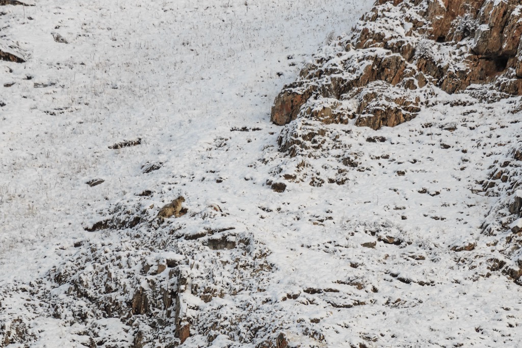
Animal life up here is even scarcer, with species like the snow leopard (Panthera uncia), the Himalayan tahr (Hemitragus jemlahicus), and the bar-headed goose (Anser indicus) showcasing adaptations to survive the thin air and extreme temperatures.
The landscape transitions to a more hospitable alpine zone as you move down the slopes. Here, short, windswept grasslands dominate, dotted with colorful wildflowers during the brief summer season.
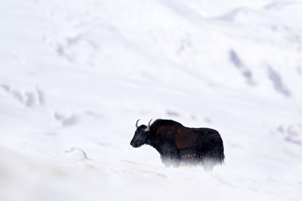
This zone provides vital grazing grounds for herbivores like the yak (Bos grunniens), the Himalayan bharal or blue sheep (Pseudois nayaur), and the pika (Ochotona daurica), a small, rabbit-like mammal. Golden eagles (Aquila chrysaetos) can be spotted overhead, while pikas scurry between rocks, forming the base of the mammalian food chain.
Further down, sheltered valleys offer a haven of relative biodiversity. Here, shrublands and stunted forests are dominated by juniper and birch trees, providing habitat for birds like the blood pheasant (Ithaginis cruentus) and the lammergeier (Gypaetus barbatus) or bearded vulture. There are also small wetlands, often rife with clumps of sea buckthorn (Hippophae rhamnoides).
Small mammals like silver mountain voles (Alticola argentatus) and pikas thrive at these lower elevations. Larger predators like the Tibetan sand fox (Vulpes ferrilata) and the Himalayan wolf (Canis himalayensis) may also be spotted.
Qomolangma National Nature Preserve’s high elevation and relatively inhospitable climes mean that human habitation has historically been scarce. However, although evidence is limited, early human groups are believed to have inhabited the lower valleys of the region as far back as the Paleolithic era.
The region was first part of the ancient Zhangzhung Kingdom (c. 500 BCE), a pre-Buddhist civilization that thrived in western Tibet. Zhangzhung culture was historically tied to the Bon religious sect, which profoundly influenced Tibetan Buddhism's philosophies that now prevail in the region. Zhangzhung fell under conquest by warlord Songtsen Gampo, who established the Tibetan Empire in 625 CE.
From this point, the region’s history parallels that of Tibet. The empire fragmented in 800 CE, later fell to the Mongols and was relatively independent, ruled by successive families from 1354 CE to 1642 CE. At that point, it was controlled by the 5th Dalai Lama until the Qing dynasty’s conquest in 1720.
After the fall of the Qing dynasty in the early 20th century, the 13th Dalai Lama returned to Tibet, and the country reestablished independence until the Chinese (People's Republic of China) invaded and annexed the region yet again in 1951.
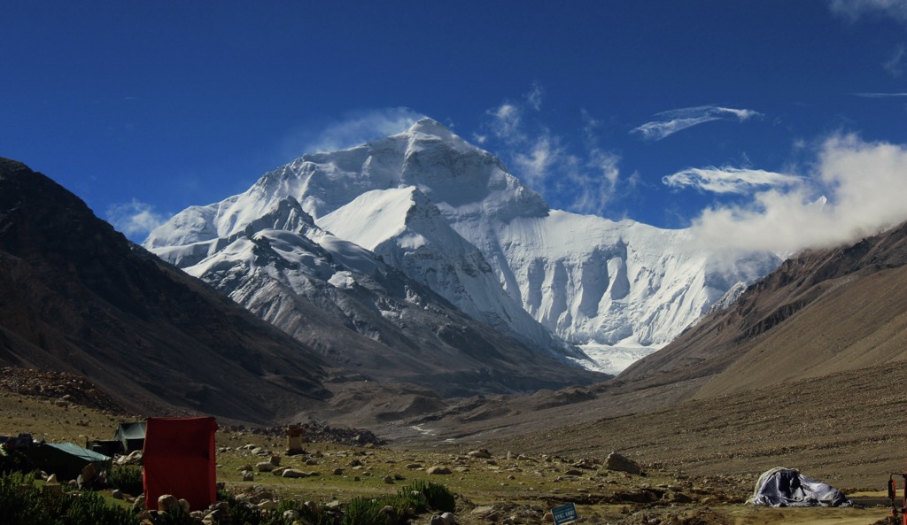
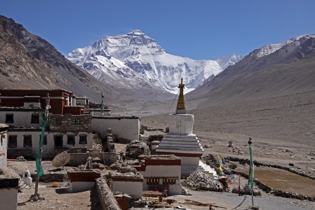
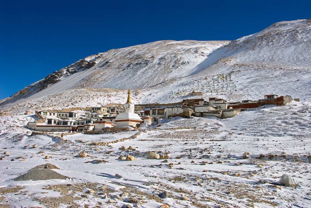
The rugged terrain and spiritual significance of the region around Qomolangma led to the establishment of numerous Buddhist monasteries and hermitages, including the Rongbuk Monastery. Although the current monastery was not built until 1902, it sits on a site used for centuries by Buddhist nuns and hermits for meditation and spiritual practice.
Of course, the 19th century also saw increased interest from British explorers and surveyors, who mapped the region as part of the “Great Trigonometrical Survey of India.” Among other achievements, this survey identified the elevations of several 8,000-meter peaks, including Everest (8,849 m / 29,029 ft), K2 (8,611 m / 28,251 ft), and Kangchenjunga (8,586 m / 28,169 ft), finding the former to be the world's highest summit.
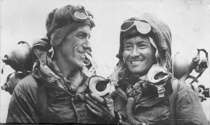
The early 20th century witnessed numerous attempts to summit Mount Everest in the 1920s and 1930s, and a final success in 1953 from the southern (Nepal) side by Tenzing Norgay and Sir Edmund Hillary. The first summit from Tibet occurred seven years later, in 1960, by a Chinese team.
In 1989, the Chinese government established the Qomolangma National Nature Preserve to protect the region's unique biodiversity and cultural heritage. The preserve is unique in that it was the first protected region in the world to be managed by local volunteers rather than outside wardens or rangers.
Village leaders from the surrounding counties, Tingri, Dinggyê, Nyalam, and Gyirong, are trained in conservation and serve as stewards of the preserve. These workers—educated by Future Generations China—are known as “Pendebas.” In addition to ecological conservation, they have contributed to the restoration of a number of monasteries in the region.
Approximately 90,000 farmers and nomads live within the preserve's borders today. Despite its environmental beauty, the region is one of the fiscally poorest in China, and over 50% live below the poverty line.
Qomolangma National Nature Preserve can be visited any time of the year, save for mid-February until the start of April, when Tibet is traditionally closed to all foreign travelers. The best times to visit are typically April to May or October through December. These months typically feature minimal snow, moderate temperatures, and clear skies that allow for the best views. From June to September, the monsoon season brings heavy clouds.
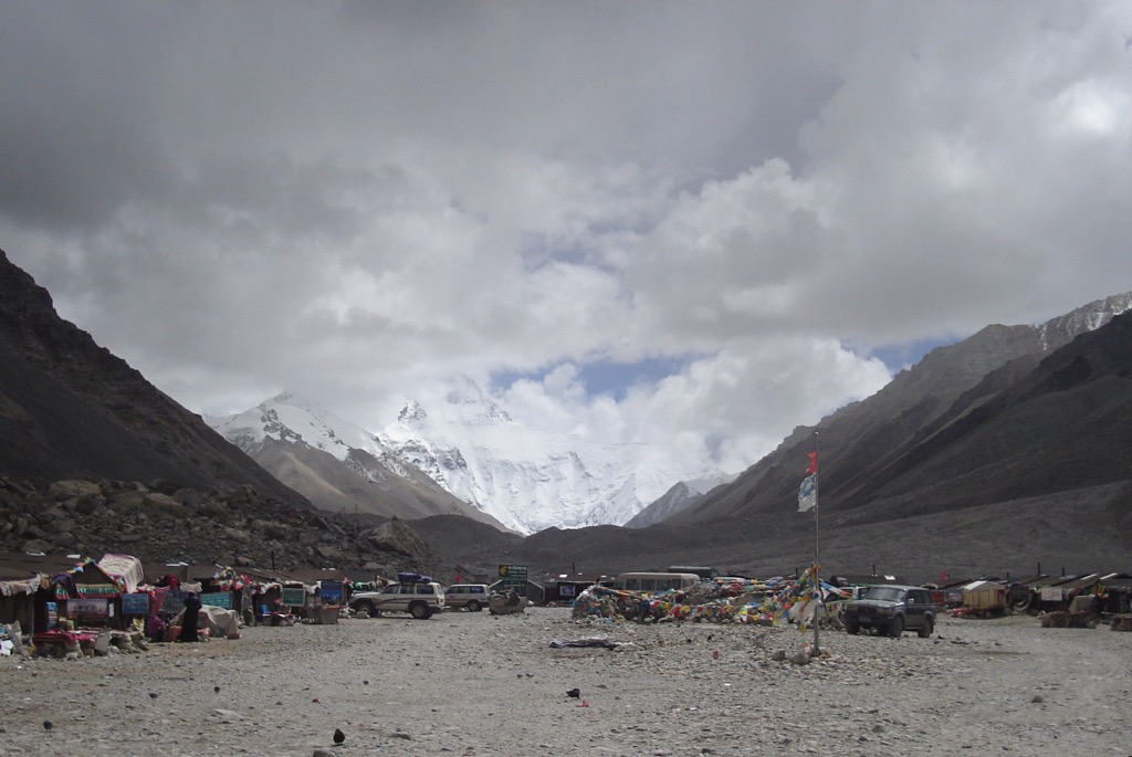
Perhaps the most popular hike in the preserve is the trek to Everest’s North Base Camp. The most common starting point is the small town of Tingri. From here, the trek is around 70 kilometers (43 mi) to base camp. The walk typically takes only four days, much shorter than the South Base Camp Trek in Nepal (below).
Aside from the considerably smaller crowds than in Nepal, the other benefit of this trek compared to the Nepal Base Camp trek is a much shorter elevation gain (801 m / 2,632 ft). Hikers begin at 4,349 m (14,268 ft) above sea level at Tingri and end at 5,150 m (16,900 ft).
NOTE: Unlike South Base Camp, you can actually drive practically to the doorstep of North Base Camp. This means you can trek one way and ride back in the car.
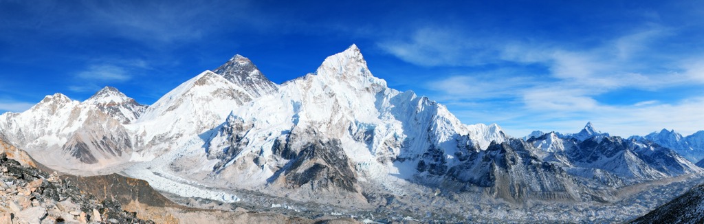
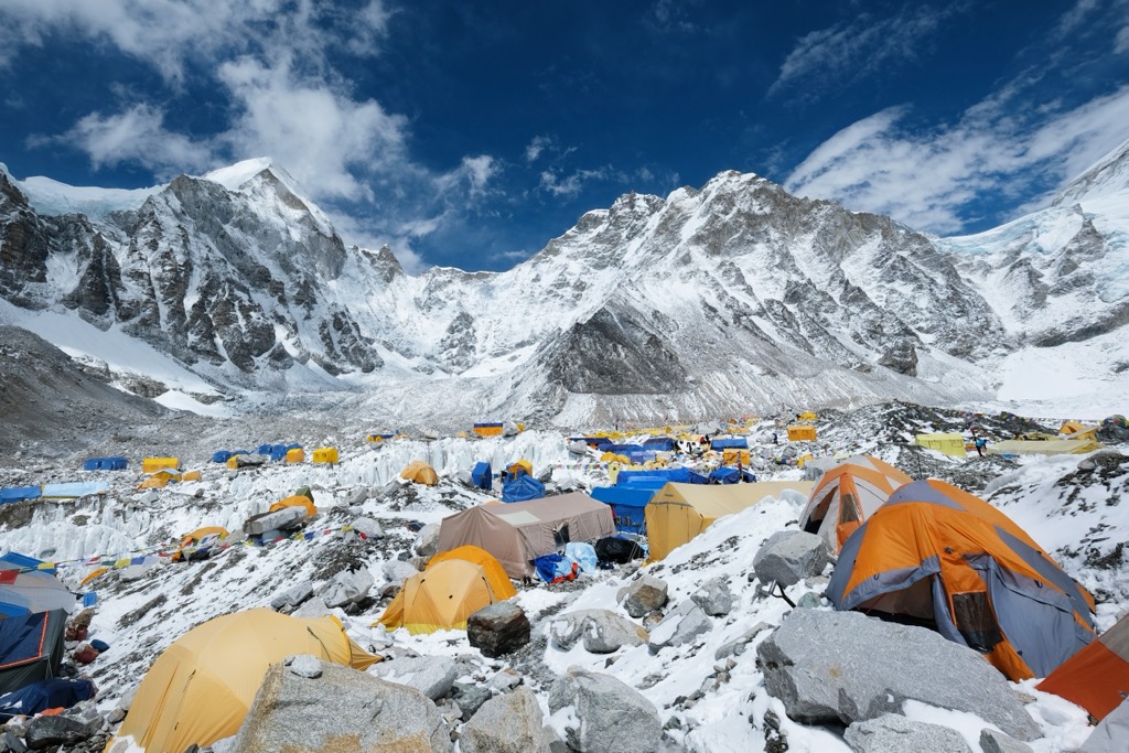
While this classic route is actually in neighboring Nepal and Sagarmatha National Park, we can’t skip it here. The trek to Nepal’s Everest Base Camp is a bucket list adventure for many hikers and might be the most famous multi-day trek in the world.
The standard out-and-back hike from Lukla to Everest Base Camp is around 130 km (80 mi) and offers breathtaking views of other giants like Lhotse (8,516 m / 27,939 ft) and Nuptse (7,864 m / 25,801 ft). The trail goes through a variety of landscapes, from Rongbuk Valley to the foot of Everest at 5,364 meters (17,598), with options for shorter day hikes or longer treks with camping or lodge stays.
It usually takes around seven days one way, with out-and-back trips running 15 days or more. It’s no stroll, either. Expect an elevation gain of 2,504 m (8,215 ft).
If you’re visiting Qomolangma National Nature Preserve and don’t want to go all the way to Everest (8,849 m / 29,029 ft), make sure to see the Rongbuk Monastery. Rongbuk, the world's highest monastery, is perched at an elevation of almost 5,000 m (16,404 ft) at the end of the Dzakar Chu Valley. Reaching the monastery on foot from Tingri takes around four days, but you can also simply take a car.
Rongbuk Monastery hosts several cultural festivals each year. In April, don’t miss the Saka Dawa Festival, a celebration of Sakyamuni's (Buddha) birth, enlightenment, and death. This three-day festival includes dancing and rituals performed by monks from across the region.
Since the Qomolangma National Nature Preserve (QNNP) is a protected area high up in the Himalayas, the region is sparsely populated. However, a few county towns nearby serve as hubs for tourism and administration for the QNNP.
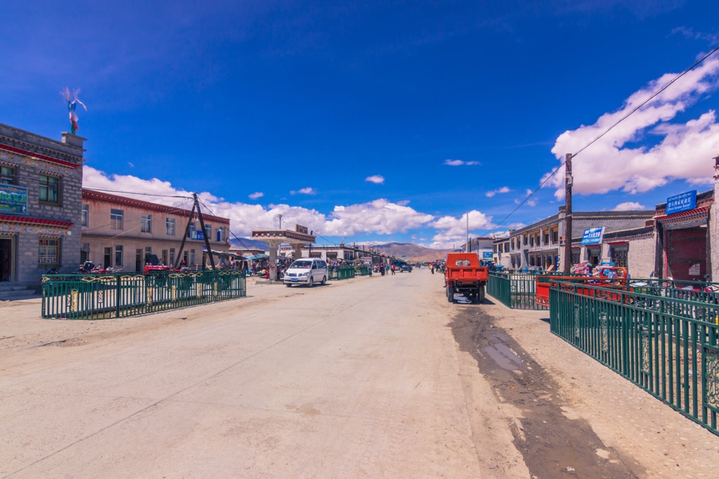
The most common starting point to reach Everest’s North Base Camp and Qomolangma National Nature Preserve, Tingri (pop. 500) or Gangga, is a small high-altitude plains town and former trading post. It sits at 4,348 meters (14,268 ft).
In years past, it was a key hub for Tibetan wool, salt, and livestock. Today, it is primarily a tourist town for trekkers looking to reach peaks like Everest (8,849 m / 29,029 ft) and Cho Oyu (8,201 m / 26,906 ft), as well as a popular stopping point on the Friendship Highway from Lhasa to the border of Nepal. The drive from Shigatse (below) to Tingri is around eight hours, taking travelers over awe-inspiring passes like Lhakpa La (5,246 m / 17,211 ft).
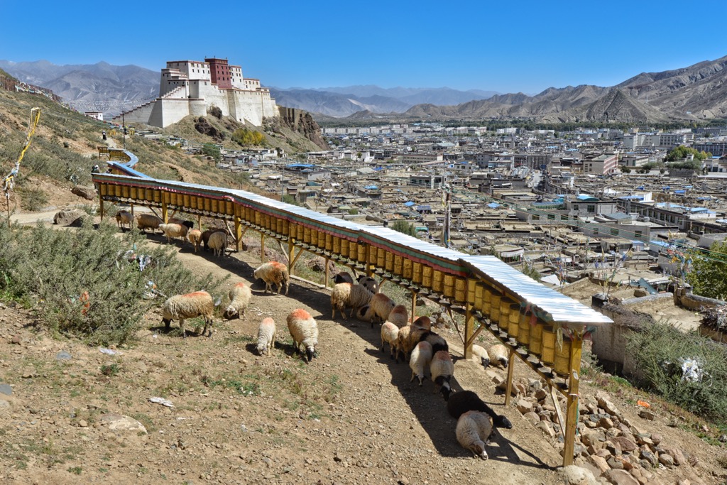
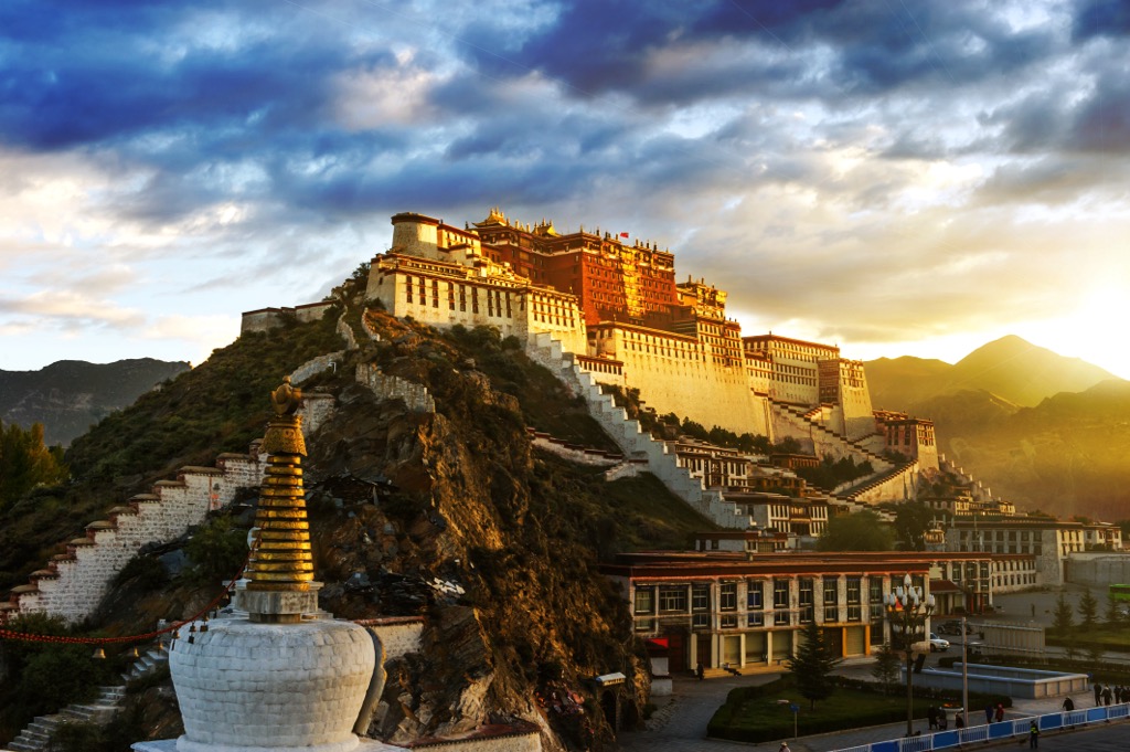
Sitting at an elevation of 3,782 meters (12,408 ft), Shigatse is the second-largest city in Tibet and the largest city near the QNNP. It's located about 250 kilometers (155 mi) northwest of the park and has a population of around 845,300 people.
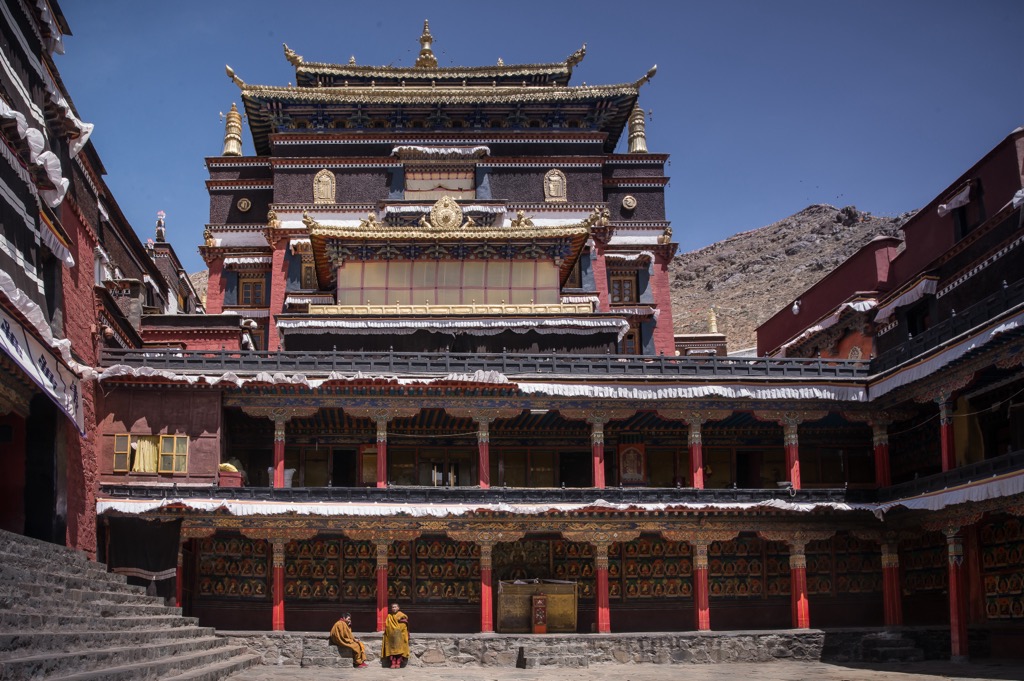
Shigatse is at least 900 years old and has a rich history dating back to the 11th century. Renowned as the seat of the Panchen Lama, Shigatse houses the grand Tashi Lhunpo Monastery, a key site for Tibetan Buddhism. Located on a hill in the city's center, the monastery was built by Gedun Drub, the 1st Dalai Lama, in 1447.


ultra
8000ers
china-ultras
nepal-ultras
ultra
8000ers
china-ultras
nepal-ultras
ultra
8000ers
china-ultras
nepal-ultras
ultra
8000ers
china-ultras
nepal-ultras
ultra
8000ers
china-ultras
nepal-ultras
ultra
8000ers
china-ultras
nepal-ultras


