
Scan the QR code and open PeakVisor on your phone
Makalu Barun National Park is a 1,500 sq km (580 sq mi) national park in Nepal’s Solukhumbu and Sankhuwasabha districts. The park is best known as the home of the 8,000-meter peak Makalu (8,485 m / 27,838 ft), the fifth-highest mountain in the world. The park contains many other peaks popular for climbing and trekking, including Chamlang (7,319 m / 24,012 ft), Baruntse (7,152 m / 23,465 ft), and Mera (6,476 m / 21,247 ft). In total, the park contains 18 named summits, of which Makalu is both the highest and most prominent.
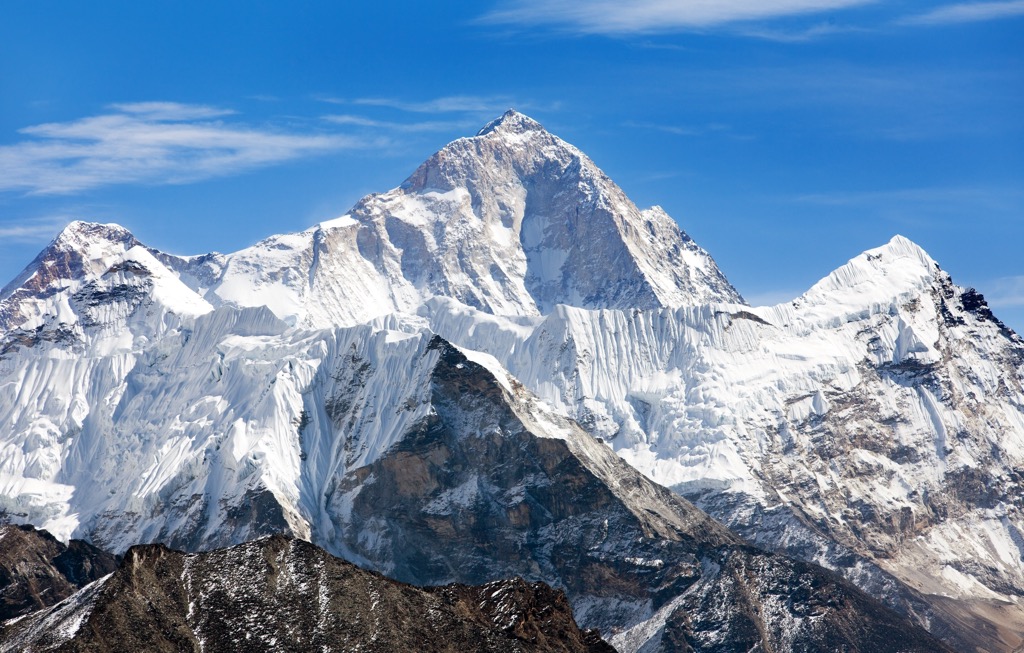
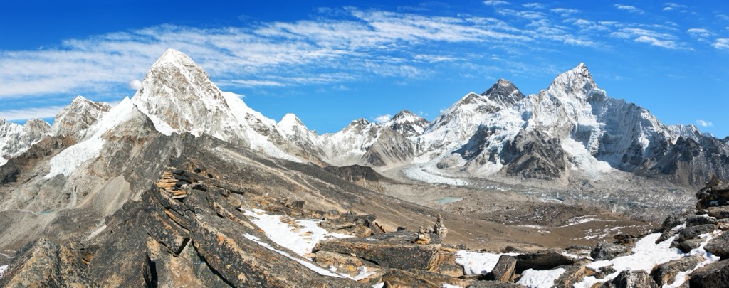
Makalu Barun National Park is a rugged, remote national park in the Nepalese Himalayas. It sits just east of Sagarmāthā National Park, home to the world’s highest peak, Everest (8,848 m / 29,029 ft). Makalu Barun is best known for its ultra-prominent, isolated 8,000er Makalu (8,485 m / 27,838 ft), which gives the park its name. Makalu is the world’s fifth-highest mountain.
Other well-known mountains within the national park include Mera (6,476 m / 21,247 ft), Chamlang (7,319 m / 24,012 ft), Baruntse (7,152 m / 23,465 ft), and the subsidiary peak Kangchungtse (7,678 m / 25,190 ft) also known as Makalu II.
In addition to the 1,500 sq km (580 sq mi) main park, Makalu Barun has a buffer zone of 830 sq km (320 sq mi) around its south-southeast edge, added in 1995. Along with Sagarmāthā, which borders it to the west, Makalu Barun shares an international border to the north with the Qomolangma National Nature Preserve of Chinese-occupied Tibet.
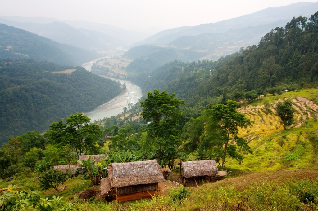
The high peaks of Makalu Barun are undoubtedly its most notable feature. Still, the park is topographically diverse and is the only protected area in the world with elevation differences over 8,000 meters (26,247 ft). In the lowlands of the Arun Valley in the southeast, elevations reach as low as 350 meters (1,148 ft) and include a variety of subtropical and temperate forests. Given the lofty heights of Everest and Makalu on either side, many consider the Arun the deepest valley in the world.
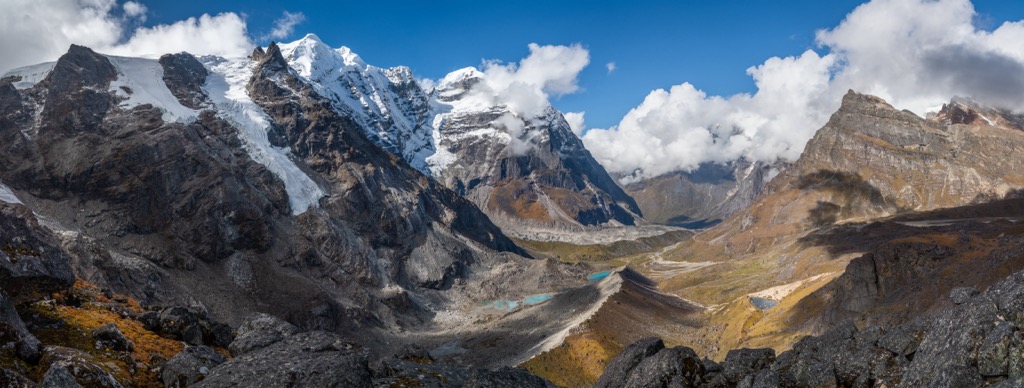
Like the pyramidal Makalu, the other peaks of Makalu Barun National Park are typically sharp, with jagged ridges and deep, precipitous valleys that have been shaped by both ancient and recent glacial activity. Noteworthy is the Barun glacier, one of the largest in the region and the source of the Barun River, a key tributary of the Arun. Glaciers like the Barun are vital for water resources in the area, where they supplement river flow during dry periods.
The park experiences a significant climatic variation due to its elevation range. The monsoon season starts slightly earlier (June) and lasts longer (until September) than in western Nepal. The park averages a whopping 4,000 millimeters (160 inches) of precipitation annually, with over 70% occurring during the June-September season. Precipitation, however, largely depends on elevation and aspect, with some regions receiving even more than 4000 millimeters and others receiving less.
Temperatures fluctuate considerably, with lower elevation areas experiencing warm summers and mild winters, while the higher reaches remain cold year-round. Naturally, the highest elevations above 5,500 meters experience a polar climate with year-round snow and ice.
Like the rest of the Himalayan range, the peaks of Makalu Barun National Park were born from the convergence of the Indian and Eurasian tectonic plates. The process began around 80 million years ago as the Indian plate—then separated from mainland modern-day Asia by a small ocean, the Tethys Sea—moved north towards the Eurasian plate.
When the plates collided around 40 to 50 million years ago, during the end of the Cretaceous period, the Eurasian plate was partly crumpled and pushed up above the Indian plate. However, because both plates were of similar density, neither was subducted entirely (pushed under the other). Therefore, the continental crust thickened and compressed onto itself. Today, the continental crust in this region is around 75 kilometers (46 mi) thick, twice the average thickness elsewhere on Earth.
The region's uplift has continued into the present day. The Himalayan range gains about 6.1 cm (2.4 in) in elevation each year as the Indian plate continues to push north.
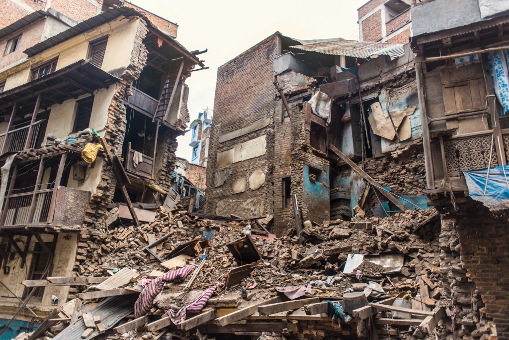
An additional consequence of the active geology is powerful earthquakes, such as the Gorkha quake in April 2015. The quake’s epicenter was about 65 km northwest of Kathmandu and registered as high as 8.1 magnitude. Nearly 9,000 people perished as a result, mainly in the populated urban areas around Kathmandu. However, the quake also triggered many rock, snow, and ice avalanches in the mountains; at least 25 avalanches occurred on and around Everest, and 22 climbers are known to have perished.
Extensive glaciation also played a crucial role in shaping the Himalayas and Makalu Barun. Massive glaciers carved the deep valleys that run through the park today, leaving behind U-shaped scars and glacial lakes as they retreated.
Glacial erosion was particularly pronounced after the last ice age, which ended around 10,000 years ago. These glaciers also deposited rock and debris, influencing the formation of landforms like moraines. Today, climate change is causing them to recede, further transforming the landscape as glacial lakes expand. One direct consequence of glacial recession is the increased difficulty in access for trekkers and climbers. Scaling the moraines has become more technical, and rockfalls and landslides have become more common.
The peak Makalu (8,485 m / 27,838 ft) comprises metamorphic rocks like gneiss, schist, and marble. These rocks were initially sedimentary but transformed under intense pressure and high heat during the collision of the tectonic plates.
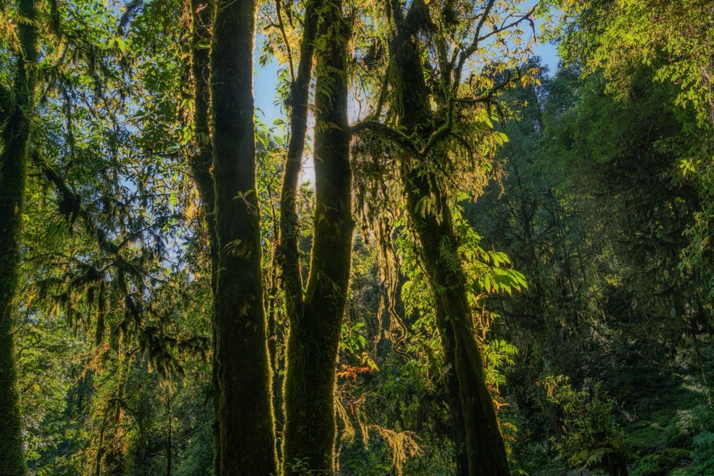
Thanks to its vast range of elevations, Makalu Barun National Park boasts a remarkable diversity of life. It consists of five ecological zones: tropical (below 1,000 m / 3,281 ft), subtropical (1,000-2,000 m / 3,281-6,562 ft), temperate (2,000-3,000 m / 6,562-9,842 ft), subalpine (3,000-4,000 m / 9,842-13,123 ft), and alpine (above 4,000 m / 13,123 ft).
Lower elevations around the Arun River are populated with sal trees (Shorea robusta), sacred in Hindu and Buddhist religious traditions. (The Buddha’s mother is said to have grasped the branches of a sal tree when giving birth, and the Buddha also died beneath two sal trees.)
Oaks, maples, laurels, and magnolia dominate the middle temperate regions. In contrast, the subalpine regions feature Himalayan varieties of birch and fir (see below) and flowering rhododendrons at the highest elevations. Over 3,100 species of flowering plants have been recorded inside the park boundaries. Five of the most prominent species of flora include:
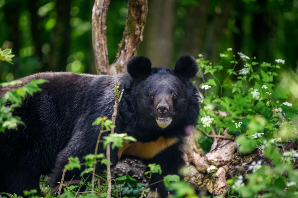
Though its lofty heights may appear unsuitable for extensive life, Makalu Barun is home to a variety of fauna. It is one of the few places in Nepal where there are regular sightings of the Himalayan black bear (Ursus thibetanus), also known as the Asian black bear or “moon bear.” This bear is native to the Himalayas and inhabits the forest and mountainous regions within Makalu Barun.
These medium-sized bears are easily recognizable by their distinctive white chest patch and muzzles, contrasting with their primarily black fur. They are omnivorous, feeding on a mix of fruits, nuts, insects, and small vertebrates.
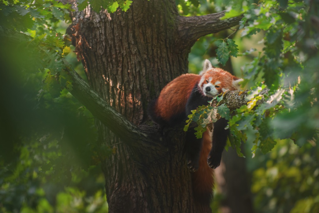
Makalu Barun was also the first place where—in 2009—zoologists were able to capture footage of the elusive Asian golden cat (Catopuma temminckii) with a camera trap at 2,517 meters (8,258 ft). Besides the moon bears and Asian golden cat, five of the most iconic animals found in Makalu Barun are:
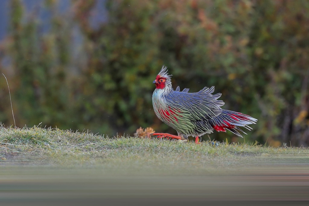
Makalu Barun is also popular for birdwatching. In addition to the blood pheasant, there are over 500 species of birds within the park, and 16 rare or protected species, including the rose-ringed parakeet (Psittacula krameri), blue-naped pitta (Hydriornis nipalensis), pale blue flycatcher (Cyornis unicolor), silver-eared mesia (Leiothrix argentauris), sultan tit (Melanochlora sultanea), spiny babbler (Turdoides nipalensis), white-naped yuhina (Yuhina nuchalis), Blyth's kingfisher (Alcedo hercules), and blue-eared kingfisher (Alcedo meninting). The park is also home to 43 species of reptiles, 16 species of amphibians, and 78 species of fish.
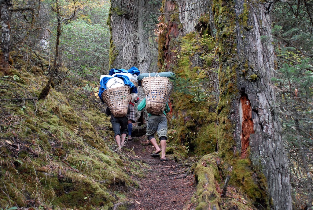
The area now known as Makalu Barun National Park has been inhabited by indigenous communities for centuries. Evidence suggests the Limbu people, believed to be of Tibeto-Burman origin, were the earliest inhabitants. Around the 13th century, they migrated eastward from their ancestral lands, settling in the foothills of the Himalayas. The Limbus developed a deep connection with the land, practicing subsistence agriculture and revering the mountains as sacred spaces.
Other groups soon arrived in the region, including the Rai and the Sherpa, who migrated from the Solukhumbu in the 17th century. Additional inhabitants of the area include Yakkha, Gurung, Newar, Brahmin, Tamang, Magar, and Chhetri. For centuries, the Makalu Barun region has held religious significance for these people. Pilgrimage routes leading to sacred sites like Macha Khola and Khumbu Chorten wound through the valleys. These journeys fostered a sense of spiritual connection with the land, one common throughout the Himalayas.
The history of Western exploration in the Makalu Barun region is relatively recent due to its remote and inaccessible terrain. It wasn’t until the 1900s that the area gained attention from the international mountaineering community.
Makalu was first successfully climbed in 1955 under a French expedition led by Jean Franco. Legendary alpinists Lionel Terray (author of Conquistadors of the Useless) and Jean Couzy represented the team at the summit.
The increased development and traffic in the park due to mountaineering and tourism—as well as growing levels of deforestation and overgrazing—began to raise concerns about environmental conservation, and the American nonprofit The Mountain Institute (TMI) collaborated with Nepal’s Department of National Parks and Wildlife Conservation (DNPWC) to protect the land, first as a conservation area in 1988 and later as a national park in 1992. The main park is ringed by an 830 sq km (320 sq mi) buffer zone to the south and southeast, added in 1995 to allow indigenous communities to continue living on the land in their traditional manner while adhering to conservation principles.
Fees to enter Makalu Barun National Park vary depending on your citizenship. Citizens of Nepal must only pay 25 Nepalese rupees (NPR), equivalent to around $0.20. Citizens of South Asian Association for Regional Cooperation (SAARC) nations are required to pay 1,500 NPR ($12), while other foreign tourists must pay 3,000 NPR ($23) per person.
Trekking to Makalu also technically requires a Trekking Information Management System (TIMS) card, though park officials rarely check for this. The price for a TIMS card for SAARC citizens is 1,000 Nepalese rupees ($7.,50), and non-SAARC is 2,000 NPR ($15).
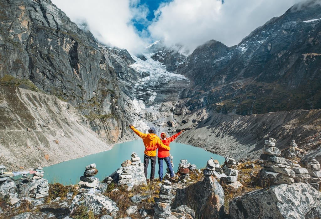
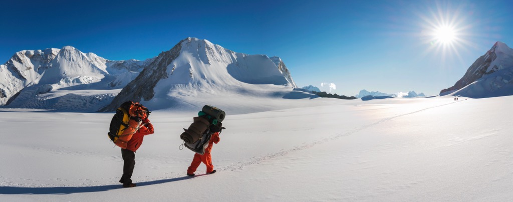
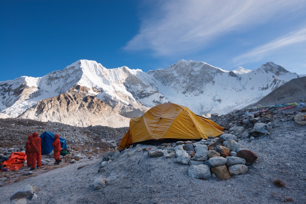
There are several trails winding within Makalu Barun National Park, but the most popular objective for trekkers is to reach Makalu Base Camp (4,870 m / 15,978 ft). This can be done via several routes, so the distance varies, but reaching Makalu typically entails hiking around 75-100 km (47-62 mi) each way and taking anywhere from 12 to 15 days round-trip, not including a stay at Base Camp. See “Accommodation within the Park.”
Because the park is so remote, rugged, and undeveloped, the best way to experience Makalu Barun National Park is through a trekking agency, which will handle all permits, lodging, supplies, gear, and other logistical questions.
The best time to visit Makalu Barun National Park is from October to November or March to April. It can be quite hot in April and May at lower elevations, and the monsoon season makes trekking extremely difficult from June to September.
However, most high passes and many trails are snow-logged until after April or May, and some have rockfall hazards. Per the DNPWC, “one particularly hazardous area is the trail between Mumbuk and Yangle Kharka” due to high levels of rockfall and instability. Trekkers in this area should move quickly.
Several small towns along the Arun River run north-south through the Arun Valley, but the Kumal village of Tumlingtar is the most common starting point for visitors to Makalu Barun. Makalu is around 50 km (31 mi) northwest of Tumlingtar, and it’s easy to take a taxi or bus into the park from here. Tumlingtar is accessible by plane (30 min) from Kathmandu and by car or bus (12-15 hr).
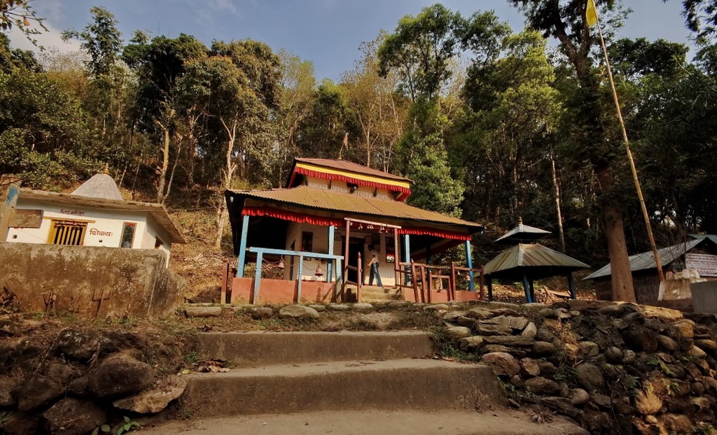
The town itself is pretty small, but there are a few interesting sites, like Radha-Krishna Temple in its central bazaar. Don’t miss the 17th-century Manakamana Temple across the river, dedicated to an eponymous Hindu goddess, a local incarnation of Parvati. Animal lovers may want to stay clear; there are regular animal sacrifices here. Many other temples and monasteries are deeper in the mountains, like Kailash Temple in Dingla.
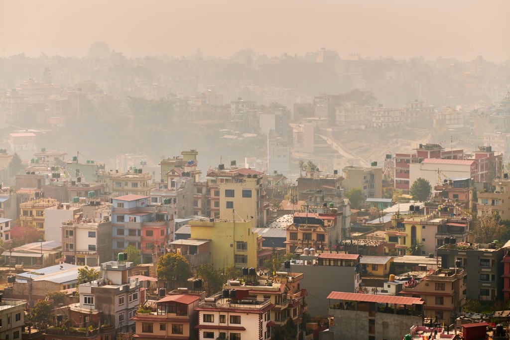
With Makalu Barun National Park and any other trekking destination in Nepal, the starting point is the country’s capital, Kathmandu (pop. 1.4 million). Kathmandu is around 173 km (107 mi) as the crow flies from Makalu Barun, but the driving distance is closer to 500 km (310 mi). The city boasts a rich history dating back to the 2nd century AD. Though increasingly developed, Kathmandu remains a captivating blend of ancient traditions and modern life.
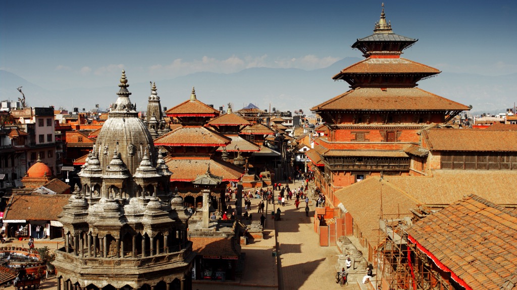
Perhaps the most famous sight in Kathmandu is the bustling Durbar Square, a 3rd-century ancient palace square and UNESCO World Heritage Site in the heart of the old city. It is surrounded by a labyrinth of narrow alleys, intricately carved temples, and pagoda-style buildings.
Thamel, the city’s tourist hub and nightlife zone, is a maze of shops selling everything from traditional handicrafts to trekking gear. Durbarmarg (the “King’s Way”), a long, broad avenue lined with cafes, restaurants, and luxury hotels, is another popular hangout spot. It leads to the Royal Palace of Narayanhiti, once the residence of Nepalese monarchs and now a museum.
Kathmandu is also a haven for Hindu and Buddhist devotees. Swayambhunath, a stupa (dome-shaped Buddhist shrine) perched on a hilltop, is a significant pilgrimage site for Buddhists. The Boudhanath Stupa, one of the largest stupas in the world, is a center for Tibetan Buddhism. Pashupatinath Temple, a sacred Hindu shrine, is dedicated to Lord Shiva. Religious ceremonies provide a glimpse into the deep faith permeating Kathmandu's culture.
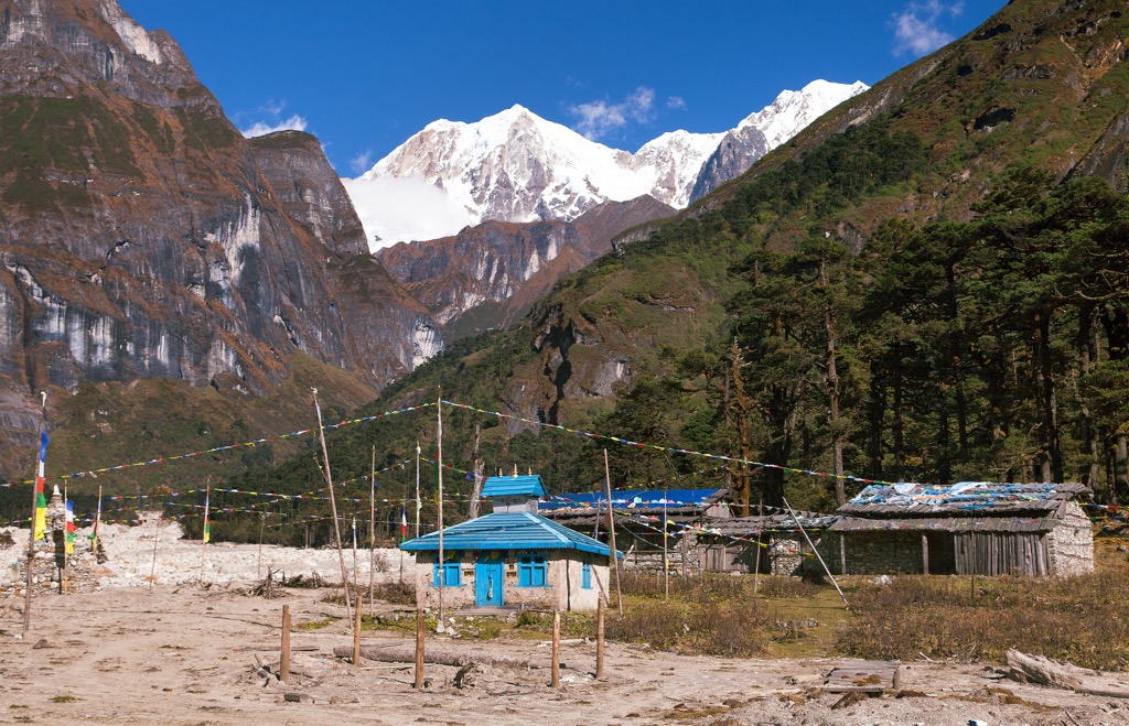
In addition to Makalu Base Camp (4,870 m / 15,978 ft), many shelters have been built specifically for sleeping purposes inside the park, and there are dozens of designated campsites. The most established and well-equipped are along the trekking route to Base Camp. The most popular of these are Khongma (3,637 m / 11,932 ft), Dobato (3,862 m / 12,671 ft), Nehe (3,700 m / 12,139 ft), Yangla (3,557 m / 11,670 ft), Langmale (4,410 m /14,469 ft), and Shershong (4,630 m / 15,190 ft).


ultra
8000ers
china-ultras
nepal-ultras
ultra
8000ers
china-ultras
nepal-ultras


.jpg)