
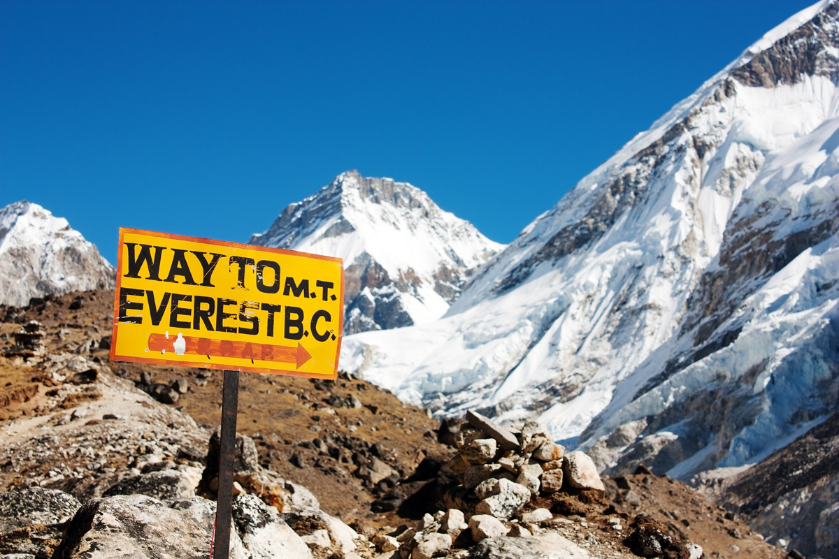
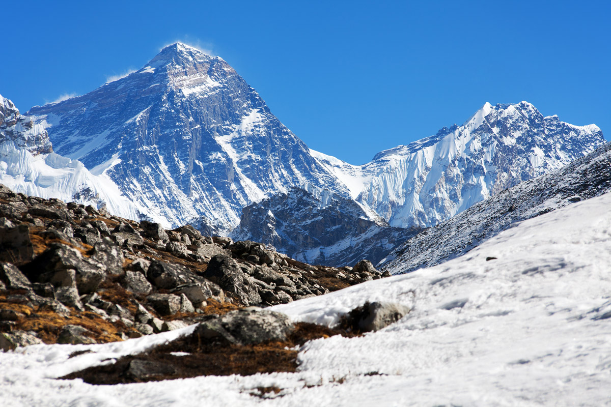
Everest Base Camp trek is an epic adventure of a lifetime at the foot of the world’s highest mountain through the scenic Sagarmatha National Park in Nepal. The trek requires proper planning and strict adherence to the rules of high-altitude trekking in order not to finish it earlier than expected and not to end up lying there in permafrost forever. Oftentimes the journey might be challenging, reaching the trek’s high point Kala Patthar 5 648m (18 530 ft) is out of the usual comfort zone of any human being. But rewards are enormous and our mission at PeakVisor is to make sure you get every tiny little bit of those benefits.
We heard from many EBC trekkers that PeakVisor was essential for their Himalaya trekking experience but there was some room for improvement. We listen attentively, react instantly, and improve quickly. This season we have brought numerous improvements and prepared a lot of useful materials for your Everest Base Camp adventure and many other Nepal treks. First of all, we have made sure that PeakVisor users will be able to identify and learn even about the least known peaks. Our mountain database is the most thorough you can get. Only the best sherpas can challenge our knowledge of the landscape.
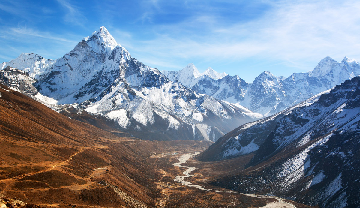
We started with several interviews and in-depth research on Nepal trekking areas. Arguably, Sagarmatha National Park and Annapurna Conservation Area in the Himalayas are the most popular of them, but we paid attention to less-visited yet no less spectacular regions like Makalu Barun National Park. We encourage you to read our articles about these national parks and available treks. Apart from a useful guide, you’ll find great photography and mountain panoramas to choose from for your unique adventure.
Here are the most important PeakVisor improvements for trekkers in Nepal:
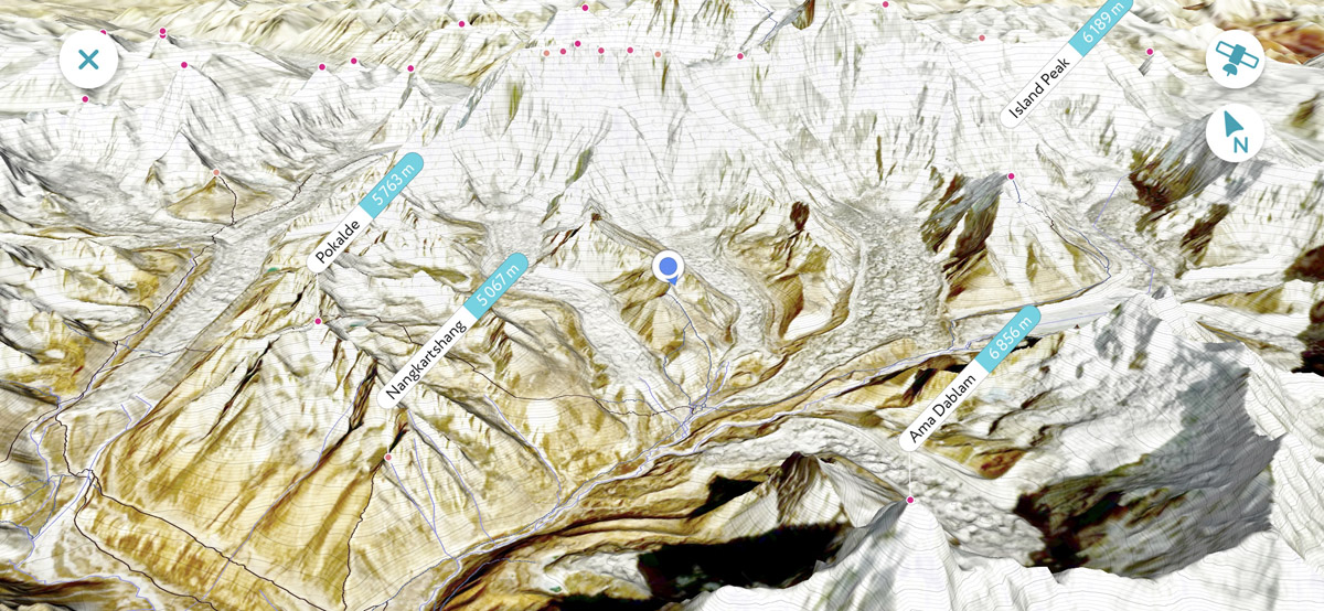
- PeakVisor features high-precision 3D maps with satellite imagery covering all regions of Nepal and most of the Himalayas.
- All major treks including Everest Base Camp and Annapurna Base Camp are presented in the app. We have manually checked all the data. While the app allows easy navigation through a unique route, you can always have a reference itinerary.
- New types of points of interest and landmarks were added into the app such as Buddhist stupas, even the smallest villages, lakes, mountain passes, dedicated camping areas, and spectacular viewpoints.
Finally, we advise
- Downloading all the maps in advance as the Internet connection in Nepal leaves much to be desired.
- Packing a power bank (or two) with your gear. Electricity might be a luxury at high-altitudes.
- Trying to get some buffer days for additional side-trips and flight cancellations due to unpredictable weather in the mountains.
- Getting an interesting book for your acclimatisation days when you can’t scale higher due to altitude sickness or just lack of steam and stamina.
We’re looking forward to hearing about your adventures in the Himalaya at peakvisor@routes.tips. Also, please send us your photos of those majestic peaks, especially those with tiny PeakVisor tags on top of them!
Happy trekking!