Scan the QR code and open PeakVisor on your phone
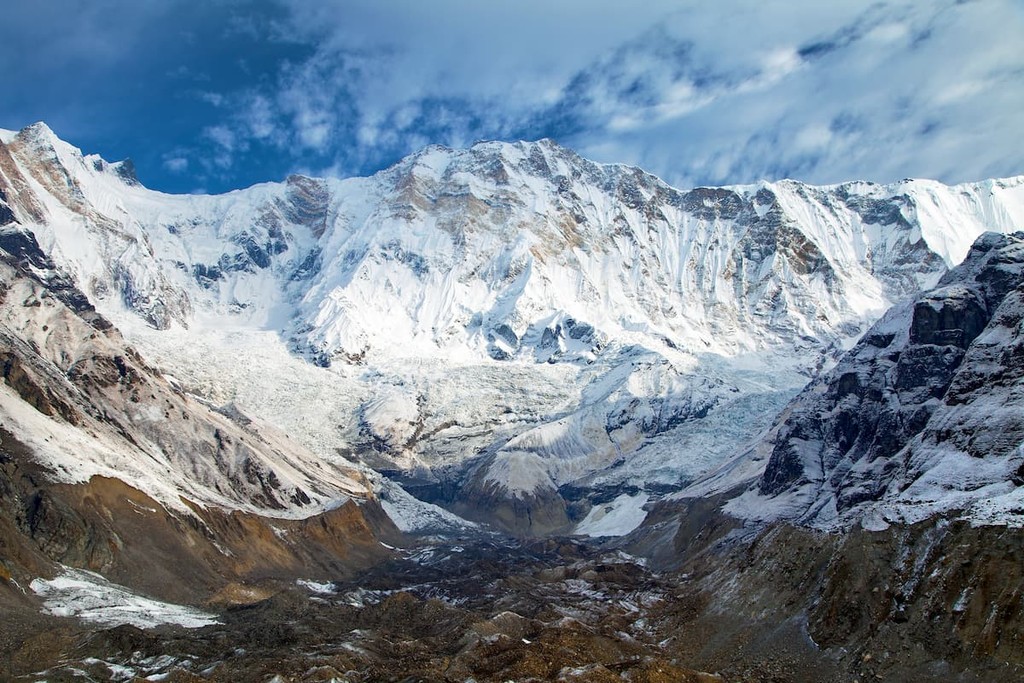
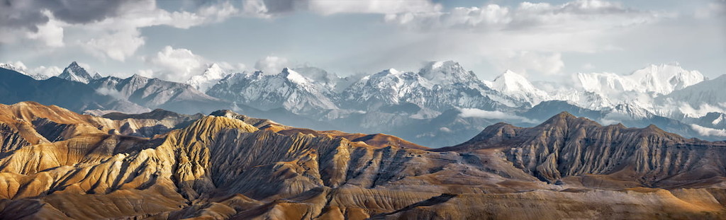
Nepal’s most popular trekking region, Annapurna Conservation Area is a land of stunning mountainscapes and vibrant villages. The conservation area contains 118 named mountains, the highest and most prominent of which is Annapurna I (8,091m/26,545ft).
The largest single protected area in Nepa (नेपाल)l, the Annapurna Conservation Area (अन्नपूर्ण संरक्षण क्षेत्र) is a vast landscape that’s some 7,629 square kilometers (2,946 sq. mi) in size.
Located in the north-central part of the country near its border with Tibet (China), the Annapurna Conservation Area includes part of the Lamjung (लमजुङ), Myagdi (म्यग्दी जिल्ला), Kaski (कास्की), Mustang (मुस्ताङ जिल्ला), and Manang (मनाङ) districts in the Gandaki Province (गण्डकी प्रदेश) of the Western Development Region (पश्चिमाञ्चल विकास क्षेत्र).
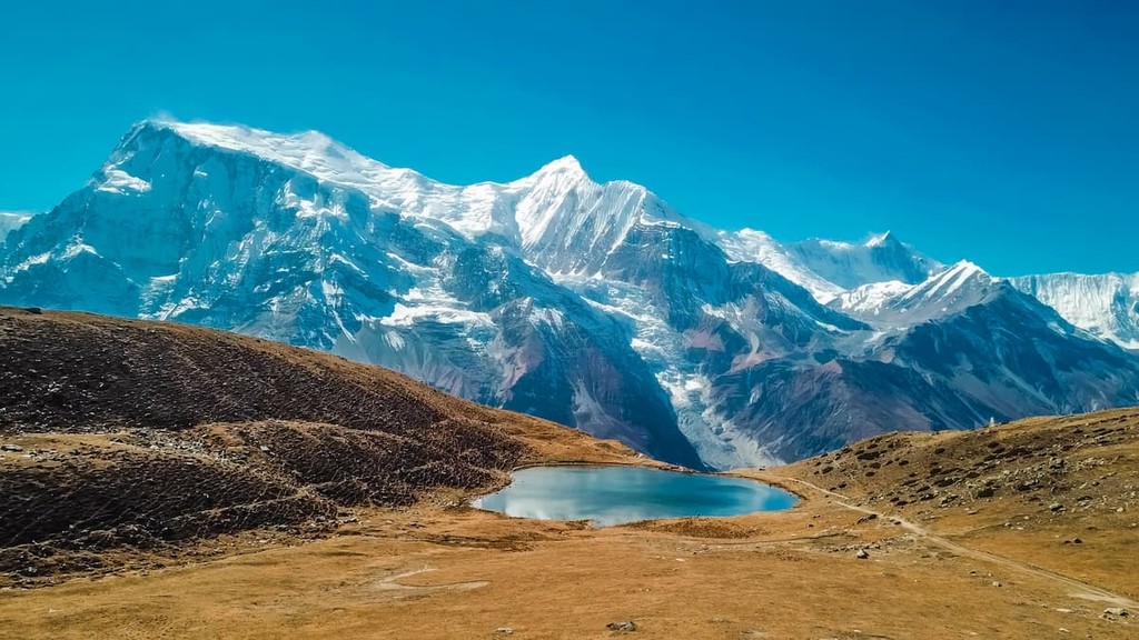
As the name suggests, the Annapurna Conservation Area is centered around the Himalayan peaks of the Annapurna Massif, which includes Annapurna I (अन्नपूर्ण), Annapurna II (अन्नपूर्ण दोश्रो), Annapurna III (अन्नपूर्ण तेश्रो), Annapurna IV (अन्नपूर्ण चौथौ), Annapurna South (अन्नपूर्ण दक्षिण), Gangapurna (गङ्गापूर्ण), and the truly stunning Machapuchare (माछापुच्छ्रे).
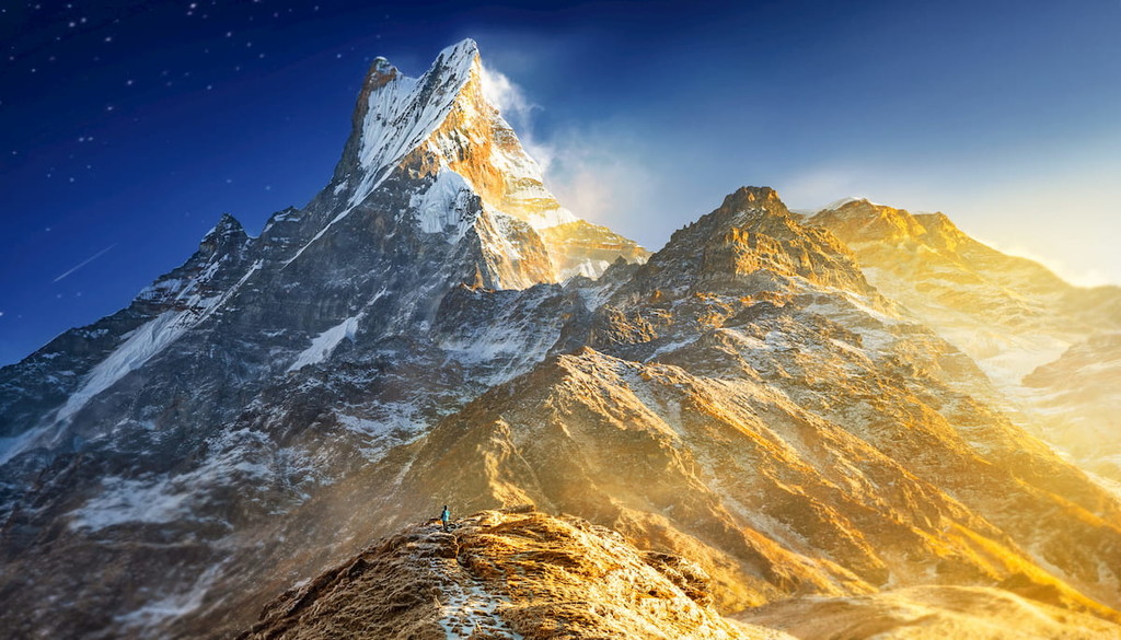
Interestingly enough, however, the summit of Annapurna I isn’t visible from much of the region as it is shrouded behind other nearby peaks. In fact, the most easily spotted peak along many of the area’s popular trekking routes is not Annapurna I, but Annapurna South. Nevertheless, the summit of the region’s highest peak is visible from a number of viewing points, including at Annapurna Base Camp (ABC).
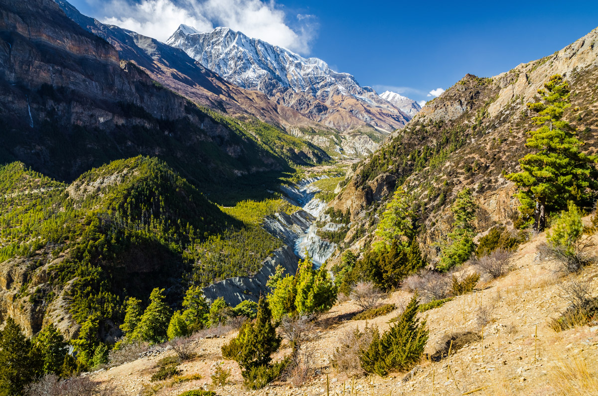
The trekking area also incompases the Kali Gandaki Gorge (कालीगण्डकी खोंच), which separates the peaks of the Annapurna Massif from Dhaulagiri (धौलागिरि) and Dhaulagiri II. In fact, the Kali Gandaki Gorge of the Gandaki River is believed to be the deepest gorge in the world, as it separates two 8,000-meter (26,246ft) peaks, creating a depth of about 5,571m (18,278 ft) below the summit of Annapurna I.
Although the conservation area is the largest in the country, it is far from its only protected region. In fact, the Annapurna Conservation Area is located relatively close to a number of major protected areas, including Shey Phoksundo National Park (शे-फोक्सुण्डो राष्ट्रिय निकुञ्ज) to the west, Dhorpatan Hunting Reserve (ढोरपाटन शिकार आरक्ष) to the southwest, and both Manaslu Conservation Area (मनास्लु संरक्षण क्षेत्र) and Langtang National Park (लाङटाङ राष्ट्रिय निकुञ्ज) to the east.
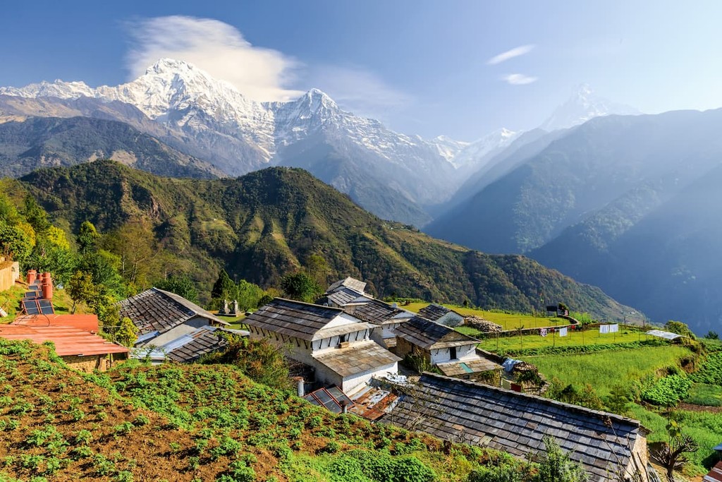
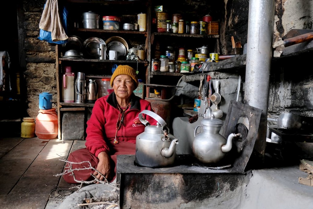
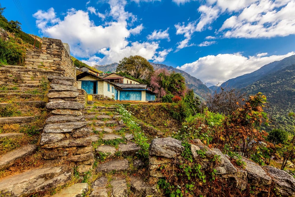
Moreover, while the Annapurna Conservation Area is best-known for its beautiful mountain scenery, however, it is also home to about 100,000 people who live throughout the region’s many villages.
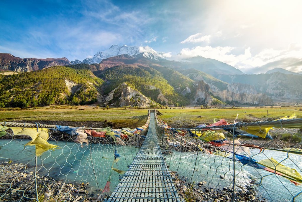
In fact, most visitors to the conservation area stay in tea houses and other lodging accommodations in local villages, so no trip to the Annapurna Region is complete without experiencing the area’s rich cultural heritage. With well over 1,000 tea houses and lodges in the region, there are plenty of chances to meet the locals while trekking and to learn more about the beautiful place that they call home.
Additionally, the Annapurna Conservation Area is the most popular trekking destination in all of Nepal. Since permits are required for all trekkers in the region, the Nepali government is able to keep track of the number of visitors that spend time in the Annapurna Conservation Area each year.
On average, it’s estimated that about 120,000 trekkers visit the Annapurna Conservation Area on an annual basis. As a result, the region is currently struggling with a number of environmental issues, particularly when it comes to wood consumption (wood is the primary fuel source for many of the local towns) and garbage production.
To combat these issues, the local government has implemented a number of important community-based conservation programs. Moreover, the Annapurna Conservation Area is also the first protected area in Nepal that allows for community development within the region and that maintains traditional community rights to all of the area’s natural resources.
Overall, the Annapurna Conservation Area has 3 goals:
The peaks within the Annapurna Conservation Area are part of the Himalaya, which is the world’s highest mountain range. Stretching across India, Pakistan, Tibet, Bhutan, and Nepal, the Himalaya includes nearly all of the world’s 8,000-meter peaks (4 are located in the Karakoram), as well as over 50 peaks with summits above 7,000m (22,965ft).
Geologically, the Himalaya, including the peaks of the Annapurna Massif, are quite young. They started to form in earnest during a mountain building event known as the Alpine orogeny, which saw the Indian and African plates collide with the Eurasian plate to the north.
As a result of this collision, a major system of mountain ranges, known as the Alpide Belt, started to form during the Late Cretaceous. Interestingly, many of Europe and Asia’s other major mountain ranges, including the Alps, the Apennines, the Pyrenees, the Hindu Kush, and the Caucuses, also started to form during this mountain building event.
That being said, it’s important to point out that the Himalaya are still growing as the Indian subcontinent continues to move northward into the Eurasian plate. While the rate of movement is believed to be but a scant few centimeters per year, it is more than enough to cause some of the region’s highest peaks, such as Mount Everest (Sagarmāthā/Chomolungma/珠穆朗玛) in Sagarmatha National Park (सगरमाथा राष्ट्रिय निकुञ्ज), to grow by about 61cm (2ft) in recent years.
Major peaks in the Annapurna Conservation Area include Annapurna I, Annapurna II, Nimjung, Machapuchare, Kanguru, and Jakrijang Lek.
The Annapurna Conservation Area is a highly biodiverse region that enocmpases a wide range of different ecosystems. In fact, there are more than 1,200 species of flowering plants, 100 species of mammals, 500 species of birds, 20 species of amphibians, and 40 species of reptiles that are found within the borders of the conservation area.
Part of the reason why the conservation area is so biodiverse is because it includes land at a wide range of elevations. In addition to the highly forested ecosystems in the deep valleys, the conservation area also includes temperate mid-elevation forests that are lush in rhododendron, high-altitude pine forests, terraced agricultural fields, and alpine meadows.
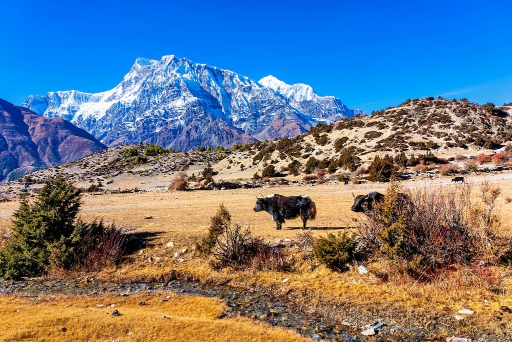
Nevertheless, although wildlife is abundant in the conservation region, most of the animals you’ll see while trekking are domesticated livestock. Indeed, along the major trekking routes, terraced fields and agricultural communities are abundant, so cows, chickens, and water buffalo are common sights. That being said, while you may see yaks on the trekking route, these are more common in other parts of Nepal, such as the Solukhumbu.
Humans have lived in and around what is now the Annapurna Conservation Area for thousands of years. It has a rich cultural heritage and has long been home to agricultural communities.
Indeed, the conservation area is home to a number of different ethnic groups, including the Gurung, Magar, Manage, Loba, and Thakali people. Within the region, a wide range of different languages and dialects are spoken, including Nepali. Moreover, although the region is predominantly Hindu, there is also a large population of Buddhists in and around the Annapurna Conservation Area.
Although Annapurna is not the tallest mountain in Nepal, its status as an 8,000-meter peak means that it has long been a source of intrigue for mountaineers.
Interestingly enough, however, although other major peaks such as Mount Everest and Nanda Devi, saw their first legitimate summit attempts in the early 20th century via Tibet or India, Annapurna didn’t see its first climbing expedition until 1950 when a French expedition led by Maurice Herzog journeyed to the mountain.
Perhaps even more interesting, however is the fact that Herzog and his team didn’t even intend to climb Annapurna in the first place. In fact, the team had set out to climb Dhaulagiri I, but after failing to find a way to the base of the mountain due to the difficulties of navigating the Modi Khola, Herzog and his fellow climbers set their sights on Annapurna, instead.
Eventually, after weeks of trekking and climbing, Herzog did actually manage to make it to the summit of Annapurna alongside Louis Lachenal on June 3, 1950. However, the duo ended up having quite the adventure on the descent, which resulted in serious frostbite for both climbers.
Nevertheless, Annapurna I thus became the first 8,000-meter peak to have been submitted and the only one of the world’s 14 highest peaks to have been summitted on its first attempt.
After the first successful Annapurna expedition, a number of other major climbing expeditions soon arrived in the region. In 1970, Don Whillans and Dougal Haston both summitted the mountain via its treacherous South Face without oxygen.
Additionally, in 1978, Arlene Blum’s American Women’s Himalayan Expedition became the first group of women to summit the mountain, as well as the first ever all-women's expedition to the Himalaya.
More recently, the late Ueli Steck made a speed ascent and descent of the mountain in just 28 hours from Base Camp in 2013. His climb has frequently been cited as one of the most impressive climbs in Himalayan mountaineering history.
These days Annapurna I remains a fairly popular climbing objective among very experienced Himalayan Mountaineers. However, it also has one of the highest fatality rates of all the 8,000-meter peaks. In fact, many well-known climbers have died on the mountain, including Anatoli Boukreev, Iñaki Ochoa, Pierre Béghin, Ian Clough, Alex MacIntyre, Park Young-seok, Vera Watson, and Alison Chadwick-Onyszkiewicz.

The Annapurna Conservation Area was created in 1986 in response to growing tourism in the region. In fact, it was Nepal’s first ever conservation area and it continues to be the largest one in the country more than 30 years after its founding.
These days, the conservation area remains Nepal’s most popular trekking destination and tourism numbers are only expected to increase in the coming years. As a result, the National Trust for Nature Conservation and its local partners have instituted a number of community-based programs to help encourage sustainable and environmentally-friendly tourism in the region that can provide economic opportunities for residents.
Visitors to Nepal are required to obtain a TIMS (Trekker’s Information Management Systems) card from the Nepali government before trekking in the country. TIMS cards can be obtained in Kathmandu at the Tourist Service Center/Nepal Tourism Board, though any reputable guide service can also help you navigate the paperwork for an additional fee.
In addition to a TIMS card, all visitors to the Annapurna Conservation Area also need an ACAP Nepal Permit. It’s important to note that you’ll need this permit to enter the conservation area, even if you’re only doing a short trek.
You can obtain an ACAP in Kathmandu (just a short walk from Thamel) when you apply for your TIMS card. Do remember to bring a copy of your passport as well as 2 passport-sized photos and payment in Nepali rupees when you apply for your permits.
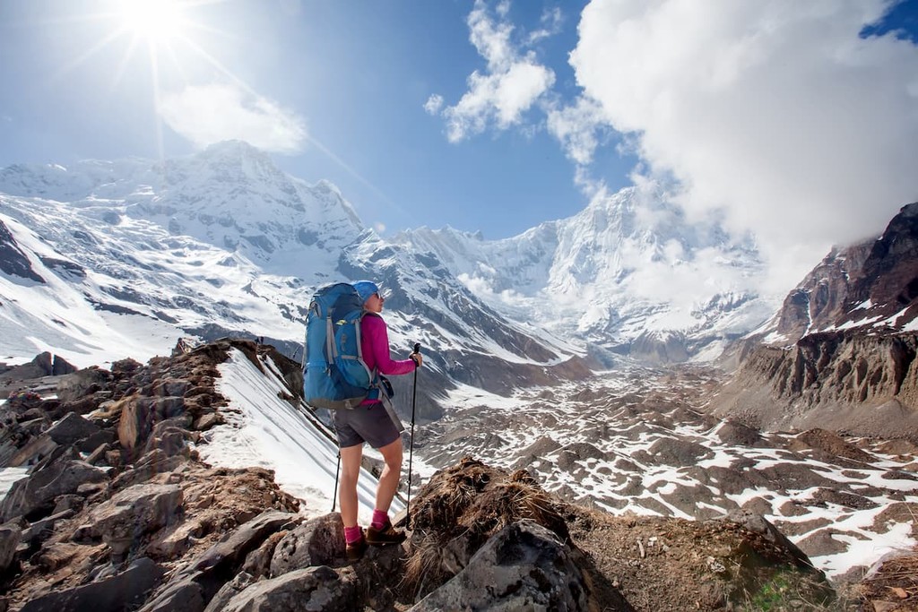
As the most popular trekking destination in Nepal, the Annapurna Conservation Area offers no shortage of opportunities for adventure. Although there are many different trekking routes in the region, here are some of the most popular:
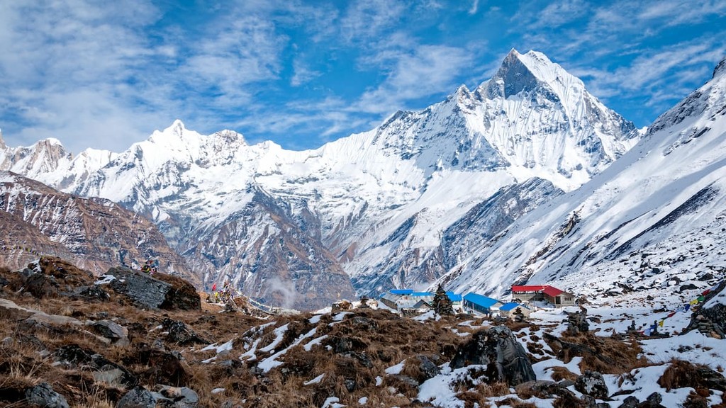
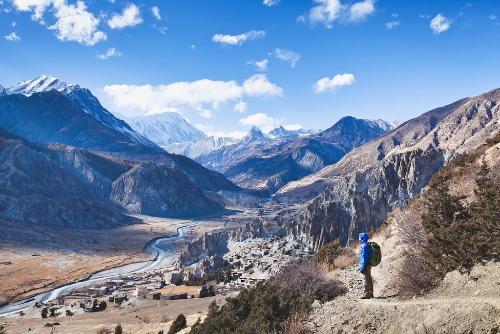
Perhaps the most popular of the Annapurna Region treks, the hike to Annapurna Base Camp is a must for any first-time visitor. Depending on the season and your fitness levels, the trek generally takes about 9 to 12 days (not including time in Kathmandu or Pokhara), though it can certainly be completed faster with proper acclimatization.
The Annapurna Base Camp Trek is a particularly fun trek because it allows for plenty of time in the region’s many villages. Although you can complete the trek as a tent-based adventure, staying in the local tea houses is part of the fun.
Perhaps the next most popular trek in the region after the Annapurna Base Camp trek, the Annapurna Circuit trek is a journey that takes you around the entire Annapurna Massif. Usually completed in 14 to 18 days of walking, the trek takes you as high as Thorong La Pass (5,416m/17,769ft) and offers great views of Annapurna I and Dhaulagiri.
As a result of the high altitude of the trek, the Annapurna Circuit does involve quite a bit of acclimatization, so taking things slowly is encouraged.
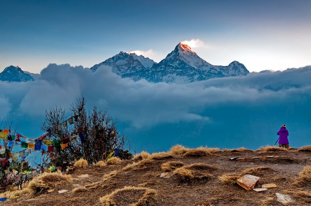
For a short foray into the Annapurna Region, trekkers can opt to do a quick 5 day trek to Ghorepani-Poon Hill. The trek usually starts at Ulleri, though you can opt to take a Jeep to the point where the navigable road ends and the walking path starts.
From there, you head out to Ghorepani where you spend a night before making your summit attempt on Poon Hill the next day.
Planning a trip to the Annapurna Conservation Area? Here are some of the best places to stay during your adventures:
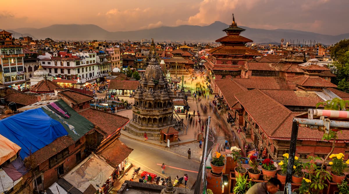
The capital and largest city in Nepal, Kathmandu is located in the east-central part of the country. Home to about 1 million people, Kathmandu is a major center for culture and commerce in Nepal. The city also has the country’s largest airport, which offers international flights as well as connections to Pokhara, where many trekkers start their trip into the Annapurna Conservation Area.
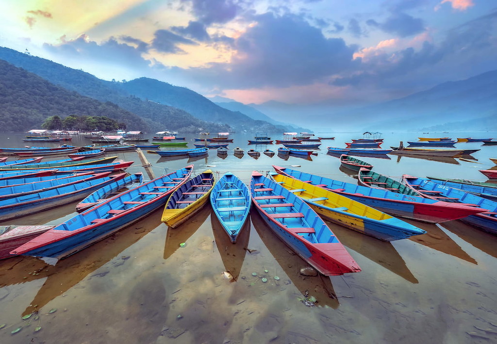
Situated in central Nepal, Pokhara is the capital of Gandaki Province and the home of about 500,000 residents. It is often considered the tourism capital of the country due to its proximity to the über-popular Annapurna Conservation Area. Visitors can get to Pokhara by road or by air and then take a jeep into one of nearby towns along popular trekking routes.
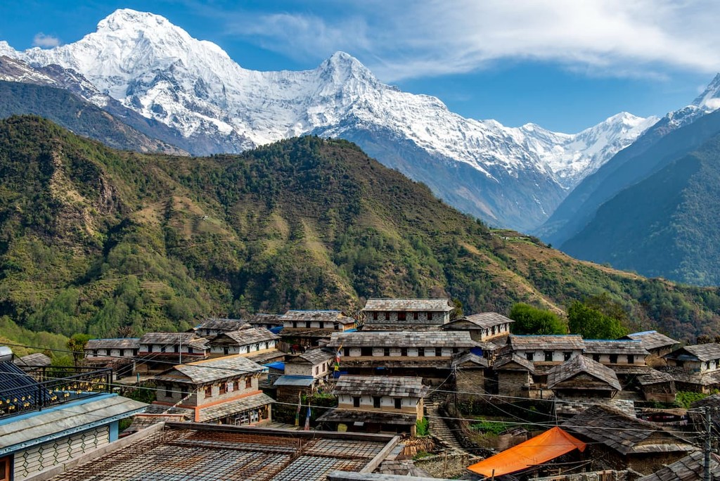
One of the larger villages in the Annapurna area, Chomrong is a popular rest spot for trekkers making their way to Annapurna Basecamp. From the town, there are truly excellent views of Annapurna South and Machapuchare.
Chomrong is accessible only by foot, though there are a number of shops, cafés, and restaurants in the village, as well as some German bakeries, which are not to be missed. There are also plenty of tea houses, such as the popular Excellent View Top Lodge, which cater to trekkers in the region.
Located at nearly 3,000m (9,800ft), the village of Ghorepani is a particularly popular stopping point on any Annapurna Region trek. The village is located along one of the main trekking routes to Annapurna Basecamp and it can be reached from Birethanti or Tatopani in about 8 to 10 hours of walking.
In addition to being home to a number of great hotels, cafés, shops, and momo dumpling restaurants (highly recommended for a quick meal), Ghorepani is a must-visit destination because of its proximity to Poon Hill.
Although Poon Hill isn’t particularly lofty, a sunrise hike to the summit allows for a great chance to see many of the region’s major peaks and even a potential glimpse at Mount Everest on a very clear day.
One of the most accessible villages in the Annapurna Region, Ghandruk is a community of about 5,000 people that’s located about 32km (20mi) by road from Pokhara. Since Ghandruk is accessible by private taxi or public bus from Pokhara, it is a very common starting point for treks in the region. Plus, the town offers excellent views of the Annapurna Massif.