Scan the QR code and open PeakVisor on your phone
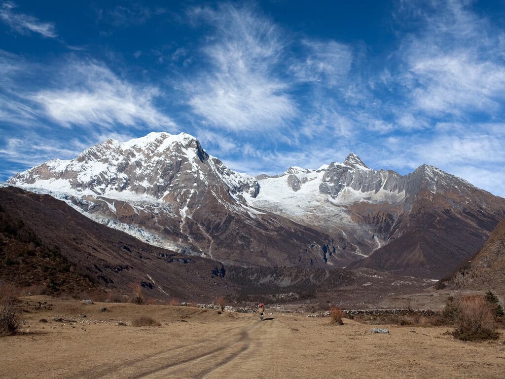
Manaslu Conservation Area is a beautiful protected mountainous landscape that’s located in north-central Nepal. The park contains 34 named mountains, the tallest and most prominent peak of which is Manaslu at 8,163 m (26,782 ft) in elevation with 3,098 m (10,164 ft) of prominence.
The Manaslu Conservation Area is situated within the Mansiri Himal range, a subrange of the Himalaya, in north-central Nepal. The park spans 1,663 sq. km (642 sq. mi) of land across the Manaslu region in the Gorkha District of the country. Furthermore, its northern boundary marks the border between Nepal and Tibet.
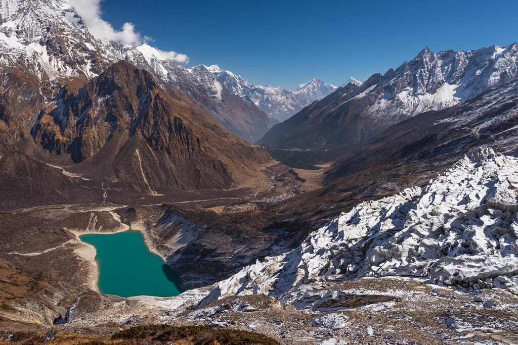
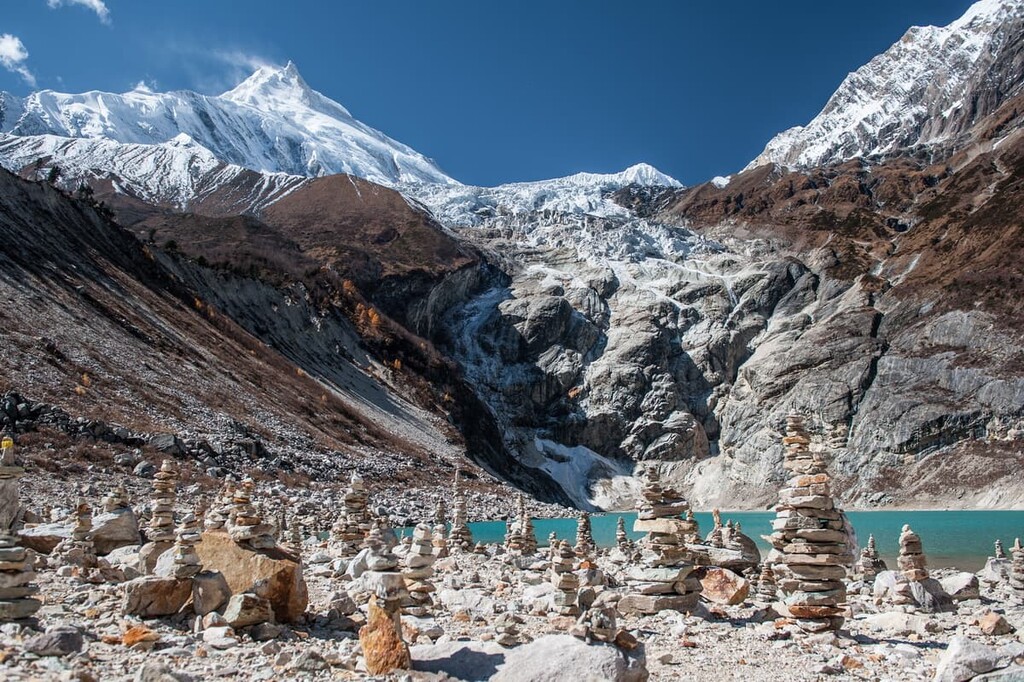
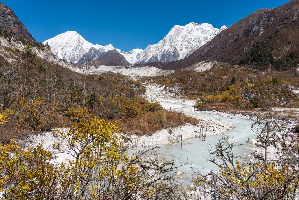
Elevations in the park range from 1,400 m (4,593 ft) up to the summit of Manaslu at 8,163 m (26,782 ft) in elevation. Besides the rugged peaks, the area is home to numerous glaciers and waterways. One of the largest rivers is the Buri Gandaki, which flows through nearly the entire protected area.
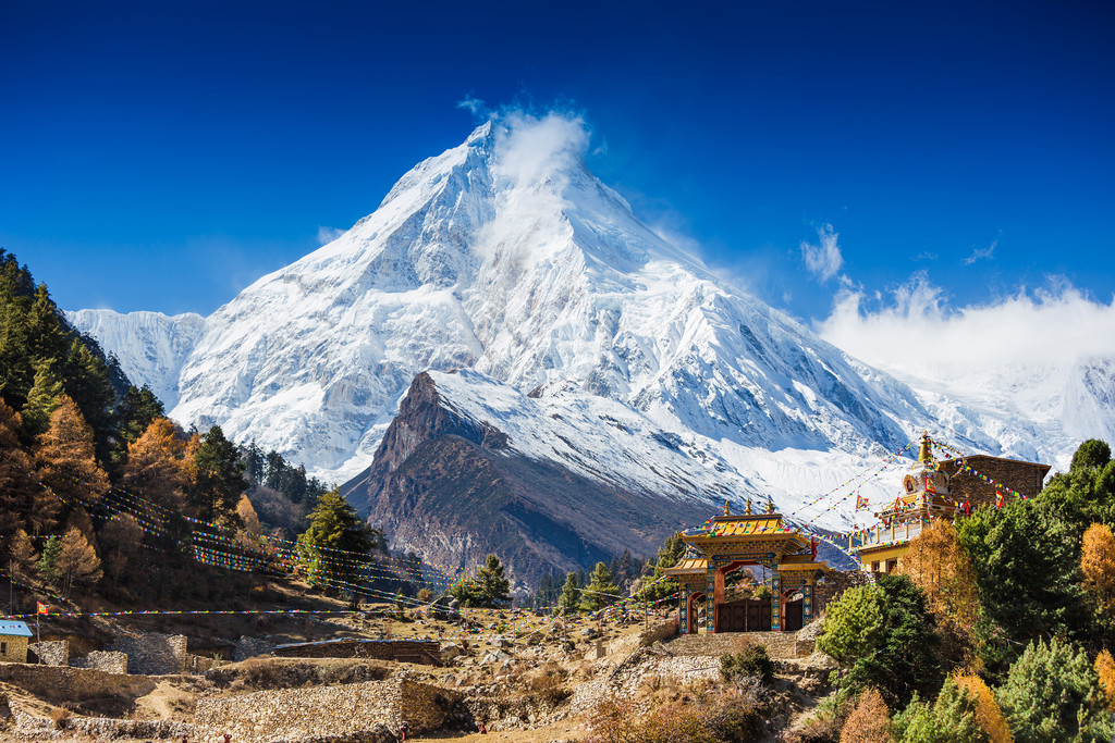
The Manaslu Conservation Area ecosystems span from sub-tropical foothills to arid high pastures. The main feature of the conservation area is Manaslu, which is also the eighth tallest peak in the entire world.
Manaslu is located along the western edge of the protected region. It is defined by its long ridges that extend throughout the nearby region. Valley glaciers fill the landscape, showcasing the prominence of the peak. The name “Manaslu” translates to “mountain of spirit” and it derives from the Sanskrit word manasa, which means “soul” or “intellect.”
To the east of Manaslu lies the Ganesh Himal, which runs throughout the protected park. Just to the west of the peak, outside the protected area, lies the gorge of the Buri Gandaki.
Additionally, Manaslu Conservation Area is surrounded by other popular outdoor recreation areas. The Annapurna Conservation Area lies directly to the west while Langtang National Park sits to the east and Chitwan National Park is located to the south.
The mountains in the Manaslu Conservation Area are part Mansiri Himal, a subrange of the Himalaya proper. The Manaslu peak, along with the other mountains in the region formed around 50 million years ago when the Eurasian plate and the Indian plate collided.
Manaslu Conservation Area is located near the Main Central Thrust Zone (MCT), the geology of which is similar to much of the Himalyan proper. Manaslu granite along with dolomite, quartzite, and slate are found throughout the protected region.
Compared to other ranges across the world, the Himalaya are one of the youngest ranges. The Indian plate continues to collide into the Tibetan Plateau, allowing for the ever so gradual rise of this iconic range. The Indian plate moves an average of 67 mm (2.6 in) per year, resulting in the range growing by 5 mm (0.2 in) each year
Major peaks within the park include Manaslu, Manaslu East Pinnacle, Himal Chuli North, Samdo, Langbo Kangri, and Chamar.
The valley within the Manaslu Conservation Area is home to numerous endangered species. Both snow leopards and red pandas find solitude in this conservation area, in hopes of helping their populations thrive.
Other common mammals in the conservation area include the Asian black bear, Himalayan tahr, blue sheep, musk deer, grey wolf, dhole, Assam macaque, and various others. Much of the wildlife conservation in the region has been achieved through the work of monks and local monasteries, many of which have implemented hunting bans in the area.
Because the Manaslu Conservation Area spans such a wide range of elevations, there are three major categories of vegetation in the park. The lower elevations, in the deep valleys of the conservation area, are dominated by a forested landscape. Here, rhododendron and blue pine are common amongst the 19 different types of forest.
Higher elevations in the park have sparse amounts of vegetation. Above the treeline, medicinal herbs and various aromatic plants can be found along with alpine grasses. The protections that were once put in place for endangered species have allowed over 1,500 plant species to thrive in the region.
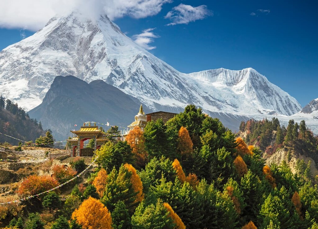
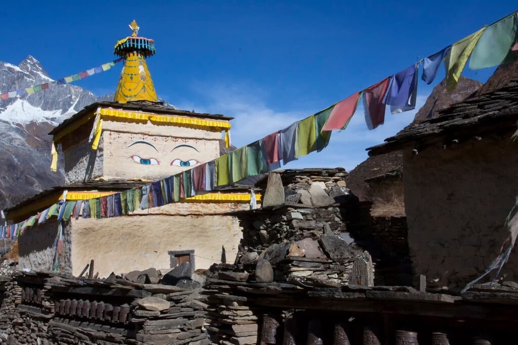
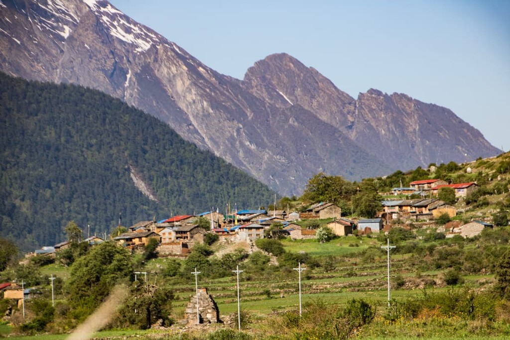
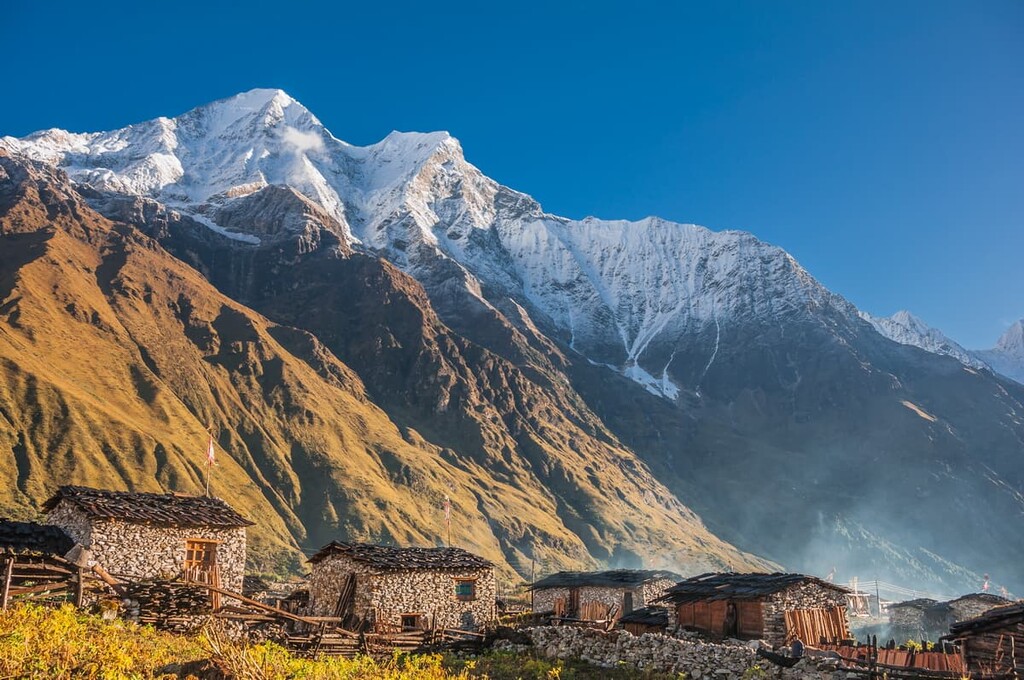
The region that surrounds Manaslu Conservation Area has been inhabited for thousands of years by humans. Manaslu has long since been referred to as “Spirit Mountain” by local communities. The mountain, and the surrounding land, is considered holy and is thought to be home to various spiritual deities.
Today over 7,000 people live in the protected area with the major ethnic group being Gurungs. Both monasteries and chhortens can be found throughout the conservation area and along the major trekking routes.
Despite being one of the tallest mountains in the world, the first European expedition up Manaslu didn’t occur until 1950. The mountain was finally summited in 1956 by a Japanese team.
The next successful expedition didn’t occur until 1971 led by Kazuharu Kohara and Motok of Japani. Just a year later, in 1972, the Austrian expedition led by Reinhold Messner reached the summit. That same year, a Korean expedition attempted to climb the northeastern face of the mountain, though fifteen of the expedition's members lost their lives in an avalanche.
That being said, even today, climbing Manaslu is far less popular than climbing Mount Everest. While around 800 people try to climb Mount Everest each year, less than 300 people have ever summited Manaslu. However, as Manaslu is an 8,000-meter peak, it is a must-climb among people looking to summit the fourteen highest mountains on Earth.
Though the main summit of Manaslu is rarely climbed, even by expert mountaineers, there are various other trails through the Manaslu Conservation Area. Here are some of the top hiking areas to visit in the park:
The trail to Birendra Lake starts near the Samagaon village in the northwestern region of the park. The route to the lake is just 4 km (2.5 miles) out and back and it has 139 m (456 ft) elevation gain. This moderate trail offers sweeping views of the pristine alpine lake with the Manaslu massif extending out to the west.
The trail to the Manaslu Glacier starts in the same village as the route to Birendra lake. The steep trail is 12.7 km (7.9 miles) with 1,262 m (4,140 ft) elevation gain. It sweeps around the east side of Birendra Lake before heading west towards the glacier. The turnaround point for the trail is near the Manaslu Base Camp.
Located in the southern region of the park lies the Tsum Valley or Larke Pass Trail, which is accessible via the Manaslu Circuit. The route has 864 m (2,835 ft) elevation gain over the course of the 18.5 km (11.5 miles) one way. This well-maintained path follows a gradual gradient throughout the route while passing through the Tsum Valley.
Looking for a place to stay near Manaslu Conservation Area? Here are some of the best cities and villages to check out in the region:
The main way to reach the conservation area is through the municipality of Gorkha. The municipality is a 10 day trek to the south of the protected area and it has a population of around 50,000 people.
The community was once home to an oldy royal palace, known as Gorkha Durbar, though it was mostly destroyed during the 2015 Nepal earthquake. The community is known for being the starting point for both the Manaslu and Mount Ganesh trekking routes
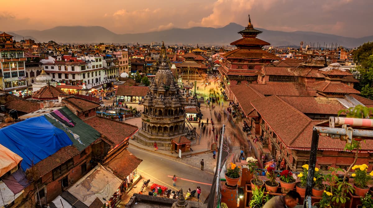
Located a four hour drive to the east of Gorkha, the city of Kathmandu is the capital of Nepal as well as the country’s most populous city. Kathmandu is home to 1.4 million people and has long been the home of the Newar people.
Kathmandu is the major cultural, historical, and economic hub of the country. A large majority of the city is home to people who practice Hinduism and Buddhism. Religious festivals and celebrations form a major part of the city’s culture and events. The city sits in the Kathmandu Valley which was historically known as “Nepal Mandala.”