
Scan the QR code and open PeakVisor on your phone
The Karakoram include 570 named peaks. The highest is K2 at 8,611 m. Other notable peaks include Jiā Shū ěR Bù Lǔ Mù Dì Yī Fēng, Broad Peak and Gasherbrum II.
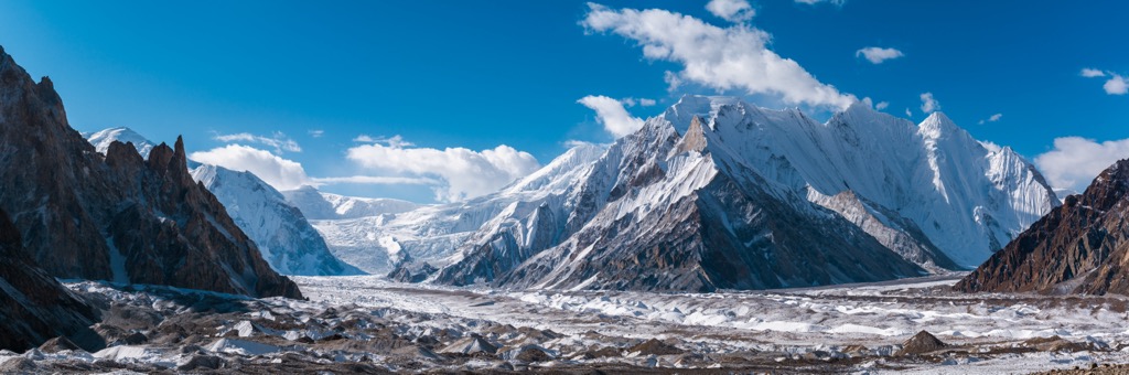
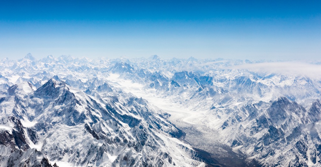
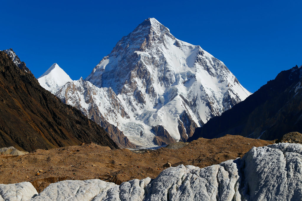
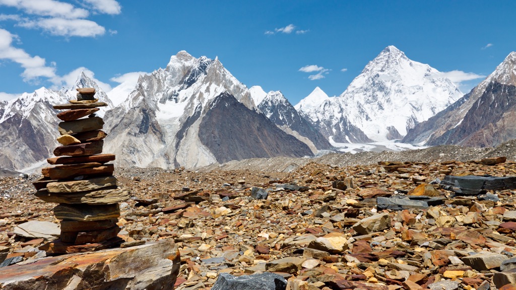
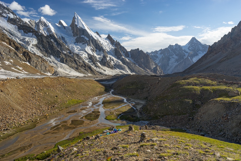
The Karakoram is one of the world’s most prominent mountain ranges; these massive peaks stretch across Central and South Asia and are home to 570 named peaks, including some of the tallest peaks in the world. Nearly 2,000 glaciers fasten to the steep faces and bowls, flowing dozens of kilometers into long glacial valleys. K2 is the tallest and most prominent peak in the range at 8,611 m (28,251 ft), with 4,011 m (13,159 ft) of prominence.
The Karakorams are part of a significant complex of mountains near Asia's center. Other major ranges in this region include the Himalayas to the southeast, the Kunlun Mountains to the northeast, the Pamir Mountains to the northwest, and the Hidukush to the west.
The Karakorams span 240 km (150 miles) in width and 500 km (310 miles) in length. With the Chang Chenmo and Pangong ranges included, the length extends to 800 km (500 miles). The range covers roughly 207,000 sq km (80,000 sq miles), extending into India, Afghanistan, Pakistan, China, and Tajikistan.
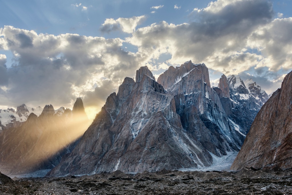
Four peaks exceed 7,900 m (26,000 ft), with the tallest being K2 at 8,611 m (28,251 ft), making it the second-highest mountain globally. The elevation averages 6,100 m (20,000 ft) throughout. Steep slopes dominate the landscape, and glaciers cover many deep, narrow valleys that snake through the mountains.
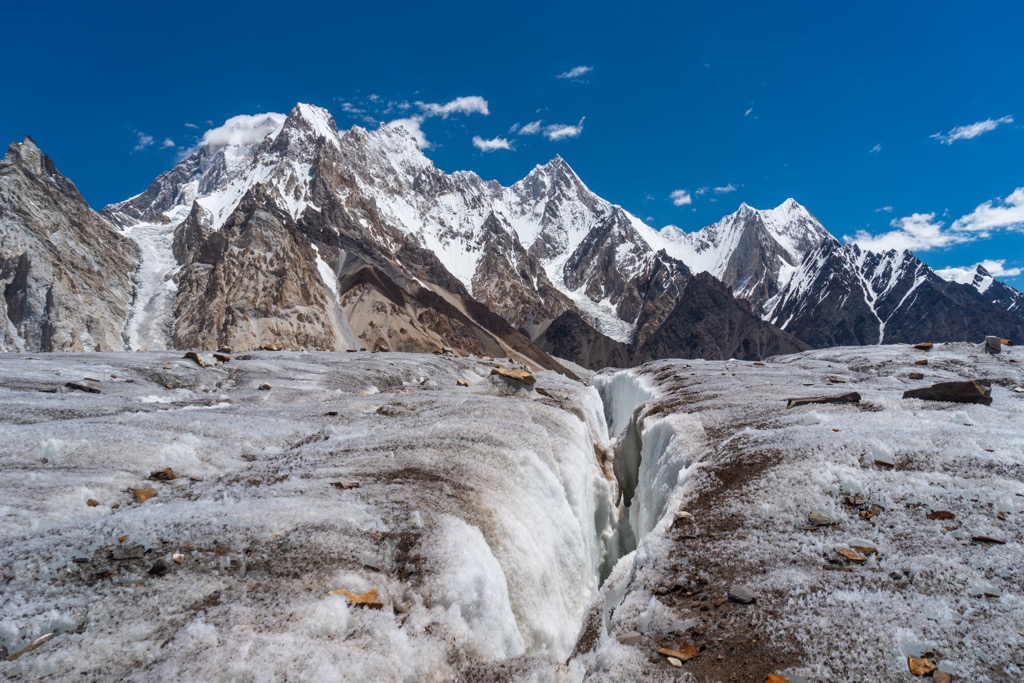
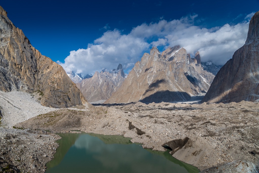
Between 28 and 50 percent of the Karakorams is glaciated. Prominent glaciers include Baltoro, Biafo, Braldu, Hispar, Chogo Lungma, and Siachen. The Siachen Glaicer is 75 km (47 miles) long, making it the second longest nonpolar glacier in the world.
The plethora of glaciers in this region often converge into complex glacial systems, sometimes spanning entire watersheds. Watersheds for the Indus and Yarkand river basins lie within the Karakorams. Rivers fed by these glaciers are quite opaque due to the high concentration of rock flour. Rock flour is a fine-grained sediment byproduct of the friction of heavy glaciers grinding the bedrock surface as they flow down a mountain. It’s also partly responsible for the magnificent turquoise hue of glacial lakes.
There are multiple national parks within and surrounding the Karakorams. The most extensive park is Central Karakoram National Park, encompassing K2 and marking the largest protected area in Pakistan.
Significant peaks in the Karakorams include K2, Batura Sar, Buni Zom, Rakaposhi, Masherbrum East, Broad Peak, and Distaghil Sar.
K2 is the tallest peak in the Karakorams and the second-highest peak in the world. It straddles the border between Pakistan and China and is known as one of the world's most technical and deadly summits. At 20%, the mortality rate is a bit higher than your chances at Russian Roulette with a six-shooter.
The name K2 was first given to the peak by Thomas Montgomerie, who sketched the two most prominent peaks in the range and named them K1 and K2, with the K standing for Karakoram.
The legend of The Belay is perhaps the most heroic event minted on the slopes of any 8000m peak. In 1953, a team of six American climbers was in the midst of a retreat after a 10-day storm forced a bivouac at 7,800 m (25,590 ft). The team had roped together for a steep traverse over exposed ice, and a fall from one of the climbers pulled the entire group off the mountain.
Incredibly, climber Pete Schoening was able to move and wedge his axe in between a boulder, arresting the fall and saving the lives of four of his companions - Art Gilkey, an incapacitated climber being transported down by his team, disappeared in the fall. His companions speculate that he cut himself loose to reduce the team's burden.
Batura Sar is the second most prominent peak in the Karakorams and the tenth tallest in Pakistan. Situated in the Batura Muztagh subrange, Batura Sar lies in the northwestern region of the Karakorams. It forms the apex of the Batura Wall, a towering ridgeline within the Batura Muztagh. Batura Sar is also called Batura, Batura I, and Batura I East.
Buni Zom lies in the Buni Zom group of Pakistan, 50 km (30 miles) east of Tirich Mir, the tallest peak in the Hindu Kush. The Buni Zom group features 12 mountains reaching over 6,000 m (19,700 ft). A New Zealand expedition completed the first recorded ascent of the Buni Zom in 1957.
Rakaposhi is the third most prominent peak in the Karakorams and the 27th tallest peak globally. Located in the Bargote Valley, it’s also known as Dumani, which translates to the Mother of Mist. Rakaposhi is noted for its dramatic face, dropping nearly 6,000 m (19,700 ft) from summit to base. The nearby town of Gilgit is host to a viewpoint known as the Zero Point of Rakaposhi.
The Karakoram fault, an oblique-slip fault system, is beneath the Karakorams. The fault sits at the convergence of the Indian and Eurasian plates, resulting from the collision of these two land masses.
The formation of the Karakorams dates back to the Cenozoic Era, which began 65 million years ago. The Karakorams are part of the Alpide belt, a major mountain system that includes the Alps, Alborz, Hindukush, Himalayas, and nearly every other range stretching from Western Europe to China.
The Alpine Orogeny formed the Alpide Belt beginning about 65 million years ago. The Indian and Eurasian landmasses shared similar rock densities; thus, the land where they converged was forced upwards rather than one plate being subuducted under the other.
The geologic composition consists predominantly of crystallized schists, granites, gneisses, and phyllites. Harsh elements and extreme cold have heavily eroded the exposed slate. Paleozoic and Mesozoic limestone is found near the core, while granite intrusions lie in the south.
The extreme climate, cold temperatures, and arid landscape make it difficult for plant and animal life to flourish. Most of the range (everything above 4,500m / 15,000 ft) is a moonscape of barren rock and ice, the climate too extreme to support plant and animal life. Above 8,000 m (26,000 ft), an area known as the ‘Death Zone’ features enough cold, snow, ice, and oxygen concentrations low enough to be utterly devoid of biological presence. Indeed, these are some of the most lifeless corners of our planet.
Oleander thickets, willow, and poplar tree populate terrain near waterways at elevations under 3,048 m (10,000 ft). Patches of juniper survive at higher elevations (4,000m / 13,000 ft) featuring seasonal snowfields.
Widespread hunting has left many animals threatened and endangered. Siberian ibex and markhors inhabit the eastern slopes, while Ladakh urials are more common amidst the flatter slopes. Marco Polo sheep once roamed much of the range but now breed in the Pamirs and occasionally migrate to the western Karakorams.
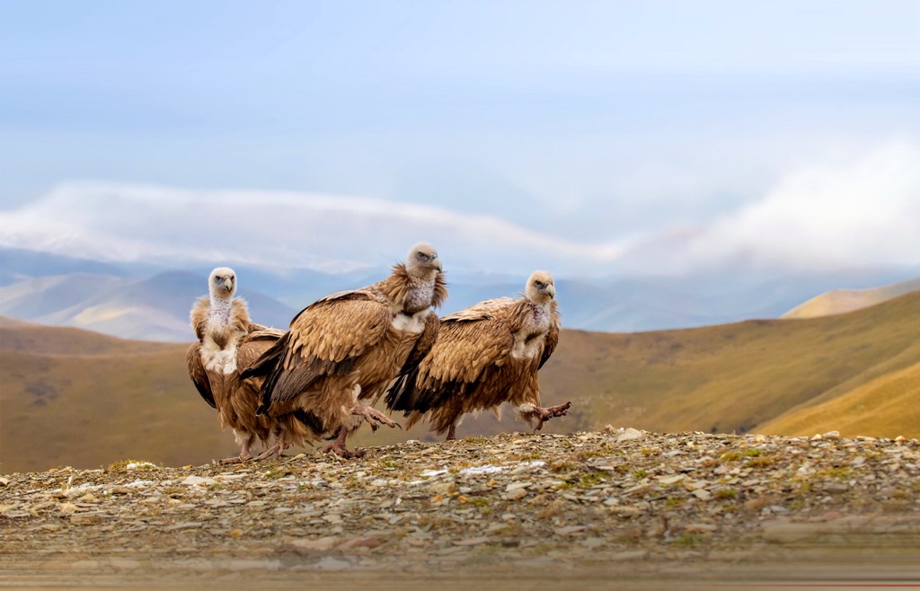
Common bird species include golden eagles, Himalayan griffons, and lammergeiers. Endangered species include elusive snow leopards, lynxes, and brown bears. Kiangs, wild yaks, and other ungulate species inhabit the eastern plateau.
The Karakorams encompass a large portion of the historic Kashmir region, which marks the northernmost section of the Indian subcontinent. Numerous cultures, religions, and military powers have shaped this geographic region.
Researchers have found neolithic sites in Kashmir Valley dating to 3000 BCE. The Uttara-Kurus settled in Kashmir during the Vedic period, while other Vedic tribes expanded throughout the surrounding ranges.
The region was an important center for Hinduism throughout the first half of the first millennium. Under the Maurya Empire's and Kushana Empire's rule, Kashmir also became a vital region for Buddhism. During the Karkota Dynasty, Shaivism rose to prominence and lasted until the mid-fourteenth century, spanning the Utpala and Lohara Dynasties.
Islam spread throughout Kashmir in the thirteenth century and continued under Muslim rule in the fourteenth and fifteenth centuries. This widespread presence of Islam eventually led to the decline of Kashmir Shaivism. Shah Mir, of the Shah Mir Dynasty, became Kashmir’s first Muslim ruler in 1339. Muslim rule lasted five centuries under the Mughal Empire and the Afghan Durrani Empire. In 1819 the Sikhs annexed Kashmir.
The British East India Company defeated the Sikh Empire in 1846 in the First Anglo-Sikh War. The British declared Jammu and Kashmir a separate princely state after the war. The Raja of Jammu, Gulab Singh, became the ruler of Kashmir under British suzerainty.
Descendants of Gulab Singh ruled until the Partition of India in 1947. The Kashmir region became a disputed territory and currently consists of areas administered by Pakistan, India, and China.
Pakistan established the Central Karakoram National Park in 1993. At 10,557 sq km (4,100 sq miles), it marks the largest protected area in the country.
The rugged terrain that defines this region has left it less inhabited than the Himalayas that lie to the east. Ancient Chinese and medieval Arabic documents showcase the earliest knowledge of Karakoram geography.
During the early nineteenth century, Europeans began exploring and documenting the range. William Moorcroft, Godfrey Thomas Vigne, and George Trebeck are some of the most notable surveyors who plotted various rivers, glaciers, and mountains.
Colonel Francis Younghusband first crossed the Muztagh Pass in 1887. General Sir George K. Cockerill explored the steep valleys above the Hunza River in 1892. Shortly after, in 1902, a group of English and Swiss mountaineers attempted to climb K2. After spending 68 days on the mountain, the expedition turned around due to the extreme conditions, having reached 6,525 m (21,407 ft).
Further attempts to summit K2 followed in 1909, 1938, 1939, and 1953, with the 1939 expedition coming within 200 m (660 ft) of the summit. In 1954, an Italian expedition was the first to reach the summit. It took 23 years to repeat the climb; Ichiro Yoshizawa from Japan and Ashraf Aman from Pakistan completed the second successful ascent in 1977. Only around 400 people have summited K2, with 91 recorded deaths. The astounding death toll has garnered K2 a reputation as one of the world's most challenging and dangerous mountains.
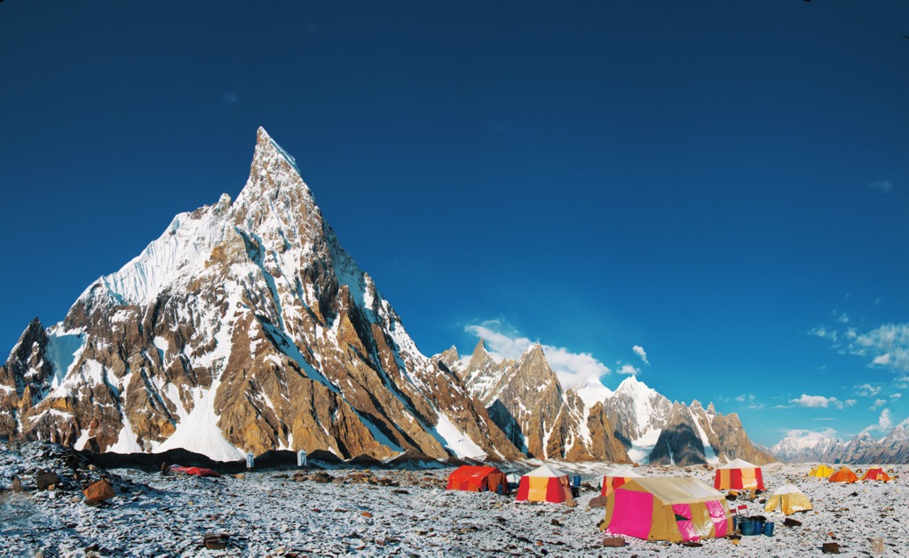
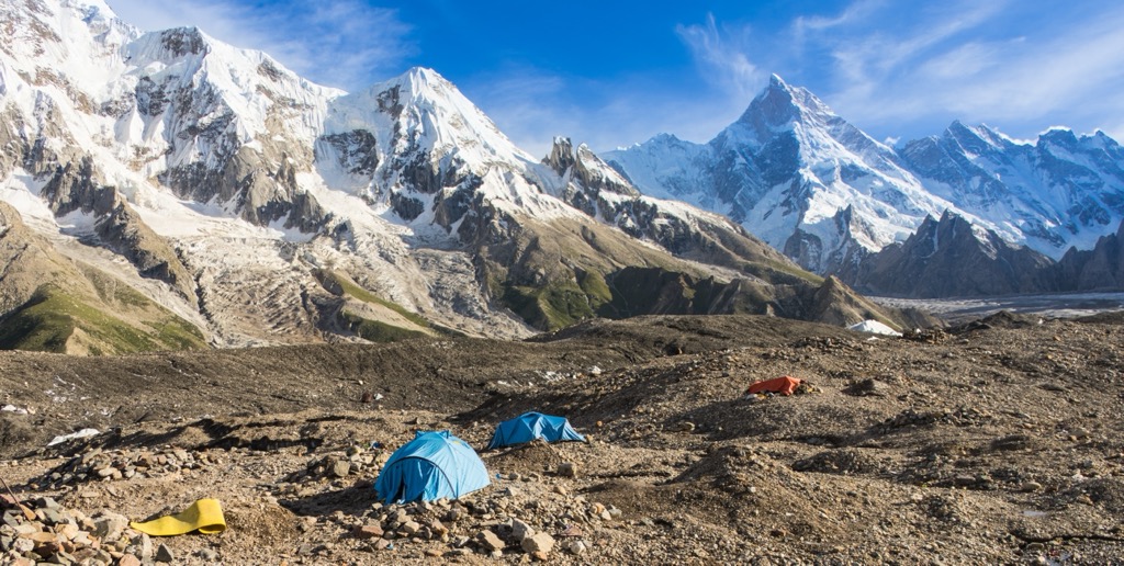
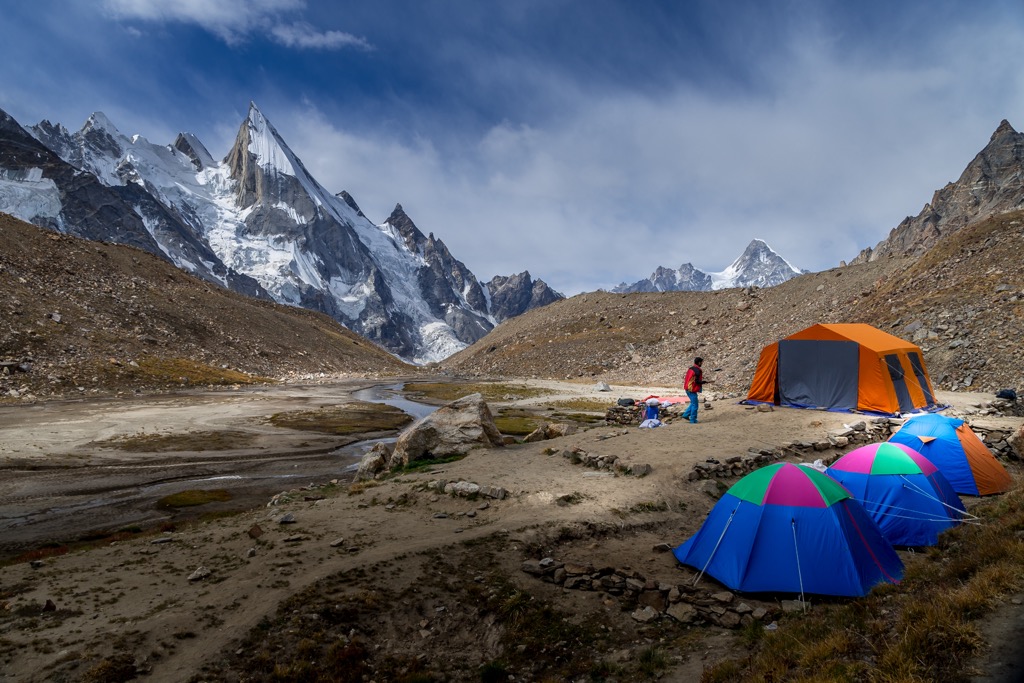
Hundreds of routes crisscross the Karakorams. Climbers hoping to summit the range’s peaks should be highly experienced and/or work with expert guiding companies. Most people opt to experience the range through trekking instead of high-altitude climbing. Below are some significant hiking areas to check out on your next visit.
Central Karakoram National Park is the largest protected area in Pakistan, situated in the central Karakorams. The park encompasses towering peaks, including K2, the second-tallest mountain in the world. Other notable sites include the Baltor, Hispar, Biafo, and Panmah glaciers and their tributaries. The Siachen Glacier, the second largest nonpolar glacier, lies directly to the east. Situated along the Karakoram fault, the park is part of an incredibly active tectonic zone.
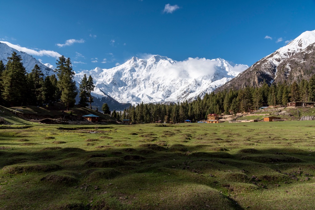
Fairy Meadows National Park has numerous hiking and trekking routes. The park lies near a base campsite for Nanga Barbat, at 3,300 m (10,800 ft). Those climbing the Rakhiot face of Nanga Parbat begin by passing through Fairy Meadows. The terrain features a sweeping grassland that rises steeply to the craggy peaks of the Karakorams. Be aware that in 2013, the World Health Organization declared the gravel access road the world’s second-deadliest road.
Those visiting the Karakorams should check with their country’s travel advisory before planning any trips. Below are a few of the most popular destinations near the range:
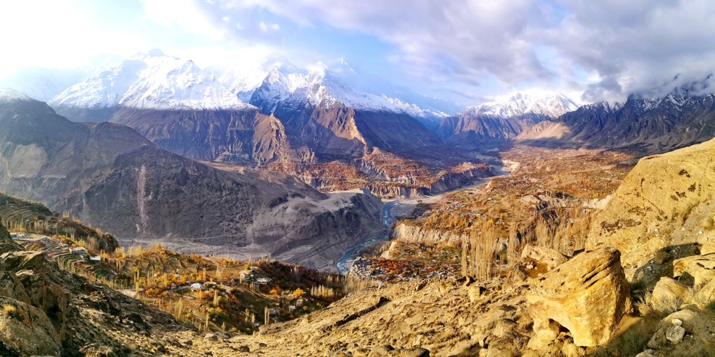
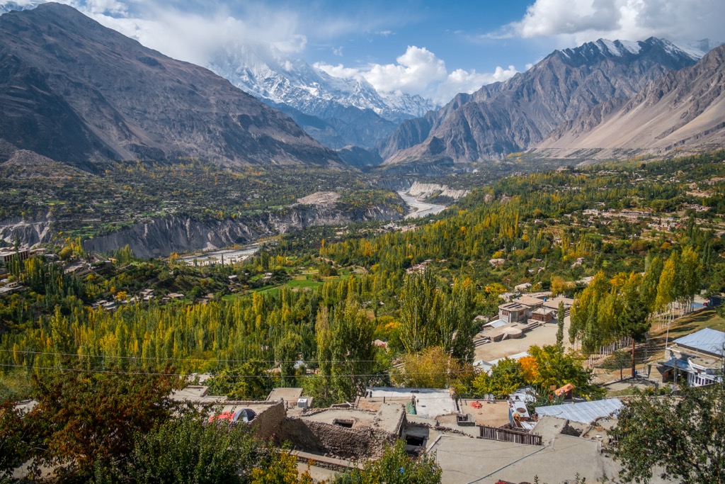
Gilgit lies in the Kashmir region and marks the capital of the Pakistan-administered territory of Gilgit-Baltistan. Situated near the confluence of the Gilgit and Hunza Rivers, Gilgit is a hub for exploring the Karakorams.
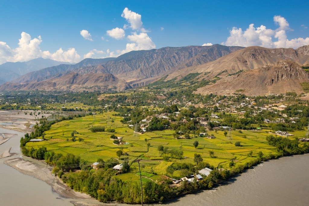
Before gaining notoriety as a starting point for trekking and mountaineering expeditions, Gilgit was an important Buddhist center and a notable stop on the Silk Road. Besides tourism, agriculture is an essential part of Gilgit’s economy.
Gilgit features a small airport making it easy to access. The city’s notable sites include the Victory Monument of the Taj Mughal, Karga Buddha, Henzal Stupa, and the Danyore Suspension Bridge.
Leh lies in the Kashmir region and marks the capital and largest city of the Indian-administered union territory of Ladakh. Leh is the historical capital of the Kingdom of Ladakh. Home to the Kushok Bakula Rimpochee Airport, Leh has a population of around 30,000.
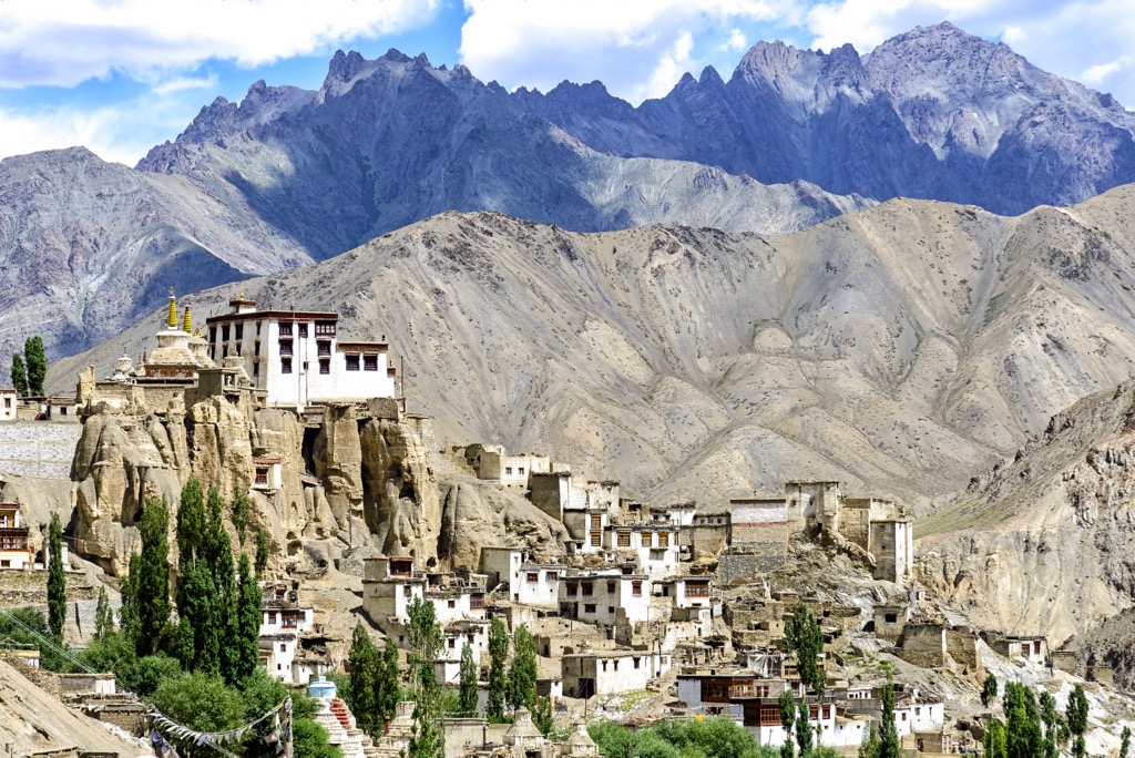
Situated at 3,542 m (11,562 ft), Leh can be a gateway for those heading into the Kashmir region. Islamic and Tibetan architecture is mixed throughout the city, as seen by the Sunni Muslim mosque. Other notable sites include Leh Palace, Shanti Stupa, and Namgyal Tsemo Gompa.


ultra
8000ers
china-ultras
pakistan-ultras
ultra
8000ers
china-ultras
pakistan-ultras
ultra
8000ers
china-ultras
pakistan-ultras
ultra
8000ers
china-ultras
pakistan-ultras
ultra
8000ers
china-ultras
pakistan-ultras
ultra
8000ers
china-ultras
pakistan-ultras
The highest peak in the Karakoram is K2, at 8,611 m.
The Karakoram have 570 named peaks.


