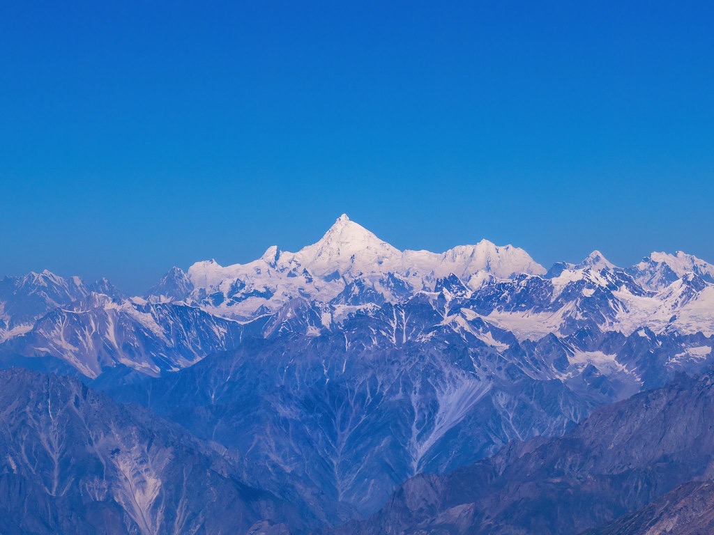
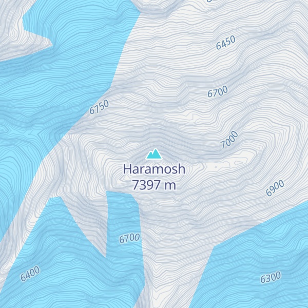
Haramosh Peak (Urdu: ہراموش چوٹی), also known as Haramosh or Peak 58, is a Karakoram range mountain located in Gilgit-Baltistan, Pakistan. The total population of the Haramosh Valley is at least 8000. The 7,409-meter Haramosh Peak is situated roughly 65 kilometers (40 miles) to the east of Gilgit, within the south-central part of the Rakaposhi-Haramosh Mountains, which is a subrange of the Karakoram range. This mountain rises steeply above the north bank of the Indus River, just upstream from its confluence with the Gilgit River.
The Haramosh massif consists of two main summits: Haramosh Peak and Haramosh Kutwal Laila Peak. The Haramosh Peak was first successfully climbed in 1958 by an Austrian team comprising Heini Roiss, Stephan Pauer, and Dr. Franz Mandl.
By elevation Haramosh is
# 44 out of 8262 in Pakistan # 41 out of 552 in the Karakoram
By prominence Haramosh is
# 11 out of 8262 in Pakistan # 7 out of 552 in the Karakoram
We use GPS information embedded into the photo when it is available.
3D mountains overlay
Adjust mountain panorama to perfectly match your photos because recorded by camera photo position might be imprecise.
Move tool
Rotate tool
Zoom
More customization
Choose which peak labels should make into the final photo and what photo title should be.
Next
Photo Location
Satellitte
Flat map
Relief map
Latitude
Longitude
Altitude
OR
Latitude
°'''
Longitude
°'''
Apply
Register Peak
Peak Name
Latitude
Longitude
Altitude
Register
Teleport
PeakVisor
This 3D model of Sagarmatha National Park in Nepal was made using the PeakVisor app topographic data. The mobile app features higher precision models worldwide, more topographic details, and works offline. Download PeakVisor maps today.
Download OBJ model
PeakVisor
The download should start shortly. If you find it useful please consider supporting the PeakVisor app.
PeakVisor for iOS and Android
Be a superhero of outdoor navigation with state-of-the-art 3D maps and mountain identification in the palm of your hand!