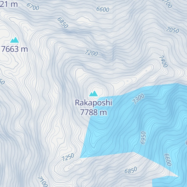
Rakaposhi (Burushaski: رآکاپوݜی, lit. 'Shining Wall'; Urdu: راکاپوشی) also known as Dumani (Burushaski: دومآنی, lit. 'Mother of Mist') is a mountain within the Karakoram range in Gilgit-Baltistan in Pakistan. It is situated in the middle of the Nagar Valley and the Bagrote Valley. The mountain is extremely broad, measuring almost 20 km from east to west. It is the only peak on earth that descends directly and without interruption for almost 6,000 meters from its summit to its base.
By elevation Rakaposhi is
# 18 out of 8262 in Pakistan # 13 out of 552 in the Karakoram
By prominence Rakaposhi is
# 6 out of 8262 in Pakistan # 3 out of 552 in the Karakoram
We use GPS information embedded into the photo when it is available.
3D mountains overlay
Adjust mountain panorama to perfectly match your photos because recorded by camera photo position might be imprecise.
Move tool
Rotate tool
Zoom
More customization
Choose which peak labels should make into the final photo and what photo title should be.
Next
Photo Location
Satellitte
Flat map
Relief map
Latitude
Longitude
Altitude
OR
Latitude
°'''
Longitude
°'''
Apply
Register Peak
Peak Name
Latitude
Longitude
Altitude
Register
Teleport
PeakVisor
This 3D model of Sagarmatha National Park in Nepal was made using the PeakVisor app topographic data. The mobile app features higher precision models worldwide, more topographic details, and works offline. Download PeakVisor maps today.
Download OBJ model
PeakVisor
The download should start shortly. If you find it useful please consider supporting the PeakVisor app.
PeakVisor for iOS and Android
Be a superhero of outdoor navigation with state-of-the-art 3D maps and mountain identification in the palm of your hand!


.jpg)