
Scan the QR code and open PeakVisor on your phone
Hidden from the rest of the world by majestic mountains, Tajikistan is the smallest state in Central Asia. This is a landlocked mountainous country which has preserved the ancient traditions almost intact. The ultimate attraction of the country is the Pamir - the second highest mountain system in the world. The scenery is mind-blowing. With snow-capped peaks standing in the background against the golden desert sands you are sure to take plenty of postcard quality photos. You can visit high mountain glaciers, walk the valleys blooming with flowers, or drop to the many orchids to try pistachios and sip some tea with excellent lemons.
It is believed that the origin of the name ‘tajik’ means ‘crowned’ or ‘a wearer of the crown’. So where did the word come from and what does the crown have to do with it?
The name Tajikistan is quite young and appeared at the same time as the creation of the republic in the 20th century, but the word "‘tajik’ is more than 1,000 years old. The term can be found in many medieval works but to this day there are disputes about its origin. From the Tajik language the word ‘taj’ is translated as a crown, wreath or aureola. Hence the translation related to the crown. The version is beautiful, but scientific circles still treat it with distrust.
The history of Tajikistan is as rocky as its terrain. There were many ups and downs, periods of enslavement changed into subsequent wars of liberation. The first references to the ancestors of the Tajiks date back to the beginning of the first millennium BC during the reign of the oldest slave-owning states (Bactria, Sogd, and Khorezm). The territory of Tajikistan was conquered by the Ephtalites, Turks, Arabs, Mongols and Uzbeks. The country was annexed to Russia (1873-1917) and later transferred gently under the Soviet rule. Tajikistan gained its independence on September 9, 1991. Tajikistan is now a member of the United Nations Organisation.
The Republic of Tajikistan neighbours Uzbekistan to the west and northwest, Kyrgyzstan to the north, China to the east, and Afghanistan to the south.
The population is 9,537,645 people, which is comparable to that of the United Arab Emirates or Hungary. The total area is 143,100 km², which approximately equals Greece or Bangladesh. The capital is Dushanbe.
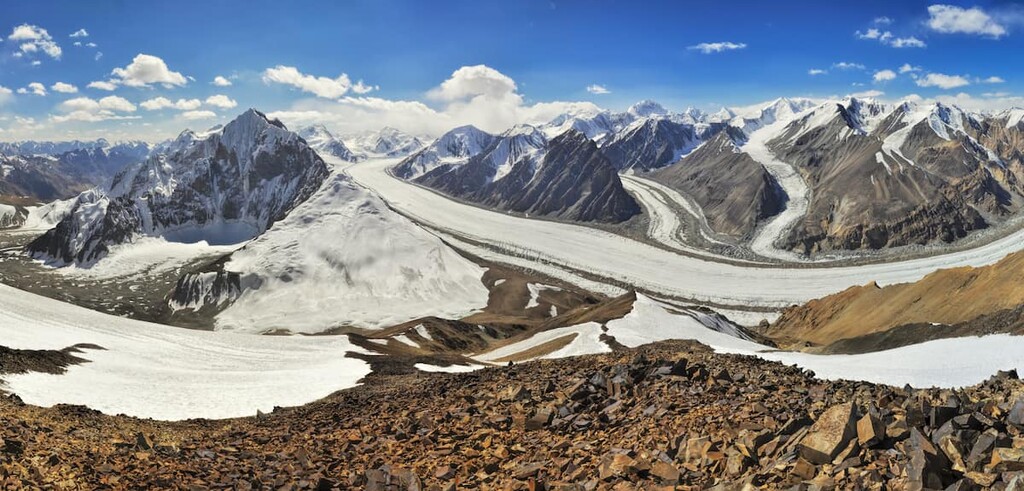
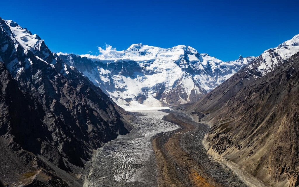
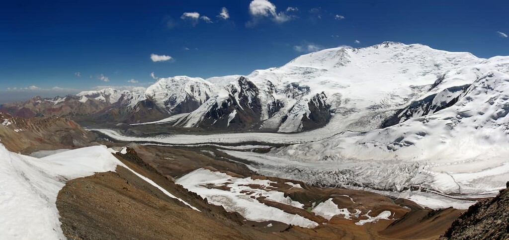
Tajikistan is the seventh heaven for mountain landscape lovers. About 93% of the territory is occupied by mountains belonging to the highest systems of the world - the Pamir, the Tien Shan, and the Hissar-Alai. There are over 1,000 mountain glaciers, the largest of which is located in the Yazgulem Range - the Fedchenko Glacier, the biggest icefield in Eurasia.
The total number of mountains in Tajikistan is 966 with Ismoil Somoni Peak (7,495m) being the highest.
The length of the Pamir Range from north to south is 350 km, and from northwest to southeast is 700 km. The highest peak in Tajikistan is Ismoil Somoni Peak (7,495 m, formerly called Stalin Peak or Communism Peak). The locals also call the peak ”Uz-tergi” which literally “makes your head go round” Covered with eternal snow, the summit is located at the convergence of the Academy of Sciences Range and Peter the Great Range. Today, it is on the 50th place among the highest mountains of the world.
On the northern border of the country is the almond-shaped Fergana Basin strewn with different oases. It is 300 km long and up to 170 km wide.
The main rivers of Central Asia originate in the high mountains of Tajikistan. The largest rivers of the region are: the Amu Darya, the Pyanj, the Zeravshan, the Vakhsh, the Kofarnihon, and the Bartang-Murgab-Oksu. The latter is actually one river, it is called the Oksu in the upper reaches, Murgab in the middle and Bartang in the lower part, when it flows into the Pyanj River.
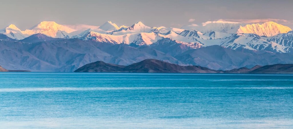
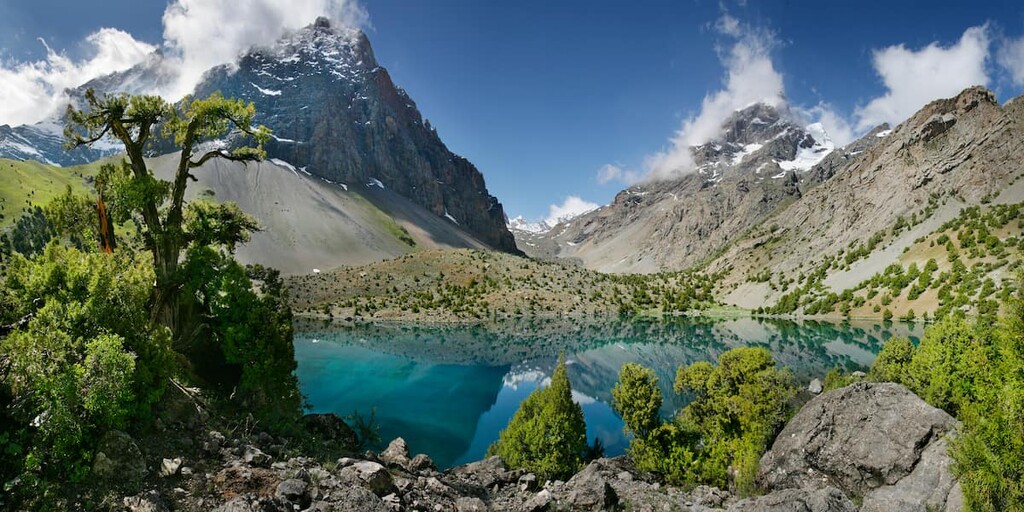
Among the largest lakes are the Karakul, Yashilkul, Zorkul, Shorkul, Bulunkul, Sarez, Iskanderkul, and the Kayrakkum Reservoir. The water in the mountain rivers is crystal clear, and the surrounding scenery is fascinating and harmonious.
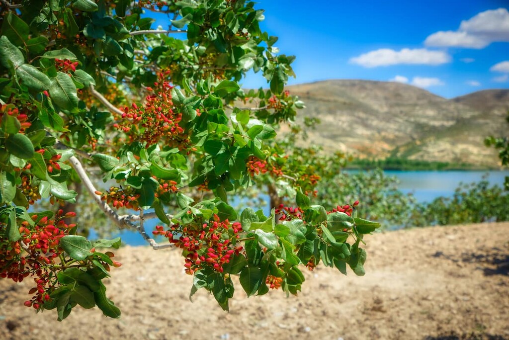
The flora of Tajikistan is surprisingly rich despite harsh climate conditions. You can see the representatives of the north, south, west and east flora. The typical species are pistachio, almond, saxaul (Haloxylon), juniper, wormwood, saltwort (Salsola ruthenica). There are also plants common for the Mediterranean region: figs, Pontic hawthorn, walnut, sycamore and others.
Local valleys and mountains can boast of over 5,000 species of plants. Predominantly, here grow various grasses, semi-shrubs, and shrubs which can be seen in deserts, steppes and highlands.
The high-altitude alpine meadows are full of poppies, tulips, wild irises, and edelweiss. As for forests, they are not that abundant and occupy only 4% of the region. Trees in the mountains are found in isolated clumps, however, they sometimes turn into really big forests that can form a kind of a mantle covering the slope of some mountain or ridge. The forests of the Tien Shan Range are filled with juniper, spruce, and laurel.
Tajikistan is considered one of the ‘siring fathers’ for such cultivated grains as wheat and rye since the scientists believe that this is the region from which they began to spread.
Plants are well adapted to rather harsh climatic conditions generated by the deserts, high-rise mountains, and insufficient amount of freshwater resources. As a result, many plants have small leaves with needles to reduce evaporation, some plants are pillow-shaped, and the root system is long and branched to get water from deep layers of the ground.
An interesting trivia. In order to combat desertification, people planted vast plantations of saxaul in some areas of the country. Saxaul belongs to the endemic plants of Central Asia, it is drought-resistant and requires very low maintenance. As a result, saxaul shrubs have naturally overgrown their initial plantations and spread to the neighbouring bare lands prone to erosion. Now these lands are suitable for landscaping.

The animal world of Tajikistan is highly adaptable and diverse. Here live the typical northern animals - brown bear, fox, hare, Siberian ibex, ermine badger, ground squirrel, etc. There are also many Central Asian, Indo-Tibetan and Indian species: Himalayan snowcock, Asian leopard, Tibetan wolf and porcupine. There are even Afghan species living comfortably here - varan, mosquitoes, mouflon, starling-maina, cobra, termites.
There are about 70 species of mammals, 46 species of reptiles, over 350 species of birds. There are a large number of insects - the inconceivable over 10 thousand species. But there are relatively few fish in Tajikistan, just about 40 species, which is due to the relative youth of the rivers and lakes of the region.
The population of many species has sharply decreased in recent decades due to unregulated fishing and hunting. Now the Red Book features the snow leopard (irbis), leopard, argali/muflon, goitered gazelle, markhor and others.
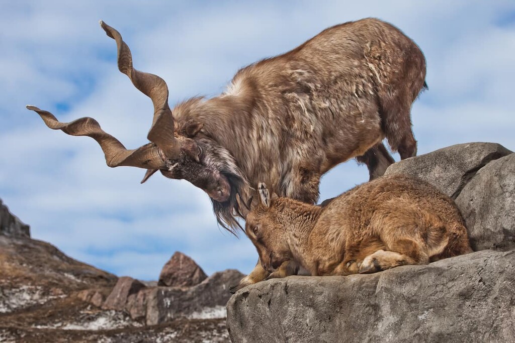
Markhor is a cloven-hoofed mammal of the ibex genus. Its name comes from Persian words: mar - "snake" and khur - "eating". It is associated with the belief of early peoples living in Tajikistan and Afghanistan that this ibex specifically looks for snakes and then eats them. It is believed that markhor meat can neutralize the effect of snake venom. One more thing found in the stomach of this ibex is bezoar (say hi to Harry Potter), a stone formed organically in the stomachs of some animals. It is believed that bezoar can draw out the poison from the snake bite.
The preservation of rare animals in Tajikistan is monitored by the staff of protected areas, and hunting is prohibited there. Much work is being done to enrich the fauna by introducing new species, such as European beaver, trout and trout perch now found in floodplain lakes.
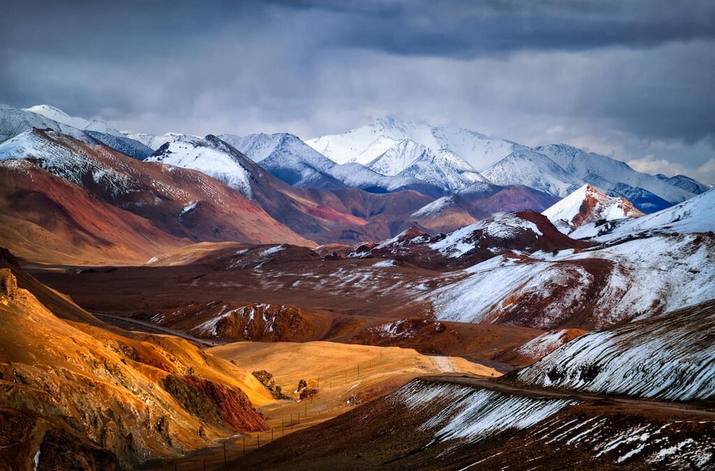
The climate as a whole is sharply continental and dry. At the same time, the region has a pronounced altitudinal zonality. The low valleys enjoy subtropical climate whereas the mountains manifest a colder climate. At medium altitudes, there is moderately warm weather and the higher you get, the harsher the climate. Day and night temperatures exhibit great differences. In summer, the air in the mountains warms up to +15°C (59F) on average, and in the valleys the average daily temperature can reach +30°C (86F). In winter, the temperature in the lowlands drops to 0°C (32F) whilst in the highlands there may be frosts as low as -27°C (-17F). In the Pamir Mountains, the recorded low was -50°C (-58F).
Storms of various kinds are very frequent from October to May. In summer, sandstorms often devastate the plains and they may last even more than a week. Precipitation is most abundant in late winter and spring. The rain fallout varies depending on the area, the rain in the lowlands is virtually nonexistent whereas the highlands enjoy a lot of moisture.
March to May is by far the best time to visit Tajikistan. Everything transforms magically, the plains bloom with endless expanses of flowers and the mountains cease to be so hostile.
The most favorable month for hiking is September and the best climbing season is July and September.
Tajikistan is known worldwide as one of the largest mountaineering centers. It lures travellers with unconquered peaks and a true spirit of adventure. Trekking is very popular here. Walking along the hardly accessible terrain of amazing beauty is worth every drop of sweat you shed. Tajikistan can also meet the demands of most fastidious fans of rafting. There are a large number of mountain rivers with rough streams and rifts.
In wintertime, you can go skiing, snowboarding, sledging, snow tubing and experience the pleasure of winter fun at Safed-Dara, the only ski resort in the region. It is located in Varzov district of Tajikistan.
Should you be more fascinated with a desert landscape, go to Istaravshan. This town is surrounded by the Tajik Desert.
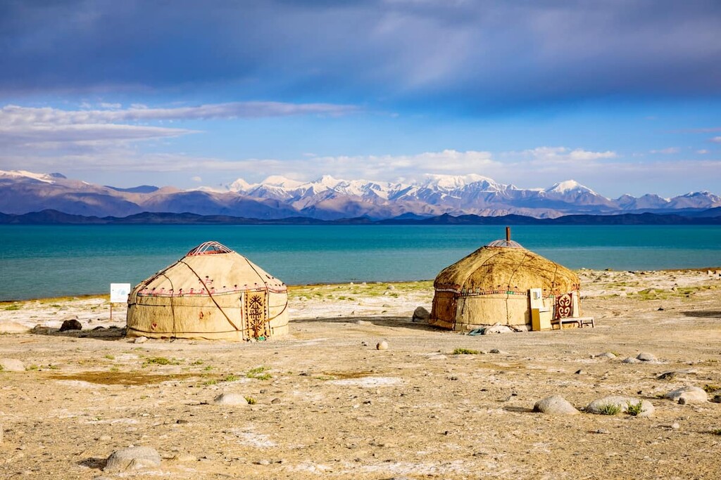
Tajikistan is relatively unexplored and unspoilt by mass tourism. People here still lead a rather nomadic life, that is why travelling becomes really authentic, almost Marco Polo style. Recently, more and more ecotourists visit Tajikistan. They often choose the routes of nature reserves and natural parks of the region.
Tajikistan is also famous for its numerous sites of ancient culture and history, which attract not only tourists but also historians and archaeologists.

One of these cultural monuments is the city of Penjikent. It used to be the center of the Sogdian princedom. Archaeologists have a lot to do here: the remains of residential buildings, a palace with murals, a necropolis, etc. have been found here. Nowadays, there is a museum at the place of the ancient city.
The Pamir Mountains are situated in the north of Central Asia, they cover the territory of several countries: Tajikistan, Kyrgyzstan, Afghanistan, China and India. It has three peaks with a height of more than seven thousand kilometers. Ismoili Somoni Peak (7,495 m) is the greatest peak of Tajikistan and the most popular among tourists. It is situated on the Academy of Sciences Range in the place where it connects with the Peter the Great Range.
Lenin Peak (7,134 m) is another seven-thousanders. It is located on the Zaalai Range, on the border of Kyrgyzstan and Tajikistan. Lenin Peak shrouded in the clouds was first documented in 1871 by a Russian geographer and traveler Alexei Fedchenko. Until 1928, it was named Kaufman Peak in honor of the Governor-General of Turkestan. With the advent of the Soviet power, it was renamed Lenin Peak. In 2006, the Tajik government unilaterally gave it the name of Abu Ali ibn Sina (Avicenna). In spite of its neighbors, or probably to spite them, in 2017 Kyrgyzstan offered to name it Manas Peak. However, tourists and climbers are more familiar with the old name, Lenin Peak. By the way, it is best seen from the Kyrgyz side. Today, 16 routes lead to the peak: nine on the southern slope and seven on the northern one. The most accessible way to the peak leads from the north through Mount Razdelnaya. It does not require any special skills and a great mountaineering experience, which makes Lenin Peak the most accessible 7K-peak in the world.
The Pamir Mountains are blessed with numerous glaciers. Fluffy sparkling snowcaps, like hats on the heads of giants, cover the peaks all year round. The Pamir is closely adjacent to the other mountain systems of Central Asia - the Tien Shan, Karakorum, Hindu Kush, Kunlun. The Pamir borders on the Himalayas.
The Pamir has historically been the bone of contention. There is even still no consensus about the meaning of the word "Pamir". Interpretations differ from "the foot of Mitra" (the god of the Sun), to "the roof of the world", "the foot of the bird", and "the foot of death", probably depending on how the Pamir treats those pestilent humans.
The Pamir continues to be the crux of unresolved conflicts between several states, but this does not affect tourists and travelers. For the numerous experienced climbers who come to conquer the mighty peaks from all over the world, special camps are set up at different heights. When planning a trip to the mountains, it is important to inform the local authorities so that in the event of an emergency (such as an avalanche), rescuers can find you.
You can read more about the Pamir Mountains and the Pamir-Alai mountain system in our articles.
The Fann Mountains aka Fanny stretch in the southwest of the Pamir-Alai, they connect the Hissar Range (translated as "Fortress") and the Zeravshan Range ("Giving Gold"). The subsoil of this area still holds gold to this day.

The Fann Mountains are on the UNESCO World Heritage List. The snow-covered peaks have seven five-thousanders, the highest point being Mount Chimtarga (5,489m). Climbers and mountaineers can choose routes of any complexity. And if you plan your visit to the Fans in late summer or early autumn, you can predict with great probability excellent clear weather in the mountains! For more details on the routes and the sites in the Fanns, read our article.
Unfortunately, the wildlife and the vegetation are gradually declining. Some species feature barely a dozen individuals, and some have just one or two bions. In order to preserve the flora and fauna and picturesque landscapes of the Tajik nature, about 22% of the territory of Tajikistan is protected by the state. Nature preservation lands include:
To visit protected areas which include the alluring peaks and ethereal landscapes of the mountains, you must first obtain a permit.
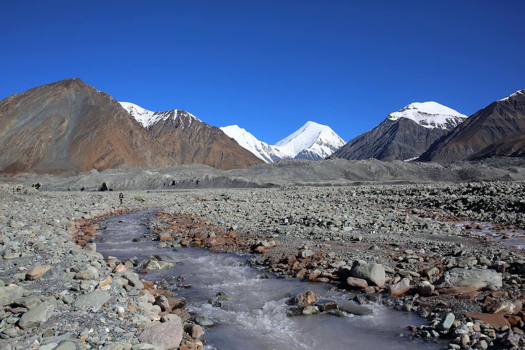
Mountain rivers of Tajikistan are abundant with fish, which is just a dream for lovers of rafting and fishing. One of the hottest destination points is the largest river in Tajikistan, the Vakhsh, which is also called the Tajik Amazon. The Vakhsh merges with the Pyanj River to form the Amu Darya.
The blue smooth surface and amazingly beautiful shores of the mountain lakes will cheer up the lonely spirits and tune anyone into harmony with nature.
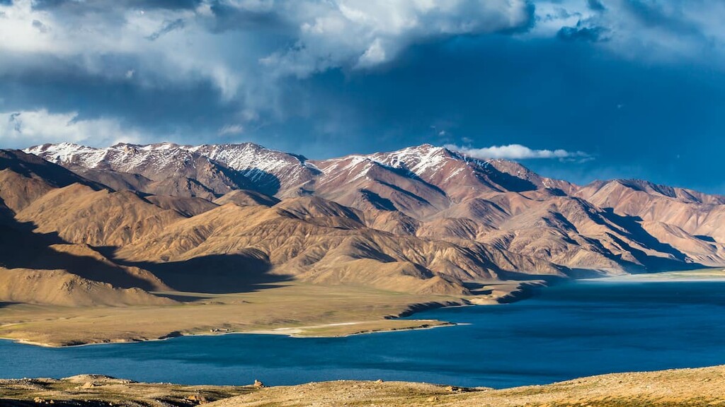
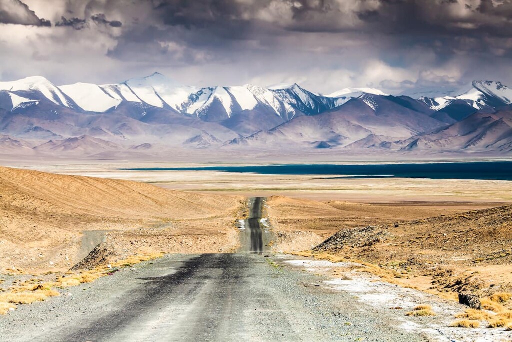
Karakul is the largest lake in Tajikistan. It is located in the northern part of the Pamir Mountains, to the south of the Zaalai Range. The name is translated from Turkic as "black lake" although in reality the water there has bright blue and turquoise-greenish hues. The water transparency reaches 9 meters, but the temperature even in summer barely rises to only +10°C (50F). So if you want to swim in the lake, you should remember that the water is very cold. Situated at the height of three kilometers above the sea level, the lake attracts with its remoteness and absence of any noise from civilization. Enjoy the serenity and the merry sounds of the surrounding nature.
Having studied the geological structure of its bottom and space images, a number of scientists came up with a hypothesis that it filled the shock crater from a meteorite that fell here 230-190 million years ago. It is rather easily accessible as the East Pamir Highway connecting Osh and Khorog goes along the eastern bank of the lake.
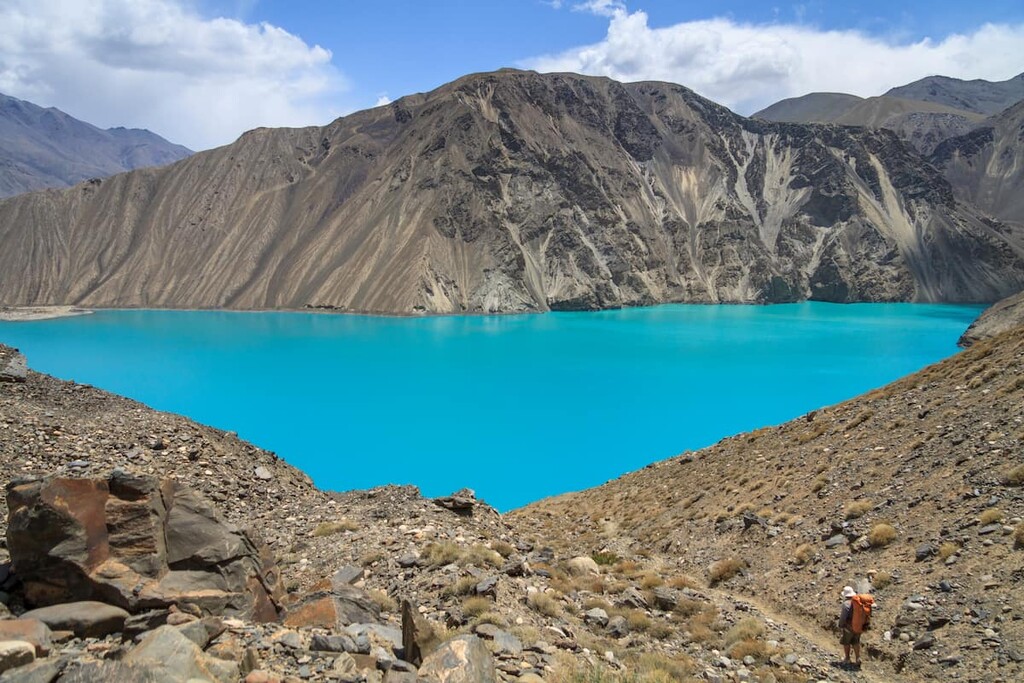
Sarez Lake is one of the most unusual places on the planet and is the jewel of the Pamirs. Bounded on all sides by mountain ranges (the North Alichur Ridge and the Muzkol Ridge), the lake is located at an altitude of 3,255 m a.s.l. The places here are hard to reach, but this does not prevent travelers from visiting this fairy-tale lake every year.
Lake Sarez is the deepest lake in the Pamir. The water reservoir is 505 meters deep. It was formed in 1911, when a 9-point earthquake caused a landslide and blocked the Murghab River, thus creating a rocky dam over half a kilometer high. The water flooded the village of Sarez overnight, which gave the name to the lake. It took 37 years to fill the basin of the lake that now spreads over 70 km and has a total area of 17 sq.km. Now there is a danger of this naturally made dam to be washed away since the river Murghub is still flowing at its bottom and keeps washing off the rocks. That is why there is a research station keeping an eye on Lake Sarez.
At a height of two kilometers, in the heart of the Fann Mountains is another mountain lake nestled - the Iskanderkul. Its history is associated with various legends. One of them says that the horse of King Iskander (Alexander the Great) died there in the times of the ancient Macedonia military campaigns.
The Hot Mineral Spring of Garmchashma is also worth a visit. Its water has been considered healing since ancient times, that is why people set up various altars here and then opened a balneological sanatorium. Here you can not only bathe in hot water but also improve your health and get some treatment.

Most people of Tajikistan lead a semi-nomadic way of life. This affects the sanitary situation in the republic which leaves much to be desired. In this regard, it is recommended to use only boiled water (bottled water if possible) for drinking, washing fruits and vegetables and brushing your teeth. Since in the southern part of Tajikistan there is a small risk of contracting malaria or brucellosis (intermittent or Malta fever), guests of the republic are required to vaccinate appropriately before visiting the country.
A few simple rules will help to travel safely and securely in Tajikistan.
So, a memo for tourists:
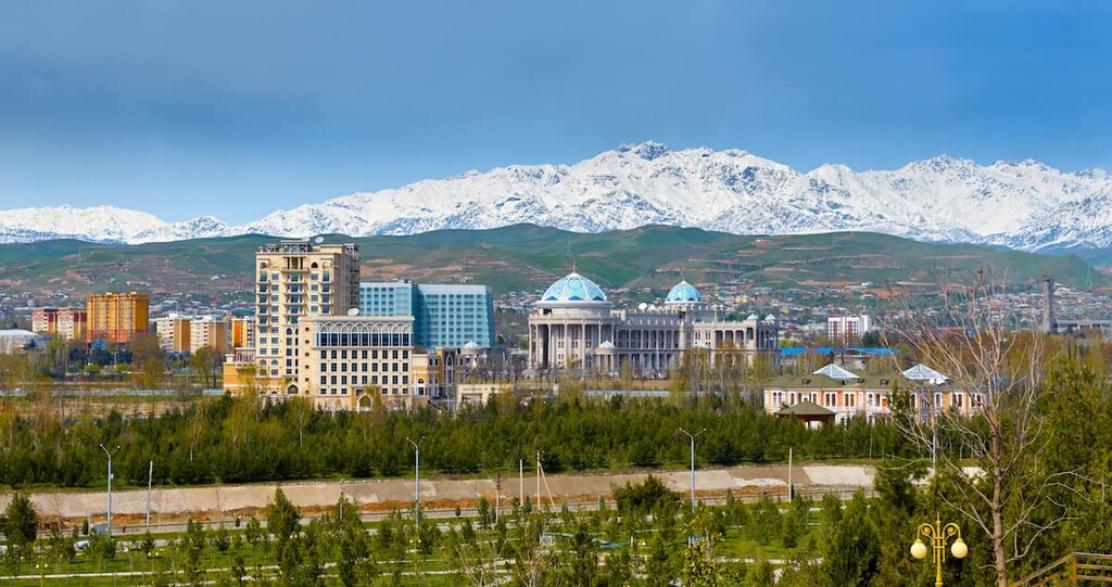
The capital of Tajikistan is Dushanbe, it is a gateway to visitors from all over the world. Mostly, people fly to the international airport located on the eastern side of the city and then get to the center of the capital by trolleybus, bus or cab. Dushanbe has direct flights to Afghanistan, UAE, China, Turkey, Russia, Kyrgyzstan and other countries. The railway services connect Tajikistan with Russia, Turkmenistan, Kazakhstan and Uzbekistan.
Being quite old, Dushanbe has acquired certain economic, cultural and historical importance for the region. During its history, the city has changed several names, the first being Dyushambe, then Stalinabad during the Soviet times and finally, Dushanbe. The first mention of the settlement dates back to the 17th century when a village was built at the crossroads of Asian trading routes. It was a popular place where wagons of goods from different places used to come in on Mondays. Hence the name of the city in Tajik language - Dushanbe means Monday.
The main historical sites include:

Next to the Republican Hospital, there is a monument to the great eastern healer Avicenna. Around the sculpture there is a park for recreation and two swimming pools.
There are 5 theaters, over 50 cinemas, a zoo, a water park, an amusement park with many rides and a botanical garden in Dushanbe.
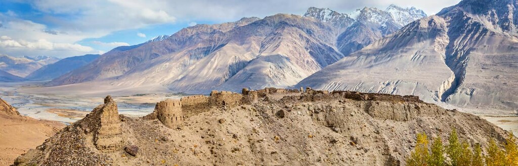
Badakhshan is the name of the mountainous region in Tajikistan. It covers an area of 64,100 sq.km (43% of the country). It is an autonomous region in the southeast of Tajikistan, the official name is Gorno-Badakhshan Autonomous Region, GBAO. The capital city of the region is Khorog. Badakhshan has borders with Kyrgyzstan, Afghanistan, and China. It has long been a subject of dispute between the Russian and British empires. As a result of the bilateral agreement between the empires, Badakhshan was divided into two almost equal parts stretching along the Pyanj River (along the Pamir Road). The famous Wakhan corridor formed during that division now serves as a safety cushion between Tajikistan and Afghanistan.
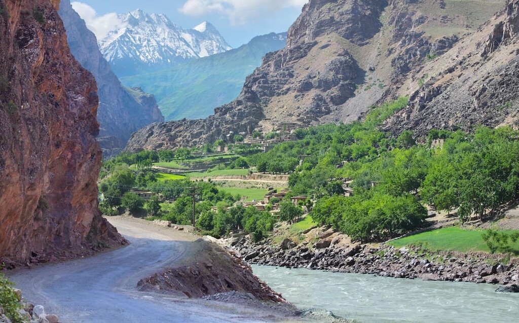
Badakhshan is home to the Eastern Pamir. If you are into ethnography, the region can become your mecca because there live small ethnic groups in the neighboring villages. These peoples have their unique culture, traditions, and peculiar ways of life. Having reached the villages of Ishkashim and Vakhan, you can visit the ancient fortresses and holy places on the right bank of the Pyanj River.
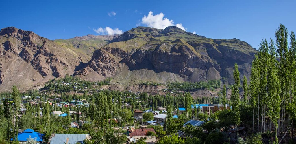
Khorog is the capital of Badakhshan. It has a city park, a university, and a hospital, which is a luxury for these remote places. An excursion to the Pamir Botanical Garden will be fascinating. It is located at a considerable height of more than 2,300 meters above sea level.
Staying in Badakhshan is considered safe enough for tourists, which cannot be said about the other side of the Pyanj River, where the territory of Afghanistan begins - there is still low-intensity fighting between the centuries-long enemies. Visiting Badakhshan requires a pass which can be obtained at the Dushanbe OVIR (5 Mirzo Tursunzade Street) or from the other end of the Pamir highway at the Tajik consulate in Osh, Kyrgyzstan.
You can get to Gorno-Badakhshan by a kind of public transport - there are minibuses and four-wheelers that can combat the hostile terrain of the Eastern Pamir. Renting a jeep is a better idea since you will be able to stop at any place you want and enjoy the beauty of the scenery along the way or take photos. Some tourists prefer to travel to Badakhshan by private car. You can also fly to Khorog, its airport is one of the highest in the world.


