
Scan the QR code and open PeakVisor on your phone
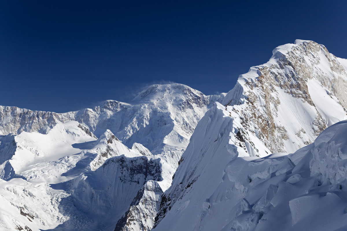
The Tian Shan include 2,375 named peaks. The highest is Pobeda Peak (Jengish Chokusu) at 7,439 m. Other notable peaks include "Obelisk" Po Puti Na Pobedu, Khan Tengri and Yanamax.
The Tian Shan, also known as the Tengri Tagh, meaning the Mountains of Heaven or the Heavenly Mountains, is a large system of mountain ranges located in Central Asia. It stretches across China, Kazakhstan, Kyrgyzstan, and Uzbekistan. The highest peak in the Tian Shan is just 500 meters short of being called an eight-thousander. It is the impressive Jengish Chokusu ( 7,439m). Its lowest point is the Turpan Depression, which sits at 154m below sea level. The Tian Shan is sacred in Tengrism, and its second-highest peak is known as Khan Tengri which may be translated as "The Lord of the Spirits".
At the 2013 Conference on World Heritage, the eastern portion of the Tian Shan in western China's Xinjiang Region was listed as a World Heritage Site with the official name the Xinjiang Tianshan. The western portion of this mountain range is located in Kazakhstan, Kyrgyzstan, and Uzbekistan, and is officially named the Western Tien-Shan, as of the latest listing in 2016.
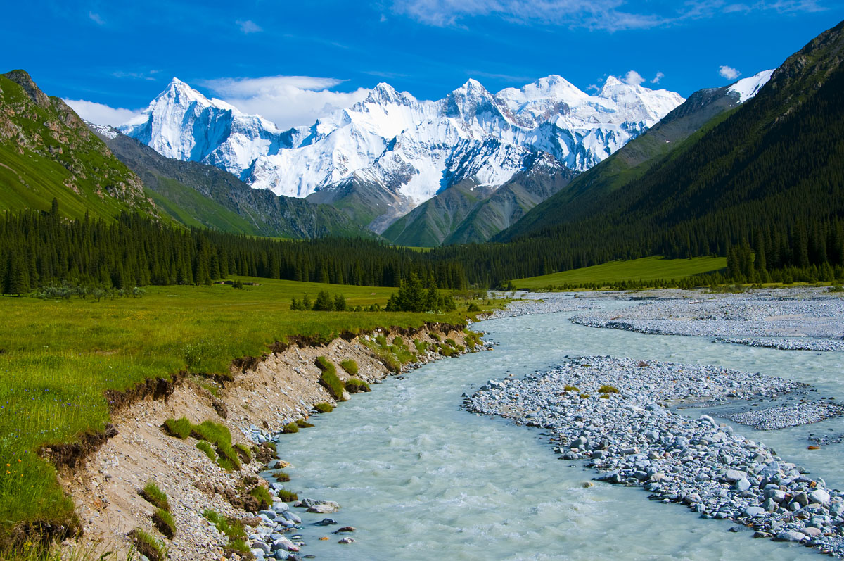
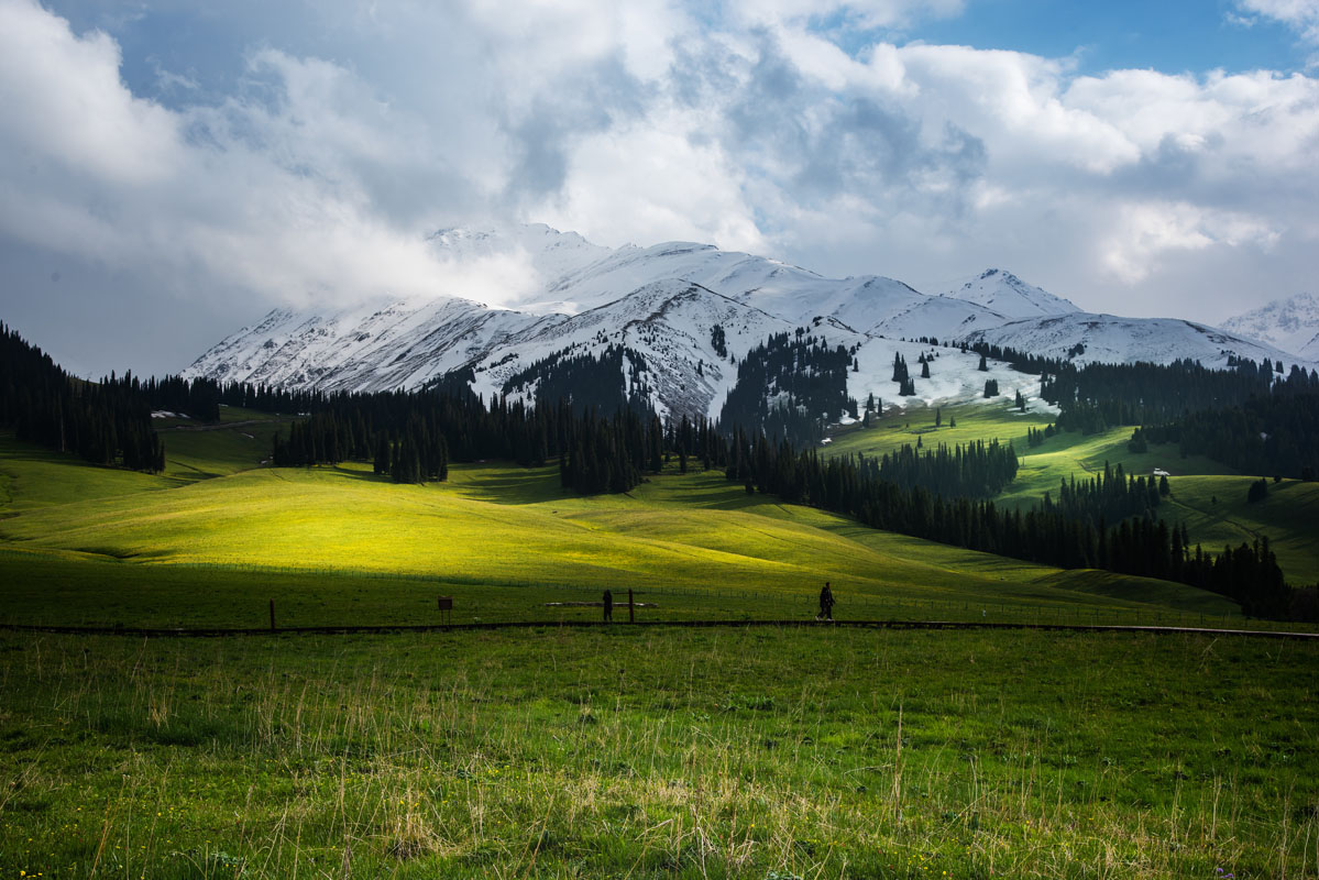
The Xinjiang Tianshan is made of four chunks, viz. Tomur, Kalajun-Kuerdening, Bayanbulak, and Bogda, with the total area amounting to 606,833 hectares. Possessing unique physical geographic features, the Xinjiang Tianshan offers a huge range of spectacular landscapes. You can find everything here: snowy mountains, glacier-capped peaks, pristine forests and meadows, crystal clear rivers and lakes and red-bed canyons. These landscapes contrast with vast adjacent desert landscapes, creating a striking visual contrast between hot and cold environments, dry and wet, desolate and lush vegetation. The landforms and ecosystems of the site have preserved almost unchanged since the Pliocene epoch (5.3 to 2.6 mln years ago) and present an outstanding example of ongoing biological and ecological evolutionary processes. The range also extends into the Taklamakan Desert, one of the world’s largest and highest deserts, known for its large dune forms and great dust storms. The Xinjiang Tianshan is moreover an important habitat for endemic and relic flora species, some rare and endangered.
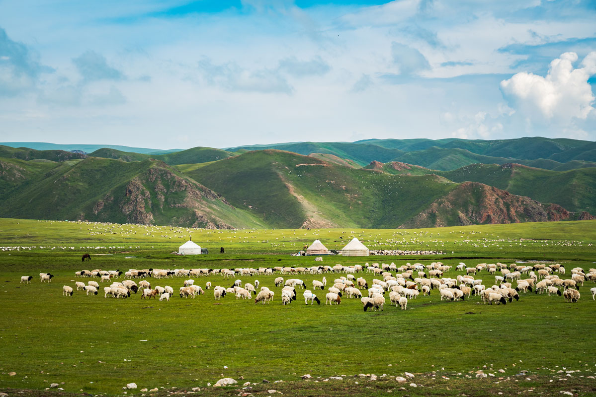
Kalajun Scenic Area lies deep in the midst of the Tianshan Mountains. In Kazakh, "Kalajun" can be translated into a barren grassland, "Kala" means dark, rich and broad, and "Jun" means density. Dark green primeval forests, white yurts of herders, sheep flocking on the open grassland, snow-capped mountains, glaciers, deep canyons, rivers, lakes, and colorful wildflowers, all come together here to compose an image of a paradise. This is surely one of those places worth visiting (preferably from May to September) once in a lifetime. Kalajun was where the north part of the ancient Silk Road lay, as well as where Wusun Kingdom, the ancient kingdom of nomads, was located. There is little tourist infrastructure there, so you will be able to enjoy the pure, original scenery of blue sky and white clouds.

Mind you, that the ticket office is quite far from the sites which you cannot visit unless you’ve paid the admission fee 80RMB/person. Access to the sacred holy land is either by a sightseeing bus (90 RMB/Person) or by bike (50 RMB/hire). Still, the area is well-worth spending some dollar as it offers mind-blowing sets for photographic shoots.
Kalajun is an AAAAA tourist attraction of China and is located in Tekes County, within the Xinjiang Uyghur Autonomous Region and under the administration of the Ili Kazakh Autonomous Prefecture.
The Kalajun Prairie scenic area is divided into western and eastern parts. The west Kalajun area includes spots such as Wang Yu Tai, the marmot habitat, Liang Yi Tai, Die Lang Gu, Shi Quan, Yin Ma Wan and One Tree and you can view them one by one by taking the shuttle bus. The west area has undulating hills and grasslands.

The east Kalajun area lies deeper in the mountains and is the place where the essential beauty of the prairie is. The most famous scenic spots are Wu Hua Cao Dian (five-flower meadow), Xian Hua Tai (flower field), Kuerdai Grand Canyon, a 3-level plantation viewpoint and Lie Ying Tai (falcon field) viewpoint. With snow mountains, grasslands, forests and canyons, the scenery is diverse and beautiful there. Among them, Wu Hua Cao Dian and Xian Hua Tai are the spots you should not miss. The former is an open meadow with colorful wildflowers blooming all summer season and the latter is the place where you will be able to take amazing photos of the spectacular snow-capped mountains behind the grasslands. Since the five spots are a little far away from the shuttle bus stops, it will take you half an hour to one hour to walk there. You can also spend 50 RMB to hire a motorcycle to take you there.
The admission of Kalajun Prairie, covering the west and east parts, is 80 RMB. A round-trip ticket of shuttle buses is 90 RMB while a one-way ticket costs 45 RMB. People older than 65, children and students will be offered a discount. The prairie is open all day but the shuttle buses work from 8 am to 8 pm. The round trip of the whole prairie is about 60-km long and will take at least 3 hours to visit.
Many visitors would choose to stay on the prairie for the night. The only choice is nomads’ yurts with Kazakh characteristics. It costs about 50 RMB per one night per person and you can book a yurt in advance. Generally, the owners of the yurts will pick up their guests at the World Heritage exhibition center by car or by motorcycle for free. You’d better confirm with the owner when reserving the yurt. You can have meals in the nomads’ homes or have some prepared food and water carried with you, but that might mean you are missing on a truly authentic experience.
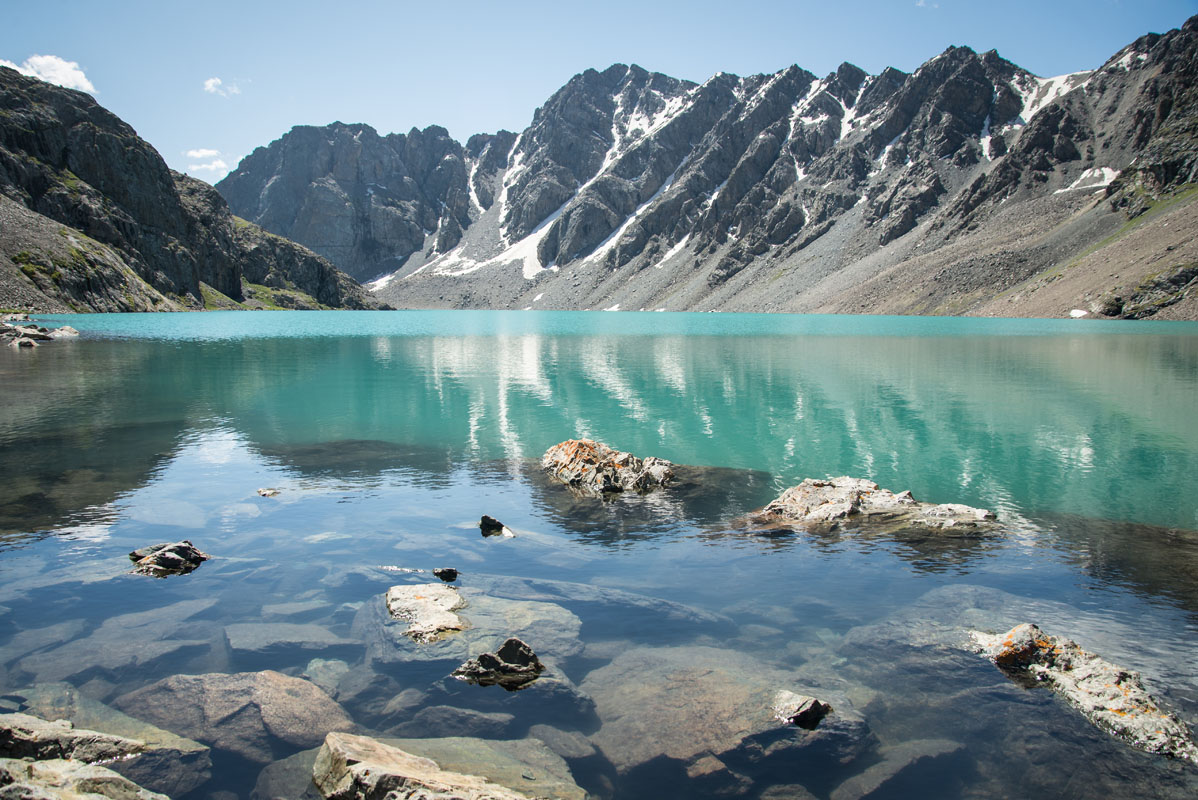
Kuokesu Grand Canyon is at the core of the five scenic areas of Kalajun tourist attraction. It features spectacular and graceful scenery of canyon landform, snow-capped peaks, alpine grasslands, primeval forests, cliffs, rivers and lakes. The main scenic spots to go are Kalajun Lake, the Crocodile Bay, and The Nine Bends and Eighteen Curves.

The admission is 40 RMB, a round-trip bus ticket is 50 RMB and a round-trip boat ticket is 80 RMB. People over 65 years old, children and students can get a discount. If you are planning to visit both the Kalajun Prairie and Kuokesu Grand Canyon, it will be cheaper to buy a combo ticket.

Among the numerous options, a classical trail along the Ili prairies is the one embodying the true spirit of the region. You can have a relaxing stroll among the sea of flowers and grass swinging slowly in the winds, take in panoramic view, zoom your camera around and shoot amazing photos very easily.
The full trail usually starts in Qiongkushitai and ends in Kuerdening, while you can also go reversely by ascending.
Distance: Around 120 km.
Time: 6 days for hiking and 3 days for going to and from Urumqi.
Day 1: Urumqi - Yining.
Day 2: Yining - Tekes - Qiongkushitai and stay in Qiongkushitai Village for the night.
You can take a long-distance bus departing from Urumqi at 6 pm to Tekes, which will take 16 hours, or take a night train from Urumqi to arrive in Yining at 7 am, and take a bus to Tekes.
Take a bus or hire a car from Tekes County to Qiongkushitai. It will take 3 or 4 hours and the distance is 96 km.
Day 3: Start hiking in Qiongkushitai Village - West Kalajun campsite.
Distance: Around 15 km.
Time: approx. 8 hours.
The hiking starts in Qiongkushitai pastoral village, which is also the starting point of the Wusun Ancient Road hiking trail. The Qiongkushitai village is governed by Kaladala Village, Tekes County, Ili and the major residents are Kazakh. Surrounded by mountains and lakes, the place feels to be a paradise.
It is mainly an ascent from Qiongkushitai to Jiasagan then to the borders of the Kalajun Prairie scenic area.
Day 4: West Kalajun campsite - East Kalajun campsite.
Distance: 16-18 km.
Time: approx. 8 hours.
This part of the trail is mainly composed of plains and gentle hilly slopes.
Day 5: East Kalajun campsite - Tarim manor.
Distance: 28 km.
Time: approx. 9 hours.
This part of the trail continues to lead you to the east. The first half is easy but you will climb the peak of Kizilsu Daban (2,900m), and then keep descending for 1,300m. The weather is changeable in the area of Daban, which is the high mountain pass. The road will be muddy and slippery after rain, so be careful and watch out. Your endeavours will be highly rewarded by the most spectacular scenery of the whole journey.
Day 6: Tarim manor - Qiaxi campsite.
Distance: 30 km.
Time: approx. 11 hours.
Some nomad households are scattered along the road, immersing you in the atmosphere of the peaceful pastoral countryside. The following journey are almost plain roads and gentle downhills and you almost pass through the Qiaxi Grassland National Forest Park. It’s a different experience from what the 3D prairie scenery in the previous 3 days gives you. You can camp or stay in Qiaxi Village for the night.
Day 7: Qiaxi campsite - Mohuer Grassland campsite.
Distance: Around 20 km.
Time: approx. 7 hours.
From Qiaxi Village you will traverse Qiaxi Grassland. In the beginning the grass is tall, which makes it hard to walk. After you leave the grassland area and get through three mountain passes and a forest, you will step into the Sukelun Grassland. The green grass is fading in the distance, buoyant streams are flowing at the foot of mountains, and you are walking in the dreamland.
Day 8: Mohuer Grassland campsite - Kuerdening scenic area. The hiking ends here and you can go to Yining.
Distance: Around 12 km.
Time: approx. 5 hours.
You can enjoy the view of the sun shining and rendering the mountains gold around the campsite. The peak of Nalati Mountain, Kabanbayi Peak, seems close enough to touch. After you reach Kuerdening, you can take a bus to Yining and then go back to Urumqi to complete the journey.
Day 9: Yining - Urumqi.
The recommended visiting time is from April to October every year, and the golden season on the Kalajun Prairie is from mid-June to mid-September. The weather is changeable in the Kalajun Prairie. It’s very likely to rain especially when you get over the mountain pass and the roads will become muddy and slippery. Prepare some rain gear and choose proper hiking shoes. Download trail maps in advance as the internet coverage will be close to nonexistent and travel with a company to avoid getting lost. Be careful with local dogs, they might run in packs and wish to devour some your your meat.
Having come back to Yining, you can choose to continue your journey to Sayram Lake. You can also reverse the trail by starting in Kuerdening and ending in Qiongkushitai to make it much more challenging. You will ascend more in this way. After you reach Qiongkushitai, you can start hiking along Wusun Ancient Road.
The known Top Three Trails of Xinjiang are Xiate Ancient Trail, Wusun Ancient Road and Lang Ta C Trail. The trails are the best in both their beauty and treacherousness. You are exposed to the elements, being in the middle of nowhere, walking along the cliffs, crossing the gushing waters, encountering man-eaters (well, animals look ferocious and sometimes can attack humans, just behave yourself and keep calm) and more, these trails require very professional skills, sophisticated plans and preparation, and guides. As it is known that Xiate Ancient Trail has been forbidden for free public access, you may try your luck by searching online for professional clubs or trekking teams that work on the other two trails.
Besides risking your life to complete the whole trail, there are many other ways you can go around to savor the beauty of the scenery around the trails.
The Xiate Valley or Xiata Scenic Area (Chinese: 夏特大峡谷风景区 or 夏塔旅游区) is an AAAA scenic spot 75 km away from Zhaosu County. There are breathtaking views of Muzhaerte Glacier and the Xiata River in the spot. Xiata is near to the main part of the Tian Shan and used to be a courier station between Ili and Akesu in ancient times. This is where the Xiata River rushes down from the lofty mountains and cuts through the vast grassland to dive into the Tekes River. Xiata Valley is also known as Tang Monk Ancient Road, and is the most precipitous part of the Grand Silk Road. Walk up along the valley for 20 km and the mist-shrouded snow-capped peak of Muzhaerte comes into your sight.
Around 30 km away from the gateway of the Xiata Valley there is famous Xiata Hot Spring. There are 6 major pools. The spring is available from mid-June every year and dries up in November, reaching the peak flow in August. The water temperature is 42-64 degrees Celsius.
Mostly, one day is enough for the scenic area. Some may choose to stay in the area for the night.
Transport: It's over 100 km from Yining to Zhaosu and another 80 km or so from Zhaosu to Xiata. You are free to take either a road trip or public transport. It's also an enjoyable trip all the way from Zhaosu to Xiata as you can feast your eyes on the view.
Entrance ticket and other fees: For each person, the entrance ticket costs 30 RMB and shuttle bus fare is 60 RMB. An extra cost of shuttle buses at the core of the scenic area, from Primitive Hot Spring to Frog Spring, is 50 RMB and there is an option to take a carriage drawn by real horses, the price is 80 RMB. Horse riding projects are also provided in the area, for which the prices vary from 80 to 300 RMB depending on the route and the schedule you choose. Unfortunately, the shuttle bus arrangement is not satisfying enough as tourists often wait in line for over 1 hour at the entrance. Let's hope it gets better as time passes.
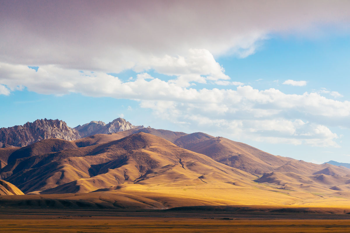
The beautiful Zhaosu Grassland lies in Ili Kazakh Autonomous Prefecture, northwest China's Xinjiang Uyghur Autonomous Region. It is one of China's four largest and most famous grasslands. Lying in an almost enclosed basin embraced by Wusun Mountain, Atengtao Mountain, South Tian Shan and Chadan Mountain in Kazakhstan, the grassland enjoys a semi-humid climate and has the most plentiful rainfall in the Yili River Valley, which makes it the most suitable land for growing rapeseed. Rape flowers, blossoming from late June to early July every year, are a must-go-to sight for professional or amateur photographers. Get shocked by the huge golden carpet that shines and waves gently against the sunlight in the soft winds.

Leave the golden sea behind and go up to the hills and mountains, to step into colorful wonderland of flowers. The wild flowers, in all colors and forms, cluttering in valleys and slopes, at the edges of forests and even on the cliffs, with the names known or unknown to tourists, creep all the way to the place beyond reach.

Fees: Unlike other scenic areas of grassland such as the Nalati and the Bayanbulak, the Zhaosu Grassland is open and free, and it covers the entire Zhaosu County. You can drive here and be free to take photos along the roads. However, some highly popular scenic spots there may have some officials charging fees on their own accord, so have some spare cash in your pocket.
Transport: Most tourists come here from Yining City for two-day sightseeing. Xiata Scenic Area is to the southwest of Zhaosu County so you can spend one night in the county or the scenic area.
Qiongkushitai Village is located in Karadala Township in Tekes County, northwest China's Xinjiang Uygur Autonomous Region. Qiongkushitai Village, at the starting point of Wusun Ancient Road, has gained great popularity for its beautiful scenery, unique wooden buildings and villagers' original lifestyles. Walking in and around the village is relaxing and enjoyable.
Located to the east of Nalati Town of Xinyuan County, the Nalati Grassland is one of the highest prairies in China and also one of the four largest grasslands in the world. Owing to its high altitude and steep terrain, it is also called 'The Sky Grassland'. Nalati Grassland offers stunningly beautiful scenery at the border of Xinjiang.
This pastoral valley is usually inhabited by nomadic Kazakhs half of the year. On this floral carpet, sheep and cattle graze while some nomads are busy training falcons to be used later for hunting. Their camps are still arranged as traditional yurts blending perfectly into the lush landscape where rivers meander through the Nalati and amid temporary dwellings. In winter, the prairie is buried under snow, but in spring, it is turning into an enchanting landscape. Nalati Scenic Spot is China's AAAAA scenic spot, open from 8:30 am to 8:00 pm and best visited from June to September for one day.
Entrance ticket and other fees: The entrance ticket is valid for double entry within 48 hours, with prices varying from 37.5 RMB to 95 RMB depending on the season. The shuttle bus fare varies from 40 RMB to 60 RMB depending on the routes. There are discounts for children shorter than 1.4 meters and people older than 70 years old.
Transport: There are few buses from Ili to Nalati. After getting to Nalati you can take a taxi or a motorcycle to the scenic spot. A route from Ili to Xinyuan County and then to Nalati will also work. Airplanes from Urumqi to Nalati Airport are available.
Bayanbulak Grassland National Nature Reserve (from Mongolian "abundant spring") is the second largest grassland in China, located in the Bayanbulak Basin of the Tian Shan mountains in northwest China. Considerable water supply there supports the lavish grasslands, numerous varieties of multihued flowers, and hundreds of thousands of cattle and sheep. The terrain is mostly flat, and encompasses a middle section of the Kaidu River. The reserve is 200 km northwest of Korla in the Bayingolin Mongol Autonomous Prefecture of Xinjiang Uyghur Autonomous Region.
As a high-altitude marshland (at 2,000 - 2,500 meters), the reserve is an important breeding and staging ground for birds and waterfowl, and is the highest-altitude breeding ground for swans in the world. The area has been designated an Important Bird and Biodiversity Area by Birdlife International.
Scenic spots:
Swan Lake Reserve: At the center of the Bayanbulak reserve there is "Swan Lake", a connected series of wetlands, which was designated in 1986 as the "National Swan Reserve" by the government of China. It is the first swan reserve in China and the habitat of thousands of swans of different kinds. The reserve, with fertile grass, moist air and comfortable temperatures, is the home to 128 species of birds and over 20 species of animals, and is inhabited by the biggest group of wild swans in China.
The Kaidu River: The Bayanbulak Grassland features 13 springs, 7 lakes, and 20 rivers. The Kaidu River also has another name — nine turns and eighteen bends, and is famous for making its entrance on stage in Journey to the West, one of the Four Great Classical Novels of Chinese literature, as the Tongtian River.
Kuike Wusu Stone Forest: The stone forest got its name for being under the Kuike Wusu Mountain Pass at the north foot of Nalati Mountain, the west part of the Tian Shan Mountain Range. The various shapes of the stones are what makes it noteworthy.
Other spots include the Haotengsala Waterfall, the Aerxian Hot Spring and Gongnaisi Forest Park. The best time to visit the Bayanbulak Grassland is September.
Bishkek has many moments of beauty, but it's the Tien Shan mountains that are the real scenic draw of Kyrgyzstan. Situated in the northern centre of Kyrgyzstan just above the Tien Shan range, Bishkek makes an excellent hub for short trips into the mountains.
It is the easiest and closest option to Bishkek, just south of town and almost accessible with public transit. A hired car can get you from the centre of the town to the alplager (mountain camp) of Ala-Archa Canyon within an hour. This national park is popular with locals and tourists looking for an easy respite from the city. The main trail follows the Ala-Archa River for around 18km along a valley dotted with small copses of the juniper (archa) tree, which gives the park its name. A shorter but more difficult walk leads to the Ak-Sai glacier and Soviet-era Ratsek Hut (still used as a climbing base by mountaineers). The steeper and quieter Adygene Valley loop can be taken from the alplager back down the main road for about one kilometre to a bridge that crosses the river to the west and climbs steeply past an alpinist cemetery and up to the valley far above.
Transport: To use public transit from Bishkek to Kashka-Suu village or to the entrance to the national park, take Minibus 265 leaving from just east of the intersection of Toktogul and Beyshenalieva in Bishkek. From Kashka Suu to the Park gate and beyond, though, you'll have to hike or hitch the last 12km to the alplager. Park entrance costs 80 som, roughly $1.15.
Alamedin Canyon to the east of Bishkek is most famous locally for its hot spring spa, which for hikers is the trailhead leading to more than 35 km of hiking track that passes a number of beautiful side valleys and eventually climbs over the Alamedin pass and south to the old road to Song-Kol.
Public transportation runs reliably to the village of Koy Tash from Bishkek's Alamedin Bazaar. From Koy Tash, it may be necessary to walk or hitch the last 10 km to the trailhead at the hot springs.
The Issyk-Ata Valley, just to the east of Alamedin or a two-hour-minibus drive from Bishkek, is behind the Issyk-Ata Sanatorium complex replete with pastel-colored rest houses and dining halls to host the guests that visit the health resort. Push into the mountains beyond the well-known waterfalls less than an hour away from the Issyk-Ata Sanatorium and the trail continues to the foot of a mountain about 8 km away. The 4018m Byty Peak looms over the valley. After 7 km hiking to the south there is a large glacier at the end of a really beautiful trail. A sparkling lake lies 8 km to the southeast, and a good campsite is 11 km from another pass leading to the old Song-Kol road.
Ala-Archa, Alamedin and Issyk-Ata can all be enjoyed on a day out. Of course, camping overnight is better.
The Kegeti Valley is the site with broad loops of a number of interconnected decent hiking trails. On the road into the valley a fork goes left to the "Kegety Tour" guesthouse, from which the turquoise Kol-Tor lake is a day hike away. On the right fork a 48 km "lollipop" the loop goes into the mountains and returns, or alternatively 38 km plus an additional steep 8 km connection leads to Kol-Tor and back down. Whether you opt for an easy waterfall jaunt, a steep lake walk, or an ambitious itinerary that takes it all in, the rewards in beauty and mountain views are worth the effort.
Transport: Bus 304 from the East Bus Station goes much of the way to Kegeti. Ask to get off just before crossing the river into Kegeti village. From here, follow the road for about 12km until the fork.
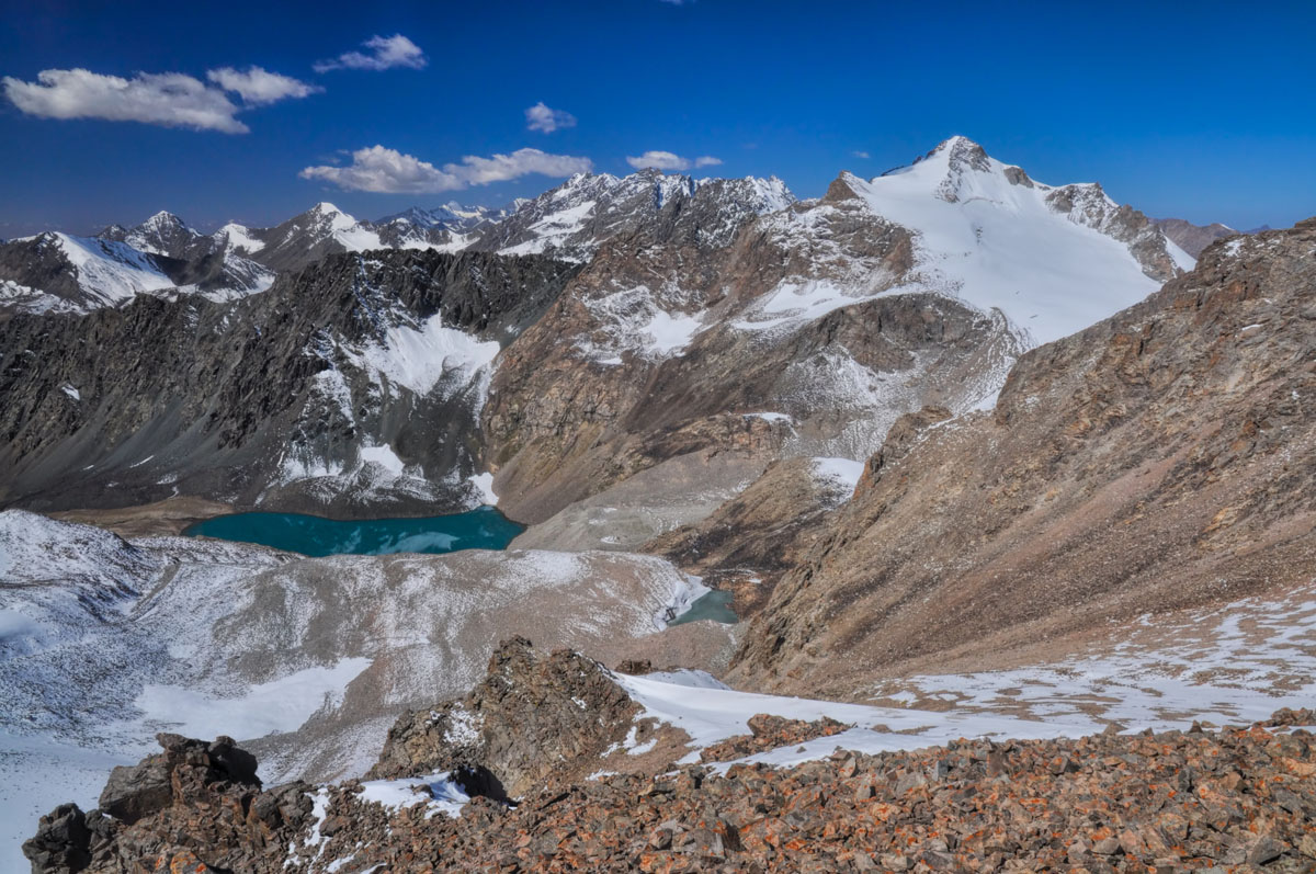
The combined exhilaration of standing on a pass above multi-coloured Ala-Kul lake and the relaxation of soaking in Altyn Arashan's hot springs is a highlight of trekking in Kyrgyzstan and worthy of crossing half the country for a three-day hike. Starting early from Bishkek's Western Bus Station, you can eat lunch in the city of Karakol and be on a trail into the national park in Karakol Valley by early afternoon. The first 16km trekking along the Karakol river is idyllic and the trail offers its most picturesque scenery on the 17km second-day trekking when you climb to 3500m Ala-Kul and over a steep pass into the Arashan Valley and springs. Having climbed and dropped nearly 1800m of elevation over two days, paying 200 som (approx. $3) to soak in the private hot spring cabins at Altyn Arashan feels like a bargain and makes the next day's 17km downhill to the nearest bus stop in the village of Ak-Suu feel like an easy stroll.
Transport: From central Karakol, shuttle bus 101 terminates at the national park entrance (8 som - approx. $0.11). To return from Altyn Arashan, wait for shuttle bus 350 just on the outskirts of Ak-suu, where two paved roads come together to head into the village centre.
July through mid-September is the ideal season for hiking in Kyrgyzstan; it's also possible to hit the mountains as early as mid-May and up to mid-October, but the weather gets cold and you should pack accordingly.
For skiing and snowboarding enthusiasts, there are more than 20 ski resorts in the Tian Shan (Tiānshān), which are located throughout the range, but mainly in its northwestern part, where you will find most of the resorts, including also the largest of them. It is also one of the main areas for skiing in Central Asia.
The largest ski resort in the Tian Shan (Tiānshān) is Shymbulak (Chimbulak) near the city of Almaty, the capital of Kazakhstan, in the Zailiysky Alatau Range with more than 20 km (12 mi) of slopes and more than 5 ski lifts. However, the Karakol Ski Resort in neighboring Kyrgyzstan near the town of Issyk-Kul is just of the same size with just one ski lift less than Shymbulak.
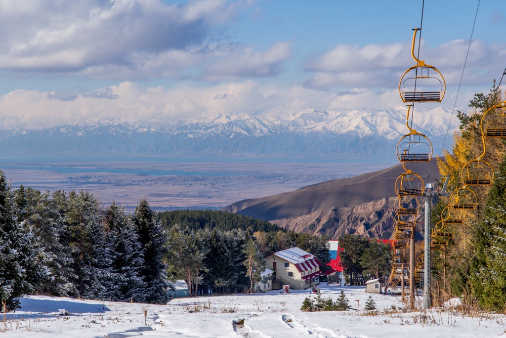
Other major areas for skiing in the Tian Shan (Tiānshān) with more than 10 km (6 mi) of slopes and more than several ski lifts each include the following:
Check the Tian Shan (Tiānshān) ski resorts map on Kazakhstan and other countries' ski maps in the World Mountain Lifts section of the site. It includes information about open ski lifts / slopes in the Tian Shan (Tiānshān) in real-time with opening dates and hours. There are also year-round cable cars, funiculars, cog railways, aerial tramways, and all other types of mountain lifts.
Tianchi (Heavenly Lake), one of the most impressive sights in China, is 110 km away from Urumqi. The deep blue lake is set amid the Tian Shan Mountains below the north side of the imposing Bogda Peak (5,445 metres) and is surrounded by spruce trees while the lake surface reflects Bogda Peak, making the surrounding scenery seem like it came out of a fairy tale. Tianchi, at an elevation of 1,981m above sea level, is a natural alpine lake. The lake is like a half-moon and is praised as the Pearl of Tianshan.
Other than the main lake, there are also two water areas on the east and the west. The "Eastern Small Tianchi" which is also named Black Dragon Pond is in the east and is 500m away from Tianchi. Under the pond, there is a waterfall cascading horizontally like a rainbow reaching the ground, which is the famous "Nacre Rainbow of the Hanging Waterfall." The "Western Small Tianchi", also named "Jade Lady Pond", is in the west and is about 2km away from Tianchi. Its shape resembles a round moon surrounded by cedar trees, and it looks like a still shadow and sunken jade with the bright moon shining in the sky, thus it has been given the name "Emerald Moon of the Dragon Pond".
Ancestral Temple of Queen Mother of the West is located on the east coast of Tianchi and northwest to Bogda Peak. At an elevation of around 2,000m, it is one of the oldest and highest Taoist temples in Xinjiang. It is said that the temple was the place where Queen Mother of the West became a goddess and that was why it was named so.
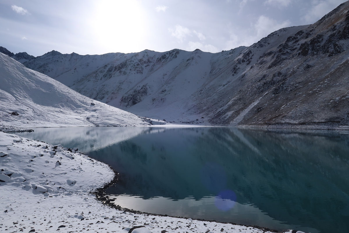
Issyk-Kul Lake is an endorheic lake in the northern Tian Shan mountains in eastern Kyrgyzstan. It is the seventh deepest lake in the world, the tenth largest lake in the world by volume (though not in surface area), and the second largest saline lake after the Caspian Sea. Issyk-Kul means "warm lake" in the Kyrgyz language. The lake appeared as a result of volcanic activity. It is heated underground by thermal springs. Although it is surrounded by snow-capped peaks, it never freezes even in the depths of winter. In summer, the water temperature reaches 25-28℃, which is warmer than the air. The lake is also a Ramsar site of globally significant biodiversity and forms part of the Issyk-Kul Biosphere Reserve. Extremely deep and pleasantly warm, over the centuries the lake has been something of an oasis in this inhospitable mountain environment. Take a dip in the lake on the Kyrgyzstan and Tian Shan Mountains expedition or on the Silk Road to Samarkand via Kashgar.
Close to the shore of Issyk Kul Lake, you'll find the site of the Cholpon Ata Petroglyphs. Set at the foot of the Kungei Alatau Ridge, they form an interesting cultural stop on a trip in the Tian Shan Mountains. Most of the petroglyphs date from the Saka-Unsun time (the 8th century BC - the 1st century AD) and were made by Saka priests for sacrifices and other rites. There are also more recent engravings from the Turkic era, with the most beautiful one depicting several ibex being hunted by snow leopards. You’ll have a nice view of Issyk Kul Lake from the site.
The Charyn Canyon is a canyon on the Sharyn River in Kazakhstan, 200 kilometres east of Almaty. Close to the Chinese border it is part of the Charyn National Park, established in 2004. The canyon stretches 154 kilometres along the Charyn River in the northern Tian Shan mountain range. Over time, the canyon has gained colorful formations of varying shapes and sizes. Though it is much smaller than the Grand Canyon, it has been described as being equally impressive. You can explore this particular section of the Tian Shan mountain range on Kazakhstan and Kyrgyzstan by bike.
Jeti-Oguz translates from Kyrgyz as 'Red Cliffs of Seven Bulls'. Jeti Oguz Gorge is set at the height of 2,250 metres above sea level on the north slope of Teskey Ala-Too Ridge near Issyk Kul. The slopes of the gorge are covered with the world-famous Tian Shan blue spruce and form a fantastic mountain wood to trek through. There is a fast mountain river flowing parallel to the trail and a waterfall named Maiden Tears. Imagine spending the night in a traditional yurt with the red cliffs and green conifers as a backdrop.
The ancient Bezeklik Thousand Buddha Caves are located on a cliff face overlooking a river valley. In the Chinese part of the Tian Shan Mountains, you can visit the caves on your way to or from Urumqi, about three-hour-drive apart.
The beautiful Karkara Valley lies on the border between Kazakhstan and Kyrgyzstan. This area was once part of the Silk Road, traversed by Kazakh, Kyrgyz and Chinese traders. Nowadays, the spot is reserved for Base Camp Karkara. It is literally the jumping off point for expeditions to Peak Pobedy (7,439 metres) and Khan Tengri (7,010 metres). For those that are visiting the Tian Shan Mountains, the camp may be a welcoming break. Accommodation is in “walk-in” tents, and comes with hot showers, a traditional sauna and a bar! In the valley, you may meet the nomads who have brought their flocks up to this fertile land, perhaps taste some local tea inside a yurt, or chat with the horsemen and try your hand at milking a horse.
Zhaosu is a county of Northwest Xinjiang with vast grassland and lavish forests endemic to Xinjiang. In recent years, Zhaosu has become a hot destination for tourists both domestic and foreign, who come here to enjoy horse riding, to see ancient stone figures in the grassland, and to take hot spring baths. However, what attracts tourists the most, besides the above-mentioned, is the flowers in the grasslands and mountains. They look upon the sea of flowers, lasting from late Spring to late Summer, in great wonder. A few kilometers away to the east of the county is a major scenic spot of Zhaosu Grassland, the Hongnahai Grassland Stone Figures Scenic Area. The stone figures standing in the grassland is a great fit for photos. Sheng You Temple in the county and Ge Deng Monument established in Qing Dynasty, which is 70 km to the west of the county, are famous cultural tourist attractions.
Sayram Lake is located in the Bortala Prefecture near the Tian Shan Mountains, Xinjiang, China. It is the largest (458 km²) alpine lake in Xinjiang and also the highest (2,070 m a.s.l.). Sayram Lake is a national scenic spot. The best visiting time is June and July every year and it will be a swell place to stay in summer. The other extreme is to visit the lake in winter. Even though it is very cold, the view will never fail you. The recommended route starts from Yining to Khorgas Port, Guozigou and Sayram Lake, taking 4 days in total.
Tekes County is known for being a planned community with a shape of a ba gua and thus is also called Ba Gua City. The county is a great place to stay to reach out to Akekule Lake, Kalajun Prairie, Tekes Prarie, Tekes Karst Cave & Stone Forest, Qiongkushitai Village and Kuokesu Hot Spring.


ultra
snow-leopard-award
china-ultras
kyrgyzstan-ultras
ultra
snow-leopard-award
china-ultras
kyrgyzstan-ultras
kazakhstan-ultras
ultra
snow-leopard-award
china-ultras
kyrgyzstan-ultras
The highest peak in the Tian Shan is Pobeda Peak (Jengish Chokusu), at 7,439 m.
The Tian Shan have 2,375 named peaks.


