
Majestic and oftentimes brutally deadly, mountains have made their way not only into many countries’ lore and hearts of people, but also on such a mundane thing as money. One would assume if a country has a mountain, it certainly should appear on the banknotes. Well, you’d better not jump to conclusions too fast. What if you wish to have a mountain, but it is simply not yours, yet the wishful thinking makes you place it not on one, but on several banknotes. Alternatively, what if you have several important peaks, which one to choose: the most politically correct, the most important for religion or just the most beautiful? Finally, what if your mountains are small, yet so charming you even confuse the scientific names of endemic fauna living on them or forget to put some part of the country on the map featured on a banknote?
There have been many more wonderful insights while I was writing this article. Peering into the banknotes, I came to an idea of making a challenge - can a man climb or hike all those magnificent rocks and take pictures on the way with the exact same view as on the banknote? That would definitely require some navigating and visualization skills as well, or just a PeakVisor app, itchy feet and a phone camera.
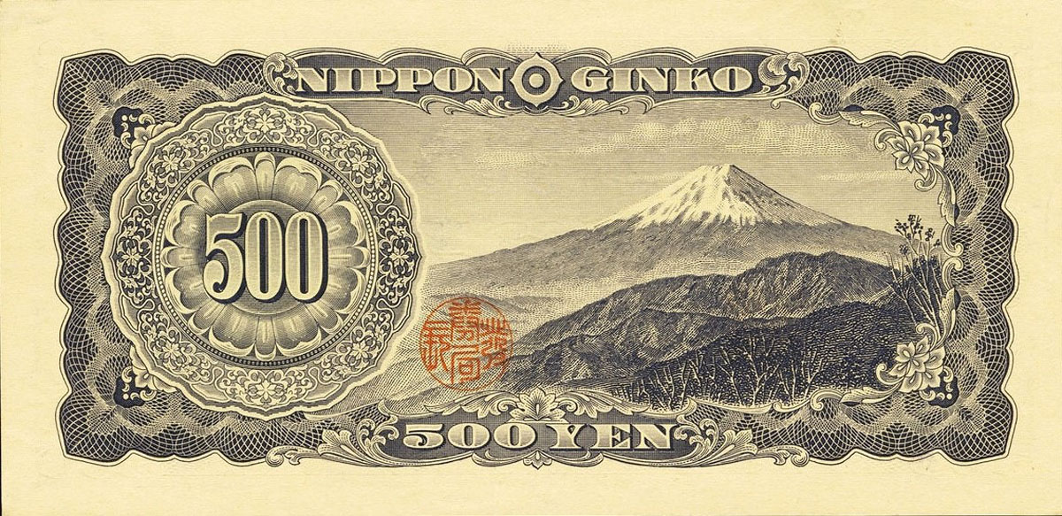
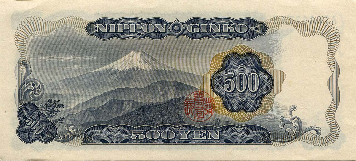
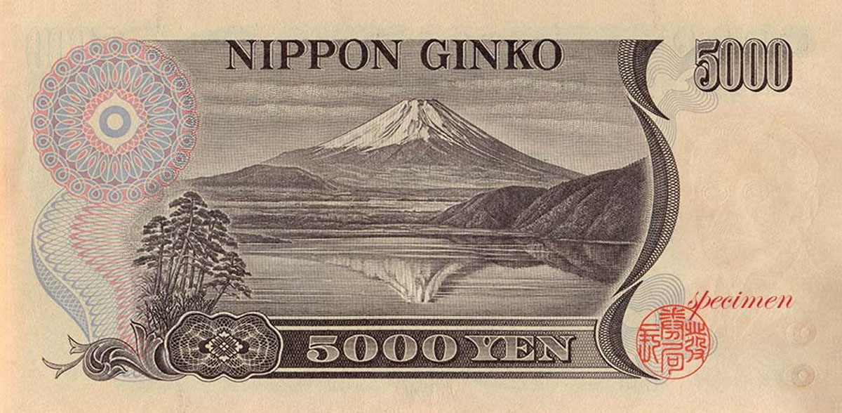
Mount Fuji, Japan (Yen)
The sacred, the blessed, the beautiful, Mount Fuji is the symbol of Japan, awesome in its splendour and serenity. No wonder it has frequently appeared on the country’s currencies over the centuries. Currently, it is featured on a 1000 Yen banknote.
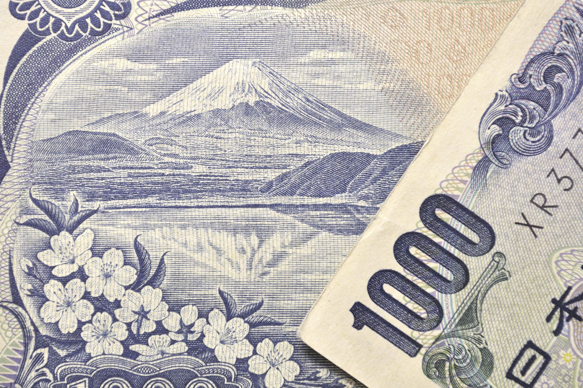
Scheduled to be issued in 2024. The image is borrowed from a series of landscape prints by the Japanese ukiyo-e artist Hokusai (1760–1849). The series depicts Mount Fuji from different locations and in various seasons and weather conditions. Despite its name, it actually consists of 46 prints, with 10 of them being added after the initial publication.
Mount Fuji (3,776m) is an active volcano, the most recent eruption happened in 1707. It stands on the border between Yamanashi and Shizuoka prefectures and can be seen from Tokyo and Yokohama on clear days. Visibility tends to be better during the colder seasons of the year than in summer, and in the early morning and late evening hours than during the middle of the day. The best view of the mountain can be enjoyed from around Shin-Fuji Station on the right-hand side of the train, about 40-45 minutes into the journey if you take the Tokaido Shinkansen train (Tokyo - Nagoya - Kyoto - Osaka).
How to explore Mount Fuji
The most leisurely way to enjoy Mount Fuji is definitely from the Fuji Five Lake (Fujigoko) region at the northern foot of the mountain, or from Hakone hot spring resorts where you can soak in a luxuriously hot bath.
Mount Fuji is officially open for climbing during July and August via several routes. Anyone without much hiking experience is advised to tackle the mountain during the official climbing season. The specific dates depend on the year and trail. In recent years they have been set as follows:
- Yoshida Trail: July 1 to September 10
- Subashiri, Gotemba and Fujinomiya Trails: July 10 to September 10
The peak season for climbing Mount Fuji is during the school vacations which last from around July 20 to the end of August. The peak of the peak is reached during the Obon Week in mid-August when climbers literally have to stand in queues at some passages. In order to encounter neither too large nor too small crowds, we recommend climbing Mount Fuji on a weekday in the first half of July before the start of the school vacations. The downside of a climb in early July is the weather, which tends to be somewhat more unstable than later in the season.
The trails up the mountain are divided into ten stations with the first station at the foot of the mountain and the tenth station being the summit. Paved roads go as far as the fifth station halfway up the mountain. There are four 5th stations on different sides of the mountain, from where most people start their ascent. Learn more about climbing Mt. Fuji here.
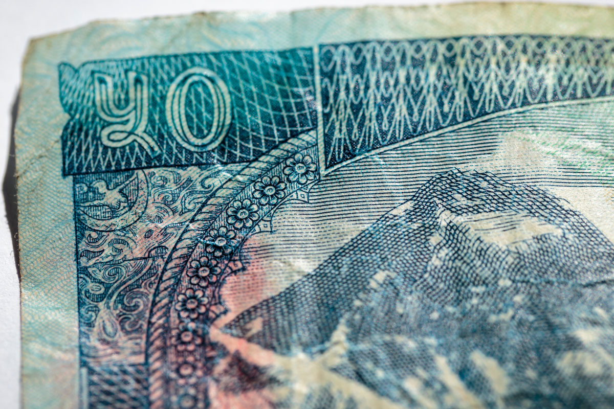
Mount Everest, China (Renminbi) & Nepal (Rupee)
Being the highest mountain in the world you would assume to be entitled to a place on a banknote. Well, Everest made it, not once and not only in the country it belongs to. Here is the Chinese version of 10 Yuan (no longer in circulation).
Mount Everest, the mother of all mountains, was discovered by a Bengali surveyor in 1852 who estimated it to be the highest mountain in the world with an astonishing height of 8,848 meters (29,029 feet). It was known as Peak XV at the time, but later, during British rule, renamed Mount Everest. After a British Surveyor General of India, Sir George Everest.
Don’t be deceived by the gentle name, this mountain acts more like a stepmother, having killed already over 300 people trying to conquer it. Some casualties are not due to the elements, but due to the large crowds that leave people queuing in the mountain's "death zone." Yet, it is not the deadliest in the Himalayas. Annapurna I and K2, the second highest mountain, are the most dangerous. The two mountains have a 32% and 29% fatality rate, respectively, according to NASA.
Everest has two approaches, one from the southeast side in Nepal; the other from its northern side in Tibet. As is with human desire, were several unsuccessful attempts made to climb this monster for years on end. Although, patience, training and endurance paid off for Sir Edmond Hillary and Serpa Tenzing Norgay on 29 May 1953, who is today credited for the first official, successful climb. Since then, Mount Everest has remained an enigma to the many who attempt to climb her each year.
The best time to visit Mount Everest is the months of April and May.
Mount Everest is also well-known by two other names:
- Chomolungma is the Tibetan name for Mount Everest. Meaning: “Goddess Mother of Mountains” - An appropriate name for the highest mountain in the world. Interesting Fact: In 1715, the area was surveyed by the Chinese who included the mountain under their territory, and called it, “Mount Qomolangma,” in 1719.
- Sagarmatha in Nepalese. Meaning: Literally translated it means, “Forehead of the Sea or Sky,” or “Mother of the Universe.”
Nepal has Mount Everest on every banknote now.
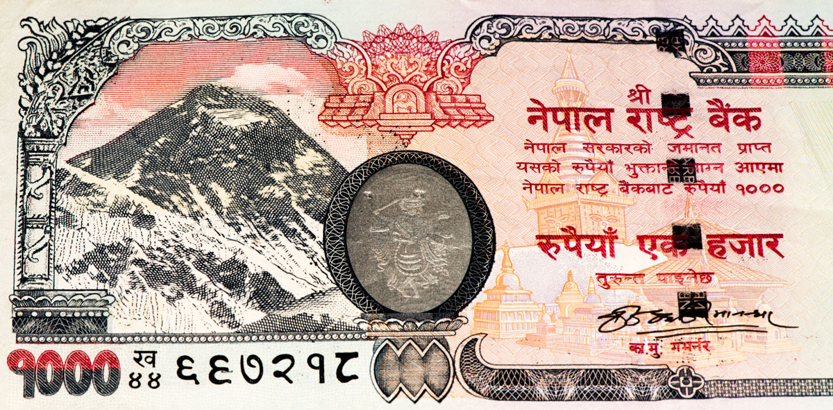
In 2012, Nepal Rastra Bank issued a revised banknote series that are similar to the 2007 series, but now include inscriptions in English and the year of issue on the back. So convenient, isn’t it? This series feature Mt. Everest on every banknote (5, 10, 20, 50, 100, 500, 1000). Luckily, this is not the only mountain present of the Nepalese currency. There is Mount Ama Dablam and Thyangboche monastery are on a 500-rupee banknote (see the central part of the banknote).
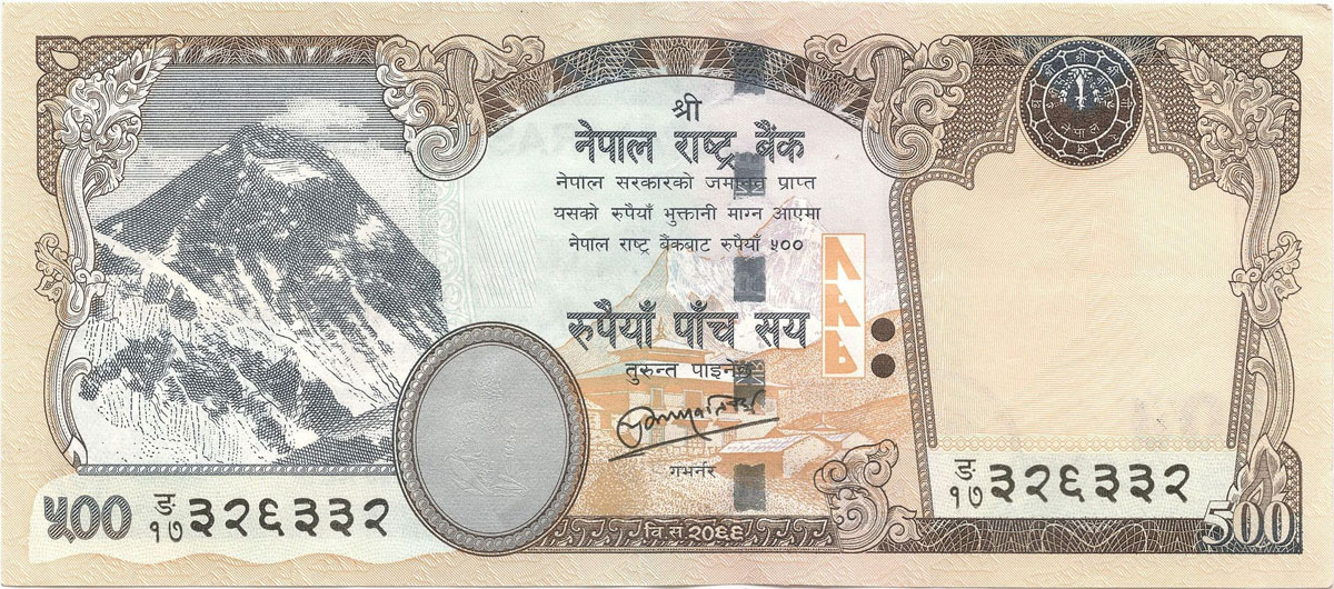
Ama Dablam, popularly known as the “Matterhorn of the Himalaya” for its almost pyramid-perfect shape, is one of the most gorgeous mountains in the world located in the Himalayan range of Eastern Nepal. The hanging glacier seen on the southwest face of Ama Dablam bears a resemblance to the sacred ornament box used by Sherpa Women, which is known as Dablam, therefore giving it a name as “Ama Dablam” This peak is 6,812 meters in elevation from the sea level, but don't grudge the size, the mountain’s aesthetics is what really matters. Mt. Ama Dablam is located in the Khumbu region of Nepal, south of Mt. Everest.
The usual ascension to Ama Dablam is done from the south-western ridge. This was the same route followed by the climbers who reached to the top for the first time to the top in 1961. Commonly, climbers set up three camps just below and the right of the hanging glacier, “Dablam”. The hike is modest up to camp 1, but the challenge starts from camp 1 to camp 2 as it gets more technical in the narrow edges of ridges made from granite. This challenge increases even more from camp 2 to camp 3. Some risk of glacier falls is unavoidable but it is said that adventure without risk is Disneyland. One should have expert skills of rock and ice climbing and get used to the high altitude before thinking of Ama Dablam. The best months to climb are April, May, September, and October.
Speaking of Matterhorn, regardless of it being a powerful symbol of Switzerland, it has never made its way to a banknote! Matterhorn seems to be staying firmly affiliated with Swiss chocolate, which is better than money.
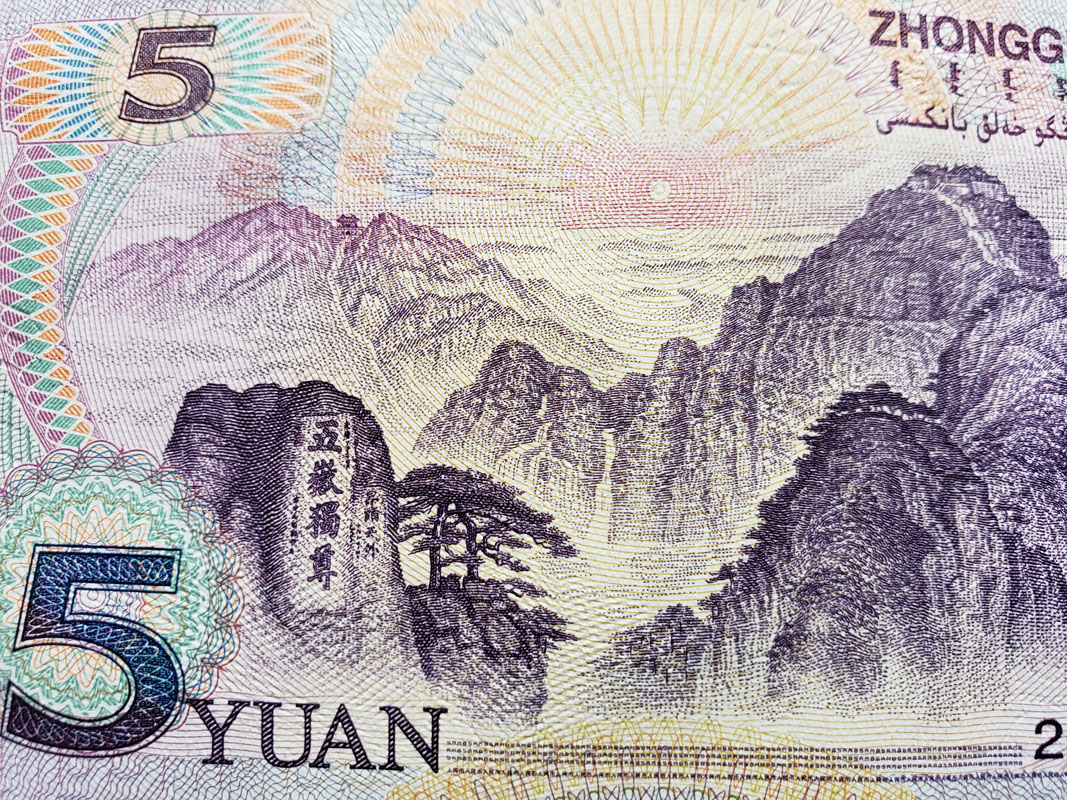
The Jinggangshan Mountains, China (Renminbi)
The Jinggang Mountains (Chinese: 井冈山; pinyin: Jǐnggāngshān) are a mountain range of the Luoxiao Mountains System (罗霄山), in the remote border region of Jiangxi and Hunan Provinces. These mountains are the cradle of the Chinese communist revolution. Visitors can come here by the long-distance bus to Ji’an and then transfer to the long-distance bus to Ciping. They usually come to pay respects to revolutionary relics and enjoy the surrounding natural beauty as well. The best time to travel to the Jinggang Mountains is from April to October every year.
The range's massif consists of a number of thickly forested parallel ridges. On the heights, there is not much farmland with most settlements at the base of the mountains. The main settlement is at Ciping, which is surrounded by five villages whose literal meanings are Big Well, Little Well, Middle Well, Lower Well, and Upper Well. Henceforth came the name of the mountain range—"井冈山" literally means "Well Ridge Mountains".
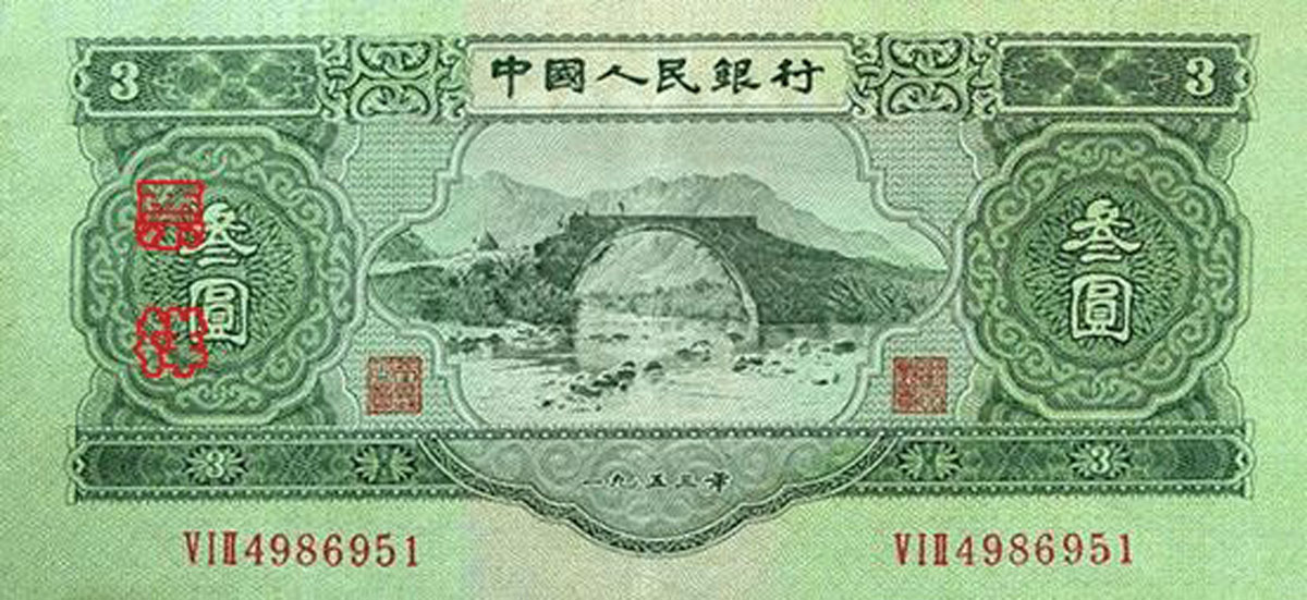
The Jinggangshan Mountains were also present on ¥100 from the 4th Series Banknotes, in circulation 1987 - 1997.
Mount Tai aka Tai Shan, China (Renminbi)
Tai Shan (or Mountain Tai) is one of the five Daoist sacred mountains in China. It is associated with sunrise, birth, and renewal, and is often regarded as the foremost of the five. Mount Tai has been a place of worship for at least 3,000 years and served as one of the most important ceremonial centres of China. Because of its history, it is the most climbed mountain in China. It now hosts Mount Tai international Mountaineering Festival held in September every year since 1987. There is a 5 km climb for seniors group (591 steps and 800 meters high), 7.7km climb for middle-aged group (5884 steps and 1400 meters high) and 8.5 km climb for youth group (6566 steps and 1545 meters high).
Mount Tai (Chinese: 泰山; pinyin: Tài Shān) is quite modest in comparison with the previous contenders, it is just 1,532.7 m (5,029 ft) tall. Mount Tai is located in western Shandong, just north of the city of Tai'an and to the south of the provincial capital Jinan.
There are four routes to get to the summit of Mount Tai. The East Route is the most popular. It is considered to be the imperial route which emperors all took to make sacrifices. The East Route starts from Mount Tai Arch (people usually visit Dai Temple at the foot of Mount Tai first before getting to the Mount Tai Arch). There is a total of 7,200 stone steps on the routes with Red Gate Palace, Jing Shui Valley, Hu Tian Pavilion and Eight Mountain Bends on the way up. It usually takes two and a half hours (sprinting hikers) to six hours to get to the summit. Once up there, don’t miss the sunrise or sunset, depending on what time you are hiking up.
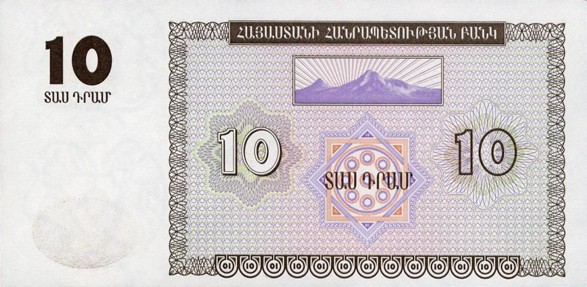
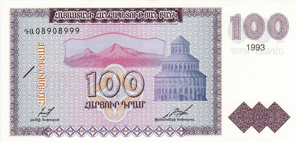
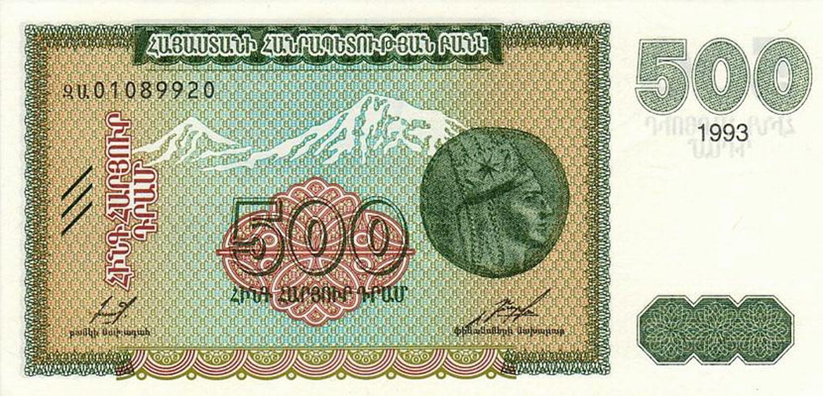
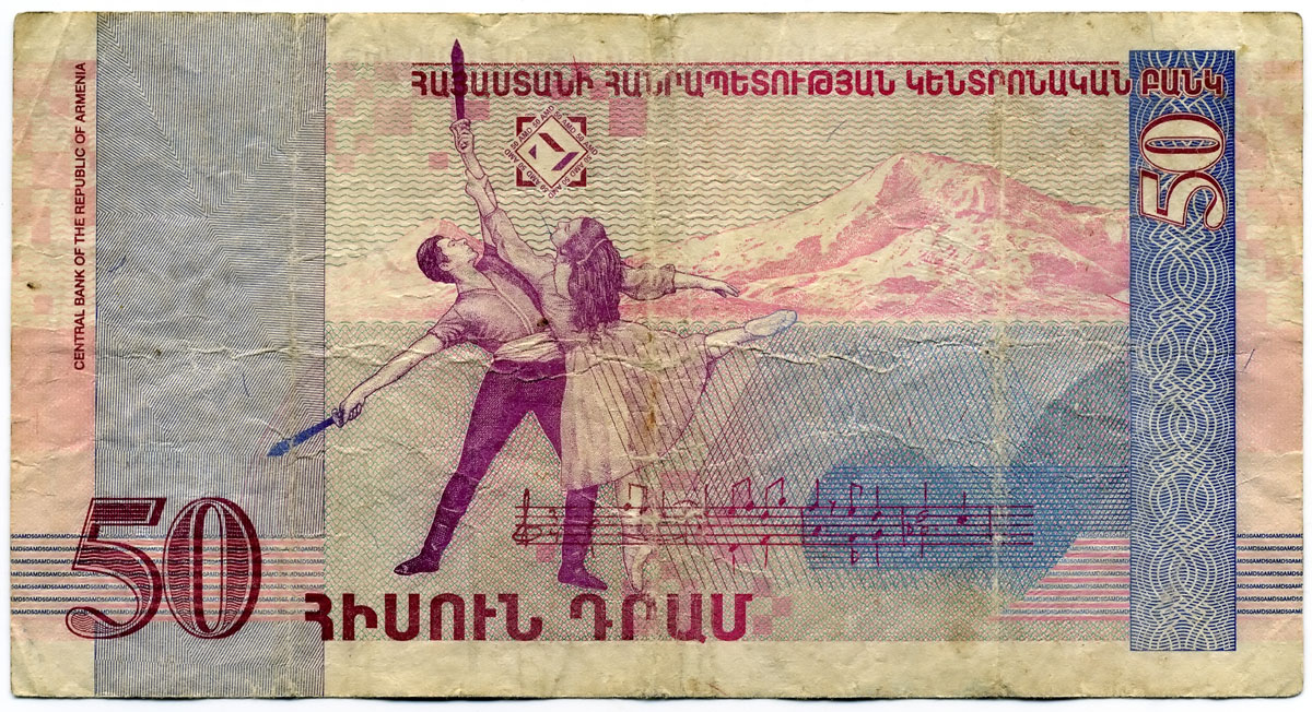
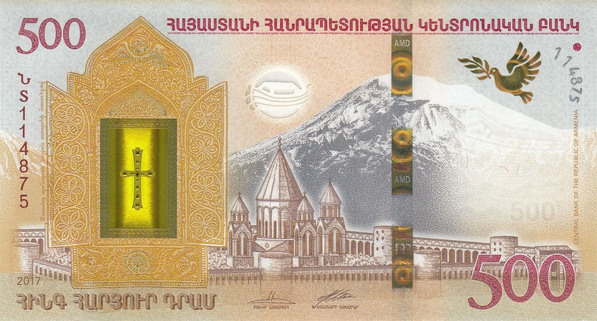
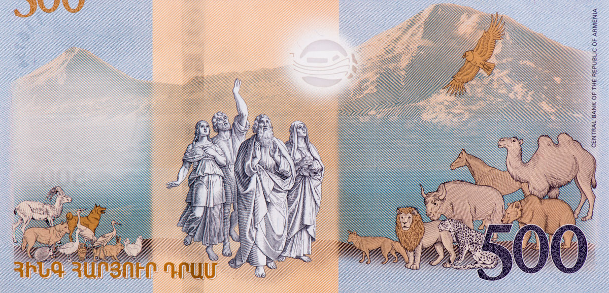
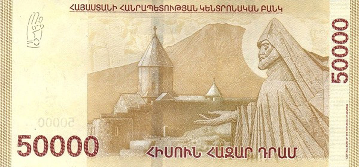
Mount Ararat, Armenia (dram) & Turkey (lira)
Mount Ararat, the star of the Bible and the destination point of the lucky Noah and his Ark as well as historians and archaeologists seeking fame, is in the Lesser Caucasus. Ararat (5, 137m) is a dormant volcano; the last eruption was on June 2, 1840. Ararat is currently located practically on the borders of four countries: Turkey, Armenia, Azerbaijan, and Iran. Its summit is located some 16 km (10 mi) west of both the Iranian border and the border of the Nakhchivan exclave of Azerbaijan, and 32 km (20 mi) south of the Armenian border. The nearest cities in Turkey, as the crow flies, are Erzurum (about 250 km west), Kars (130 km northwest) and Van (160 km south). As you might have guessed, Mt. Ararat has been a bone of contention, it under Turkish control during the 1920 Turkish–Armenian War, but there is so much culture, religious and national issues connected with it for Armenia.
It is the principal national symbol of Armenia and has been considered a sacred mountain by Armenians. It is featured prominently in Armenian literature and art and is an icon for Armenian irredentism. Along with Noah's Ark, it is depicted on the coat of arms of Armenia.
As of 2004, the mountain is open to climbers only with "military permission". The procedure to obtain the permission involves submitting a formal request to a Turkish embassy for a special "Ararat visa", and it is mandatory to hire an official guide from the Turkish Federation for Alpinism. Access is still limited, even for climbers who obtain the necessary permission, and those who venture off the approved path may be fired upon without warning.
Mt. Ararat appeared on the reverse of the Turkish 100 lira banknotes of 1972–1986 and many more times on Armenian drams.
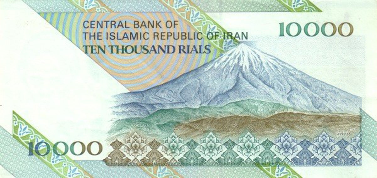
Mount Damavand, Iran (Rial)
Mount Damavand is a perfect cone-shape volcano of 5,671m a.s.l. located in the central part of the Alborz Mountain Range in the north of Iran on the southern coast of the Caspian Sea. It is the highest volcano in Asia, the highest summit in the Middle East and the second highest volcano in the northern hemisphere. It is probably the fastest 5000m in the world to ascend. The first camp, Polour, is just a couple of hours from Tehran’s IKA International Airport. In a short Itinerary you can ascend to the top and get a taste of the natural beauties, sightseeing and landscapes of this distinguished summit.
Snow covers the entire mountain in winter and the upper parts in the other seasons. Damavand has a narrow summit crater usually covered with snow and clouds. The snowy white peak with its regular Lenticular Cap Cloud is the most beautiful sight of Iran. Should you be unwilling to climb it, the view of this huge mountain looks more attractive from away than close up. On a clear day, it is visible from 250 km.
Ascend to Damavand summit in summer is not technically difficult but physically it is a difficult trek. The main challenge of the climb is Damavand acclimatization because the air gets thinner with less oxygen as you go higher. To raise the chance of success and lower the risk of AMS and to enjoy a safe hike to the peak it is essential to get accustomed to this new environment. If you intend to attempt Damavand Mountain either from the classic south route or the west trail, the following campsites are the best places for Accomodation and settlement. Camp 1 Polour Resort in Polour Village as the first camp and the best starting point and Camp 3 Bargah New Hut as the high camp.
In general, there are at least 16 known climbing routes to Damavand Summit. Four of these routes are popular because they have a shelter, refuge or a suitable campsite midway. The most favorite side is the south route because of its major settlement resort called high camp or the third camp Bargah Sevom New Hut.
Things to bear in mind when you are a foreigner in Iran.
- All foreigners who intend to climb Mt Damavand (and also Mt Alam Koh) in Iran either for trekking, mountaineering, ski touring or snowboarding, from any route and in any season, must obtain a climbing permit from Iran Mountain Climbing Federation in advance. The price of Damavand climbing permit is 50 USD per person.
- Damavand climbing season starts from mid June and it may last to mid September. The best time is in July and August. In this period the footpaths are generally free of snow, the weather is usually moderate and approach by public transportation to the base camp is easy. Best starting day is Saturday. Remember Iranian weekend is Thursday and Friday.
- The main challenge is acclimatization; attempt the summit only after your body is well-acclimatised. The recommended climbing route is the south face. A reliable guide is helpful and will increase your chances of success. Start early in the morning and never climb at night. Use the daylight only.
Damavand is not the only peak worth visiting in Iran, read more about Iranian attractions here.
Khan Tengri, Mount Sulaiman, Cliffs of Seven Oxen, Kyrgystan (Som)
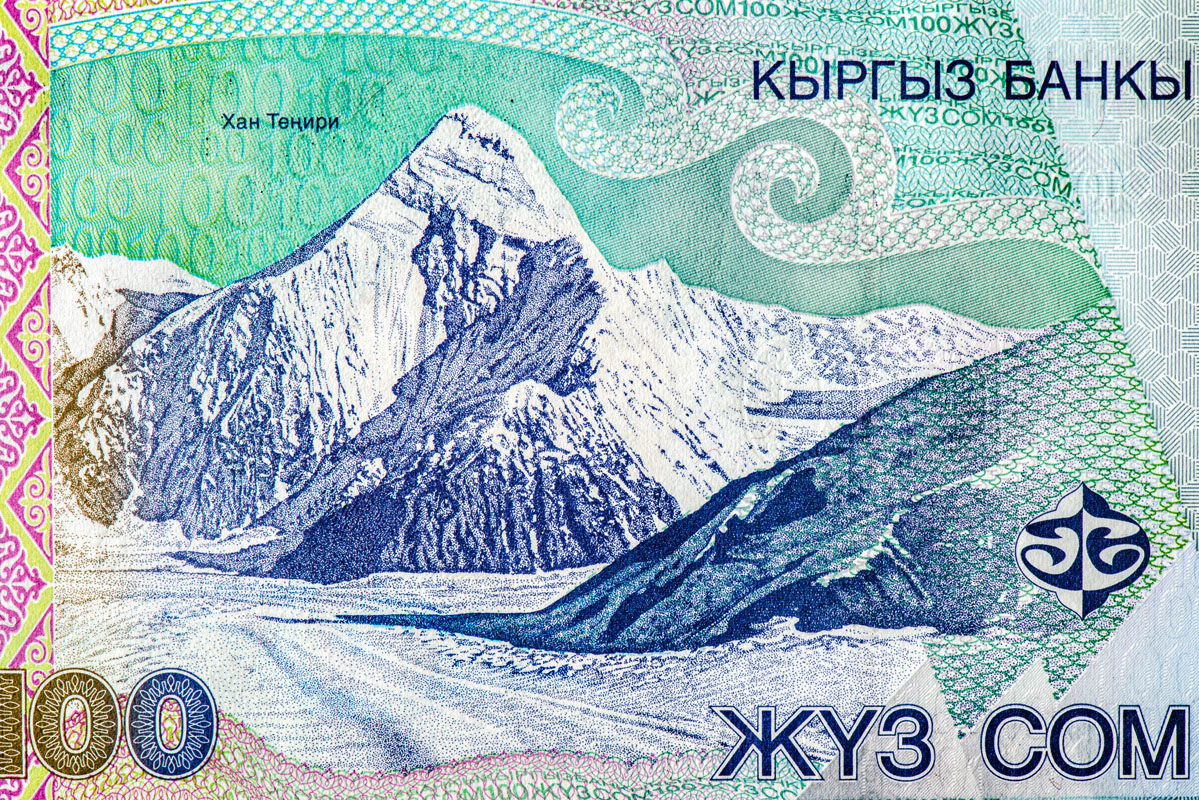
Khan Tengri
Khan Tengri (Kyrgyz: Хан-Теңири, حان-تەڭىرى;) is 5 meters short of 7K, the elevation is 6,995m a.s.l., but if you take into account the glacial cap, the elevation is 7,010m. That is why this mount is assumed to meet the requirements of Snow Leopard award, it is considered a 7,000-metre peak. This peak belongs to the Tian Shan mountain range and is located on the Chinese-Kyrgystanian-Kazakh border, east of Kyrgyzstan landmark Lake Issyk Kul. The name "Khan Tengri" literally means "King Heaven" in Kazakh and possibly references the deity Tengri. In some other local languages, it is known as Khan Tangiri Shyngy, Kan-Too Chokusu, Pik Khan-Tengry, and Hantengri Feng.
Khan Tengri is the second-highest mountain in the Tian Shan, surpassed only by Jengish Chokusu (means "Victory peak", formerly known as Peak Pobeda) (7,439 m). Khan Tengri is the highest point in Kazakhstan, but it is not on any of Kazakh banknotes! And the third-highest peak in Kyrgyzstan, after Jengish Chokusu (7,439 m) and Avicenna Peak (7,134 m), which surprise-surprise, also did not make it to the national currency despite being higher than Khan Tengri. Khan Tengri is also the world's most northern 7,000-metre peak, notable because peaks of high latitude have a shorter climbing season, generally more severe weather and thinner air.
haped like an artist’s drawing of a mountain, Khan Tengri has been an untomst lure to many climbers. The standard west ridge can be approached from the north (Kazakhstan) or south (Kyrgyzstan). The southern approach is technically easier but objectively more dangerous with fatalities. If you start from the south, depending on weather conditions, you will stay in between three or four camps to climb Khan Tengri. The Khan Tengri ascent is for expert mountaineers only. You need to have considerable mountaineering experience and also an excellent fitness level. The ascent is very demanding and should not be underestimated.
Mount Sulaiman
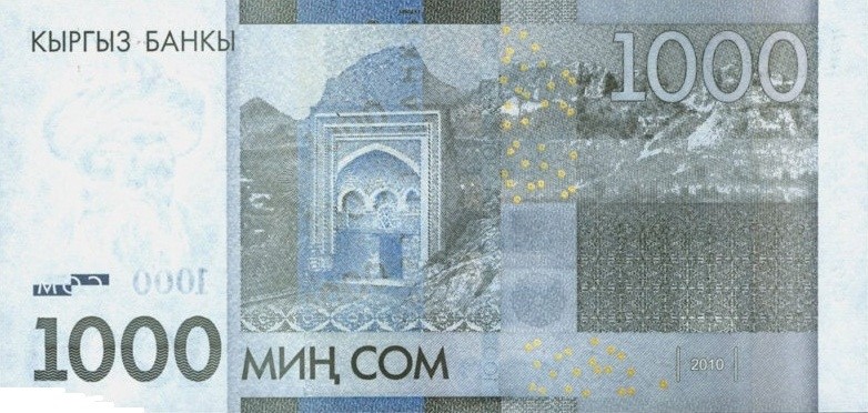
Sulayman (or Sulaiman) Mountain is only 1,115m a.s.l. but it got the the banknotes because the size does not really matter. It is of great cultural heritage as it used to be a major place of Muslim and pre-Muslim pilgrimage. The rock rises abruptly from the surrounding plains of the Fergana Valley and is a popular place among locals and visitors, with a splendid view.
Cliffs of Seven Oxen
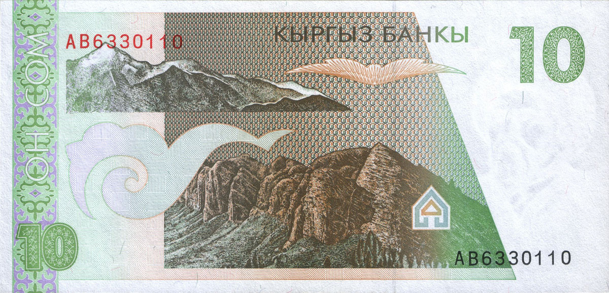
Basically, it is the picture of the gorge Dzhety-Oguz surrounded by unique red rocks that remind of oxen lying on the ground. As any unusual edifice, it has a background folklore story to it. Surely, it is about love, very much like that of Helen of Troy. A man had a beautiful wife, a neighbour wanted to have that woman as well, so he stole the femme fatal, a bloody war ensued and to end it, the neighbour devised a devilish plan. The husband, who was claiming his wife to be returned, did not state whether he wanted her to be dead of alive. So, the neighbour decided to kill the woman. The unsuspecting husband was invited to the fest after which he was told his wife would be given back. According to the old tradition, the fest should last a week, every day an ox/bull was killed to feed the guests, so when the seventh day came, the last bull was killed and so was the woman. Once the blood of that unlucky female was spilt, some drops of it got onto the cliffs and torrents of water flooded the gorge, killing the wicked neighbour and his friends (and assumedly the unlucky husband). Since that time, the gorge is called Seven Oxen or Dzhety-Oguz.
Dzhety-Oguz Gorge is formed by Mt. Kok-Debe (2,700m), Horseshoe Peak (Peak Podkova, 3,500 m), People’s Friendship Peak (Peak Druzhby Narodov 3,800m), Kok-Belle Peak (2,600m) and Asan-Tukum (3,600m). There is a resort called Karakol at the end of the gorge.
Mayon Volcano and the Chocolate Hills, the Philippines (Peso)
Hardly can you associate an island state with any high-rise mountains, but the Philippines defies that stereotype. The country has some of the most charming banknotes, it might have got some of the scientific names of the animals featured on the reverse side of its banknotes rendered incorrectly, but who cares when you see the cutest beasts in your hands.
The Philippines has a turbulent history, so does its currency. The "VICTORY-CBP" banknotes were devoted to the end of American era (first issued in 1949), they were followed by the English series in 1951 and both featured volcano Mayon, on 20 pesos, on ½ peso note, both void in 1967.
Mayon Volcano
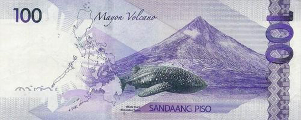
Mount Mayon (2,463m) is an ultra and the Philippines’ most active volcano. It is also the world’s most symmetrical volcano, with Mt Fuji in Japan being the close contender for the title. Mayon Volcano is undoubtedly the icon of Bicol and is the most famous of the 7 volcanoes of the region. It is the perfect backdrop in the Bicol Peninsula of the Cagsawa Ruins. In fact, it is the most active volcano in the Philippines with no less than 46 volcanic activities occurring after 1814 after the eruption that killed thousands and resulted to Cagsawa ruins. That is why, if you opt for visiting it, check the seismic activity reports and plan accordingly.
Mayon is the central story in Bicol mythology and is regarded as a result of the undying love of the princess named Magayon and a warrior named Handiong. Mayon, just like Makiling and Arayat are feminine in legends whereas, Kanlaon and Apo were attributed to male deities.
A good place to see the volcano from are the Cagsawa Ruins, the remnants of an 18th century Franciscan church that was destroyed in an eruption in 1814. You get a great view of the volcano in the background. Lingñon Hill located close by, somewhat between the city and the volcano, can give an even better overview, especially if you take into account the amount of electric cables hanging loose and usually obscuring the view.
Banaue Rice Terraces in the Ifugao Mountains
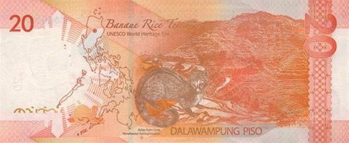
Banaue Rice Terraces located approximately 1,500 m a.s.l. are terraces that were carved into the mountains of Ifugao in the Philippines by the ancestors of the indigenous people. The terraces are occasionally called the "Eighth Wonder of the World". It is commonly thought that the terraces were built with minimal equipment, largely by hand. Currently, the area is officially GMO-free organinc farming site.
The most popular place to look at the rice terraces is called the Sunrise Viewpoint, where local Igarot tribes people pose for photographs and sell wood carvings. But it is also possible to set out on foot along the pathways across the rice paddies, their banks scattered with scarlet wild flowers that contrast spectacularly with the vivid green of the rice plantings.
The Banaue Rice Terraces are just the most notorious terraces in northern Luzon but there are other notable ones that are worth visiting: the Batad Rice Terraces, Mayoyao Rice Terraces in Mayoyao, Hapao Rice Terraces and Kiangan Rice Terraces.
The terraces can be visited anytime of the year but the best time for a visit is between February and March when the cleaning and planting time occurs and between June and July when the harvest occurs.
The Chocolate Hills
Here comes the most charming banknote from Asian cycle: 200 pesos from the current 2010 & 2017 series. It features no mountains, but still, the Chocolate hills rising barely 120 meters maximum (on average most hills are between 30 and 50 meters), they are so alluring in their deep brownish beauty that it is impossible to pass them by.
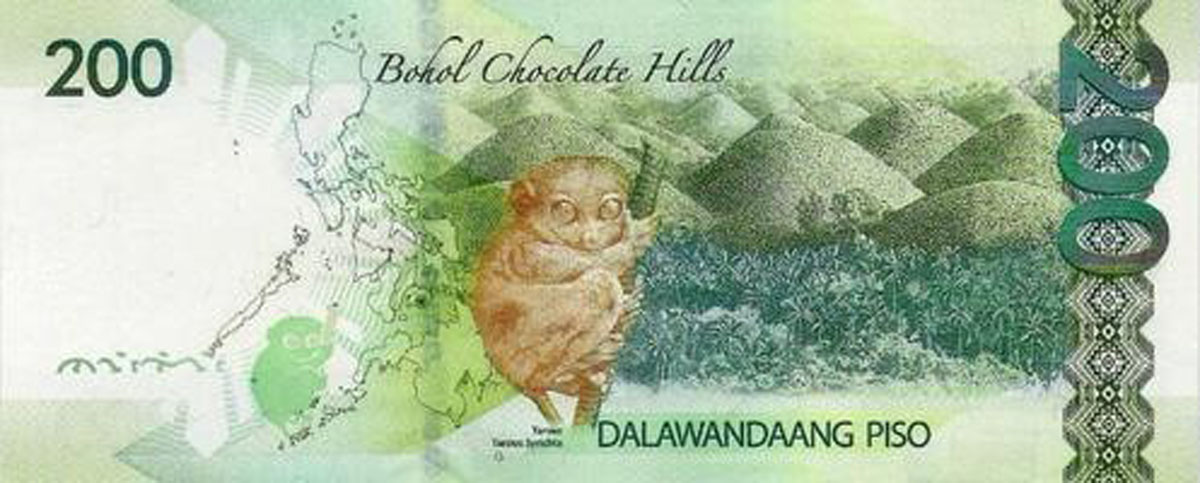
A UNESCO Heritage Site, The Chocolate Hills are a catcher of Phillipinian tourism. Along with being declared the 3rd National Monument, the Chocolate Hills have been recently included in the new nominations for the seven wonders of the world. These hills are a unique and unusual geological formation. Spread across 50 sq. km, (20 miles approx.), the Chocolate Hills consist 1268 to 1776 dome-shaped hills (they have never been counted precisely, so you stand a chance of making it into the Guinness Book), covered in grass that turns brown in dry seasons, thus the name. These hills are spread across the towns of Sagbayan, Carmen, and Batuan in Bohol.
The chocolate hills can be visited anytime of the year, them being spectacular no matter rain or sunshine. Take into consideration that the hills cannot be climbed individually and there is only a viewing deck from where you can marvel at the scenery around. The viewing deck is accessible by stairs and temperatures can be hot sometimes, especially in the rainy season. Usually visits to the hills are short ones as there is not much to be done besides viewing them. However, after you leave them, there are plenty of other things to do in the island of Bohol.
Bohol can easily be accessed by air via Manila. Cebu Pacific and Philippine Airlines have daily flights to Tagbilaran. There is another airport in Ubay, but it is not currently used by the local major airlines. By boat, access points are in Tagbilaran, Tubigon, Jagna, Ubay, Talibon, and Jetafe, connected to Cebu, Manila, Leyte, Mindanao, Siquijor, and Negros. The most popular option is to get to Cebu city via the airport and from there to take a 90 minute ferry to Tagbilaran.