
Scan the QR code and open PeakVisor on your phone
The Pamir-Alay Mountain System include 1,270 named peaks. The highest is Kongur Tagh at 7,649 m. Other notable peaks include Dongbei Peak, Gōng Gé ěR Jiǔ Bié Fēng and Muztagh Ata.
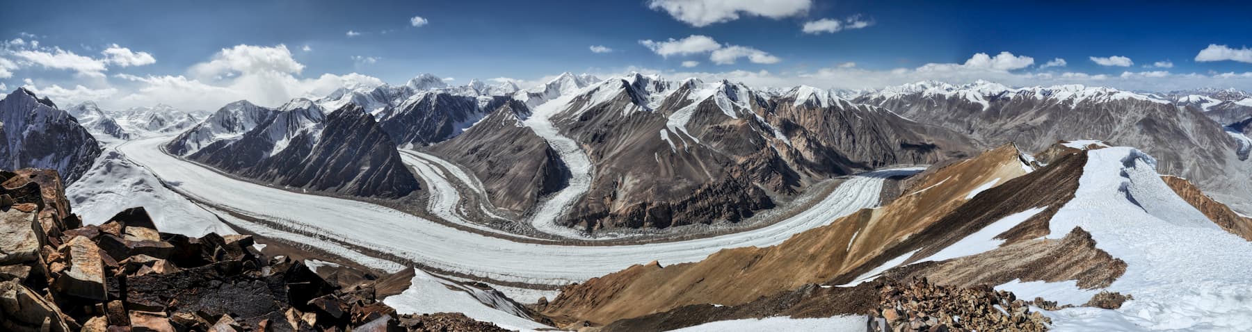
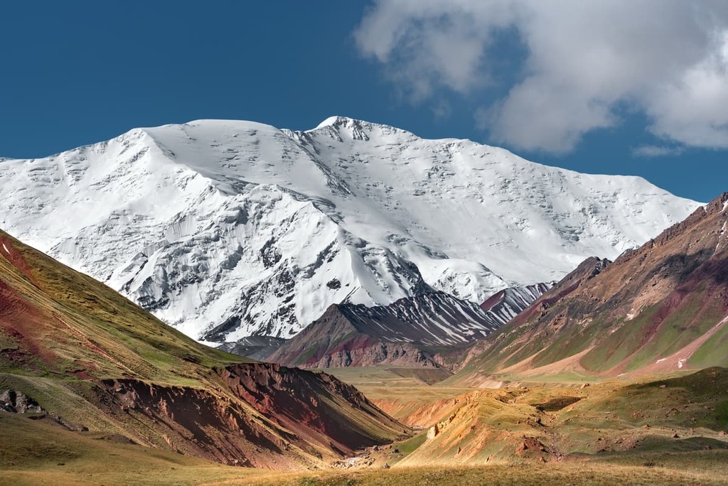
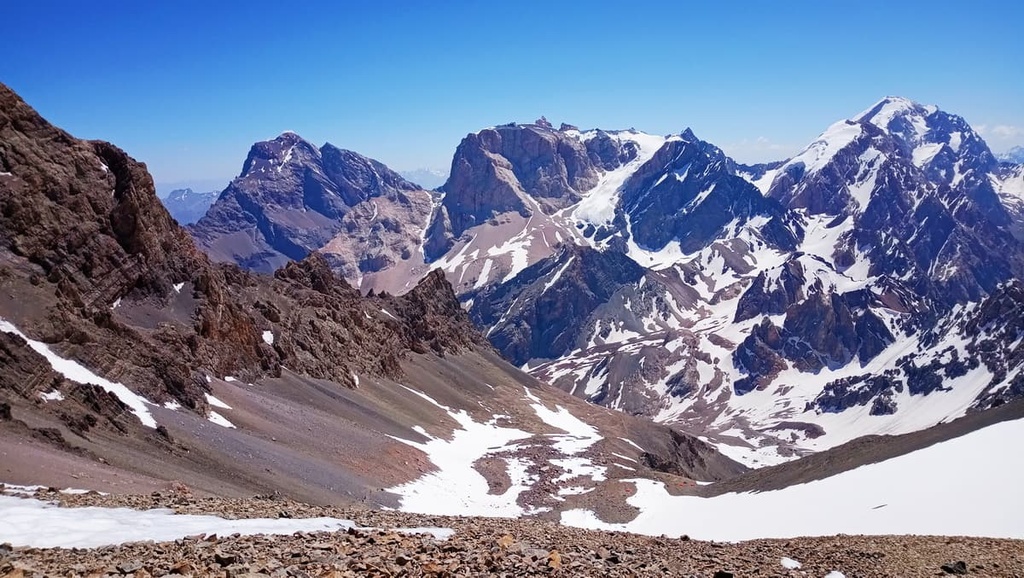
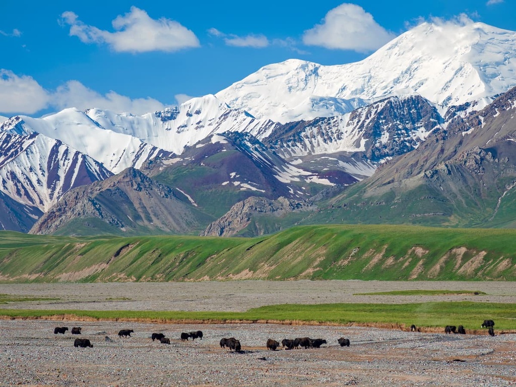
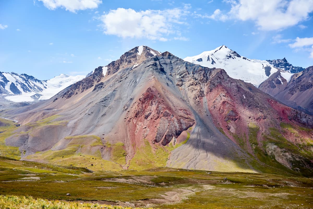
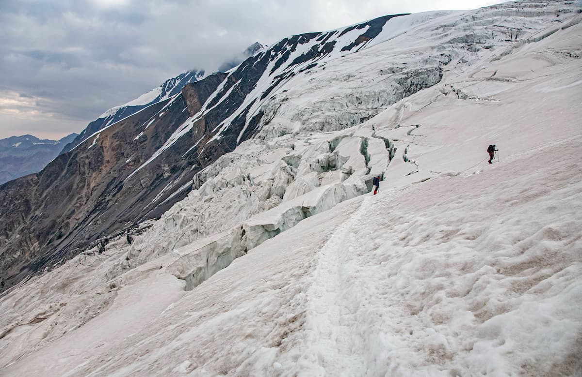
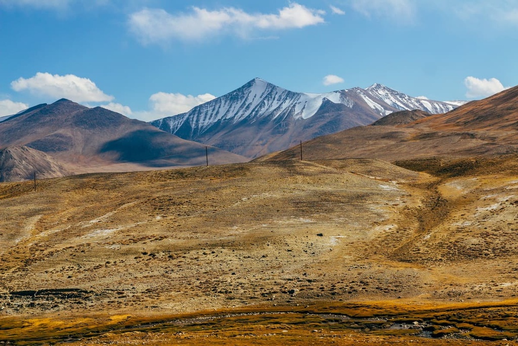
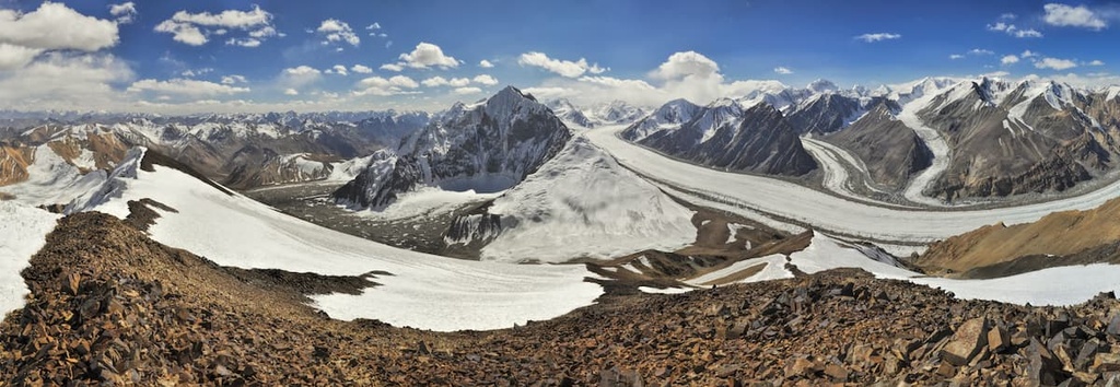
Some mountains are grand and well-explored, others are grand and mysterious. The Pamir falls into the latter category. Let alone the fact that it has a huge bulk of unnamed peaks waiting for you to peg your name on them, it is now considered a part of an even bigger mountain system called the Pamir-Alai System (also spelt as Pamiro-Alay) that stretches from west to east for 900 km, from north to south for 400 km. It is also the largest area of mountain glaciation: there are more than 10,600 glaciers on an area of 9,820 sq.km.
In this article, we shall try to wrap our heads around the composition and the conventional divisions of these mighty mountains into smaller more distinctive mountain systems.
The Pamir-Alai Mountain System consists of mountain ranges and highlands between the Fergana Valley in the north and the upper Amu-Darya River in the south. The Pamir-Alai includes three heterogeneous regions:
As to the political map, the Pamir-Alai is situated in six countries: the Kyrgyz Republic, Tajikistan, Uzbekistan, Turkmenistan, China and Afghanistan.
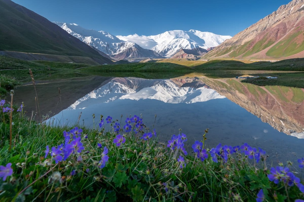
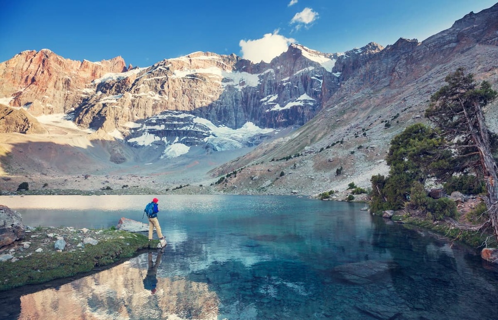
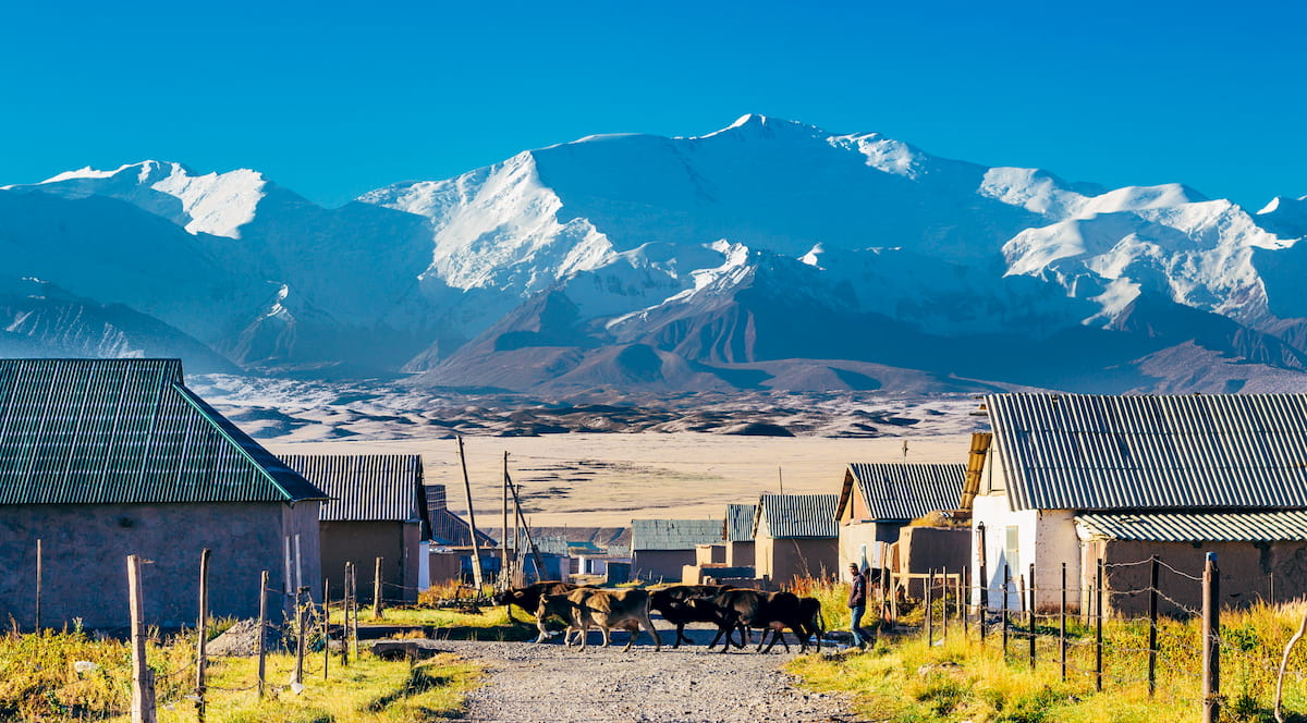
Located in the heart of Central Asia, the Pamir enjoys skyscraping, snow-capped, majestic mountains, transparent clear blue waters of lakes and rivers, wide valleys and bone-dry deserts. The Great Silk Road crosses the Pamir Mountains as well. With the elevations ranging from 4,000 m to 7,700 m, the Pamir is one of constituent parts of the "Roof of the World”, which also includes the Tibet Plateau, the Himalayas, the Tian Shan and the Altai Mountains, all known as High Asia.
Geographically, the Pamir Mountains are at the junction of the greatest mountain ranges of Asia and the world: Himalayas, Karakoram, Kunlun, Tian Shan and Hindu Kush. The proper territory of the Pamir lies in Tajikistan, Afghanistan and China, and the major part of these mountains is situated in the Gorno-Badakhshan province of Tajikistan.
The most impressive peaks of the Pamir are in the Chinese Pamir. They are Kongur Tagh (7,649 m) and Muztagh-Ata (7,546 m). The highest peaks in the Tajik Pamir are Ismoil Somoni Peak, formerly called Communism Peak (7,495 m) and Korzhenevskaya peak (7,105 m). Lenin Peak (7,134 m) stands tall at the Tajik-Kyrgyz border.
We have a separate article focusing on the Pamir classics only, there is also an extensive section on the paperwork that you should have when travelling in the Pamir.
Here, we shall speak in general about the two other constituents of the Pamir-Alai system, viz. the Hissor-Alai and the Tajik Depression. There are separate articles available on the Hissor-Alai Mountains, viz. the Fann Mountains, the Hissor Range, the Zeravshan Range. The Turkestan and the Alai Ranges are described in this article.
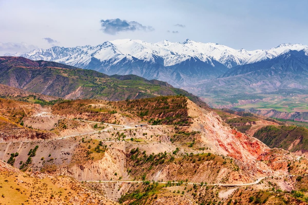
With such a mighty southern neighbour as the Pamir, the Hissor-Alai Mountains are oftentimes overlooked by the travellers. Yet, there are both natural and cultural gems that are well worth a visit.
The Hissor-Alai includes the northern ridges of the Pamir-Alai, which are the Alai and Turkestan Ranges that border the Fergana Valley from the south. Then comes the Zeravshan (aka Zarafshon) Range which stretches to the west from the south of Zeravshan town, it starts off these ranges near the Matchinsky mountain junction (over 5,600 m). These three ranges are characterized by serrated ridges, sharp peaks and mountain glacial relief forms. Finally, a mighty Hissor Range starts from the southern side of the Zeravshan ridge.
The Hissor-Alai is a wild mixture of natural zones. It is distinguished by ephemeral deserts and semi-deserts, subtropical steppes, middle forests, alpine meadows subalpine type, and nival-glacial zones with eternal snows.
The climate of the Hissor-Alai is characterized by the sharply continental climate, significant drops in elevation, a big gap in thermal conditions, and uneven distribution of precipitation and moisture. In ravines and valleys on the outskirts of the mountain system, the average temperature in July is 24-28°C (75-82F) and in January it rarely drops below 1,5-3°C (33-37F). However, once you go to 3,600m and above, the average temperature in July would be about 13°C (55F). On the windward slopes of the mountains facing south and west, the annual rainfall reaches 1000-2000 mm, whereas on the leeward slopes, even in the middle mountains, some places get less than 200 mm of annual precipitation. The maximum rainfall happens at the foot of the mountains in spring, and in the mountain regions, the wettest months are May and June.
The flora of the Hissor-Alai is rich and abundant, there grow wormwood, purple sage, juniper and pistachio. Due to the dominance of the Mediterranean belt, walnuts, figs, and Pontic hawthorn have become common. The local population grows wheat. On the mountain slopes grow various representatives of semi-shrubs. There are no solid vast woodlands in these mountains but it is common to see many trees in the gorges. As the climate is rather dry, some plants have become resilient and have needles that allow keeping the most moisture. High mountain plants are characterized by cushion-shaped growth. So the moisture and heat are preserved longer.
As to the animal world, you can encounter Siberian goat, badger, brown bear, porcupines, gopher, wolf, and a very rare animal - Asian leopard. The locals usually hunt mountain partridge and Indian Runner. There are over 70 species of ungulates and various reptiles. Beware of cobras, which like hiding under rocks.
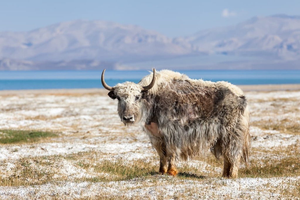
The local population raises yaks, which also give milk. The animals themselves are excellent for transportation of large luggage and feel good both in the lowlands and highlands.
Here comes another range of many names. The Hissor aka Gissor aka Hissar is the 200-km long range starting in the southern part of Uzbekistan and stretching in the general east–west direction across the territory of Tajikistan and Uzbekistan. The Hissor Range highest point is also the maxima for Uzbekistan, it is found right on the border of these states. Khazret-Sultan (4,643 m), remained nameless for some time after the break-up of the USSR, on old maps its former name was Peak named after ХХII Congress of the CPSU (the Communist Party of the Soviet Union).
The Hissor Range has a few four-thousanders. The Range has the spurs that form into the Chatkal Ridge (that some attribute to the Tyan Shan system), the Nurata Ridge, the Karateginsky Ridge, and the Zaamin Mountains. The majestic Fanns are usually considered as a connector between the Hissor and the Zeravshan Ranges.
The Hissor Range landscape varies from east to west – hilly slopes gradually transform into colossal rock massifs.
The range is extremely rich in historical and natural sites, but due to the remoteness from the main tourist routes and poor infrastructure, they still remain untrodden. The most famous Hissor sites are the Tamerlane Cave, the Teshik-Tosh Cave, a picturesque Baysun village, a modern Alpine observatory called Maidanak. In addition, the travelers will be interested to visit the picturesque Kulasay canyon and see fossilized dinosaur footprints and a host of other things.
There is the Shirkent National Park in the Hissor Valley. The park is a 3,000-hectare (7,400-acre) reserve, which is expected to be expanded to some 30,000 ha (74,000 acres) in the coming years, it has an unusually high concentration of sites of historical and scientific interest. Geologists and dinosaur lovers should head to Shirkent to see the dinosaur footprints in the rock. More than 400 such prints have been identified: the mud in which they were originally laid down has fossilised, and the rock is now open to the air. The prints date from quite a wide period of time, and give a remarkable geological record, as well as an indication of which prehistoric species inhabited these lands.
Another great park is the Hissor Reserve (81 000 ha), featuring beautiful red sand mountains, alpine meadows and the Tamerlan Cave. The cave is hard to get to, you should have some help from an experienced guide, yet the site is worth all the trouble. The Cave is located in a huge canyon, the walls are towering over you for 300 meters, the entrance to the cave is in the eastern part of the canyon. Inside the cave, there is a big lake and bizarre looking stone jellyfish - the dripstones that are often found next to big stalactites.
The range runs by several names probably to scare away the faint-hearted and feeble-minded. The Zeravshan aka Zarafshon aka Zaravshan aka Zerafston Range has a traditional Uzbek name given by the River Zeravshan. The range is located in Uzbekistan.
It stretches for 370 km in latitude direction. The average altitude is 4,110 m. Mount Chimtarga (5,489 m) is considered by many sources the highest point of the range, but it technically belongs to the Fann Mountains that connect the Zeravshan Range with the Hissor Range.
The northern slopes are traversed by numerous valleys formed by the left tributaries of the Zeravshan River, the southern slopes are poorly dissected. In the east (up to the Fandarya River) there is a high-mountainous relief, in the west are the middle mountains with karst forms of relief. On the Zeravshan Range slopes, there are rare woodlands (mainly juniper), mountain steppes and alpine meadows. There are about 560 glaciers with a total area of 270 sq.km.
Zeravshan Range conceals a lot of interesting things, it is perfect for both beginners and experienced tourists, so a trip to the local places will certainly be remembered for a long time. Among the biggies is the Kiev Abyss, whose popularity is conditioned by the depth of 950 meters, which is a record figure among other cave complexes in the post-Soviet space. For more tidbits, read the Zeravshan Range article.
My heart’s in the Fans,
Now heartless I wander.
In gentlest chitchats
And at loudest feasts,
I silently dream of those blue peaks
Russian poet Yury Vizbor (1976)
The Fann aka Fanskiye Mountains as many experienced travellers have long called them are one of the most beautiful areas of the Pamir-Alai. They are located mainly on the territory of Tajikistan. From the north, there lies the Zeravshan Range and from the south stretches the mighty Hissor Range. The Fann are considered to be a connector for those two. The eastern border of the Fann is the Fandarya River, whereas the River Archimaidan forms their western border.
The highest point of the Fann is Chimtarga Peak (5,489 m). Other five-thousanders are Bodhona (5,138 m), Chapdara (5,050 m), Big Hansa (5,306 m), Small Hansa (5,031 m), Zamok aka Castle (5,070 m), Mirali (5,132 m), Energy (5,120 m).
Interestingly, there are eight five-thousanders in the Fann Mountains. Exactly the same number as in the Caucasus. And the highest point of the range is only 150 meters lower than Elbrus!
Read more about the Fann Mountains and the city of Samarkand here.
The Turkestan Range serves the border between Kyrgyzstan, Uzbekistan and Tajikistan, it also frames the Fergana Valley from the south-west. These little explored rocky areas are oftentimes compared with South American Patagonia, noting that the local climate is much warmer and more pleasant, and some travellers compare it with the Yosemite National Park, but larger and higher.
To the east, at the Matcha mountain junction, the Turkestan Range joins the Alai Range, while to the west it rests on the Samarkand Plain. The gentle northern slopes are buried in vast juniper forests, whereas the short and steep southern slopes are covered with rocks and screes.
The highest peaks are Skalisty Peak (5,621 m) and Pyramidalny Peak (5,509 m). Overall, there are 91 peaks in the Turkestan Range. The ridge crest, especially from the east, is covered with eternal snow. The largest glaciers are the Tolstoy, Shurovsky and Zeravshansky. There is the Dushanbe - Khujand highway running through the Shahristan Pass at an altitude of 3,378 m. On the northern slope is a mountain lake called Ai-Kol.
The boisterous streams of the Isfara, Ak-Suu and Kara-Suu rivers crash into the steep cliffs that frame the shores. If it hadn't been for the noise of the water, the landscape would have seemed totally unearthly. Coniferous forests here are replaced by monochromatic rocky slopes, sharp cliffs and white glaciers.
All northern slopes of the central and eastern parts of the range are a kind of training ground for climbers. Here, every adept of active recreation will find a route befitting any level of expertise. You can try your hand at the already known climbing routes, or set your sights on the first climb or laying new tracks to the peaks. Among the local peaks, there are some highly treacherous mounts even for professionals. There are almost two kilometres of steep cliffs, the most famous of which is the northern wall of Aksu Peak (5,365m). The most convenient route passes through Uzgarysh village. You can come here by car, and then entrust heavy cargo to pack transport - horses or donkeys - and go up light, admire the nature, acclimatize yourself, gaze at the stars at night and spend the night in a tent.
Tourists and outdoor enthusiasts come here more and more every year. The Leilyak (Aksu) and the Karavshin gorges are actively explored. The Laylak Gorge is an ideal platform for practicing bouldering and free-climbing on the most difficult rocky routes. The peaks of the Laylak Gorge are basically a rocky barrier that embraces a glacier like a horseshoe. From west to east, the mighty five-thousanders rise into the sky - Iskander (5,120 m), Admiralteets (5,090 m), A. Blok (5,229 m), Aktyubek (5,125 m) and the most difficult - Aksu (5,365 m). In the upper reaches of the neighboring Karasu Gorge, there are peaks called 5011 Peak, Peak named after the 50th anniversary of Moscow Spartacus (4,690 m), Dalniy Peak (4,457 m) and the northern spur of Vizbor Peak (4,655 m). To the west in the Uryam gorge, the picturesque Sabakh Peak (5,283 m) stands tall.
From here, you can easily reach the neighboring Karavshin Gorge that is massively attracting those who are keen on extreme adventure or on developing their own style of climbing, or looking for the glory of a pioneer discoverer. Mountaineers go to the highest peak of the Turkestan Range - Pyramidalny Peak (5,509 m), as well as smaller giants - 1000 years of Baptism of Russia Peak (4,810), Asan (4,230 m), Usan (4,378 m).
The locals tell a beautiful legend about the rocks of Asan and Usan (aka Asen and Usen). An old man with two twin sons allegedly lived nearby. He loved them very much but he was strict because he wanted to bring up the warriors. They grew up to the joy of their father but the war took the lives of the heroes. When the father learned of their death, he was beyond himself with grief. Falling to the ground, he asked Allah to exchange the remaining years of his life for the lives of his sons. The prayer was heard and the giant broad-shouldered peaks rose from the ground. Since then, two rocks opposite each other in the upper reaches of the river Karavshin are called the twins - Asan and Usan, from afar it looks as if the old sage of Pyramidalniy Peak is watching over them.
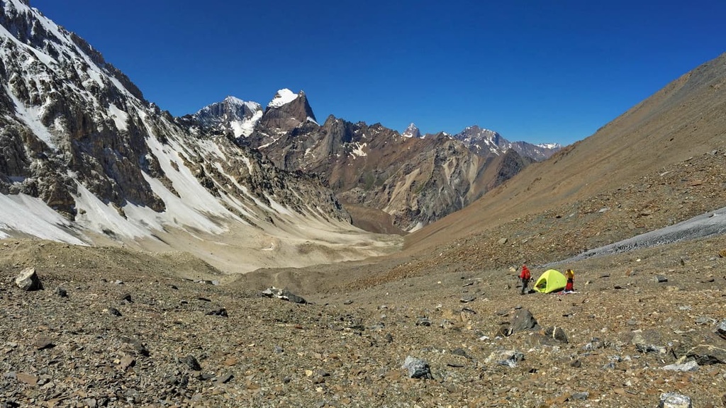
The Alai is practically unexplored by mountaineers, there are few routes to the tops. Most of the possible climbs are technically complex, featuring rocky and snowy-icy terrain. However, the endeavour is worth every minute of it given there are still a bunch of nameless five-thousanders which are yet to be named by the most adventurous pioneers. There are beautiful peaks for classic mountaineering as well. The daredevils will appreciate the breathtaking panoramas of snowy peaks in the Alai Range.
The almost 400-km-long Alai highland divides the Fergana and the Alai valleys. It is located in the southwest of Kyrgyzstan and north-east of central Tajikistan. It is a large section of the Hissor-Alai mountain system east of the Matcha hub (aka Matchinsky Mountain hub).
The Alai begins in the east located between the Tar and Kyoksuuu Rivers and goes westward. Its northern side ridges are the Gulcha, Kichik Alay, Kollectorny (Collector’s), Kuruksai, and the Guamysh. And closer to the central part of the Alai Range start the southern side ridges Tekelik and Kuturgan.
The main summit of the Alai Range is Tandykul Peak (5,539 m), its runner-up, Snezhniy Shater (Snowy Marquee) (5,529), is six kilometers away. The average height of the peaks is about 4,500 m but there are also many five-thousanders like Gaumysh aka Ailama (5,428) for example. Actually, there are two dozen peaks over 5,000 m. The peaks here are rugged, rocky, quite prone to rock slides and mudflows. In total, there are 386 peaks in the Alai Range.
The Alai Range is calling for the ambitious and powerful climbers. According to our data, the area between Tandykul and Matcha Hub (the Tutek and Yashilkul gorges) has not been visited at all since 1994.
The high Alai Range suits perfectly for the climbs of the 3-4th category, the 4th category will be not very difficult technically, but the 3rd would be physically and technically challenging. For the 4th category it would be interesting to cover the 2B passes of the Physicists), the Serpovidny, and the Yanghidavan West. The eastern part of the area (up to the Iolisu valley) can be connected with the Abramov and Jamankirchin glaciers. As to 3A-3B milestones, they are not numerous, but usually divided by long distances. If you are keen on combating the 5-6th categories, you are likely to be a pioneer in discovering new peaks.
Passes are numerous and complex, read more about the passes, glaciers, mountains and valleys in our article on the Alai Range here.
The main passes are Dzhyltyk Pass (4,185 m), Sarymogol (4,303 m) Kindyk (4,000 m), Tyuzashu (4,276 m), Tekesazdy (4,000 m), Kauk (4,067 m), Dzhallydjer (3,996 m), Tenghizbai (3,627 m), Karakazyk (4,196 m) and Yanghidavan (4,319 m). You will see numerous flocks of sheep using these passes to get from one valley to another.
The starting point to explore the Alai is the city of Osh in Kyrgyzstan. It has an airport which ensures access from any part of the world. Osh has many guest houses and hostels, and if your budget is really tight you can rent a flat from the locals. From Osh, you can get quite high to the mountains just riding a van or an off-road vehicle.
As to the paperwork, make sure you have insurance and a pass if you are planning to visit border regions. You can get the pass at any border guard post, if you are going to traverse the zones covered by several border guard posts, i.e. the Sokha Valley, the Koksu Valley and the Dugoba Valley, you should notify the border guards, they will help with the paperwork.
The High Alai is sadly known in connection with the so-called Batken events of 1999-2000, when militant groups infiltrated Kyrgyzstan from Tajikistan for two consecutive years and occupied a number of valleys and ranges (the valley of Khodzhiachkan and most of its tributaries, the springs of Jilisu and Zardaly), from where they were then driven out by government troops. The bombing destroyed an old and very popular hydrometeorological station at the Abramov Glacier in August 1999. The valleys and glaciers still show signs of fighting in those years. Currently, the probability of stumbling upon something hostile is rather low.
To the south of the Hissor Range lies the Tajik Depression, which has many relatively low folded ridges stretching from north-east to south-west and south-south-west, it is slightly curved and has a convex turned to the north-west. In comparison to the high-rise ranges surrounding it, the Tajik depression does look like a huge hollow. It is not that interesting for hikers and tourists, but it is of great importance for industry since it is rich in gas and oil deposits due to the Paleogene, Cretaceous and Jurassic pre-salt oil deposits. Currently, there are 4 oil, 2 oil and gas and 3 gas fields operating here. Great prospects are connected with different age deposits of various construction materials and Jurassic rock salt. Lead-zinc ores of stratiform type (Yokundj, Surbion, Sangi Sabz deposits) have been found in the Upper Cretaceous reef limestones of the region. Strontium mineralization has been detected in carbonate deposits of the lower paleogene (Chaltash, Daudyr, etc.).
The Tajik Depression has very mild winters and scorchingly hot summers. Temperatures remain positive all year round at the sites near some rivers. In summer, the thermometer can often show numbers exceeding 40°C (104F) and the temperature can easily reach 50°C (122F). Winds come here from Afghanistan, bringing dust with them. Precipitation is rare, with a maximum of 700 millimetres per year recorded on the hills. This explains the lack of sustainable snow cover. The main precipitation falls on the spring period.
Due to the almost complete absence of soil cover, the vegetation is meagre. There are some damp soils suitable for growing cotton though. The flora is mainly represented by sedge and bluegrass communities. These are low-grass representatives of semi-savannahs, which might feature some poppies and astragalus. Calligonum and sand sedge grow on sand dunes. In the river valleys, the vegetation is a little richer. You can see cereals, tamarisk and jujube (aka Russian olive) here.
The animal world of the Tajik depression is mainly represented by birds. But you can also meet a jungle cat, which is also called a swamp lynx or chaos. This is a large animal weighing up to 12 kilograms. It is perfectly adapted for living in dense thickets, the animal usually hides in them, sometimes climbing the mountains to a height of no more than 800 meters. A jungle cat is a rare animal listed in the Red Book. Here also lives the red-tailed gerbil, rufous deer, hyena, wolf and fox, and if you are lucky, you can even encounter a tiger. If you don’t know how to behave with this mighty predator, read on tiger encounter rules here.
Whatever way you choose to travel in the Pamir-Alai, make the most of it. The region is generous to the open-minded travellers and offers mind-blowing views indeed. Take the Pamir high-mountain road connecting Tajik city Khorog and Kyrgyz city Osh, its length of about 700 km. It is one of the most picturesque highways in the world, laid through a plateau, bottomless gorges, Martian-like plains and inhospitable mountain deserts. Many car travellers dream of driving along this road.


The highest peak in the Pamir-Alay Mountain System is Kongur Tagh, at 7,649 m.
The Pamir-Alay Mountain System have 1,270 named peaks.


