
Scan the QR code and open PeakVisor on your phone
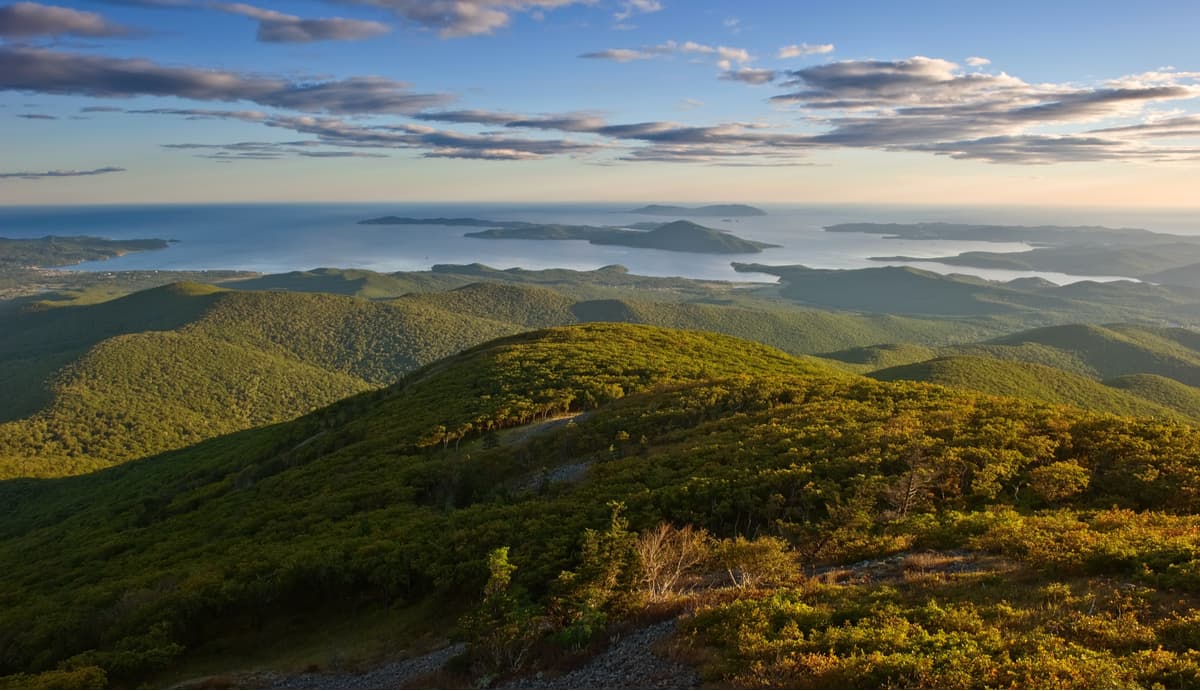
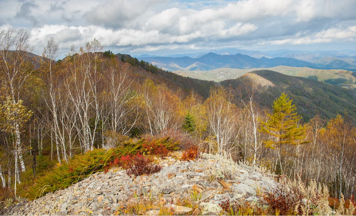
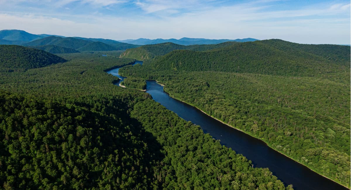
A wonderful mountainous Sikhote Alin lies on the territory of Khabarovsk and Primorsky Territory in the Far East of the Russian Federation. Having emerged due to rampant volcanic activity in the Mesozoic period, this area consists of a number of mountain ranges, stone massifs and plateaus separated by deep valleys formed by numerous rivers. The Sikhote-Alin is located between the Sea of Japan and the valleys of the Ussuri River and the lower part of the Amur River. The 250-km wide Sikhote-Alin range stretches along the coast of the Sea of Japan for 1200 km. The average altitude is 800-1000 m, but the maximum altitude is Tordoki-Yani (2090 m). Its northern limits are near the town of Nikolaevsk-on-Amur, located in the very north of the Khabarovsk Region, whereas in the south it ends at the town of Nakhodka, in the southern Primorsky Territory.
The name Sikhote Alin in the Manchurian language means "mountains of large western rivers", and in the Nanai language, Sikhte means ‘a pine’ and ala (alin) is ‘low mountains’. The old name of the range is Dzubghe which in the Bikini dialect of the Nanai language means "elevation".
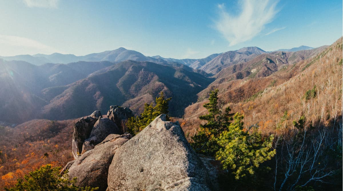
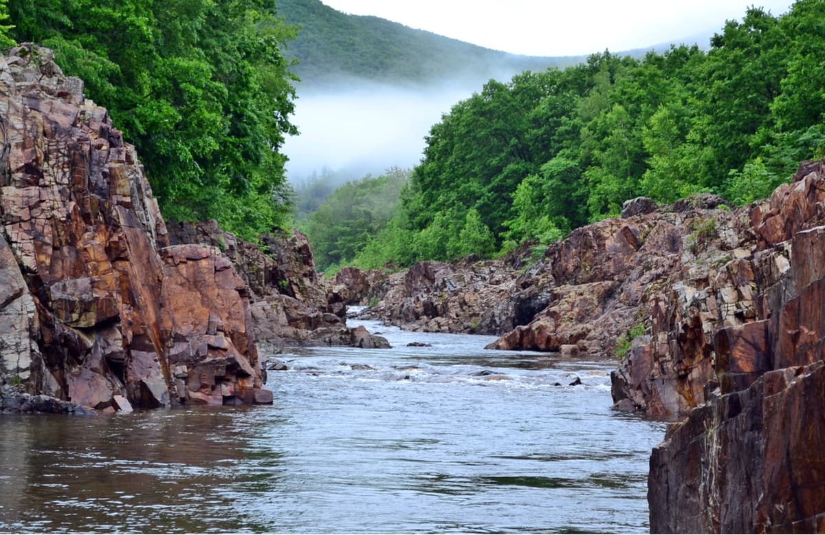
The ridge consists of several almost parallel folds – ridges with a northeastern direction, its eastern slopes are short, almost perpendicular to the sea and end with high steep cliffs dropping into the rampant sea.
The eastern spurs form several large sea gulfs: the St. Olga, the St. Vladimir and the Peter the Great Bay. There are fast mountain streams and small rivers running down the eastern slopes and flowing into the sea: the Mangougai, Suifun, Sedemi, Tsymukhe, Psukhun, Sichan, Tuzaniya. Those streams rush along the narrow and deep valleys.
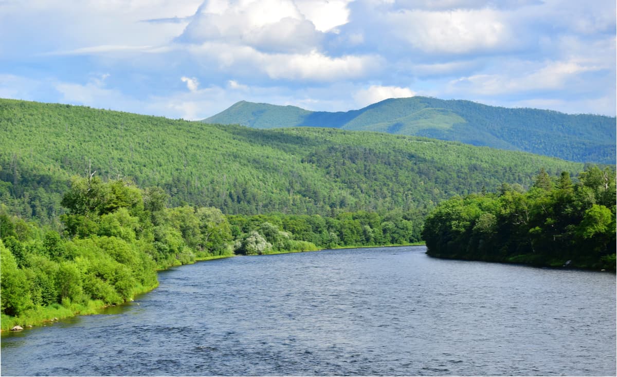
The western spurs of the Sikhote-Alin are gentle and the rivers that flow on the western slopes are longer than in the east of the massif and have less rapid flow: the Ussuri, Sungari, Nor, Donndon, Ima, Baku, Biki, Fudri.
The Sikhote Alin is considered to pose a high seismic threat. Thirty earthquakes with a magnitude of 7 and more (on a 12-point scale) happened over a short period of merely 40 years last century here. These mountains were formed in the Mesozoic era which ended about 65 million years ago, but they are still young and active. When dinosaurs lived in those lands, the mountains looked about the same as they do now. The native inhabitants of Sikhote-Alin are the Nanai, the Udege, and the Orochi.
The Sikhote-Alin is a mixed natural area. It is located at the junction of taiga and subtropics. This explains the great diversity of fauna and flora, where southern species live very well next to the northern ones.
According to the legend of the indigenous peoples, during the creation of the world, God forgot about the Primorsky Territory and remembered it only on the seventh day. Then he collected all available leftovers and threw them on the map. That's why everything is mixed here: plants and animals of such opposite origins and habitats, all the earth’s knick-knacks. That's the kind of riches this region got – just leftovers. But despair not, there are plenty of wonders on display.
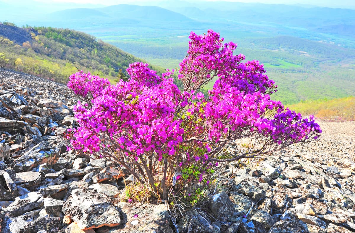
On this mountain range, you can see the Korean Dahurian larch (Larix olgensis) and coniferous shrubs of microbiota which are not found anywhere else in the world. The diversity of plant life on this ridge is amazing. It is probably only here that you can see trees shrouded with Actinidia lianas and lemongrass, thickets of cobnuts, bizarre ferns, golden honeysuckle. The valleys feature pine trees intermittent with ash, Manchurian nut and poplar, there are impassable thickets of barberry, currants, mock orange, Eleutherococcus, udo (Aralia), and Actinidia.
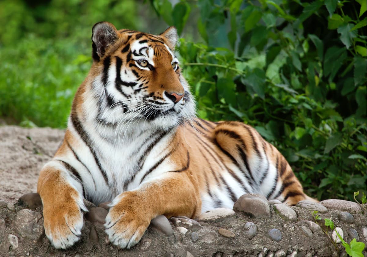
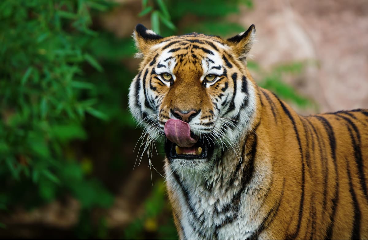
The Sikhote-Alin is the place where endangered animals can be found in the wild. Here, in the reserves, scientists study the life of the largest representatives of the cat family – the Amur tigers, also called Siberian tigers. Each tiger has a collar with a microchip and they are virtually a handful. In addition to tigers, there are 62 other mammal species – wolverines, Himalayan bears, gorals and spotted deer. The area also has its own endemic species – an animal that lives only here, this is the Amur leopard.
On the official sites of the parks and reserves located in the Sikhote-Alin you will find exhaustive information on how to behave should you see a tiger or any other big predator cat. The main message is to keep calm and try to avoid any confrontation. We’ve summed up the most typical rules for you.
Rejoice! It is such a rare occasion. Jokes aside, it is not a trifling matter. You will surely suffer if being attacked by the animal, but probably the injuries will not be fatal. The most often occurrences are with tiger cubs who are very curious and not very cautions. Do not come close and don’t touch them, even little ones can cause a serious injury. A tigress might be lingering nearby. If you happen to walk near the lair with newborns, you are in deep trouble. As a rule, the beast makes a warning roar. In this case, don't panic, turn back and bypass the dangerous place no less than in half a kilometre. The critical distance that drives the female to attack is about 100 meters. A beast can rush into defence without paying attention to people or vehicles.
Tigers particularly favour the dogs. But in a gastronomic sense. A tiger may follow a man with a dog for hours, and neither the owner nor the dog will detect the presence of the beast. The tiger chooses the moment when the dog moves away from its master and kills instantly. Tracking a dog can last for a few days, the tiger accompanies the man to his forest home. In this case, not only is a dog doomed, but a human being is exposed to serious dangers as well. The tiger who took the dog usually leaves a man alone. Under no circumstances should you follow the tiger. The dog can't be helped, but you can provoke a predator to protect its prey. Sometimes a dog has time to spot a stalker and becomes sluggish, clings to the master's feet, whines, shudders at every rustle. In this situation, it's advisable to take a few shots in the air, fire a flare gun, and in the absence of a weapon, to knock on anything that can produce loud clanking sounds (a cauldron, a tree trunk) and try not to panic.
The appearance of a tiger in clear sight is a warning. Usually, the beast behaves covertly. It studies people by smells, sounds, looks out of hiding places, gets all the information it needs about humans. Deviation from that norm is alarming, the beast showing itself is potentially dangerous.

Repeated encounters with tigers on the roads or close to settlements must be reported on to the State Committee for Environmental Protection of the Primorskiy Territory or to a district or city environmental protection committee.
The climate is characterized by mild winters. This is explained by frequent cyclone intrusions coming from the Sea of Japan. The average temperature in January is -10-15°C (14-5F). The amount of precipitation per year is quite high (up to 800-1000 mm), most of it falls in the summer period. The first snow falls on the peaks at the end of September, and the final snow cover is formed in November – December. Snow lies from 3 to 5 months. The average thickness of the snow cover is 30-50 cm.
On the western slopes, protected from sea winds by the ridge, the climate is more consistent with the continental climate – humidity is low, summers are hot and winters are colder than in the east. The average monthly temperature in January is -23°C (-10F).
On the east side due to the wind from the sea, there are fogs, heavy rainfalls, high humidity and sudden cold spells even in early summer. Rains are predominantly heavy, with August being the wettest month. The average temperature in January is -12°C (10F).
The Sikhote-Alin is rich in minerals, tungsten and manganese ores, lignite and black coal are mined here. There are deposits of complex ores containing minerals which include zinc, lead, cadmium, indium, silver, gold, copper, and bismuth.
Here are the ten highest peaks in the Sikhote-Alin.
Mount Tordoki Yani (2,090m) is the highest peak in the Sikhote Alin mountain system. It means "snowy peak" in the Nanai language. The peak is located in the south-east of the Nanai district. The top of this mountain is rocky with lots of loose rock and thick mountain tundra. In the summertime, the slopes of the mountain are quite often covered with a thin sheet of snow but you still see blossoming cowberries, huckleberries, and reindeer moss coming from under that snow. The mountain rises up to 1600 meters above the Anyui River valley.
Mount Ko (2,003 m) is the second-highest peak in the Sikhote-Alin and is located in the area called Lazo on the border of the Khabarovsk Region and the Primorsky Territory. River Ko starts on the southeast slope of the mountain and flows into the Katen. The mountain is almost inaccessible for hiking, it is also called the witch's mountain because in translation from the Nanai language "Ko" means "a witch".
Yako-Yani (1,955m) closes the top league of the three highest peaks in the Sikhote-Alin. It has a rocky peak located in the Soviet-Gavan district of the Khabarovsk Region. Its slopes are covered with coniferous-broadleaved taiga.
Mount Anik is an extinct volcano 1,933 meters high. This mountain is dome-shaped; it has steep slopes on the banks of the river Katen. The top of the mountain contains lots of magmatic rocks: granodiorites, quartz diorites and granosyenites. The mountain is located in the coldest and harshest area of the Primorsky Territory on the border with Khabarovsk Region.
Mount Durhe (1,903 m) consists of granite and granodiorite. The north-western foot of the mountain is a relict corrie niche formed during the Quaternary glaciation of the mountains. Its location is in Lazo, the Khabarovsk Region, in the basin of the river Chuken. There is a spring approximately 1.4 - 1.6 km from the top of the mountain.
Being 1,855 m high, Mount Cloudy is the sixth highest mountain in the Sikhote-Alin. It is located on the territory of the Call of the Tiger Park in the Chuguevsky district, the Primorsky Territory. This peak is the southernmost in this mountain system. On November 18, 2013, when the sun went down, the fire from the Olympic torch of the 2014 Olympic Games in Sochi was lit on the top of the mountain. The top of Mount Cloudy is a stone desert. Considerable altitude, strong winds and frosts do not allow any tree to grow here, which allows for unobstructed views from the top. At the top of Mount Cloudy, there is a stone tower - a shelter from the wind built by tourists.
Swamp (Bolotnaya) Mountain (1,814 m) is located in the Pozharsky district, the Primorsky Territory. It has a bizarre phenomenon: between it and mountain Anik, located just 2 km away, there is often a snowfield formed that does not melt even in a warm summer period.
Mount Sputnik (1,805 m) is in the Khabarovsk region. The top of the mountain is a stone field with some spots of cedar elfin woods. Cedar trees hardly ever grow over 30-50 cm in this harsh place and they have marvellous crooked shapes. From the top of Mount Sputnik, you can see Mount Ostraya, Mount Anik which is eight kilometres away and the valley of the rivers Katen, Ko, and Chuken.
Sharp reaches a height of 1,788 m. Located in the Terneisky district of the Primorsky Territory, the mountain rises above the left bank of the Bekin River, the slopes are covered with stone placers and cedar shrubs.
Arsenyev’s Mountain (1,757.9 m) is located on the border of the Khabarovsk and Primorsky Territories, between the rivers Khor and Bekin in the western spur of the Sikhote-Alin, the Arsenyevski Granites Range and is its highest point. It is often confused with an observation hill with the same name in the same area, but the hill is half as low. The lower part of the mountain is dominated by coniferous taiga, and above 1000 m, there go cedar shrubs. The top of the mountain is mountain tundra and rocky, barren spires.
The Anyui State Natural National Park was established on December 15th, 2007. It is located in the Nanai district of the Khabarovsk Region, the territory least exposed to human invasion and least modified by human activities. It lies on the right bank of the Amur River and in the lower reaches of the Anyui River.
Cedar-broadleaved forests are home to Himalayan and brown bears, wild boar, raisins and, naturally, tigers. Tiger habitats cover more than two-thirds of the territory of the national park.
The nearest settlements are Upper Manoma, Troitskoye, Jari, and Arsenyevo villages.
Troitskoe village has a museum of the local lore with about 6 thousand exhibits of the Nanai culture: fishing paraphernalia, national wedding gowns, handmade wicker boxes, kitchen utensils. You can feel the distant past of this region.
Jari village is a national Nanai village. There is a workshop of folk arts and crafts, souvenirs, embroideries and other products of the Nanai masters.
The Anyui Park offers great opportunities for water tourism in spring and autumn, and in winter, you can go skiing along the frozen bed of the legendary river. The park ‘s administration is in Troitskoye. You can visit the park only with an official permit, the application should be filed in advance (the official period of response is three business days). The visit costs 100 RUR (approx..1.5 USD) per person per day. It is typical for all the Sikhote-Alin parks and reserves, with a couple of more expensive exceptions. For more information, visit the official website.
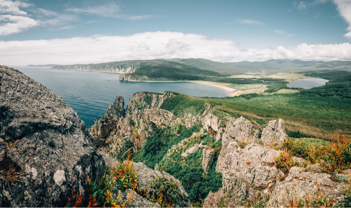
The Lazovsky reserve named after L.G. Kaplanov is located in the south-eastern part of the Primorsky Territory in the Lazo district. The area is 120998 ha. From west and north, the reserve is limited by the Kievka River valley. The southeastern border of the reserve passes along the coast of the Sea of Japan, but it was not possible to connect the sea area to the reserve, as it was done in the Sikhote-Alin Reserve. There are no large rivers on the territory of the reserve.
The most important peak is Black Mountain (1,382 m). It is the starting point of the Black (Chernaya) River which flows near the reserve’s eastern border. The reserve includes two small islands – Petrov and Beltsov Isles. Winter lasts about three months. The complex mountainous relief and the proximity of the sea have created a wide variety of flora here divided into four large groups: Manchurian, typical for the zone of broad-leaved forests of East Asia; Okhotskaya, gravitating to the taiga zone; plants of the sea coast, as well as Sikhote-Alin endemics – species that grow only within the Sikhote-Alin Mountain Range.
On Petrov Island, there are excavations of a multilayered archaeological monument: the lower layer belongs to the Neolithic Age, the second is from the Early Iron Age (Jankowski culture), the third is from the early Iron Age as well, but belongs to the Krounovsky culture, the fourth belongs to the Middle Ages, there are remains of a settlement with a rampart about 400 m long and 2-3 m high.
All the reserved areas are accessible from the village of Lazo where the Visit Center and the Museum of Nature of the Reserve are located.
On Petrov Island, there are excavations of a multilayered archaeological monument: the lower layer belongs to the Neolithic Age, the second is from the Early Iron Age (Jankowski culture), the third is from the early Iron Age as well, but belongs to the Krounovsky culture, the fourth belongs to the Middle Ages, there are remains of a settlement with a rampart about 400 m long and 2-3 m high.
All the reserved areas are accessible from the village of Lazo where the Visit Center and the Museum of Nature of the Reserve are located. Mind you, that you should obtain the permit to enter the park. File your request travel@lazovzap.ru , print the response from the park’s officials and show it at the cordon, they will issue the permit (work hours is 9 am to 6 pm daily). See the park’s official site for details.
The Botchinsky Reserve was established in 1994 in the Soviet-Gavan district of the Khabarovsk Region on the site of the existing reserve. It is located on the north-eastern slopes of the Sikhote-Alin Range. The relief of the territory is mountainous, with prevalent heights of 600-1000 meters above sea level. The highest point is Mount Bo-Jausa (1,679 m) sitting near its north-western border.
The Reserve is the northernmost permanent habitat of the Amur tiger whose numbers in recent years have ranged from 4 to 6 individuals. Other rare endemics are the white long-eared bat and brown-toothed water shrew.
In the Botchi River valley, you can see the fossil flora. Plants were buried directly at the places of their growth, at the bottom of a vast lake, in a ring of extinct volcanoes, so they are very well preserved and are very diverse.
There are several tour-guided routes in the Reserve. You can go hiking, horseback riding or skiing depending on the season. However, due to the Reserve remote location (120 km to the nearest town of Soviet Gavan, by very bad dirt roads), the flow of visitors is very low, thus the admission fee is just 50 Rubles (about 0.7 USD). There is a 1-kilometre long hiking trail with a campsite and car parking lot here.
The Sikhote-Alin State Natural Biosphere Reserve named after K.G. Abramov is located at the junction of the Terneisky, Krasnoarmeisky and Dalnegorsky districts of the Primorsky Territory, it is divided into the main part which has a small exit to the sea and a minor part which covers a mountain ridge behind the village of Ternei. The territory of the reserve covers 401,600 hectares, including 2,900 hectares of the Sea of Japan waters. The area is mountainous, with an average height of 800-1000m. It stretches from the rocky shores of the Sea of Japan inland for almost 100 km covering the eastern and western spurs of the Sikhote-Alin mountain range. The coastline is steep, the cliffs are from a few meters to several hundred meters tall, there is a narrow strip of 5-to-30-meter wide pebble beach. Mount Glukhomanka (1,598 m) is the highest point of the reserve.
The original purpose of the Sikhote-Alin Reserve was to preserve and restore the sable which was almost exterminated at that time. Now the main objective is the conservation and natural development of biological and landscape diversity of mountain forest ecosystems of the Central Sikhote-Alin Range, including unique mountain cedars.
The Reserve enjoys a unique mix of different representatives of the Manchurian and southern ecosystems, as well as Okhotsk and northern ecosystems who peacefully coexist here. In 2001, the Reserve was put on UNESCO's World Natural Heritage List.
The Call of the Tiger National Park is one of the youngest parks in Russia, founded on June 2, 2007. The main purpose was to preserve and restore the endangered species included in the Red Book of Russia and IUCN Red Book. Among them are 6 mammal species, but the starring one is the largest tiger and the most perfect predator in the world - the Amur tiger. The park runs a special programme on conserving the population of the Amur tiger. The park also develops and implements scientific methods of nature protection, carries out environmental monitoring, and creates conditions for tourism and recreation. The park is located in the south-east of the Primorsky Territory and occupies lands of three districts: the Lazovsky, the Olginsky, and the Chuguevsky.
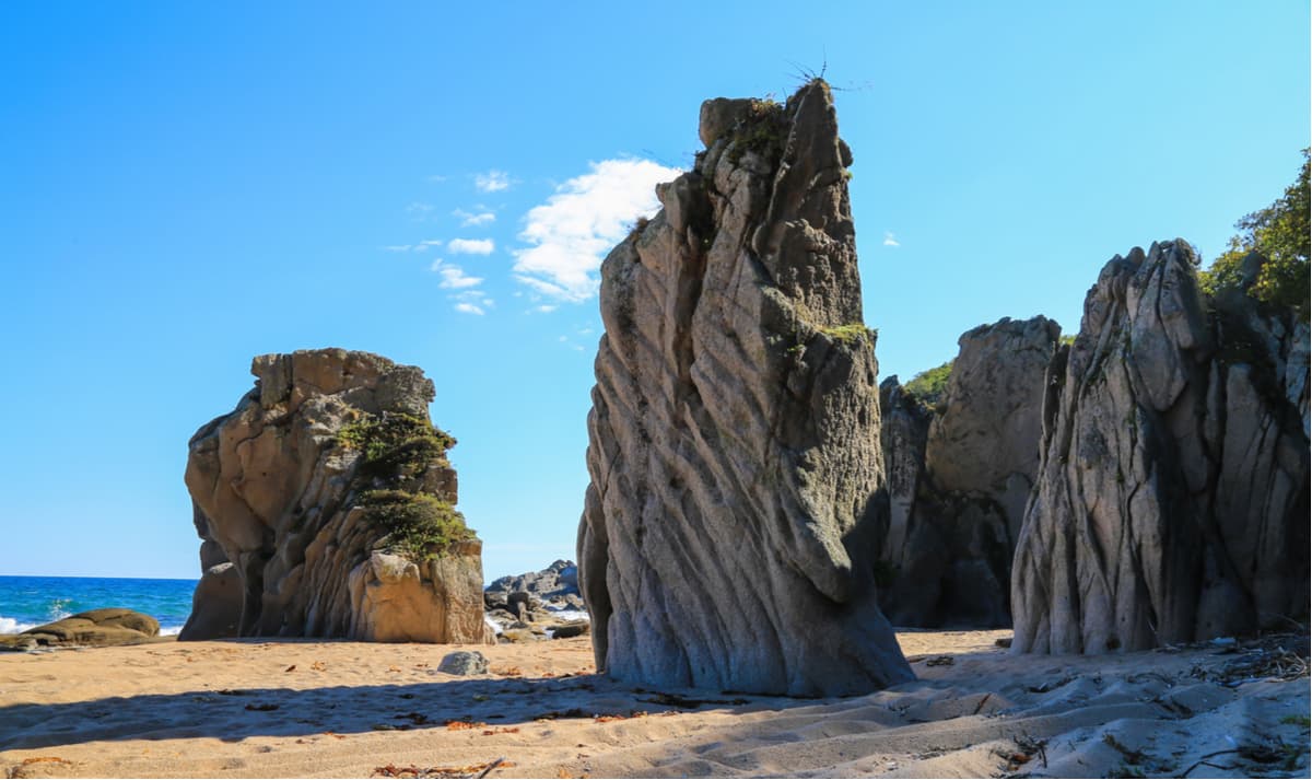
Geographical location, unique climate features and the fact that in the millions of years the territory of the Southern Primorsky Territory has not been subject to the cover glaciation generated the unique diversity of flora. Modern plant species and representatives of the most ancient flora create exceptional landscapes. Outstanding mountain peaks, bizarre rocks, waterfalls, centuries-old trees with massive trunks will make a lasting impression on anyone.
The Tumninsky State Nature Reserve was established in order to preserve the main places of elk migration during the autumn and spring seasons, to control the summer pastures of elks on the sea coast and along the old rivers, to preserve the habitats of valuable commercial animal and fish species, as well as to protect waterfowl on Byki Lake and at the mouth of the Aukan River. The Reserve also takes special care of the spawning grounds for Amur sturgeon and salmon. The Reserve is located in the coastal zone of the Tatar Strait in the south-east of the Khabarovsk Region, the total area is 143,100.0 hectares.
The largest mountains in the Reserve are Mount Bald (872 m), Mount Abua (862 m), Mount Stony (Kamennaya) (806 m), and Mount Istok (631 m). The sea coast is precipitous.
The Sikhote-Alin Mountains are home to an ancient civilization, lots of their buildings are still found in the area. There are fragments of a castle, fortified protective structures and a signal tower. They date back to the era of the Bohai Kingdom (7-10 century AD). Previously, ancient but developed tribes of the Mohesians (engaged in agriculture and cattle breeding) lived here.
The tribes united first into a union, then into an independent state when the pressure from the Chinese Tang Empire began to increase. This is how the first Tunguso-Manchu state was born in 698 AD. It was located in the Primorye Territory, Manchuria and the north of the Korean peninsula.
Nakhodka belongs to the Primorsky Territory. It is administratively part of the Nakhodka City District. Its population is 147,468 people as of 2019. Nakhodka is the third-largest city in the Primorsky Territory. It is situated on the Trudny Peninsula near the coast of the Nakhodka Bay in the Sea of Japan, 186 km southeast of Vladivostok. It is the southernmost city in the east of Russia. The city is cut off from the sea by the port area. It is a large Pacific transport hub of international importance. It connects Russia with Japan, South Korea, and China.
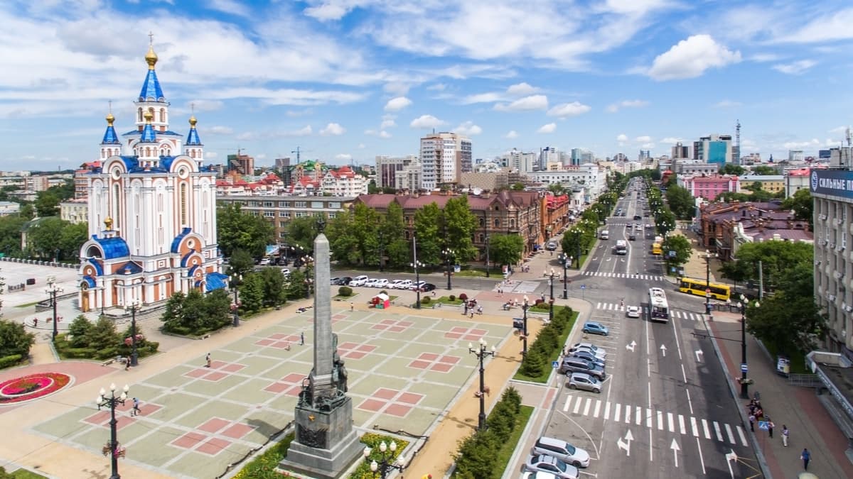
Khabarovsk is one of the largest political, educational and cultural centres in the Russian Far East. It is located in the centre of the crossing of international railway and air transport routes on the right bank of the Amur River in the Middle Amur Lowland, near the border with China. The Khabarovsk Region is a place of intersection of European and Asian cultures, it enjoys a rich diversity of nature and monuments of ancient history. In many villages strewn around, it is possible to get acquainted with the traditional culture of indigenous peoples, and on the bank of the Amur River 75 km from Khabarovsk there was opened a unique archaeological monument "Sikachi-Alanian Petroglyphs" with drawings on the rock. Petroglyphs date from the early Neolithic period – 8-10th centuries BC and ending with the Early Middle Ages 6-13th centuries AD.
Vladivostok is the city and port in the Russian Far East, a political, cultural, scientific, educational and economic centre of the region, as well as the administrative centre of Primorsky Territory and Vladivostok City District. It is situated on the Muravyov-Amursky Peninsula and the islands in the Peter the Great Gulf of the Sea of Japan.
Vladivostok is the endpoint of the famous Trans-Siberian Railway and also the seaport that annually receives tens of cruise liners. It is one of the largest ports in the Far Eastern basin and the main base of the Russian Pacific Fleet. The city hosts the Far Eastern Federal University and the Far Eastern branch of the Russian Academy of Sciences.
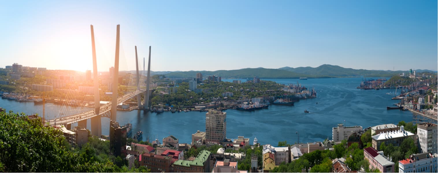
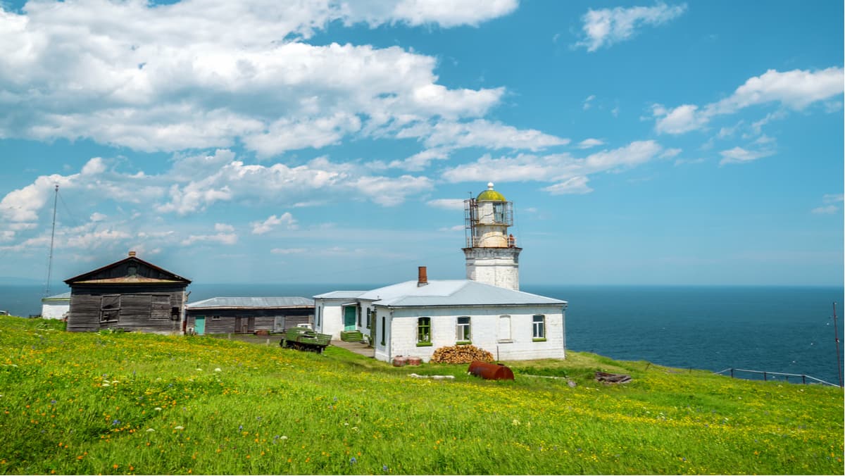
Many of Vladivostok's sights are located near the seafront, the way to which lies through the historical district called Millionka – the Chinese quarters. You should definitely drop to Tokarevskaya Cat Dam and see a beautiful lighthouse in action.
Should you wish to climb high, visit the highest point of the historic centre – the Eagle's Nest Hill, which is best done by cable car. The viewpoint offers a panoramic view of the Zolotoy Rog (Golden Horn) Bay with its embankments and port and the majestic Golden Bridge and the bridge to the Russky Island.


