Scan the QR code and open PeakVisor on your phone
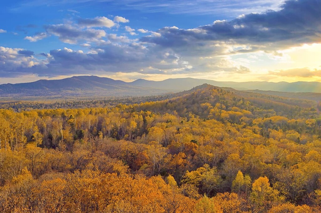
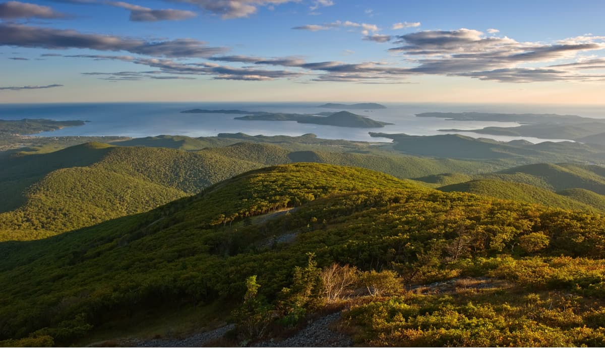
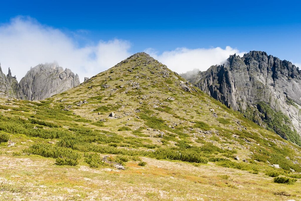
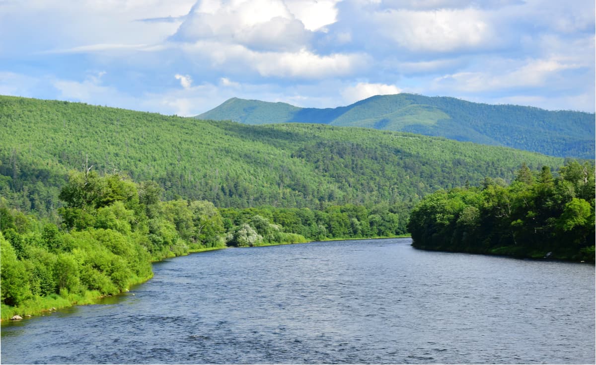
The beauty of the Khabarovsk Region lies in its majestic landscapes. Imagine a vast area, most of which is covered by mountain peaks around 3,000m high. That magic splendour is topped by glaciers, picturesque rivers, lakes with lotuses blooming, and stunning beaches washed by two raging seas.
Man has inhabited the Amur Region since time immemorial. In the Middle Ages, Russian pioneers came here to explore the lands along the Amur River and got gradually settled here because the game was ample, mineral deposits astounding and life seemed to be a bliss. The land exploration was hindered for many years due to the assault of the Qing Empire that resulted in desolation of the region. It was not until the 1800s that the Russian Empire resumed vigorous development of the Amur Region and established clearer borders between the states. The Khabarovsk Region was officially established on October 20, 1938 when it was split into the Far Eastern Territory, with its administrative centre in Khabarovsk. In addition to the mainland, it includes several islands, the largest of which are the Shantar Islands.
The region has an area of 787,633 sq.km. which makes it rank 4th among all constituent entities of the Russian Federation in terms of size. At the same time, the Khabarovsk Region is considered to be one of the most sparsely populated regions in Russia. Its population is 1,301,127 people (as of 2021), which means 1.65 man per 1 square kilometer, which is lower than in Mongolia by at least a quarter. The main contributors to such freedom from neighbours miles around you is the economic decline of the post-Soviet period and harsh climate conditions, the severity of which can be compared with the Far North.
Speaking of human-unfriendly climate, the Khabarovsk Region is washed by the rather cold Sea of Okhotsk in the north-east and east and by the Sea of Japan in the south-east. The region is cut off from Sakhalin Island by two straits, the Tatar and Nevelskoy. It borders the Amur Region in the west, the Magadan Region and the Republic of Sakha (Yakutia) in the north, the Jewish Autonomous Region and the People's Republic of China in the southwest and the Primorsky Territory in the southeast.
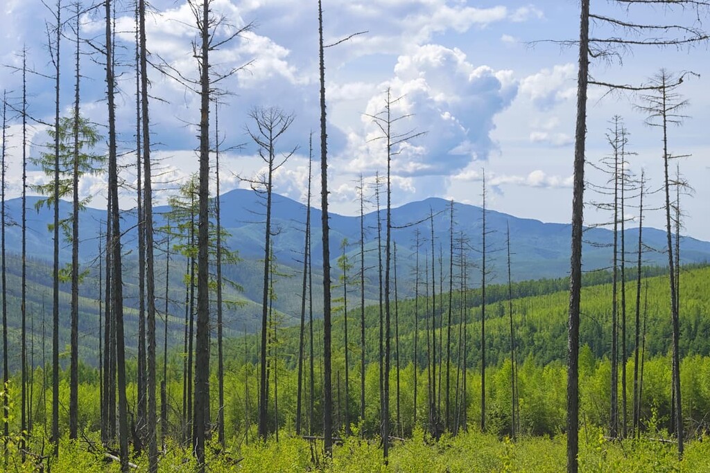
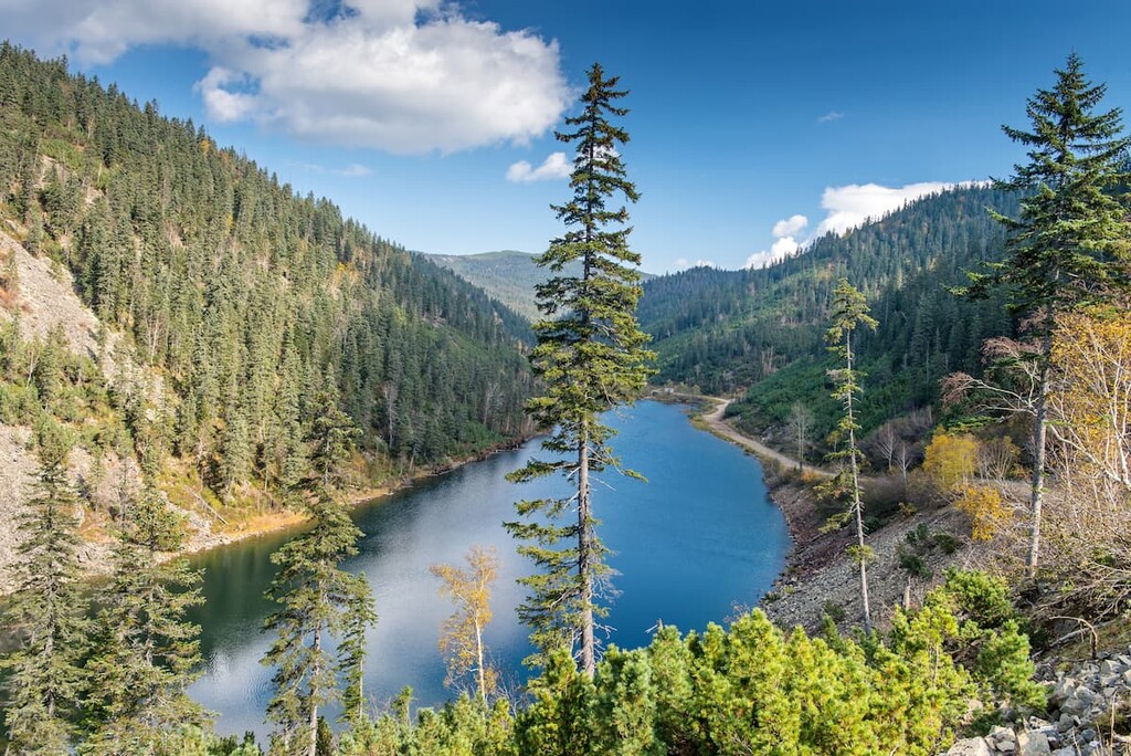
The region stretches 1,800 km from north to south, basically from Primorsk Territory to the Arctic Circle, and 125 km from west to east. Mountain ranges predominate, with many rivers flowing through the region.
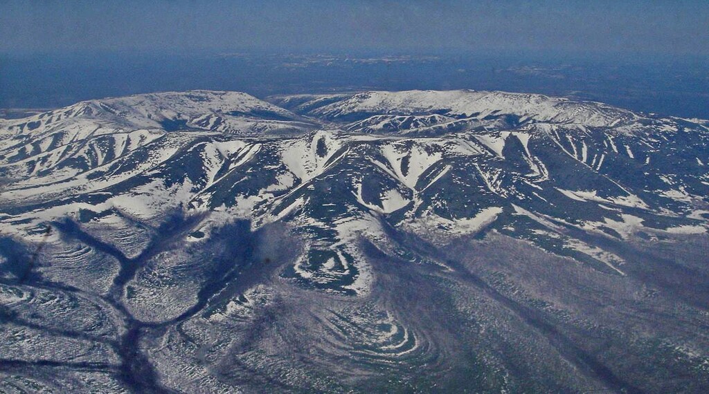
The main mountain ranges are the Sikhote-Alin, Dzhugzhur, Suntar-Khayata, Dusse-Alin, Burein and Yam-Alin. The highest point is Mount Beryl (2,933 m), the lowest is zero point of the sea level.
The mountains of the Sikhote-Alin Range seem to plunge from their head-dizzying height into the Sea of Japan, their slopes are so steep that vertigo comes as part and parcel of any climb. Standing there, you can feel as if you are on the edge of the world.
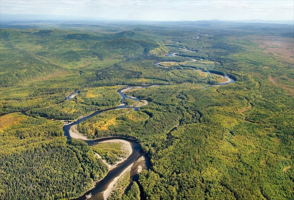
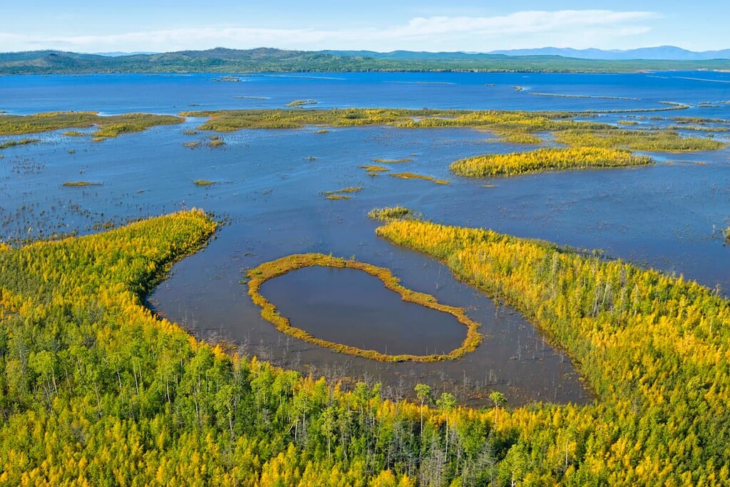
This is the land of full rivers and rampant streams; the total amount is over 200,000 (including the smallest brooks with names). The number of lakes is also impressive.
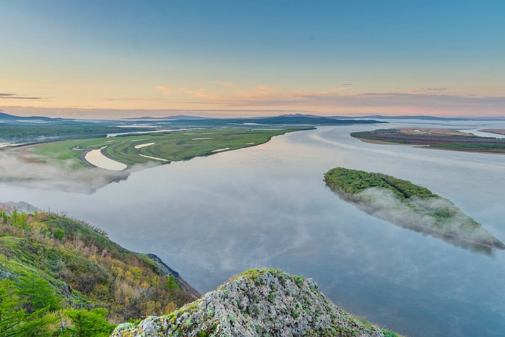
The Amur River is the main waterway and the true gem of the region. It is one of the largest rivers, ranking fourth among Russia's rivers after the Yenisei, Ob and Lena in terms of basin area and the tenth among the world's rivers.
The lakes in the region are mostly small and shallow. The largest lakes are located in the Amur River basin – Lake Chukchagirskoe, Bolon, Orel, Udyl, Bolshoe Kizi and Evoron. The region also partially hosts the Bureya Reservoir.
The volcanoes have long been extinct here, yet, some of their craters house beautiful lakes e.g. Bolon Lake, and most long dormant fiery dragons are home to mineral and thermal springs. The most famous springs are the Tumninskiye (Vanino district), the Annenskiye (Ulchsky district) and the Mukhenskoye water deposit (in Nanayskiy district).
Hardly can you find a more diverse vegetation and animal world. Peculiar climatic conditions have contributed to the great variety of plants and animals in the Khabarovsk Region. It is one of the largest and most unique regions in Russia for its natural resources. Although the government is making an effort to preserve the flora and fauna, the Red Book of the Region features more and more species that are on the verge of extinction.
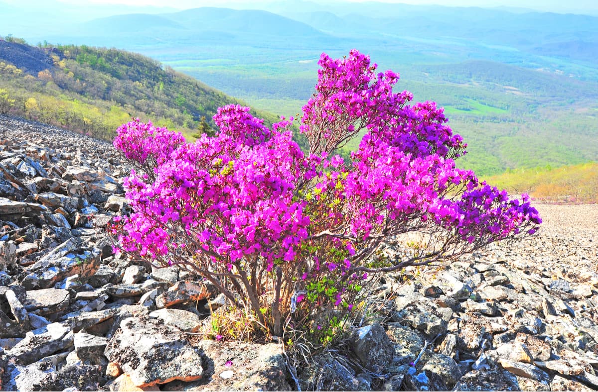
The area can pride itself on an astounding mix of southern and northern species of flora and fauna. Plants of different climatic zones coexist in the region: you can see oak, Manchurian walnut, fir, lotus, ginseng, Dahurian rhododendron, Amur cork tree, eleutherococcus, Chinese lemongrass and others.
The region has become home to many exotic animals, one of them being the Amur tiger. This predator, which dominates the region, is astonishing in size – it can weigh up to 320 kg. At the same time, its population is very small and the tiger is listed in the Red Book, which still does not mean you can be safe in the wild in case you happen to encounter this fantastic beast. You can read in detail how to behave if you see a tiger in our article on the Sikhote-Alin Range.
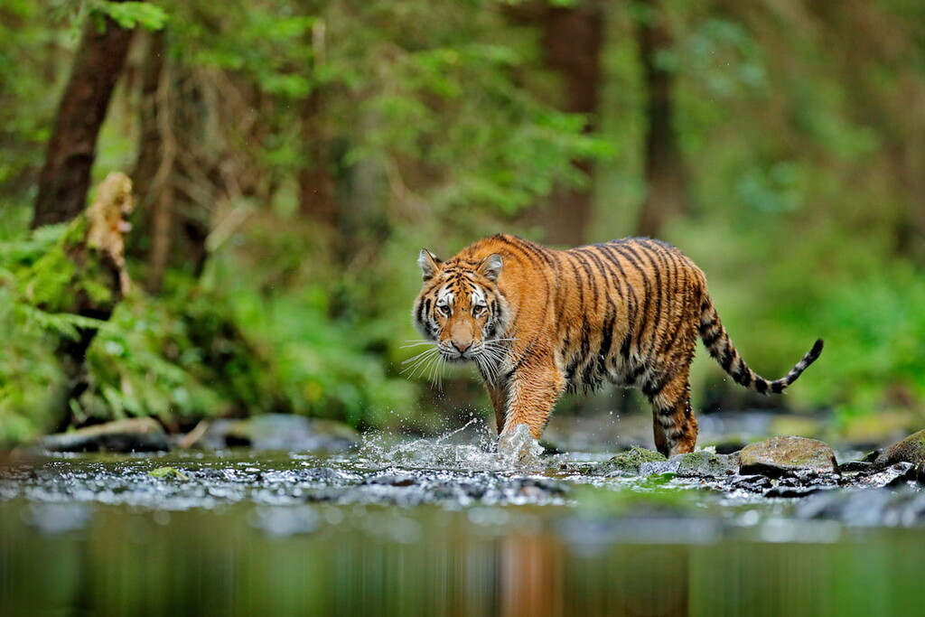
Shortly, should you be lucky enough to encounter a tiger in the many nature reserves or wildlife sanctuaries of the region, please do not reach for your camera first, but take measures to ensure your safety. Seeing an exotic elusive animal in a natural habitat can make your day. On the other hand, your life may be at stake. Mind you, that if a tiger is in the hunting mood, you or your dog would not even see or feel it. The tiger is notorious for its stealth and can catch an unleashed dog before you can say Quidditch. To reduce the life-threatening encounters, keep to the trail and stay close to your guide.
The appearance of a tiger in clear sight is a warning. Usually, the beast behaves covertly. It studies people by smells, sounds, looks out of hiding places, gets all the information it needs about humans. Deviation from that norm is alarming, the beast showing itself is potentially dangerous.
If a tiger appears anywhere near, you should remember never to turn your back to it, let alone run away. This will only provoke an attack because tigers are big cats and like to play no less than your domesticated tabby. The tiger can make three or four leaps forward, then stop abruptly and leap sideways, displaying itself in all its glory. After that, it usually withdraws unless the tiger is protecting her cubs, of course. If the tiger is a cub, rest assured there is its mum lurking nearby. It is desirable to move away from the place of encounter and increase the distance to at least 500 m, and better to 1 km. You should also be aware of the Siberian tiger's behavior; it may appear to be attacking and this can either scare a man stiff or make him run in a futile attempt to escape, which is a sure way to excite more curiosity in the animal. Running is forbidden under any circumstances. Thus, move back slowly, increase the distance from the tiger.
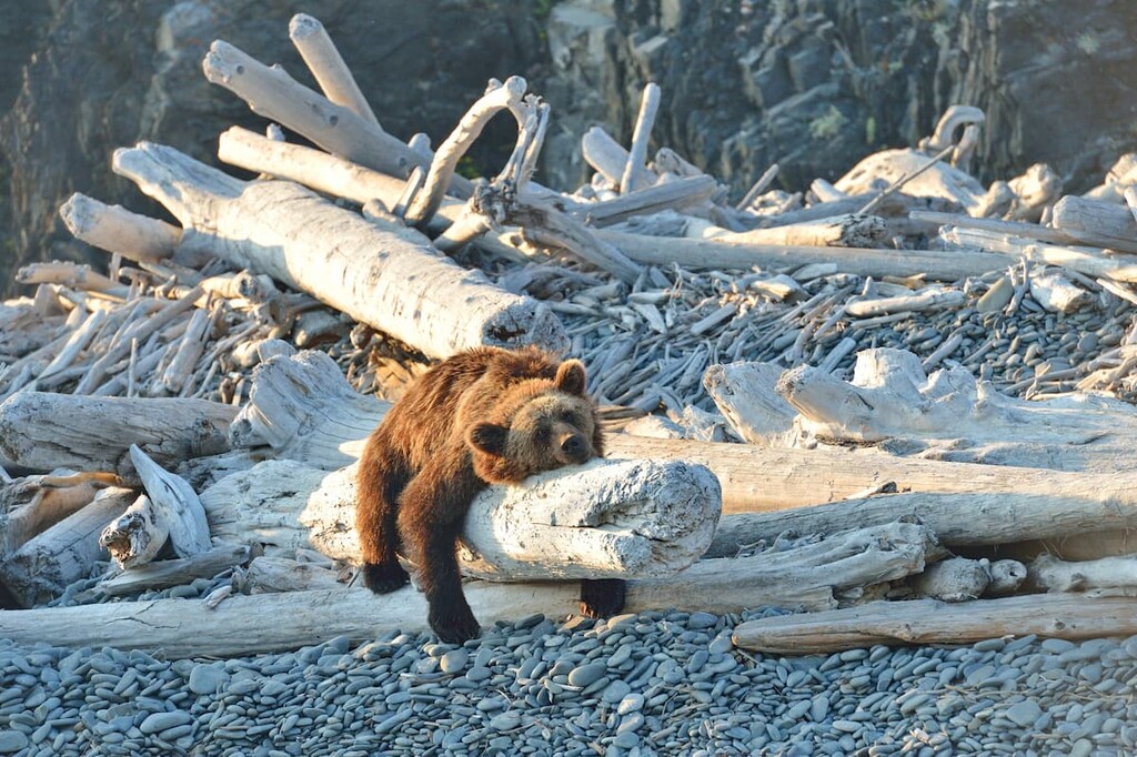
Another mighty predator worth keeping away from is the brown bear. It is a more frequent visitor to human settlements and camps than a tiger but nonetheless dangerous. It hates surprises and may be easily provoked to attack. That's why it's better to walk through forests in a large group and speak loudly. You can frighten the beast by clanging metal objects, shouting, clapping or using flares or false flares. But it is better to avoid conflict with the bear, avoid bear trails and stay away from dense, impenetrable bushes and other places favoured by bears.
As to other wonderful animals, you can see elk, reindeer, bighorn sheep, Himalayan bear, wolf and lynx here. However, they are unlikely to come close to humans since they tend to avoid hiking trails and open areas. The region is also rich in fur-bearing animals: squirrels, foxes, sable, otters and muskrats.
More than 100 species of fish live in the lakes and rivers. Many of them are endangered – the great Siberian sturgeon, the chum salmon, the pink salmon, the small yellow perch, the Chinese perch, the Amur sturgeon, and others. The largest of the freshwater fish, the great Siberian sturgeon can weigh a tonne (1000 kg or 2,204lb)! Imagine the fisherman’s delight when catching such a fish.
If you move to the sea coast, you will see many rookeries of sea lions, sea dogs (aka true or common seals), ringed and bearded seals.
For ornithologists, the Khabarovsk Region is a true paradise. There are about 362 species of birds there. Even though flamingos and mandarin ducks are rare, you can catch a glimpse of them now and then.
The climate in Khabarovsk Region is continental. However, climatic conditions depend on the proximity to the sea, the shape and character of the relief and may change dramatically as one moves from north to south. The Ayano-Maisky and Okhotsk districts, as well as the Shantar Islands, are considered to be areas of the Far North.
This is the land of winter fairytales. The cold season is harsh, snowy and quite long, averaging six months from the end of October to the end of April. The average January temperature ranges from -22°C (-8F) in the south to -40°C (-40F) in the north. It is warmer on the coast though, from -18°C (0F) to -24°C (-11F) but given the strong winds, it does not help much to feel any warmer. Frosts in the south of the region can reach -50°C (-58F). Summers are hot and humid with lots of torrential rains. The average monthly temperature in July in the south is +20°C (68F), while in the north, it is about +15°C (59F). The plains and eastern slopes of the ridges receive considerably more rainfall than their western counterparts.
Despite its proximity to the powerful Asian cultures of Japan, China and Korea, the Khabarovsk Region has preserved its endemic history, cultural heritage, traditions and architecture.
The authenticity and richness of natural resources in the region make eco-tourism and water tourism especially popular. There are interesting routes to the Dusse-Alin Range, to Mount Beryl located in the Suntar-Khayata Range, to the amazing Tordoki-Yani Mountain and the Kojama Ice Cave, to the lighthouse in Sovetskaya Harbour and picturesque islands. People travel here to see lotuses blooming on lakes, to raft down the swift mountain rivers and to go fishing.
There are many well-preserved ancient artifacts found in numerous ethnographic sites. Among these, the most interesting are the petroglyphic drawings located near the Nanai village of Sikachi-Alan and Lake Bolon. Also,the traditional sites of indigenous peoples have certain appeal as well – Verkhnyaya Ekon, Dzhari, Gvasyugi, Innokentyevna villages, the Russian Village cultural and historical complex etc. It is also fascinating to visit such tourist centres as Riviera Park on Zaimka, Volkonsky sports and shooting complex, Voronezh Eco-Park, Eco-Estate, Manoma Manor, Priamursky zoo, etc.
Being one of the Seven Wonders of the region and lying in the very heart of it, the Dusse-Alin range stretches for 150 km at the joint of three administrative districts: Verkhnebureisky, Solnechny and Poliny Osipenko. This area is sometimes called The Lost World because of its inaccessibility. But those daredevils who traverse its rather gently rising slopes, can experience major healing effects since it is believed that clear waters and fresh air here coupled with majestic landscapes can sooth any rough feathers and quench the heart aches.
The highest peak is 2,150m. There is a beautiful glacial lake, called Bear lake snuggly tucked on the slopes of the ridge, as if in a stone bag. A part of the Dusse-Alin Range has the reserved status and belongs to the Bureinsky Reserve, the territory of pristine mountain taiga. Therefore, tourists should only visit this area in groups accompanied by the reserve's staff.

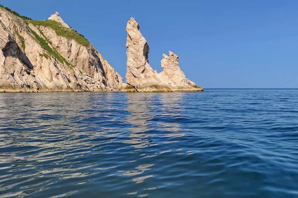
The Amur Pillars are stones 12-70 metres high. They are located on the slopes and on top of one of the mountains of the Chayatyn Ridge, which is 885.8 m high. For a very long time, scientists have been trying to unravel the mystery about the nature of the origin of these pillars. It is still unknown whether nature made these wonderful objects or they are the creations of ancient people. Among the local Nanai people, it is believed that they are the petrified family of a great shaman. And there are many different legends about how exactly they turned into stone.
The Sikhote-Alin is located between the Sea of Japan and the valleys of the Ussuri River and the lower part of the Amur River. The 250-km wide Sikhote-Alin Range stretches along the coast of the Sea of Japan for 1200 km. The average altitude is 800-1000 m, but the maximum altitude is Tordoki-Yani (2,090 m). Having emerged due to rampant volcanic activity in the Mesozoic period, this area consists of a number of mountain ranges, stone massifs and plateaus separated by deep valleys formed by numerous rivers. The Sikhote Alin is considered to pose a high seismic threat. Thirty earthquakes with a magnitude of 7 and more (on a 12-point scale) happened over a short period of merely 40 years last century here.
The ridge consists of several almost parallel folds – ridges with a northeastern direction, its eastern slopes are short, almost perpendicular to the sea and end with high steep cliffs dropping into the rampant sea. The western spurs of the Sikhote-Alin are gentle and the rivers that flow on the western slopes are longer than in the east of the massif and have less rapid flow: the Ussuri, Sungari, Nor, Donndon, Ima, Baku, Biki, Fudri.
Mount Tordoki Yani (2,090m) is the highest peak in the Sikhote Alin. The name means "snowy peak" in the Nanai language. The peak is located in the south-east of the Nanai district. The top of this mountain is rocky with lots of loose rock and thick mountain tundra. In the summertime, the slopes of the mountain are quite often covered with a thin sheet of snow but you still see blossoming cowberries, huckleberries, and reindeer moss coming from under that snow. The mountain rises up to 1600 meters above the Anyui River valley.
Mount Ko (2,003 m) is the second-highest peak in the Sikhote-Alin and is located in the area called Lazo on the border of the Khabarovsk Region and the Primorsky Territory. River Ko starts on the southeast slope of the mountain and flows into the Katen. The mountain is almost inaccessible for hiking, it is also called the witch's mountain because in translation from the Nanai language "Ko" means "a witch".
The name may hold true also due to quite nasty terrain and weather. To exacerbate any hike, there are peculiar stone 'spikes' poking out everywhere on the slopes. The weather here is very unpredictable: it can change in seconds, and fogs are rather frequent. It is very difficult to find your way around. It is not for nothing that ancient people believed that this mountain was home to evil spirits and tried to avoid it. Even today this mountain is usually bypassed. In spite of all this, scientists are inclined to consider the mountain as a gemstone of the Sikhote-Alin Range. Interestingly, ufologists believe that Ko is a launching pad for alien space objects. No one has yet been able to prove or disprove this fact.
Mount Anik is an extinct volcano 1,933 meters high. This mountain is dome-shaped; it has steep slopes on the banks of the river Katen. The top of the mountain contains lots of magmatic rocks: granodiorites, quartz diorites and granosyenites. The mountain is located in the coldest and harshest area of the Primorsky Territory on the border with Khabarovsk Region.
According to a Nanai legend, the rock on the shore is none other than a great shaman, petrified under the influence of magic. It is even possible to see a face and when touching the rock, it feels as if the stone is warm. Indeed, the rock itself is warmer by about 10 degrees than the rest of the stones. The same phenomenon is observed in Stonehenge. This phenomenon has not been scientifically verified yet. There are flowers growing on the mountain that you won't find elsewhere in the area. And if a flower is picked, the weather can go bad in an instant.
The Nikolaev Stones (or Bekchi Pillars) can be seen near Mnogovershinniy village in Nikolaevsky district. The appearance of half-ruined towers on top of the hills reminds of the setting for Lord of the Rings film. Who built them? It turns out that these stones are the remnants of volcanic lava, elaborately chipped by the winds. Such so-called stone idols are often found near volcanoes that once erupted. These formations are usually isolated but here there is a huge number of them, as if there is a whole ancient city! It's an impressive sight.
The Bajal Range is located between the rivers Amgun and Amur, east of the Bureinsky Range. It is 220km long and its highest point is Ulun (2,221 m). It consists of volcanic rocks, sandstones and shales, which makes it an attractive destination for mountain climbers and outdoor tourists. Numerous tourist routes are laid here, and mountaineer training camps are held on a regular basis. The ridge crest is covered with bush-lichen tundra vegetation, slightly lower slopes are covered with spruce-fir taiga, in the foothills - with larch forests and marshes.
On the north-western slope of the range, there lies the Bajalski Nature Reserve established in 1987 to protect and reproduce the unique flora and fauna of the Khabarovsk Region.
An almost perfectly ring-shaped mountain ridge 8 km in diameter and 1200-1387 m high lies a thousand kilometres north of Khabarovsk in the Ayano-Maisky district. Its name is Kondyor - the sacred mountain of the Evenks and the Yakuts, they also call this ridge Urgula. The Kondyor has been attracting scientists' attention since the 1930s, but at that time it was very difficult to reach it.
There is no unequivocal answer as to its origin. Numerous hypotheses have been proposed, one more fantastic than the others.
It is not only the shape and structure that make Kondyor famous. The world's biggest platinum deposits are here. The biggest platinum nuggets of up to 3.5 kg were found on Kondyor. Moreover, some of them were crystalline and have never been found anywhere else in the world. An amazing natural mystery that has confounded the minds of scientists.
With the development of platinum mining, gold was mined here as well. Gold extracting mills and mines were built, as well as other industrial complexes followed by shops, houses for prospectors, sports fields and finally the Platinum Arena palace, which name reflects the origin of this place.
One can get to Kondyor only by winter roads or by plane. More than 300 miners work here during the mining season. Day after day, without a minute's downtime, 14 machines wash away the rock, separating grams of the precious metal. Grams add up to kilograms, kilograms to tons. With fingers crossed, let’s hope that human greed would not grind this majestic ring ridge to the ground.
Translated from the Evenk language as a "high unforested mountain" Dzhugzhur Ridge is a medium-altitude range located in the Khabarovsk Region along the north-western coast of the Sea of Okhotsk. It extends for about 700 km with prevailing elevations of 800-1300 m, the highest point is Mount Topko (1,906 m). They are composed of sedimentary and magmatic rocks.
On the western slopes of the Dzhugzhur, lie light coniferous mountain taiga dominated by Daurian larch, while the eastern slopes are covered with Okhotsk mountain taiga, dominated by Ayanian spruce. Above 1300 m, there grows cedar shrubbery interspersed with mountain tundra.
The Dzhugzhur lies in a cold monsoon climate zone, characterised by cold winters and cool summers. It is part of the Dzhugzhur Nature Reserve.
The Dzhagdy Ridge is the easternmost link in the Yankan - Tukuringra - Soktakhan - Dzhagdy mountain chain. The highest point of the range is 1,593 m.
Southern spurs of Dzhagdy Ridge in the basin of the Lower Burunda river are occupied by the Norsky state nature reserve, which is the habitat of Japanese and black cranes, black and far-eastern storks, osprey, white-tailed eagle.
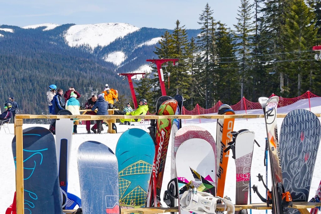
The Khabarovsk Region might not be on the bucket list of an avid skier, but there are plenty of options to choose from if you wish to have an enjoyable ride.
Specially protected areas occupy about 8.5% of the total area of the region. Many of these have a federal status. There are 6 nature reserves, 2 national parks and 5 wildlife sanctuaries.
Protected areas of regional significance include 3 natural parks, 1 dendrological park, 26 nature sanctuaries, 8 wildlife corridors, 1 wetland, 61 natural monuments. There are also 67 protected areas of local importance.
The most popular among them are the Anyuisky National Park, the Botchinsky, the Bolonsky, the Bureinsky, the Komsomolsky, the Tumninsky, the Bolshekhetsirsky and the Dzhugzhursky Nature Reserves.
The Shantar Islands are one of the region's most striking and unique natural features. The scenery here is fabulous. There are many bizarre-shaped marble and jasper rocks on the islands. The variety of colours is breathtaking, you can see cliffs coloured in green, red, pink, white, and more shades. Summer on the islands is so short that there can still be ice floating in the straits but at the same time, the shores are already green and blooming with a variety of flowers. The tourist season includes all summer months and September. The islands are luckily difficult to access, so nature has been preserved here in its pristine condition. Here, killer whales chase seals and brown bears roam self-confidently along the shores. In the Ongachan Bay, it's easy to spot a whale just a few metres from the shore.
Located in the Vini district, Toki Island has been recognised as a nature monument and was classified as a private nature reserve in 2007. Excursions are free of charge, but it is necessary to make an appointment in advance as no one lives there permanently. The island has a zoological profile, as it is a rookery of various pinnipeds – sea lions, seals and walruses. This earned it the second name Seal Island.
In the north, there are many swift mountain and taiga rivers teeming with fish and flanked by picturesque banks. Travellers annually catch trophy taimen (salmon trout) of gigantic size (up to 40-90 kg) on fishing tours along the Uda River which flows into the Sea of Okhotsk. Popular fishing catches are grayling, Brachymystax lenok (a type of salmon), char, coho or silver salmon, and cherry salmon.
The Amur River valley has the greatest concentration of natural wonders as well as cultural and historical tourist sites. You can get acquainted with all this natural diversity if you go on a river trip on the Amur River lasting from several hours to 10 days.
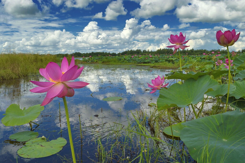
Should you wish to observe some really ethereal beauty, come here when lotuses are in full bloom. The most popular lotus lakes are the Barkhatnoye (Velvet Lake), the Tsvetochnoye (Flower Lake) and the Lonchakovo. The water surface is covered with flowers, which creates a colourful natural canvas. Lotuses bloom for only a few days at the end of July and in the beginning of August. Many legends are associated with this amazing phenomenon. It is said that whoever looks at a lotus during the blooming season will be lucky for the whole year.
Travellers also frequent Amut Mountain Lake (761 m a.s.l.) located in the Solnechniy district. The lake was formed by the descent of mountain masses from the slope, which blocked the course of the river of the same name. The water temperature does not get warmer than +6 °C (43F). There is sparse woodland growing along the banks. Snow remains until midsummer.
There is a beautiful waterfall called Sagena, located in the Anyuisky National Park. It is one of the most unusual waterfalls in the Sikhote-Alin Range. The explorers believe that it is an underground river that comes to the surface in the form of numerous streams.
Another beauty is the Bear (Unexpected) Waterfall in the Dusse-Alin Range. There are other waterfalls in the region, less well-known but nonetheless picturesque.
The Vyazemsky warm springs are also in high demand. The locals believe that their waters have healing properties and cure many ailments. They use the warm springs as jacuzzis and recommend bathing in them in winter, when the healing effect is even more pronounced.
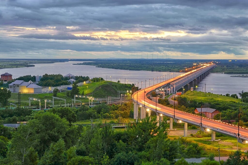
Khabarovsk is an important transport hub in Russia. It is one of major railway, river and air transport centres in the country. There are three airports, four railway stations and a river port in the city, which makes it easy to reach.
From the airport, you can get to the city centre by taxi or by public transport (shuttle, bus or trolleybus).
Khabarovsk is the largest city in the Russian Far East, officially considered its capital until 2018 because now Vladivostok bears that status. It is located on the right bank of the Amur River, near its confluence with the Ussuri River. The city occupies an important strategic location – its centre to the state border with China is only 15 km away, and the nearest Chinese settlements (Fuyuan) are 36 km away. However, the distance from Khabarovsk to Moscow is approximately 6,100 km.
In the late Middle Ages, the area on which the town now stands was the subject of disputes between the governments of Russia and the Qing dynasty in China. Eventually, in 1858, the area was ceded to Russia, after which there appeared Khabarovka. The settlement was originally purely a military one, but over time it began to grow into a civil town. After the famous Trans-Siberian Railway was laid through the settlement, the town became the most important transport hub in the Far East that it is today.
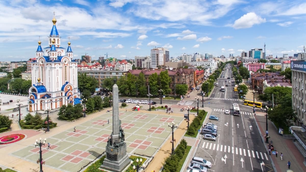
The city's main religion is Orthodox Christianity, so it's not surprising that the city skyline is dominated by Christian cathedrals from different historical periods. Each has a unique style, reflecting the architectural trends of their time. The largest of them are the Cathedral of the Assumption, the first stone cathedral in the city, the Transfiguration Cathedral, the Church of the Venerable Seraphim of Sarov and the Church of Saint Innocentius of Irkutsk.
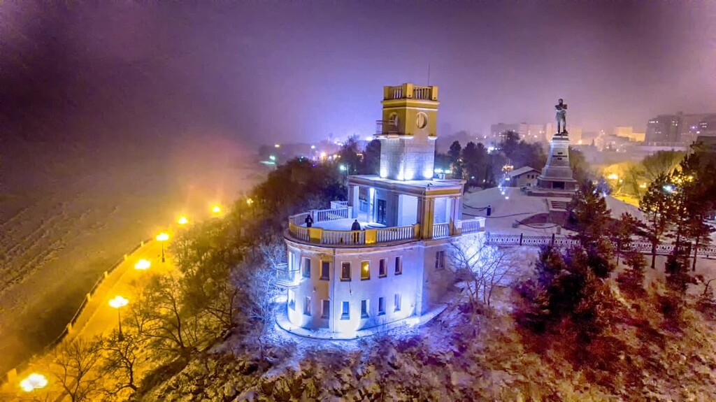
Unlike most industrial cities in Russia, there are quite a few statues and sculptures amply scattered around Khabarovsk. They reflect the entire history of the city. The most famous sights of this type are monuments to Muravyov-Apostle, Civil War heroes and others.
Khabarovsk is also worth a visit for its extensive museum network. One of the most visited is N.I. Grodekov;s Regional Museum. It has a world-wide reputation for its unique exhibits and workshops on Russian folk art. They give master classes in Russian folk art and clay crafts here. The Museum of Art presents the collections of the Hermitage and the Tretyakov Gallery. There are also the Pushkin Museum of Fine Arts, the Military History Museum, the World of Talking Machines Museum, and the Amur Bridge History Museum. All museums are equipped with modern multimedia allowing visitors to get deeper into the atmosphere of bygone times.
The city also has many theatres and parks. Gagarin's Central Park is especially noteworthy. There is a Kuril larch tree planted by the great cosmonaut Yuri Gagarin himself during his visit to the city. When you stroll along Khabarovsk embankments, you enjoy beautiful landscapes and city views.