
Scan the QR code and open PeakVisor on your phone
Primorsky Krai is home to 1,437 named mountains. The highest is Gora Oblachnaya at 1,860 m.
The lands of the Primorsk Territory are a treasure trove of magnificent natural wonders. These are the lands of majestic ridges and graceful cliffs, ancient reefs and extinct volcanoes, karst caves and lotus lakes, mountain rivers with waterfalls and picturesque bays with cozy beaches. These are the lands of paradoxical symbioses where coniferous trees are intertwined with tropical vines, fresh water springs break out in the middle of the salty sea. It's the only place on the planet where no glacier ever made its way.
Nestled on the coast of the Sea of Japan, the Primorye / Primorsk Territory aka Primorsky Krai occupies the south of the Far East, the southeastern edge of Russia. At various times, it belonged to various people. It was a part of the Bohai State, the Jin Empire, the Russian Empire, the Far Eastern Republic. In the beginning of the 13th century after Mongol invasions, there was a period when the local lands were deserted and forgotten until Russian pioneers appeared there. It was not until the 1800s that Russia began to actively develop the area. On October 20, 1938, Primorsky Krai was formed as a result of splitting the Far Eastern territories. The remarkable city of Vladivostok became its administrative centre.
The Primorye covers an area of 164,673 sq.km., it has a population of 1,877,844 people as of 2021, which is roughly the same as the population of Latvia or Kosovo in Europe. It stretches from north to south for almost 900 km. It is bordered by the Sea of Japan to the south and east, by the Democratic People's Republic of Korea (aka North Korea) to the southwest, by the People's Republic of China to the west, and by the Khabarovsk Region to the north.
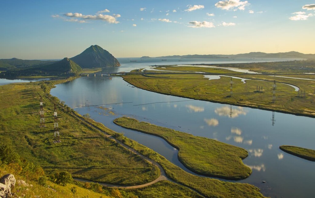
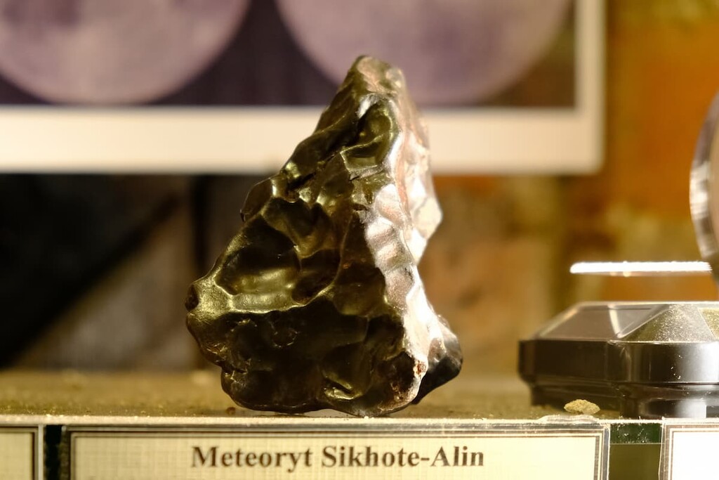
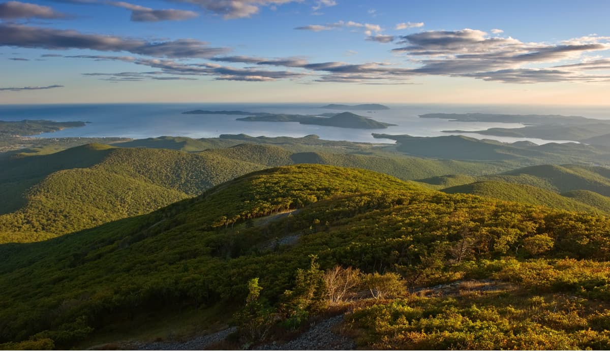
The Primorye is situated on the eastern part of the Eurasian continent and on the islands which seem to have been assembled into a single archipelago. The largest islands include: Bolshoy Pelis, Russky, Putyatin, Askold, Popov, Rikorda, and Reineke. The region is considered to be a mountainous country because only one fifth of its territory is made up of river valleys and intermountain basins. The rest of the land is occupied by the Sikhote-Alin Range which stretches from northeast to southwest, parallel to the coast of the Sea of Japan, and the Manchurian-Korean mountains.
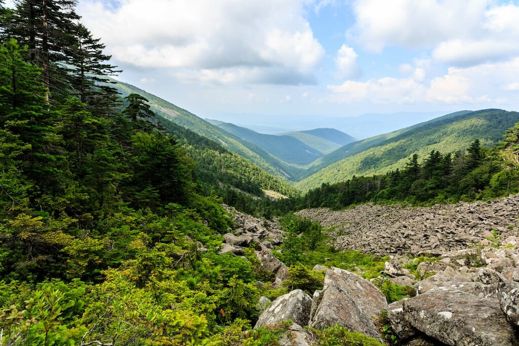
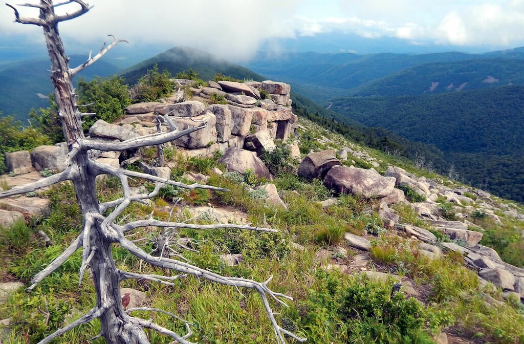
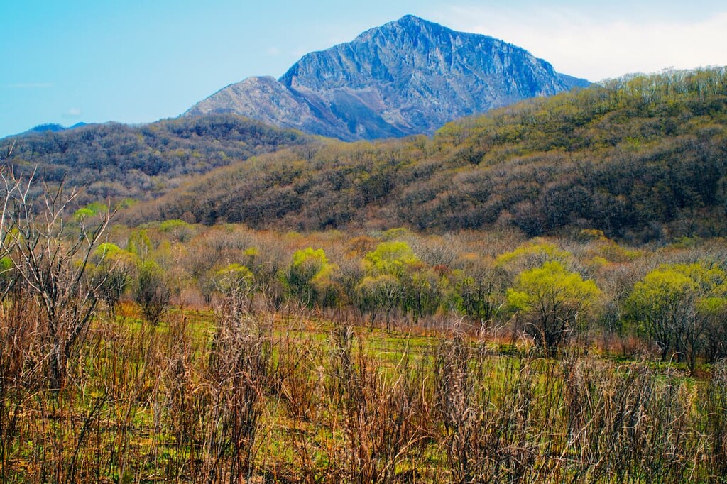
The Sikhote-Alin Range is a set of eight parallel mountain ranges. Each chain is cut by deep river valleys. The slopes are mostly gentle and the peaks are rounded, which reminds you of a head. On the other hand, the mountain spurs on the eastern side of the ridge have steep slopes that are close to the sea. The highest mountains of the range are Tordoki-Yani (2,090 m), Mount Anik (1,933 m), Cloudy aka Oblachnaya (1,855 m), High aka Visokaya (1,746 m), and Snowy aka Snezhnaya (1,684 m). Mind you, that name High aka Visokaya is rather frequent in the region and you can also see a peak with the same toponym in a different ridge.
The East Manchurian Range is located between the state border with China, Lake Khanka, the Razdolnaya River and the coast of the Sea of Japan. It is represented by low and medium-mountain ridges with some volcanic plateaus.
The Black Mountains rise in the south and it is on their crest that the state border passes. The highest points are Mount Vysokaya aka High (997 m), Mount Kedrovaya (964 m) and Mount Luna (921 m).
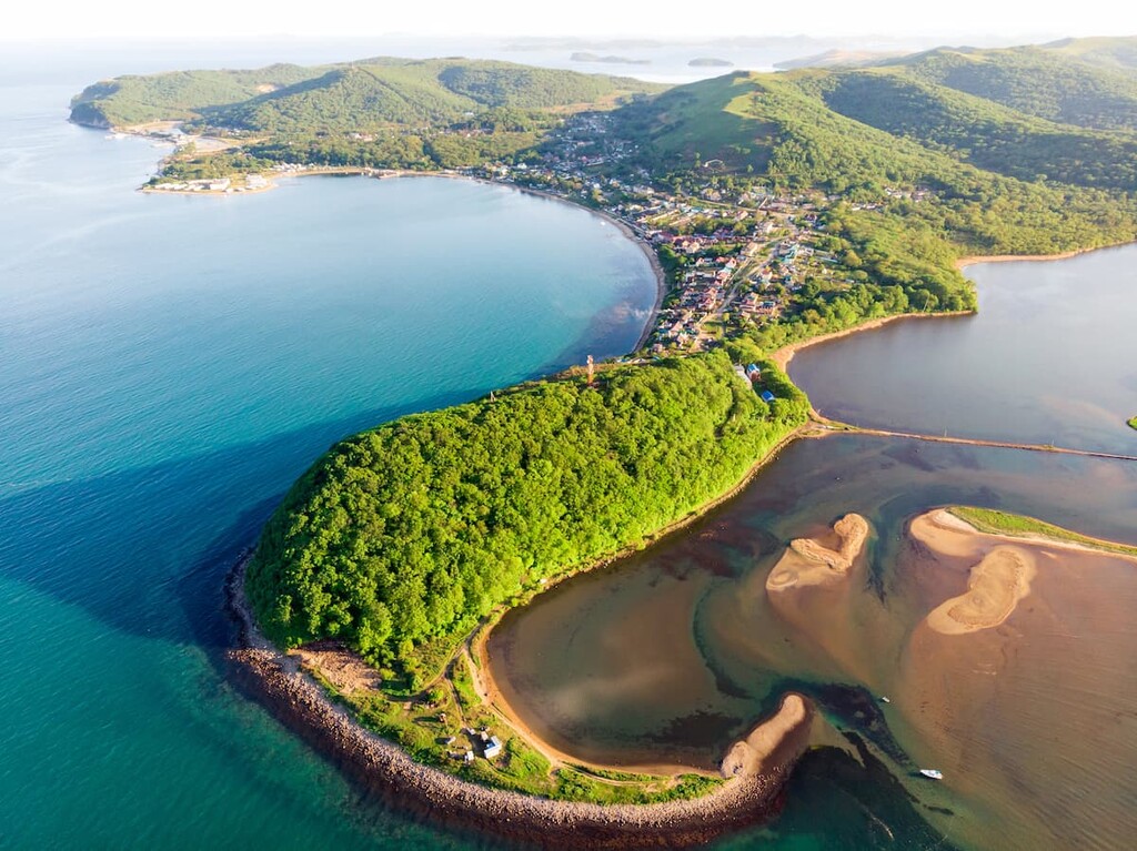
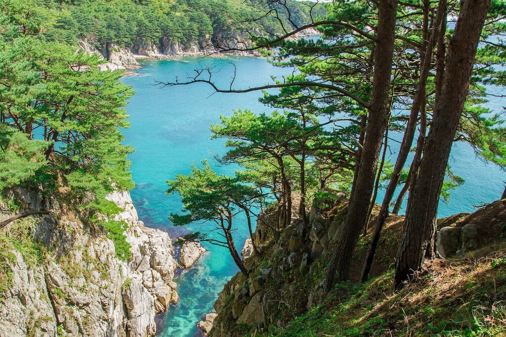
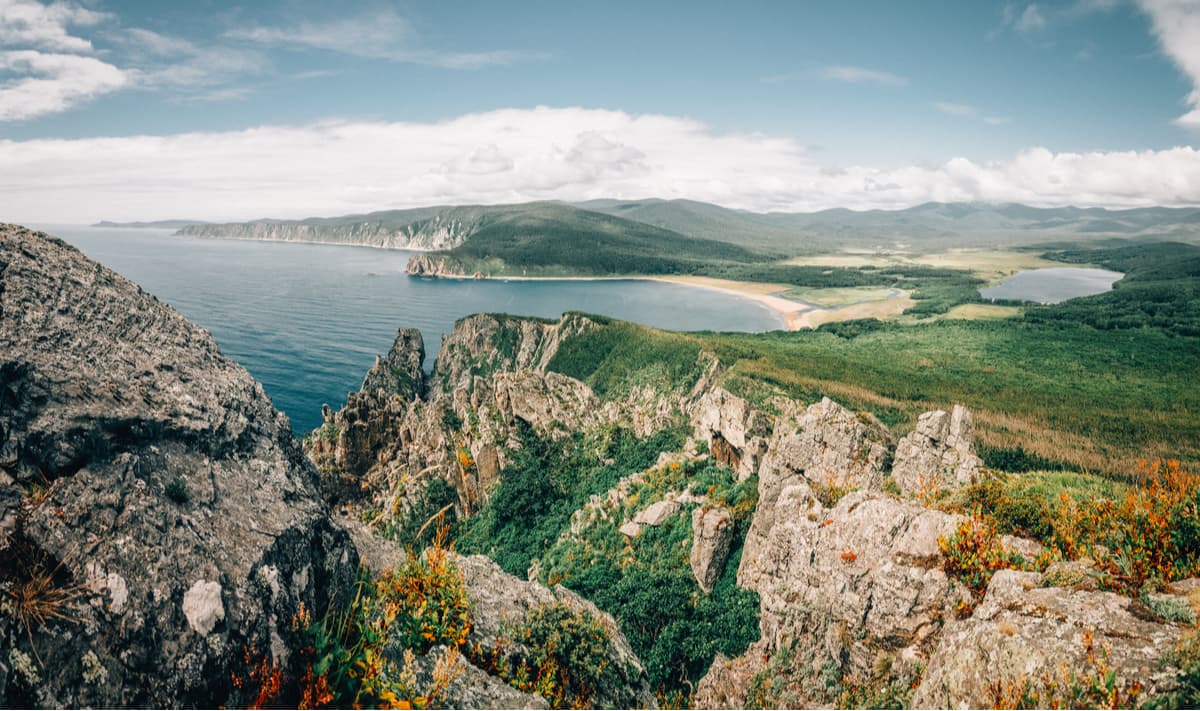
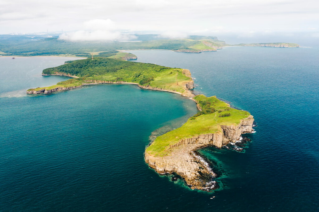
The coastline of the Primorsky Territory is rugged and quite strongly dissected by bays and coves. There are many islands close to the rocky sea shores. Those shores with many mind-blowing cliffs attract a lot of climbers here.
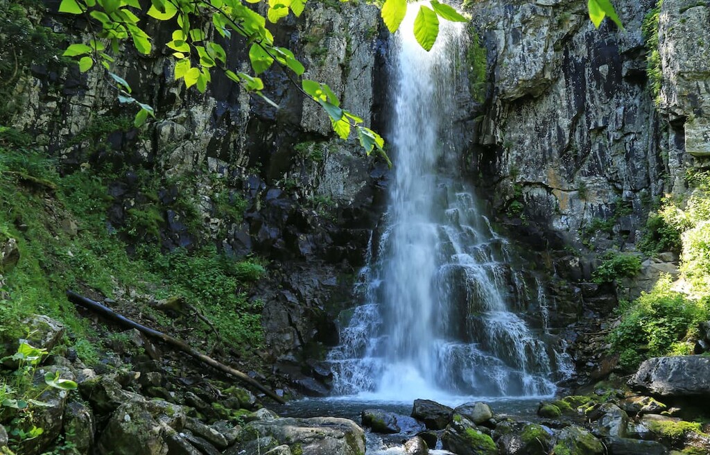
There are over 6,000 rivers in the Primorsky Territory; they are relatively short though. This is due to the close proximity of the watershed line to the Pacific coast. The main watershed in the southern part of the Far East is the Sikhote-Alin Range (translated from the Chinese as ‘the range of the long Western rivers’). Most of the rivers are rather turbulent in their upper reaches because they rush down the slopes and form many rapids and rifts. There are about 30 scenic waterfalls, of which the most picturesque are Amginskiye, Milogradovskiye, Benevskiye and Shkotovskiye. The biggest waterfall is the Primorye Star (24 m high).
In the middle and lower reaches, the rivers widen and flow more quietly, winding and bending along the way. The largest river in the region is the Ussuri, which has its headwaters on the slopes of Mount Snezhnaya. The rivers predominantly fed by rainfall are distinguished by abundant flooding during typhoons, usually in July-August. In the Ussuri River basin, they can become catastrophic.
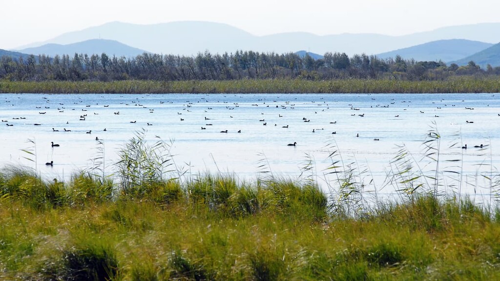
There are about 3,000 lakes in the region, of which 2,800 are shallow. In the western Primorye lies Lake Khanka, the largest freshwater reservoir of the region. It forms a natural border with China with the 2/3 of the lake being located in Primorye. The lake and its surroundings belong to the Khanka Reserve. This is a fascinating and unique natural area in the Far East.
Wetlands in the region occupy about 4% of the territory.
Since ancient times, the nature of the Primorsky Territory has preserved a huge number of unique plant and animal species which are found nowhere else in the world. There are also many red-book-listed endemics.
The forest covers about 79% of the area. The mountains display a variety of hues due to the different composition of the forests that grow there: from spruce-fir, cedar-spruce, cedar-broadleaved forests to heat-loving black fir and broadleaved forests. On the other hand, the river valleys are filled with broad-leaved forests. There grow ashes, elms, Manchurian walnuts enlaced with vines.
There are 2,200 - 2,500 species of vascular plants, including about 250 species of trees, bushes and woody lianas, a huge variety of ferns, algae and fungi, mosses and lichens. There is an abundance of medicinal plants as well, such as eleutherococcus, Chinese lemongrass, and ginseng root.
Ginseng means "root of life". According to traditional Chinese medicine, this perennial herb is supposed to prolong life. In China and Korea, by the way, its root is also used as a food.

True animal lovers will certainly appreciate the diversity of nature of the region: here live about 103 species of mammals (including 82 terrestrial), 18 species of reptiles, 483 species of birds, 9 amphibians, 377 freshwater and marine fish, over 22,000 insects, including the largest beetles, the butterflies and hornets.
The Primorye Territory is home to such an indescribably beautiful but dangerous predator as the Amur tiger. The Amur tiger hides from humans in the taiga, so it is unlikely that you will come across it by chance. You can read more about this mighty cat in our article devoted to The Call of the Tiger National Park.

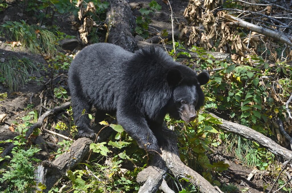
Black, brown and Himalayan bears, on the other hand, may be encountered more than once, so it is best not to go too far into their habitats without a guide, and for safety reasons you should never stray off the trail.
The area is also home to spotted deer, the far-eastern leopard, squirrels, mice, hedgehogs and many others. It is worth mentioning that one of the most venomous snakes, the Ussuri copperhead snake (moccasin), has found a home here as well. It likes rocky places in the mountains. Therefore, it is important to be vigilant and careful when climbing the mountains. There are also men-brought species in the region: Canadian beaver, European hare and European mink, muskrat, termites, huntsman spider (heteropoda venatoria).

In addition to fascinating animals, many of which are included in the Red Book of Russia, the underwater world of Primorye is also interesting. The waters of the Sea of Japan are teeming with fish. Many species of fish are commercially viable and swim close to the shores until the freeze-up. Unfortunately, deforestation of the taiga influences the fact that many rivers have become very shallow, which has an adverse effect on the ‘pedigree’ fish. However, predatory fish, such as sharks and rays, sometimes swim into the Sea of Japan.
The climate is temperate and monsoonal, with frequent typhoons and cyclones bringing heavy rainfalls. Decisive to the climate is the region’s location on the edge of a vast continent, which cools down considerably in winter and warms up in summer. Due to the sea monsoon winds that prevail on the coast, the region is usually divided into two parts with different climatic conditions.
Central Primorye is characterised by winters that last 4-5 months, with occasional thaws on the coast and the cold season lasting 3 months. Winters are mostly dry, cold, with a significant number of clear days and little snow cover. The average monthly temperature is -8 to -18°C (18 to 0F). Frosts can reach -50°C (-58F) during the coldest periods.
Spring in the continental part of the region is late and cold, with significant temperature variations. The first half of the summer is hot and dry on the mainland and quite cool, with fogs and drizzle on the coast. The second half of the summer is hot and humid, with an abundance of prolonged heavy rainfalls. Such rains are usually associated with typhoons and southern cyclones that pass over these parts of Primorye. The average monthly temperature in July is +18 to +26°C (18 to 79F), with a maximum absolute high of +40°C (104F).
Autumn is moderately warm and dry and in some areas the heat lingers for a long time. This is the best time of the year in Primorye, the so-called golden season.
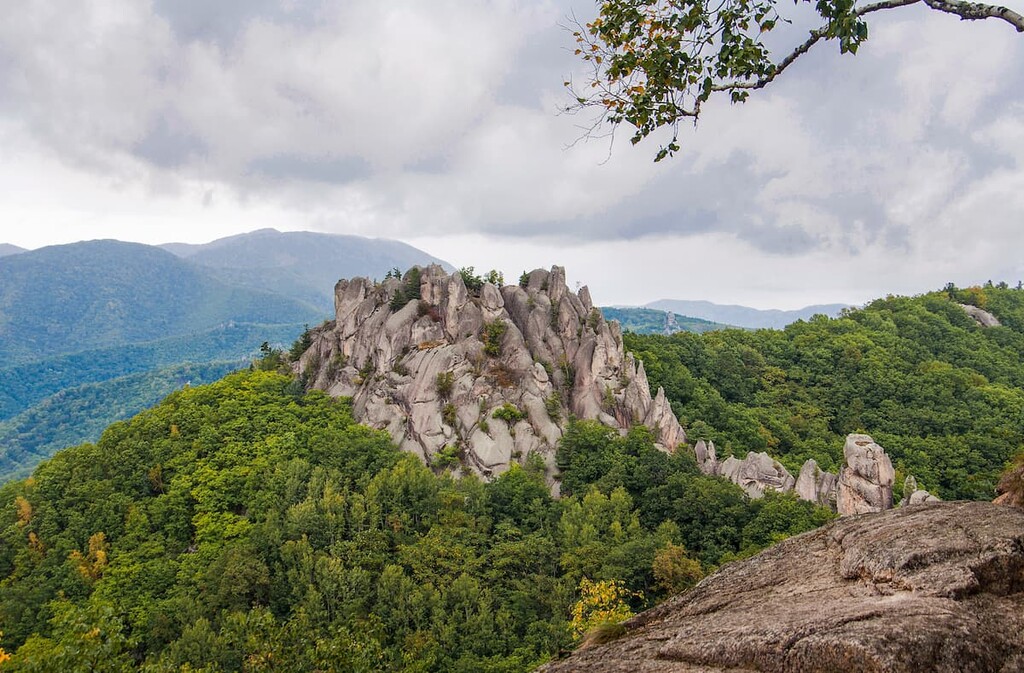
Here the plains alternate with mountains, and the steppes intermingle with impenetrable taiga. Views from the mountain tops open up wide panoramas. Many of the local mountains are actually gigantic ancient reefs. The names also breath legends: Brother and Sister, Nephew, Large Hayrick (Zarod) and others. Many places are also of historical value, there are quite a bunch of archaeological excavations that allowed scientists and researchers to determine the origins and history of the entire Primorsky Territory.
The region's natural attractions include a large number of waterfalls, crystal-clear lakes and caves. Of the latter, the most noteworthy are such beautiful caves as: Spasskaya, Sleeping Beauty, the Cave of the Geographic Society, the Speleologist’s Dream.
The waters of the Sea of Japan are rich not only with representatives of the underwater world, they also contain numerous mineral springs and therapeutic muds. The best resorts in the region can be visited on the coast of the Peter the Great Gulf, as well as near the tributaries of the Ussuri River and on the volcanic field of the Sikhote-Alin Range.
In addition to natural attractions, the region has an abundance of historical monuments. Many of them are associated with the region's wartime past. These include the remains of the Voroshilov Battery on one of the islands, the legendary Vladivostok Fortress, a pre-revolutionary patrol ship museum, a submarine museum, and many others.
Situated not far from Shkotovo village, the Primorye Safari Park is the place where animals, including bears, wolves, lynxes, muskrats, deer, wild boars, badgers, wildcats, raccoon dogs, and various birds of prey live in free and comfortable conditions. And even Amur tigers can be watched here from platforms raised to a safe height.
The 250-km wide Sikhote-Alin Range stretches along the coast of the Sea of Japan for 1200 km. The average altitude is 800-1000 m, but the maximum altitude is Tordoki-Yani (2,090 m). Having emerged due to rampant volcanic activity in the Mesozoic period, this area consists of a number of mountain ranges, stone massifs and plateaus separated by deep valleys formed by numerous rivers. The Sikhote-Alin is located between the Sea of Japan and the valleys of the Ussuri River and the lower part of the Amur River.
The territory of the Sikhote-Alin mountain chain has several protected areas, including the Anyuisky National Park, the Sikhote-Alin Natural Biosphere Reserve Reserve, Lazovsky Nature Reserve, and Botchinsky Nature Reserve. Archaeologists have found traces of ancient people's camps on the floodplains, and in the Sikhote-Alin Mountains there are many remains of early man buildings: the remains of a very large stone structure resembling the remains of a Bohai palace, signal towers, and various fortifications. A single-track railway and a section of road have been built through the mountains.
Mount Pidan (1.332 m) which is officially known as Livadiyskayaa Mountain is part of the Livadisky Ridge in the Sikhote-Alin Range. It is one of the most mysterious and popular mountains in the Primorsky Territory. It is a place of power left over from the times of the ancient Kingdom of Bohai. The huge stones scattered across its slopes contributed to the choice of its name. In translation, Pidan means "stones heaped by God". The legend has it that in ancient times, a magic crystal was placed atop this sacred mountain, only the priests could approach it. Another legend tells of a man who once lived here and could fly.
Situated in the south of Primorye, the Chandolaz Ridge is actually a very ancient coral reef 7.5 km long rising from the ocean floor. Located in the middle of the taiga today, it is now a part of the bigger Lozovy Range. The old Chinese name Chandolaz aka Chindoliz aka Chindalaz means ‘a big long mountain’. The highest point of the Chandolaz Ridge and the Lozovy Range is Chertov Utes aka Devil’s Cliff (756 m). The ridge features a lot of karst pits. Currently, there are 30 explored caves. The deepest cave in Primorie - Solyanik - is located here. The Solyanik Cave is 125 m long and 425 m deep.
The local caves are shrouded in legends and mysteries. They are believed to contain the golden treasures of the Jurchen Empire, which was once destroyed by Genghis Khan's warriors. Yet, archeological findings have failed to recover the rumoured heaps of gold but there have been made some discoveries important for understanding the history of the region.
The cave which is definitely worth visiting while you are climbing Chandolaz is the Spelaeologist's Dream. The large arch of the cave entrance is visible from afar. The 38-meter-long cave has several underground galleries and corridors with well preserved ancient stalactites inside.
The local vegetation is of unusual colour: the oaks are bright red in autumn, while in spring the rosemary blossoms are violet. This phenomenon defies explanation.
White walnut and 'devil' trees can also be found here. By the way, the prickly trunks of the 'devil' trees are quite disliked by hikers. Clothes cling to them, they cut hands and feet with their sharp thorns. But not many people know that this plant is medicinal. Its scientific name is Manchurian Aralia. Aralia roots are used to treat a variety of ailments, including diabetes. Also, aralia tincture is used as a tonic. The effect of this natural energy drink is superior to that of ginseng or eleutherococcus extracts.
You can get here by car or by public transport. If you drive, take Vladivostok-Partizansk road to Ekaterinovka village. There is a railroad bridge right after the village, turn right and cross the railway tracks at the abandoned poultry farm. Then take the dirt road and every time you see crossroads, turn left. The road will take you to the foot of the Chandolaz Ridge.
If you opt for public transport, take a suburban train to Ekaterinovka Village or 152 km Station (Vladivostok-Partizansk or Vladivostok-Nakhodka routes). All the roads and paths from the railway platform will take you to the Chandolaz.
It is quite easy to climb Chandolaz. From the foot of the ridge upwards there is a fairly wide geological road. It will eventually turn into a rather rocky slope, but you can climb it without special equipment. It is also possible to walk along the local power line. There are two roads branching off from the upper power line. One leads straight ahead. The other climbs steeply upwards. You should walk in a straight line. After 5-10 minutes of walking, a small path branches off to the left from the road, leading to the cave Spelaeologist's Dream.
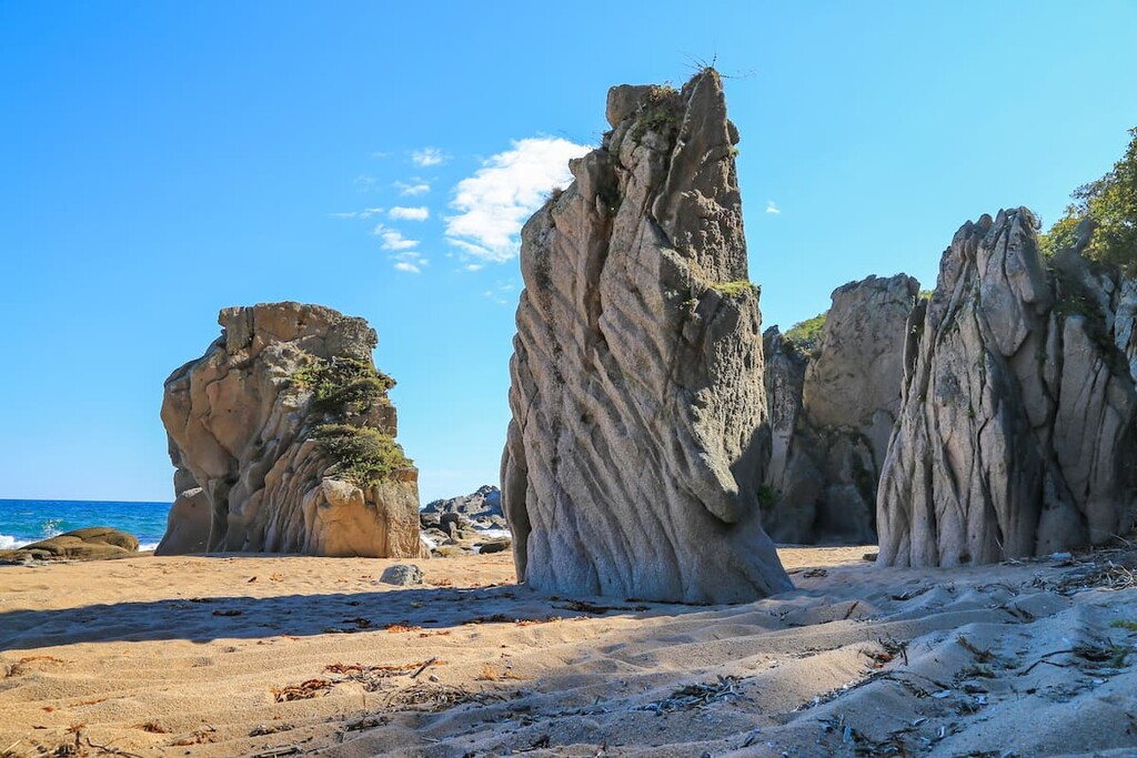
A bunch of bizarre rocks are strewn on an area of 36 sq. km. near Chistovodnoye Village in the Lazovsky District. These natural stones were named for their amazing shapes resembling huge prehistoric animals. According to the official version, the park was formed as a result of century-long weathering. However, the silhouettes of the boulders (dragons, dinosaurs, turtles, crocodiles, snake heads and even images of human faces) look so realistic that there are supporters of their man-made origin. Such fantastic theories suggest that the stones are the creation of an ancient human civilisation or have even perhaps been planted here by aliens. At the foot of the Dragons’ Park, travellers see two paths. One leads to the park itself and the other to a radon spring.
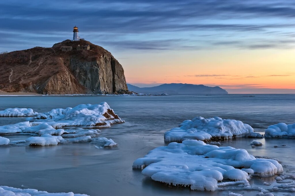
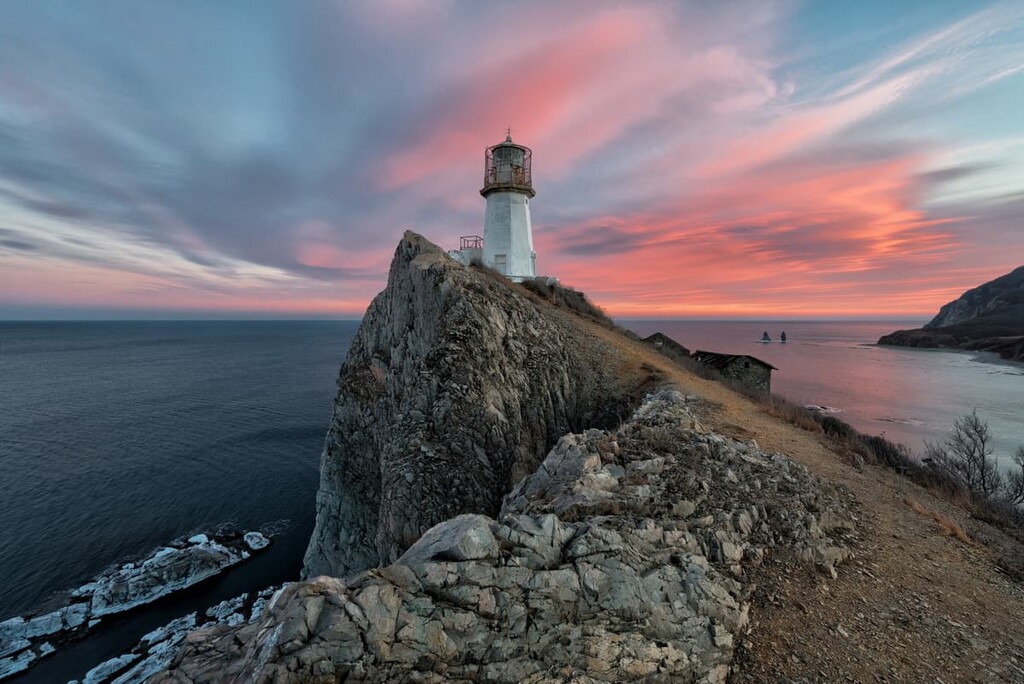
The Two Brothers Rocks are one of the most famous places in the Far East. They used to be featured on the Russian banknote until 1997. Two cliffs are 130 metres off the coast, they tower over the waters of the Sea of Japan in the Rudnaya Bay near the Briner’s Cape. Those tall rocks are thought to be about 60 million years old.
On top of the Briner’s Cape there is a lighthouse. This white stone tower was built in 1950 and now is featured on many photos of the region.
Nestled on the ridges and hills, Primorye offers ample opportunities for breathtaking rides down local ski slopes. There are only two skiing slopes in Vladivostok - Kometa and Lesnaya Polyana (Forest Glade). However, moving farther from the city, and you can find a ski resort for all tastes, because the choice is already much greater:
The nature here is unique, but it is also a tidbit for hunters, poachers and loggers. Because of this, large areas of Primorsky Territory are under protection. If you want to visit these places, you'll need to obtain a visitor's permit beforehand.
Six nature reserves are located here:
There are four national parks: the Call of the Tiger, the Udeghe Legend, the Land of the Leopard, the Bikin, the Khasansky National Nature Park. Also, Primorye hosts thirty wildlife sanctuaries.
Even though Primorsky Territory is not so rich in islands as the nearby Sakhalin Region, it can still boast of a few beauties.
Putyatin Island can be found in the Peter the Great Gulf. It is connected to the mainland by a ferry. It reveals to a lucky traveler its picturesque bays and sandy beaches, springs with drinking water, rocks with strange shapes, historical monuments. In the warm season, the Goose Lake allows you to enjoy the beautiful picture of the Red-Book lotuses blooming on it.
On the south of Russky Island, travelers can visit the Voroshilov Battery, built in the 1930s to defend the land against enemy naval attacks. Nestled in the lowlands between the hills, the two turrets with guns are camouflaged so that they cannot be seen from the sea. Under the turrets, there are multi-storeyed underground bunkers, designed to withstand very powerful bombs. The battery has now been decommissioned, and houses a museum.
Vladivostok is the capital of Primorye and the south-eastern extreme point of Russia. Today, the city is connected to Russia and other countries by rail, sea, road and air. Direct air links connect the city to China, Japan, the United States, Thailand, South Korea, Uzbekistan and many Russian cities.
It takes just a few hours by bus to get here from China, and a couple of hours by flight from Seoul, the capital of South Korea.
Planes arrive at the current airport Knevichi, which is located 40 km from Vladivostok. Buses, aeroexpress trains and, of course, taxis run between the airport and the Vladivostok city centre.
Vladivostok is the terminus of the Trans-Siberian Railway. Sometimes adventurous people choose to take a week-long train ride from Moscow to Primorye’s capital. The train arrives at the train station located in the centre of the city, near the main square.
Water transport is available from Popov Island, Slavyanka, and Peschany (Sandy) Peninsula. It is also possible to reach Vladivostok by ferry from Seoul, it will take just 1 day. In this case, the water transport will arrive at the sea terminal, also located in the city centre.
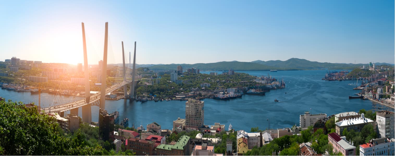
Vladivostok is situated on the coast of the Sea of Japan. You can see Peter the Great Bay from practically anywhere in the city. Due to this abundance of sea water, it is very humid here. This coupled with strong winds blowing almost constantly makes your walking adventures rather invigorating. You have to be prepared for the weather to be completely unpredictable.
Founded in 1860 as a fortress, Vladivostok is still a stronghold for the navy, and one of the largest ports in the Far East. In its time, it was the most fortified and protected fortress which included about 122 facilities.
The name "Vladivostok" combines two words - "to possess" and "east". There is also an unofficial Chinese name which means "the sea cucumber bay" in translation. As to the Japanese language, in ancient times, the territory was dubbed "the Salt Bay".
Vladivostok's original development, nature and culture attract many visitors from other countries. The city is spread over several hills, so it is worth having comfortable shoes for walking, let alone hiking in the city’s vicinity. Alternatively, you can take a leisurely sightseeing ride on Vladivostok's funicular. It is located on the slope of the Orlinaya (Eagle Nest) Hill. It is the only cable car in Russia that operates as public transport.
The city's trademarks are:
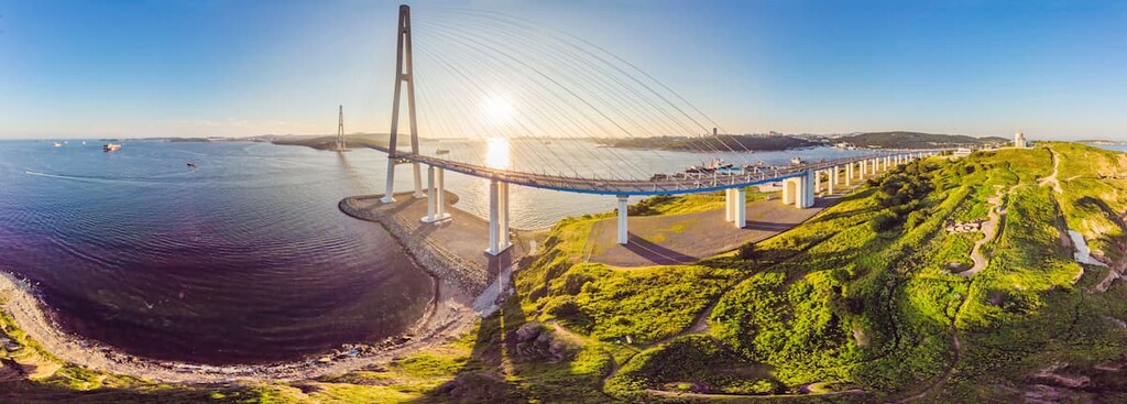
Russky Island is connected to Vladivostok by a modern cable-braced bridge. There are recreation camps, comfortable beaches, cultural and entertainment facilities situated on the island. The sea aquarium and dolphin aquarium are quite popular here. Around the sites, there's a park, a beach, and cafes. It is a very popular place for families who usually spend the whole day on the island.
One of the bays of the Sea of Japan hosts the oldest lighthouse in the region, the Egerscheld Lighthouse. It has been in operation for more than 200 years.
The highest point of the city is Orlinaya (Eagle Nest) Hill with a TV tower and an observation platform at the top.
There are parks and protected areas in the city and its suburbs:
Cultural sites include:
There are historical, art and specialized museums in the city. The famous Mariinsky Theatre from Saint Petersburg opened a branch in Vladivostok. It is called Mariinsky Theatre Primorskaya Stage.
Tell us about your adventures in Primorye, we appreciate your feedback! Send it to


Yes. Primorsky Krai has 1,437 named mountains. The highest is Gora Oblachnaya at 1,860 m.
The highest mountain in Primorsky Krai is Gora Oblachnaya, at 1,860 m.
Primorsky Krai has 1,437 named mountains.


