
Scan the QR code and open PeakVisor on your phone
Nestled among the sands and mountains in the very heart of Central Asia, Uzbekistan is a country with ancient original traditions, fascinating architecture, and gastronomic delights.
Uzbekistan has a rich historical heritage. Its origins go back to ancient times. Dwellings of primitive peoples of very early periods and even the burial of a Neanderthal child have been found here. There have even been found dinosaur footprints in the Hissar Range, which, according to scientists, are over 75 million years old.
Uzbekistan’s history is rich in military escapades and cultural exchanges. The territory was subject to China’s expansion which sought to take control over the Great Silk Road that was passing through Uzbekistan’s area. The early state was captured by the Turki, then it was conquered by the Arabs, later it was under Genghis Khan’s rule. The land has survived the invasion of the nomads who called themselves Uzbeks, whose ancestors were the Sogdians, the Chorasmians (aka Khwarazmians), the Bactrians, the Ferganians and the Sako-Massaghetians. The Uzbeks came to stay, they later joined the Russian Empire and then the Soviet Union only to be separated almost 70 years later. The Republic of Uzbekistan received its independence on August 31, 1991.
The name "Uzbekistan" was formed by the combination of the word "Uzbeks" and the word -stan, which is translated from Iranian as "country". The meaning of the word uzbek is still a subject of heated debates with the prevailing theories claiming it is translated as "a master of oneself" or "your own master”.
The territory of modern Uzbekistan is 448,924 sq. km., which is approximately the same as the total area of Sweden, or Morocco, or Iraque. The population is 33,570,609 people as of 2020. It borders Afghanistan on the south, Tajikistan on the southeast, Kyrgyzstan on the east, Turkmenistan on the southwest and south, and Kazakhstan on the northeast, north and northwest. And the northern border runs along the middle of the former lake called the Aral Sea, now a dried up part of the sea also known as the Large or the South Aral Sea.

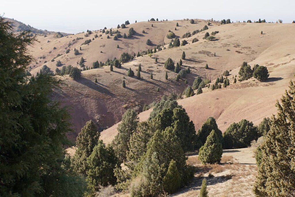
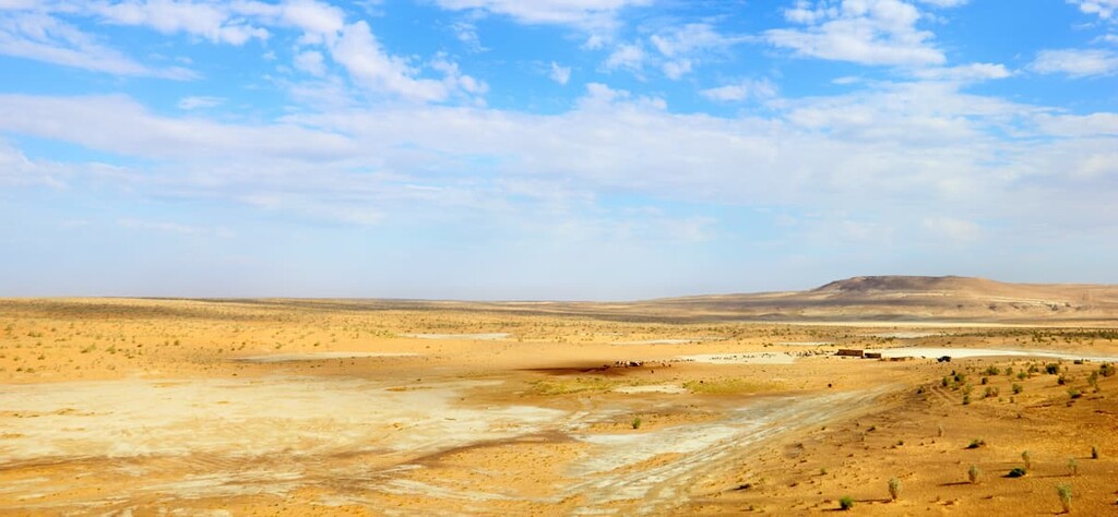
The terrain of the republic is diverse with large areas hostile to man and not suitable for life. Deserts alone occupy about 80% of Uzbekistan: the Aralkum Desert is in the northwest of the region and the Kyzylkum Desert sits comfortably in the center of the republic. The area of mountainous areas of the country is 96,000 sq. km, which is 21.3% of the total territory. More than 2 million people live in the mountainous regions of Uzbekistan, which is about 7% of the country's population. Major urban areas of Uzbekistan, which are the centre of life, are situated in the valleys of the Syr Darya and Amu Darya rivers. By the way, the Syr Darya is the longest river in Central Asia - its length is more than 2,200 km.
From the east, Uzbekistan's territory is protected from cold winds by the Tien Shan Mountains and the Hissar, the Zeravshan, and the Turkestan ranges.

A large freshwater lake Aidarkul (3,000 sq.km.) is located in the north-east of the republic. There is also a water reservoir in the region, which is part of the Aidar-Arnasai system of lakes.

Despite the large desert expanses, the vegetation of Uzbekistan is extremely diverse. There are about 3,700 species of plants. Of these, 20 percent are endemics found mainly in the mountains.
Lowlands are lavishly green with trees, shrubs and grasses. The main crop is the Zarafshan juniper which is considered a very valuable tree species.
Deciduous trees e.g. pistachio, walnut, birch, maple, hawthorn, wild apple, willow, poplar, magalebka cherry are also common here. Among the shrubs there are barberry, honeysuckle, thickets of wild vines, meadowsweet and rose hips. Herbs and grasses also enjoy an excellent variety: you can see dock, tulip, ziziphora, rhubarb, sage, Pskem onion. By the way, the latter is a medicinal plant.
Middle highlands are represented by shrubs, the higher you go, the skinter is the vegetation. At higher altitudes only tipchak (Festúca valesiáca) survives.
The vegetation in the deserts is diverse as well. There are not only lifeless piles of sand with cacti and thorns in the Uzbek deserts. Local flora is mind-blowing, especially if you visit the sands in the spring. Just imagine the fields of bright flowers (usually poppies, tulips) that disappear in the distance. It is a breathtaking sight.
The animal world of Uzbekistan is rich as well. There are 97 species of mammals, 579 species of birds, 132 species of reptiles, 2 amphibian species and countless different species of insects. The reservoirs are inhabited by 70 species of fish e.g. catfish, pike, perch, snakehead, Aral salmon, Amu Darya trout, pike, carp, common carp, grass carp and others. Among mammals inhabiting Uzbekistan are Bukhara deer, silverback jackal (Canis mesomelas), wild boar, leopard, snow leopard, goitered aka Persian gazelle (Gazella subgutturosa), bear, ibex, mountain sheep, fox, corsac aka dog fox, and others. Some endangered species are included in the Red Book. One of such representatives protected by the state is the goitered gazelle.
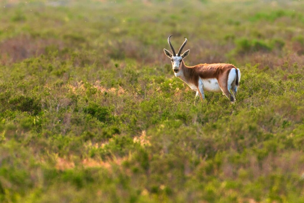
The goitered gazelle (Gazella subgutturosa) is a graceful but rather timid member of the gazelle family. There is a very low chance of bumping into it on your route, as it typically lives in deserts and semi-deserts with really sparse vegetation and shies away at the sight of any human. This gazell can also dwell on stony, clayey, and sandy terrain. It inhabits foothills and may ascend even higher, but it is not found very high in mountains. In the areas where snow falls in winter, the animal migrates to the south, to areas with little snow.
Back in the Sovet days in the mid-1970s, there was a state programme meant to protect this beautiful species. There were plans to establish 13 breeding centers for these rare animals in the republics where the species lived, namely Georgia, Tajikistan, Uzbekistan, Turkmenistan, and Azerbaijan. As a result, 7 nurseries were created, and only one remains to date - the nursery of the Jeyran Center (jeyran is the local name for the goitered gazelle). It is located in the south-west of the Kyzylkum Desert , 42 km from Bukhara between Kagan and Karulbazar.
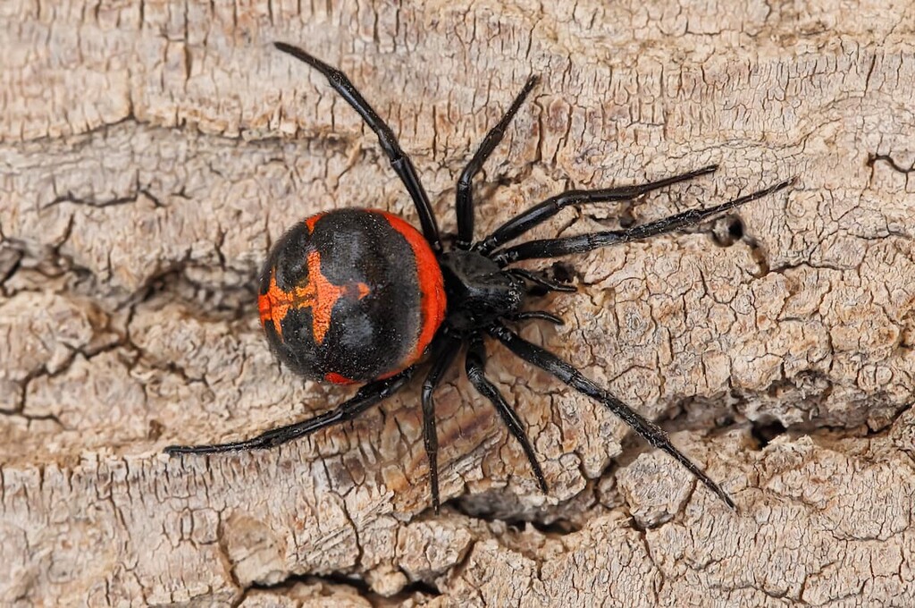
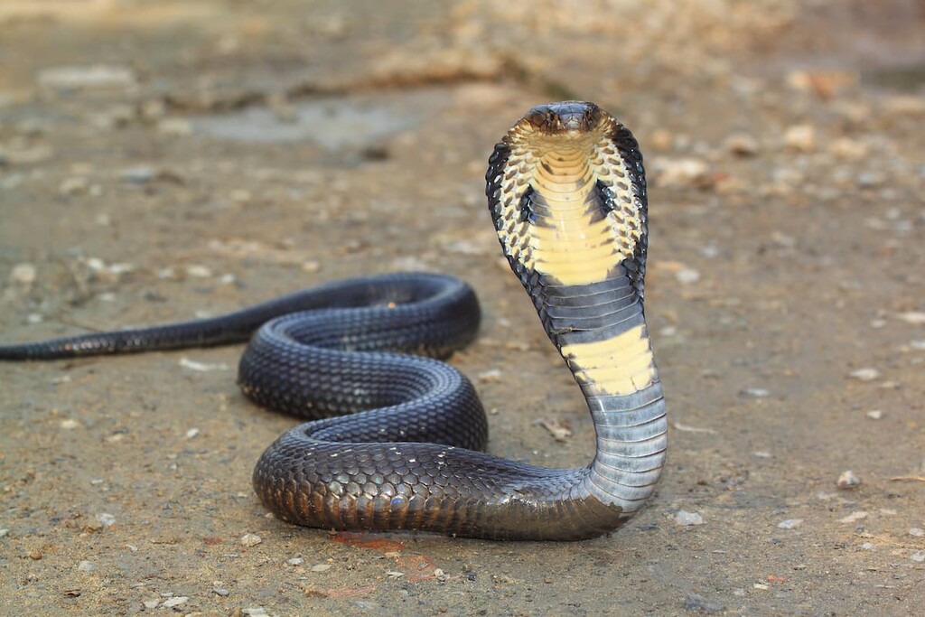
Uzbekistan is home to many poisonous spiders and snakes. What representatives of the local fauna are better to be avoided? The top gun is caracourt (or black widow) among the spiders and carpet viper (Echis carinatus) among the snakes.
Other arthropods you wouldn’t like to cross paths with include scorpions, ticks, hayflies, spiders and others.
The caracourt or black widow is considered the most dangerous since its venom is about 15 times more toxic than that of a rattlesnake. It received its second name erroneously for the fact that the female destroys the male after coitus, which was established in the labs, but rarely seen in the wild. Recent studies have shown that the female spider is very hungry after love making and eats anything within its reach. In the confinement of a lab cell it is no wonder that the only thing she can eat is the partner who cannot escape like he does in the wild. Anyway, it is important to know what they look like in order to avoid them or to shake them off in time.
Uzbekistan is home to 38 species of snakes, 5 of which are poisonous: Central Asian cobra, blunt-nosed viper, carpet viper, moccasin, eastern steppe viper (Vipera ursini renardinii).
Snakes pose a real danger to tourists. They are unlikely to attack during the daytime when they hide from the heat in crevices of rocks and all kinds of piles of stones unless they are bothered by a man. But at night snakes are often attracted by the light and the heat from the campfire, so be extra vigilant and careful.
When traveling in dangerous areas, you should have high boots and pants that are rather loose and not go too tight around the legs. If you wear boots, pants should be tucked into them with some overlap. Thick woolen socks provide additional protection against snakebite. Before examining the crevices in the rocks with your hands, you must first check them with a stick to see if there are any poisonous snakes.
Knowing the habits of snakes will help to save life in an emergency situation. Thus, the threat posture of
Because of the rapid development of the toxic effect, first self- and mutual aid measures are of great importance. It is important to suck the venom out of the wound as quickly as possible, spitting it out constantly. To do this, squeeze the tissue surrounding the wound, suck the blood and venom it out, quickly spit out the extracted liquid. Continue this procedure for 15 - 20 minutes. Don't suck venom if you have fissures, sores or wounds on your lips and in the mouth. It has been found that suction removes from 28% to 46% of all poison introduced into the body. However, you should be aware that this measure is only effective for the first 20-30 minutes!
Then the bite site should be treated with antiseptic and an aseptic dressing should be applied.
After sucking the venom, and sanitising the wound, immobilize the bitten limb of the victim, and better the whole body of the person. Do not apply any tourniquet (strap) under any circumstances. It is recommended to drink plenty of liquids (water, tea and even broth). It is better to refrain from coffee as it has a stimulating effect. You will also need to give up alcohol, so as not to increase the effect of the poison. To slow down the absorption of poison, put some cold cloth to the bite site. The victim after a snake bite should be taken to the hospital as soon as possible, preferably transporting in a lying position.
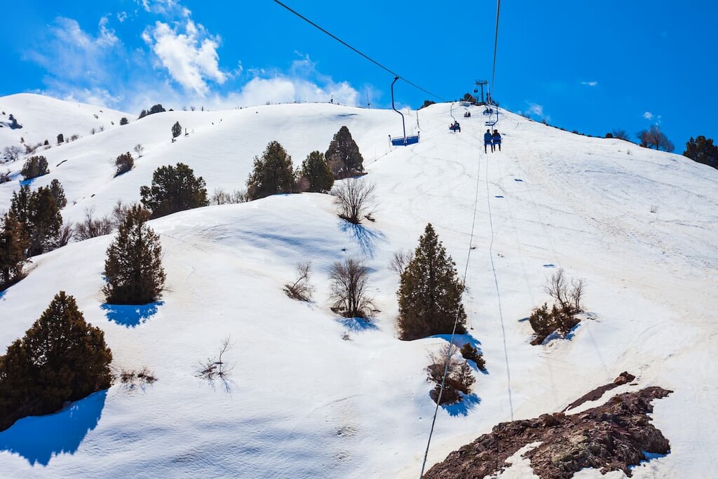
The climate is very pleasing and is often considered one of its attractions, allowing the country to welcome visitors at any time of the year. The best time to visit the country is the spring (March to May) and the autumn, the so-called mellow season (September and October). But for lovers of peaks and alpine skiing the winter in Uzbekistan will also be a pleasure.
The climate is characterized as sharply continental. Summers here are hot and dry, with little precipitation and a great difference in daily temperatures. And it lasts for six months. Such weather conditions contributed to most flat areas of the country becoming deserts.
The mountains located in the east of Uzbekistan receive most of the rainfall.
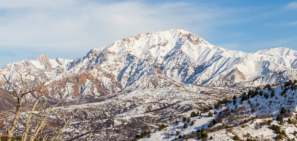
Winter is very short, from mid-December to February. There is rain with cold winds, fog, and even snow. It is during this period that most of the precipitation falls. Snow falls quite rarely and does not stay for long - it melts away in a day or two. But not in the mountains! At the summits, there is snow cover lasting for months, which makes fans of mountain skiing and snowboarding very happy. The average monthly temperature in January ranges from +4°C (39F) in the south to -10°C (14F) in the north of the region, with an absolute low of -38°C (-36F). If there are cold days, do not get upset, they may change sharply to warmer, clearer and sunnier ones. In the deserts, however, nighttime frosts can reach -30°C (-22F).
Since spring is very early, summer in the country starts in May. The weather is warm and sunny until early November with very rare precipitation. The average monthly temperature in June is +27° C (81F), with daytime temperatures of 41 - 45°C (106 - 113F). If the temperature rises above +35°C (95F), you must be careful not to get heat and sunstroke. You should remember to wear a hat and use a high SPF cream, and on hot afternoons it is best to avoid the sun.
Uzbekistan is a land of many wonders. There are many natural attractions: mountains and gorges, deserts, national parks and protected areas with natural monuments, lakes, caves and underground rivers. Just make a pick and you will get an unforgettable experience wherever you go.
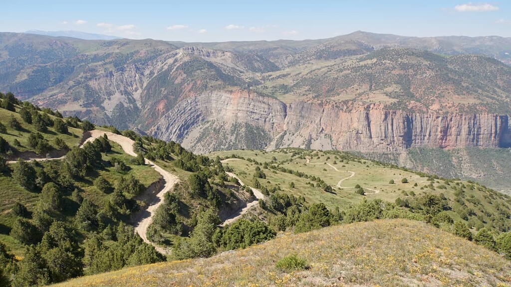
There are two giant mountain systems in the republic. These are the famous Tien Shan, viz. its Western (Chatkal Ridge) and South-Western regions, and a part of the Pamir-Alai, its Hissar-Alai section (Hissar, Turkestan, and Zeravshan Ranges). There are also separate massifs of old mountains that do not belong to the aforementioned biggies:
Such remnants are a visible evidence of the passage of time because once there used to be very high peaks, but the wind and water have changed the relief beyond recognition.
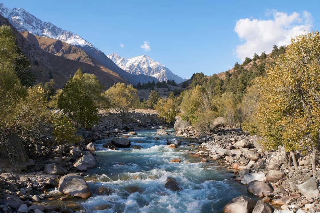
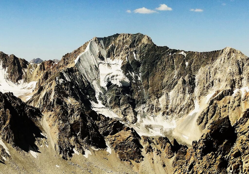
The Tien Shan aka the Heavenly Mountains is one of the highest mountain systems in the world. It is second, perhaps, only to the Pamir. Those brave enough to dare climb the peaks can enjoy truly incredible scenery: rushing waterfalls, lavish meadows, Martian-like deserts and endless steppes at the foot of the steep ranges. The high mountains are covered by glaciers which are the source of freshwater for the local inhabitants. Unfortunately, in recent years, there has been a significant decrease in the area of the glacier cover.
The Tien Shan Range also known as the Tengri Tagh or Tengir-Too (in China) is 2.5 thousand kilometers long and has its peaks on the territory of several countries: China, Uzbekistan, Kyrgyzstan, Kazakhstan and Tajikistan. The Tien Shan has over 30 peaks that are over 6,000 meters high. The highest point is Pobeda Peak (7,439 m), located on the border of Kyrgyzstan and China. The runner-up in popularity is Khan-Tengri (6,995) also known as the Bloody Mountain because this almost regular pyramid colours in red at sunset and because it is the most northern seven-thousander. Nestled among the Tien Shan Mountains are the ice-free Lake Issyk-Kul and Lake Tyanchi.
Lake Issyk-Kul
The ranges of the Western Tien Shan - the Karatau, Talas Ala-Too, Chatkal, Pskem and Ugam - begin in Kyrgyzstan and end in the Tashkent region of Uzbekistan. This popular tourist destination is accessible both from Kyrgyzstan and from Tashkent, the capital of Uzbekistan. The southern and southwestern border of the Tien Shan, the Fergana Ridge, frames the Fergana Valley.
The best time for travel is considered the period from May to October. However, when preparing you should keep in mind that due to the melting of the glaciers, some routes have gradually become easier, while others are more difficult and dangerous to overcome.
The Chatkal Range which crosses Russia, Kazakhstan, Kyrgyzstan and Uzbekistan is the most western branch of the Tien Shan mountain system. The main peaks of this ridge are just a little above 3000m, and among them are Big Chimgan, Kyzylnura, Babaytag, Karakush and also Chatkal peak which, in fact, lies in the territory of Kyrgyzstan. Snow does not thaw from November to March in these mountains.
Just a 2-hour drive from the Uzbek capital will take you to holiday camps Chimghan and Beldersay with cable ways and Yangiabad camping site on the Chatkal southern slopes. In spring and autumn the Chatkal Range attracts climbers and mountaineers who not only climb the mountain routes of different degrees of complеxity but also make a multi-day trekking to the mysterious Pulatkhan Plateau. It is quite common to come across prehistoric petroglyphs in the Chatkal, the most famous of which are the Beldersay ones.
Adelunga peak (4,301m) is the highest peak of the Pskem Range of the Western Tien Shan and is the highest point of the massif. The peak was named after Alexei Adelung, a geologist who explored the Chatkal and Kuramin mountain ranges of the Western Tien-Shan.
Mount Beshtor / Beshtar (4,299m) is just 2 meters shy of Adelunga, it is the second highest peak of the Pskem Range. Before the discovery of Adelunga, Beshtor was considered the main peak of the range. The mountains are located not far from each other, but the confusion was caused by too small a difference in altitude. The difficulty category is 3B, which requires serious preparation from the climbers.
Big Chimgan (3,309m) used to be the highest point of Uzbekistan before Khazret-Sultan Peak (4,643m) was climbed. There is a cross on the very top. Triangulation mark is located 34 meters below. For the summit to be considered conquered, it is enough to reach it, further ascent is too dangerous for life.
Big Chimgan can serve as a training ground for practicing tactics for climbing higher snowy peaks. For instance, if you are planning to climb Lenin Peak (7,134m) in summer, test yourself on Big Chimgan in winter. As the routes here range from 1B to 4B, Chimgan is well known as a cradle for many athletes because all the necessary ascents up to the first degree of mountaineering can be done here.
Climbing some of the mountaineering routes (e.g. 1B on the west ridge, "Hare Ears", "Iron", Zhukov Route, etc.) are feasible in one day. Others require time to approach. Certainly, it is better to arrive in advance for acclimatization. Some people prefer to cover three peaks at once: Chimgan - Kichkina (Chilanzarchouki) - Okhotnichy Peak (Aukashka) by traverse 3A.
Big Chimgan is a very visited place. It is close to the capital, the mountain is actually visible from Tashkent. For the climbers of Uzbekistan, this place is convenient logistically on the one hand, and on the other hand, it is iconic. That is why there are many memorials here. If you climb the western ridge, at an altitude of just over 3000 meters is a grotto with memorial plaques to the climbers from Uzbekistan who died in the mountains. Up to the grotto, the route is quite simple, but after it begins the way which is inconceivable without special equipment.
At the foot of the peak, there is a ski resort which was not professionally maintained from 2005 to 2011, but now they are being groomed again and made fit for skiing competitions and even the championship of Uzbekistan. Due to its location on the northern slopes of the mountain, the skiing season here is long.
South-southwest of Big Chimgan is the second highest peak of the Chatkal Range - Kyzylnura / Kyzyl Nura (3,267 m). The name of the peak means Red Ray in Uzbek, which is due to peculiar geological features of the peak. It is composed of red granite and when the stone is not covered with snow, which usually happens in August and September, the peak becomes very red at sunset thus standing out against the background of other mountains. This phenomenon can also be observed directly from Tashkent, if you look east from the city center.
The Chatkal State Biosphere Reserve is located on the southwestern slopes. When you climb Kyzylnura, your final point of the route is most likely to be Yangiabad, the town where the road to Babaytag begins.
The highest point of the mountain ridge of the same name is Babaytag (3,555m). The ridge belongs to the Chatkal Range of the Western Tien Shan and is located in the Tashkent Region (called viloyat), near the towns of Angren and Yangiabad. The village of Ertash is optimal for the set off, although if you follow the course of the creek Dzhakindek and through the Kattachon Ridge, it is possible to start the journey from Yangiabad.

Aktash (3,369m) is the highest mountain of the Koksu Range, a spur of the Western Tien Shan. It is located in the Tashkent Region, on the border with Tajikistan.
The Pulatkhan Plateau is quite an expansive area of about 8 sq.km and a maximum height of 2823 m. It is basically a table mountain with a cut-off top. Pulatkhan is situated 11 km to the south-east from Big Chimgan and is a part of the Chatkal Range.
One of the routes to the summit is suitable for tourists without any special training and equipment but they must be physically fit people. In the old days, in case of military danger during the wars, the local nobility lived here, shepherds brought here their flocks of goats and sheep, and a small garrison could guard the entrance to the plateau for as long as it was desired. The people felt comfortable enough in the evacuation: goats provided them with food and springs gave fresh water.
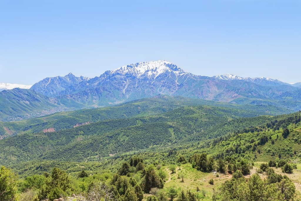
In the southern part of Uzbekistan there is the country’s high-mountainous region – the Hissar Range, aka Hissor or Gissar. The major part of this mountain system is located in Tajikistan, but its highest point, found right on the border of these states, is the highest peak (4,643 m) of Uzbekistan. The landscape type changes from east to west – hilly slopes gradually transform into colossal rock massifs.
Khazret-Sultan Peak (4,643m) is the main peak of Uzbekistan. It belongs to the Hissar Range, part of the Pamir-Alay mountain system. The first assumed ascent happened in 1961, and as it were the Soviet times, the peak was dubbed Peak of the XXII Party Congress, but this name was abolished when Uzbekistan gained independence, there is no documentary evidence of the conquest left, as well as no assurance that this was the same peak.
In 2010, a group of climbers from Uzbekistan made an official ascent to the then unnamed peak. They found traces of other climbers there - an Englishman and his guide from Tajikistan. In the conditions in which the ascent took place, the climbers classified the route as 3A, but it is possible that in another season, when there is less snow, it may be more difficult
After the ascent, the peak was given the name Khazret-Sultan - the name of Khoja Ahmed Yasawi, a Sufi poet, philosopher, Islamic saint and the founder of the Yasawiya school of Sufism. Khazret-Sultan's biography is not connected with the territory of modern Uzbekistan: he was born, lived and died in Kazakhstan in the 12th century. But he lived in the state of the Karhanids, the capital of which was Samarkand.
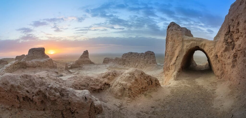
The Kyzylkum Desert is located on the territory of Uzbekistan, Kazakhstan and Turkmenistan. Covering a vast area of 300 000 km, it is one of the largest in Central Asia. The desert is bounded by rivers Amu Darya and Syr Darya, the Aral Sea and the Tien Shan Mountains.
Do not think that the desert is just a lifeless expanse of sand. There are many interesting things here: salty lakes and beautiful landscapes of multicoloured fields, hot radon springs, remains of extinct animals and ancient rock paintings, castles of ancient Khorezm, the ancient settlements of Toprak-Kala and Kyzyl-Kala. There are yurt camps where campers of jeep tours usually make stops. Here you can also take a ride on a camel.
The snow and peaks of the Tien Shan, with their dizzying descents and spectacular views, attract fans of mountain skiing and snowboarding to Uzbekistan in winter. The popular ski resorts are:
The importance of protected areas in Uzbekistan can be hardly overestimated. With the country’s fragile ecosystem and hostile climate, it is crucial to preserve the flora and fauna of the area. Unfortunately, during the turbulent 1990s, many nature reserves have been abolished. At present, seven reserves are active:
On the premise of the abolished Baday-Tugay State Reserve and additional land areas of the Amudarya and Beruni districts of Karakalpakstan, the Lower Amudarya State Biosphere Reserve was established in 2013.
Kyzylkum and Sukhan reserves are also popular. There are also hunting farms in Uzbekistan. There are two national parks - the Ugam-Chatkal Park, Zaamin National Park - and 12 wildlife sanctuaries.
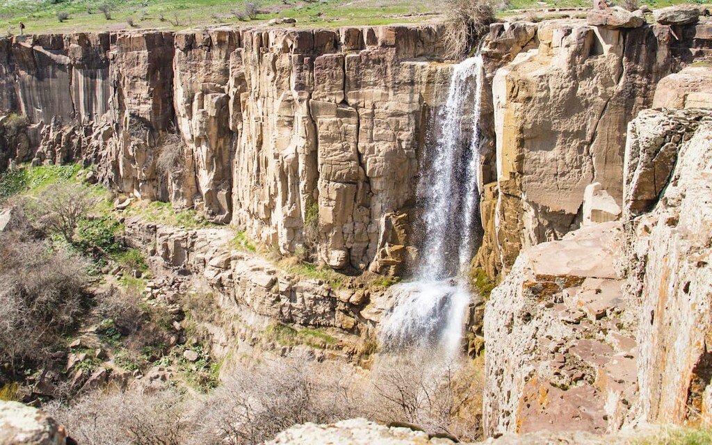
Uzbekistan is not deserts alone. There are rivers, lakes, and even waterfalls. Most waterfalls are located in very remote places, all you need is astounding stamina and burning desire to climb up the mountain slopes to get there. Another prerequisite is a visitor’s permit because many natural wonders are located in the national parks or close to the state border.
The most famous waterfalls are the Chukuraksu, Tavaksai, Kulasia, Sangardak, Paltu Valley waterfall and others.
Located in the Eastern Tien Shan, the Tavaksai Waterfall is also known as the Valley of Waterfalls because it is actually not one, but six consecutive waterfalls located on a stream (sai in the Uzbek language) in a small canyon 40-80 minutes from Tashkent, depending on the means of transport you take. You can get there by public transport (one-way trip is 0.6USD), a taxi (1.2USD one way) or a minivan booked for small tourist groups (these are not the regular travel agents, but the locals who gather together in Facebook or Telegram just to do a short hike).
The route is easily accessible to people of all ages, there are no sudden drops in elevation and precipices where you need to be in good physical shape. The difficulty of the ascent is felt only in the last 500 meters of the route, as you need to climb the mountain to get to the canyon. As to the permit, the Tavaksai is officially close to the state border thus there is a permit required, you can get it in the local OVIR, but the procedure is long and tangled. However, the place is so popular with the locals who flock here on the weekends that the border guards do not care for checking the permits. Just have your passport and its copy with you when you travel to the Tavaksai.
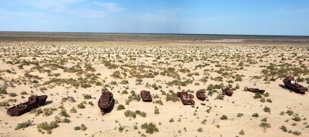
The Aral Sea is a misnomer just like the Caspian Sea in Dagestan. It is actually a giant inland lake of amazing natural beauty. Who would have thought that only 60 years ago ships sailed on it, and there were ports and fishing farms along its shores. At the time, it was considered the fourth largest lake on the planet after the Caspian Sea (still the biggest), Lake Superior, and Lake Victoria. By the way, Lake Baikal in Buryatia now is in the 7th place. But in the Soviet times, Uzbekistan began actively developing agriculture, and the construction of irrigation canals went on a massive scale. As a result, the Aral Sea got shallow to an alarming state. On a good side, a drastic shoaling of the lake exposed bizarrely shaped rocky outcrops, as well as sunken ships.
The Aral Sea is a perfect showcase of short-sighted human exploitation of nature. Since the 1960s, water volume has been reduced by a factor of fourteen. In 1983, more than 20 different fish species were declared extinct and by 1987, the lake had split into two separate parts.

No rivers flow out of the Aral Sea; water disappears through evaporation. Before construction of the excessive irrigation systems, water level used to be kept stable by inflow from Amu Darya and Syr Darya. With the disappearance of rivers flowing into the Aral Sea area, drinking water is a highly valuable resource. Also, as human use of river water has increased, the water has been getting more and more salinated. Salt concentration has increased tenfold and local groundwater has a salt concentration reaching 6 g/L. This is six times higher than the concentration considered safe by WHO.
If that weren’t grim enough, the rate of dust deposition is among the highest in the world and contains large amounts of salts and pesticides, probably related to the water quality in the tributary rivers.
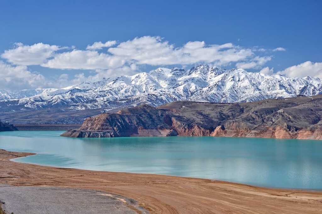
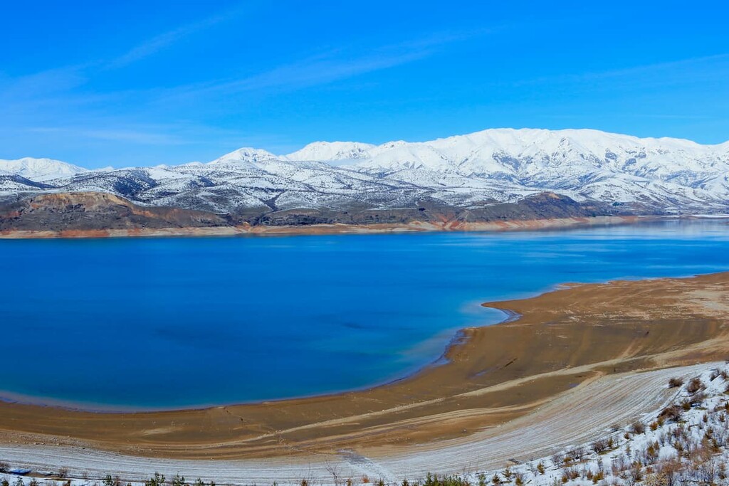
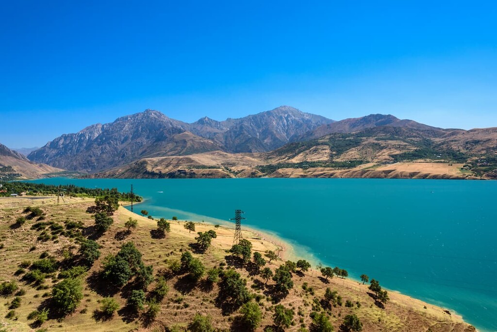
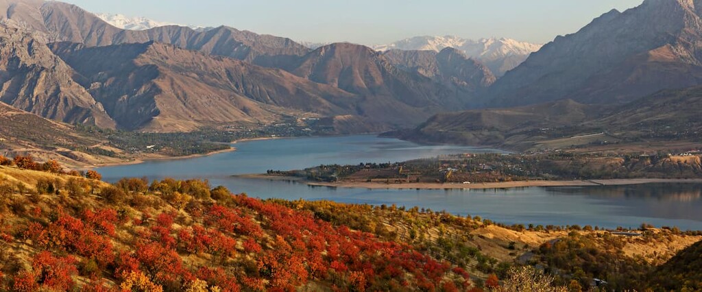
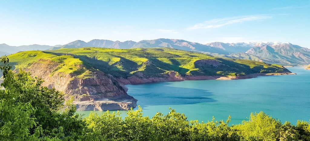
Lake Charvak is a picturesque artificial reservoir. Its azure waters can be seen rolling leisurely among the mounts of the Western Tien Shan. From the shores of the reservoir, you can enjoy gorgeous views of the Big and Little Chimgan, as well as the peaks of the Chatkal and Ugam Ridges.
The cities of Bukhara and Samarkand, Khiva and Fergana are the true gems of medieval architecture, they witnessed important events in the history of Uzbekistan and have well-preserved millenia-old sites. In the vicinity of Samarkand, there is the ancient Ulugbek Observatory, which has become one of the main attractions of the region. The most ancient archeological monument in Bukhara is the grandiose Ark fortress. And it is not the only one in Uzbekistan. In Khiva you can visit the Ichan-Kala fortress with a huge fortress wall, with towers and secret passages.
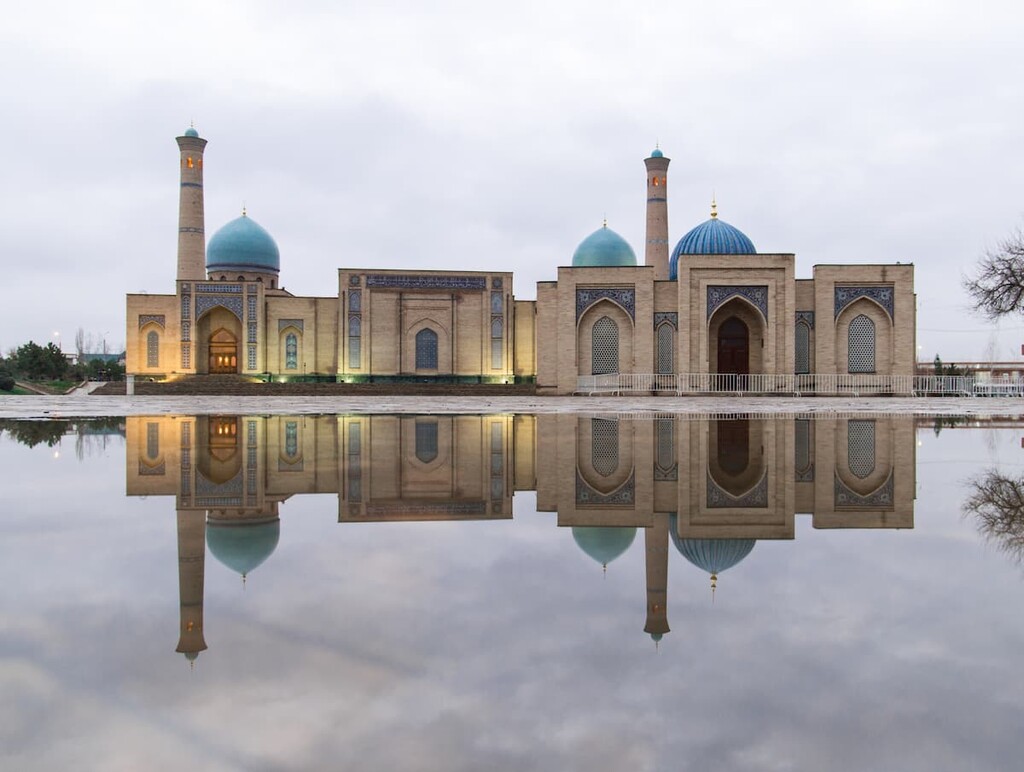
But the perfect place to start your exploration of the country is definitely Tashkent, the capital of Uzbekistan.
As the capital, Tashkent has an international airport and rail service. The air hub receives direct flights from many countries around the world: Russia, Germany, Turkey, UAE, South Korea, Egypt, Belarus and others. All it takes is just 15 minutes to get from the airport to the city center by bus.
Tashkent airport also services domestic flights, but sometimes it is faster to get around by train, especially if it is Afrosiyob express.
In 2009, Uzbek President Islam Karimov went to Spain and bought two high-speed trains there for €38 million. The train was named "Afrosiyob" and has nothing to do with Africa. Afrosiyob is the ruins of an ancient settlement that served as the basis for the present-day Samarkand. These ruins got their name in honour of King Turan Afrasiab, one of the legendary heroes.
Afrosiyob was launched on the route Tashkent-Samarkand-Bukhara, and since then the life of the tourist has become easier, to the rightful indignation of local cab drivers because it takes just 90 minutes or so from Samarkand to Bukhara, 2 hours from Tashkent to Samarkand and a bit under 4 hours from Tashkent to Bukhara. Mind you, if you want to see the schedule on the official website of Uzbek railroad, it will be half-Russian, half-English.

Tashkent is one of the largest megalopolises in Central Asia with almost 2.4mln people living in it (as of 2021).
The history of Tashkent is ancient. The first mention dates back to the Chinese source of the 2nd century BC. The settlement had a favorable location and was a stopover on the Great Silk Road that connected the Mediterranean region and China.
Nowadays the city is a keeper of culture and religion of many nations. It is full of historical sights:
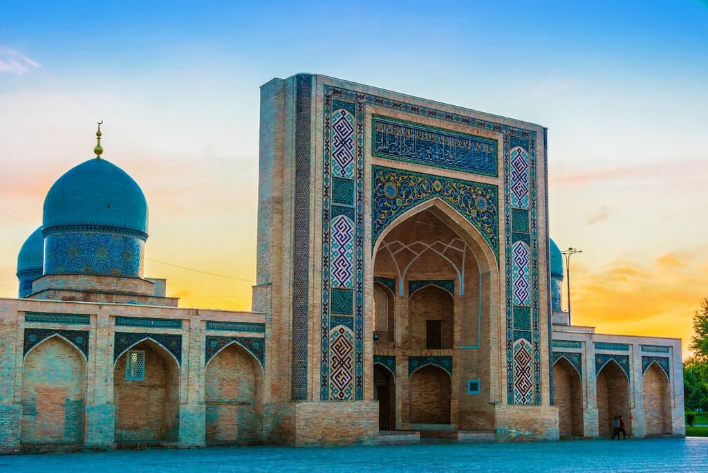
Modern Tashkent is no less fascinating.
One of the original attractions of the city is the subway. Its Oriental spirit and the amazingly skillful work of the best craftsmen made each subway station a unique work of art.
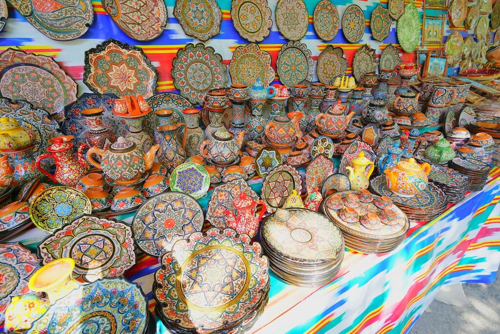
A favorite place for tourists is the Chorsu market. Under the high blue dome, you can buy souvenirs and national products, taste various local fruits, ripe or dried.
The festivities are usually held in the central square of Mustakillik. The square has a park area and fountains and is very crowded.
The Alisher Navoi Park covers about 60 ha. It enjoys lots of greenery, places to relax and entertainment facilities. Another recreational area in the city centre is the Japanese Garden. There is a traditional tea house, a pond with fish, many trees and flowers, birds are chirping merrily, this is a place of harmony and contemplation. The Japanese Garden is open 10 to 19 every day, make sure you take some lunch with you because there are no catering facilities on its territory.
There is a local Broadway which residents call Sayilgokh. It is a colorful street with cafes and stores, street dancers and magicians, artists and musicians. It connects two of the main and most beautiful squares of the capital: Mustakillik (Independence) Square and Amir Temur Square.
Tashkent has a zoo, a water park, ropeway and many other interesting places.
There is one more capital in Uzbekistan, this time a very ancient one. This is the mind-blowing Samarkand.
Once you step off the train, you get into an oriental fairy tale. The city’s ancient quarters are included in the UNESCO list of cultural heritage.
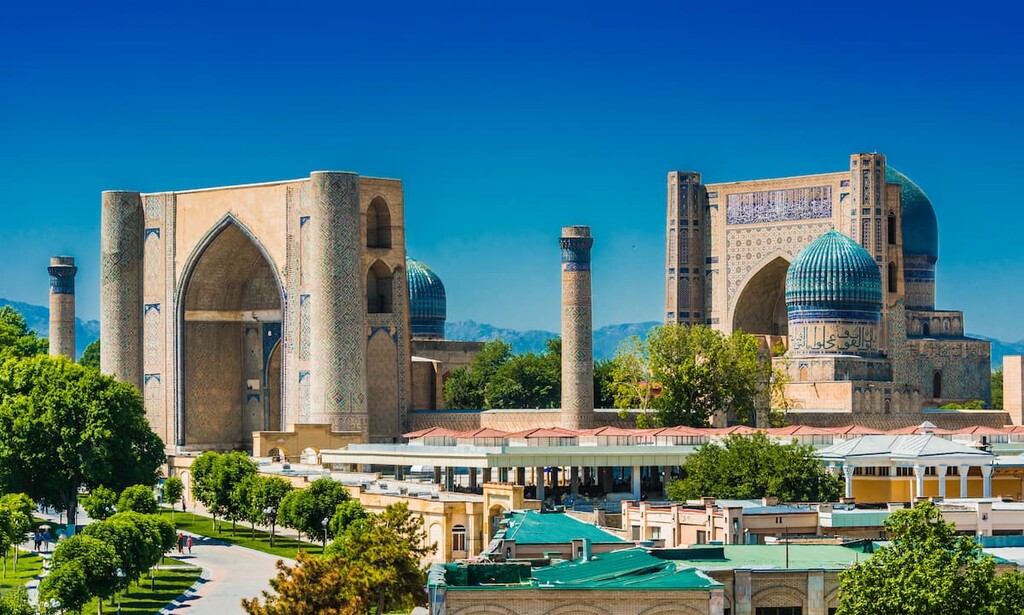
On Registan Square, there are three madrassahs (Muslim schools) - the Sherdor, Tillya-Kari, and Ulugbek.
The most outstanding architectural delights are the Ruhabad Mausoleum, and Gur-Emir Mausoleum, both located not far from Registan Square. The latter is one of the most famous tombs in the world.
After a walk through the quaint streets of Samarkand, you can visit the cathedral mosque Bibi-Khanim. This medieval building was built by Tamerlane's beloved wife as a gift to him.
The most famous market of the city is Siab oriental bazaar. You can read more about Samarkand in our article on the Zeravshan Range.
What draws hordes of tourists to Bukhara in the first place is the Old City. Its beauty is great and what is also heart-warming is that you don't need any transportation here, everything is within a walking distance. One of the most notable sights of the city is the Kalon Minaret built by the Karakhanid ruler Arslan-khan in 1127. According to a legend, the khan killed an imam and in a dream the murdered imam asked the ruler to bury his head in a place where no one could step on it. Arslan Khan then built a tower over the Imam's grave. The minaret is 47 m high and its ornamental strips are finished with blue tiles - it is believed to be the first use of such ceramics, which later became ubiquitous all through Central Asia.
The minaret is called the Tower of Death because convicted criminals were once executed by being thrown off it. And this practice was stopped only in the early 20th century.
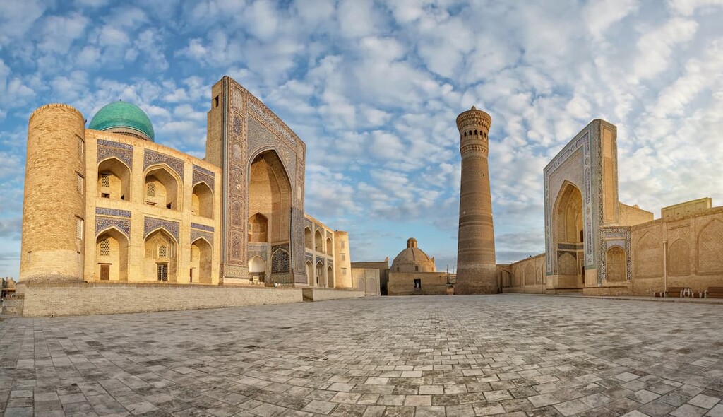
Summer residence of Bukhara emirs - the Ark Fortress - is located on Registan Square. Since ancient times, the Ark was a real fortress where the rulers of Bukhara could survive any siege. Everything necessary was located on the territory - palaces, temples, barracks, offices, warehouses, workshops, stables, as well as an arsenal and a prison. Today there is a museum in the citadel.
The Mausoleum of Ismael Samani was built during the lifetime of this ruler, one of the most prominent members of the dynasty who ruled Bukhara from 892 to 907. The mausoleum was originally intended as the tomb of Ismael's father, Ahmad, but later became a tomb for all members of the royal family. It is the oldest Muslim landmark in Bukhara and a true masterpiece of early Islamic architecture.
Labi Haus is considered the center of the Old City. This square has a name that means an ensemble by the pool in Persian. The rectangular pool is surrounded by three monumental 16th-century buildings: the Kukeldash Madrasah, built under Abdullah II (at the time of its construction, the largest Islamic educational institution in Central Asia); the Nadir-Divanbegi Madrasah, originally built as a caravanserai but converted into a college under Imam Kulimkhan; and the Nadir-Devanbegi Winter Mosque. Near all this is a wonderfully preserved Toki Zargaron market.
In addition to those described above, architectural monuments of world significance in Bukhara include the mausoleums of Chashma-Ayuob (or the Source of Job), Buyan-Kuli Khan, Sayfiddin-Boharzi. The list of relics continues with the cult ensemble Gaukushon at the Khoja-Kalyan Mosque, the Khoja-Gaukushon Madrasah, the unique Magoki-Attori Mosque, the Jami Palace Mosque, the madrasahs of Ulugbek, Abdulaziz-Khan, Modari Khan and Abdulla-Khan.
What else is there to do in Bukhara if you are dog-tired of the sights and information about historical sites? Go to a bathhouse. Seriously: the Borzi-Kord hammam is one of the most famous public hammams in the city. It's open only to local men until 2 p.m., and from 2 p.m. to midnight it's open to tourists. The session includes a massage and a scrub. The Kunjak women's bath is located near the Kalon Minaret.
The ancient city of Khiva was once the center and the most beautiful place of Khorezm Khanate. Its rich heritage, well-preserved to this day, makes Khiva one of the most interesting cities of modern Uzbekistan. Many sites of Old City are in UNESCO World Heritage List and Khiva can be rightfully called a museum city.
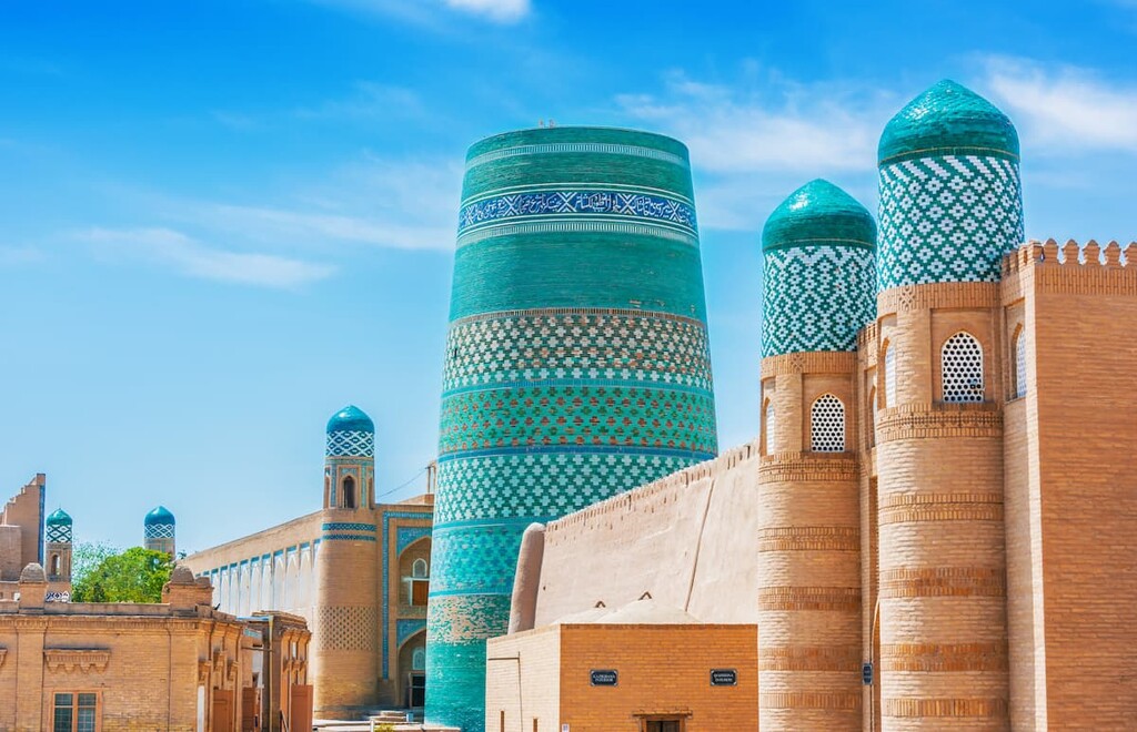
According to legend, Khiva appeared on the site of a well that was dug by one of Noah's three sons and provided amazingly delicious water. This well is still considered one of the city's landmarks. Heiwak, as the well and the city were called at the time, was founded two and a half millennia ago and over the centuries became one of the most prosperous centers in Khorezm.
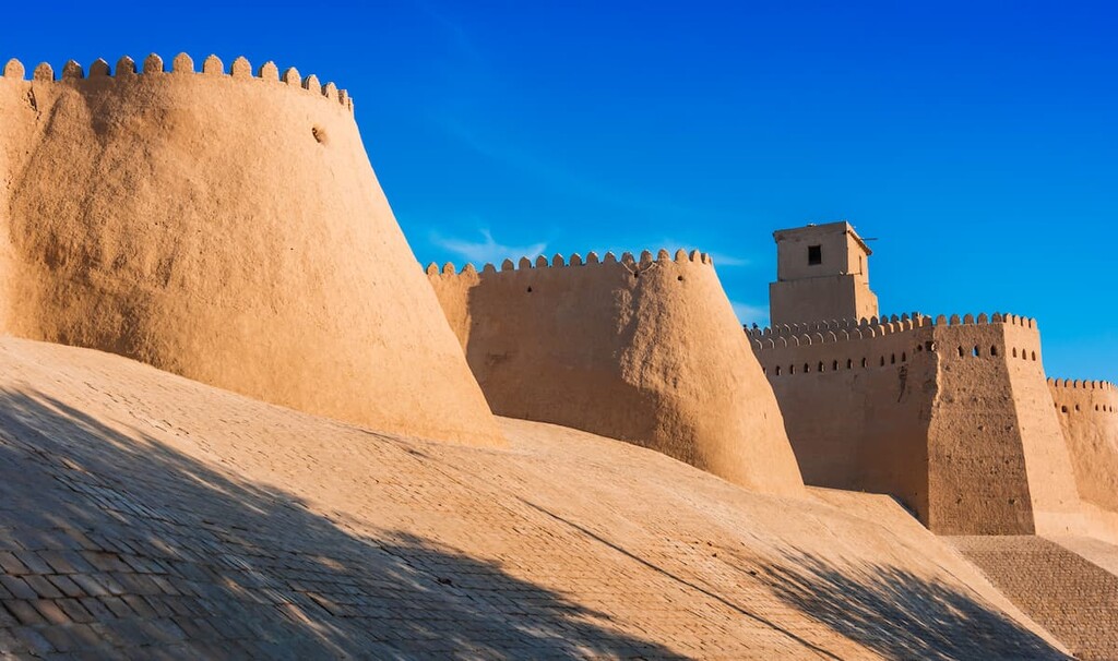
The main attraction of the city is Ichan-Kala. This is the old city surrounded by a thick wall with a complex of protective fortifications. Powerful defensive constructions of Ichan-Kala were erected for hundreds of years and today one can see constructions dating back to the 14th century. There are palaces and bastions, mosques with minarets, madrasahs and tombs, bathing complexes, inns, etc.
Ichan-Kala was the first monument in Central Asia to be placed under UNESCO protection as a World Heritage Site.
There are totally 30 historical madrasahs and over 10 minarets in Khiva. Visit the Madrasah of Mohammad Amin khan, Madrasah of Mohammad Rahim Khan II, Madrasah of Allah Kuli khan (first half of the 19th century) and Shergazi-khan (first half of the 18th century), Kalta Minar minaret, Tash Hauli palace, Mausoleum of Said Alauddin. All these buildings are often exquisitely decorated with the famous Khiva plant ornaments carved in stone or wood or lined with blue-white-blue mosaic.
We will be delighted to hear about your adventures in Uzbekistan. Drop us a line at


