
Scan the QR code and open PeakVisor on your phone
The Sikhote-Alin State Natural Biosphere Reserve named after K.G. Abramov was established on February 10, 1935. In translation from Manchurian language, Sikhote Alin is the country of mountain ridges, fast and clean rivers.
The territory of the reserve is located at the junction of the Terneisky, Krasnoarmeisky and Dalnegorsky districts of the Primorsky Territory, it is divided into the main part which has a small exit to the sea and a minor part which covers a mountain ridge behind the village of Ternei.
The first description of the nature of Middle Sikhote-Alin was made at the beginning of the last century by Russian researchers, a zoologist Y.A. Salmin and hunter K.G. Abramov. Until the early 20th century, this region remained a white spot on the map of the country. There was uncontrolled, rampant hunting or better say poaching on the territory, the number of many species of animals significantly reduced, and many species endemic to the Russian taiga were on the brink of extinction, e.g. the Far Eastern sable. Therefore, the main objectives of the Reserve were and still are the restoration and conservation of rare species of fauna of the Primorsky Territory, primarily the Amur tiger, ghoral (Himalayan chamois), sable, as well as the protection of intact ecosystems and biological diversity of the Sikhote-Alin range, scientific research, environmental monitoring and development of ecotourism.
The territory of the reserve covers 401,600 hectares, including 2,900 hectares of the Sea of Japan waters. The area is mountainous, with an average height of 800-1000m. It stretches from the rocky shores of the Sea of Japan inland for almost 100 km covering the eastern and western spurs of the Sikhote-Alin mountain range. The Far Ridge (Dalniy) is located in the southern part of the reserve, Mount Glukhomanka is situated in the western part, it is the highest point of the ridge and the entire reserve, 1,598 m above sea level.
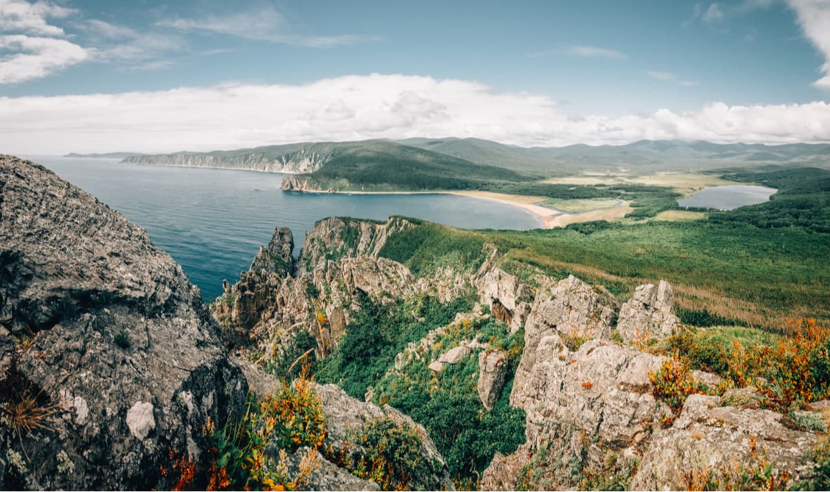
The reserve stretches over two parts of the coast of the Sea of Japan, i.e. in the south from the mouth of the Big Inokov River to the mouth of the Third Spring; and in the north, it spans from the mouth of the Commissioner's Spring (Upolnomochenniy) to approximately 1.5 km north from Cape Pervenets (aka First-Born). The coastline is steep, the cliffs are from a few meters to several hundred meters tall, there is a narrow strip of 5-to-30-meter wide pebble beach. The bays here are wide, up to 2 km, open from the sea and shallow up to 3 km, they go deep into the land, like the Dzhigit Bay for example.
The Reserve enjoys a unique mix of different representatives of the Manchurian and southern ecosystems, as well as Okhotsk and northern ecosystems who peacefully co-exist here. In 2001, the Reserve was put on UNESCO's World Natural Heritage List as the ‘most important or significant natural habitat for the conservation of biological diversity, including endangered species of exceptional global value in terms of science and conservation’.
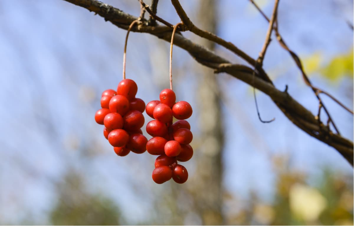
The flora and fauna of the Sikhote-Alin Reserve are exceptional in its diversity. The Reserve is home to a large number of rare and endangered plants. The total number of plants on its territory is 1,094 species from 129 families, it is 55% of the flora of Primorsky Territory and Priamurye; 63 plant species are included in the Red Books of different ranks.
One of the most important natural attractions of the Reserve is the Far Eastern cedar trees. In Primorsky Territory, there are almost no such large, pristine forest massifs left. The star of the lot is Korean cedar pine or Korean cedar. Cedar grows to a height of 40 meters and reaches 2 meters in diameter. There are trees which are 600-700 years old. Time seems frozen in such a forest of cedar giants.
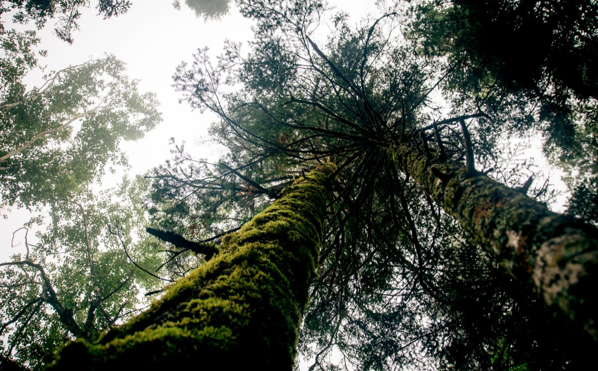
Pristine indigenous forests with relict species of trees and shrubs have preserved in the upper reaches of the Dzhigitovka and Serebryanka rivers. There grows a long-liver among the local flora – a Japanese yew (Taxus cuspidate). This tree prefers to grow solitary, it reaches a height of 14-15 m and up to 40 cm in diameter. There is a small yew grove found in the upper reaches of one of the left tributaries of the Solontsovy brook. The age of individual yew trees here is up to 1000 years.
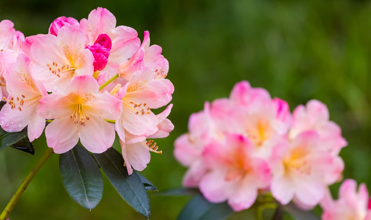
Rhododendron Fauriei, a relict species, is another wonder of the reserve. It is listed in the Red Book of Russia and the Red Book of Primorsky Territory. Except for the territory of the Sikhote-Alin Reserve, it is not found anywhere else in Russia.
Edelweiss Palibina (Leontopodium palibinianum) is another rare red-book species. Edelweiss grows in groups on seaside terraces, the period of active flowering is in August-September.
There are 61 species of terrestrial and 10 species of marine mammals, including 13 red-book species. There is a nice movie shot about the Reserve’s fauna, but it is in Russian.
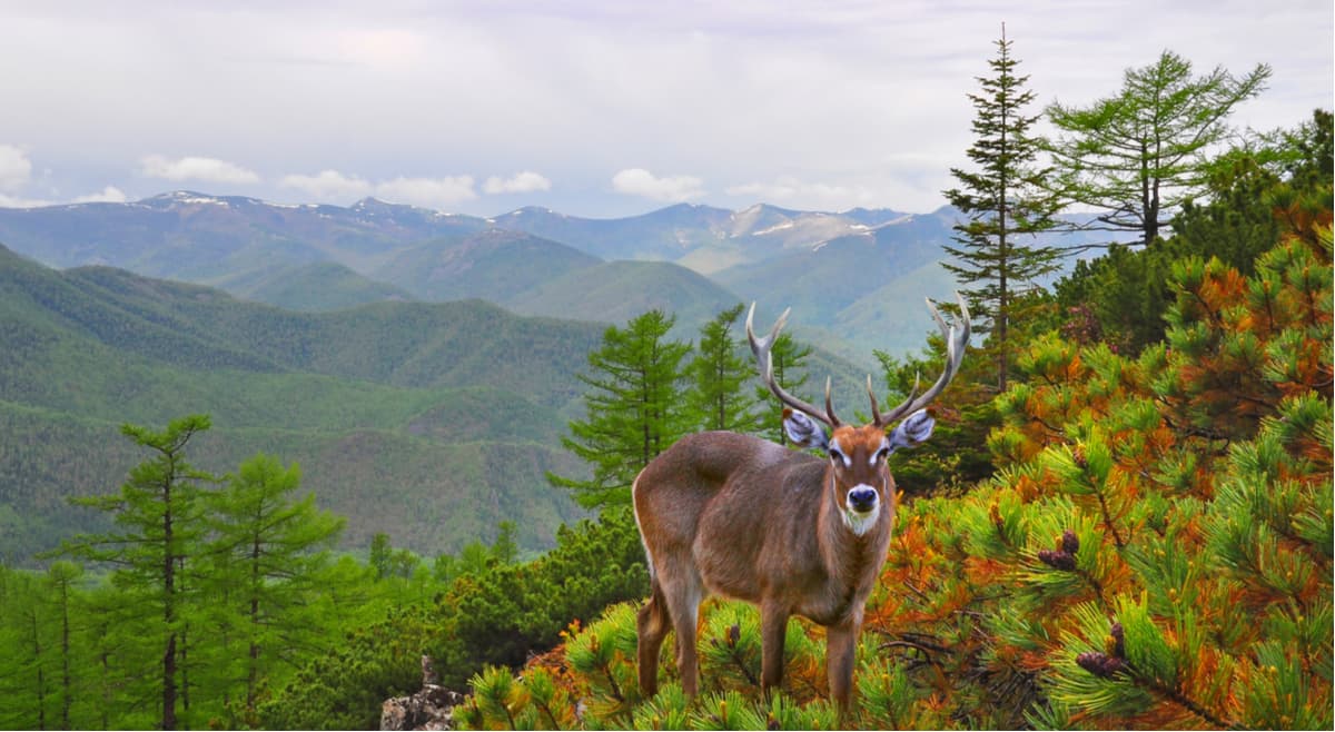
There is also a spotted deer roaming freely in the forests close to the sea. It is the most wonderful ungulate which is called a deer-flower for its beauty. It's a small slender, lightweight and the most elegant of all the deer.
In springtime, the sea lures another type of deer – the Manchurian elk to drink some salty water, to munch some algae in order to get the salt its body needs.
The Abrek site on the rocks of the sea coast is home to a population of Amur ghoral. It is a very rare and endangered species. There are about 200 individuals of this graceful chamois in the reserve now.
Bears are found everywhere in the reserve. In the northern taiga areas, there are more brown bears and in the south, the bears are predominantly white or Himalayan.
Three species of cats live in the reserve zone: the forest cat, the lynx and the Amur tiger (it is also called Siberian tiger). The Amur tiger occupies an absolutely special place, it is one of the main objects of protection in the Reserve, and Sikhote Alin is the last large integral territory in the world where it can live and breed in wild nature.
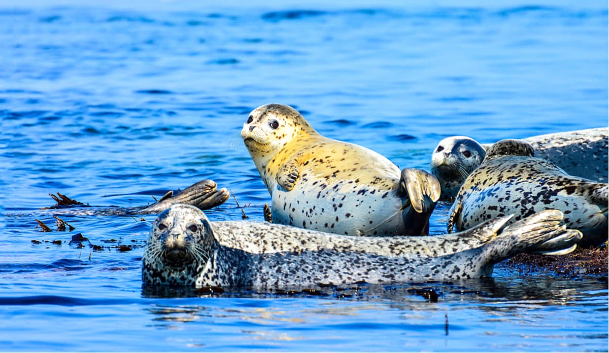
The waters of the Sea of Japan have many cetaceans: killer whales, minke whales, beaked whales (aka Beard’s beaked whale), common dolphins, white-bellied porpoises, bottle-nose dolphins, seals. The spotted largha seals (Phoca largha) have a large year-round rookery on Cape Happy in the protected area. A larger rookery is located in the protected area on the reefs of Cape North. In autumn months, up to 400 seals gather there.
Birds are aplenty here. Many of them are with bright plumage this is because their origins are in Southeast Asia. The family of butterflies is not small either. Here you can find the largest daytime butterfly of Russia – the Papilio maackii – with a wingspan of up to 13.5 cm. Yellow Ussurian Machaon, various Satyruses, Parnassians, Apatura butterflies, pygmy blues are also common in the reserve.
The climate of the Middle Sikhote-Alin has a pronounced monsoon character; it is manifested in the sharp changes of wind direction in winter and summer.
The higher above sea level you go, the greater the snow cover. The most typical snow cover is 30-50 cm, it lies three or four months a year. The average monthly temperature in January is -12.5 degrees Celsius (10.4F) on the eastern slopes and -22.6 degrees Celsius (8F) on the western slopes. The average July temperature is +15 degrees Celsius (59F) on the eastern slopes and +19.1 degrees Celsius (66F) on the western slopes.
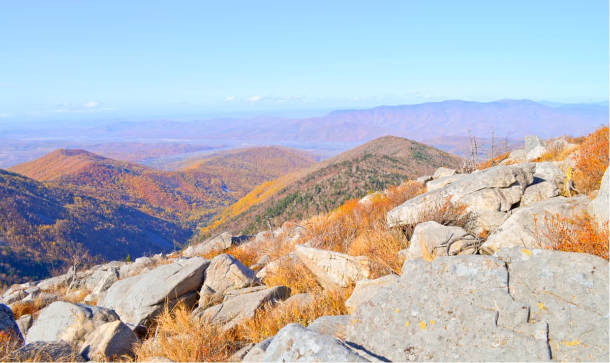
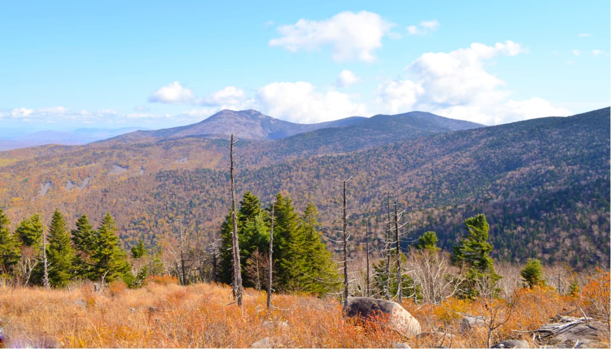
The territory of the reserve is mountainous, the average height is 800-1000 m. The highest peaks (1300-1600 m) are Glukhomanka, Celestial Empire (Podnebesnaya), Snowy (Snezhnaya), Camel (Verblud), Shishkina, Foggy (Tumannaya).
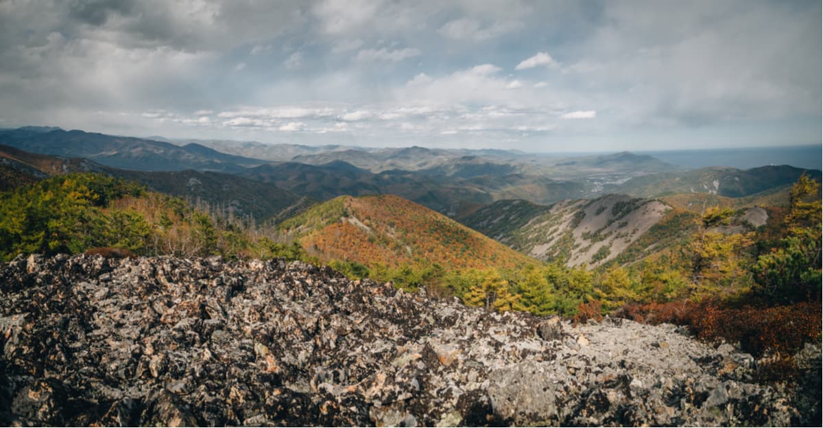
The highest point is Glukhomanka mountain (1,598 m). Since the relief was formed as a result of volcanic activity, most mountains are former volcanoes. Mount Glukhomanka had the Chinese name Luchikheza which means ‘the sixth tributary of the river’ until 1972. It is one of the peaks of Central Sikhote-Alin. It is located in the most beautiful place of the reserve on the border of the Terneisky, Krasnoarmeysky and Dalnegorsky districts, 35 km southeast of the village of Melnichnoye and 70 km north of the town of Dalnegorsk on the watershed of the rivers Big Ussurka and Serebryanka. The mountain is cupola-shaped with steep slopes and a wide sloping ridge, with protruding smaller peaks and stone placers of large round stones – the so-called corroms. Not far from Glukhomanka, there are similar but smaller mountain peaks, Mount Pamyatka (1,447 m) and Mount Velikoman (1,332 m).
At the foot Glukhomanka’s eastern slope at an altitude of 700 m at the head of the Sporny Spring, there is a belt of cedar-broadleaved forests. It occupies a small strip giving way to fir and spruce-birch forests which are more widespread on the mountain.
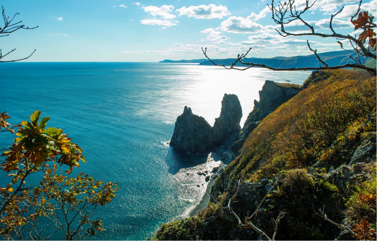
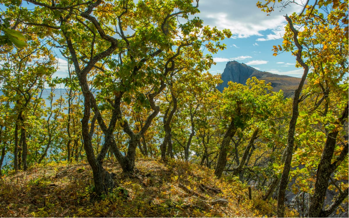
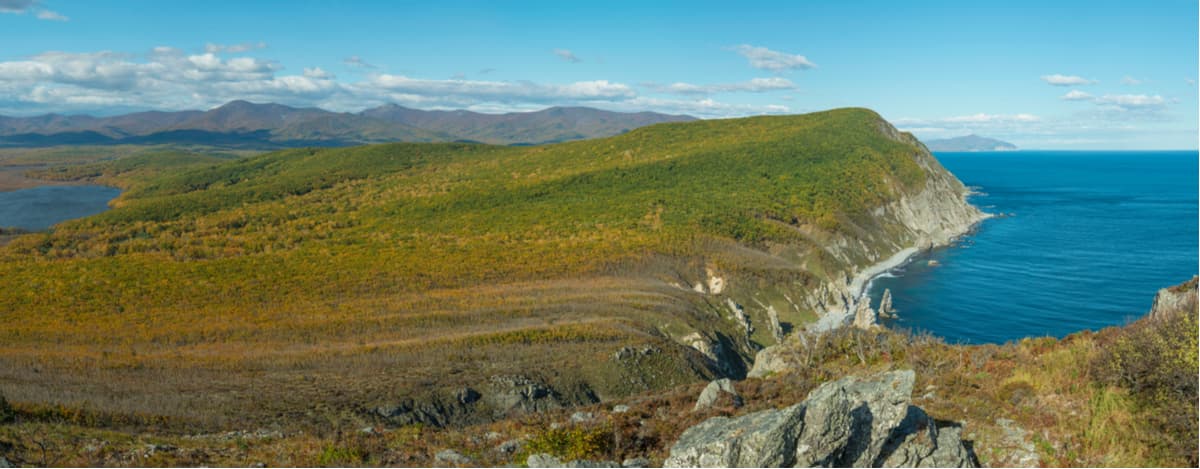
Mount Abrek is the peak of the Abrek mountain system. Its height of 632 meters. Abrek is unusual because its eastern slopes plunge directly into the sea. The slopes of the mountain ridge are steep, rocky with heights of 100-150 m. In some places, there are craggy cliffs which alternate with deep crevices, many cliffs are up to 300 m high. The mountains of the Abrek ridge are covered with oak with cedar, linden and black birch forests.
The Abrek mountain ridge stretches along the coast and is especially loved by a very shy and secretive mountain goat, the Far Eastern ghoral. On the seaside slopes of the mountain, there are colourful grass meadows with blooming rosehips. There are also colonies of seabirds – sooty guillemot and the Ussurian cormorant, as well as a permanent inhabitant of the coast – a white-tailed eagle. The area around the mountain is a separate cluster of the Reserve. This rocky nook with dense thickets pressed against the cliffs is heavenly beautiful. It is on these ledges that photo hunters hide to track down the secretive and cautious eastern chamois. Here you can find traces of archaeological sites and barely noticeable ruins of cave towns. It is difficult to notice them, but they are present here. But the poaching trails are well visible. Not far from here sits the village of Ternei.
The Kolumbe is among the largest rivers on the territory of the Reserve. The ones flowing into the Sea of Japan are the Taezhnaya, the Serebryanka, and the Dzhigitovka. These are fast mountain and foothill rivers with frequent rapids and waterfalls. The lakes are not that plenty but they definitely make up with their scenic beauty and unusual views. On the coastal strip, these are lagoon-type lakes – they are shallow sea gulfs cut off from the sea by sandy sediment. Golubichnoye and Japanese Lakes are completely isolated from the sea, and Blagodatnoye lake is connected to the sea by a duct that appears only during heavy rainfalls.
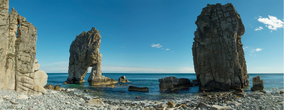
Golubichnoye Lake adjoins a picturesque site with the same name. Many relict aquatic plants grow along its shores. The place is home to a large population of rare Manchurian spotted deer, and here you can often see Manchurian elk, wild boars, eagles, great-crested grebe, and seabirds. The lake has a comfortable sandy shore. On the vast flowering meadows nearby and on the sea terrace one can observe different kinds of ungulates. From here, you can observe the so-called kekurs, rocks that separated from the nearest cliffs and now stand in the water. The peaks surrounding the lake are impressive of right conical shape and covered with the lavish greenery of pine and birch forests.
Golubichnoye and Blagodatnoye Lakes are of lagoon type and are special protection sites in the Reserve.
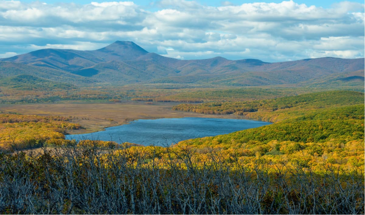
These are the mountain lakes in the upper reaches of the Solontsovy brook at an altitude of about 500 m above sea level. They were formed by landslides that blocked the streambed. Six purest mountain lakes framed by oak groves hid among the ridges in the upper reaches of the Solontsovy brook. The name of these solonetzic lakes comes from the volcano Shandui which formed the relief of these places in times immemorial. The largest and most mysterious lake is Tsar Lake which has an unusual triangular shape. You can admire it only in autumn, as during the spring floods the lake disappears, leaving only a thin crust of ice at the bottom. Only in autumn does the water return to its original place. Lake Round is located nearby and its water level is almost constant both during the autumn rains and during the spring stormy water runoff from the mountains. The reasons for such untypical behaviour have not yet been established.
The Sikhote-Alin Reserve also makes sure historical monuments are well protected. There are monuments of different times and archaeological cultures on the territory of the reserve and its surroundings. The most ancient is the settlement of the Ustinov culture (Mesolithic, 7 – 6 millennia BC) in the middle reaches of the Tayozhnaya River in the Terneisky enclave. The second oldest settlement, the Blagodatnoye, belongs to the Lidov culture (Paleo-metal era, late 2nd – early 1st millennia B.C.).
In the basin of the Dzhigitovka River, there are medieval monuments of the Moche, Bohai and Zhurzhen cultures (the 1st and the early 2nd millennia) – ancient settlement sites of Kunalei, Red Lake and Celestial Empire, as well as fortresses and settlements of the Middle Ages and settlements of the 19-20th centuries.
There is the Information Centre for Nature Protection and the Nature Museum in the Reserve. Four excursion routes have been approved. The department of environmental education organizes guided tours which are conducted in the reserve territory by the Reserve staff.
Lake Blagodatnoye is located in the bay with the same name, the second name of the bay is Udobnaya aka Comfortable. The lake is of an irregular shape, the largest diameter is 2 kilometres, the water is brackish (it means it has more salinity than fresh water, but not salty enough to be called seawater). The lake is connected by a 73-meter wide strait of the Sea of Japan. One side is a pebble bar separating the lake from the bay water area. In the southwest, it is divided by a narrow mountain cape from Golubichnoye Lake which is located in the adjacent bay. The lake is unusually picturesque. It is surrounded by the rarest flora of the region, endemics, on the shore, there are orange mandarin ducks, and in the water – whooper swans, ducks, herons, geese. The pioneers called this lagoon "the heavenly grace", or Blagodatnoye.
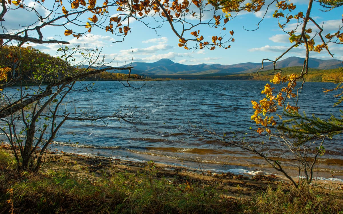
There are many wild animals in the lake area: wild boars, Manchurian elks, roe deer, you can even see their tracks and beds. Tiger footprints are often found as they regularly visit this area. During spring and autumn flights, large flocks of birds gather at the lake. To observe birds and hoofed animals, a special tower has been installed on the lakeshore thanks to which wild animals can be seen without humans disturbing their peace.
This route is the most popular and visited one. This is where tourists from cruise ships come most often since it is one of the most attractive and easiest in complexity. The length of the route is 4.1 km and takes 2-3 hours. The route is pedestrian. You can get here either by a trail overlooking the road from the district centre of Ternei or from the waters of the Comfortable Bay by inflatable boats hoisted out from cruise liners or ships.
Cape North is another gem of the Reserve. Both the land and the adjacent sea area belong to the territory of the Reserve.
Cape North is a kind of a shore cusp the gulf of the Sea of Japan, there is a 5-kilometre wooden plank leading to it. The hiking trail winds through a picturesque forest with many different types of trees, there are well equipped and very original parking lots. On the route, tourists get acquainted with animals and vegetation of the coast of the Sea of Japan. The Cape is a resting place for numerous seabirds and a rookery of the common spotted seal (largha). The largha seals rookery at Cape North is one of the few places along the coast of the Sea of Japan where the largest number of these sea animals gather. In summer as well as during autumn and winter migrations you can see up to 400 seals at a time leisurely basking in the sun.
The route is pedestrian, runs through the forest, meadows and comes back by the sea. The total length of the route is 4.6 km. Duration: 3 hours. Level of difficulty: does not require special training, suitable for visitors of different ages.
High-mountainous routes in the Sikhote-Alin Reserve also include paths running in the direction to the Boar Spring (Kabaniy Klyuch). The route runs along the southern borders of the Reserve, along the basin of the Dzhigitovka River from marine oaks to the belt of fir and spruce forests. The local coniferous-broadleaved forests are a permanent habitat of the Siberian musk deer, and in the cedar forests, there are traces of Manchurian elks. There is a viewing platform on the route, and you can clearly see the huge Maximovich poplar trees (aka Japan poplar) which are famous for their longevity. There are giant trees of 1.5-2 m in diameter and aged over 300 years old. Often a Himalayan bear uses a hollow inside some of these trees as a lair.
The route has unique views over virgin pine, spruce and fir forests. This is the only place in Russia where a very rare relict plant – rhododendron Fauriei – grows. Yew is another rarity growing here. There is also another relict species in the tract – the Japanese yew. You will be told about the monuments of the Middle Ages in the basin of the Dzhigitovka River. The first settlements found here date back to the Bronze Age.
The total length of the route is 95 km, which means some of it is covered on foot, some by car. Duration: 5-6 hours: 3 hours by car and 2 or 3 hours on foot. The route is designed for visitors older than 10 y.o., as well as for wildlife researchers – botanists and ornithologists. The level of complexity medium.
The Yasnaya (Clear) Site is located at the confluence of two beautiful mountain rivers Yasnaya and Zabolochnaya. Their old names are the Maisa and the Tunsha. This is an exciting nook in the Reserve since it has fabulous forests with wonderful plants and ancient settlements. The Bohai and Zhurzheng ancient settlements were located here. There is still a fortress made of flagstone and standing on a high rocky hill. Only here one can observe all stages of restoration and revival of cedars after terrible forest fires. On the northern slopes of the hill, one can see the indigenous cedar forests which have remained almost untouched by fires. There are Eleutherococcus, barberry, cork trees and various lianas: lemongrass, grapes and Actinidia kolomikta. The rough beauty of this protected area is enchanting, its coniferous and berry aromas with faint notes of barberry, Chinese lemongrass, Eleutherococcus is intoxicating. Such a potent mixture of southern and northern species is characteristic of the whole central Sikhote Alin. On the route, you can learn about the life of the Reserve's inhabitants, from tiny mice to the impressive chamois.
The route is both pedestrian and motor. It starts from the village of Ternei and goes 27 km along the highway to the Yasnaya Site. From here starts the 3-km long hiking route.
The ecological trail is a five-kilometre route leading through a picturesque mixed forest to Cape North. One and a half kilometres of the trail is a wooden plank which is laid on logs along the marshy bog, the dense forest is all around with fancifully curved trees looming over you from all sides. Sometimes, wild animals can be found here, you can even hear the roar of a bear somewhere nearby, and if you are lucky, you can see a furry brown bear from afar. Those in the know claim that one tigress called Varvara favours this route as well. The traces of Varvara can often be found on the coast and on the trails where people walk. But tigers, though curious, unlike bears, are very careful. They say that if you manage to see a tiger, it will definitely not eat you, just warn you about its presence. Should a tiger really wish to eat you, you will definitely never see it. They watch carefully from behind the bushes so that it is highly unlikely for a human to see this biggest cat predator.
In the near future, it is planned to finish equipping the 56-kilometre route called Arsenyev’s Trail which will connect visitors with the Ust-Shundui site and other interesting places. The name refers to the expedition of V. Arsenyev in 1906 after which he wrote his famous book Dersu-Uzala.
There are several wilder routes in Sikhote-Alin Reserve. You can go alone, or take a guide. The land of Sikhote Alin is a fairytale, it is far from any civilization but so close to the soul of any traveler. It is surely a must-visit at least once in a lifetime.
The official website of the Reserve provides up-to-date information on the trails and the Reserve facilities.
The address of the administration of the reserve: Primorsky Krai, Terneisky district, village Ternei, 44 Partizanskaya Str.
The nearest large city is Vladivostok, which is 680 km away. A small town Dalnegorsk is closer – just 180 km away.
The closest settlement is Ternei village where the Reserve's administrative building is located. There are grocery stores, a hotel and a medical centre in the settlement.
There are many ways to get to the reserve. You can either take your own transport to the reserve administration and get a visitor pass or order a tour on one of the eco-trails, or you can take a small plane to Plastun or Ternei. The most economical but the most exhausting option is a local shuttle bus.
The best time for visiting is from May to October.
The guided tours of ecological paths of the Reserve need no special equipment but make sure you wear sensible sturdy footwear and comfortable hiking clothes, and some headdress. For protection against ticks, trousers must be tucked in your boots, a T-shirt with a long sleeve, and don’t be shy to use mosquito repellents.
Ternei village has a hotel with a cafe. By prior agreement, it is possible to accommodate an organized group in guest houses of the Reserve (2-4 people per room). Staying on the territory of the Sikhote-Alin Reserve is possible only if accompanied by an employee of the Reserve.
Six cordons are organized in the Reserve, but there is no cordon system, and state inspectors (25 people) work on schedule.
To order a guided tour, it is necessary to agree on the date and time with the Department of ecological education of the reserve in advance. Phone +7 (423) 743 1559.


