Scan the QR code and open PeakVisor on your phone
Being often called a realm of snow peaks and deep valleys, the Alai Mountain Range remains mysterious and even hostile to casual travellers. Its high altitude, harsh weather, lack of roads and viable routes make the adventures larger than life. Yet, the rewards are equally grand.
The almost 400-km-long Alai highland divides the Fergana and the Alai valleys. It is located in the southwest of Kyrgyzstan and north-east of central Tajikistan. It is a large section of the Hissor-Alai mountain system east of the Matcha hub (aka Matchinsky Mountain hub). Its main ridge is the Alai Mountain Range which runs from Igla (Needle) Peak - the intersection of the Alai, Zeravshan (aka Zarafshon) and Turkestan ridges. At the intersection of the Zeravshan Range and the River Sokh right at the Alai Range starts the Zaalai Range which belongs to the Northern Pamir.
The Alai begins in the east located between the Tar and Kyoksuuu Rivers and goes westward. Its northern side ridges are the Gulcha, Kichik Alay, Kollectorny (Collector’s), Kuruksai, and the Guamysh. And closer to the central part of the Alai Range start the southern side ridges Tekelik and Kuturgan.
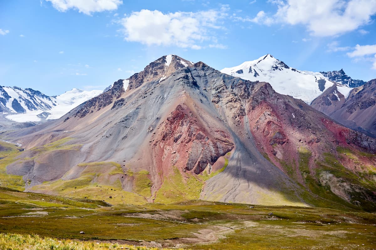
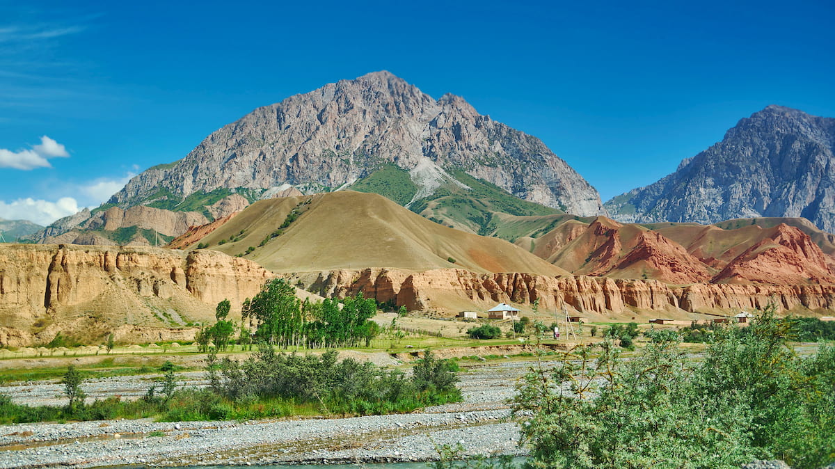
The main summit of the Alai Range is Tandykul Peak (5,539 m), its runner-up, Snezhniy Shater(Snowy Marquee) (5,529) , is six kilometers away. The average height of the peaks is about 4,500 m but there are also many five-thousanders like Gaumysh aka Ailama (5,428) for example. Actually, there are two dozen peaks over 5,000 m. The peaks here are rugged, rocky, quite prone to rock slides and mudflows.
The Alai is practically unexplored by mountaineers, there are few routes to the tops. Most of the possible climbs are technically complex, featuring rocky and snowy-icy terrain. However, the endeavour is worth every minute of it given there are still a bunch of nameless five-thousanders which are yet to be named by the most adventurous pioneers. There are beautiful peaks for classic mountaineering as well. The daredevils will appreciate the breathtaking panoramas of snowy peaks in the Alai Range.
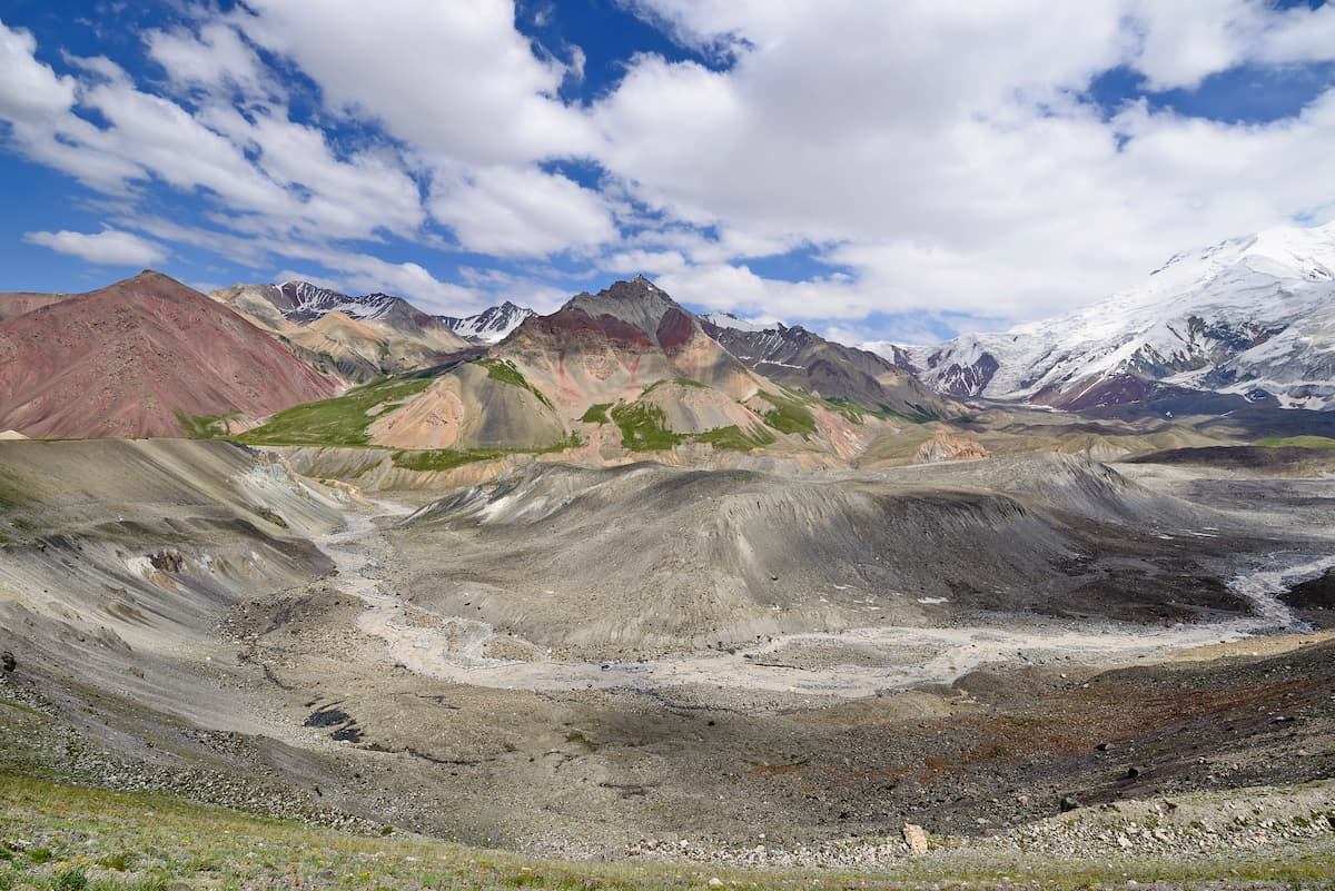
The western part of the range (the Tutek, Yashilkul Valleys) is traditionally considered part of the Matcha Hub. The section between the Archabashi Valley and the Abramov glacier (the Tandykul-Yanghidavan node) is similar in character to the Matcha node. To the east, near the Abramov glacier, the character of the mountains is changing. Narrow gorges are replaced by wide potholes with large underdeveloped glaciers (Jamankirchin, etc.). High and sharp peaks tower over the glaciers, but the elevation gap here is relatively small, the absolute height of the passes is much higher. The main range here makes a sharp bend to the north and then branches into powerful spurs - the Kollektorny (Collector's) Ridge and the Kuruksai Ridge (Gaumysh, Ailama Mts.). The Collector's Ridge together with the main Alai Range form a separate area - the so-called Dugoba which combines the features of both mountain systems. There are large glaciers and cirques here, but there are also narrow valleys with canyons, high passes and beautiful peaks here that remind of the Fann Mountains.
Farther to the east lies the Kichik-Alai, though it is usually included in the High Alai, it should be considered a separate unit.
The Alai Range has an extensive system of northern and southern spurs, which allows you to build a fairly diverse route. Long branching northern spurs are characterized by a sharp decrease of snow cover at a distance from the main ridge, their lower reaches are dry, barren mountains. The southern spurs are slightly shorter in length than the northern ones and are practically alien to tourists. The valleys of the southern slopes are on average more difficult to travers than those in the north.
The Alai Range is calling for the ambitious and powerful climbers. According to our data, the area between Tandykul and Matcha Hub (the Tutek and Yashilkul gorges) has not been visited at all since 1994.
The high Alai Range suits perfectly for the climbs of the 3-4th category, the 4th category will be not very difficult technically, but the 3rd would be physically and technically challenging. For the 4th category it would be interesting to cover the 2B passes of the Physicists), the Serpovidny, and the Yanghidavan West. The eastern part of the area (up to the Iolisu valley) can be connected with the Abramov and Jamankirchin glaciers. As to 3A-3B milestones, they are not numerous, but usually divided by long distances. If you are keen on combating the 5-6th categories, you are likely to be a pioneer in discovering new peaks.
The Alai Range does not drop below 4000 m a.s.l, except for a few passes. Here is the classification of passes in the Pamir-Alai with heights and geopositioning. And here are the Alai passes only.
As a rule, the passes are covered with snow, ice and crumbling stones. Reliable rock surfaces are not typical for the area. As a rule, the defining approach to the passes is northern or eastern. The height of most passes varies from 4300 to 4600 m, but due to the great ruggedness of the mountains, many main passes here have a lower height (4000-4200 m). To the east, near the Abramov glacier, the simplest passes are 4300-4400 m high, and most of the interesting passes exceed 4600-4700 m a.s.l.
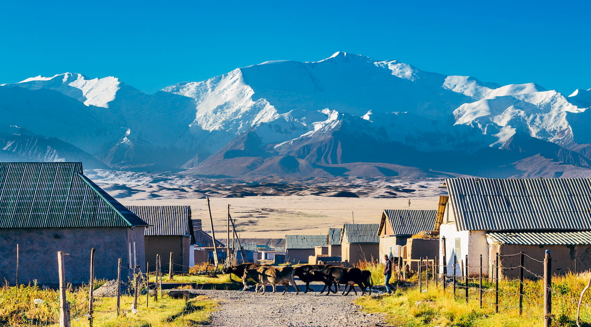
The main passes are Dzhyltyk Pass (4,185 m), Sarymogol (4,303 m) Kindyk (4,000 m), Tyuzashu (4,276 m), Tekesazdy (4,000 m), Kauk (4,067 m), Dzhallydjer (3,996 m), Tenghizbai (3,627 m), Karakazyk (4,196 m) and Yanghidavan (4,319 m). You will see numerous flocks of sheep using these passes to get from one valley to another.
Here are some tidbits on traversing the passes:
Speaking of the roads, There is an excellent highway from the city of Osh to the village of Sary-Tash in the eastern part of the Alai Range, it runs through the Taldyk Pass and the 40 years of Kirghizia Pass.
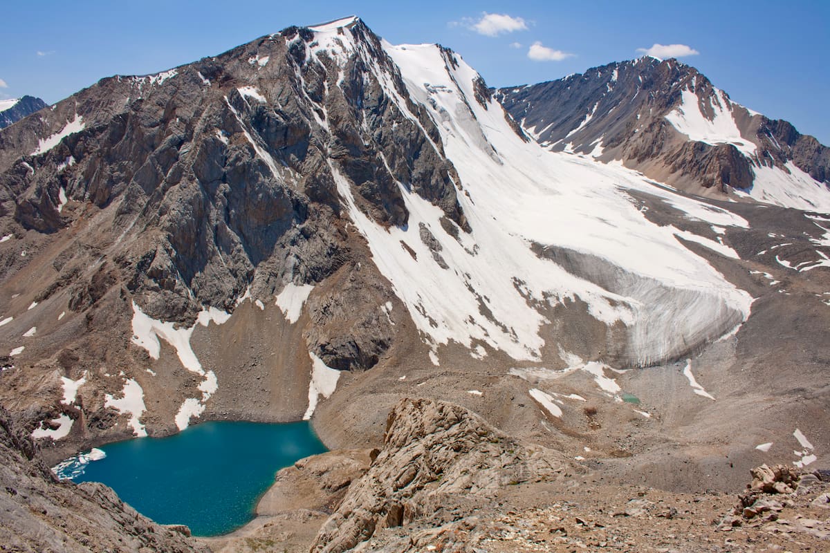
The biggest glacier is Abramov glacier located in the central part of the range in the upper part of the southern gorge Koksu, in the cirque formed by the Alai Range and its southern side of the Tekelik Ridge .
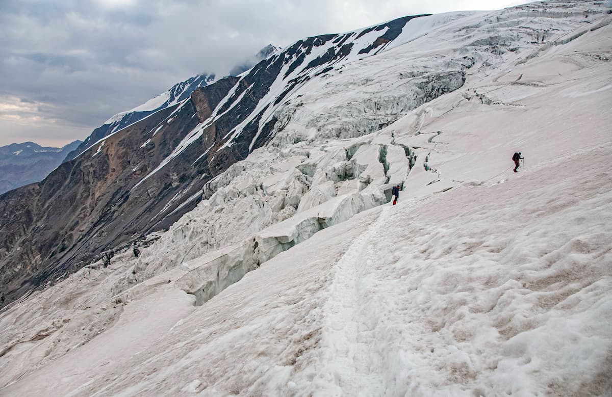
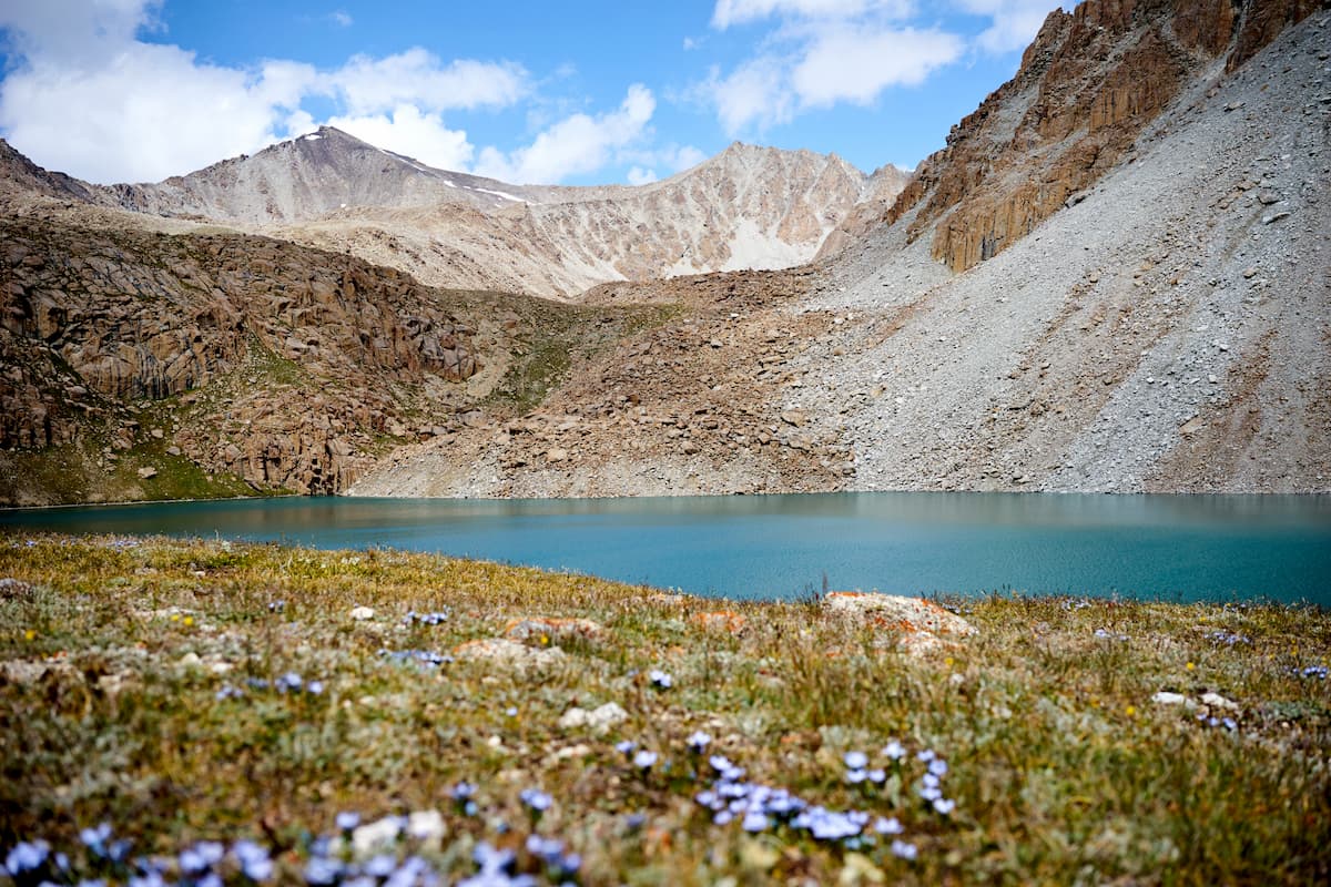
The glaciation of the main Alai is inferior to that of the Matchinsky Mountain Hub and the Abramov Glacier. Nevertheless, the total area of glaciation is 568 sq.km, with most glaciers located in the west of the range. there are visible glaciers in the upper reaches of all valleys whose activity determines the shape of the mountains and the nature of the passes. The largest glaciers of the region are Archabashi (10-12 km. long, 20-25 sq.km.), Nedostupny, aka Inaccessible (9.5 km long, 15 sq.km.), Tandykul (10 km long, 9.5 sq.km.), Tilbe West (6 sq.km.), Tilbe East (5 sq.km.), Iolisu (5 sq.km.), Yanghidavan South (7.5 km, 12.5 sq.km.). Most glaciers are either stable or in the phase of slow but not dramatic retreat. In many cases, there is no noticeable difference from 30-year-old photos, although in some cases the process of separation of side tributaries of large glaciers is noticeable. Most glaciers have zones of large ruptures and icefalls. The snow line is about 4100-4200 m a.s.l. At night, there are stable frosts on the glaciers, in the morning, the snow is hard and even by the end of the day at altitudes up to 4500 m its surface seldom melts. Snow cornices are typical for mountain passes and ridges. There is no avalanche risk in summer (an exception may be Snow Marquee Peak). The tongues of large glaciers hide under a thick moraine.
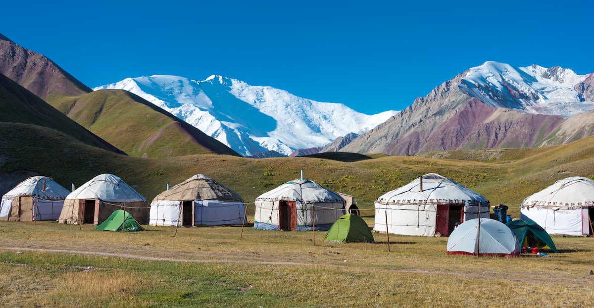
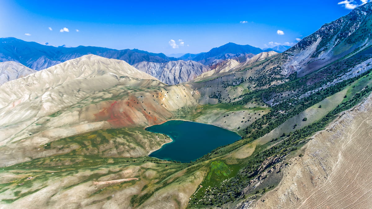
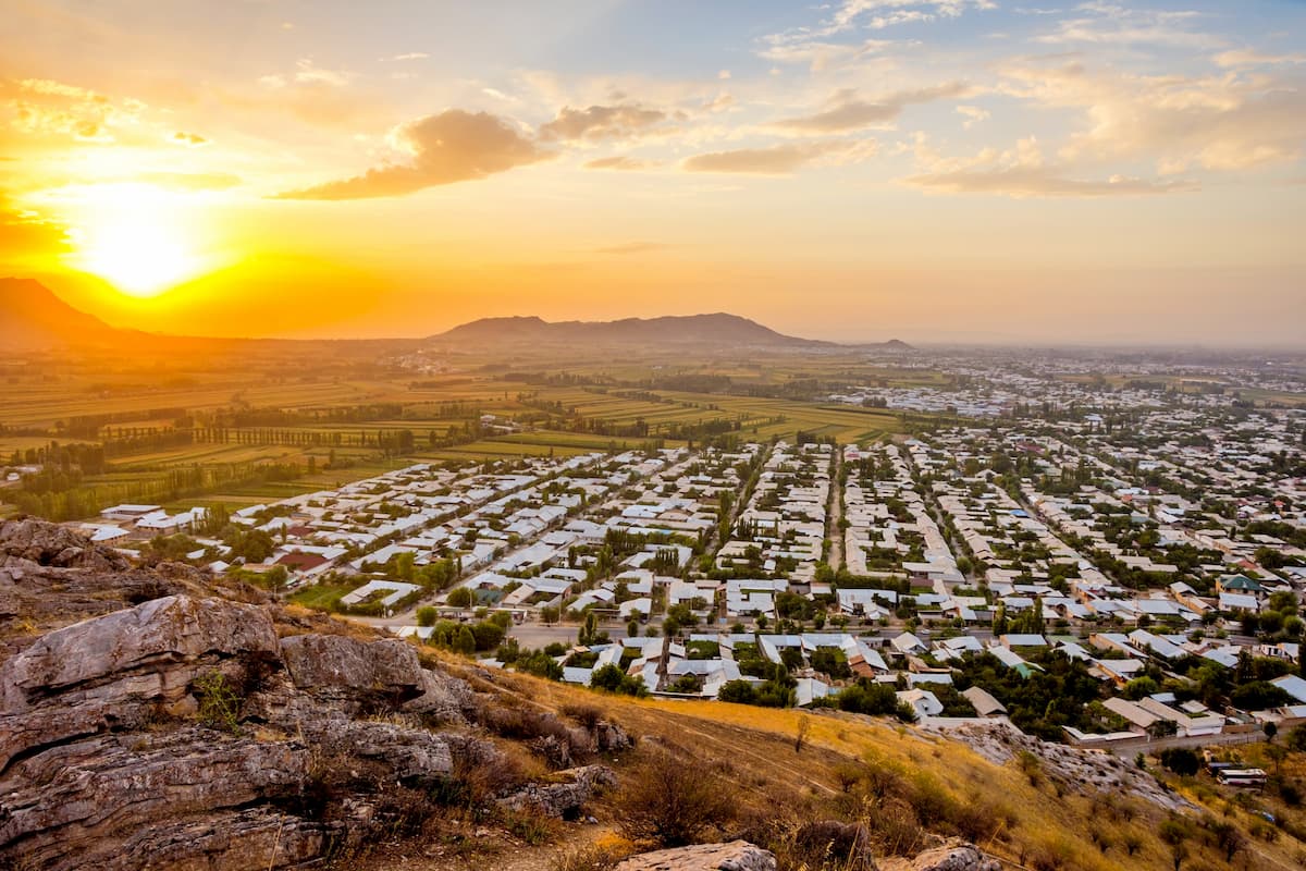
On the border of the Alai, Zaalai, Hissor Ranges and the Pamir lies the amazing Alai Valley. It is a realm of high grasses and lavish pastures snuggly tugged in the heart of an impregnable mountainous country. The Alai Valley is a land of contrasts: behind flat meadows rise the grey stone walls of mountains, whereas mighty glaciers reveal crystal clear lakes. It gives travelers a break before the road to the whitened peaks of the Zaalai and the Alai Ranges, and the Central Pamir. Here passes the road from Kyrgyz Osh to Tajik Khorog, both cities are the main starting points for trekking and climbing in this part of the Pamir and Khorog is the town to go to if you want to obtain a visa to Afghanistan quite fast (it takes only a couple of days and 150 USD). This road then leads on through the Irkeshtam Pass to the Kashgar Mountains in China.
The Alai Valley is quite often called heaven for its proximity to the celectal chancellery. It is basically a tectonic depression stretching along the River Kyzyl-Suu in the latitudinal direction for 150 km. It is 8 to 25 km wide and has a gradual descent from east to west and a small slope to the south. The upper part of the Alai Valley, located at the source of the Kyzyl-Suu River, is at an altitude of 3,536 m, whereas the lower part, near the village Daraut-Kurgan, lies at an altitude of 2240 m.
The Iolisu Valley in its middle is badly passable, so you should not count on covering at the same speed as the Gaumysh Valley, for example. Fording across the River Iolisu is a dangerous event that should be planned only for the early morning.
In general, the valleys of the Alai Range are numerous and mainly lie in the northern and southern spurs of the range. This makes it easy for mountaineering teams and groups of outdoor fans to choose the most suitable mountain route based on their training and experience. The valleys are wide in the east and narrow in the west and south. They are usually covered with lush greenery featuring cherries and wild apricot groves, riparian woodlands, birch and Turkestan juniper groves. The trees here can grow to quite an impressive size being protected by the towering peaks.
Close to the Abramov Glacier, the gorges are expanding, giving way to large glaciers. Altitude differences are slightly smaller here but the absolute height of the passes is much bigger.
The Alai Range has many mineral springs. Mineral waters of Jilisu are popular among the locals. Archabashi springs and Tandykul resort in the valleys of the same name are also famous for their healing properties.
The foothills are hot and dry. One you go higher, the vegetation would concentrate closer to water. In the Alai Range valleys, the middle parts are quite green and noticeably more lavish than the valleys in the Fann Mountains. Grass stops growing at an altitude of 3400-3600m. In wet shady areas, such as canyons, there grows a local giant hogweed (Heracleum gen.), which is called yugan, its burns are very painful. There are many different flowers. You can see Nanking cherry and apricot trees at an altitude of 2,000-2,500 m. Along the large rivers below 2500 m a.s.l. one can find thick tugais (riparian trees) birches, and junipers.
The area is quite warm and dry in comparison with other local mountain systems, but due to the proximity of the Pamir and the position between the large valleys (Surkhoba-Kyzylsu and Fergana) bad weather spells are common, but those are usually very short. Bad weather almost always comes from the south-west. It is hot in the valleys in good weather, so it is desirable to plan a siesta and wait for the heat to subside. The wind is always strong at the mountain passes.
The region is seismically active. Small earthquakes regularly occur at the distance of 50-100 km in the Western Zaalai Range and the North-Western Pamir (4-5 points of the Richter Scale).
Kirghiz time is +6 hours GMT (Greenwich Mean Time). In August, it means dawn is around 5:30-6:00, twilight comes around 20:30.
The starting point to explore the Alai is the city of Osh in Kyrgyzstan. It has an airport which ensures access from any part of the world. Osh has many guest houses and hostels, and if your budget is really tight you can rent a flat from the locals. From Osh, you can get quite high to the mountains just riding a van or an off-road vehicle.
As to the paperwork, make sure you have insurance and a pass if you are planning to visit border regions. You can get the pass at any border guard post, if you are going to traverse the zones covered by several border guard posts, i.e. the Sokha Valley, the Koksu Valley and the Dugoba Valley, you should notify the border guards, they will help with the paperwork.
If you are set on accessing the Alai from the north, you will have to go through the Khodzhiachkan Valley which offers only two viable options:
If you start exploring the Alai Range from the south, it is possible to start in the valleys of the rivers Tandykul and Ptovkul. In general, southern access is more difficult than from the north, because the passability of most southern valleys is much worse than the northern ones.
The High Alai is sadly known in connection with the so-called Batken events of 1999-2000, when militant groups infiltrated Kyrgyzstan from Tajikistan for two consecutive years and occupied a number of valleys and ranges (the valley of Khodzhiachkan and most of its tributaries, the springs of Jilisu and Zardaly), from where they were then driven out by government troops. The bombing destroyed an old and very popular hydrometeorological station at the Abramov Glacier in August 1999. The valleys and glaciers still show signs of fighting in those years. Currently, the probability of stumbling upon something hostile is rather low.
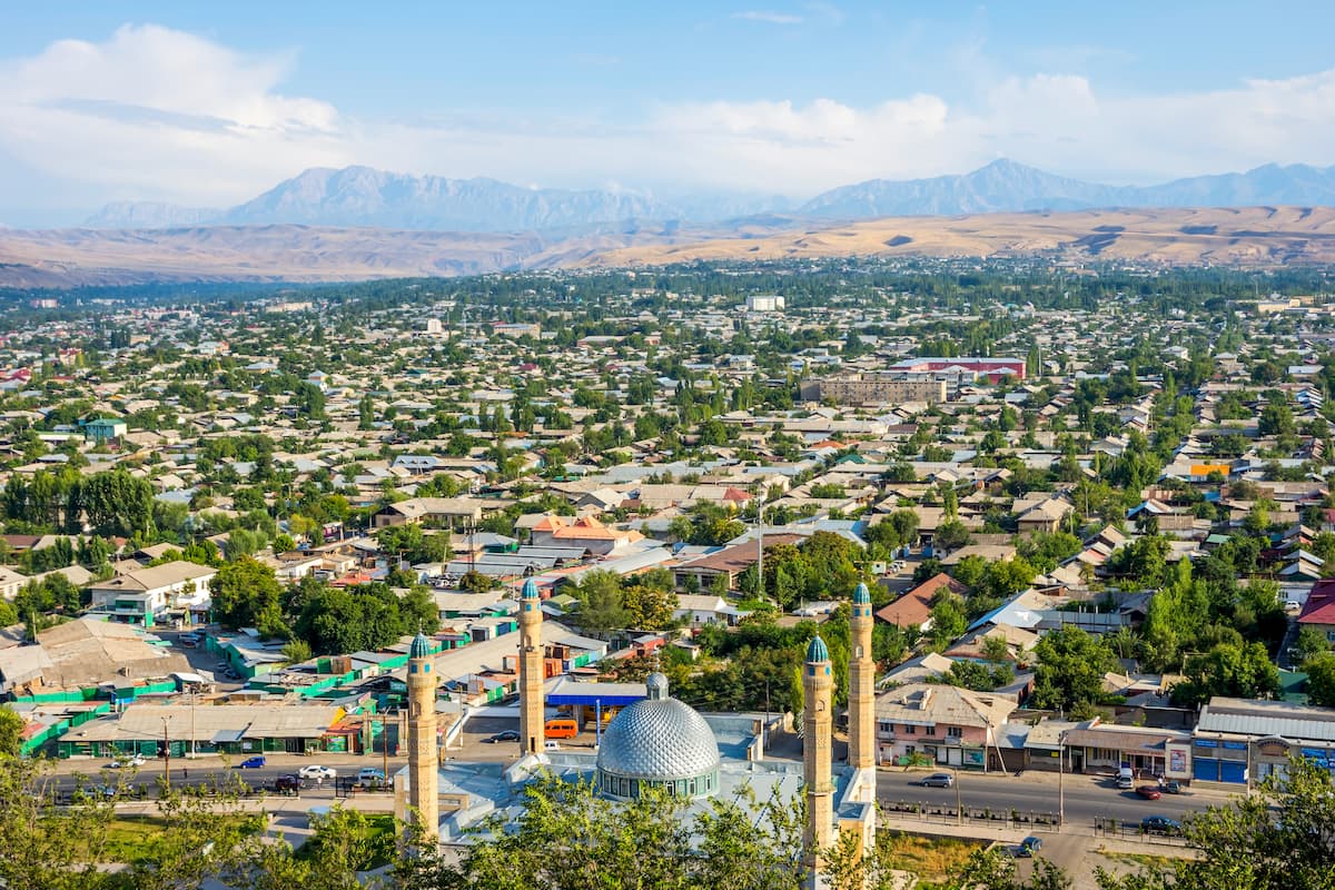
Osh is the second largest city in Kyrgyzstan after Bishkek, it is officially called the "southern capital". In 2018 Osh was declared the Cultural Capital of the Turkic World for 2019. The city’s population is around 260,000 people, it is almost evenly split between the ethnic Kyrgyz and Uzbek. Tensions have flared up occasionally, most notably in 1990 and 2010, but now there is peace and quiet. Osh has since been calm for a decade. It is well-loved for its distinct character and delicious pilaf.
The exact etymology of the name Osh is unknown, but there are some fun versions of the toponym. Firstly, according to a legend, King Solomon (Sulayman) when leading an army during one of his military campaigns, decided to camp in this place and shouted to stop "Hosh! - "That's enough!", this exclamation gave the name to the future city. Another theory is that the toponym came from the Persian 'خوش' ('huwuš) meaning 'nice, good city’.
The city is located in a foothill oasis, which has long been inhabited by people long before the arrival of Kyrgyz people from the Yenisei (about 800 years ago). The archeological findings by Y.A. Zadneprovsky in the 1950s revealed the remains of an ancient settlement of farmers of the Bronze Age, which proved that the history of Osh counts three millenniums, but historical science counts the age of cities from the earliest mentioning in historical acts, therefore, Osh dates back to the 9th century AD, which still allows us to consider it the oldest city of the country. Osh has been a crucial point for merchants and traders for millennia. The bazaar, located along the Ak-Bura River, has been in its same location for many centuries.
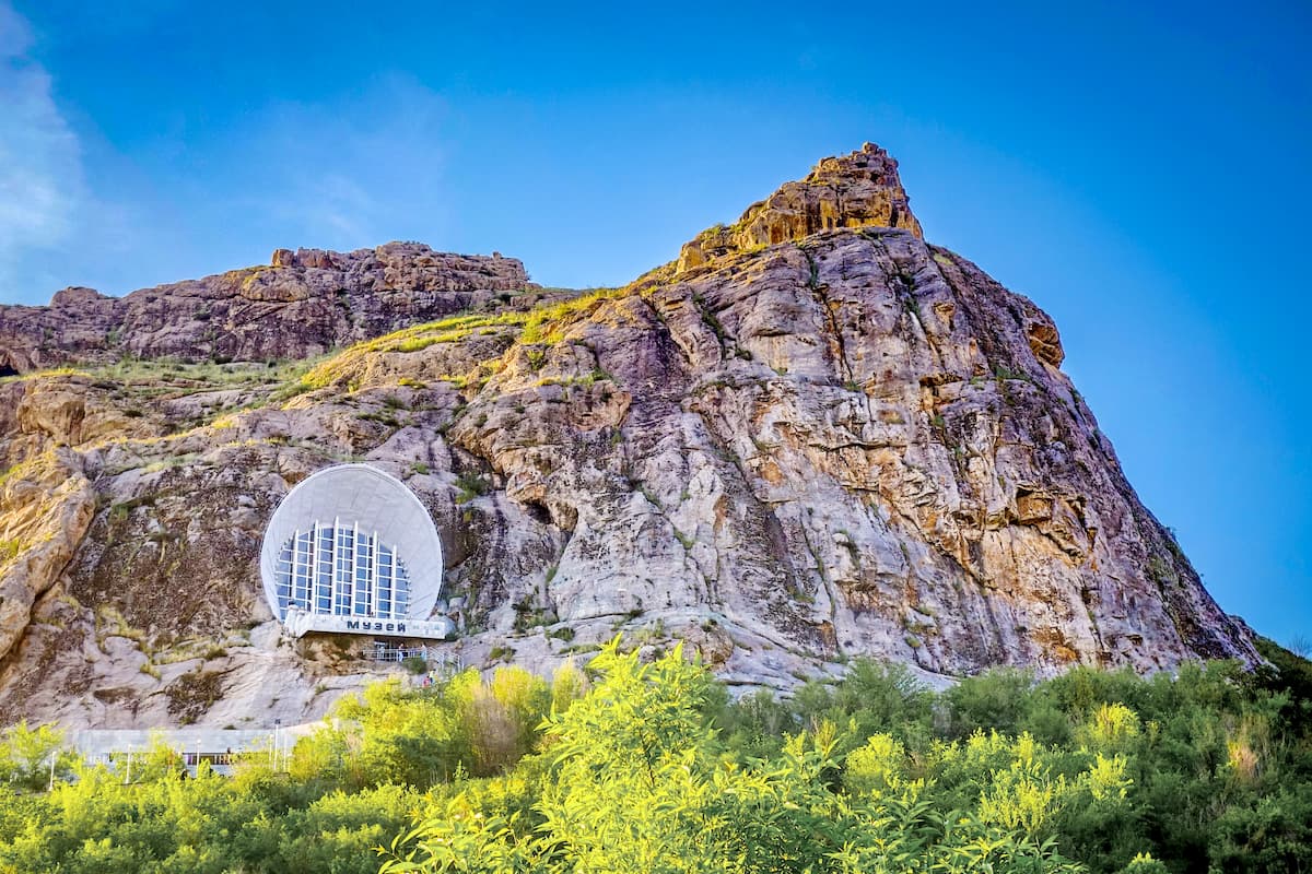
Osh is located 700-1000 m a.s.l. on the south-eastern outskirts of the Fergana Valley at the northern foot of the Kichik-Alai Ridge (the south-western suburbs of the Tien Shan and north-eastern suburbs of the Pamir-Alai). The Kichik-Alai Ridge surrounds Osh on three sides, with Suleiman-Too Peak rising over 100 m in the city center.
The names of the five-headed Suleiman Mountain from left to right are Buura-Too, or Takhty-Suleiman (Camel Mountain or Solomon's Throne), Shor-Too (Salt Mountain), Rushan-Too (it is the highest of the five, 1,172m a.s.l.), Kattama-Too (Layered Mountain) and Eer-Too (Saddle Mountain).
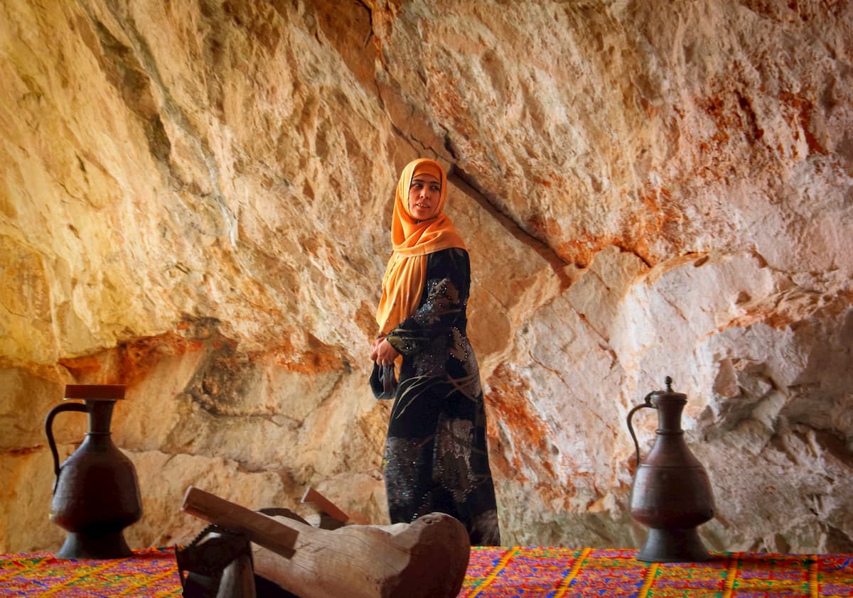
Suleiman Mount is similar to a giant transmitter which is passing on people’s wishes from the Earth to a higher power. That is why there are many spots considered to be healing various ailments. You can cure head, back, knees, arms or even ask for a baby. The mountain has many petroglyphs of islamic origin which have not been unpuzzled yet, sacred stones, caves and fantastic views from the top of the mountain. Allow at least a day to spend there. By the way, it is very easy to go up the mountain because you have a feeling of some updraught blowing in your spine and pushing you forward.
Suleiman-Too Mountain has 7 caves, viz.
There are several museums in Osh that are also worth visiting. The Great Silk Road Museum, at the base of Sulaiman Too, has exhibits about Kyrgyzstan’s history, nature, and people. There is the Kurmanjan Datka Museum, a three-story yurt filled with textiles and paintings.
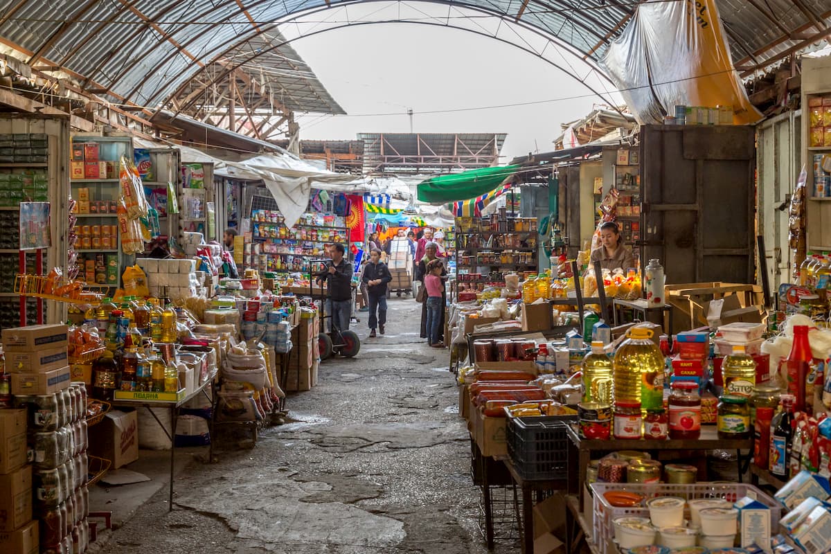
The Jayma Bazaar, which stretches along the banks of the Ak-Bura River, is one of the oldest and most picturesque in Central Asia. The bazaar is a great place to just explore and find foods and handicrafts for sale. The Osh bazaar is considered one of the Central Asian most colorful and biggest markets by sales turnover. And what is more, it has been operating on the same place for over 2,000 years, since the time when Osh was crossed by one of the branches of the legendary Silk Road. Speaking of exotics, go to the Bazaar’s meat section, where in addition to conventional beef and mutton they sell horse meat and various meat byproducts which are a delicacy, but exotic one for European taste. You can be offered all parts of a lamb’s head to taste: eyes, ears, tongue, and sheep brains can be picked out right from the brainpan with a spoon.
Stop at the Shaid Tepa Mosque, the largest mosque in Kyrgyzstan. The original mosque was built between 1908 and 1910, but was used for blacksmiths and stables in the Soviet era. Recently, the mosque was rebuilt using funds from Saudi Arabia, and now it has room for 5,000 worshippers.
At the southeastern edge of the sacred mountain Sulaiman-Too, there is a famous place of pilgrimage for Muslims - the Asaf ibn Burhia Mausoleum, one of the oldest monuments surviving in Osh. It is a rectangular portal-domed structure of 7,3 by 9,59 meters. The corners of the building, as is customary in Islamic architecture, are oriented to the cardinal points. Its dome, 4.4 meters in diameter, rests on an octagonal drum. The interior part has an octagonal shape with sides of 2.11 to 2.23 m in length. Of special beauty is a portal-domed mausoleum niche. The upper part of the portal is crowned with battlements in the form of a stylized trefoil. Its edges are decorated with ornamental columns.
Other worship places include the Rawat-Abdullakhan Mosque (17th-18th century), the Mohammed Yusuf Bayhoji-Ogly Mosque (1909), the Sadykbay Mosque, the Alymbek Paravanchi Datka Madrassah, the Muhamedba Tur Turk and Muratbayev Madrasah etc.
The city has a lot of parks and historical and cultural monuments: a medieval bathhouse, memorial complex "Evening Fire"; monuments to V.I. Lenin, Toktogul Satylganov, Risilay Abdykadyrov, Sultan Ibraimov Orozbekov, Kurmanzhan-Datka, Alisher Navoi; cave "Echo of love", grotto "Swallow's Nest"; the most beautiful places: Kyl-Kuprik, Beshik-Tash, Chakki-Tamar, Kol-Tash, Sylyk-Tash; as well as an old cemetery, petroglyphs.
Osh Region is famous for the largest caves in Kyrgyzstan: Chil-Ustun, Chil-Mayram, Keklik-Too.
The entrance to the Chil-Ustun stalactite cave is located almost on a cliff at an altitude of 250 m. The name of the cave means “Forty Columns”. This cave is a cult place for pilgrims. The legend says that if a traveler passes along the steep rock and returns to the foot of the mountain unharmed, then all the sins will be forgiven. A powdered stone brought from Chil-Ustun can cure any disease.
As is typical for Central Asian cities, there is a good choice of accommodation for those who are on a tight budget and those who are willing to squander. Here is a nice list of guesthouses, hostels and hotels in Osh. Mind you, you can rent a flat if you wish to taste the real Osh, but there are not many options on airbnb.
We’d appreciate to hear about your adventure stories in the Alai Mountains, drop us a line at peakvisor@routes.tips